Continental Divide Trail: Day 47 – 10 Miles (732 miles from Mexico)

Another bad night of no-sleep. The cough has GOT TO GO. I will take care of it in Durango.

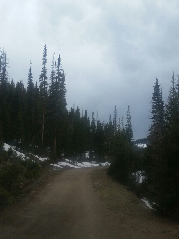
I headed back on the road a bit, I had scoped out a short-cut on the map, if I could cross the river in the valley and climb up the steep banks to the highway, I would only have about 4 miles to make it to Wolf Creek Pass this morning. I figured the snow melt would be at a minimum this morning and I would have the best chance of making it across.

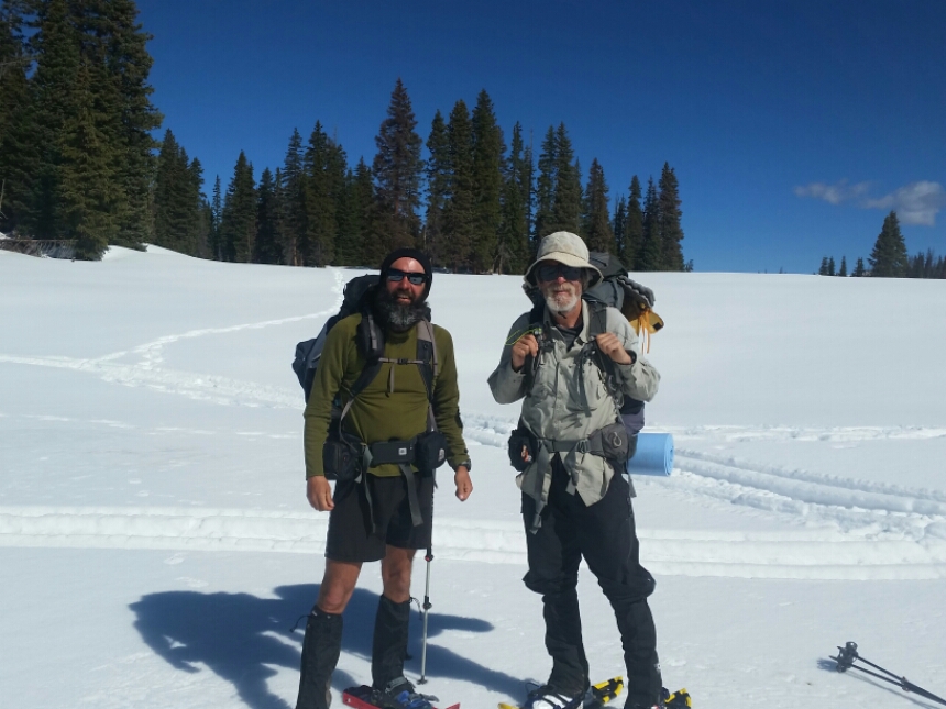
I was just rounding a bend in the road when I heard a hoot and holler…The boys are back! Apparently deciding to go back up on the divide wasn’t the best decision they ever made, and in between moments when they thought they might die, they spied a bailing point to get out of the snow and onto the road I had been walking. I was relieved to see they were ok, and as they were regaling me with chilling tales of their snowy feats, I felt a sense of accomplishment that I had made the smart decision, the right decision. There is too much trail up ahead to take risky risks in these mountains. To enjoy the trail I need to not feel like I might die several times a day. But hey, that’s just me.

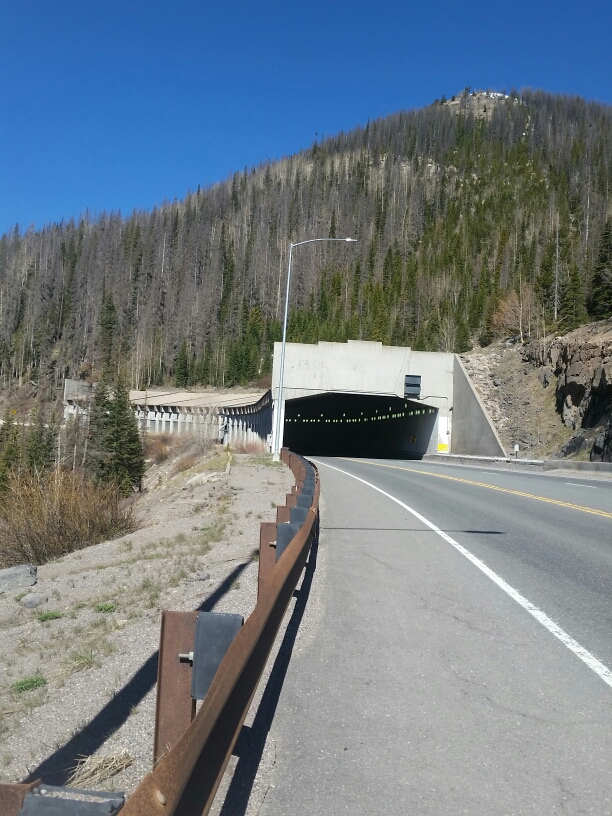
The guys had already scoped out my short cut idea, and informed me it would be a bad idea to cross. Ok, bummer, our other solution was to walk 3 miles to where the road intersects the highway, and then back up 7 miles to the pass. BLAH.
image

We had just enough time to hike fast to make it to the pass for 10am when I had arranged to meet Whiptale.

Walking, walking with skis on my pack, trucks wizzing by, honking, strange looks, walking, tired.

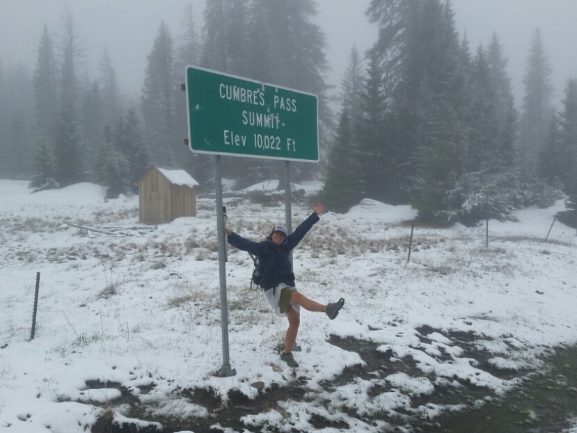
The pass!!!!!!!

I had made it before Whiptale, and threw down my pack and went over to inspect the sign. THE CONTINENTAL DIVIDE TRAIL. We don’t get much recognition on this trail, and this sign made me glow with pride.
image

The guys made it up and Mark Trails noticed a can of diet soda perched on the concrete..surely forgotten by some passing tourist, but OH WONDERFUL DAY, it was full and unopened!!! Trail Magic!! We did a little dance and carefully opened the can to share it among the 4 of us. Trail Magic!!! The little pleasures are so so sweet.

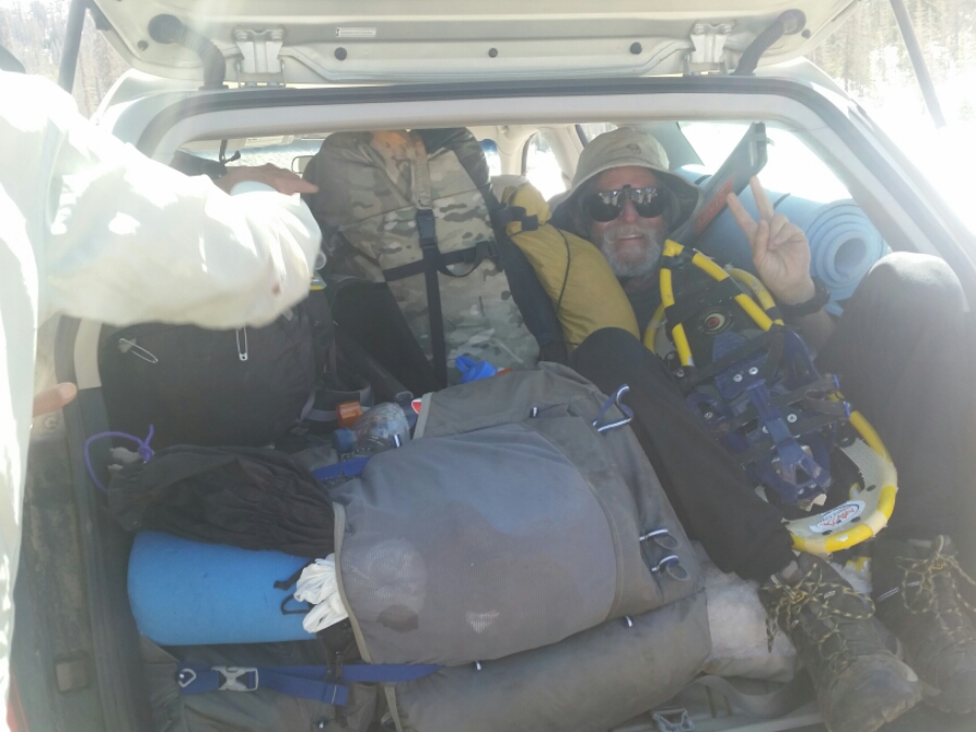
Then Whiptale drove up and out popped First Man! He had been hitching in Pagosa Springs, intending to head to Alomosa, when Whiptale drove by. I had been a bit worried about him as he had entered the mountains 2 days before we did, without snowshoes. I had suspected the 30 miles of postholing had been him, and I was correct. He was beat up and ended up spending 24 hours in his tent one day to wait out a storm. Embrace the brutality!

Now there were 5 hikers and our Trail Angel that needed to fit in the Suburu. But we did it with Mark Trails snug as a bug in the back of the car with all our packs. Ha!
image

We stopped in Pagosa for a huge lunch and we learned it was Whiptales birthday today! What a guy to drive up and pick up a bunch of smelly hikers on your birthday. So lucky to have a friend like this.

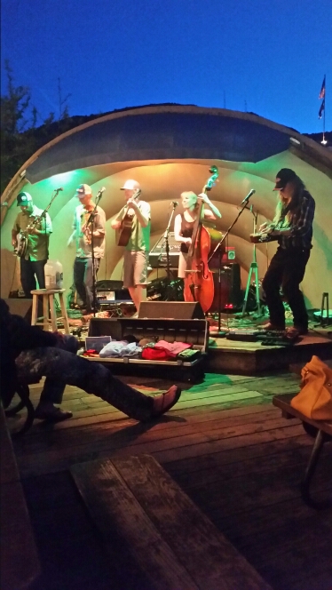
Oh the land is so green and lush. Wow. Before we knew it we were in Durango and settling into our rooms. Showers and lounging and getting ready for the night…Whiptale’s band, Running Out Of Road, would be playing a show at the Balcony. The bluegrass band was made up of fellow adventurous folks and amazing musicians.

The thru-hikers descended on the bar and danced, reveled in the sights and sounds of modern life, and I even got to catch up with Amy, my former boss at Southwest Conservation Corps…I had lived in Durango 8 years ago for a few seasons to lead trail crews, and it felt good to be back on my old stomping grounds.

image

image

image

Durango, you are amazing!

Continental Divide Trail: Day 46 – 26 Miles (722 miles from Mexico)

I did not sleep well. For some reason when I’m extremely tired my body decides to hold me hostage and withhold the much needed rest…and I’m developing a much deeper cough…a mild annoyance that has plagued me since New Mexico…is now a deeper chesty bark of a cough. I will need to do something about that soon.

We all roused ourselves and packed up camp in the chill of the creek valley air. We were on the road, and right around the corner entered another stretch of snow. Snow level seems to hover around 10,200-10,500…and we would be climbing to Elwood Pass at over 11,000.
image

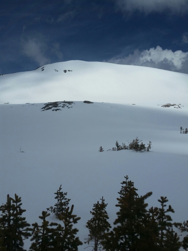
The cold night had firmed up the snow, so we all walked confidently on top of the crust as the road wound up and up and up. Suddenly we had views! Oh beautiful blue-bird day, we hadnt seen anything quite so billiantly blue in a long time! However it was getting to be mid-morning and our much desired sun was now turning the firm crust into a slightly slushy mixture where every 5 steps I would break through and posthole to the ground beneath. Walk faster!! Seak shade!!
image

I motored around the curves of the road trying to find firm snow, cursing when I broke through. Finally Restless and I reached the point where the CDT joins the road, and stopped to spread out our wet gear on the still frosty snow…suprisingly you can still dry out gear on snow! Oh the sun.

I had already determined that I would continue walking roads to Wolf Creek Pass as the topo looked again to be a dangerous mix of steep slopes, ridgewalking on knife’s edges, and slushy unstable snow. Number 2, Restless, and Mark Trails however, were inspired by the blue above and wanted to go back on the trail.

image

We said our goodbyes and I made them promise to be careful.

The snow was just getting slushier by the moment, so I put on my skis and cruized the next 5 miles down the road until I hit pavement. Bliss! Skis are magical!
image

image

I took a nice long break at the end of the snow, and then began to trudge down the mountain roads…the valley was green and lush and the snow melt-off seemed to be increasing steadily…trickles and drips and seeps overflowed from the mountain sides as I walked.

image

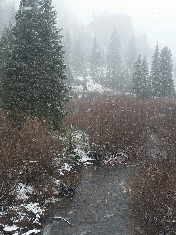
When I bottomed out in a beautiful little valley I walked over to the creek running through the middle and found a safe spot to ford. Then crossed another tributary and up onto a road that would take me around to Wolf Creek Pass.

For the first time there were no other footprints to follow…others had the same escape plan I had, but now it was just me and the increasingly dark clouds over head. Hey, what happened to our blue-bird day?
image

I wound in and out of the ridge’s curves, started mushing through mud and snow, and hoped the sky wouldn’t open as it threatened to do.

Then footsteps! Hmmm, someone must have bailed out of the mountains here. Then more footsteps, it must be getting steep up there.

Finally I made it to Turner Pond campground…I saw the potential yoging opportunity in a place where people packed coolers full of too much food and drink. Tourists on the road for the summer would surely want to trade a cold beverage for a good mountain story! But, alas, no cars. This ugly little site had been clear-cut, you could hear the traffic from the highway up above, and the tent spots weren’t even flat! For $17 I could eat a huge meal in town, I will not be paying that when I could walk down the road and sleep in luxury in the forest.

So I did. Wolf Creek Pass tomorrow to meet Whiptale, a PCT friend, who would wisk me into Durango to have more adventures.

Continental Divide Trail: Day 45 – 18 Miles (696 miles from Mexico)

Ok, yesterday. Well the two last days. If I was on a ski touring trip or a ski mountaineering trip will all the proper gear, it would be gnarly, but probably a lot of fun. As a hiker wearing boot-ski bindings, I probably did the best of all those going in the mountains…although I would have much appreciated a full touring set up AND a pair of snowshoes. The terrain so variable, the snow slushy to icy, steep to miles of ridge ski terrain…all I can say is WOW and about two days of it was all I could take.

image

Exhausting, exhilarating, scary, we did our best to stay warm, although Restless has some cold injuries on his feet…we did our best to stay safe, although the Continental Divide Trail does just that, stay on the rocky crest of the HUGE MOUNTAINS and sometimes took us where we shouldn’t be with this much snow.

It will be WEEKS before any trail can be found under the snow. It snowed on us the past three days. It’s on the verge of going though…once the clouds clear and there are some warm days, watch out for the flooding creeks. There’s always something on the CDT.

So this morning as Restless and I were packing up from our second snow camp, up snowshoes Mark Trails and Number 2. We quickly joined them and I realized my skis, even with the skins on, were not going to cut it as we made our way down an icy canyon. I started hiking…for a bit…until it was postholeing. ARRRRRRR Postholing can suck it.

image

image

image

But we made it to trail!!!!!! We had decided to hike an alternate that dropped down to some forest service roads in the valley below, and judging by the only other footprints we had seen in the mountains so far, so did the other hikers ahead of us. The next section is SCARY for the heavy wet avalanche danger. The week of rain and heavy snow on the snowpack means supersaturated conditions. The steep ridges would not be keeping all that snow much longer with the warming trend. Not a good place to be right now. Once it stabilizes hikers will be much safer out there.

image

image

We all were beat up from the snow and weather and difficulty of travel, and dropping onto the trail in a beautiful valley was the best decision any of us could have made.

Beautiful day, easy miles on the road, scenery to rival what we had seen on top. We laughed and marveled at what we had just done for two days and were here to tell the tale. EPIC

image

Continental Divide Trail: Day 43 – 15 Miles (665 miles from Mexico)

This trail was made for touring skis! Wow, i could not have planned it better. Once Restless and I got to the trail about 9am, we boot packed in the first 3 or so miles…the trail was muddy and full of water, and there were snow patches, but we made good time until our first ridge.

image

Hitching back to the trail

I popped those skis on and magic!!! Most of the day traversed dramatic ridges with views you would not believe. Restless was doing well on his snowshoes, and we cruised through a few snow showers and some ominous clouds, but by late afternoon the sun came out again and made for the most stunning photos.

image

image

I got a chance to ski down quite a bit…nothing steep, but on the slight downhills on the ridges, I was able to glide for long periods, I love the skis!!

image

I truly don’t know how anyone will be able to get through efficiently without snowshoes or skis. It is almost all snow, and fortunately even with the danger of wet slides, we kept to safe aspects…tomorrow looks much of the same, lots of ridges although we may take a lower Ley route when we get to some exposed sections near Blue Lake.

So stoked to be out here, it was a strenuous day, we are both exhausted and it’s already 9:30pm, by far the latest i’ve been up on trail, but a great day. Tomorrow will be grand.

image

Continental Divide Trail: Day 42 – 0 Miles

Another day in town, another rainy morning. We are leaving tomorrow and there is a potential window of good weather! Now that has been changing, and some hikers turned around and came back to town because of the white-out conditions and sheer difficulty of postholing without snowshoes, but Restless and I are ready and we are going to do this.

It was a quiet day. I made burgers for dinner, putzed around a lot, tried to get all my gear in my backpack, and generally not much happened.

image

Hard at work doing nothing

Tomorrow, however, I hope to have some stories for you.

Continental Divide Trail: Day 41 – 12 Miles (650 miles from Mexico)

Because I walked the highway into Chama and the trail spits hikers out on the other side of the Colorado border at Cumbres Pass, I needed to hike the 12 miles from Chama to Cumbres pass to connect my footsteps. The plan was for Restless (maybe Natty) and I to get a ride up to the pass tomorrow to continue our hike north.

Restless’s friend Andrew was in town to visit, so I asked him to drop me off at the pass and I would slack-pack (hike with just minimal gear in my pack) back the road the 12 miles to town. When we were leaving the train was just taking off up the mountain, and we got to see the engine puffing away up the grade. It was raining, then snowing. Uggg, it just doesn’t stop.
image

Up top Andrew took a few photos for me, and I started my hike down to town. It was snowing HARD the first few miles. Then it poured on me. All this fresh heavy wet snow would create even more avalanche potential in the mountains we would be soon hiking through. I will definitely not be afraid to bail out if the conditions are this nasty. There is a forest service road in the valley below the CDT that we can walk if we need to, and as i pushed through the wind and rain and snow I realized this would be a real possibility. It is not a matter of skill level in the mountains or on my skis, it is a matter of getting caught in very risky situations in the mountains. The trail goes through some perfect avalanche terrain. I won’t be afraid to go low if I need to.

So as I was walking down the road I could hear the train coming up, but the visibility was about 20-30 feet….I could smell the fumes and could tell the train was incredibly close, but couldn’t see it. Pretty trippy!

image

There is a train right there...I swear!

image

I made good time down the mountain and celebrated by buying an ice cream cone in the local fudge shop. Go big or go home!

The rest of the afternoon was pretty chill….caught up on some blog posts and just visited with other hikers. We made a nice dinner and Ben, Jill and their 2 kids who are renting out their upstairs to us came up with some homemade strawberry shortcake for dessert. Natty had picked up a pecan pie, so we indulged and just had a grand ‘ol time.

image

Inspiring future hikertrash

Oh, and we decided not to leave tomorrow. More rain and storms on tap….so we’ll leave the day after…I promise! Otherwise i might have to change my residency. 🙂

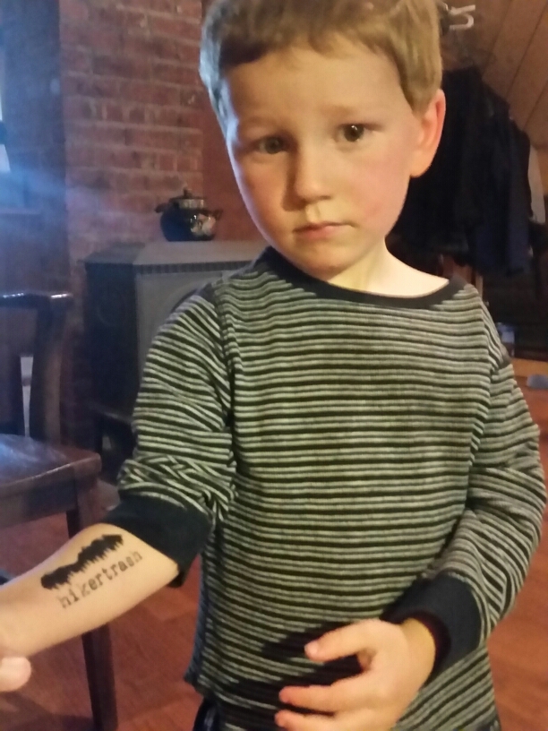
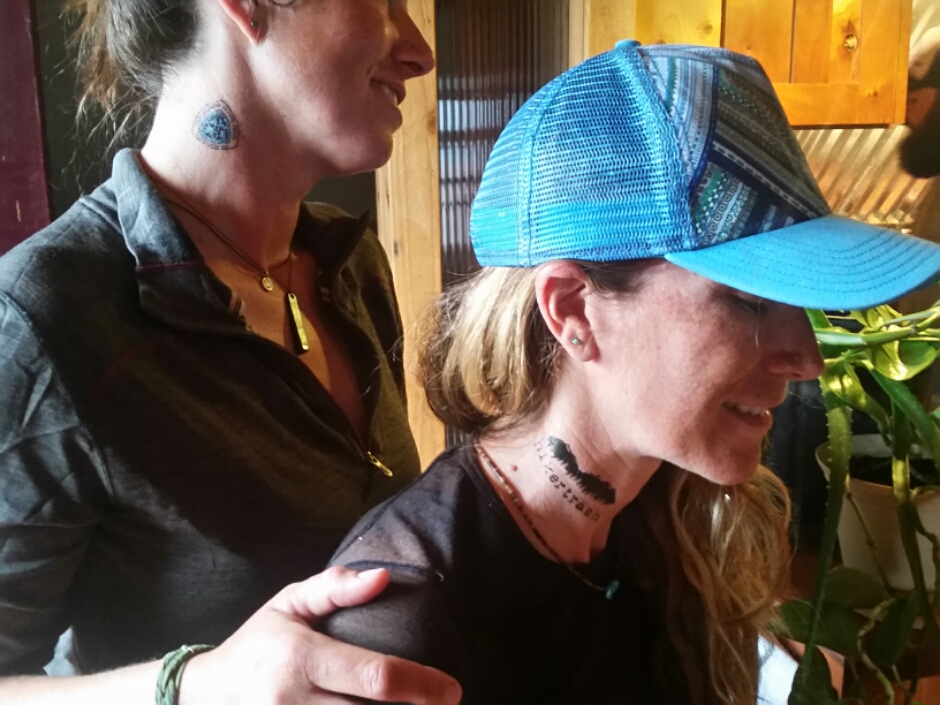
image

Neck tatts!

Continental Divide Trail: Day 39 & 40 – 0 miles

Days off!! Food and beer and good company! We had heard that on May 23 the mayor of Chama and the New Mexico Governor would be declaring the city a gateway community for the CDT. I had a feeling Teresa with the CDTC would be coming to town, and yes! In fact Snorkle and Val would be coming with her, the weekend was sure to be a blast.

I just lounged around most of the day, and when the CDTC ladies rolled into town we decided to go out to dinner at the High Country Restaurant. A huge burger and a couple beers later, I was fat and happy and was stoked to get to catch up with Boston Bones and Axyl who had hitched up from Ghost Ranch for the festivities.

There is a LOT of new snow in the southern San Juans, and more in the forecast…we are all trying to figure out the smart way to hike…lots of talk of flipping and low routes. A few guys pushed through the actual CDT north of here, but it all sounds pretty sketchy to me…I have a feeling they aren’t experienced with backcountry snow…and if they were they would not have gone through as they did. I feel like I have enough experience and knowledge of avalanches to be pretty wary of the conditions. The Colorado avalanche forecast center will stop their forecasts after this weekend, but the word is heavy wet avalanche danger. Hmmmm. Even with skis, that’s not a good outlook for the next section.

Saturday a whole bunch of hikers hitched up to Chama for the festivities and we all gathered at the train station for not only the gateway celebration, but the inaugural trip of the narrow gage train.

Lint was there! Shane too! And Bearclaw came to town! More hikers than I had seen the whole trail…what a trip. I really was at the front of a mass of hikers. Teresa thinks about 200 hikers started northbound this year, by far the largest number so far on the CDT.

I also got to meet Let it Be, or Neen, the famous triple triple crowner…who is well on his way to a quadruple triple. Wow, very impressive.

We passed the day with a huge group lunch at the High Country Restaurant, and a few cases of beer…we hikers are pretty predictable in that way…beer and food please!

Lots of laughing, a little pool at Fosters, and more laughing rounded out the day. I love these people. I love this trail. I love this life.
image

image

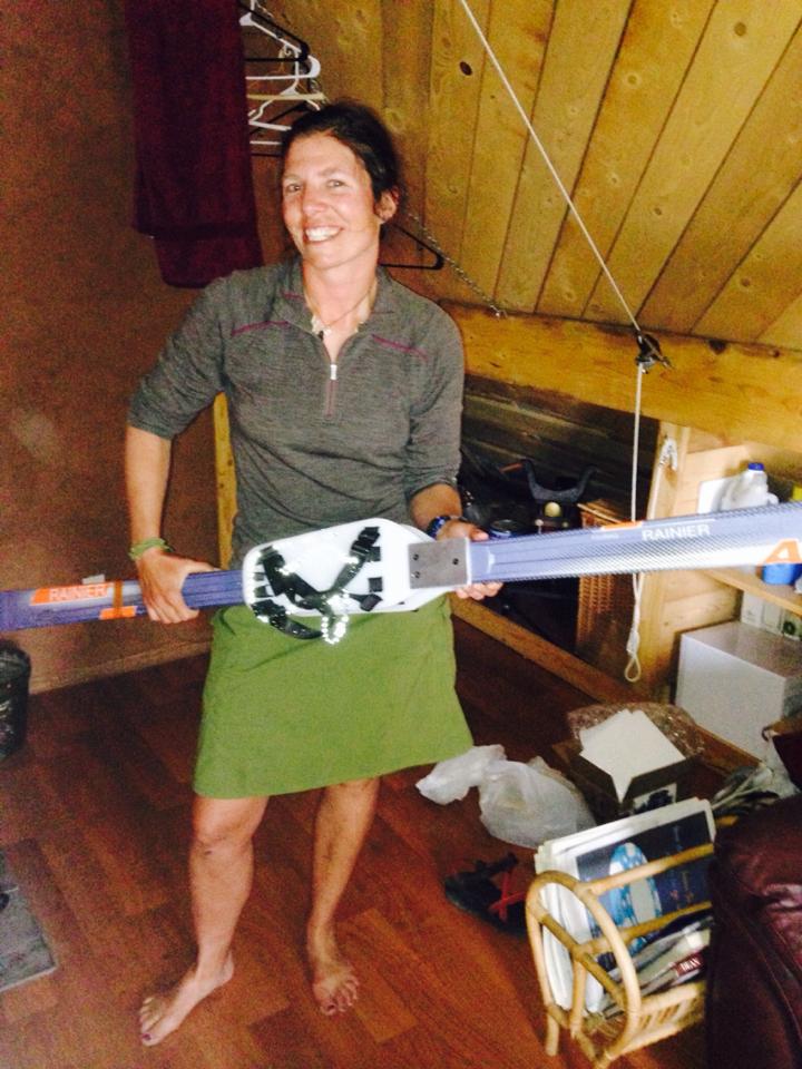
Got my skis ready!

Continental Divide Trail: Day 38 – 8 Miles (638 miles from Mexico)

Not many cars passed by my head in the middle of the night, which I was quite happy about.

I jumped on the highway and realized I had come so far that I only had about 6 miles into town. From looking at my trail data I knew there was a cafe on the south side of town. Hot breakfast!!!

I rolled into the Elkhorn Cafe just as they were opening, and had a spicy breakfast egg burrito. YUM. I then strapped on my pack and walked into town, hoping i would run into some hikers to either split a hotel room, or gather some intel on the next section. The day was sure to bring rain again and even though I had just come from a few days off, thought i might stay a few more days in Chama depending on snow levels.

I went to the library where i was able to connect with a few people online since my phone was still broken, and should be at the post office tomorrow, yes! Thanks Mom and Dad!

I found Restless was still in town (PCT 2006 friend) and that he was staying at an Air b-n-b just down the street. They had room for me and was only $20 a night!

The second story space was SWEET and even better, the young couple that own it, Ben & Jill, are outdoor adventurers themselves. Perfect.

I stopped by the post office to pick up my 7 packages including skis, ice axe, gortex pants and gaiters, and yummy goodie boxes from Nemo, Annie, my folks, and Phil and Phyllis (blog readers of mine). Thanks everyone!!!!! I would be eating REALLY well on the next stretch.

I was sharing the apartment with Natty and Restless, and we made a scrumptious dinner in the kitchen that night.

Restless and I decided to head into the mountains together in a few days when the weather was supposed to calm down, but for now, rest up, eat, pour over maps, and just be for a while.

Continental Divide Trail: Day 37 – 28 Miles (630 miles from Mexico)

I woke rested, despite slipping downhill a bit due to the slightly slanted spot I hastily selected for my camp.

I hit the road, enjoying the sunshine and the deep green grass all the rain had sprouted. Doesn’t really look like the New Mexico I had imagined!

I walked into the small hamlet of Cajillion where I saw a ranger station, and knew i would be able to find a map there. I walked up and immediately got excited for the soda machine in the lobby. I was helped by a young woman who showed me the route, a pretty straight forward walk into Chama, and helped me out with another dollar when the machine ate my $1 as I was trying to get a rootbeer. Wow, both sodas came out, so I had an extra sugar boost for the road walk.

The rest of the day was broken up by a few stops at gas stations along the way for microwaveable cheeseburgers and hot pockets.

The valleys I passed through were gorgeous…all lush and green, with snow capped mountains in the background. The same snow-capped mountains I would be in soon!

By 7pm I was exhausted, but couldn’t see anywhere I could legally camp for all the private property signs around. Finally almost delirious with fatigue, I climbed up a small hill on the side of the road and wedged myself between a tree and a fence, maybe 20′ off the highway. Oh well. I was so tired I didn’t care. I was high enough to be out of sight from passing cars, and was successfully not trespassing.

Sleep.