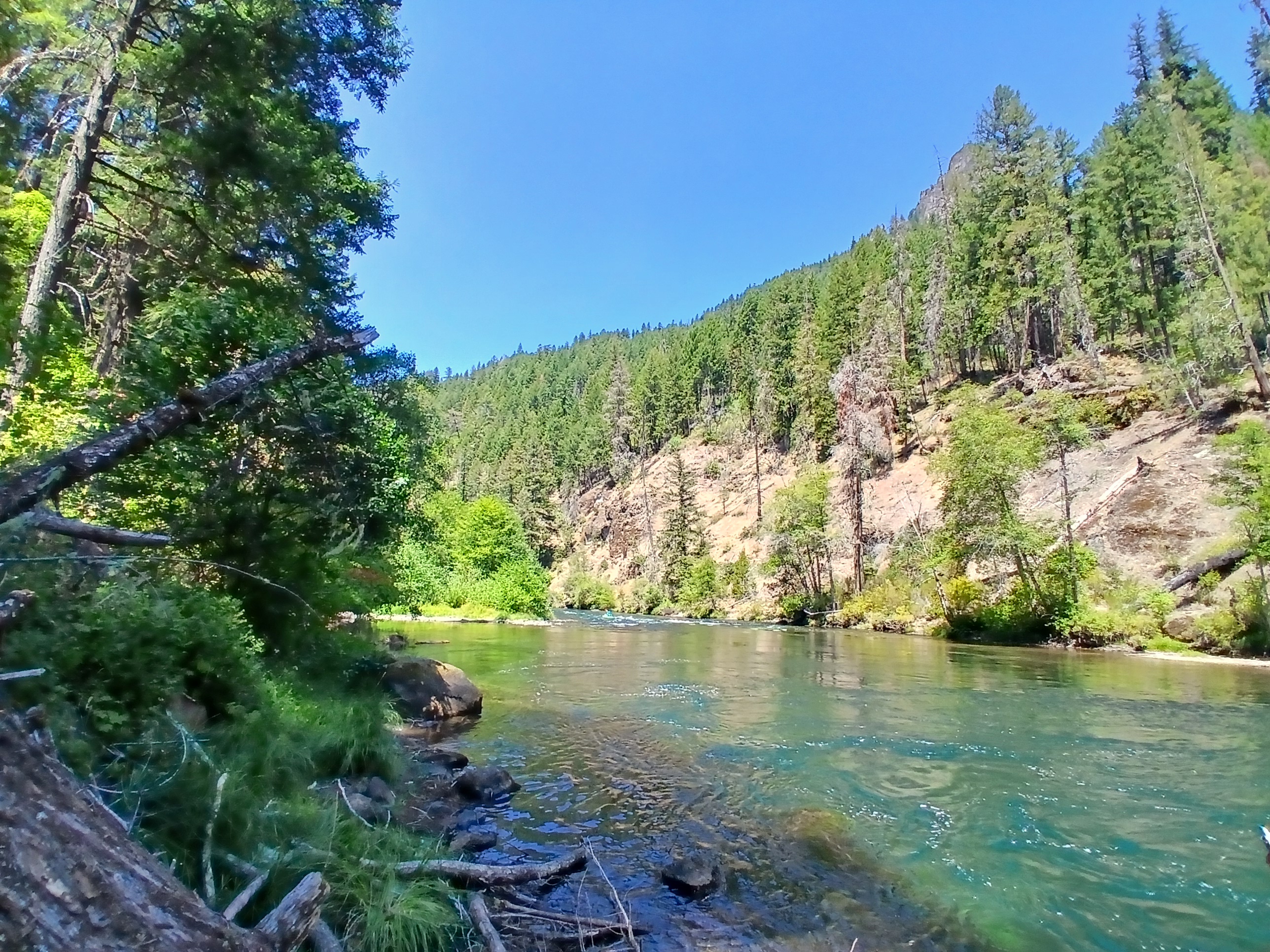
We went to the Umpqua River this weekend; the water color alone brings so much joy.
I fell three times in the last month, but I’m not broken. I have headaches now, are the two related? Maybe, maybe not. No one can say for sure. So many wrongs are overlapping at the same time and I have no idea what preceded what, what caused what, and what are simply coincidences. All of this makes me want to curl up in a ball and throw the covers over my head.
HOWEVER, for the first time I saw through this hazy state of managing my pain when my new pain psychologist said: “There is more that is right in your body than wrong.”
There is more right in my body than wrong.
I don’t have active cancer right now, I have pain.
There is more right in my body than wrong.
You will notice that I use repetition a lot in these posts, sure it’s for emphasis, but it’s also so I can get the words through my thick skull. I have been repeating her words in my head to myself for days now. I can scarcely believe them. There is more going right in my body than wrong. According to my latest brain MRI, I am stable. I’m still waiting on a Guardant Reveal blood test and a PET Scan to tell me if I’ve been in remission for a year now… but I think I still am???? (BTW, I’m VERY EXCITED for the Guardant Reveal test. It will be my first one and it detects cancer cells smaller than a PET scan can, which is great….so in essence, I think from now on I can get the blood test, and if there is cancer, then get the PET to tell us where it is.)
Other wise wisdom from my pain psychologist includes learning that I’m probably overlaying my emotional trauma on top of my physical trauma, which could explain a lot. Of course the cancer diagnosis was traumatizing. Of course ending up in a wheelchair after not dying was traumatizing. But so was watching my parents deal with a stroke, long-term care issues, late stage Alzheimer’s, their only daughter getting stage-4 cancer, and then my father’s death.
Is the pain in my brain? Most of it started escalating at the one-year anniversary of my diagnosis, which is also the anniversary of all the above.
I DO feel more robust. I do feel like I could be turning some kind of page in my health journey…The fact that I fell three times in the last month definitely helps reinforce that idea. I fell to the ground three times and stood back up again. But, I feel like a toddler, learning to walk again. I’m wobbly. I am not quite sure how to balance in this new world, not sure where the balance is. (Granted, most of the falls have also accompanied the increase in dosage of one of my pain meds, which…wait for it…causes balance issues)
But I am getting stronger. I see that now – that I needed a year in remission for my body to do what it does best: heal. In much of the last year I needed to get out of the way of my body’s ability to get stronger and avoid fall risks. I needed to act as if I’m fragile. I needed to think of walking again like I was a bull in a china shop (I’m both the bull and the china in this scenario.)
I can’t quite start bashing my way through the brush like I used to, but I can try to move in a more deliberate way in the general direction of my former activities. And that is promising!
I’m in the middle of the Fishtrap Writers’ Conference at Wallow Lake (and eastern terminus of the Blue Mountains Trail!) and am absolutely blown away by the level of writing, quality of people, and depth of community I’m finding out here. I want to write more about the week, and the multi-stop trip I took to get here, but first I want to share a bit of one of today’s writing prompts. I’m in workshop with the incredible Ana Maria Spagna where daily she takes us through a variety of thought experiments and writing exercises…one building on the other as each day progresses.
Now I’ve written from writing prompts before, they were usually grudgingly typed out in my home office, alone, and was unimpressed with my efforts: usually lack-luster and boring. Why was it different this time? Well, I’m in a room with ten other writers and we are given a time limit. It’s amazing what a little pressure will do, along with the desire to show up in a room with such accomplished writers. Also, it’s day three of the workshop, so we’ve all started to show a bit of our soft underbelly. This may seem odd to you as I’ve been all soft underbelly since my cancer diagnosis 18 months ago, but when in public, with new people, I’m not usually the first one to jump up and say: “Hey, I’m dealing with cancer, it’s all I’ve been writing about lately.” Instead, I lead with the hiking stuff.
I started sharing more at the end of our time yesterday, but today when given the hermit crab prompt, I enjoyed trying to only show a bit of underbelly. Just a glimpse.
Tea
1992
My mom brews up a mug of tea and I shake my head and fake puke when she asks if I want a cup. “Tastes like dirt” I reply.
1999
All the villagers drink tea, and take great pride in pouring it elaborately. I mean, they pour from two feet up in the air! The brown stream is expertly aimed from one small glass cup into another. They say the hight helps mix the sugar. I can’t refuse their gift; that would be rude. When I try to pour, none goes in the other cup. They laugh.
2007
The office packs lipton tea bags into our resupply. I had to drink it, I mean, I should drink it; it was carried into the backcountry on horseback for goodness sake! I had to be grateful for anything to break up the monotony of warm-water bottle water. Oh yeah, there were definitely BPAs in those old Nalgene’s, especially when we made sun tea and soaked those bags all day in those plastic bottles.
2015
Why didn’t anyone tell me there were herbal teas that tasted like mint and lemon? Yes please. I can finally move away from the dirt.
2020
A little dirt is ok…and it goes down easier in something like a green tea that is mixed with ginger or tumeric. I read that it’s good for me, a scrap of hope in these eternal COVID times? And I think I’m finally used to the earthy taste. I should be, geez, I’m enough of a dirtbag.
2025 – Spring
Now I’m supposed to drink as much green tea as possible. My naturopath tells me to drink at least two cups a day; but more is fine too. “It has immune strengthening properties,” she says. “As if that will make a difference,” I think.
2025 – Summer
Friends send me green tea now. My shelves are overflowing with the stuff. Word got out that I can’t drink right now, and so red wine is off the list. Tea will never be a substitute for a big, bold red, but the Japanese rice-based tea that Margo sent is ok…
2026
Mom found the green tea I left behind on my last visit and brewed a cup. “Uggg,” she said. “I don’t know how you can drink the stuff.”
The most illuminating aspect of spending decades of my life walking across the world has been welcoming a shared experience with strangers in far-flung places.
Kindness personified…in all these peeps!
When I met Jesse on the Oregon Desert Trail, I could only see an angry rancher with a gun on the front seat of his pick-up until we started talking about the wonders of nearby Orejana Canyon, and we both turned soft and pleasant. Sue and Don rolled up an impossibly rocky road in their ATV while I was deep in the Superstition Mountains on the Arizona Trail; I started my internal grumble at having my pleasant morning interrupted by a noisy gas engine when they offered me a cold drink and fawned over my efforts. And then there was the time I met another Renee – we were both curious about the other: one, a world traveling solo female hiker meeting another: a former nuclear engineer on the remote Lemhi Pass along the Continental Divide Trail.
It all comes down to curiosity and kindness.
I have been offered more cold water, cold beers, and cold sodas by strangers than by my closest friends and family, and that makes me very happy. That gives me hope. That with face-to-face interactions: my humanity looking at your humanity, me in my dirty pee-stained legs talking with you in your fabric-softened jeans, we can laugh together, trade stories together, and marvel at unexpected connections.
I love strangers. Especially strangers I meet when we both have something to give each other: respect.
I am happy to report that my reliance on the world to keep me buoyed in optimism and hope began long before the cancer started. It began when I started traveling.
Even back in my first days in Zogore when I was the first health education Peace Corps volunteer to live in the subsistence farming community, not to mention the first foreigner, the curious and friendly welcome of the villagers instantly broke the initial barriers of language and culture in that sub-Saharan African community. Sometimes that looked like bored teenagers sitting in the shade with me while I waited for the shuttered health clinic to reopen after lunch. The head nurse, Adama, was supposed to return in the afternoons to reopen the clinic, but sometimes he didn’t. I taught the boys UNO – they taught me how to cheat. We drank millet beer out of calabashes and swatted flies as we waited the long wait.
I believe in survival of the kindest. Not survival of the fittest, which has been misattributed to Darwin for many long years. In Darwin’s first book about humans, The Descent of Man, and Selection In Relation to Sex, Darwin argued for, “the greater strength of the social or maternal instincts than that of any other instinct or motive.”
Survival of the kindest.
Why is it that kindness and connection can be easier to find away from home, when you are raw and vulnerable, or bewildered and in need?
Is that why I was transfixed by the United airlines in-flight entertainment when I started watching the Pole to Pole TV show recently?
In the first episode, I became enthralled when I saw Will Smith find a sincere connection to another human. (You must be thinking here: “Is she really referencing Will Smith twice in recent blog posts? Yes. Yes I am.) Talking about depression will do that for you, especially when each and every one of us has experienced its heavy pull before. Will was talking to professional rugby player – turned polar explorer, Richard Parks, in a tent after they traveled on skis over Antarctic ice. The camera zoomed in when both men became teary-eyed. Richard was explaining how he broke his shoulder during a rugby game, and when he couldn’t play anymore, he floundered with an identity that didn’t apply anymore (sound familiar??). Will…well in his case, you probably know about the slap heard round the world and his accompanying fall from grace.
“When you are the center of the storm, the key is to keep moving through it,” Richard said. “We need to be willing to step into the unknown.”
And suddenly I sat up in my cramped airline seat. His words echoed how I’ve been thinking about living a life with cancer. Wait, even before then… even when I didn’t know how to deal with the countless cases of malaria, AIDS, and Guinea Worm in Burkina Faso, especially when the village nurse didn’t come back to work.
I pressed play on the next episode. The next leg of Will’s journey took him to the Amazon to meet snake expert Bryan Fry. Bryan and Will were trying to find a large Anaconda and learn about indigenous ways of life when something slid into place in my brain: If you add our assured mortality to the qualities of curiosity and kindness, meditations on death really rounded out my new way of understanding the world:
We are all curious. We all benefit from kindness. We all die.
Bryan had spinal meningitis as a kid, and when he didn’t die, he decided to devote his life to finding venomous animals that might provide new cures to diseases like his. His purpose and curiosity drove him into deep caves and jungles to find the elusive toxins. I watched as Will and Bryan’s eyes welled with tears in the conversation. Did this TV show mean to reveal what happens when people are vulnerable with each other?
In order to find the really big snake, the two visit Waorani elder Penti Baihua. The Waorani live very close to nature, with very little between their skin, the jungle, and their way of life. It turns out the snake, and in turn the tribe, is threatened by oil drilling. The drilling portends the death of an ecosystem, and Penti then says, “When I walk the jungle is when I feel most free.” Haven’t I said the very same thing? Just without the jungle part?
There are connections here that I’m just starting to pull on with this blog post. If I pull too hard, I’m going to have to write a book about it, so I’ll just outline some things that are jumping out at me.
Documenting this very scene in the TV show and discussing the Waorani’s fight to save their home, even highlighting the activism and political mobilization they are engaged in, is the essence of what I’ve begun to mull over…I call it creative activism. Creative activism is using our particular talents (like the expertise of the National Geographic storytellers and camera people) to help communicate dire social or environmental problems to the world in order to activate others’ curiosity and kindness when faced with death.
What is my part to play as a creative activist? Could it be writing this very blog? For another creative activist I admire, check out Jeremy Collins’ book Eventually a Sequoia.
Ok, before I get too meta about it, I’m going to rein it in and go back to what I learned on the airplane.
Will Smith goes to the Himalayas and meets some strangers to talk about finding happiness (turns out, happiness doesn’t necessarily involve going to this gorgeous mountain range, but, I mean, it doesn’t hurt, right?)
It immediately becomes apparent that in those experts’ eyes, happiness is closely tied to experiencing death. The guide narrowly escaped dying in a car crash. Another had a brother who got advanced cancer. Will? A death of ego.
These folks hiked up to a remote monastery to speak with a Buddhist monk who said, “When you turn your full attention to death, you understand what is important and what is not.”
Will went on to extrapolate, “Staring at death introduces you to freedom.”
Chills.
It’s as if everything I’ve been thinking and processing over this past 18 months now has been summed up in this show. In fact, almost everything I’ve been thinking and living is also outlined here.
That I found out there are no surgical fixes for my damaged spine.
That my only option is pain management.
And this was the song I was going to have you play:
But I’m not going to tell that story. I’m not going to explain how I walked away from the surgeon’s office feeling like a weight had been lifted while at the same time feeling a deep a sorrow pulling me into the ground.
I’m not going to tell you that the doctor had been incredibly empathetic. That he had looked at me with eyes that spoke of regret, regret that his knife couldn’t solve me.
There is nothing surgically to be done.
I won’t tell you that I wanted to drown my immediate feelings in a big, bold bottle of red, but because I’m not drinking, I instead sat in my Honda Fit, scrolling on my phone, trying to find the name of a passable non-alcoholic red wine. I gave up. There are none. Determined to feed my feelings, I heard the call of my next vice: sugar, and drove to the store, walked down the ice cream aisle, and grabbed several pints and boxes of treats. I fought with good cancer patient me who should be avoiding added sugars. The hurting me was determined to drown my emotional chaos in caramel swirls, but good me took control and peeked at the nutrition labels. It was too late, several sweet options were switched out for sorbet and no-sugar-added yogurt treats. This disease haunts me, even when I want to indulge.
This isn’t the story I’m telling you because it changed when I got home. I put the ice cream in the freezer – unopened, then popped the tab on a can of watermelon flavored La Croix. Something shifted.
This is where the story starts:
My body is my home.
The news that I have to accept my back’s limitations didn’t come as a surprise. In the month since I wrote that I wouldn’t stop until I got surgery on my spine, I had secretly considered that my current limitations might be permanent. That driving down two-track roads which disappeared into a sagebrush horizon would forever be out of reach; that the washboard rattle in my vertebrae would be too painful to endure.
Instead of the news prompting another round of grieving for what I lost, I stopped. I sat. I stared at the wall.
This is my body now.
This is my life now.
In the great pause of the afternoon, I got several texts from dear friends. I received a phone call from a radiant soul checking in on me in the exact moment I needed someone to check on me, and I knew I could let go now. That my friends can carry me, that my peeps got me, the world will catch me.
The final message was when I decided if pain was to be my constant companion that it didn’t matter if I was in pain at home under a heating pad, or in pain on a trail, out in the world. Yes, I had been living this way all along, walking the camino last fall, going on rafting trips, and snorkeling adventures, but I FELT it now.
This is my body now.
I looked up the yoga schedule at my local studio. I haven’t done yoga since January when I thought I was falling apart. I wasn’t physically any different now than I was then, other than I understood that I was going to have to exist in my body as is. This is as good as it gets. I might as well start doing yoga again.
Then I saw it. Joanna was teaching the 6am class, the class I had started taking 16 years ago. The class that had seen me through career changes, thru-hikes, and confronting an aging body. Joanna is a member of my cancer support group along with Pam, who just happened to be my first teacher at that 6am class on a murky morning in November. THIS was a sign. It was time to go back to yoga. It was time to find out what this body is capable of, without thinking a magical cure might appear out of my future’s uncertainty.
I entered the warmed air of the studio, eased my body into it’s first child’s pose in a very long time, and breathed as Joanna explained today’s theme was: Your Body is Home.
Tears welled behind my closed eyes.
My body is home.
This is my body now.
This is my life now.
There is certainty in that. I have a future I can work with now.
This is the song I want you to play now. Close your eyes, sit back, or better yet, lay down in the grass and let it sink into you.
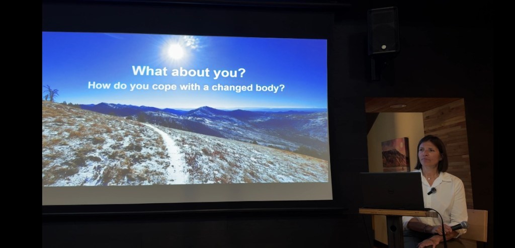
The video of the talk I gave in April is now available online. And please, I’d love to hear from you in the comments (note: Substack seems to be easier for some to comment than on my blog): how do you cope with a changed body?
Update: the story map doesn’t work on ohines now (or at least my android). Why does tech need to get obsolete so fast???? 😖.
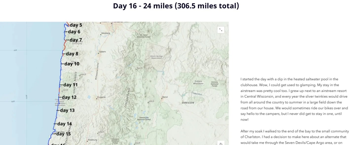
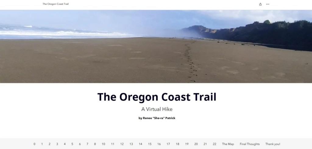
Speaking of the Oregon Coast Trail (see my recent post), some of you who have been with me for years will remember the story map I built in the painful wake of my first injuries and prior to my cancer diagnosis.
In October of 2024, when I realized that I would not be hiking the Oregon Coast Trail, I decided to go ahead and do it anyway, but from home. I would embark on a pretend journey and imagine that I was out plodding through the sand and feeling the rain sting my cheeks in groves of old-growth trees that rim the bluffs over the Pacific Ocean. I would virtually hike the Oregon Coast Trail.
This creative endeavor was my attempt at keeping sane in the new insanity of my body…and you can see that as the days progress in the story map.
My process that month was to wake up early each morning, read the guidebook (shout out to Bonnie Henderson and her excellent resource), reference the FarOut app for real-time updates from other hikers, study the weather, decide how many miles to walk, where I would camp or find lodging, where I would eat, what interesting things I’d see during the day, and how I would navigate the many gaps in the trail. I wanted to turn the virtual hike into a visual journey as well, so I created the story map by publishing each new day on the platform as I would on an actual thru-hike. The Oregon Coast Trail is a logistical mélange of hazards like high tides, which make certain sections un-doable, or eroding cliffs from a perpetually stormy sea. I wanted to experience those hazards, even if remotely, and decide how I would proceed if I were actually there.
Story mapping had become another passion by this point, and over the past few years, I had been creating them professionally for other organizations. The medium harkened back to my college days where I dove into multi-media projects, combining images with prose, sounds, and even videos.
By the second week, my creative act had become oppressive, given the sheer amount of time it was taking me to create each day’s exploration. The added weight of my painful body didn’t make things much easier. After my morning creation, my days were filled with appointments. They ranged from sessions with a physical therapist, massage therapist, chiropractor, acupuncturist, and my primary care doctor, with little result. I could barely move.
I kept going because that’s what I do, and I finished the project on October 31, 2024 to mirror when I would have finished in real time.
Because the story map software is constantly undergoing changes, I’m not sure how long this project will be available (the version I used to create this has already been discontinued), so check it out if you are interested:
And here is another story map I’m particularly proud of:
Maybe I’ll make a story map of all my hiking stories too?? The possibilities are endless!
As I’m working on writing stories from my decades of hiking, I decided that I will share some of them here periodically…I’m sure these will probably look a bit different in their final form, but I find it’s great fun to share what I have now, rather than waiting for that “one day.”
Insignificance along the Oregon Coast Trail
October 2023
I walked up to Elk River in a panic. The tidal water looked too deep and dark for me to cross. Despite hiking as fast as I could through the damp and dark early hours, it looked like I might be out of luck. Low tide was another ten hours away, and if I had to wait, my day was shot.
I knew hiking the Oregon Coast Trail would be a challenge, but it’s really not fair how tides and swells and eroding cliffs throw up the gauntlet. Other trails don’t behave like this. Other trails are obedient in their stabilized soils and rocky steps. The trail out here doesn’t care that I have to walk through deep sand and journey into the night if I can’t cross this river. She doesn’t care if I slip, splash, and dunk myself on the way across, or if my shoe is sucked off into the sifting sand. The audacity!
I didn’t see a choice, so stepped into the flow.
My crotch is wet!
I panicked while resisting the pull of the ocean. The sea was hungry, but my thick thighs prevailed and hoisted me through the last of the current and onto the sandy bench above the flow.
I peeled off the pack and spread out my tyvek ground cloth. Not much point in it though, I was already soaked, and sand had snuck into every crevice; I felt new chafe on multiple levels.
Socks off, feet out. I lay spread-eagle on the ground and listened to my breath slow.
In. Out.
Inn. Ouut.
Innn. Ouuut.
I watched the clouds move along their own current overhead before closing my eyes to the brightness.
One thing became clear: I am not the most important thing here. I am not important at all.
There was no one around to have witnessed my panicked crossing, and I laughed at the absurdity of it all.
I don’t matter. None of this matters.
The ocean does that: puts me in my place.
I thought: this is what forever will feel like. It will feel like the ocean, where I am a drop in an unfathomable depth of the unknown. Suddenly, I could take anything that came my way. The thoughts that weighed on me minutes before seemed lighter against the backdrop of the sea. Anxiety about starting my new business? Doesn’t really matter. The last argument Kirk and I had? Nah. My Dad’s dementia? What?
I’ve felt this way before: when looking at pancake layers of rock in Utah, when surveying the mountainous horizon from the summit of Mt. Whitney, when gazing up at the Milky Way from the Alvord Desert. That abyss? That’s deep time, and I’m here in it.
I thought about Rumi saying, “You are not a drop in the ocean. You are the entire ocean in a drop.” It took me a minute before the concept set up in my mind…what helped was pulling out a scene from a late 90s movie.
Remember the part from Men in Black where alien blasters Will Smith and Tommy Lee Jones realized the cat they had been toting around had a glass marble on its collar, and that glass marble was what the aliens had been after all along? The closer you looked at the marble, the deeper it went. There were stars and galaxies inside, and the magic of cinema zoom showed us that an entire universe was contained within that sphere.
The grain of sand between my toes used to be part of a mountain. That mountain used to be the sea floor. The sea floor used to be covered by glaciers. It doesn’t end, so maybe I won’t end either? I’ll become a part of it all, if only a scrap of food for a tree that will preside over the Deschutes River, and then get covered in lava the next time South Sister erupts.
It’s all good. I’m all good.
I shaded my eyes from the intense sun as I struggled to place myself.
I’ve become one with my heating pad. Actually, I have three of them. This one is USB powered when I’m on the go.
At times I forget that I’m not the center of the universe.
I went to see my oncologist a few weeks ago, part of my routine three-month scan and blood test check-in, and welcomed the news that I was still cancer-free. Whew. But when we started discussing my ongoing pain struggles, I sadly explained that I had put a lot of hope into a nerve-block procedure to dull or eliminate said pain, to no result.
Well, she took action! She ordered a rush neck MRI, and that same week I went into the clicking and whirring tube, happy to be there again. I was incredibly grateful for her sense of urgency in helping me find a solution: maybe it was the return of my cancer that other tests hadn’t picked up? Maybe it was time to get more radiation on my spine? Maybe another surgery could help? I had an appointment to see the neuro surgeon shortly after the new MRI, so I reveled in the thought that answers would be coming. There might be a way out. There might be a solution.
I had hope again.
Note: prior to the oncology appointment and after my last blog post, I visited my non-surgical spine specialist who had given me the (failed) nerve block, only to hear him say there were no other interventions he could try. In his opinion, another spinal fusion was the next step.
I visited several of my other practitioners, and although they are not surgeons, they have been on this spinal damage journey with me long enough to also chime in: their interventions could only go so far. Massage, acupuncture, Feldenkrais, and PT all helped me deal with the pain and get some mobility back, but they didn’t address the root cause of it: my damaged C7, T1, and T3. They also mused that surgery could be my best bet.
Ok! I’m ready. Lets get some surgery! I would clear my summer, I would make room for months in a neck brace again, I was ready for the immobility if it meant I could move forward once more.
Then the neuro surgeon appointment was rescheduled. To June. A full month after I expected to get some answers, and some action.
I was angry. I was indignant.
Over the next few hours, my emotions oscillated from:
Anger: My oncologist wanted this done asap!
Victimization: Doesn’t he know I’m in pain!
Justification: I’ve been in this state of uncertainty for months now!
Rationalization: Maybe he had a more critical surgical case, and that’s why I got bumped?
Acceptance: Ok, maybe I’m not the most important patient, especially as my pain is controlled by meds now.
Sadness: Maybe I’ll feel like this forever.
Redirection: Think about anything else. Dance in the kitchen. Think about the start of your PCT thru-hike 20 years ago this week.
Reminiscing: The PCT was one of the most powerful experiences of my life. The 2006 thru-hikers are having a 20-year reunion at PCT Days this August! I love those hikers.
Imagining: I want to hike the PCT again. I will hike the PCT again.
Resolve: I will advocate for my needs and desires. I will impart to that surgeon that a quality of life is everything to me now.
I’m trying to be an adult and regulate my emotions, but it’s hard!!!
I made a list of all the things I would like to be able to do again, you know, to help with the resolve part:
Stand up without pain
Drink a glass of wine (alcohol is a no-no now that I’m on a higher dose of gabapentin)
Drive on a gravel road
Ride a bike
Practice yoga
Paddle on a lake
Thru-hike!
I want a quality of life. Am I greedy for wanting to do more? Of course, I’m grateful to be alive and walking, but can I have more? Doctors have suggested that more is a possibility, so now I want it. I want it ferociously.
Then the results from the MRI came in: nothing had changed from the January scan.
Part of me was disappointed. A cause for my increased pain wasn’t showing up. It was real, right? I decided to test it and delayed my next set of pain meds, and poof! There it is again. Yes, the pain is real. (Note: the MRI is still bad, the January one showed a whole mess in there).
It became clear to me that I would need to convince the surgeon (who said everything was stable in January – that my damage is a stable damage) that I needed surgery. That I couldn’t function properly. That I was already living like I had a spinal fusion, and in fact I might be able to do more with another fusion. Please operate on me!
So I’m left in a gray fog of uncertainty again until June, but I’m still having some good times. Those moments of sunshine are worthy of some mention here, too!
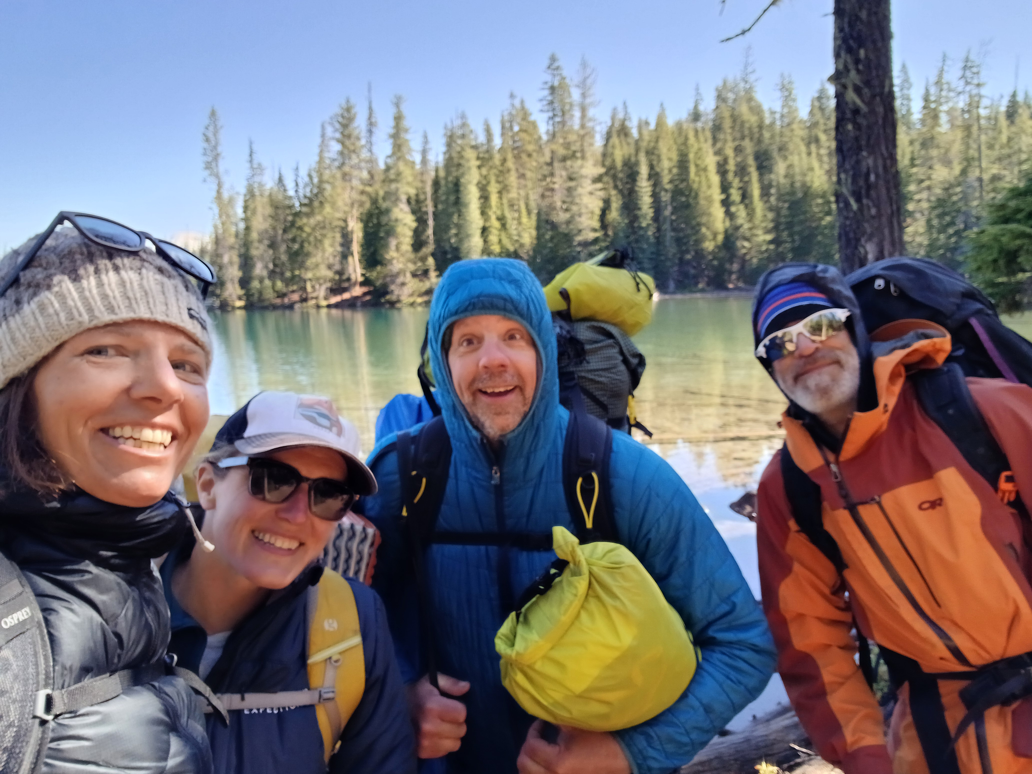
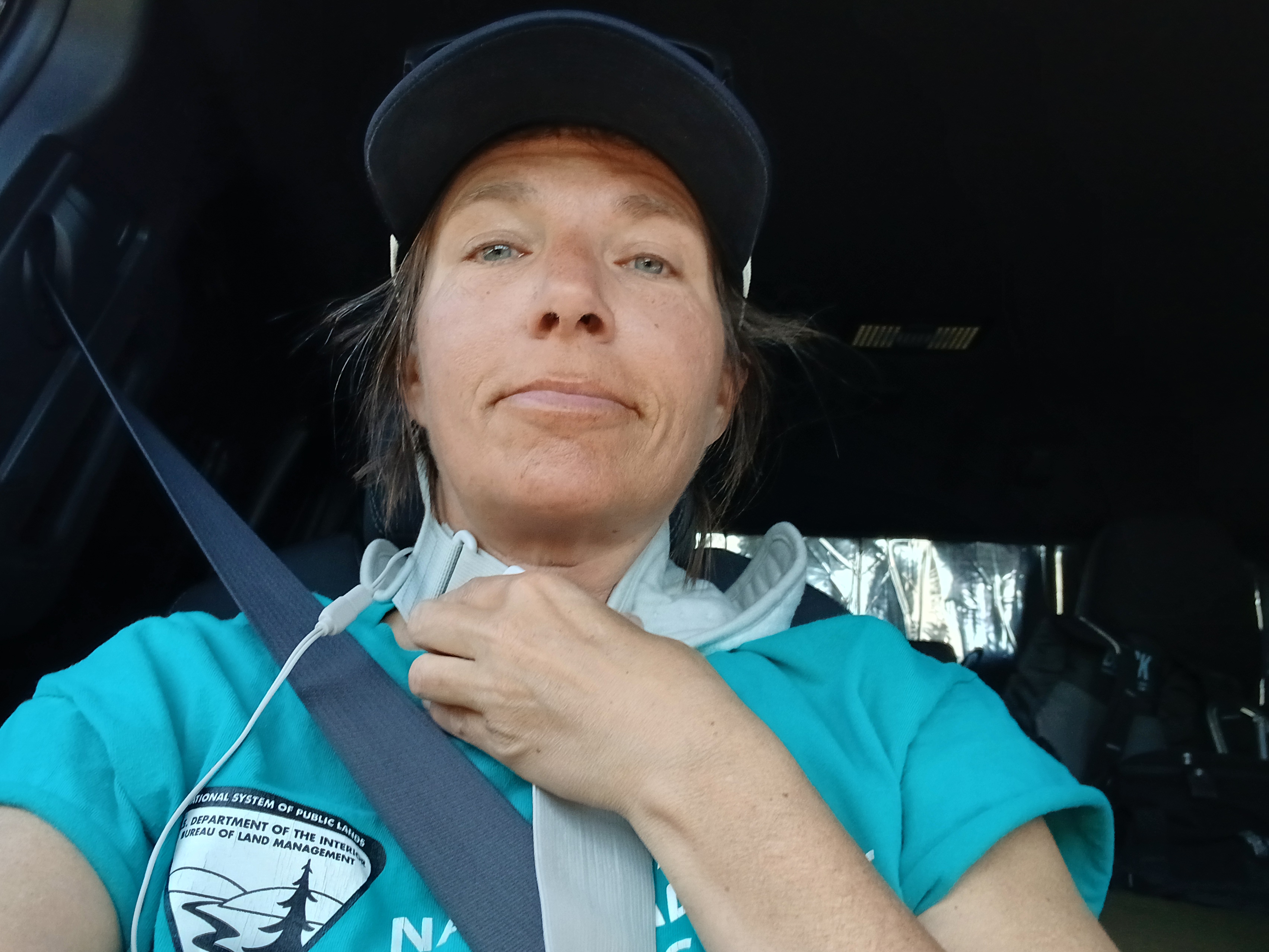
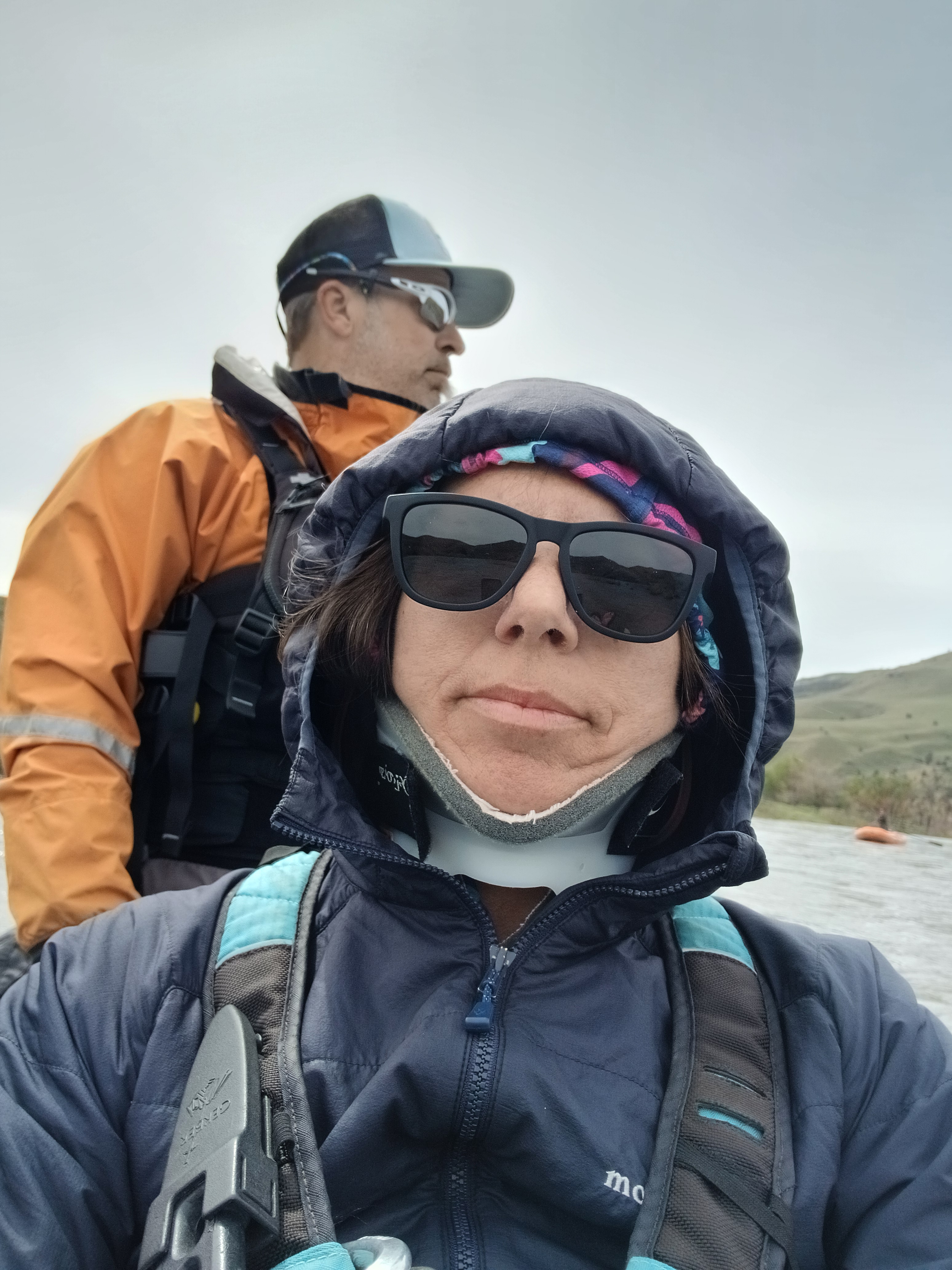
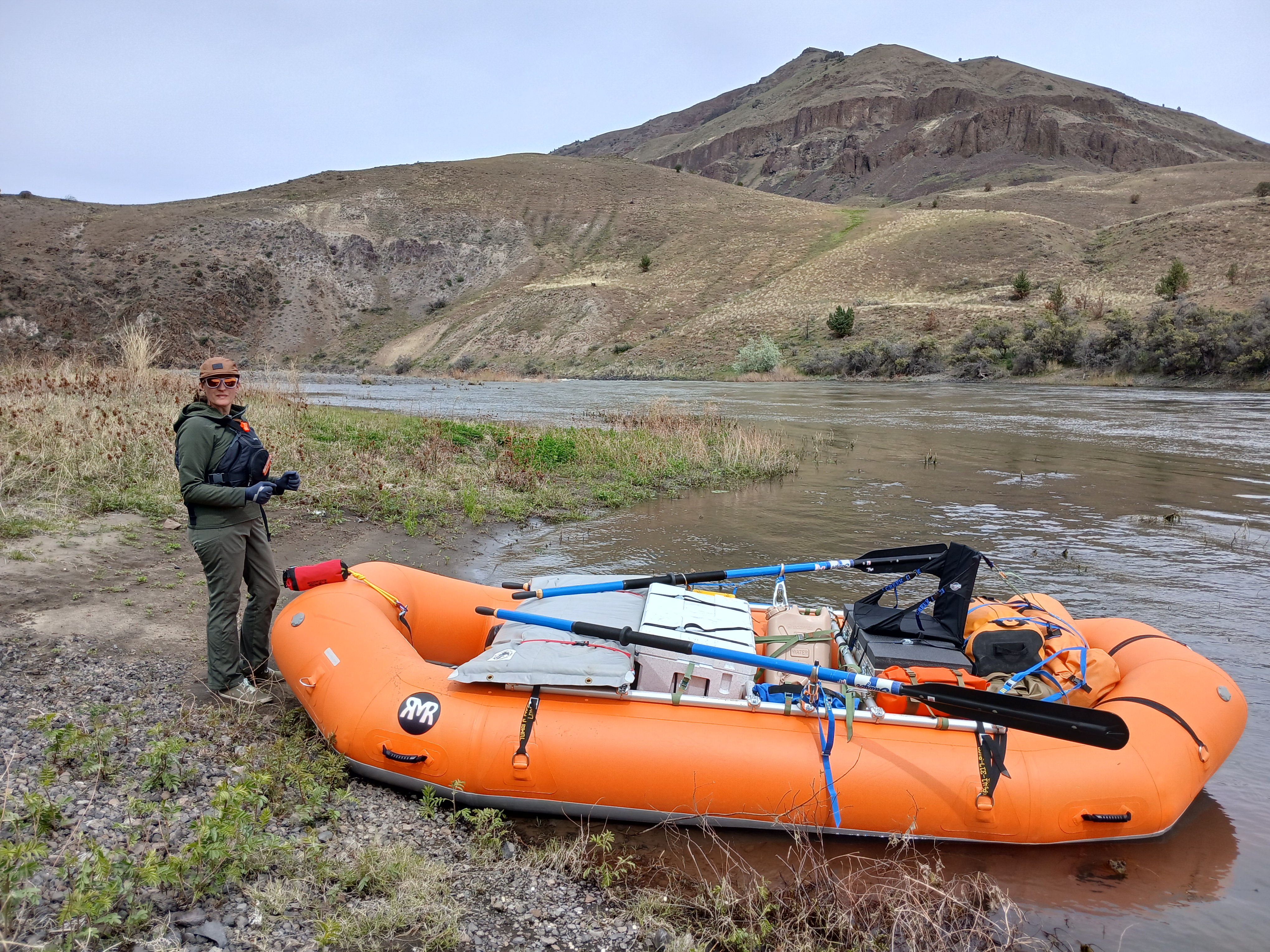
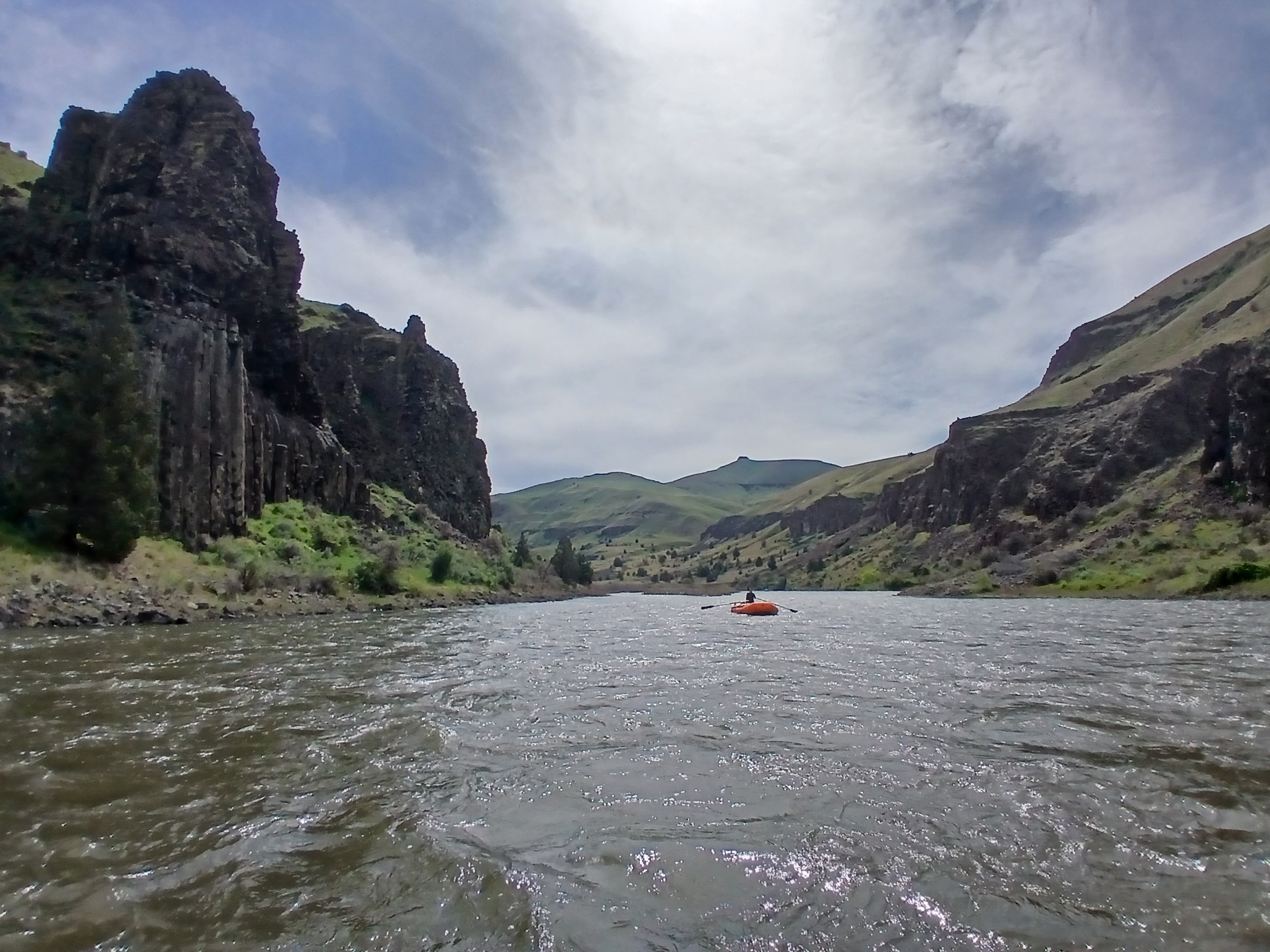
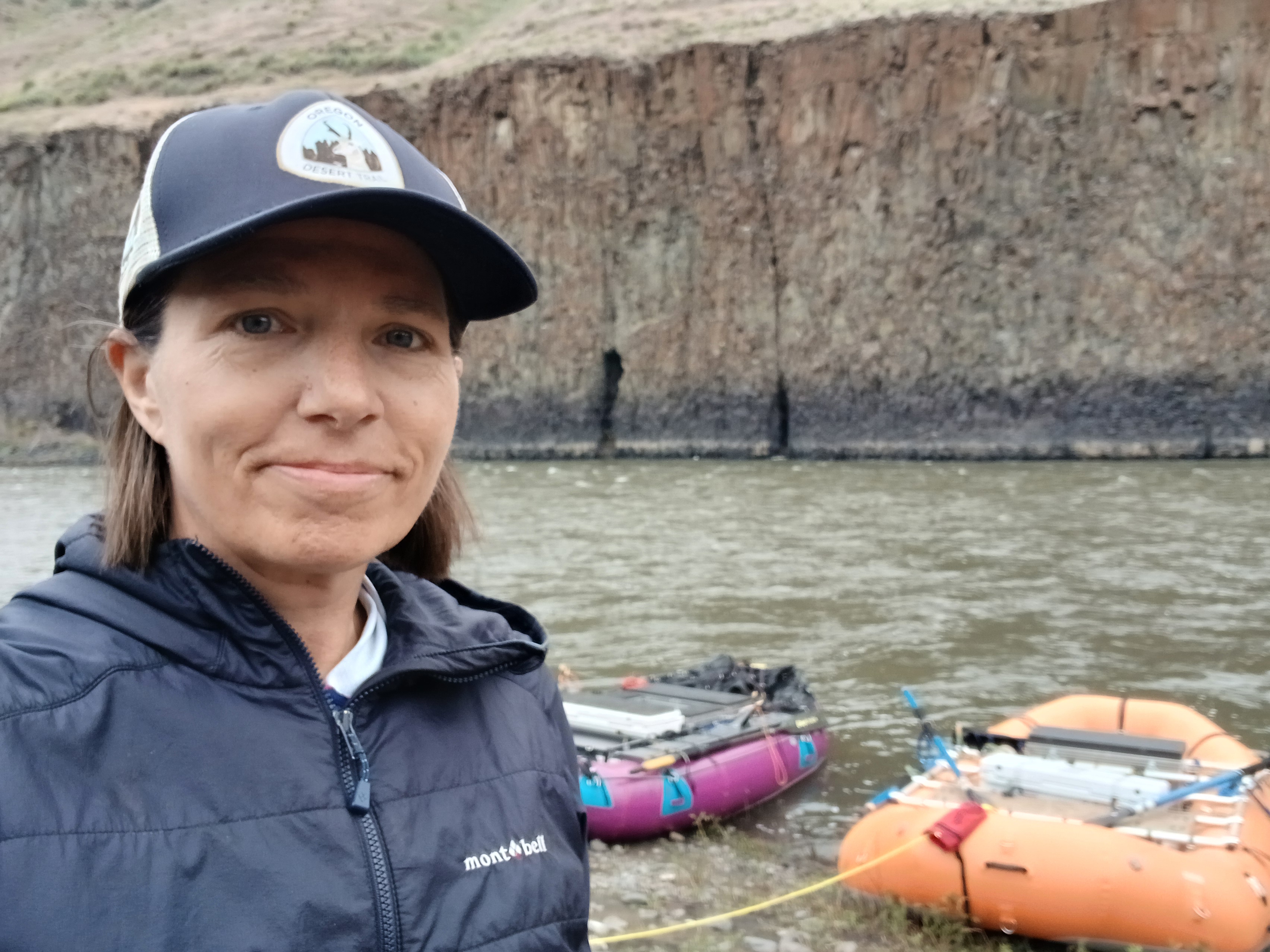
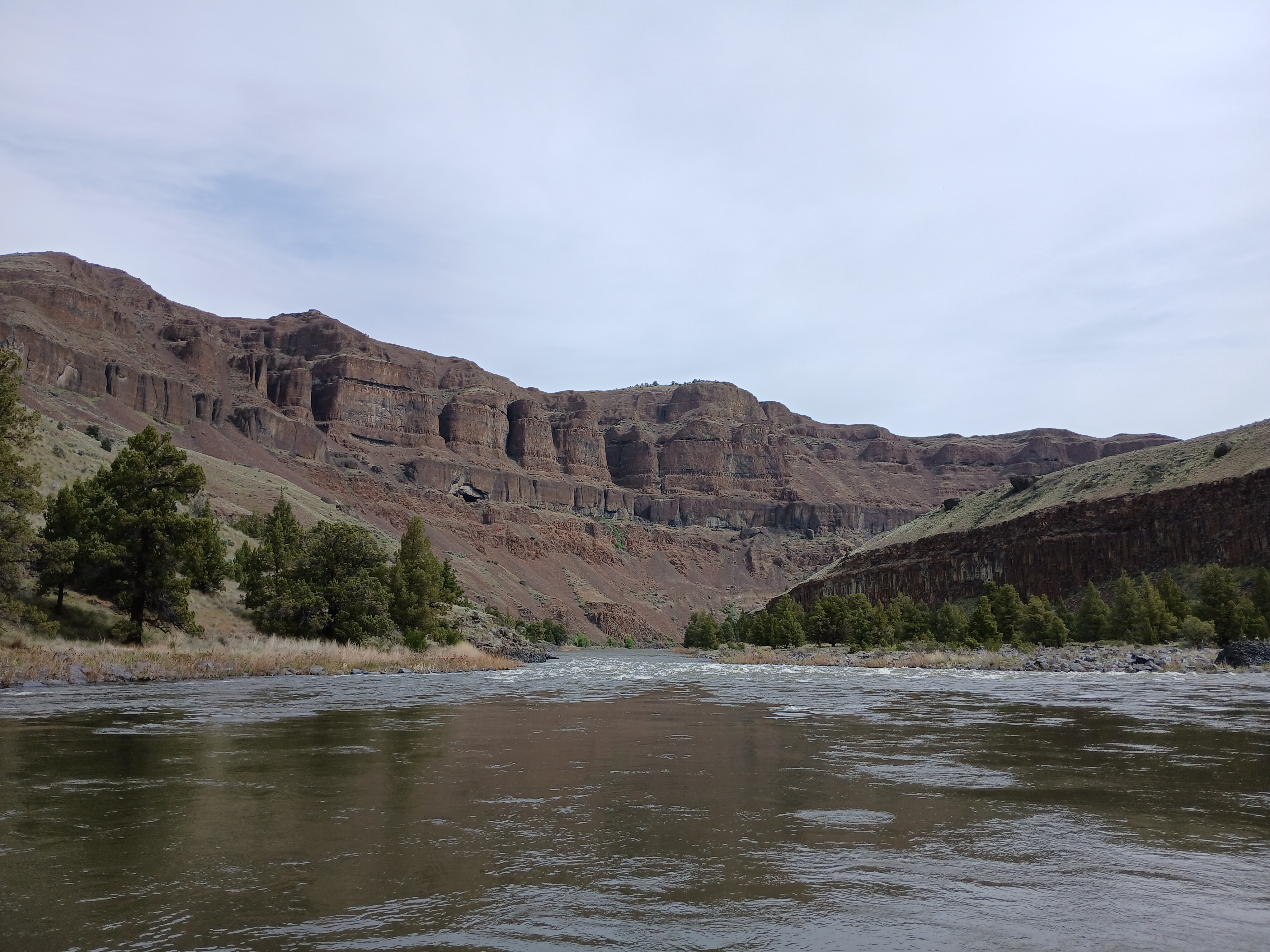
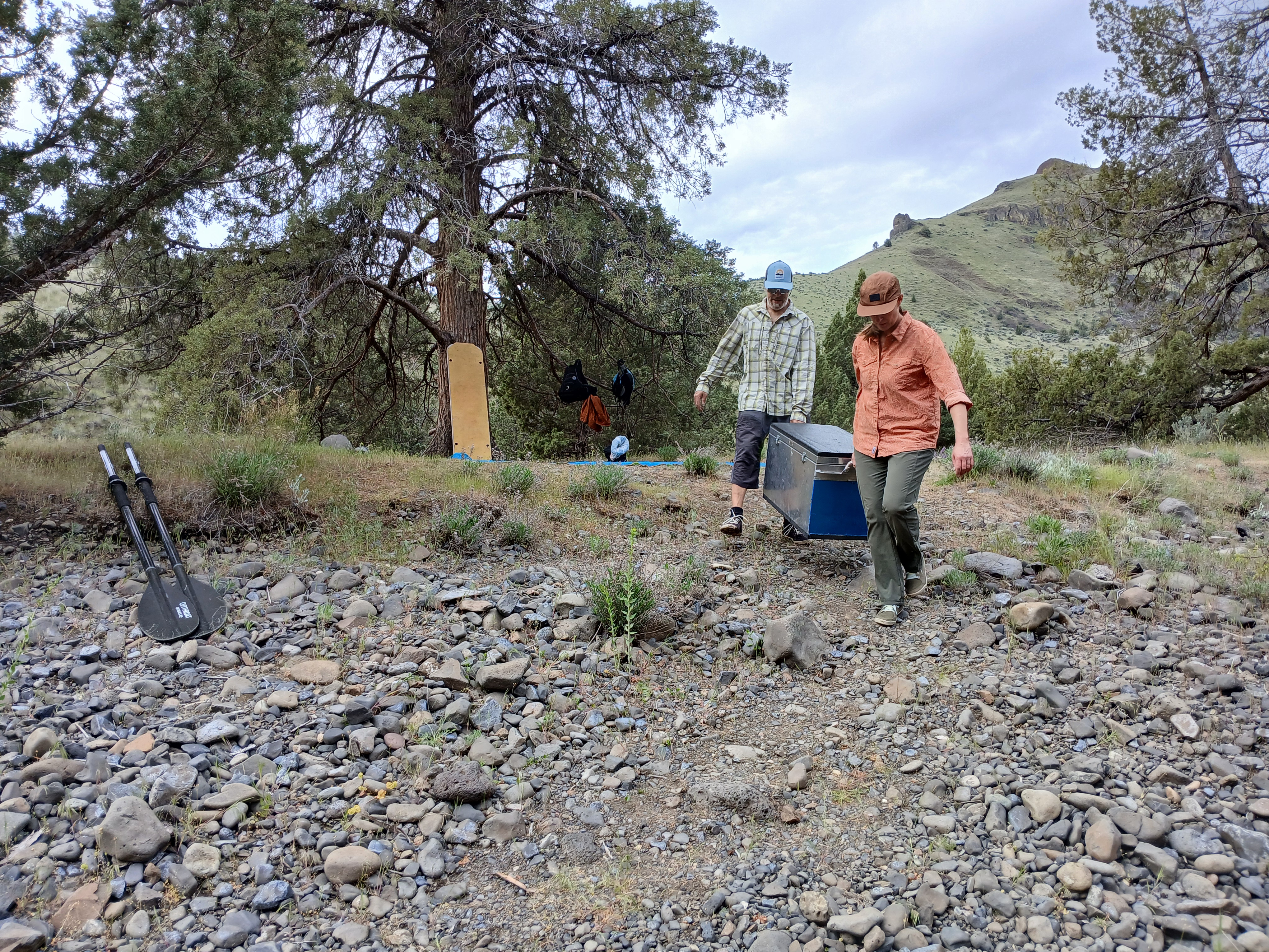
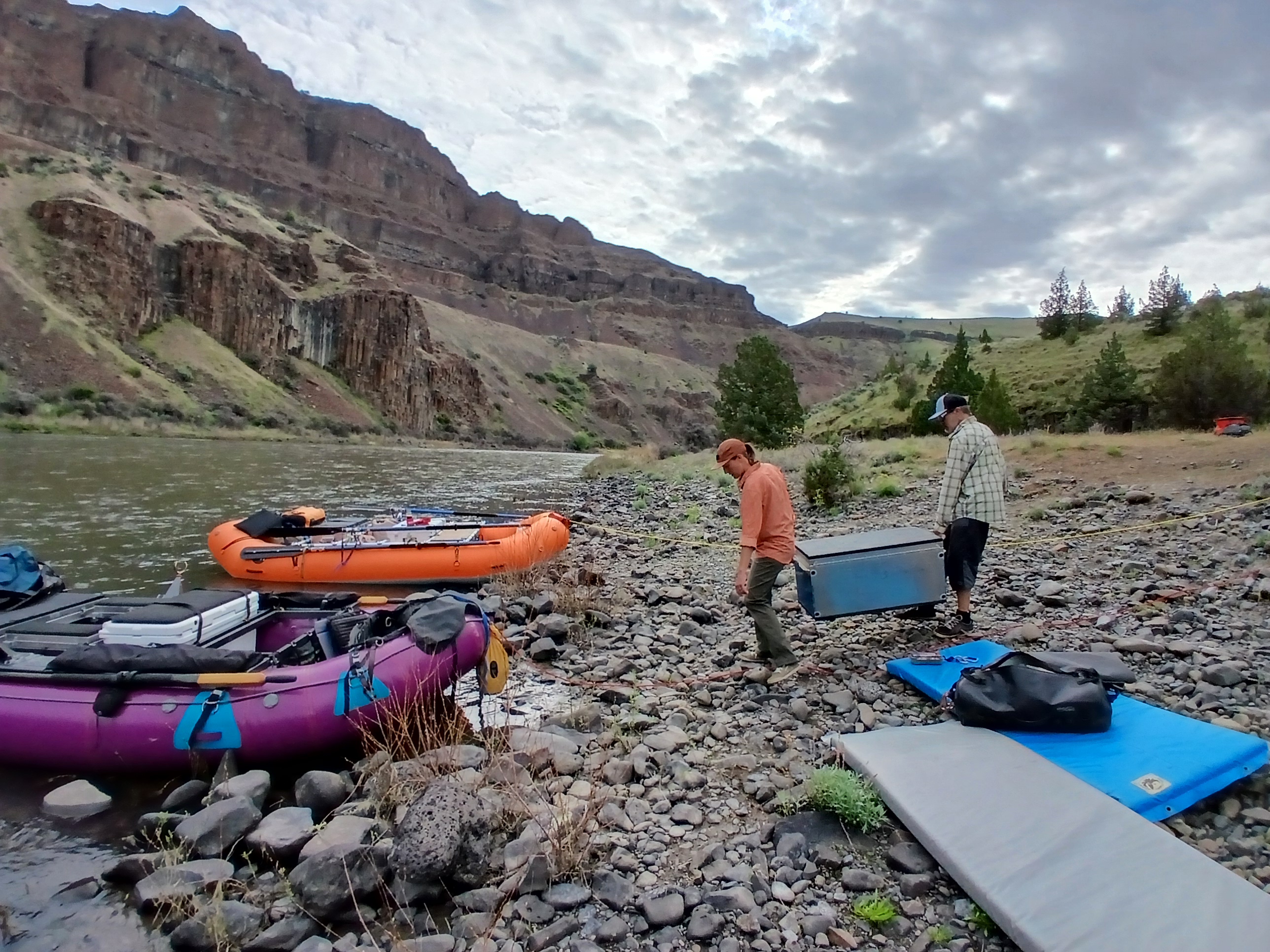
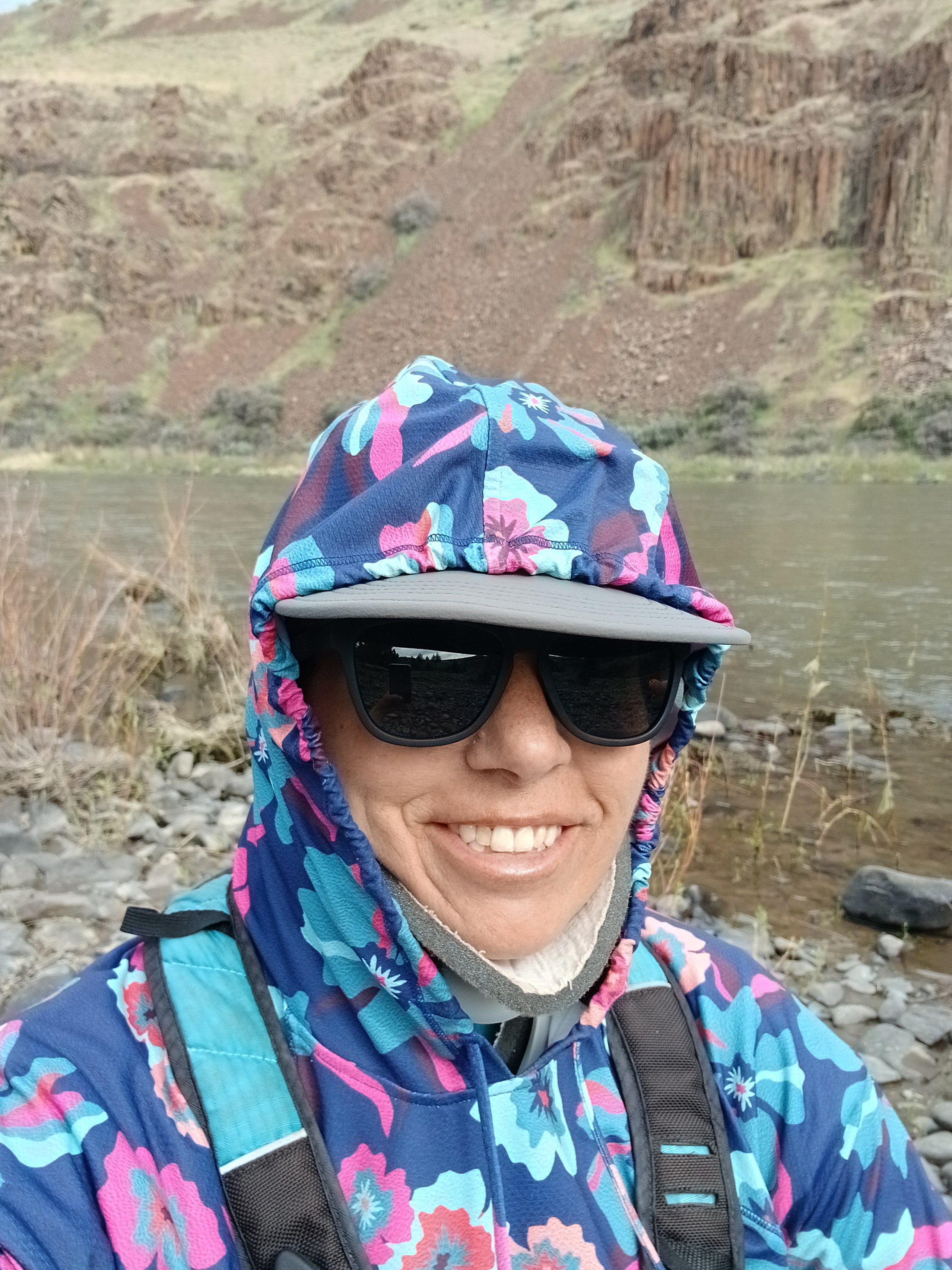
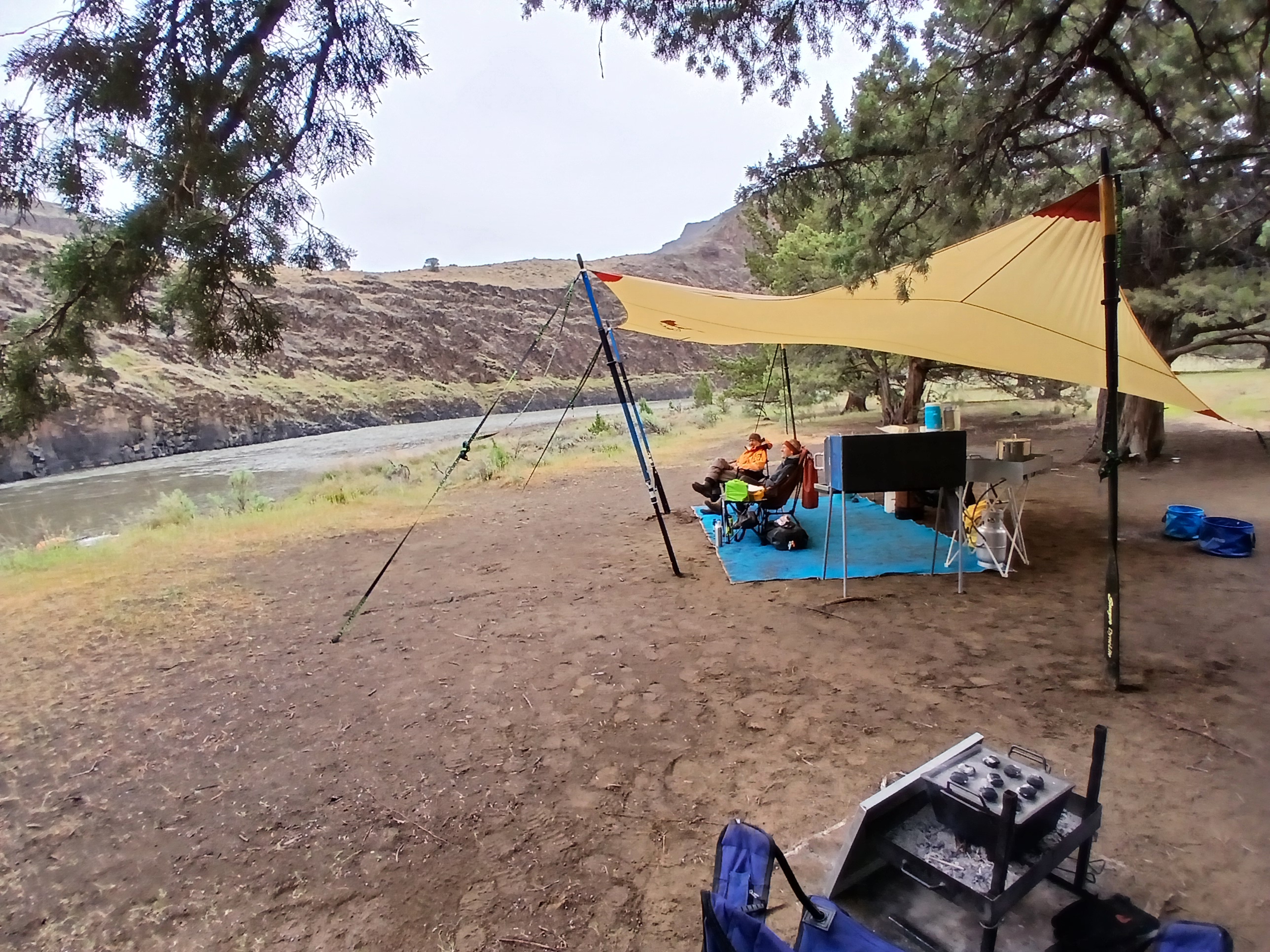
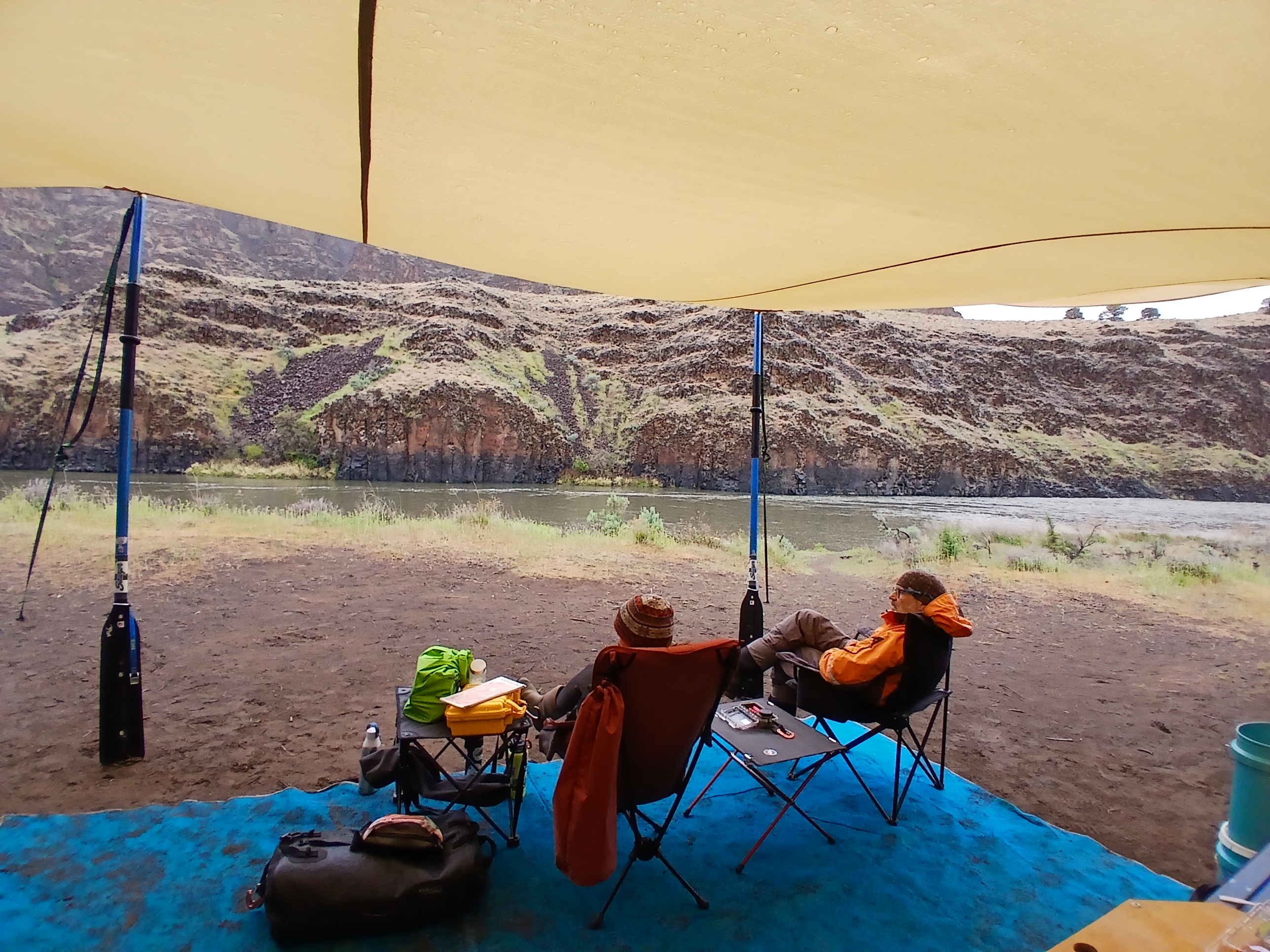
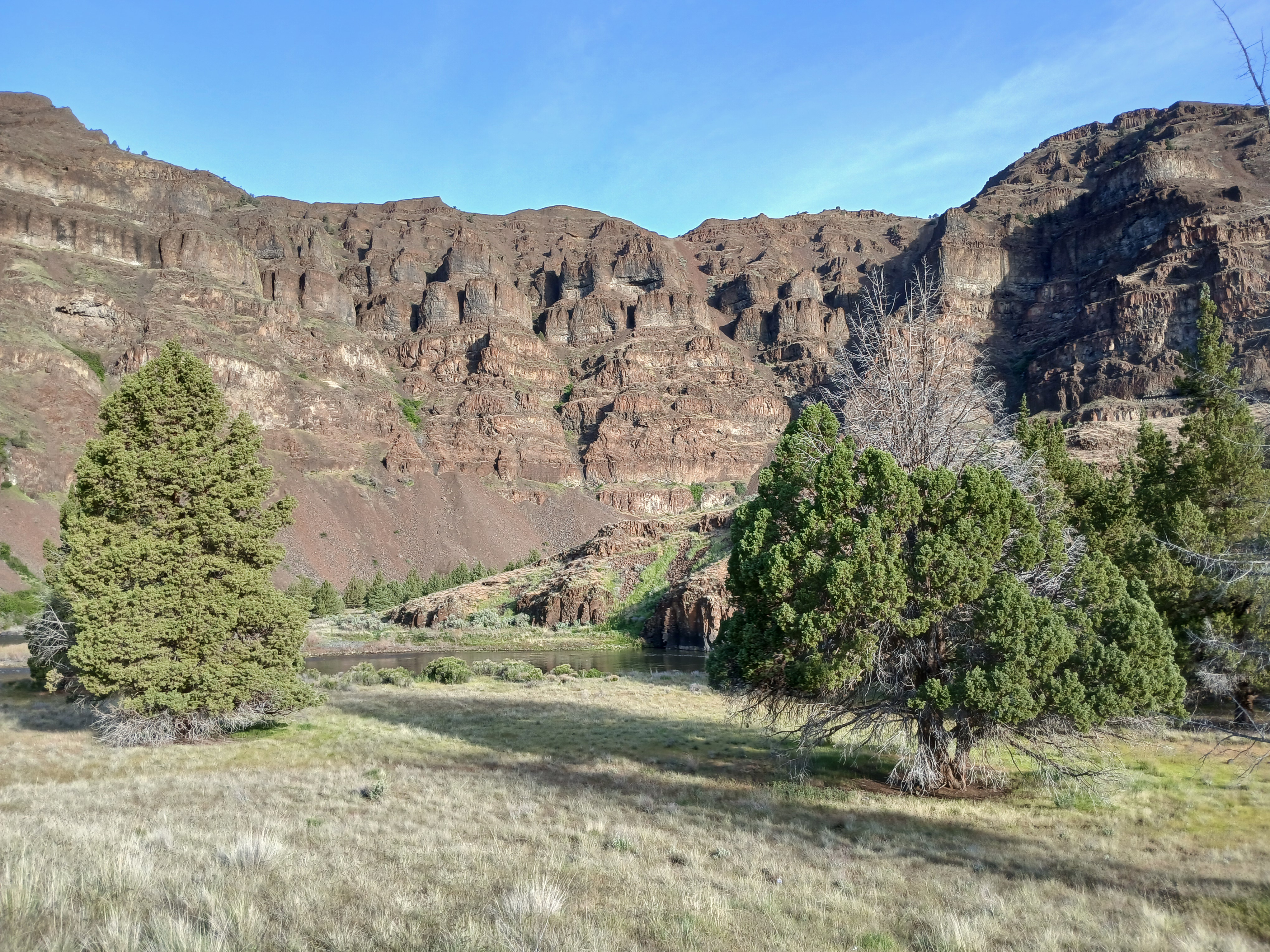
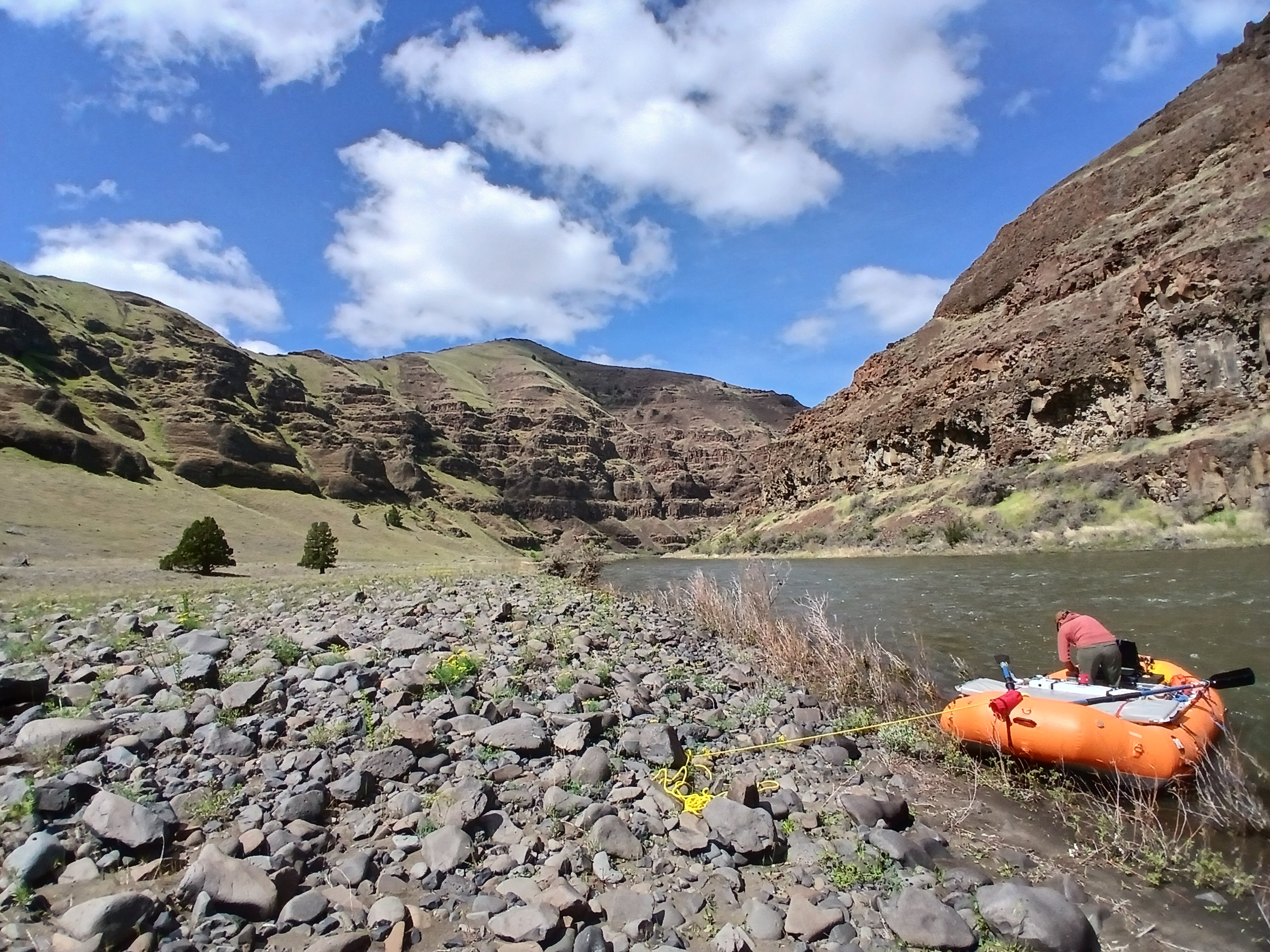
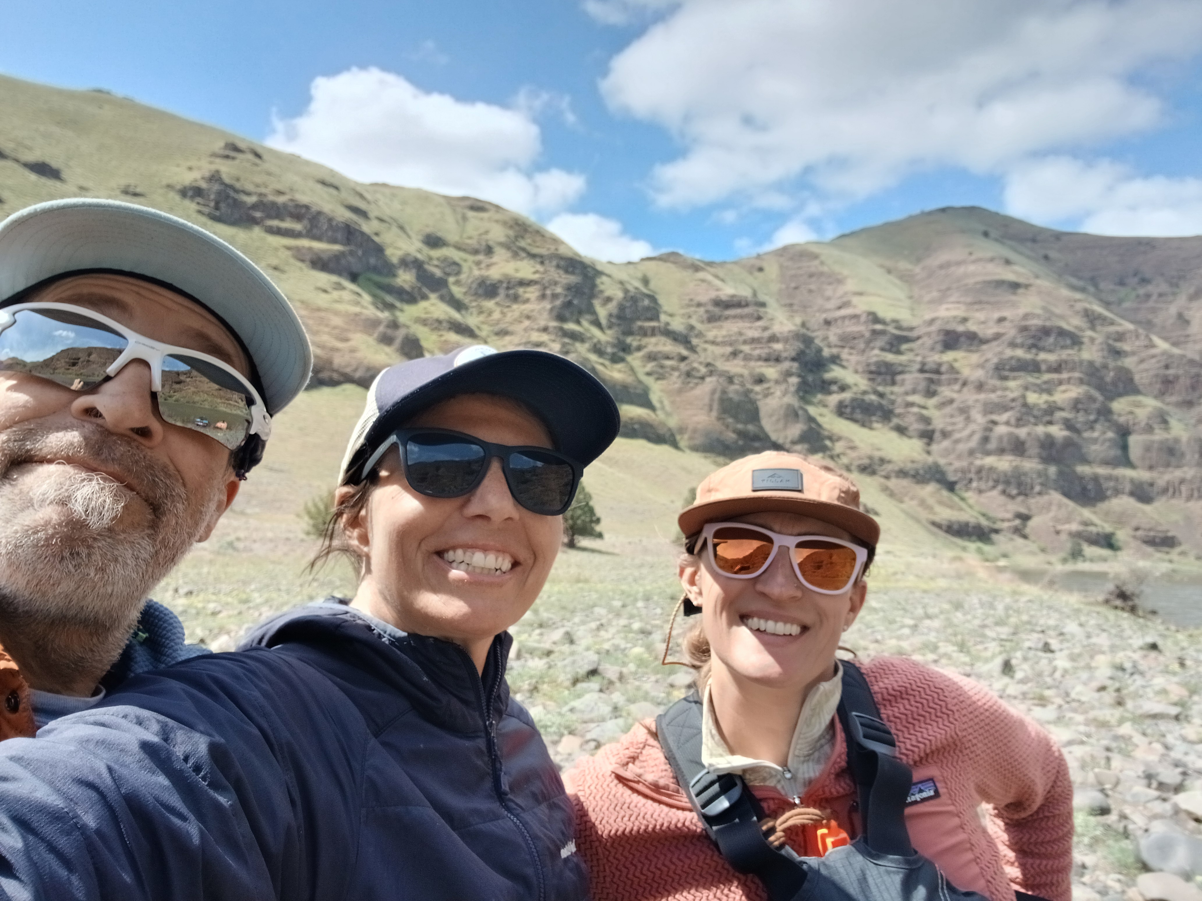
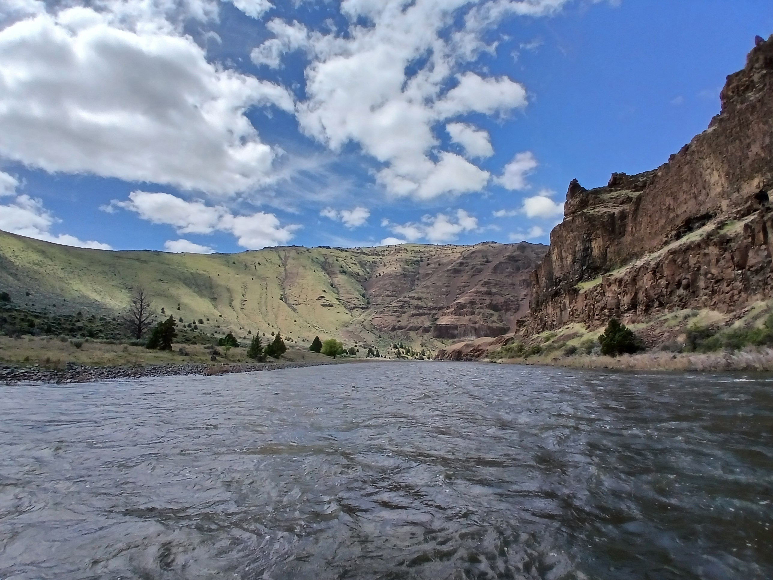
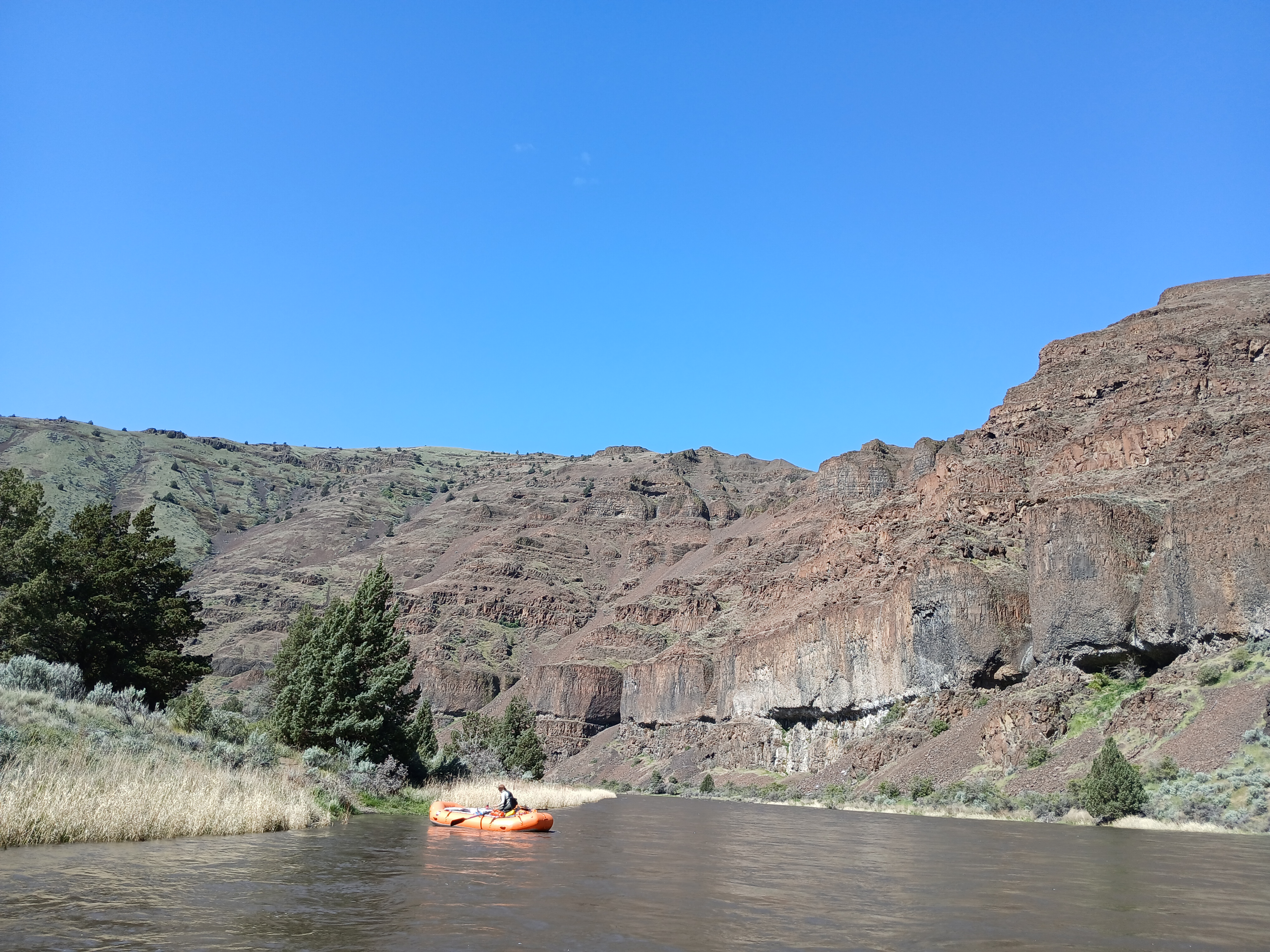
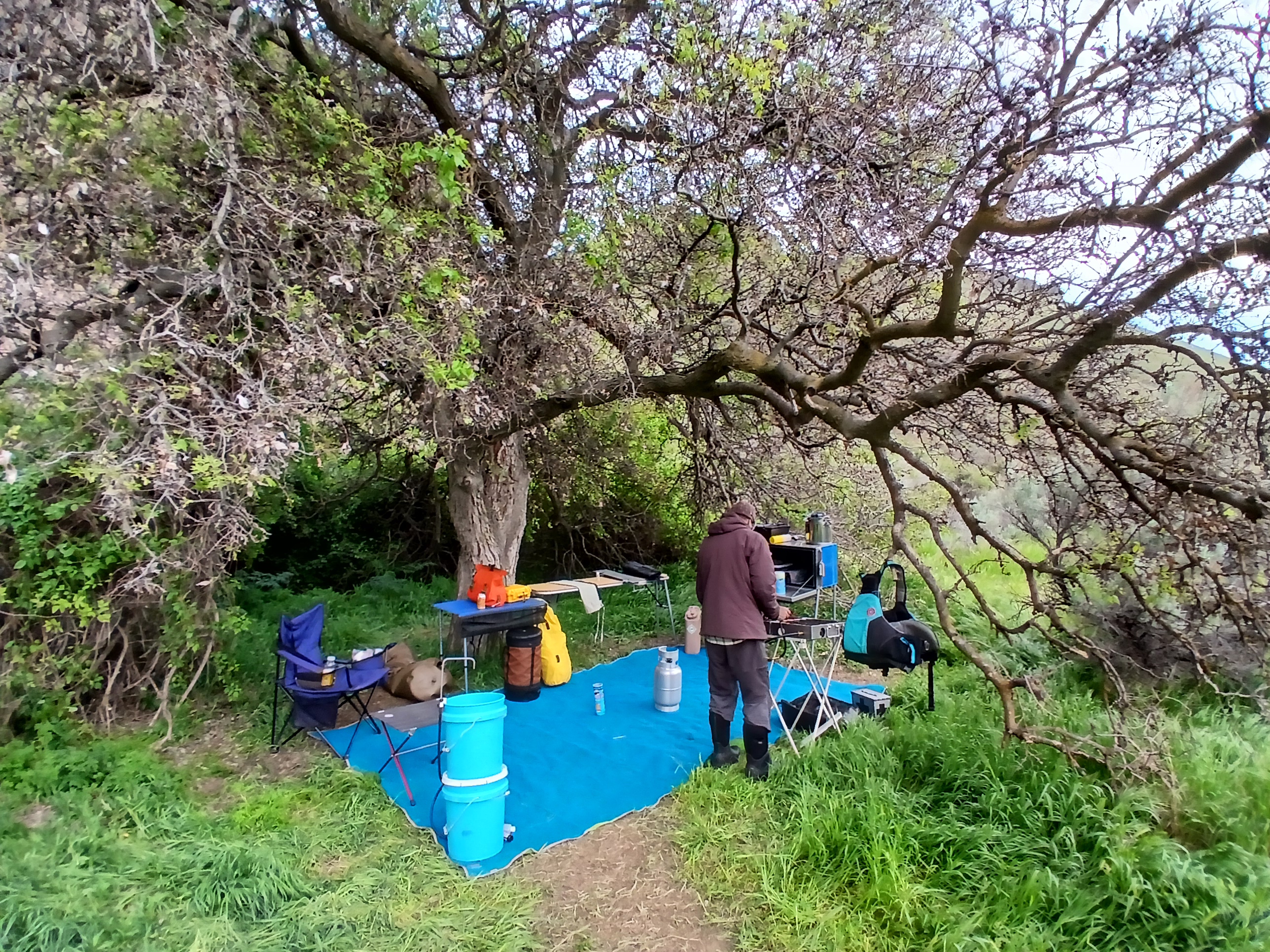
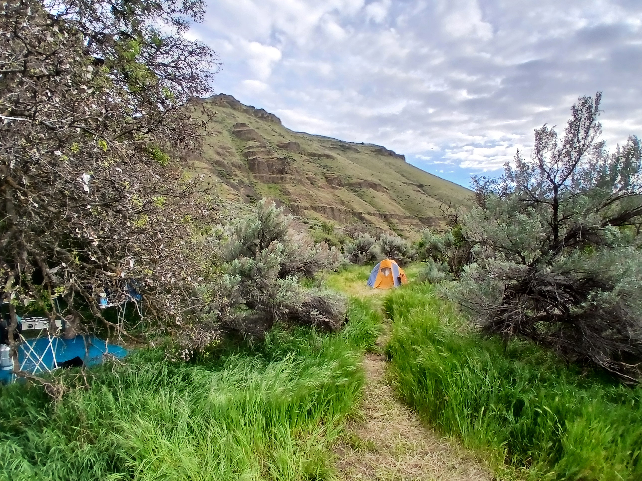
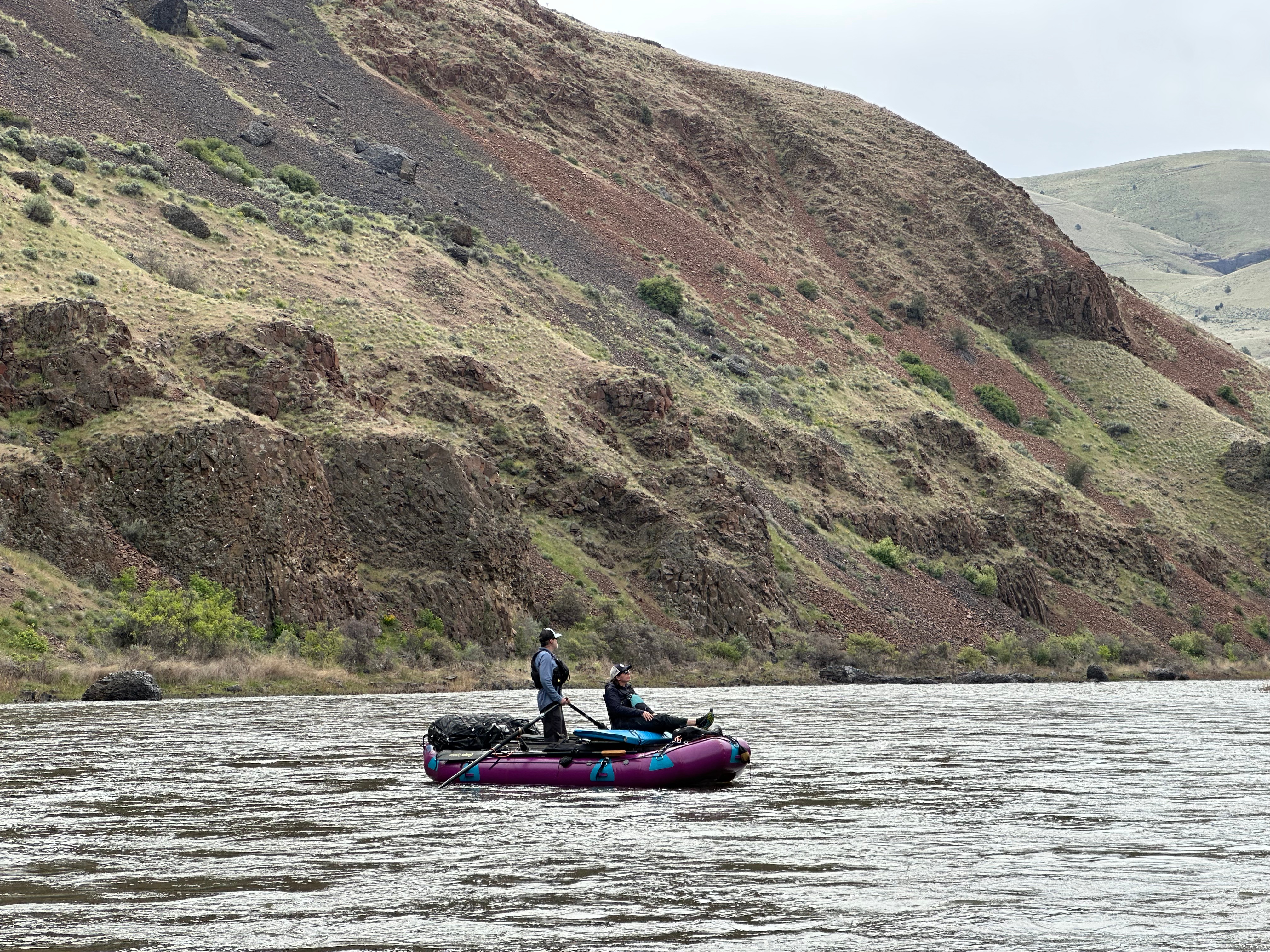
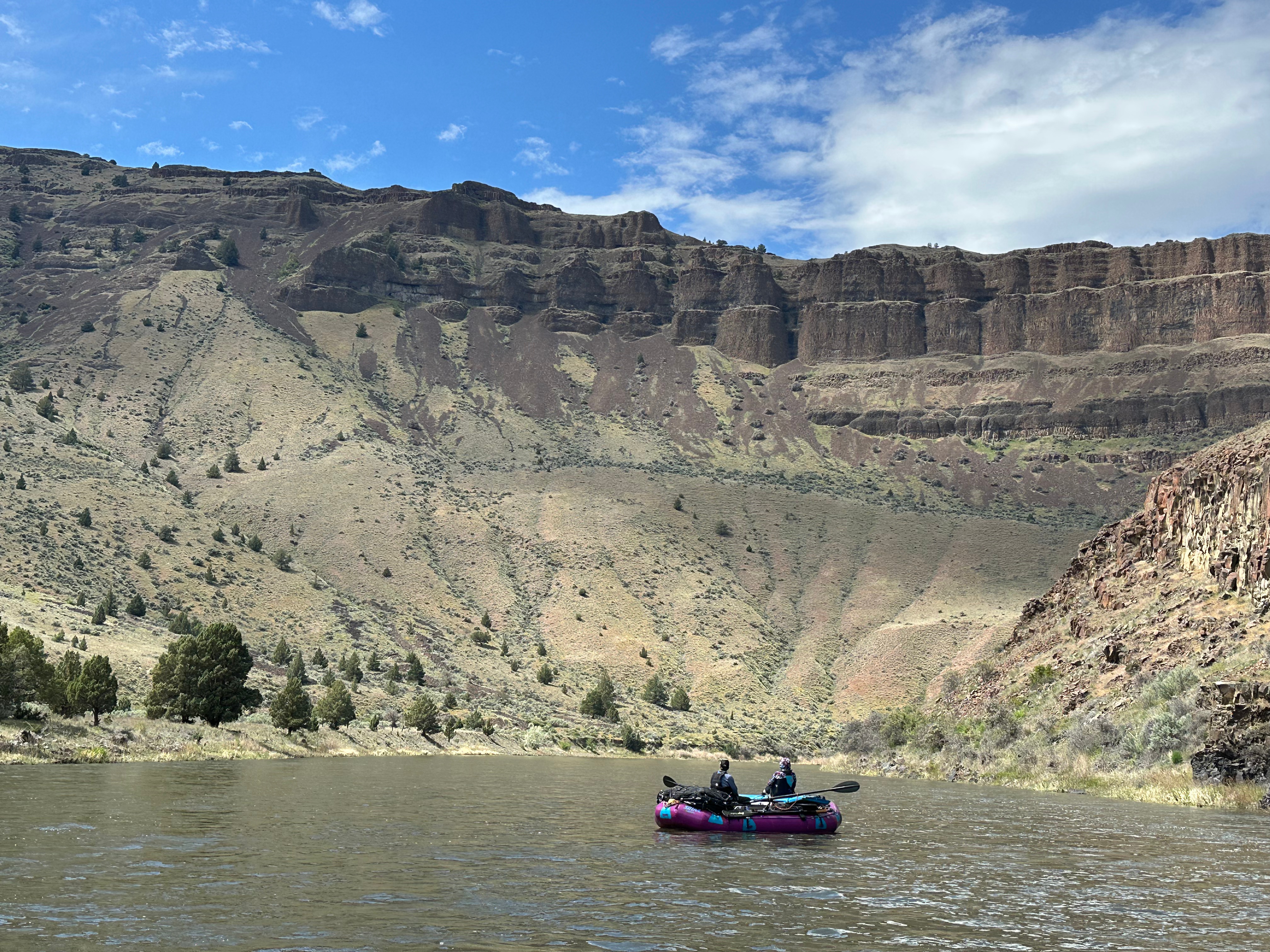
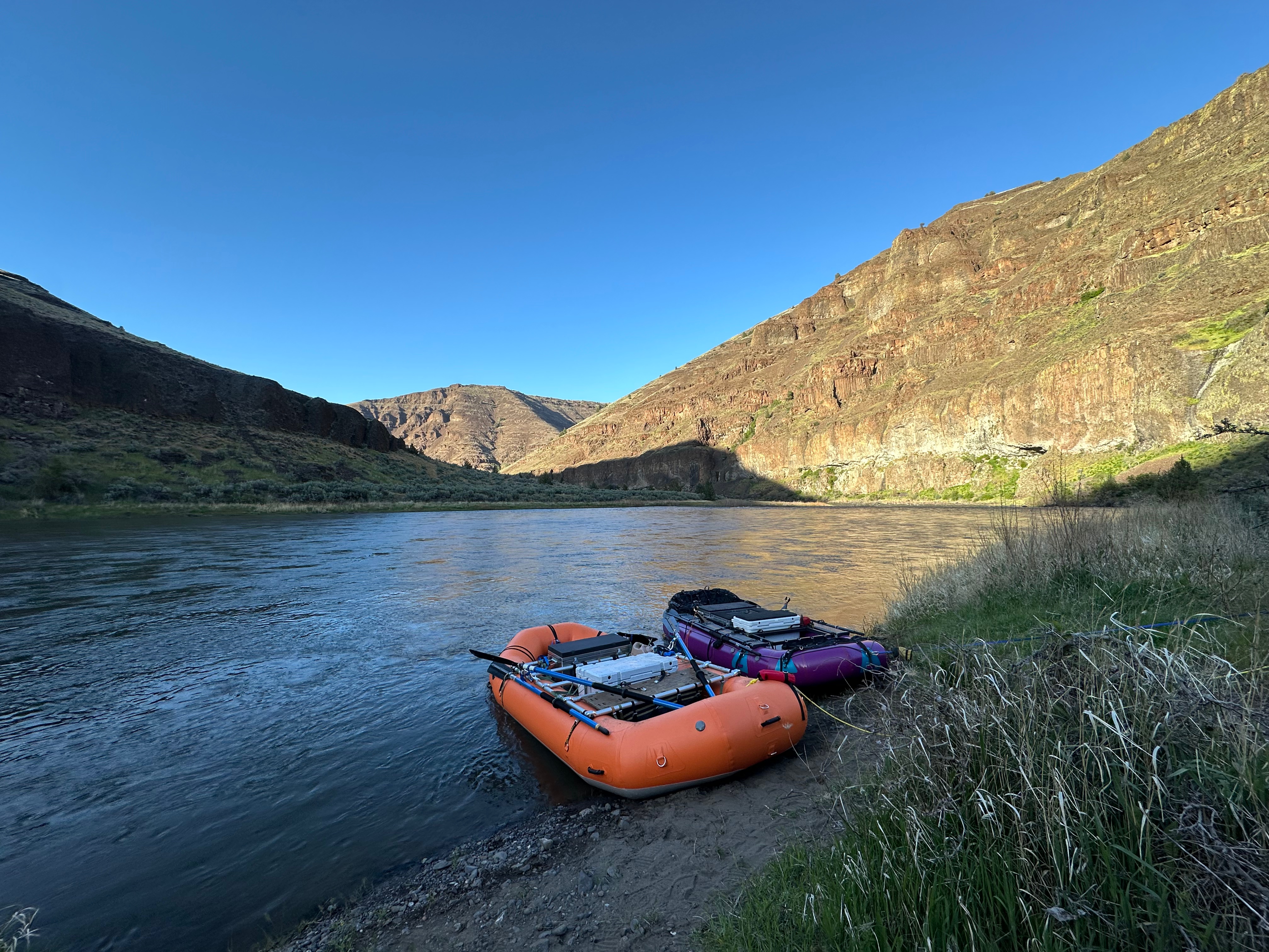
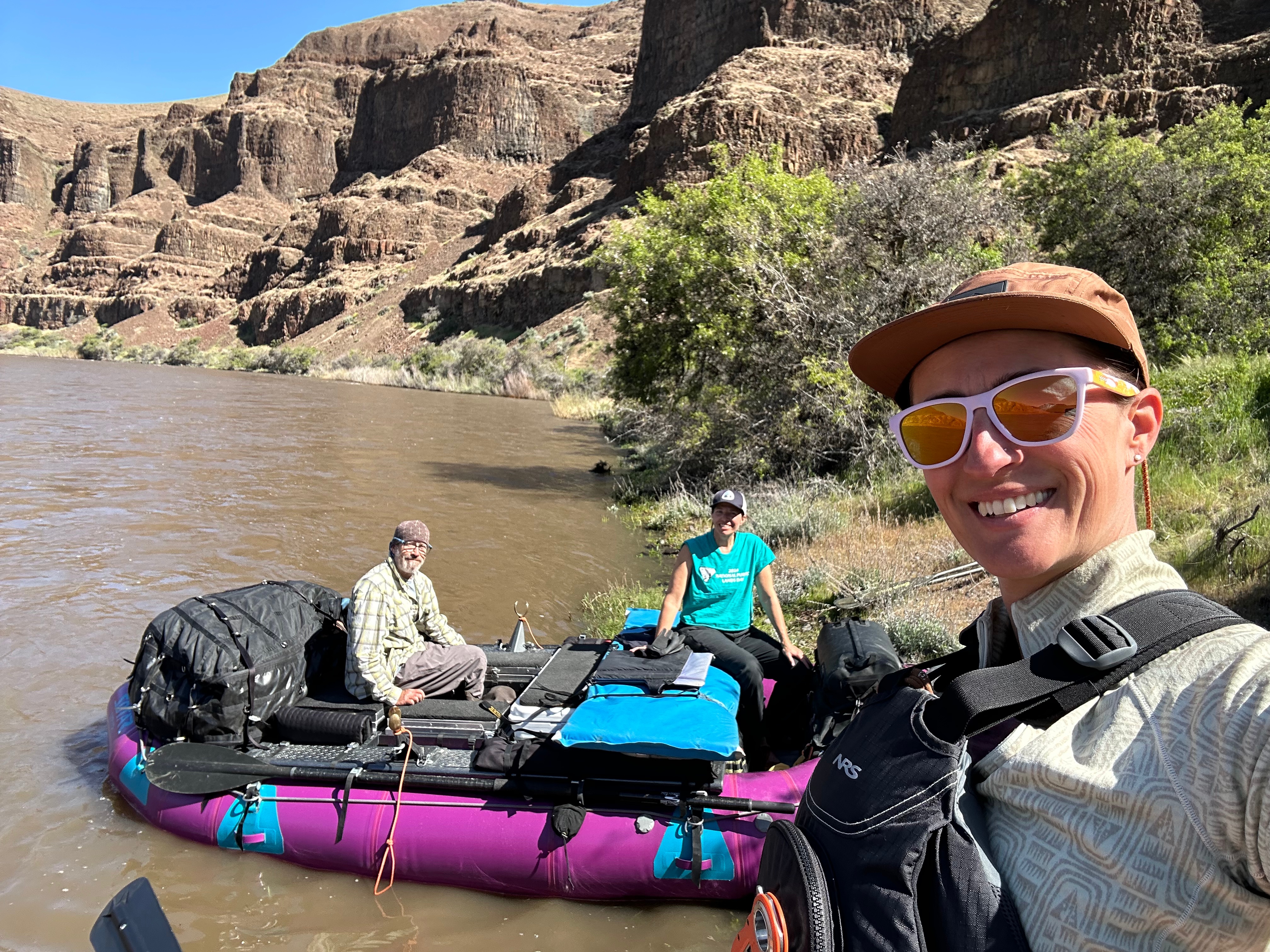
Kirk and I spent eight days on the John Day River with our friend Lorraine a couple weeks ago. We had wonderful weather with just one day of rain on our layover day. I wore my neck brace most days in the boat because I couldn’t help but crane my neck in every direction to look at the amazing geology and plentiful big-horned sheep we saw along the way:
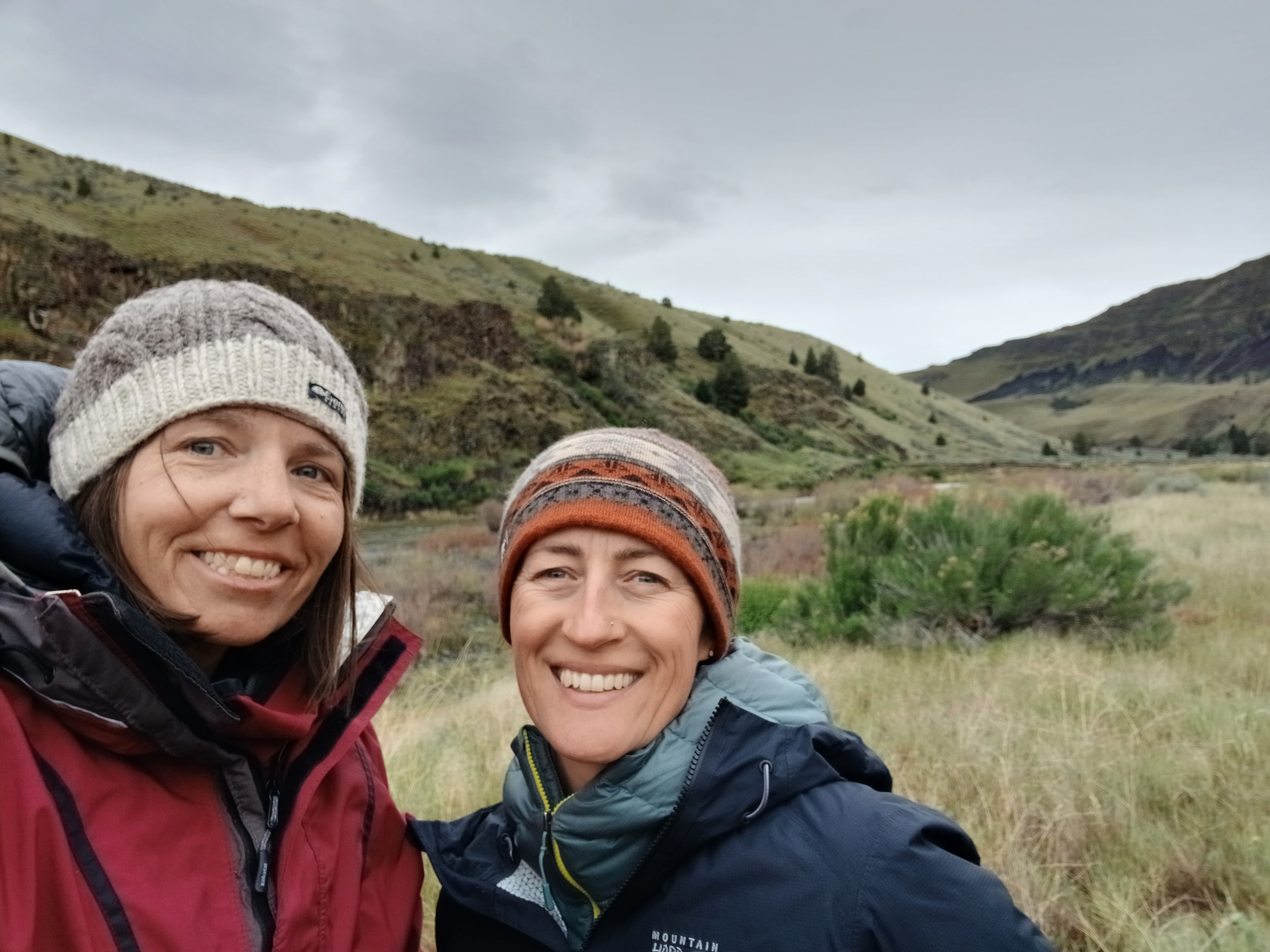
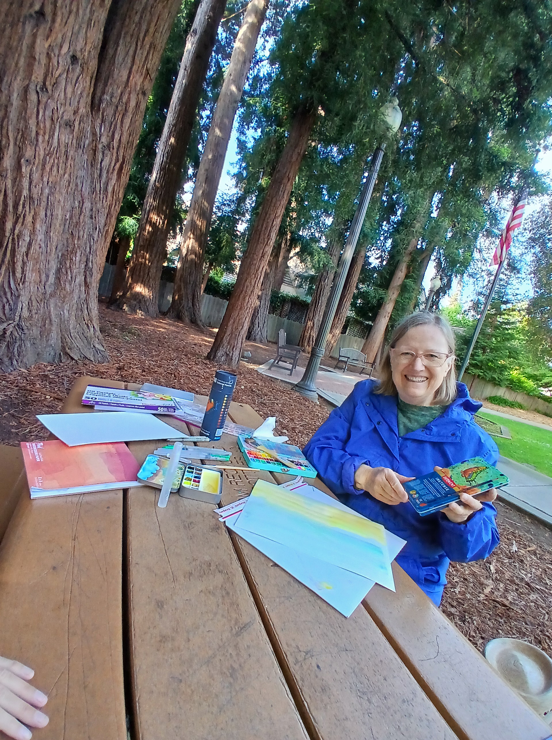
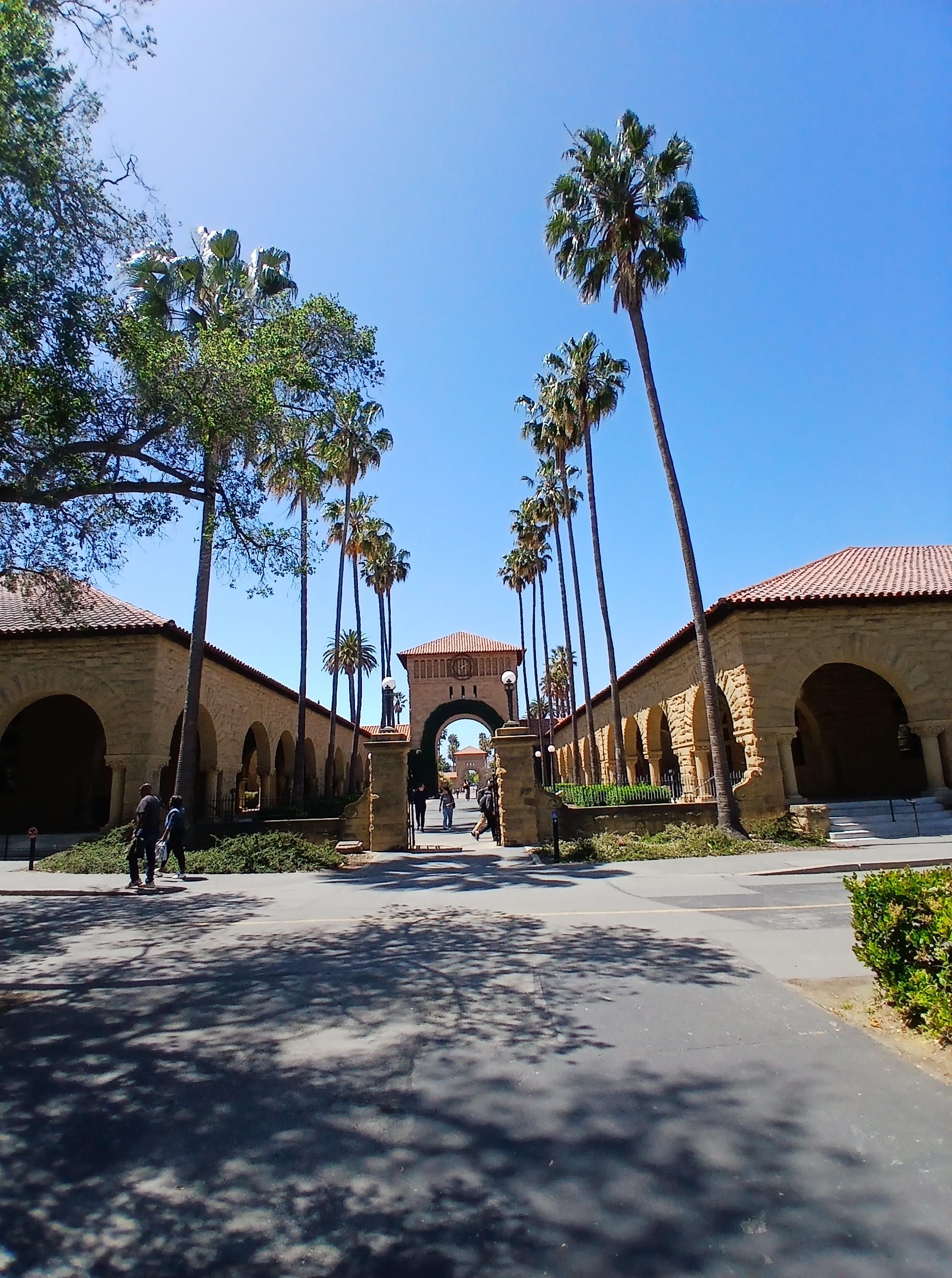
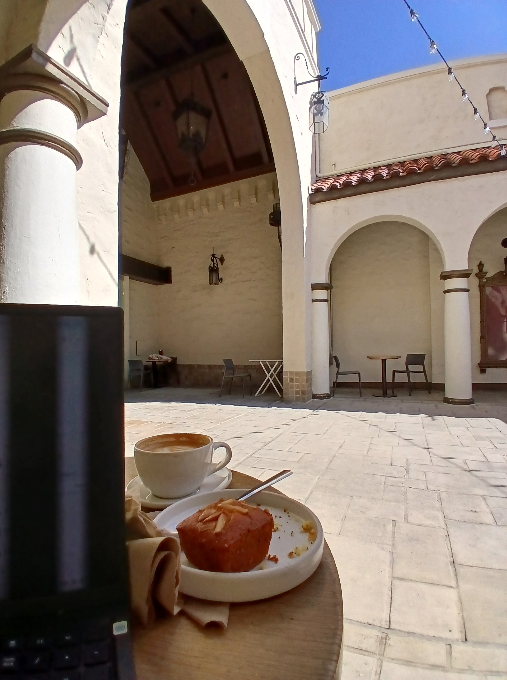
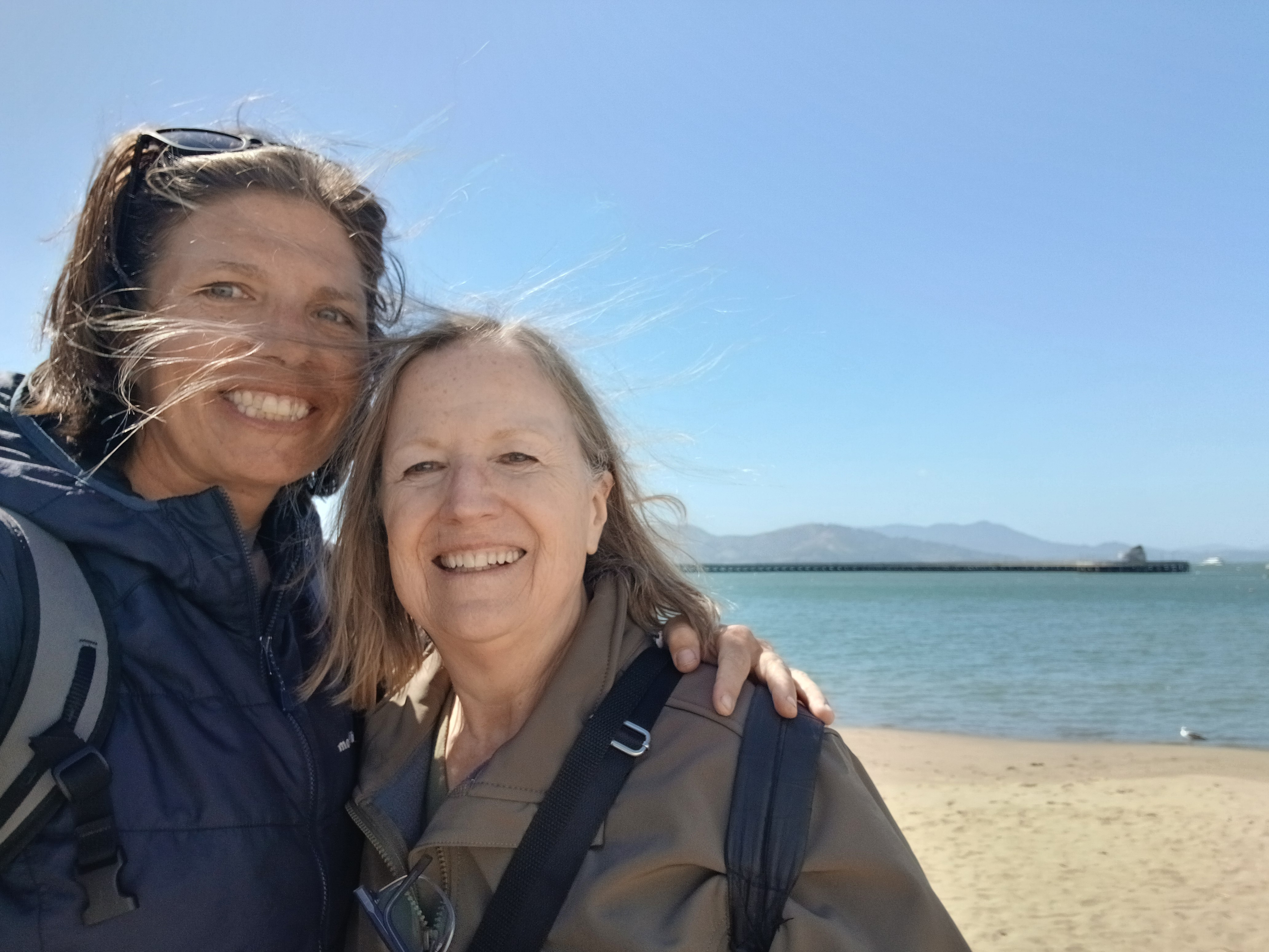
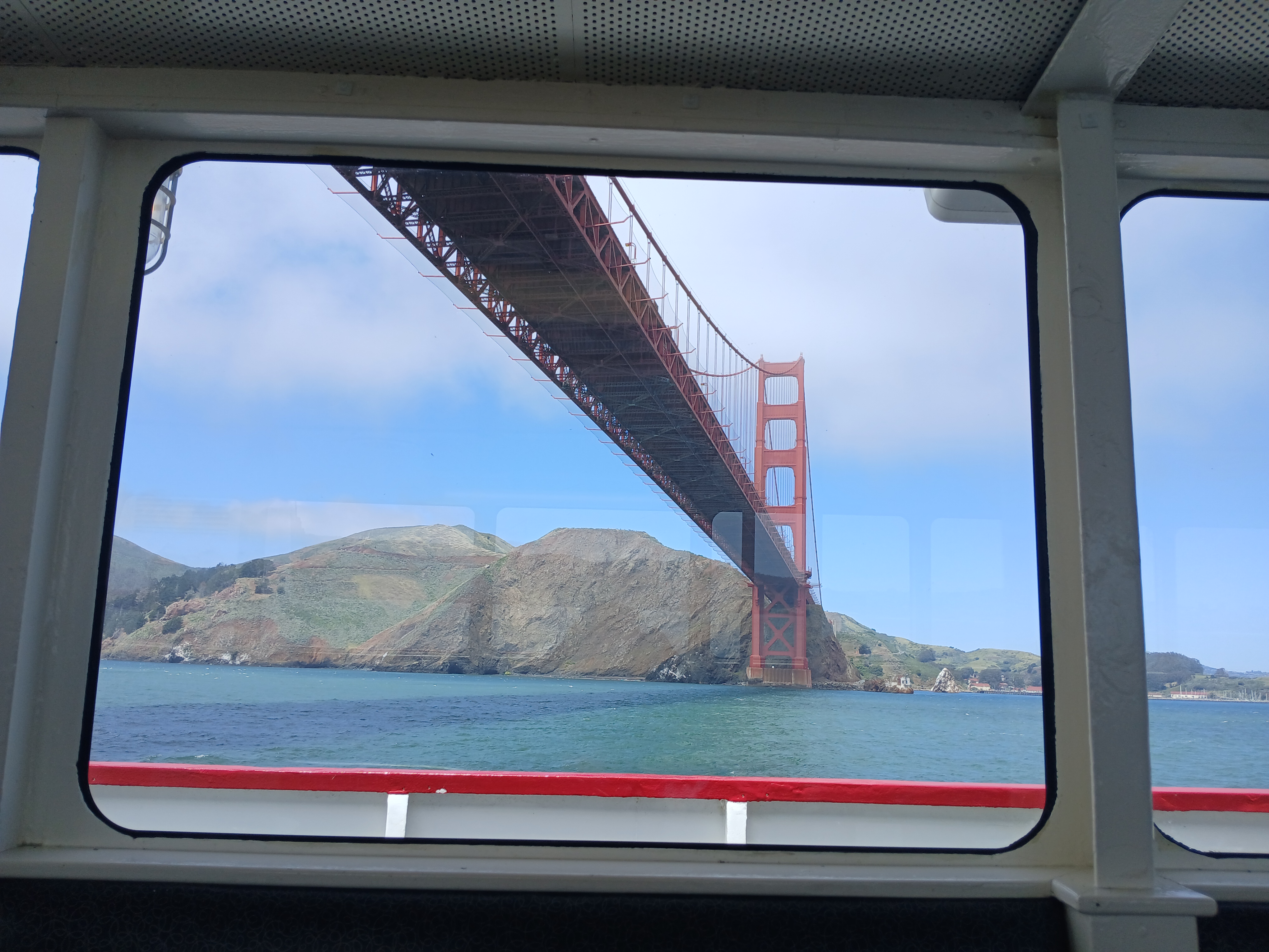
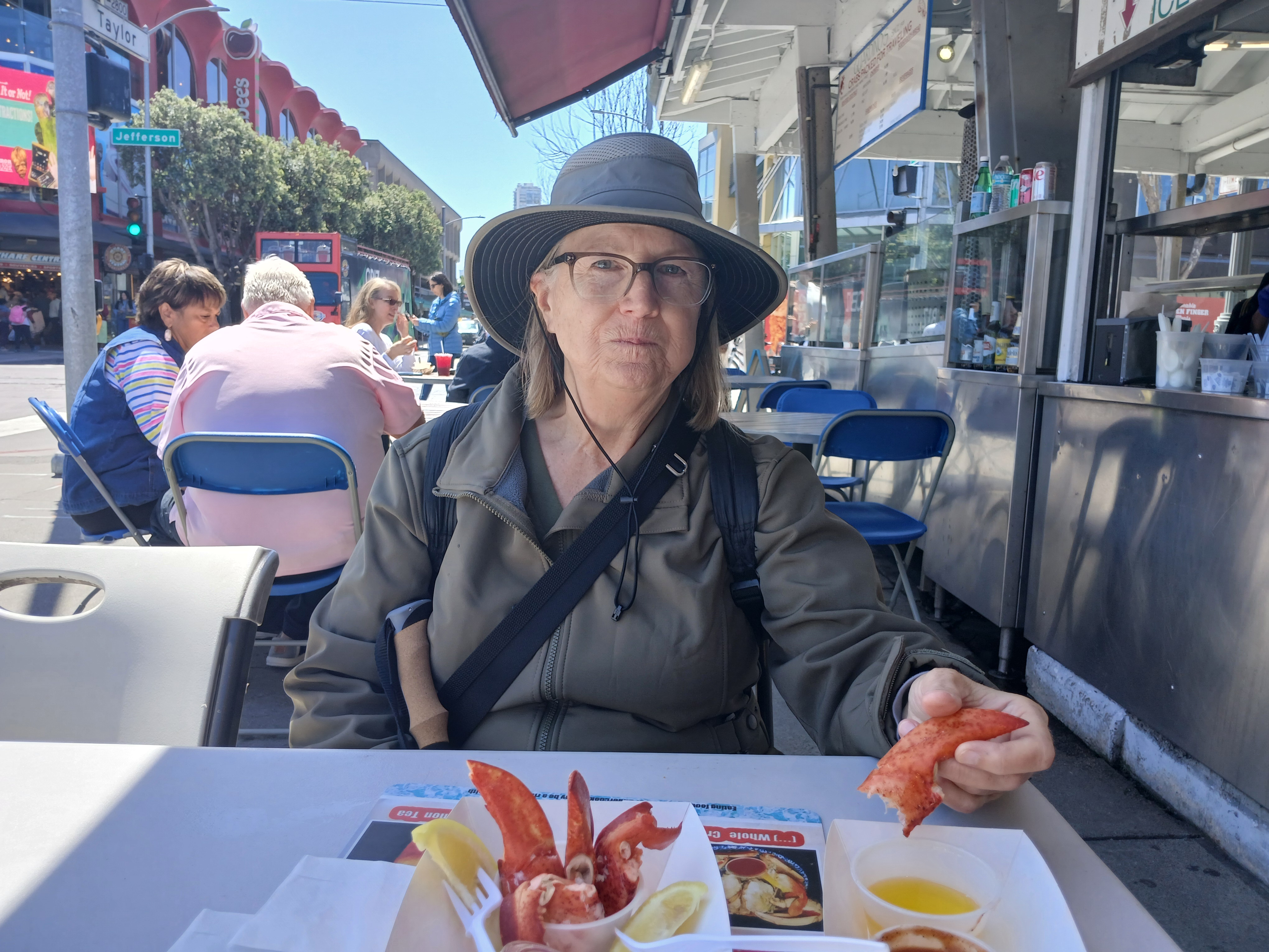
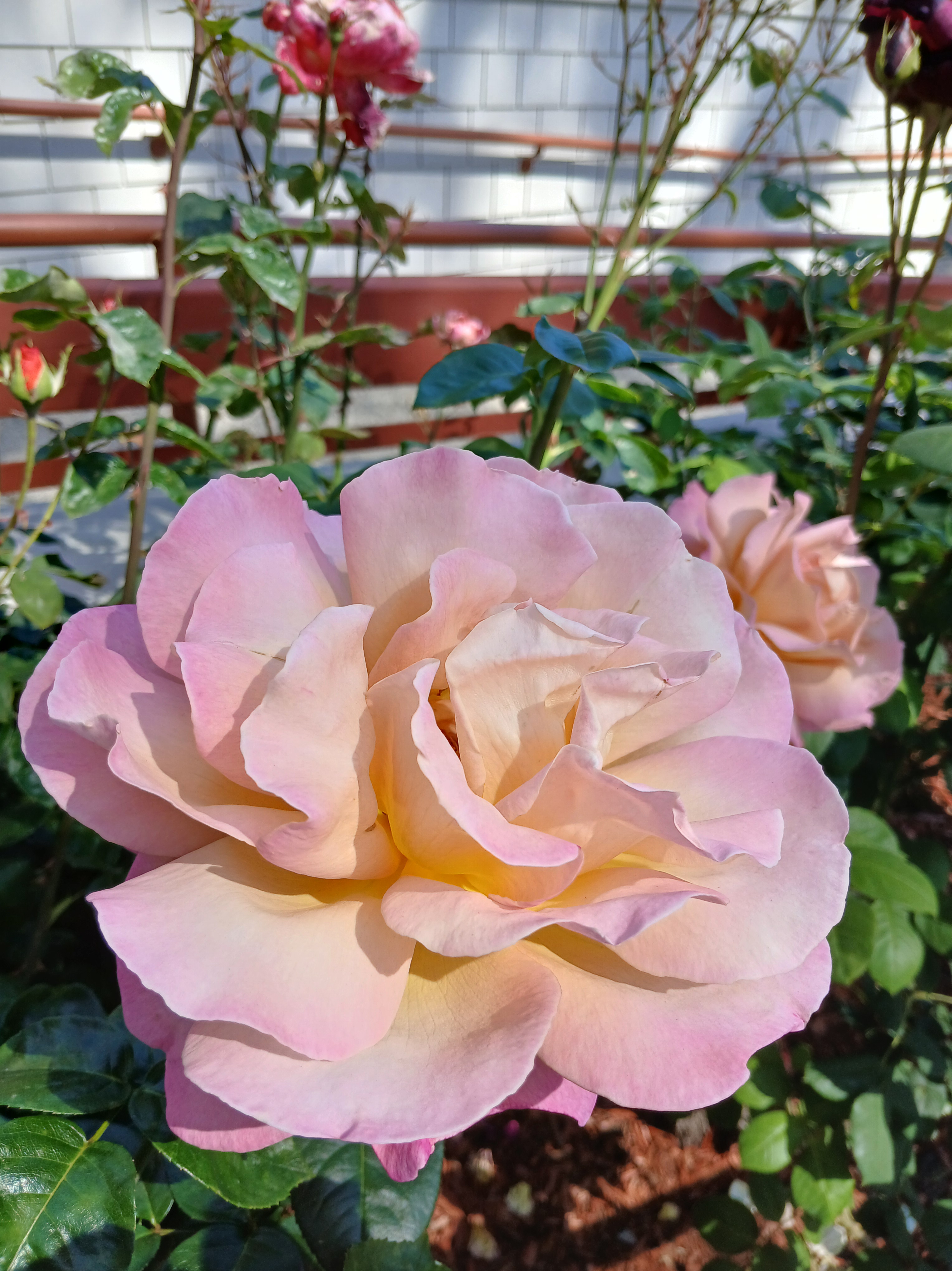
And then I took a fun quick visit to see my Aunt Barbara in San Francisco last week. We took a boat tour under the Golden Gate Bridge, ate Ghirardelli sundaes, walked around the beautiful Stanford campus, watercolored in the park, and smelled the roses:
I never met John Waller, but we were both guides for Joe Whittington at Oregon Peak Adventures back in my Portland and early Bend days.
I remember John more specifically because he took some stunning photos of Steens Mountain Wilderness for ONDA. I can’t seem to find any of those pics online, but they were amazing: golden fall scenes, a dusting of snow in the upper reaches of Big Indian Gorge, and hikers, strolling down the trail (the Oregon Desert Trail that is!).
I sensed he was a fellow adventurer: always seeking the next experience, leading from a place of curiosity.
I vaguely remember he was diagnosed with stage 4 cancer a few years ago, but it wasn’t until I thought to look him up recently that I learned more about his life, and found this TEDx talk (give yourself 20 minutes).
The presentation he gave feels like the outline of something taken directly from my brain, however, he has also marinated in the mortality of life in a deeper way than I have…and there are several aspects of his journey I haven’t explored yet.
His words are so simple, but so true:
I’m here. Right now. Talking with you. What a gift this is.
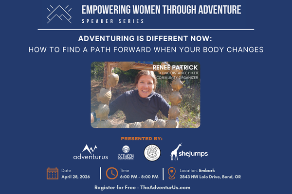
This is a quick reminder of a presentation that I am giving on April 28 in Bend, hosted by AdventurUs, SheJumps, and Between Evergreens, for the fourth annual Bend Women’s Speaker Series – “Empowering Women Through Adventure.”
P.S. I definitely don’t have all the answers, I hope to get some input from the audience too about ways you cope with a changed body that still wants to adventure. We can learn together 🙂