Idaho Sawtooth Adventure: Day 3 – 4ish miles

Last evening we climbed the rest of the way up to Edna Lake and what had to be the best campsite in the area. The headwall of the south fork drainage still had snow, in fact a few patches of snow were all around. We decided to make camp here tomorrow morning and spend the day exploring the high alpine lakes.

So this morning after our coffee we packed up and headed to the granite jetty where we wanted to make our camp, set up, and left a few things in the tent while we explored during the day. We decided to hike cross country around one side of the lake to reach the next 2 lakes, and soon had to climb high to get away from mosquito hell.


We popped up over the upper two lakes and almost to an unnamed pass that held its own little lake. As soon as we were up there we knew we had to move camps. It was just stunning with shallow green water and big slabs of granite floating like little islands throughout. We sprawled out on one of the granite islands and I decided I would hike on the trail back to the camp we just set up and bring the gear back here. It wasn’t that far, right?

But then we saw this little lake!

Well by taking the trail back I had doubled the distance to the lower lake, so 2 hours later I arrived back from the errand and decided it was the perfect time to jump in the lake. At almost 9,000’, it was still hot enough for a swim…kind of. Piles of snow were still melting into the water. Brrrr!

Blue line, cross country. Yellow line, trail.

I took a siesta and Kirk went exploring, to come back a short while later with the news that epic views in all directions were just a few hundred feet above the lake. I followed him back up and….

Dude.

Idaho is something else!


We made some mac and cheese high on the ridge and looked at all the world below.

Dude.


Later back at camp we played a rousing game of cards as night drifted down around us.

Idaho Sawtooth Adventure: Day 2 – 3,000 feet of elevation gain and 11 miles

When we woke up it was Kirks birthday! Idaho birthday trip is proving to be a success so far…including waterfalls, and some carrot cake I packed out that is only slightly pulverized.

We were drinking our coffee and looking at the river when a hiker passed by, or he almost passed by before I saw his small pack and tan legs and asked if he was thru hiking the Idaho Centennial Trail. Gentle Ben had been section hiking the trail, getting pushed back by snow and swollen rivers. I was stoked to see a long distance backpacker. He said he had seen no hikers. Almost no hikers at all on the trip.

We continue up the river canyon, stopping periodically for views of the river and various waterfalls. Kirk is living up to his trail name of “I’d rather be kayaking” because he squealed with delight at many of the drops. I may have committed to coming back at lower flow and hiking our boats up further to run some rock slidey sections.

We took a long siesta at a river crossing and strung up our hammocks for a nap.

Then onward. We had 3,000 feet of elevation today, no real destination either, but we figured we would continue to go up the South fork…might as well hike up to the headwaters.

Mid afternoon I look down, and in a beacon of light, there sat a fully wrapped orange starburst. Birthday trail magic for Kirk! The trail provides, I always say. I handed him the sun-warmed treat and after unwrapping it, he claimed we needed to bring more starbursts on our hikes.

Early evening found us at Virginia Lake, over 8,000’, and we found a sweet gravel bar to perch our camp at midway up the drainage to Edna Lake. 

Idaho Sawtooth Adventure: Day 1 – 5 miles

We woke up high on the cliff above the Middle Fork of the Payette and decided to head to the south fork and try our luck on a backpack/packraft adventure into the Sawtooth Wilderness. The fact that it also happened to be along the Idaho Centennial Trail was an added bonus, and oh so convenient.

By the time we made it to Geandjean, the trailhead up the South Fork of the Payette, it was about noon, and a hot sleepy Tuesday afternoon. There were almost no people about, which was awesome for the middle of the summer. We repacked our backpacks and packrafts with 4 days of food and the hope that we would be able to float at least 5 miles until the river canyons up and becomes waterfall and wood-ladened. Something Kirk was looking forward to seeing. He has wanted to boat/packraft the south fork for a long time, and here we were. 

20170718_152634

Hot hot hot start to the trail. We walked up about 5 miles, deciding to go for our chacos for the river crossings at Baron Creek and Goat Creek. The river looked tranquil and full of wood. It would be a float on blue-green water through a very green valley. As the canyon started to gorge up we decided to drop our boats and paddling gear to pick them back up for the packraft out. It wasn’t long before we saw a portion of the river forced into a narrow slot in the granite and found a sweet little campsite in view of a massive pour-over. We set up camp, took snacks and the can of PBR i had packed up, and sat with our legs dangling in the water on a big slab of granite. 

Protect Your Public Lands: A User’s Guide

We can’t hike trails without public lands, so I wrote this blog for Oboz about 5 things you can do!


by Renee Patrick

What Designations Does You Favorite Trail Have Photo By Renee Patrick

Image: Take some time to learn about public lands surrounding your favorite trails. Photo by Renee Patrick

After huffing up the 2,000-foot climb out of Big Indian Gorge, my sweat-dampened shirt quickly chilled in the sharp November wind. I was just days from finishing my Oregon Desert Trail section hike with the final 65 mile stretch up and over the monolithic Steens Mountain in eastern Oregon.

I surveyed the miles of alkaline playa 5,000 feet below Steens summit and the vast expanse of public land stretching far into the horizon. That early November morning was just days away from an election that would upset the nation, and jeopardize the future of the very land below my feet.

In the weeks that followed, one thing became clear: I need to act to protect what I love, and the question became: How can I advocate for public lands and have a real impact?

I am fortunate enough to work for a conservation organization, the Oregon Natural Desert Association (ONDA), which has been working for 30 years to protect, defend, and restore high desert landscapes in eastern Oregon. But after multiple conversations with friends who don’t directly work in the conservation field, I realized they too wanted guidance on how to be effective in advocating for the future of our public lands. So I surveyed a few of my colleagues and came up with these action points:

5 Tips on How YOU Can Advocate for Public Lands Protection

1. Focus on public lands close to home

One of the best ways to participate in the public lands debate is to become educated about some of your favorite places. Is your go-to hike on public land? If so, which agency manages it, and does it currently have any protections or designations? We often form personal connections with our favorite places, and those connections can be powerful when a place you love is at risk. Visit your Forest Service, BLM, or State Parks office. Learn more about how they steward your favorite places, ask how you can participate in trail maintenance, or in any upcoming planning processes.

Even the youngest volunteers can make a difference in a conservation organization. Photo by Allison Crotty

2. Join a local conservation organization

Most communities have a variety of nonprofit conservation organizations that work to protect important landscapes and watersheds. Each of these groups may have a specific focus, whether it is sustainability, climate change, river health, or supporting the stewardship of a specific wilderness area. These organizations give a powerful voice to important local and national public land issues, and rely on their members to help support advocacy for restoration activities in the places we all cherish. Consider becoming a member of one conservation organization in your area. Start volunteering, or join them on a hike or stewardship trip. Your donation, membership, volunteer time, or voice can make a difference.

3. Get to know your senators and representatives

Your senators and representatives represent you on the state and national level, so it’s important to let them know where you stand on public lands issues. There is a lot of debate these days about the most effective ways to reach out to your elected officials, but any action is better than no action. Call their offices, write postcards, attend town hall meetings…and make it personal. You don’t have to be an expert on public lands to have a powerful pull. It can be very meaningful for our officials to hear from everyday people who care about public lands, so share your stories, share your concerns, and if they have been supportive of keeping public lands public, thank them!

Get creative with your signs at the next town hall event in your area. Photo by Heidi Hagemeier

4. Hold small gatherings with friends/family

Since so many people take access to public lands for granted, we need as many folks as possible to simply be out talking with their friends/neighbors/family about why public lands are important. Invite some friends over, and over dinner or beers talk about a few of the current threats. One of the main issues you may want to discuss involves proposals to hand over American public lands to the states. Because most state governments can’t afford to manage millions of acres of land, a likely scenario would result in raising taxes or selling our land to the highest bidder in order to pay for costs like firefighting and management. Come up with a list of your legislators’ addresses, and then have everyone write a few postcards and make a night of it! (find more here: https://www.congress.gov/state…, https://www.congress.gov/ -search legislation).

5. Vote

Start local. City, county, state and even school boards have elections between the presidential election years, and we can build a strong voice from the bottom up. Do some research and find out where your local candidates stand on public lands issues. Then make your voice heard on Election Day.

Renee “She-ra” Patrick is the trail coordinator for the Oregon Desert Trail in Bend, OR, and a triple crown hiker, having completed the Appalachian Trail, Pacific Crest Trail and Continental Divide Trail in addition to 6 other long distance trails. When not backpacking, she can be found packrafting, skiing or napping in the backcountry. You can read about her adventures on her blog,www.sherahikes.wordpress.com.

Hiking with Oregon Field Guide

I’ve had a good amount of office time this spring, but I planned a trip to the Pueblo Mountains along the Oregon Desert Trail perfectly with a crew from Oregon Field Guide at the end of May. I’ve been talking with Danika, a producer for Oregon’s PBS outdoor show (and recently winner of 4 NW Emmy awards!) for the past six months about doing a segment on the Oregon Desert Trail, and had already filmed with them once on a snowy February afternoon near Bend. I’ve been watching Oregon Field Guide for years, and they’ve done a number of segments on long distance hiking, including one of my favorites on Lint, my favorite triple, triple crowner.

I had hiked through the Pueblos, a remote mountain range south of the Steens Mountain that juts up against the Nevada border, last year about this time, and remembered plenty of water, flowers and patches of snow. The weather at the end of May was glorious, and I hoped for the same this year. I met Danika, our camera-guru Todd, and volunteer and outdoors man extraordinaire, Vic, at Fields Station on a Monday night. I finished up my amazing milkshake from the store, and hopped in their car. We had decided to drive up a two-track road as high as we could to get closer to the route in the middle of the range.

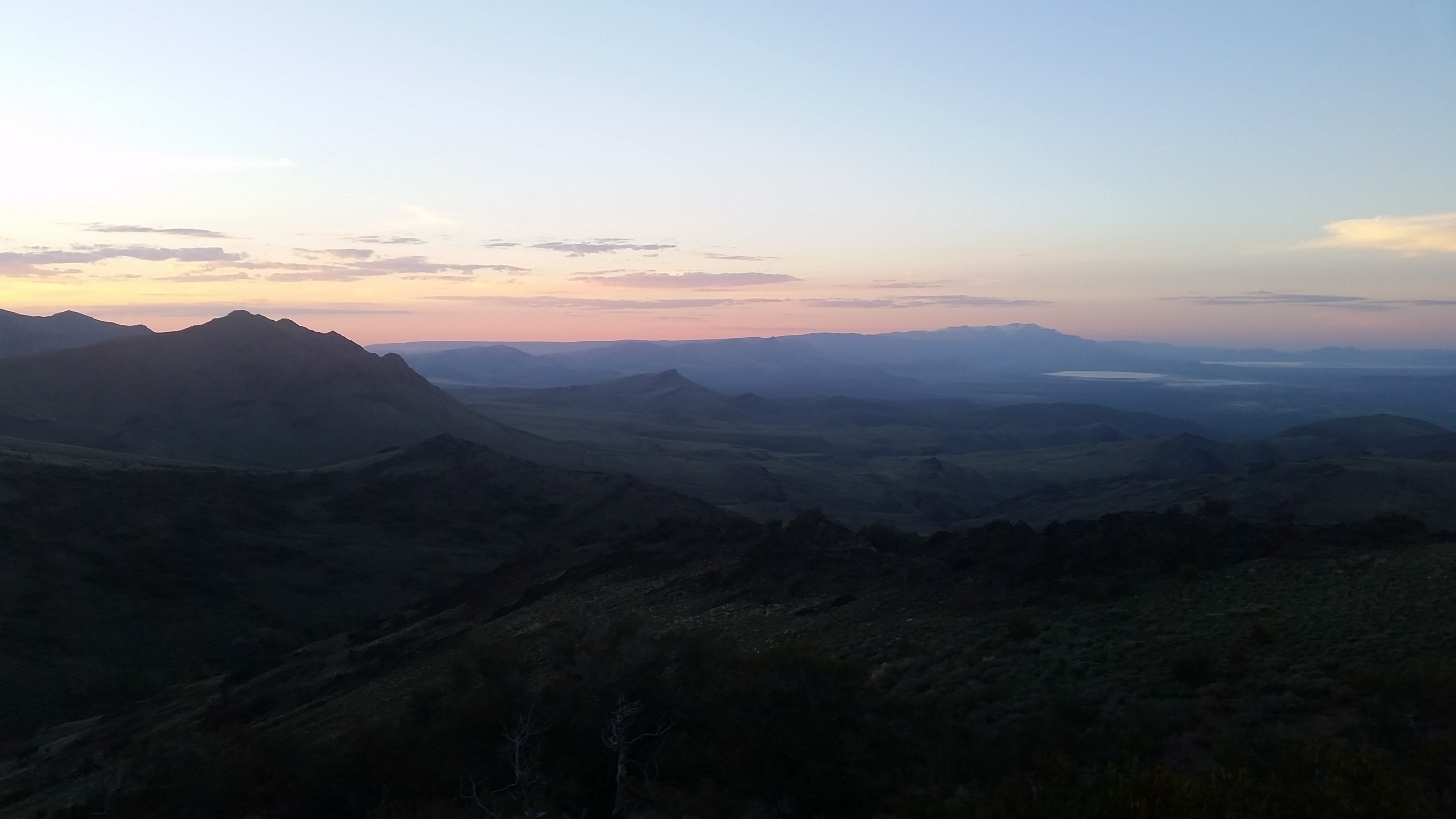
It turns out all the camera gear is HEAVY, and the closer we could get, the better. It would also be Danika’s first backpacking trip! I tried to reassure her that our packs aren’t normally filled with extra batteries, microphones, and the such. We made it about 2.5 miles from the ODT at Ten Cent Meadows, and decided to make camp on a high ridge with an amazing view over to the Steens, Alvord Desert, and the north part of the Pueblo range.

https://www.facebook.com/plugins/video.php?href=https%3A%2F%2Fwww.facebook.com%2Foregonfieldguide%2Fvideos%2F1305683846148197%2F&show_text=0&width=560

Above is a video Todd shot of the sunset on our first night.

The next day we packed up all the gear, Todd having the camera bag/backpack that looked like one of the most uncomfortable packs in all history. It’s amazing where some of these Oregon Field Guide cameras have gone over the years. Apparently this camera was about 10 years old, and had been up mountains, on rivers, and just about everything in between.

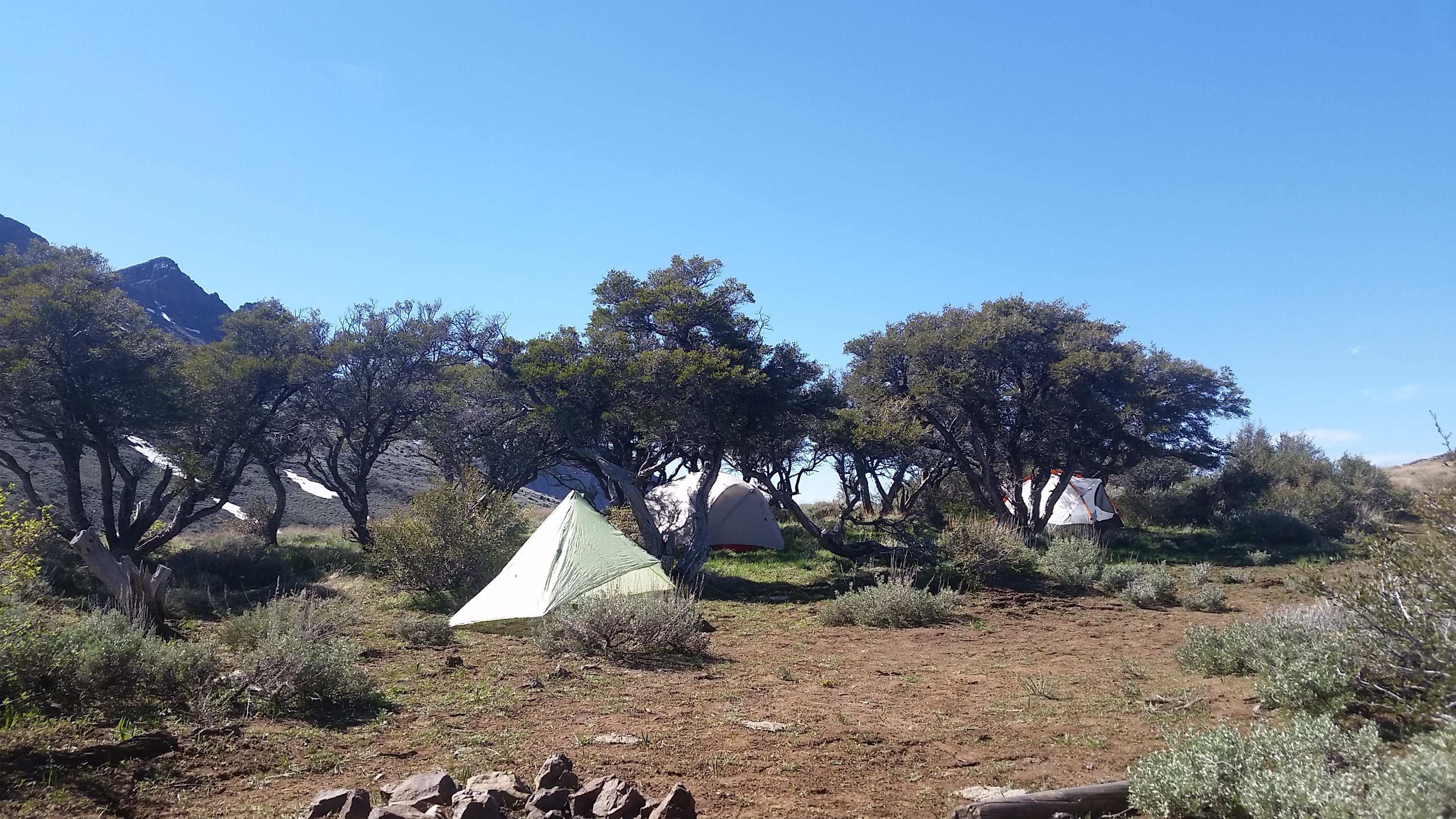
We found a sweet little grove of mountain mahogany to set up camp for the next few nights, and soaked in the views.

We did a little filming that afternoon, took a short jaunt on the trail, did a longer interview segment overlooking the Alvord, and retired at a reasonable hour.

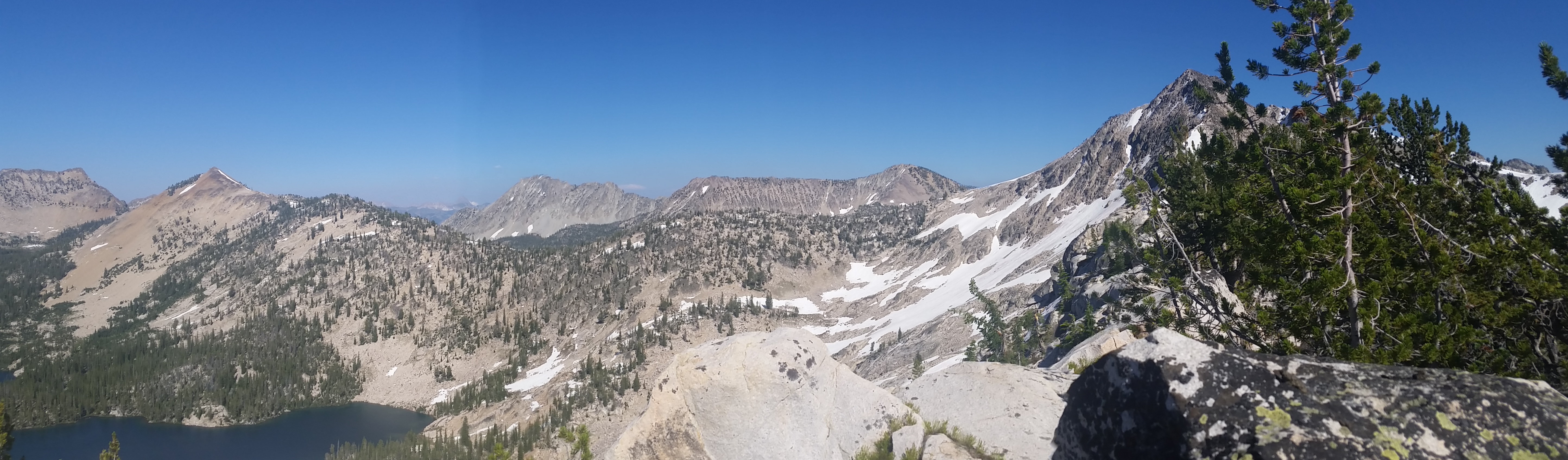
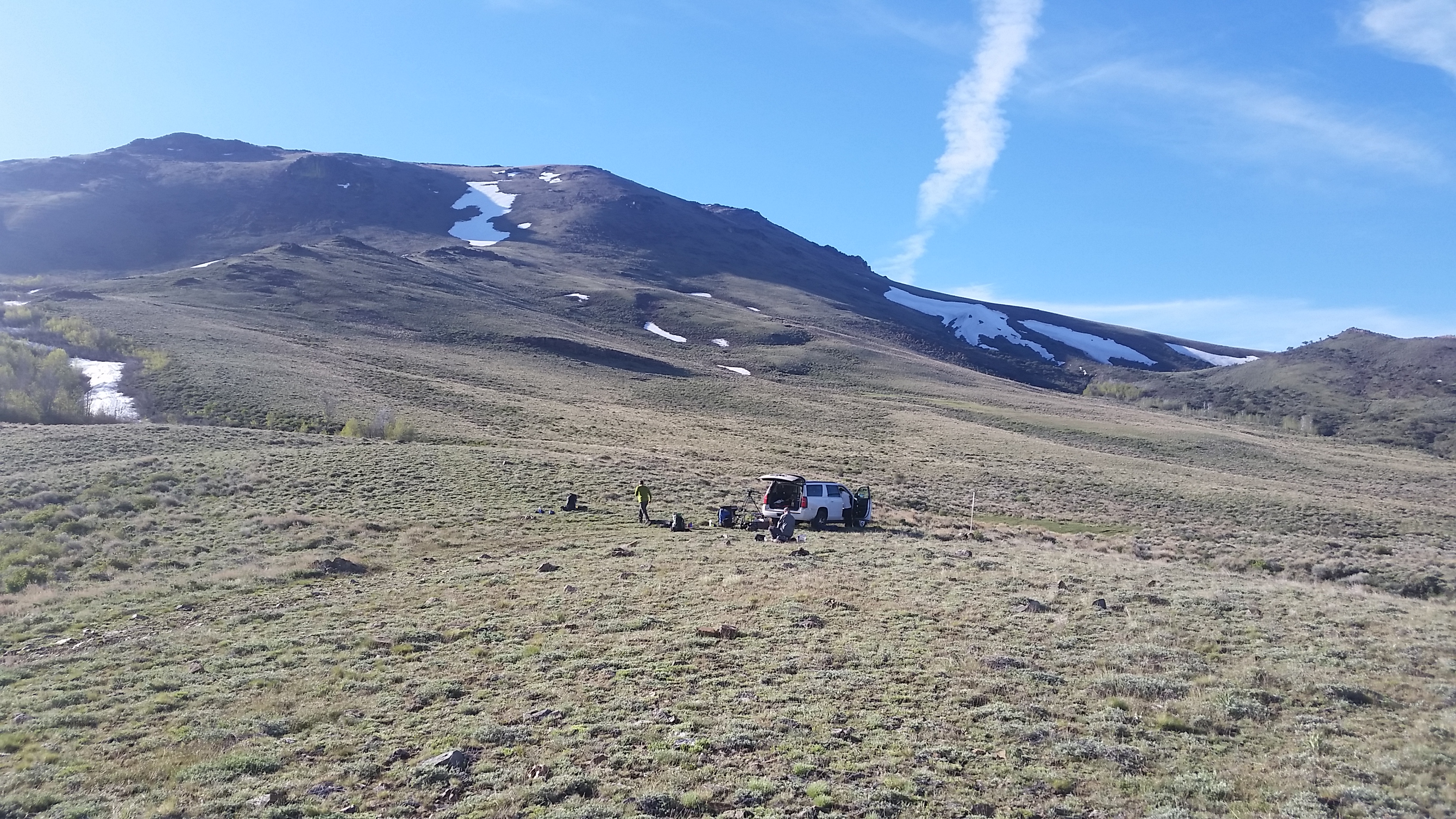
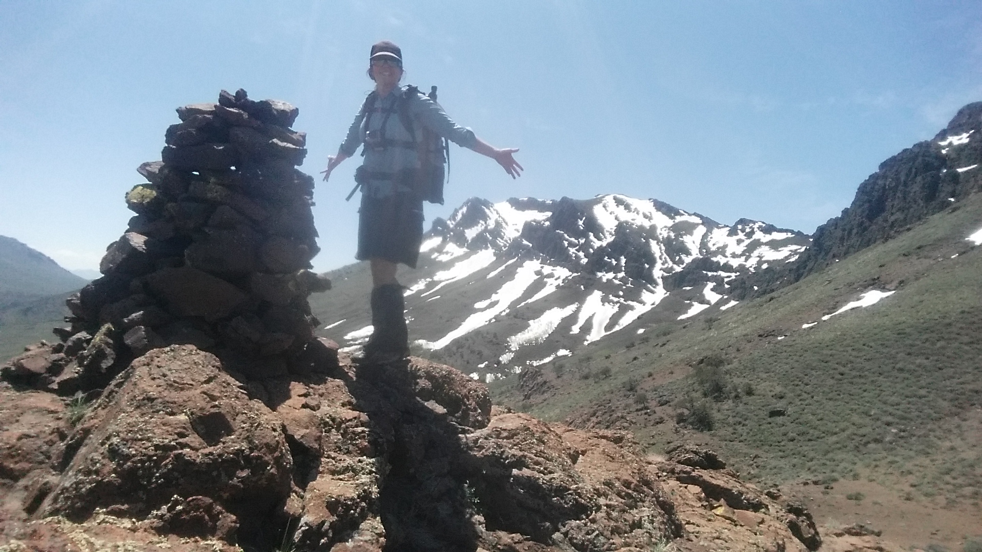
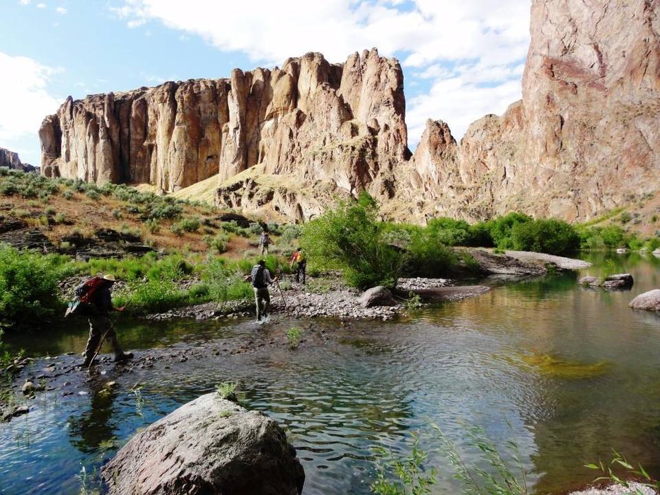
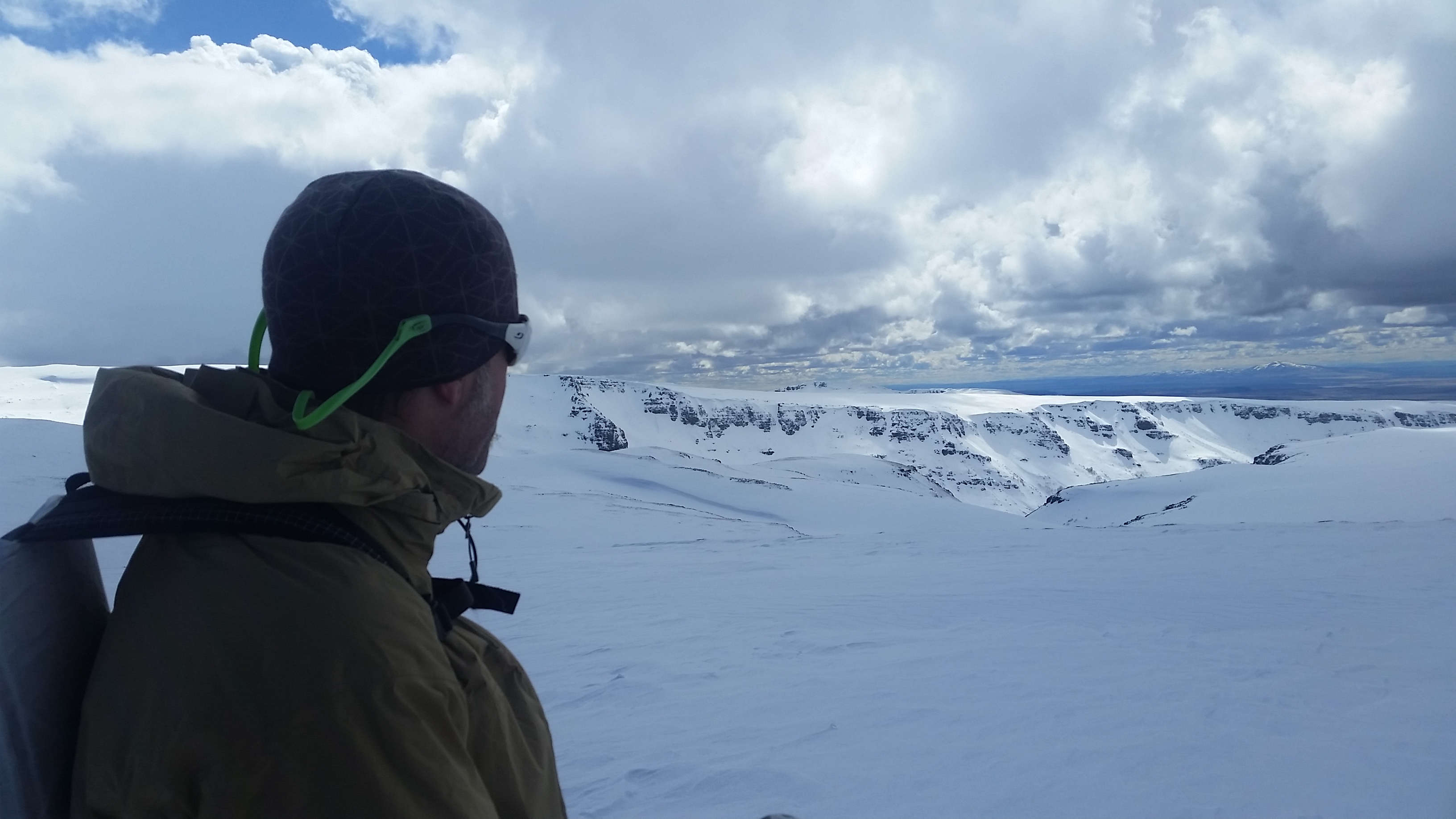
In the morning we packed up, prepared to be out most of the day. The Pueblos section ties in to the older Desert Trail route that was established in the 1980s. The Desert Trail folks are working to build a Mexico to Canada desert route, and had already designated a few sections, including this one we were on. The Pueblos are a challenging cross country hiking experience that follows the ridgeline for much of the range, and the DTA built a series of 5-6′ cairns to mark the way. Many of these cairns are still standing, and we decided to hike cross country aiming for cairn 22 on a far saddle.

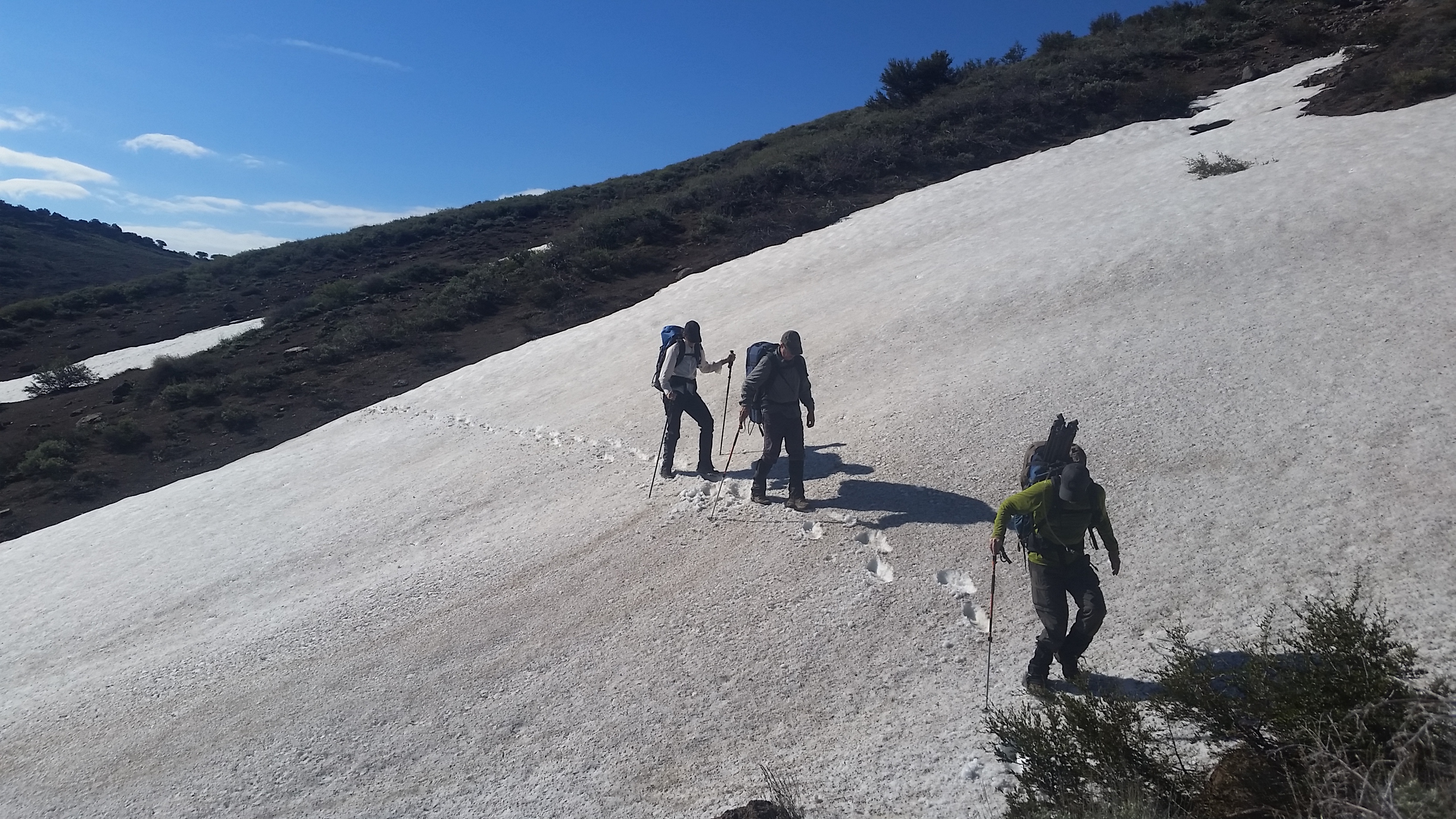
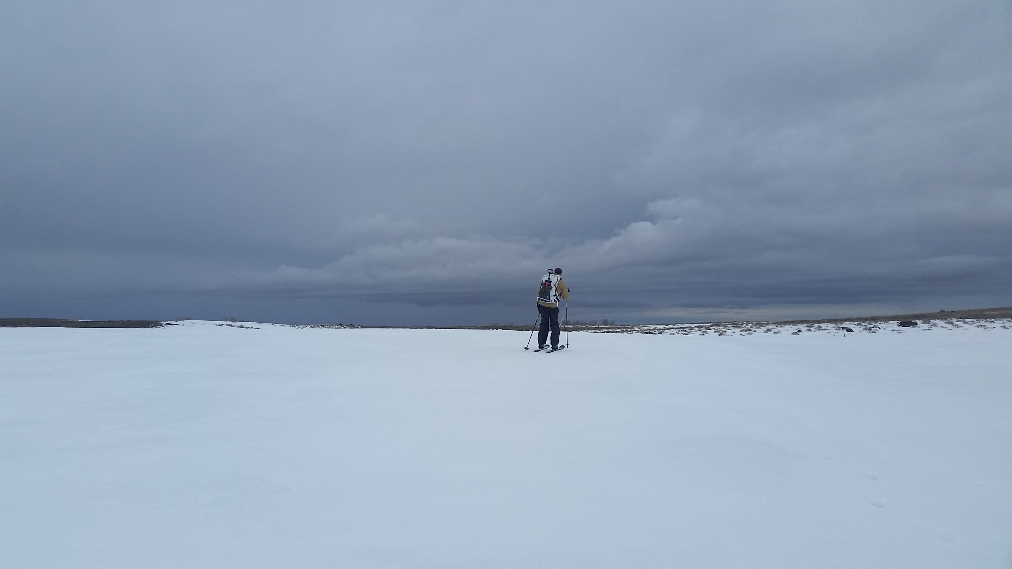
Right away we had some snow patches to cross, but I saw opportunity…opportunity to shoe ski!

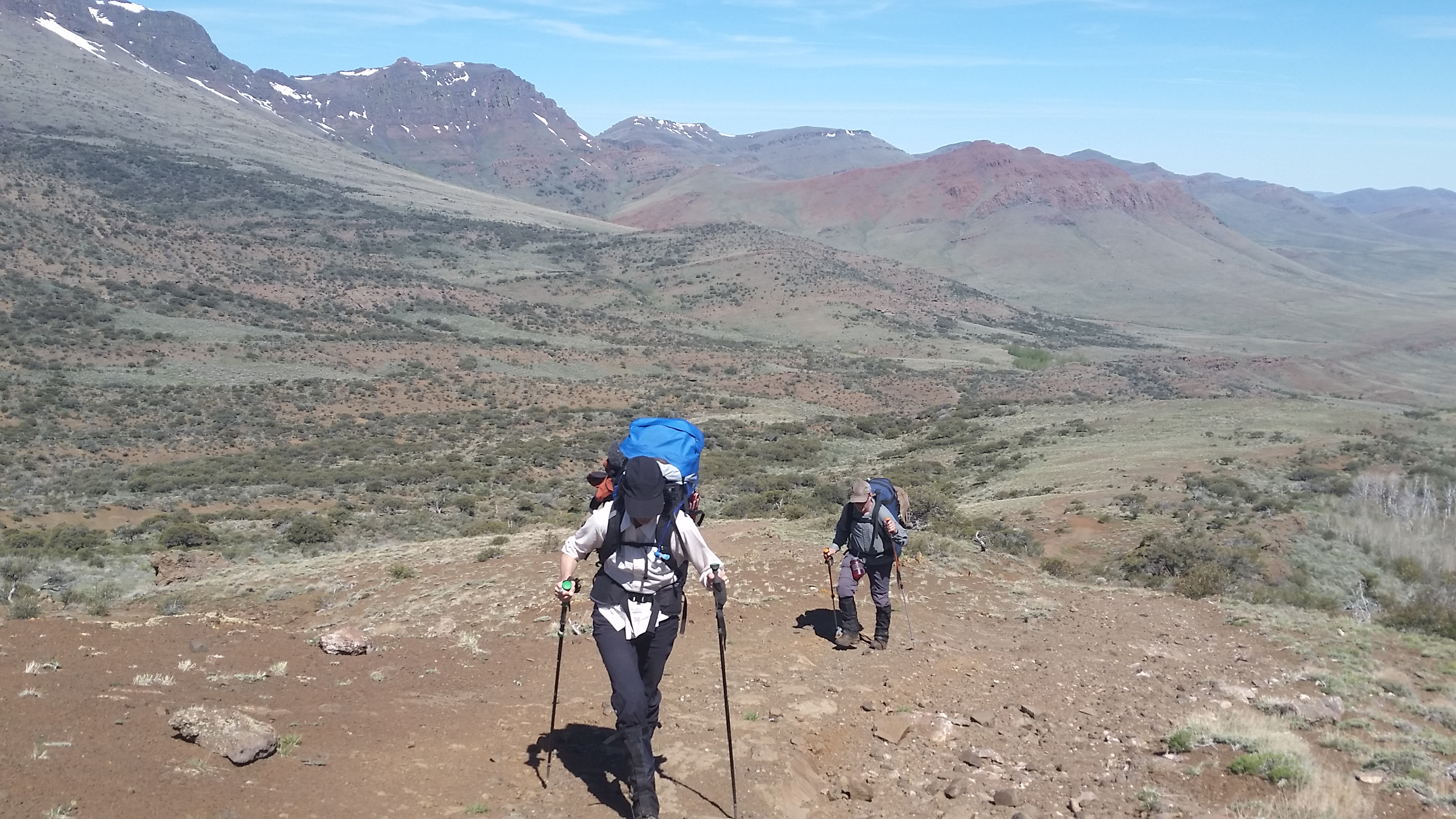
We did lots of takes in and out of the think brush, walking along the exposed slopes, walking up to cairns, it gives me new appreciation for all that goes into film projects. We made it to cairn 22 by lunch and tried to find shelter out of the increasing wind.

The hike back was a little quicker as we did most of the filming on the way in, and by the time we made it back to camp we were all ready for a siesta.

The night was WINDY and COLD and we were all in our sleeping bags well before dark because it was the warmest place to be. Welcome to backpacking Danika!

We packed up in the morning and headed back to the car, taking a shortcut because the crew was used to cross country hiking by now and saw a path that made more sense than the way we had come. The ODT is rubbing off on them already! The beauty of cross country hiking is going where you want to go…

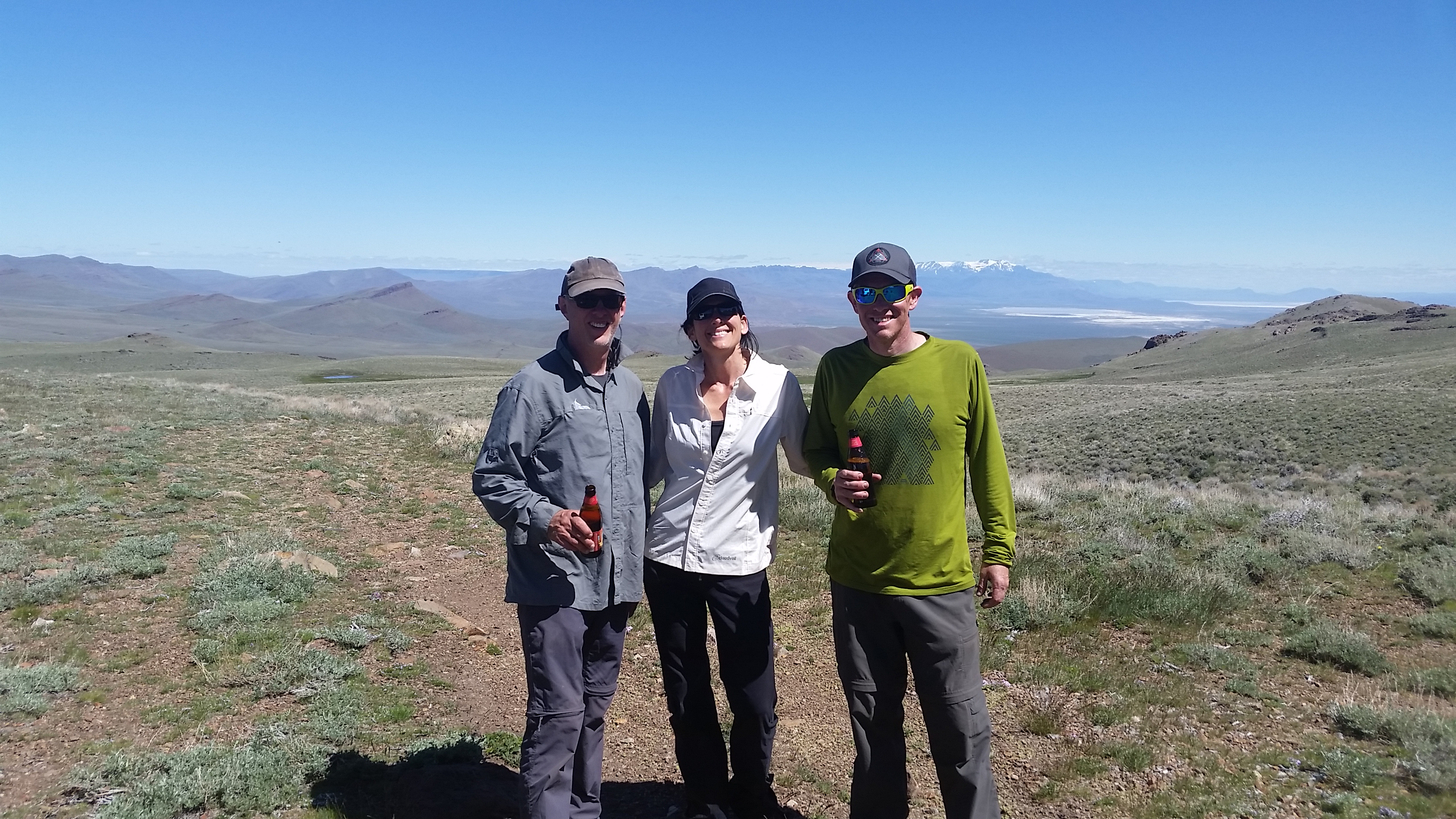
We toasted our trip with beers and chips back at the car and packed up for the ride back to Fields Station. We hadn’t seen any pronghorn on the hike, so we were all on alert as we headed the 3,000′ down to the valley below. We spied a momma and her baby a head of us on the road, and I think Todd was able to get a little footage. The Pueblos are known for big horned sheep, but they must have been feeling shy for we didn’t see any on the trip.

Back in Fields we all devoured huge portions of food in the cafe and checked into the house we had rented for the night. We did a little filming in the store, and Sandy, Nancy, and the crew there were all good sports about it, even when I walked in and out of the store 10 times, eating a milkshake to get a good shot…we wanted to get some of the character and splendor of a place like Fields Station after hiking in the mountains, and I think the crew now knows first hand how delicious the food will taste and the shower will feel after being dirty for a few days. Hunger is the best sauce.

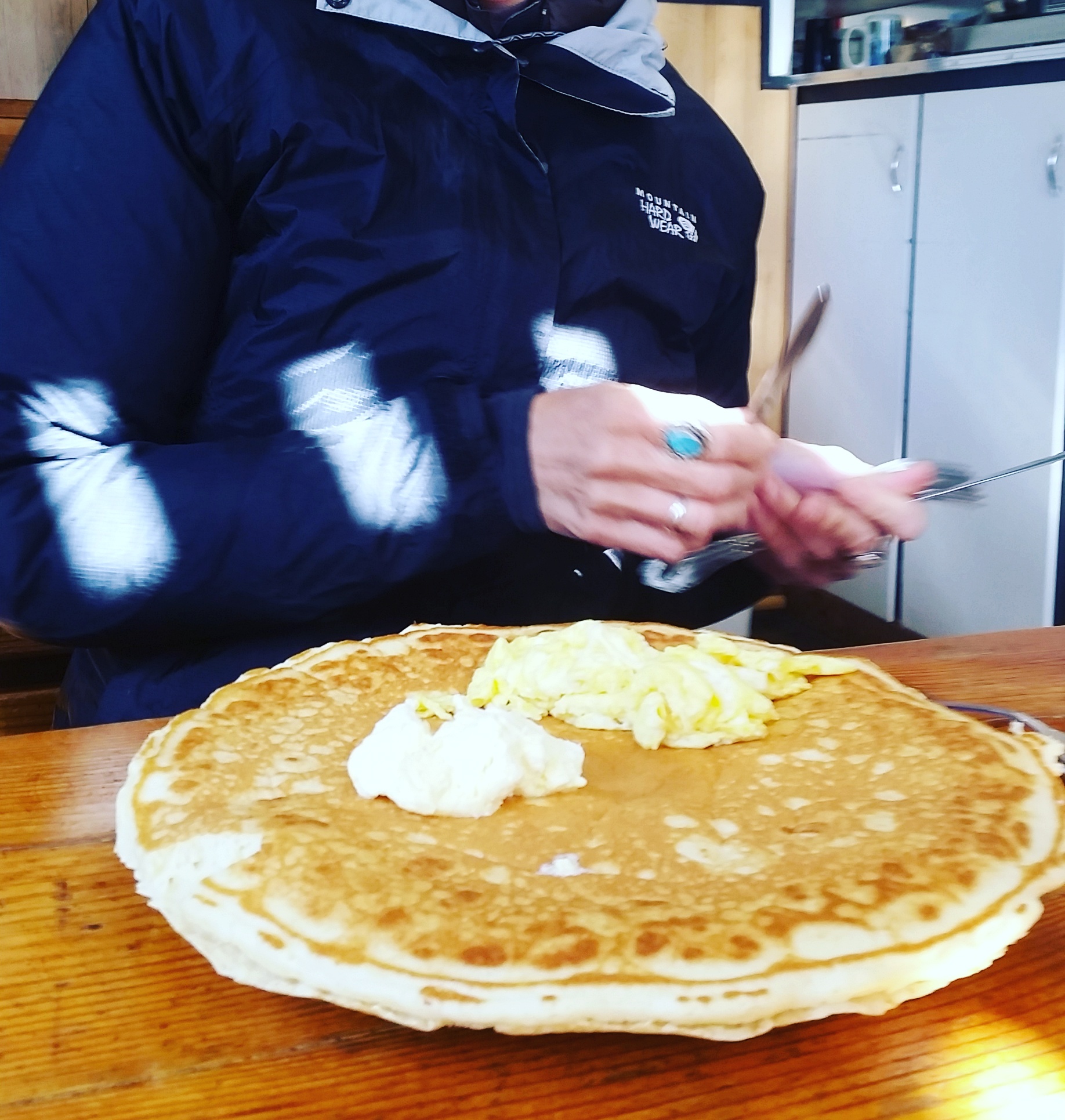
The next morning we returned for breakfast, and the biggest pancake I’ve seen outside of Seiad Valley on the PCT (pancake challenge on the ODT anyone??)

We parted ways, and I headed out to visit the family that runs Rock Creek Ranch between Frenchglen and Hart Mountain. I had a great visit with the Millers, and found out all sorts of interesting facts about the area and their family which have been homesteading in eastern Oregon for generations (whisky stills in some of the old canyons, tunnels in the mountains…)

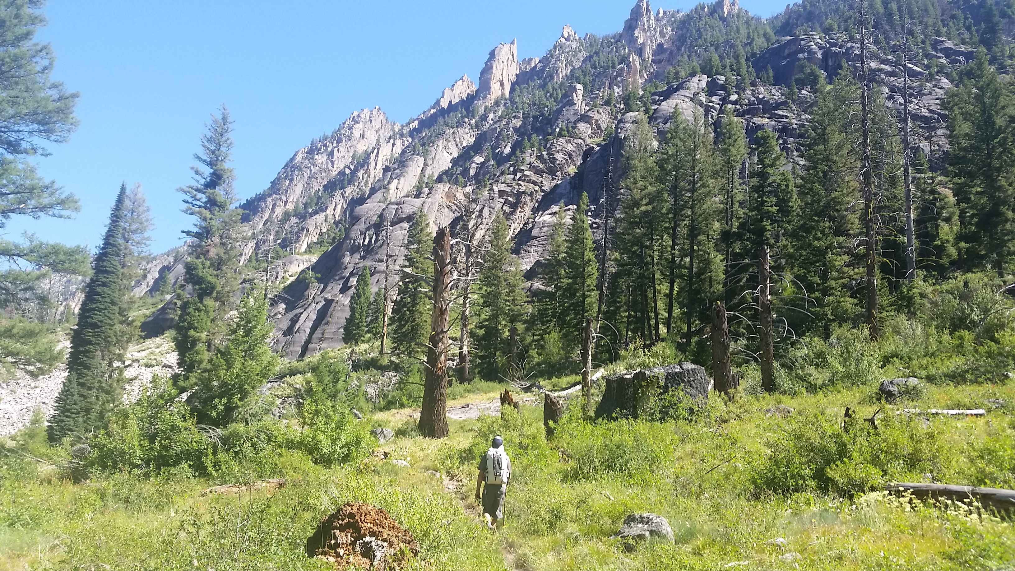
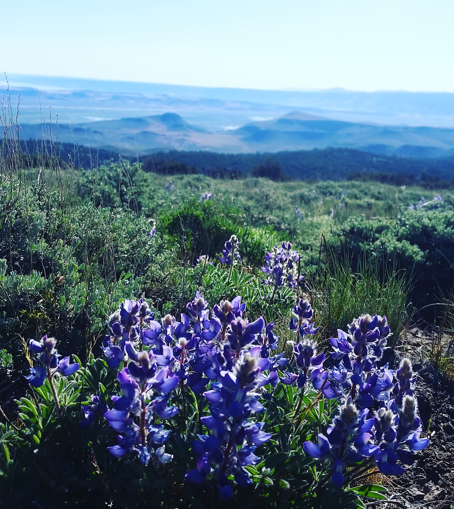
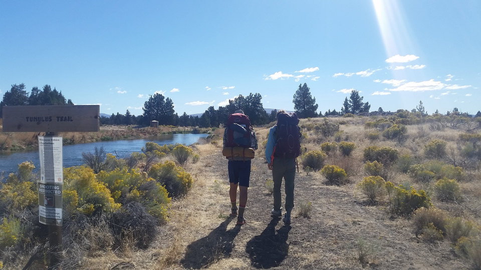
I was headed to the Fremont to hike for a few days on the ODT and scout out a section I’ll be returning to with a trail crew at the end of June. I enjoyed some sweet ridgewalking, made lots of notes on down trees and tread that needs to be cleared, and had a chill few days on the trail, even running into Kat, a current ODT thru-hiker.

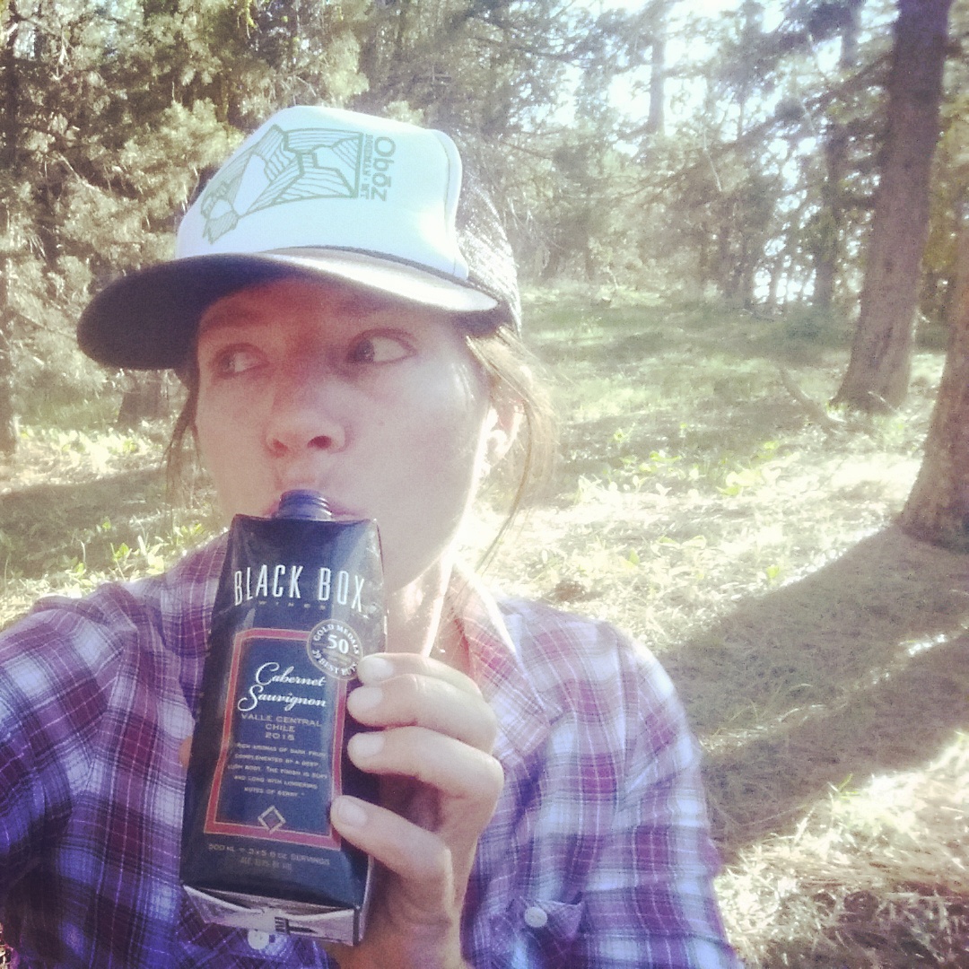
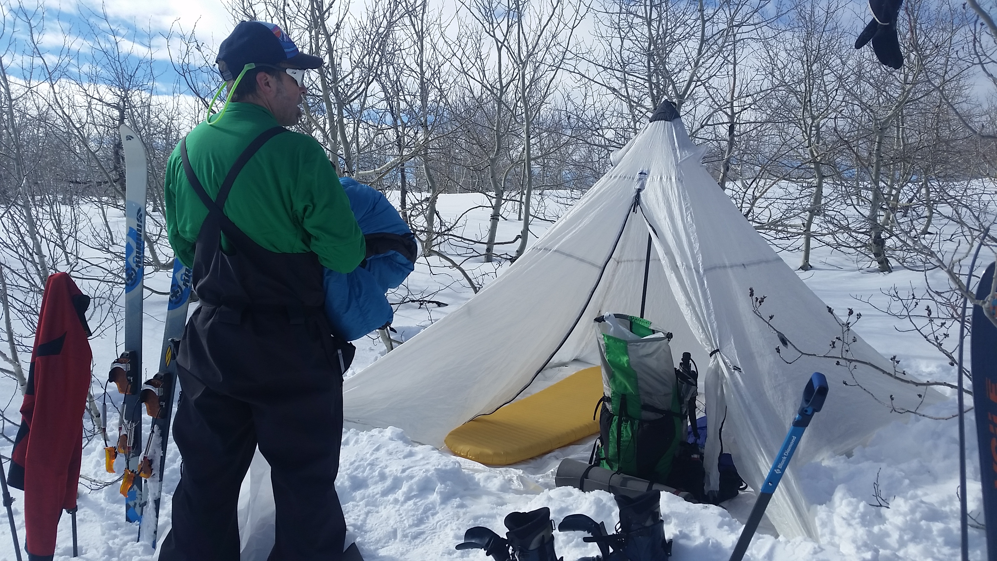
Car camping in the Fremont…black box time!

Be bear aware

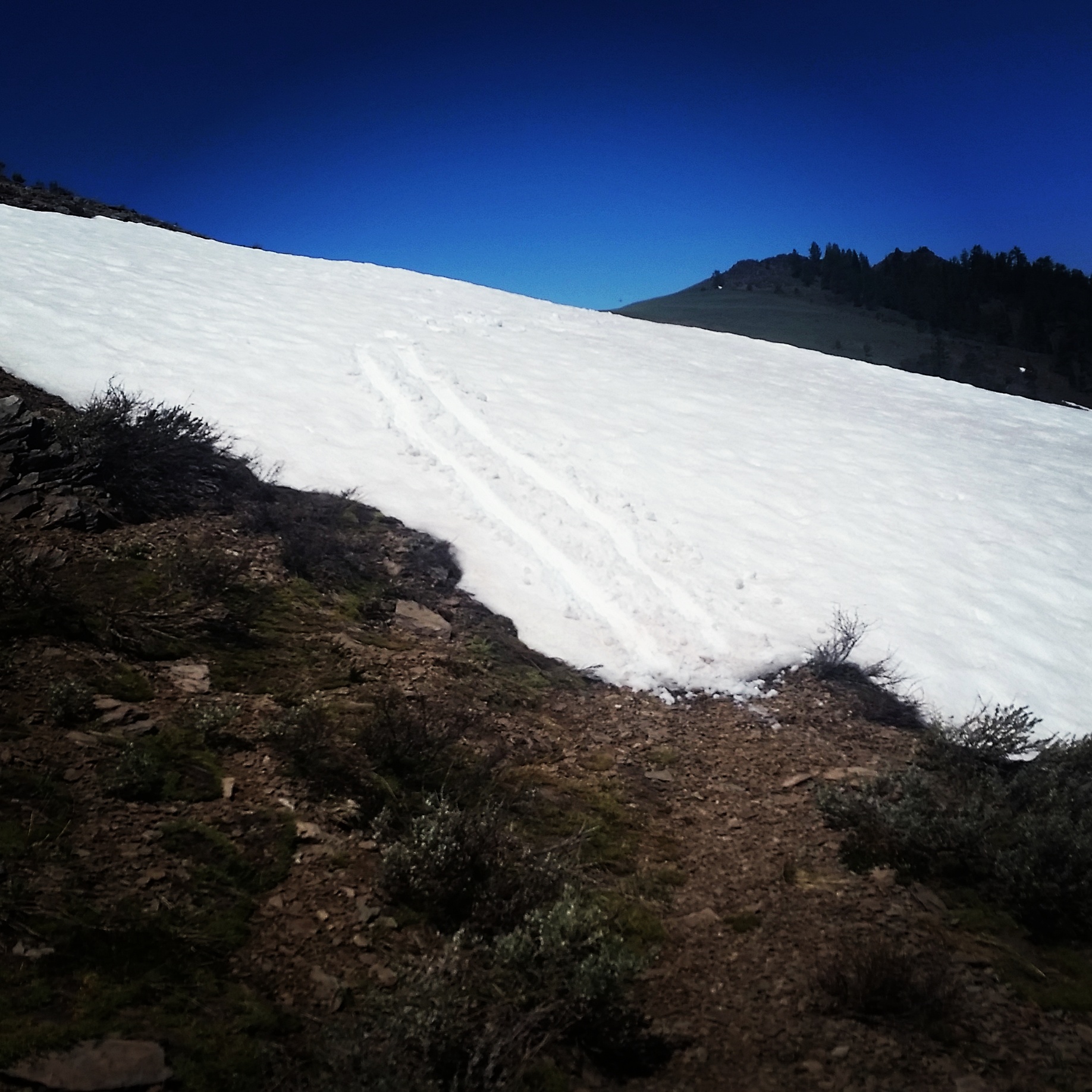
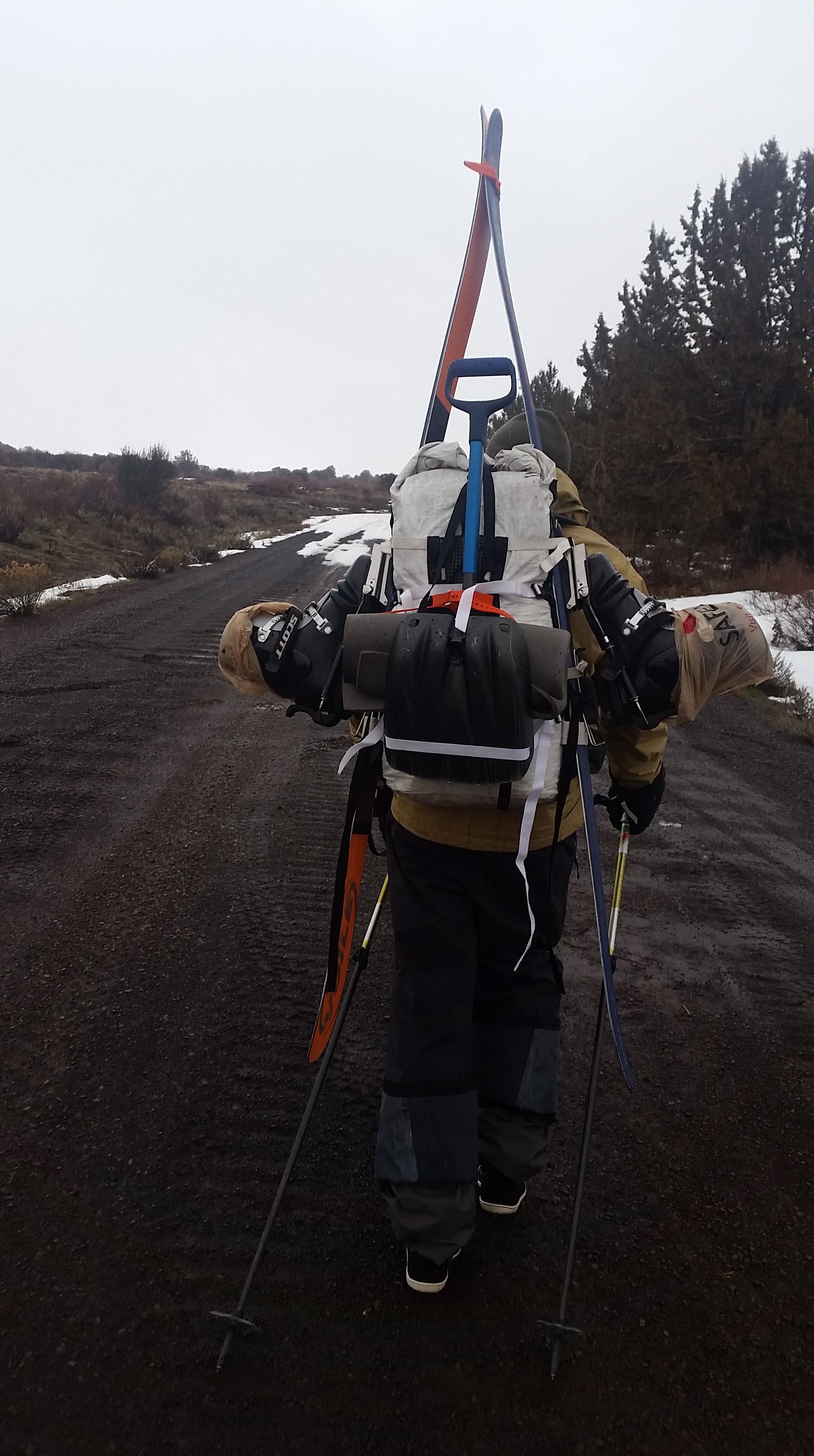
Shoe ski in the Fremont too

Not a bad week on the ODT!

The Oregon Desert Trail is Hot!

I’ve given a few more interviews about the Oregon Desert Trail recently:


The desert between Boise and Bend is the latest long-distance hiking destination


Hiking 350 Miles on the Oregon Desert Trail
From the Oregon Badlands to the edge of the Steens Mountain Wilderness, the western half of the Oregon Desert Trail is a long—and gorgeous—haul.


By Ramona DeNies at Portland Monthly (see article for photo slideshow)
Renee Patrick is no stranger to serious mileage. An experienced long-distance hiker, she’s logged more than 10,000 of them in the last dozen or so years, conquering the Appalachian Trail, the Continental Divide Trail, and the Pacific Crest Trail. She transfers that love of the wide open to her work for the Bend-based Oregon Natural Desert Association. ONDA advocates for the protection of a huge swath of the state’s public land: the high desert that stretches from central Oregon’s sagebrush sea to the stunning Owyhee Canyonlands. Patrick, more specifically, coordinates the unofficial trail that cuts through this vast territory: the 750-mile Oregon Desert Trail.

The ODT is not, Patrick cautions, for the casual backpacker. Much of the trail is unmarked and some stretches aren’t even, well, trail. “ODT stays on public lands,” says Patrick, “which means following private fence lines in certain places—respect the fence!—and navigating by GPS in others.” When Patrick feels the need to commune with the trail she stewards, she packs her sleeping bag, a tent only if wet weather is forecasted (she’s a “cowboy camper” who prefers to sleep by starlight), some high-calorie provisions, and a lot of water.

The landmarks and sweeping vistas of the entire ODT are too plentiful for one slideshow, so here, Patrick shares a selection from the trail’s westernmost half. It’s a stretch (sections 1–12 in ONDA’s guide) that travels through the Oregon Badlands Wilderness, the Deschutes and Fremont National Forests, and Hart Mountain National Antelope Refuge. Patrick navigated the entire route over several treks in the spring and fall of last year. For aspirational hikers who live west of the Cascadian rain shadow, the trail’s closest access point—it’s western terminus—is located at the Badlands’ Tumulus Trailhead a mere 20 miles from Bend. 350-some-miles later, Patrick sets the halfway point at the tiny town of Frenchglen, which boasts a cozy hotel (a state heritage site) that’s perfect for propping up some tired and dusty feet—and crossing one epic adventure off your Oregon bucket list.

Op Ed: Recreation at Risk without Public Land

Two days in a row! I’m grateful for the outdoor companies I’ve been working with for an opportunity to share how important it is to keep our public lands public for all the different kinds of recreation we are involved in. Today my Op Ed piece was published on MSR’s blog.


What do hikers, mountaineers, climbers, mountain bikers, rafters and skiers have in common? We need rivers, trails, mountains and that sweet craggy rock; we need remote and wild places in order to have our adventures, make first ascents or descents, and explore our physical limitations.

Now, much of this is in jeopardy with the push to sell, give away or exploit our public land. This public land belongs to all Americans, a legacy that is now at risk.

Since I began backpacking long trails 15 years ago, I have hiked through more national forests, wilderness areas, national parks and Bureau of Land Management lands than I can count. I’ve literally walked across more than 10,000 miles worth of public land. I fell in love with the freedom found in exploring remote corners of our country, sleeping in the dirt, swimming in the rivers and reveling in the fact that my body was capable of such feats.

What I hadn’t considered as I planned adventure after adventure was the elemental framework that creates the foundation for each of these long-distance trails: the public land used to design them. I sought to walk unencumbered across the country, but had given little thought to what made routes like the Pacific Crest Trail and Arizona Trail possible.

Public Land

Today, it is more important than ever to start advocating for the future of our land. Beyond recreation, there are plenty of other benefits tied directly to public land: increased economic growth for communities close to public land (Headwaters Economics, West is Best study), enhanced quality of life, climate change resiliency, energy production (increasingly in the renewable energy field), wildlife habitat and healthy ecosystems that support clean air and water.

What endangers these lands and puts these benefits at risk? Local and national governments have engaged in initiatives that encourage ceding much of America’s public lands to the states – a move that special interests have pushed in state legislatures across the West. Weaker protections at the state level make it easier to sell our public lands off to private parties and developers. It’s a foreseeable risk given that state governments would have to bear the financial burden of managing and maintaining millions of acres of new land—and one way to relieve that cost is to simply sell the land off.

In addition, some legislators have drafted a variety of bills and resolutions aimed at dismantling our public land management agencies, making it harder for these agencies to do their job of maintaining public lands for multiple uses.

Instead of transferring our lands to the states and hindering our federal agencies’ ability to do their job for the benefit of all, we need to hold our government accountable to the will of the people, urge them to keep public lands in public hands, and craft legislation to protect our national heritage.

Public Land

What you can do

Start paying attention to the areas in which you recreate. Do they have any form of formal protection? For what purpose are they managed and which agency is charged with their stewardship?

Let your representatives and senators know where you stand on these issues. Town halls, emails, petitions, phone calls, letters and postcards are all good options when trying to reach your elected officials.

When I started working for the Oregon Natural Desert Association in late 2015 to help establish a new long-distance hiking route, the Oregon Desert Trail (ODT), I started to pay attention—the trail was being created by an organization that has been working for 30 years to protect, defend and restore high desert public land in eastern Oregon.

I spent over six weeks in 2016 walking and packrafting the entire route, immersing myself in the solitude of these often over-looked mountain ranges and deserts, and talking with people I met along the way. I learned that this land is valuable for its remote canyons, rivers and mountains; it is valuable to the hikers, hunters, ranchers and all who live nearby.

In building the ODT, we had a unique opportunity to explore public land issues with recreation as the guiding framework. We created trail materials that educate hikers about the various land designations they’ll find along the route, including wilderness, wild and scenic rivers, and areas of critical environmental concern. The handouts explain why those areas are important, what their protections mean, and what our collective role is in advocating for their future.

It’s time for all of us who love to play in these wild and remote places to act to ensure we will be able to hike 2,000 miles, climb the high peaks, and raft the whitewater on our public land in the future.

Much of the current legislation that directly impacts recreation is on the state level. Information about state legislation can be found here: https://www.congress.gov/state-legislature-websites. On the national level consider: 1) Congress voted to repeal a Bureau of Land Management (BLM) policy called Planning 2.0, which provides for more public involvement, more transparency and faster results when it comes to making decisions about managing our public lands. 2) Bill 622 removes the law enforcement powers of the BLM and U.S. Forest Service. 3) House Joint Resolution 46 would make it easier to drill for oil and natural gas at 40 National Parks.

How Thru-Hiking And Protecting Public Lands Go Hand-In-Hand

Originally published at Oboz Footwear last fall, I had the opportunity to share my post on the importance of public lands to thru-hiking with Outdoor Research:


A version of this article first appeared on the Oboz blog, and is used with permission.

Since I began backpacking 14 years ago, I’ve hiked through more national forests, wilderness areas, national parks and tracts of BLM land than I can count…literally over 10,000 miles through public lands. But their worth has only recently been on my mind. I guess you could say I’ve taken for granted that the United States is incredibly rich in wild places.

I’ve seen  how the long-distance trails on public lands are a melting pot of people and cultures from other countries. And many of those hikers come to the U.S. because of the lack of public lands in their home countries. Their wild lands are gone, developed, extracted, or patchworked so that one would never be able to walk 2,000 continuous miles for months on end in a space that has been left for the trees, elk, butterflies, rivers and recreation.

Since starting to work on establishing the Oregon Desert Trail with the Oregon Natural Desert Association (ONDA), I’ve begun to pay closer attention to public lands. ONDA has been working for 30 years to protect, defend and restore the land in Eastern Oregon, and the Oregon Desert Trail passes through some of the most spectacular areas east of the Cascade Mountains. Not all of these lands are equally protected; not all are managed for wildlife or river health, or recreation. I’ve learned there are many layers to the puzzle of public land throughout Oregon and the rest of the country. Why does this matter?

Public land access isn’t guaranteed
There’s no guarantee the land we currently love to explore will be open to us next year, or in perpetuity. Our modern culture of wants and desires often do have an impact on the world around us; consumption on a global scale affects where we get our lumber, minerals for technological devices and oil to fuel the cars we love to road trip in.

Those resources come from the land. So the question becomes: Where is it appropriate to extract, versus protect? If we extract too much or cause environmental damages—intentionally or not—we can destroy the very land that sustains us and our wildlife and way of living.

Land use issues are deeply complex
If we protect everything from development and extraction, the cost of those goods and services can go up. It affects those who make a living from timber harvest, mining or drilling. What to protect, and what to extract is not an easy question, not an easy answer. But since working to build a 750-mile route through Eastern Oregon, I’m ready to tackle the hard questions.

Our land management agencies are trying to strike a balance between extractive practices and protective measures. A balance that strives for sustainability, but it’s often difficult to manage for all purposes out there …even recreation.

Management must account for multiple purposes
Working to build this route taught me about the different layers of public land management: What influences it, what threatens it, what happens if pieces don’t get protected, what happens if they do. It’s given me the chance to know a place on a much deeper level than I ever considered before, when my main concern was simply getting to Canada before the snow falls.

Public land is essential for outdoor recreation, and while my recreation has been a relatively personal experience in the past, I now have the opportunity to help facilitate recreation experiences for a much bigger audience: hikers, ultrarunners, boaters, bikers, horseback riders, snowshoers, skiers and more.

Be the change you wish to see
I love the saying “We must be the change we wish to see in the world,” because, for my part, I wish to better educate myself on public lands issues, and want to help others to do the same. Through understanding, I believe we can better care for and steward our special places.

I plan to explore these layers of land management by using the Oregon Desert Trail as a guide. As one hikes, bikes or paddles across Eastern Oregon, the maps, guidebook, and companion materials can be a tool to understand the different landscapes, their importance in the ecological diversity of the area, and the ways in which they are managed.

We all have a say in the future of public land, and I believe the first step is through exploration and adventure in these wonderful and wild places. The next is through education. So keep getting out there and learning about the public land around you, so you, too, will be better equipped to protect it properly for the future.

Skiing Steens Mountain

Steens Mountain is considered one 50 mile long mountain in Eastern Oregon.

One of the things I love about working on the Oregon Desert Trail is the opportunity to head out into the desert at different times of the year to explore what other seasons and methods of travel can happen along the route. In winter this year, one probably could have skied the entire route. January dumped 3-5 feet of snow many places in the high desert, an unusual event for the past 9 years I’ve lived in the area.

I knew the Steens Mountain would have some epic skiing, and last weekend Kirk and I headed out there with our touring set up and camping gear to see what we could get up to.

In the winter the Steens Loop Road, which takes folks to the 9,500 top of the mountain from the little town of Frenchglen, is closed, but the Burns BLM has a winter permit system whereby you can check out a key to the gate. I’ve been working with the BLM over the past year on issues relating to the ODT, and will in fact be leading 2 trail work trips on two different sections of trail there this summer. I also plan to head out there again in a month or so to packraft one of Oregon’s Wild and Scenic Rivers (and a water alternate to the ODT!) the Donner und Blitzen River. There are just countless things to do in the desert.

We took Friday off of work and drove to Burns to stop by the BLM office, then made a stop at Safeway to buy lots of goodies for the weekend. By 11am we were in Frenchglen, and I noticed that the Frenchglen Hotel had reopened for the season. I stopped in to say hi to the caretaker John (it’s a Oregon State Heritage Site) and decided if we made it out on Sunday in time that we would stop by the hotel for a Steens burger (yum).

We unlocked the gate and were able to drive in about 9 miles until we reached snow. It looked as if a few people had tried to drive into the snow patch, and as we could see dirt about 100 yards away, considered trying it ourselves, but the churned up snow also gave the impression that one or two of those cars had gotten suck, so we decided to play it safe and park.

It was quite blizzardly out, and we put on all our gear and goretex before leaving the car. We both brought shoes as we thought we might have to hike a bit before finding enough snow to ski. All in all it ended up being about 2 miles of walking before enough solid snow appeared. We may have regretted stopping the car so short, but on Sunday on our hike out, we saw fresh evidence of another car getting stuck. Oh, maybe we made the right choice.

Kind of a junk show

Come on snow!

The weather was nasty, and the stinging snow stuck to our packs and battered what little bits of our faces weren’t covered up. By the time we arrived at a big grove of aspen near Fish Lake we decided to set up camp even though it was early. Neither of us had been on the road this time of year, and it had been long enough since Kirk had been up here we weren’t sure there would be much tree cover further up. Fish Lake is about 7,500′, and the wind was howling. We found a spot that seemed a bit more protected and set up our Hyperlite Mid (a great snow shelter, and light as it’s cuben fiber).

Time to find shelter!

Saturday the morning was clear and sun streamed into our mid, warming us up pretty quick. After some coffee we packed up our packs for the day, and set off to ski the road up about 2,000′ to the Kiger Gorge lookout.

Oh that blissful sun!

Lunch is going to be awesome

It was fantastic! After a few miles we started traversing near the Blitzen Gorge, and it looked like it would be some epic backcountry skiing. We decided to stick to the road, and while sections were wind blown and some sagebrush and rocks would appear from time to time, the snow coverage was pretty even.

Kirk looking into Blitzen Gorge

The good stuff

Finally about 2pm we made it up to Kiger Gorge, a glaciated canyon that looks like it belongs in Glacier National Park. Epic.

The ski out was even better as we were able to coast for long periods just enjoying the view around us. In retrospect we could have taken a short cut that would have given us more elevation loss in a shorter distance, but it was still pretty fun.

By the time we made it back to camp we were both ready for food, and snacked our way through the next few hours.

Sunday morning was overcast again, and by the time we packed up the sky was threatening to start dumping on us. We made it back to the dirt, luckily the cold night had iced up the new snow from Friday, so we were able to ice-ski farther than we could have on Saturday. On the last few miles of dirt it started to snow hard and sideways, and we didn’t even pause to switch to our shoes, instead hiking back in our tele boots. We were both ready to be warm inside the car, and it was a relief to take off those boots and get out of the wind.

Time to ski out…but first, coffee.

That’s some dark sky

And as luck would have it, we made it to the Frenchglen Hotel for those burgers. Oh yeah.