I’ve given a few more interviews about the Oregon Desert Trail recently:
The desert between Boise and Bend is the latest long-distance hiking destination
Anyone who’s driven from Boise to Bend has to wonder about Oregon’s latest long-distance hike — the Oregon Desert Trail.
But the highway, trail coordinator Renee Patrick said, misses the beauty of the desert.
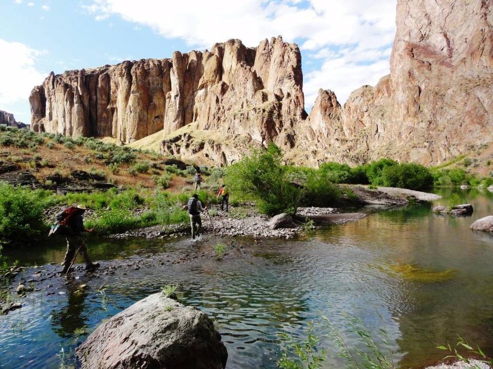
“Not many folks know what’s out there,” Patrick said. “We tie into seven different mountain ranges — often those are 7,000, 8,000 feet. We go up and over Steens Mountain, which is over 9,500 feet, and drop 5,000 feet to the (desert) below. There’s cultural artifacts, arrowheads, pictographs. … It’s kind of like a treasure hunt.”
Patrick was in Boise last week to promote the Oregon Desert Trail. She spoke to about 30 hikers who wanted to know more about her project.
The trail covers 750 miles in roughly a W-shape from the Oregon Badlands Wilderness east of Bend to Lake Owyhee State Park. The eastern terminus is about a two-hour drive from Boise. Patrick has traveled the entire trail in sections, including a pack-rafting trip on the Owyhee River at less than 300 cubic feet per second.
The route was designed to “hit the interesting places in the desert,” she said, and it’s not really a trail. Only 11 percent of the miles have actual trail. A third of the miles involve cross-country travel and the rest are on two-track roads, with few markers. Occasionally, pavement walking is required to access towns.
“A route vs. a trail is really interesting because you have to be more aware of where you are in order to be successful,” Patrick said. “Having to be present to make sure I’m not lost, I find myself having a deeper connection with my surroundings. I wanted to know more about where I was. I picked up some books about homesteading families and Native American history. I love the (Pacific Crest Trail), but it’s a trail where you don’t have to know where you are. You just walk. You don’t know what forest you’re in, what wilderness you’re in. … The fact that it is difficult and you need solid navigation skills will attract people who have done this type of thing before.”
The Oregon Desert Trail, which is a project of the Oregon Natural Desert Association, has an extensive website (ONDA.org/OregonDesertTrail) to help hikers plan their trip. Patrick has started a community-sourced chart that allows hikers to update water levels along the trail for those who come behind them.
The best short stretch to tackle, Patrick said, is the 50 miles of trail that goes south from Paisley.
“It’s nice single track, there’s plenty of water, it’s signed, there’s trees,” she said. “If people want to start somewhere, that’s it.”
The trail also offers opportunities to bike, ride horses, ski and paddle.
“It’s really a multi-modal kind of experience,” Patrick said. “Recreation of those types is really new in some of these areas. We’re trying to cultivate that recreation mindset, that there are going to be some really hungry, dirty hikers coming through.”
Chadd Cripe: 208-377-6398, @IDS_Outdoors
Hiking 350 Miles on the Oregon Desert Trail
From the Oregon Badlands to the edge of the Steens Mountain Wilderness, the western half of the Oregon Desert Trail is a long—and gorgeous—haul.
The ODT is not, Patrick cautions, for the casual backpacker. Much of the trail is unmarked and some stretches aren’t even, well, trail. “ODT stays on public lands,” says Patrick, “which means following private fence lines in certain places—respect the fence!—and navigating by GPS in others.” When Patrick feels the need to commune with the trail she stewards, she packs her sleeping bag, a tent only if wet weather is forecasted (she’s a “cowboy camper” who prefers to sleep by starlight), some high-calorie provisions, and a lot of water.
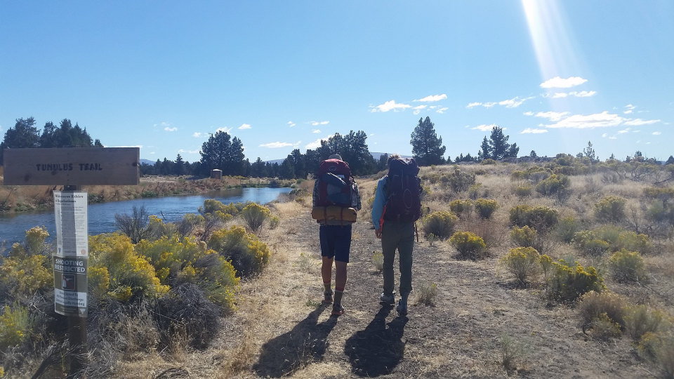
The landmarks and sweeping vistas of the entire ODT are too plentiful for one slideshow, so here, Patrick shares a selection from the trail’s westernmost half. It’s a stretch (sections 1–12 in ONDA’s guide) that travels through the Oregon Badlands Wilderness, the Deschutes and Fremont National Forests, and Hart Mountain National Antelope Refuge. Patrick navigated the entire route over several treks in the spring and fall of last year. For aspirational hikers who live west of the Cascadian rain shadow, the trail’s closest access point—it’s western terminus—is located at the Badlands’ Tumulus Trailhead a mere 20 miles from Bend. 350-some-miles later, Patrick sets the halfway point at the tiny town of Frenchglen, which boasts a cozy hotel (a state heritage site) that’s perfect for propping up some tired and dusty feet—and crossing one epic adventure off your Oregon bucket list.

This is awesome Renee 😀
LikeLike
Thanks 🙂
LikeLike