When Bend Magazine asked if I would write an article about my thru-hike on the Pacific Crest Trail 20 years ago, I was thrilled to be able to share a few slices of the experience that changed my life.
Even though I feel many miles away from the person I became on that trip, I know she underpins all of what I do and how I see the world now.
Click here to read the full story on Bend Magazine‘s website.
Getting edited for a travel magazine was something new to me, and even though they added lots of practical tidbits to the story, I prefer one of my earlier drafts which I’ll share with you here.
I don’t know if it’s frowned upon to share a draft of an article that becomes something else at the end, but here I am, doing it!
Wander through the Wonder on the Pacific Crest Trail
Years later I still rock out as She-ra. This was my birthday in 2024 shortly before my cancer diagnosis. I’m carrying a lopper I received that day to mark my move into trail maintenance and stewardship. My hiking journey had come full circle.
At the Oregon/California border of the Pacific Crest Trail I found a simple wood-burned sign nailed to a ponderosa pine. That sign, just south of Ashland, marked the transformation my body had taken over the previous 1,699 miles: my calves were swollen to the size of cosmic crisp apples, blisters were a thing of the past, and my thighs bulged out like Superman’s. By the time I walked up to that sign the miles had honed me into an invincible hiking machine, and now, Oregon was to be savored.
Oregon proved to be the indulgent treat I had waited for, especially when I gazed at the fathomless depths of Crater Lake with a water bottle full of wine; I watched the stars wink into being that soft evening and resolved to live this trail life forever. The granite expanse of mountains in California were astonishing, but the standalone chain of basalt and pumice peaks was somehow more welcoming. The trail gently ushered me through the gateway of volcanos, high cool lakes, and the kind of trail where the mind could wander around the wonder of the Pacific Northwest.
To this mid-western girl, the thought of walking the far-away lands of the PCT reminded me of the adventure books I devoured as a girl. Back then I wanted to live a life full of exploration and exploit; I still do. I walked to Canada that year, five months after I left the Mexican border, and my quest to live and work outside the bounds of the ordinary brought me back to Central Oregon two years later; I came back to hike. The trail in Oregon was originally named “The Skyline Trail” before it became part of the PCT, and it was aptly named. Our local tread ushers you along the shoulders of volcanos including South, Middle, and North Sister; past Mt. Washington; Three Finger Jack; and the hulking Mt. Jefferson.
Nemo approaching Mt. Washington
The PCT was the brainchild of avid outdoorswoman, Catherine Montgomery, back in 1926. I thru-hiked the trail 80 years later in 2006, well before another notable woman, Cheryl Strayed, made the PCT famous in her book, Wild. Cheryl stopped her 1995 hike at Cascade Locks, 455 miles on the opposite side of Oregon from that CA/OR sign, but you need not hike for months to find the respite that she did on trail. Those who want to experience the iconic volcanic section of the Oregon PCT will need a Cascades Wilderness Permit for a day hike or short backpacking trip, but it’s worth it! Gear shops in Central Oregon employ knowledgeable hikers that can help with gear choices or would be happy to pour over maps with you. Ready to head out? From Santium Pass, a short 6-mile hike will find you walking below the summit of Three Finger Jack. At Willamette Pass a 3-mile walk uphill ushers you to the clear blue waters of Rosary Lakes where you can camp and swim. Elk Lake is only a mile off trail, and if you head to the resort for lunch you are sure to see hungry thru-hikers that can’t resist the idea of cheeseburgers and beer so close to the trail.
In the years since moving to Oregon’s dry side, I’ve discovered that all the seasons offer different excitements. Cooler fall temps mean a lack of bugs, and when permit season ends in mid-October, it’s easy to head up for a short day-hike from Mirror Lakes trailhead or McKenzie Pass; well-trained eyes can spot delicious Chanterelle mushrooms, a welcome addition to any trail meal.
In the winter Ray Benson Sno-Park hosts cross country ski trails along the PCT; I’ve made it a new year’s tradition to sluice through the snow. For backcountry adventurers, skiing into Mt. Thieson’s shoulder to snow camp will give you a thrill every time you peak outside the tent on long winter nights, and a rigorous day-trip could even be made out of the skin-track up South Sister or Broken Top.
You are not excluded from the wonder if you can’t (or don’t want to) walk the dusty miles. Hang out at one of the mountain passes with a cooler of cold drinks or pick up a thru-hiker trying to get into Sisters for a shower and a meal. You will be able to identify them by their skinny, dusty legs (could be dirt or tan) and the tiny backpack. Give a hiker a ride or soda and you just might make a friend for life.
Another reason to explore the PCT is to learn more about this amazing planet we live on. Maybe your interests lie in history, or is geology your thing? Trail guidebooks, apps, and kiosks illuminate specific details about each area, and now in the age of cell-phones, it’s common for hikers to download podcasts or audiobooks about what interests them. Many use iNaturalist or Seek apps to learn the names of flowers and trees around them, and some may even contribute to a community science project about the flora or fauna they find.
There is much to discover about the land along the PCT, but my favorite part is the connection I make to place. The trail becomes home, and in fact has been home to many since time immemorial. The richness of a life lived outside can be measured in sunrises, in the number of clouds that slowly drift overhead. My wealth increases each time I take a nap under a ponderosa tree, listening to the wind swaying the heavy branches overhead. I smell tangy manzanita in the summer heat and feel the sun warming me into my slumber. I sink into the forest floor and know I am connected to this place. I am part of it. We all are. To hike is to go home.
As I’m working on writing stories from my decades of hiking, I decided that I will share some of them here periodically…I’m sure these will probably look a bit different in their final form, but I find it’s great fun to share what I have now, rather than waiting for that “one day.”
Insignificance along the Oregon Coast Trail
October 2023
I walked up to Elk River in a panic. The tidal water looked too deep and dark for me to cross. Despite hiking as fast as I could through the damp and dark early hours, it looked like I might be out of luck. Low tide was another ten hours away, and if I had to wait, my day was shot.
I knew hiking the Oregon Coast Trail would be a challenge, but it’s really not fair how tides and swells and eroding cliffs throw up the gauntlet. Other trails don’t behave like this. Other trails are obedient in their stabilized soils and rocky steps. The trail out here doesn’t care that I have to walk through deep sand and journey into the night if I can’t cross this river. She doesn’t care if I slip, splash, and dunk myself on the way across, or if my shoe is sucked off into the sifting sand. The audacity!
I didn’t see a choice, so stepped into the flow.
My crotch is wet!
I panicked while resisting the pull of the ocean. The sea was hungry, but my thick thighs prevailed and hoisted me through the last of the current and onto the sandy bench above the flow.
I peeled off the pack and spread out my tyvek ground cloth. Not much point in it though, I was already soaked, and sand had snuck into every crevice; I felt new chafe on multiple levels.
Socks off, feet out. I lay spread-eagle on the ground and listened to my breath slow.
In. Out.
Inn. Ouut.
Innn. Ouuut.
I watched the clouds move along their own current overhead before closing my eyes to the brightness.
One thing became clear: I am not the most important thing here. I am not important at all.
There was no one around to have witnessed my panicked crossing, and I laughed at the absurdity of it all.
I don’t matter. None of this matters.
The ocean does that: puts me in my place.
I thought: this is what forever will feel like. It will feel like the ocean, where I am a drop in an unfathomable depth of the unknown. Suddenly, I could take anything that came my way. The thoughts that weighed on me minutes before seemed lighter against the backdrop of the sea. Anxiety about starting my new business? Doesn’t really matter. The last argument Kirk and I had? Nah. My Dad’s dementia? What?
I’ve felt this way before: when looking at pancake layers of rock in Utah, when surveying the mountainous horizon from the summit of Mt. Whitney, when gazing up at the Milky Way from the Alvord Desert. That abyss? That’s deep time, and I’m here in it.
I thought about Rumi saying, “You are not a drop in the ocean. You are the entire ocean in a drop.” It took me a minute before the concept set up in my mind…what helped was pulling out a scene from a late 90s movie.
Remember the part from Men in Black where alien blasters Will Smith and Tommy Lee Jones realized the cat they had been toting around had a glass marble on its collar, and that glass marble was what the aliens had been after all along? The closer you looked at the marble, the deeper it went. There were stars and galaxies inside, and the magic of cinema zoom showed us that an entire universe was contained within that sphere.
The grain of sand between my toes used to be part of a mountain. That mountain used to be the sea floor. The sea floor used to be covered by glaciers. It doesn’t end, so maybe I won’t end either? I’ll become a part of it all, if only a scrap of food for a tree that will preside over the Deschutes River, and then get covered in lava the next time South Sister erupts.
It’s all good. I’m all good.
I shaded my eyes from the intense sun as I struggled to place myself.
This morning I welcomed the sunrise on my walk, this first day of spring. When I returned home to dabble with some writing, the tears came. (aided by this song…)
My heart is shredding. I’m finally pulling away from my role in crafting the Oregon Desert Trail experience, and it’s much harder than most things I’ve left behind over the years. I’ve evolved through this experience, as a human and a hiker. I have become an environmentalist, and in some ways I feel like a mother.
The grief for what I’ve lost with the change of my body feels incredibly tender; I just can’t bear to continue to steward what I can’t hike. Maybe my attitude will change, but for now it’s too much.
This morning, I cried as I read over years of adventures I’ve had out there. I’m trying to pull out some stories for a collection of hiking essays I’m working on. I thought that hiking stories would be a fun distraction from the cancer memoir, but in a way, both are opening me up to a world of hurt in a way I wasn’t expecting.
The Oregon Desert Trail isn’t just a trail; hikers are embarking on an experience in trying to bridge a cultural, ideological, and political divide.
I think this article from 2018 continues to be one of the best summaries of the larger picture of what the Oregon Desert Trail represents, and what I was trying to do with the experience. Can thru-hiking change the world? I certainly think so, even if it’s just through one conversation at a time.
The trail that cuts through the Wild West of rural land-use politics in Oregon’s high desert.
Ryan “Dirtmonger” Sylva crested a canyon rim and faced an endless expanse of sagebrush. He was hours from any sort of town, after spending days swimming through ice water in Louse Canyon, along a tributary of the Owyhee River in the remote reaches of Southeastern Oregon. He eyed two riders on horseback angling toward him.
“My impressions of the area were from the Malheur-takeover thing. It was really rural and I wasn’t sure what I’d encounter,” says Sylva, a nomadic brand ambassador for outdoor-gear businesses. “Suddenly, I’m walking across this empty expanse and there’s this cowboy coming toward me.”
The riders, a cattle rancher and his son, asked Sylva what he was doing there. Sylva had grown used to puzzled looks from the denizens of the isolated desert, but this time it felt confrontational. Yet by the end of the conversation, he says his views on rural Oregon changed.
Sylva is one of 26 long-distance hikers to finish the 750-mile Oregon Desert Trail. It’s not a hiking trail in the traditional sense. It’s a big conceptual “W” that the Oregon Natural Desert Association (ONDA), a nonprofit dedicated to high desert conservation, scribbled on a tapestry of public lands throughout Lake, Harney and Malheur counties. Unmarked sections require extensive route finding. Stretches of up to 40 miles are waterless.
The trail’s visitation numbers are small, but its true potential is carving a middle path through a longstanding legal feud between ranchers and environmental groups. It’s emblematic of a decades-long public lands debate in the American West, a struggle that has encompassed national publicity campaigns, intractable legal fights, armed takeovers.
As it traverses miles of stunning desert, the trail also explores the philosophy, biology, politics and economics that have made Eastern Oregon a hotbed for natural-resource conflicts. It invites conversation about the urban-rural divide, about land-use policy, about the relative values of traditional agrarian industries and the new-age economy of recreation tourism.
The conflicts in Eastern Oregon run so deep that ONDA, the biggest player in the environmental camp, and rural politicians and ranchers find it difficult to even sit at the same table. But lately they’ve been talking, or at least thinking about it. And the trail has something to do with it. “The more we talk, the more [the ranchers] share why they love the desert,” says Renee Patrick, ONDA’s Oregon Desert Trail coordinator. “When we get out there on the land, we find we have more in common.”
The route spotlights the natural beauty of public lands in counties where a chunk of the populace thinks the government shouldn’t own land at all. On January 2, 2016, armed militants occupied the Malheur National Wildlife Refuge in Harney County. Rancher Ammon Bundy led the takeover to protest the conviction of the Hammond brothers for burning 139 acres of public land in 2001 near Steens Mountain. One occupier was shot and killed, and a dozen others pleaded guilty to conspiracy to obstruct federal officers, firearms violations, theft and depredation of federal property.
Jesse Laird, a rancher in the Warner Valley of Lake County, agrees with Bundy’s message but not his methods. “I felt like the way they went about it was wrong,” he says as he drives his black Suburban toward the looming monolith of Hart Mountain. “They should have gone on a speaking tour.”
Laird turns and points south to a cluster of dun-colored hills. The Oregon Desert Trail drops into the Warner Valley from there, he says. It runs along a paved road, then assails the escarpment of Hart Mountain, entering a national wildlife refuge.
Laird is not shy about his views regarding the Oregon Natural Desert Association and its desert trail. He encourages people to experience the wilderness, he says. His wife, after all, is a professional wildlife photographer. But he’s concerned about the association’s proposal to have the trail designated as a national recreation trail. “I’m scared of designations,” he says. “Special designations always cause special problems.”
In the midst of a flurry of conservationist legislation, President Lyndon B. Johnson’s administration elevated the status of hiking with the National Trails System Act in 1968. In a speech several years prior, the Democrat paid tribute to “the forgotten outdoorsmen of today,” which he defined as “those who like to walk, hike, ride horseback or bicycle.” The resulting legislation created National Scenic Trails, mammoth routes of more than 100 miles that pass “nationally significant scenic, historic, natural or cultural landmarks.”
Debuted in 2013, the exceedingly difficult Oregon Desert Trail has attracted few takers compared with existing National Scenic Trails. According to an informal survey conducted by the Pacific Crest Trail Association, 912 hikers this year have completed the now famous route linking the Mexican and Canadian borders in 2018. Ten people this year have finished the Oregon Desert Trail.
Despite the small number of completions, tourism agencies and the outdoor industry are funding Oregon’s longest thru-hike. The state tourism agency Travel Oregon earmarked the route as one of seven projects that will benefit from its forever fund. Hotels, restaurants and other tourist-facing business donate a portion of their proceeds to the fund. Projects must improve the visitor experience, restore the landscape and provide volunteer opportunities for Oregonians. Last year each of the grantees received around $6,000, a destination specialist with the agency says, and a smaller figure is expected this time around.
Linea Gagliano, a spokesperson for Travel Oregon, says the forever fund money will go toward public meetings and other initiatives to address ranchers’ concerns. “Knowing there was controversy around it, the funds are going to community engagement,” she says. “So it’s something that will enhance communities and not something people feel they just can’t get behind.”
Big outdoor-gear brands have lent support to the trail. The Bend REI store gave grants totaling more than $17,500 for trail maintence. Sawyer Products, an outdoor-gear manufacturer, chipped in around $1,000, and Cnoc Outdoors $2,500. MSR, one of the biggest names in the outdoor industry, promoted the trail on its Summit Post blog.
The unconventional route has also attracted travel write-ups in national publications including The Washington Post and The New York Times. In 2014 The Oregonian reported that the Oregon Natural Desert Association petitioned the U.S. Department of the Interior to study the trail as a possible addition to the National Recreation Trails system.
Seeking to represent ranchers, who are powerful players in the rural economy, the Lake County government petitioned the Oregon Natural Desert Association in January 2014 to halt part of the designation process. They feared that a proposal to connect part of the desert trail to the Fremont National Recreation Trail marked an early step in scenic trail designation. Malheur County commissioners sent a similar letter.
Laird and other ranchers in Lake County don’t have a problem with the trail as is, but they fear designation could pave the way for scenic buffers of up to a quarter-mile on each side. In those buffer zones, agencies could ban motorized use and grazing. Along the Pacific Crest Trail, land trusts have succeeded in converting private land to public to make buffers that preserve a natural experience and allow easier access.
There’s a yawning gap between what rural communities think the Oregon Natural Desert Association is doing with the trail, and what ONDA says they’re doing. Lake County commissioners Bradley Winters and Dan Shoun say ONDA and the Bureau of Land Management have ignored their concerns about designation. “They pretty much couldn’t answer any of our questions about the use, and future use,” Shoun says. The last time Winters sat down in person with an ONDA representative was several years ago.
Three sections of the route—in the Fremont-Winema National Forest, the Pueblo Mountains and Steens Mountain—have received National Recreation Trail designations, but Patrick says ONDA is no longer actively pursuing designation for the rest of the route. “Nothing is off the table,” Patrick says, “but we’re trying to think through this thoughtfully.”
It wasn’t the only time communication broke down in the design of the trail. Alice Trindle, regional manager for the Eastern Oregon Visitors Association in Baker City, barely averted a publicity crisis. She killed an article about the new trail out of fear of offending ranchers.
“There were things [in the article] that really invited the visitor along the trail to go under barbed-wire fences and through gates,” Trindle says. “It didn’t have the respect for those traditional land managers, the ranchers.”
A rancher and owner of a horsemanship business, Trindle is deeply in touch with the region’s traditional industries. While tourism is growing, agriculture and ranching still sustain a large slice of Eastern Oregon’s economy. According to the state employment department, crop and animal production supplied 7.5% of private-sector employment and 7.1% of private-sector wages in 2017. A total $1.7 billion of agricultural products were sold in Eastern Oregon in 2012, the most recent year for which data from the census of agriculture is available. Livestock sales alone generated $762 million.
“There’s a lot of distrust for the big-city environmentalists,” Batty says. “But there are a lot of people in the business community learning to see the value of tourism and willing to overlook the political aspects of it.”
— Thomas Batty
Tourism revenue in Eastern Oregon, though small by comparison, climbed steadily each year, from $316 million in 2010 to $383 million in 2017, according to Travel Oregon figures. About 900 jobs directly related to tourism were added in that time. Gagliano says the past few years in particular have seen a significant jump. There are also secondary effects that ripple through the economy.
Although posters promoting the Oregon Desert Trail hang everywhere from the historic saloon in Paisley to the Summer Lake Hot Springs resort, Lake County businesses have yet to realize gains from the project. Sylva, an experienced thru-hiker, says he can’t see annual Desert Trail thru-hikers ever exceeding 20.
Tourism in Lake County is still largely the domain of the rodeo and a trickle of agri-tourists. Many ranchers don’t know or care that the nascent Desert Trail exists. “They make it up as some big deal,” says John O’Keeffe, a rancher in Adel, a few miles down the road from Laird. “If somebody wants to go out and walk, they can walk there now. You don’t have to make a big effort to make it a trail.”
Thomas Batty, who owns Tall Town Bike and Camp, one of the few outdoor stores in Lakeview, says he’s stocked a bit more fuel for ODT hikers, but otherwise the trail hasn’t made much impact on his business. He thinks that could change, however, as the recreation-tourism sector gains steam. Lakeview is seeing increased visitation from the Timber Trail, another relatively new long-distance route focused on mountain bikers, and the Desert Trail could follow suit.
“This is a pretty conservative area. There’s a lot of distrust for the big-city environmentalists,” Batty says. “But there’s a lot of people in the business community learning to see the value of tourism and willing to overlook the political aspects of it.”
Patrick says most of the tourism boost comes not from thru-hikers but from those who tackle small sections. The immense challenge of the trail plays to the aspirations of the weekend warrior. “The 750-mile ideal is really compelling,” Patrick says. “It’s a reason to go back.” She estimates that each year around 250 people hike segments.
“They’ll buy lunch, dinner, probably spend the night, fill their gas tank while they’re out there,” Gagliano says. “It’s bringing in much-needed economic numbers.”
Duane Graham, owner of the Summer Lake Hot Springs resort, shuttles in a handful of grateful hikers each year from an ODT trail junction 6 miles down the road. In a county where one new job is the equivalent of 520 in Multnomah County, and a group of five people makes a town, no visitor is insignificant.
“We probably will never have the numbers the [Pacific Crest Trail] has,” Patrick says, “but it’s a way to highlight the desert that works with the landscape.”
Given the air of general confusion, red-faced speculation or flat-out indifference in Lake County for the nascent trail, it would have been difficult to expect good results when Patrick ambled into the Warner Valley and ran into Laird at his ranch.
“Oh,” he said, “you’re She-ra.” Patrick was shocked that this rancher knew her “trail name” — a moniker, like “Dirtmonger,” that thru-hikers adopt during their journey. Laird explained that he had been following her blog and the trail’s development, and that he was concerned about possible buffers. Patrick expressed gratitude for the water holes developed by ranchers. Without them, she said, the Desert Trail hikers would go thirsty.
“I felt she was being very transparent and very honest,” Laird says. “I don’t feel like she is — it feels horrible to say — like the other ones there [at ONDA]. A lot of the other ones are out to get us.”
Part of the entrenched attitude of the ranchers comes from their long-standing relationship with the land. In 1867, Laird’s great-great-grandfather arrived in the Warner Valley with the U.S. Army. The Lairds carted in juniper posts on wagons to the Warner wetlands, setting up fencing and water holes for cattle. The early homesteaders fought off sporadic attacks from the Paiute Tribe as they migrated from Reno to Burns. Family folklore has it that one season, the Lairds housed an elderly woman whom the tribe had abandoned. Though she was blind, she always knew when the tribes were attacking. The only property the Lairds lost was one white horse.
Not long after, in the early 1900s, the O’Keeffe family arrived from County Cork, Ireland. They raised sheep but converted to cattle in the 1960s because of labor issues. John O’Keeffe took over the operation from his father in the 1980s after earning an agricultural economics degree from Oregon State University.
O’Keeffe has lived nearly his entire life in Adel, Oregon, 30 miles east of Lakeview. The Adel store, the only store in the unincorporated town, springs straight out of a Western. A group of ranchers in leather chaps and cowboy hats occupies the center. O’Keeffe, a 56-year-old, weather-beaten rancher, wears a white cattleman hat and a grey knit sweater. Laconic and even-tempered, he gives off an air of wisdom, the product of a lifetime of education and experience.
On an afternoon in early November, O’Keeffe’s pickup reeks of smoke. He spent the morning burning the grass around his ranch buildings with drip torches. The burning creates a buffer that starves wildfires of fuel. O’Keeffe is chief of the local firefighting association, a volunteer group that tackles small blazes before they turn into “project fires.” The nearest actual fire department is a 40-minute drive away in Lakeview.
Apart from fire, in any given year O’Keeffe battles droughts, floods, blizzards, coyotes and disease. In winter he drives around all night picking up freezing calves and warming them in a heat box. While ensuring the survival of his herd, he revitalizes the land; he rotates grazing areas, for example, to give native bunchgrasses a chance to store root reserves.
Relatively recently, the environmental movement arrived with new ideas about preserving biodiversity. The 1964 Wilderness Act directed the Secretary of the Interior to review every roadless area within National Park and Forest land every 10 years for a special class of protection. The act famously defined wilderness as land “untrammeled by man, where man himself is a visitor who does not remain.” The legislation banned motor vehicles and harvesting natural resources to maintain an intriguing but profoundly unscientific standard: “primeval character.”
In fact, many varieties of man, from Native Americans to ranchers, have come and gone from land thereafter protected as wilderness. Ranchers say their proactive management strategies, from rotational grazing to prescriptive burning, helped prevent fires and maintain rangeland health.
“I think it’s a fundamental difference in the viewpoint,” O’Keeffe says. “We’ve been grazing here for over 100 years, and it’s still in good condition. We’ve learned a lot about range management over the years and how to graze so that this is sustainable.”
In the 1980s and 1990s, some environmentalists, uniting under the cry “Cattle free by ’93,” argued that sustainable grazing was an oxymoron. In 1987 a Bend resident took out a classified ad urging fellow environmentalists to come by Thursday night if they were interested in protecting public land in the high desert. Each member at that first meeting donated $5, and they dubbed themselves the Oregon Natural Desert Association.
The nonprofit dedicated itself to preserving biodiversity in the fragile high desert. In 1991 it pioneered a method of citizen-led wilderness inventories later adopted by the Bureau of Land Management. In 1994 it convinced the U.S. Fish and Wildlife Service to remove livestock from Hart Mountain, a highlight of the Desert Trail near the Laird ranch, to protect pronghorn antelope and sage grouse. Perhaps most significantly, in 2000 the nonprofit led the effort to establish the first wilderness area in Eastern Oregon, Steens Mountain.
The organization quickly earned the ire of local ranchers. Now, depending on whom you talk to, ONDA is a dirty word. “Most of the ranchers despise them,” says John Ross, owner of the Frenchglen Hotel, a midway stop along the Desert Trail. “They don’t like them ’cause they send environmental things through the federal government and figure out other ways to make it tough on them.”
In 1994, the same year ONDA protected Hart Mountain, Laird’s family lost access to greener late season feed on some 25,000 acres on the Warner wetlands. Laird says invasive Canada thistle proliferated when his cattle were barred from grazing. For another eight years, from 2005 to 2013, the Laird family chose to intervene in a lawsuit filed by ONDA against the Bureau of Land Management over grazing on Big Juniper Mountain. In the effort to preserve their grazing allotments, Laird says, the family quite literally bet the ranch.
O’Keefe remains bitter about the results of a recent case in which ONDA contested the Bureau of Land Management’s inventory of lands with wilderness characteristics. The organization argued for protecting areas with existing roads and water holes, areas O’keefe doesn’t consider wilderness. He says, “they flat out didn’t take in the whole picture.” The negotiations are ongoing.
Actions meant to safeguard the environment, ranchers say, ended up hurting it. After ONDA’s concerns prompted the U.S. Fish and Wildlife Service to remove cattle from Hart Mountain, Laird says, coyotes preyed on deer instead. Cougars came down from the mountains into the Plush valley. “It is an area of critical environmental concern because the BLM bought it,” he says.
The chance meeting between Laird and Patrick laid a small plank in a bridge that needs to span the chasm between environmentalists and ranchers. Patrick was impressed that Laird followed her blog, showed commitment to ranching sustainably and took time after they met to attend a presentation that she gave in Lakeview. By the end of their conversations, she said, “I felt we were able to agree on the beauty of this land.”
The Oregon Desert Trail begins with little flourish or fanfare. A small wooden sign for the Tumulus Trail, hidden a mile down a rough four-wheel-drive road, marks the official start. The route enters the Oregon Badlands Wilderness Area, one of the first ONDA campaigned to protect. In the early 2000s, the Oregon Cattlemen’s Association and a group representing ATV users fought the designation, but the environmental group won. ONDA offered to buy grazing permits at an estimated cost of $100,000, winning over some ranchers. In 2009 Congress designated 29,180 acres as wilderness.
I ran into a local duck hunter near the start of the trail. He said his family owned a ranch in nearby Alfalfa, and he spent nearly 40 years hiking the Badlands with no map or compass. Now, he says, he hardly goes there anymore. There are too many people.
I couldn’t agree, as I didn’t find any more people on a 20-mile loop in the Badlands. The first seven miles of the Desert Trail offered a small sampling of its difficulties. I carried eight pounds of water uphill through sand. The route meandered through scant double-track, almost as if it was designed to lose hikers in a twisted maze of basalt and juniper. I navigated using a map and compass, and REI’s Hiking Project iPhone app, but was still fooled once by a deceptive side trail.
For those hiking longer segments of trail, getting lost and running out of water is a serious possibility — so serious, in fact, that ONDA’s Desert Trail resources run red with legal disclaimers. Patrick notes there haven’t been any cases yet of missing hikers, and she’s been meeting with rural responders. But those words of caution are not enough to appease ranchers and politicians whose rural counties foot the bill for finding lost hikers from cities. “If they get lost,” says Elias Eiguren, a fourth-generation rancher in Arock, north of Rome in Malheur County, “it’s hard to find them and hard to get to them.”
The land exhibits the stunning characteristics of congressionally protected wilderness. Western juniper trees grow much larger than usual. Basalt tumuli, remnants of 80,000-year-old lava flows from a shield volcano, rise up in cracked and tortured sculptures. Mule deer bound through the woods. Everywhere there is solitude and silence.
Patrick says a key function of the Desert Trail is educating hikers about public land like the Badlands. “We need these public lands in order to have long-distance routes,” she says. The route runs almost entirely on public land, and its guidebook describes in detail the eight types hikers will encounter. There are several precursors to wilderness designation, including lands with wilderness characteristics, wilderness study areas and citizen-proposed wilderness. Areas of Critical Environmental Concern also receive special protections to preserve wildlife and plant habitat.
Environmentalists say all these designations are necessary to protect land as it progresses through the lengthy legislative process. Ranchers see needless bureaucracy. Both Laird and O’Keeffe feel crushed beneath layers of wilderness designations.
The dispute can be described as a tug-of-war between two philosophies. The debate dates to the turn of the 20th century, when naturalist John Muir and forester Gifford Pinchot butted heads over their visions for a public-lands system. Some environmentalists, and the authors of the Wilderness Act, sought Muir’s approach of preservation, returning the land to an untouched state. Of course, that prompts a question about what “untrammeled wilderness” means on a planet that is evolving every second. Loggers and ranchers argued instead that conservation — proactive management and responsible resource use — actually lead to better outcomes for the ecosystem. Generally, both sides agree to a mix of both approaches, but the exact ratio is up for debate.
Eiguren falls into the latter camp. He runs 500 head of angus cattle, and he says he’s become frustrated by wilderness and monument designations blocking his efforts to care for the land. “ONDA would like to see the straight 1964 wilderness,” Eiguren says. “If we don’t interact with this land, it dies.”
Toward that end, Eiguren helped found the Owyhee Basin Stewardship Coalition. The group of ranchers and local families is advancing a new management plan for the area. The plan calls for temporarily lifting some wilderness designations to allow ranchers to remove invasive cheatgrass and medusahead rye, introduce appropriate perennial grasses and shrubs, and develop water holes for cattle and wildlife. Eiguren says the coalition is taking feedback on its concept paper and hopes to present to the legislature in the next few years.
The rancher says tensions with ONDA have cooled since the push for the Owyhee Canyonlands monument, a campaign sponsored by Keen and other outdoor-gear manufacturers, along with environmental activists. But the whole thing feels like a dry grassland in summer — it could ignite at the drop of a match. “I think we’re talking more, just because there isn’t a big issue right now,” he says. “Things could get tense in a hurry.”
“I think we’re talking more, just because there isn’t a big issue right now. Things could get tense in a hurry.”
— Elias Eigurn
When Sylva opened a conversation with the cowboy at the edge of Louse Canyon, he kept talking about the nearby Owyhee monument. He seemed cautious. He suspected Sylva might be a clueless urbanite or, worse, an ONDA member.
But then they began poring over maps. The rancher helped Sylva find a water source; Sylva pointed the rancher toward his missing cattle. “He definitely let his guard down when I was communicating about the land,” Sylva says. “He then had a respect for me that I knew the area and was able to help him find his cows.”
The Oregon Desert Trail evokes suspicion in some rural ranchers and politicians, but others see an opportunity for common ground. Unlike many other ONDA projects, the Desert Trail has benefited from the support of ranchers. Patrick spent long hours talking with the many private landowners along the route. She never ran into pushback, she says. Some ranchers even offered hot showers or water caches for hikers.
Laird and I certainly do not think the same way about wilderness or the Malheur takeover. But in just an afternoon, I could empathize with some facets of his frustration. He doesn’t want to get 15 signatures on a 34-page document to access one water hole. He doesn’t want a hiker from Portland pulling up fences on Hart Mountain without understanding the families who put them there 150 years ago.
Those dialogues might seem like small steps, but considering the decades of bitter legal battles that have characterized this land, they are giant leaps. The opportunity for further bridge building and discussion among polarized groups sets the Oregon Desert Trail apart from its long-distance brethren.
“I saw polar opposites probably more than any place I’ve walked,” Sylva says. “It’s all intertwined around public land. But there’s still that common bond, and it all revolves around the landscape.”
11/14/18: This article has been edited to reflect the following corrections. The U.S. Fish and Wildlife Service, not ONDA, made the descision to remove cattle from Hart Mountain. In the ligitation over Big Juniper Mountain, ONDA sued the Bureau of Land Management, the agency that owned the land on which the Lairds ran their cattle. The Lairds voluntarily intervened in the case.
***
My comment post publication: I want to address one issue mentioned in the article about hikers going under fences and through gates. There are hundreds of fences on public land throughout Eastern Oregon, and it is perfectly legal to go over or under those fences or through the gates. I urge respect above all, and want hikers to realize that not all fences mean private land, and not all private land is fenced. I have clearly marked private land on the ODT maps so that hikers can know where they can and can’t go. Gates are to be left as they are found. We as hikers want to be respected as we travel through public lands, and the land owners want to be respected for their livelihoods and traditional ways of life. I also urge hikers to think about the people who lived on the land and traveled through it before modern civilization. Eastern Oregon has the oldest traces of humans in North America along sections of the Oregon Desert Trail; sites of First Nations people are dated back to over 14,000 years ago, and another site hasn’t been verified, but dates back to over 16,000 years ago. Hikers will pass by many areas of significance to these original habitants of Oregon.
I just got home from a visit with my good friend Mary. I don’t even remember her snapping this pic, but it resonates. Big time. Is my howl about our seemingly unescapable trap of war, abuse, violence, climate change, and a robot sentience that will change humanity forever? Oh yes, it could be. It could also be an agonizing scream about confronting what my body may or may not be able to do in the future, the ever-present pain, the memory of how I filled my days just a short while ago, and the uncertainty of it all. Or maybe it was just a howl to howl.
We walked that beach for miles and miles. I walked more last week than I have in any of the months since returning from the Camino in September. Mary is a triple crown hiker too. We were supposed to hike the Hayduke Trail together this year, in the before times that is.
Letting go of the before times is proving to be a level of difficulty that I haven’t been able to manage yet. I still keep getting trapped up in what I used to be able to do. In fact, just two years ago in the 8 months before I got injured/sick, I paddle boarded the John Day River, backpacked a 100-mile section of the Idaho Centennial Trail, backpacked around Big Bend National Park for a few days, hiked a loop through the Gila Wilderness along the CDT, created and hiked a short 3-day loop around Smith Rock State Park, skied up to Broken Top to camp/ski over Memorial Day Weekend, packrafted the Umpqua River, hiked the Lost Coast Trail on the NorCal coast, backpacked 60 miles of the PCT again, and day-hiked into the Eagle Cap Wilderness. That year represented my typical outdoor adventure pace. I went hard, but also a bit slower as the years had extracted some toll on my body.
In my struggle to get over the fact that I will never adventure like that again, I’ve been revisiting some of my past exploits. This video that I filmed with Oregon Field Guide in 2017 really sums it up. Establishing the Oregon Desert Trail was the pinnacle of my adventuring, and being able to translate those adventures into something tangible was everything. To create the current version of the route, I packrafted, skied, hiked, navigated, sweated, bled, howled and more…I laughed and glowed, at moments I burst with joy, and at others, cried with fatigue. This movie shows you the reality of the kind of experiences I think we need more of, that I wanted more of.
It was all so good, and I’m glad I could go that hard for so many years before I was struck down.
And that takes me to something my visit with Mary left me with: a reminder of how resilient I am, have been, and continue to be. Two things can be true at the same time: I am damaged, and I am resilient. I choose resilience.
For today’s walk I listened to music. It’s a simply wonderful combination: walking and song.
I want you to have an experience with these posts; there are links to songs, videos, other websites, and many various adventures. So here is your invitation to leave the tab open and return to find the link to the podcast or watch the movie. Take a walk and play the song. Think some thoughts and make some notes, or just leave space to let them emerge as the morning or afternoon unfolds. You may need an hour, or two…sometimes you might need a week for your brain to untangle and release. At least that’s how I work. You do you.
Today’s song is Frank Sinatra Jr’s Black Night. If you liked that one, you also might like The Ocean by Richard Hawley, The Rip by Portishead, or Empire Ants by The Gorillaz. The crescendo of each song echoes somewhere deep inside. You know how I wrote about using sound vibrations earlier this year to help kill the cancer? I think that’s what these songs do too. They vibrate something vital inside me, and the result is elation and joy. I hope for you too.
Today I want to talk about creativity as a force for survival.
When my neck started spasming last year, the aspen trees in the glaciated gorges of Steens Mountain had just started to turn gold. I was leading a trail maintenance trip for National Public Lands Day, and I knew something was very wrong. I was due to fly out the very next day to start a 400-mile thru-hike of the Pinhoti Trail, which I would connect to the Benton MacKaye Trail, turn east, and hike to its terminus at Springer Mountain (also the start of the Appalachian Trail). I planned to bookend the hike with a visit to Pinhoti Fest before I started walking, and finish with the Benton MacKaye Trail Association’s Annual Meeting and Hike Fest at Unicoi Lodge in Helen, Georgia. I intended to make further connections with the founders and stewards of both trail organizations to explore how I could add my expertise to their trails with my long-distance trail consulting business. This was a working hike, but also my vacation. Where do I stop and my job begin? I’ve never really known, having always (or most of the time) worked within a passion.
That beautiful fall day changed everything. Once my neck started to spasm on the last evening of the trip, the jolts continued to shock me, racing from my brain, down my spine. I had no clue what was going on, and quickly said an early goodnight to my volunteers as tears streamed down my face. I thought rest and lying down might ease the bewildering condition, but no. My neck spasmed about every five minutes during the long, late-September night. I cried with fear and pain, hoping the others couldn’t hear the extent of my anguish. Something was very wrong.
I avoided facing the truth even after I managed to make the five-hour drive back to Bend and directly to an urgent care. An exam showed nothing of concern, so we blamed the spasms on a few nights of a poor pillow. I could still hike, right? Meanwhile, on the East Coast, Hurricane Helen had just hit land, tearing up the communities, towns, trails, and mountains where I had planned to hike. I rebooked my flight for a few days hence to see how my neck and the storms would play out.
This wasn’t supposed to happen, to my body or the inland communities along the Appalachians, but one thing was clear: much of the region I was planning to hike in was devastated. On the bright side, the Alabama portion of the Pinhoti Trail was spared, but it seemed in poor taste to frolic down the trail when people were suffering just a short distance away in Georgia.
The east coast hike wasn’t going to happen, so I fixated on the Oregon Coast Trail. This 413-mile hike was close to home, had many towns (meaning I could find an easy out if my neck continued to give me grief), and I had already planned to be away from work for a month, so I threw myself into last-minute planning to walk a month along the sea.
I planned to travel to and from the trail all using public transportation; it would be a cool experiment! Since my passion is my work, I started to turn this trip into another opportunity to evaluate the resources and infrastructure of the trail to see how I could improve it from a hiker’s perspective. I decided to start my hike a week out from that urgent care visit, which would give me time to get a few sessions of acupuncture and massage, and push past the pain in my neck to keep going and hike anyway. I’ve done it before, hiked through fresh and recent injuries, that is.
The day before I started my October groundtruthing hike of the Blue Mountains Trail in 2020, I walked out of the house barefoot, and a stray nail sticking up from the door frame tore a fourth-inch chunk out of the sole of my foot. The flapper was deep enough that I had ripped through a significant portion of skin and callus. I panicked, immediately cleaned out the wound, put some antibiotic ointment on it, and elevated my foot until Kirk came home from work. I shook as I showed him the wound, but slowly convinced myself and him that I could keep it cleaned and protected as I hiked for a month solo on a difficult backcountry route in north eastern Oregon. And I went, and I was fine. So I’d be fine this time too, right?
After a week of treatments, I was convinced this Oregon Coast Trail thing was a go. Kirk and I decided to head up to Waldo Lake for the weekend in our camper so he could foilboard while I read in a chair in the sun. I still wasn’t 100 percent, but I had convinced myself I would heal on the hike, much like I had done on the Blue Mountains Trail. The morning we were set to leave, I was stretching when something twinged in my back and I instantly knew I wasn’t going hiking anywhere. All the progress I thought I had made was gone in that twinge. I didn’t tell the rest of my body, though, and I packed up my backpack and headed out for the weekend. Over the next two days, it was apparent that I was having trouble moving normally. Carrying much of anything caused more pain, and I finally voiced out loud that I wouldn’t be hiking the Oregon Coast Trail. I returned home in a slump. Two hikes had now been thwarted in the last week.
Now what?
It wasn’t until I was on a morning walk recently that last year’s hiking (or non-hiking) saga gained more shape. I headed out into the frosty morning with freshly charged earbuds in place and strolled along my normal route along the Deschutes River. That morning, I listened to Rich Roll’s podcast featuring author and fellow cancer navigator Suleika Jaouad, and I saw my decisions in the wake of my physical limitations in a new light.
Suleika has experienced survival as a creative act. I read her first book, Between Two Kingdoms, this year, shortly after my diagnosis, and quickly pre-ordered her second book, The Book of Alchemy. The more I learned about her story, the more I identified with her struggles. When I heard her leukemia returned for the third time before the launch of her new book, my heart just bled for her. For us.
Back to last October: when I realized that I would not be hiking the Oregon Coast Trail, I decided to go ahead and do it anyway, but from home. I decided to embark on a virtual journey and pretend that I was out plodding through the sand and feeling the rain sting my cheeks in groves of old-growth trees that rim the bluffs over the Pacific Ocean. I would virtually hike the Oregon Coast Trail.
Ever since I set foot on the Appalachian Trail back in 2002, I kept a daily journal. Those hand-written missives from the AT are lost, but from then on, I wrote and posted them online. From my hike during a break from grad school along the West Highland Way, to my thru-hike of the Colorado Trail and the culmination of my summer of leading trail crews, I chronicled the rain, sleet, and snow. The blisters, spider bites, and those few times I caught myself on fire from my beer-can stove. Yes, there were multiple times. Over the years, I shared my joys and struggles with a small group of loyal blog-readers, but more importantly, I found great joy in writing for the love of writing. I didn’t care if anyone else read about day 56 on the Pacific Crest Trail or day 5 on the Sunshine Coast Trail, I loved waking up in the early morning and capturing the feeling of the day before.
So when my body wouldn’t let me hike last fall, I decided to wake up early each morning, read the guidebook (shout out to Bonnie Henderson and her excellent resource), reference the FarOut app for real-time updates from other hikers, study the weather, decide how many miles to walk, where I would camp or find lodging, where I would eat, what interesting things I’d see during the day, and how I would navigate the many gaps in the trail. I wanted to turn this virtual hike into a visual journey as well, so I planned to create a story map that I would build on, publishing each new day on the story map as I would on an actual thru-hike. The Oregon Coast Trail is a logistical melange of hazards like high tides, which make certain sections undoable, or eroding cliffs from a perpetually stormy sea. I wanted to experience those hazards, even if remotely, and decide how I would proceed if I were actually there.
Story mapping had become another passion by this point, and over the past few years, I had been creating them professionally for other organizations. The medium harkened back to my college days where I dove into multi-media projects, combining images with prose, sounds, and even videos. And since my virtual hike was quickly becoming another work/passion project, I decided to add on elements from a second business I had started recently, called Intentional Hiking.
Yes, the title gives it away – with Intentional Hiking, I hosted several conversations a month about ways hikers could cultivate a deeper engagement with the world around them as they were out for a day hike, week-long backpacking trip, or a long thru-hike. I invited experts to talk about things like collecting data for Adventure Scientists, learning how to identify plants and animals to contribute to research projects on iNaturalist, or even how public land management agencies are integrating Traditional Ecological Knowledge of indigenous peoples into federal planning processes. To apply this to the Oregon Coast Trail, I decided I would identify several aspects hikers (and I) could engage with as we walked. Those items were categorized and marked on the maps as: Fun Facts, Trail Stuff, Environment, Military History, Exploration History, Tribal Nations, Art and Culture, and Take Action. Each morning, I would wake at my usual 4am, spend the next 4-5 hours researching, writing, and adding on to my story map, and publish that day’s hike on my blog.
By the second week, my creative act had become a bit oppressive, given the sheer amount of time it was taking me to create each day’s exploration. The added weight of my painful body didn’t make things much easier. After my morning creation, my days were filled with appointments. They ranged from sessions with a physical therapist, massage therapist, chiropractor, acupuncturist, and my primary care doctor, with little result. I could barely move.
I kept going because that’s what I do. I finished the project on October 31 to reflect when I would have finished in real time. I remember my neck and back were feeling a hair better…in fact, everything was feeling a tad better, that is, until I slipped and fell on a wet floor while shopping on November 1. It was the kind of fall that you knew would be bad on the way down. As my feet flew out from under me, I had long enough to notice the “caution wet floor” sign by my right leg, and also know I was in trouble. I landed hard on my right glute, whiplashed my head, and passed out.
I will tell you the rest of the story another time, but needless to say, my troubles were only getting worse, and I was still about two months out from my cancer diagnosis. Life sucked, but it sucked less when I could focus on things like the virtual Oregon Coast Trail by ignoring my pain as much as I could to do something that brought joy.
I want to say many more things about how the creative act is survival. Many of you have seen it play out in real time through my blog this year, so stay tuned as I unpack more layers of pain and being so that I can continue to not just survive, but thrive through my creativity.
Slueika was in remission for 10 years before her cancer started growing again. The road ahead seems so long that I think the only thing that can get me through this is exploring what it means to be alive, creatively. And what a gift to the world that Slueika and her husband and musician Jon Baptist are giving to the world by doing the same.
Check out American Symphony on Netflix if you want to learn more about these two, they take my breath away.
2025’s Thanksgiving on the River Crew – Cindy, Kirk & Moi (photo courtesy of Cindy)
Kirk and I have had a Thanksgiving tradition of heading to water for the last 10+ years. It probably started because he just loves a flowing river, and even though my river time had been limited before we met, I quickly took to the eddies and riffles as he showed me the ropes of paddling, rafting, and floating downstream.
One of our first trips was a packraft adventure on the North Fork of the John Day River. You can read all about it here:
click for the full post…
We had many other adventures on the water, most frequently coming back to the banks of the Lower Deschutes River as it usually had the most water of any of Oregon’s rivers in late November. We would invite various friends, sometimes it would snow, sometimes it would drop into the single digits, and sometimes those friends never returned for another water-logged Thanksgiving trip…the cold really highlights how a four-day sufferfest can drive people indoors, even if we bring multiple pies.
This year my longtime friend Cindy decided to brave the unknown, and possibly rainy weather to accompany us on our float, and she was rewarded with mild temperatures and minimal splashing as I had asked Kirk to find the smoothest and driest lines through the rapids – my neck and spine still can’t tolerate much jostling.
We launched on Thanksgiving morning and pulled over a few miles later to reheat our feast. I don’t think it was the best of our efforts as my turkey cooking the day before was a bit too zealous and left the meat on the dry side, and we skipped the fancy side-dishes for instant potatoes, stovetop stuffing, canned cranberry sauce, and store-bought pumpkin pie, but it was all gravy. As Edward Abby says, “Hunger is the best sauce,” and the smell of the cooking turkey had started my mouth watering a full day before our dinner.
Dark comes early in late November, but I added some festive cheer with some battery-powered lights and hot cider.
The skies were blue and the nights dark, and we all got a solid 10 hours (or more!) of sleep each night.
It is such a gift to be on the river during this time of year. The blue heron was our steady companion each day on the water, and the sound of the current hushed any background noise that we carried over from day-to-day life.
Kirk and I took a day hike up to the base of 3 Finger Jack last weekend. It may look extreme, but this point is only 2ish miles from the trailhead! The worst part was driving up the washboarded dirt road, which was much harder on my neck than the hike.
I mentioned my intention to hike some of the Camino de Santiago thru Portugal in one of my last posts, and now, buoyed by all the good health news, I’m making it happen…and all of a sudden, the trip is soon, very soon (like September soon!)
I’ll be writing here daily while I walk, and now my time is filled with logistics like:
Whats up with the whole luggage transport system? Since my back/neck/shoulders still can’t support a pack I’ll be paying to have my roller carry-on bag transported each day. There are several companies that offer the service, and you only need to book 48 hours in advance, so that leaves room for serendipity…especially important because I don’t know how many miles per day my body will tolerate yet.
How do I book hostels, hotels, or auberges? Fortunately, many of these lodging options leave half their beds open for first-come walkers….In the day and age of cell phones and reservations, that is amazing, and again leaves some time for the hike to evolve as I see how the miles are feeling. I do have the first three nights booked, though.
Visa? Not needed
Money? Debit and credit cards will work, although I’ve had to check the international fees for both…since my trip is relatively short, just a few weeks, it sounds like getting cash from ATMs along the way will be an advisable way to go
Gear? I’m experimenting with a few different lumbar packs to carry things like a raincoat, umbrella, snacks, and water…I used the Gossamer Gear Piku this past weekend on a day hike, and loved how light it was, although the larger capacity (nine liters) means I can still put too much weight in it, like I did for a walk around town this week 😬. I have a Mountainsmith lumbar pack on order to try, although it comes off the shelf much heavier at 1.56 lbs vs the Piku at 8.9 oz.
Blogging? I thought I would bring my Surface tablet with keyboard to write at cafes along the way, but on my hike around town, it seemed heavy in the pack…I could just type on my phone like I do on regular backcountry hikes…we’ll see. I’ll take some more hikes with it and decide later.
Language? I’ve been taking some Portuguese lessons on Duolingo, but a big portion of the way will be in Spain (about 100 miles vs 70ish in Portugal), and I don’t have time to get good at two languages. Anyway, I hear English is pretty prevalent, and I can always rely on Google translate.
Sleeping? Since I’ll be in a bed each night and can transport whatever fits in my roller carry-on, I’m planning to bring my 40-degree feathered friends quilt, an inflatable pillow, and a silk liner for the beds. I hear i will need to be alert for bed bugs, so I am getting versed I need what to look for.
Food? It will be quite an urban experience, so I’ll have cafes and restaurants all along the way. I will also probably take advantage of grocery stores and hostel kitchens to buy and make my own meals…as for eating restrictions, I’m going to be a bit looser with my diet and eat what is fresh and authentic…I want to immerse myself in the experience, and if that means an occasional glass of wine or pastry with lunch, so be it!
Navigation? I bought the Wise Pilgrim guidebook and app, and I also made my own data book in miles vs kilometers, and have the route uploaded onto Caltopo, which I’ll use on my phone too.
There will be other questions that come up as I’m putting this trip together, and I’ll probably post once or twice more to share that with you. I’ll also post my gear list and anything else you might find interesting. Have other questions? Leave a note in the comments!
I see this as the first of many Camino-style hikes I plan to take since my body is different now, and as I’ve mentioned to some of you, I see developing these type of hiking opportunities for the less-able bodied or people who simply want to eat good food and sleep in beds as a potential pivot for my business once I’m able to start working again. Exciting!
I’ve had really good runs of sleep lately, and then there will be a night like tonight where I can’t get beyond the first few hours of good sleep (I can almost always fall asleep with ease, thankfully!) So here I am, before midnight! Gasp. And writing. I will most likely be up for a few hours and then will go back to bed, but I aim to enjoy these few hours, and what better way to honor the deep night than to write?
I had a successful chemo session yesterday! I was joking with my neighbor Jan across the street…we saw her and her husband Greg on their bikes just as we were getting home from my infusion.…joking that we celebrate being healthy enough to get poison injected into our veins. Totally ironic. Jan had her own brush with cancer a few years ago and is now living life to its fullest. Riding bikes to go get a burger for Greg’s birthday…they are both about 80! They go skiing, Greg makes rock art, Jan bikes to yoga, and they are both very civically involved. What good role models. 🙂 I’m so lucky to have so many people in my life who are busy living. Who spend every day (or almost every day) doing exactly what they want with the people they love. And yes, that involves those still working, too. I have always put emphasis on doing work that I believe in and that energizes me, and the end result of living in that manner is that I tend to surround myself with others living that way too. It’s a great gift.
In fact, when I couldn’t sleep before getting up, I was listening to an On Being podcast on just that subject. Give it a listen:
And I love that both the guests, Atul Gawande and Krista Tippit, gave a nod to Annie Dillard’s quote: “How you live your days is how you live your life.” You have probably read it before in my blog journals. It’s a question I have long kept at the center of my decision-making. I like to live as if each day would be full enough, joyful enough, rich enough to be my last. Before, it was never about death; it was about living a fun, fulfilling, inspired, adventurous life. I’ve had conversations with friends before when they were deliberating a heavy decision…I often say, “There are no bad decisions; some just may be more work than others.” I believe that. And also there is so much time! I look back at the 20-year-old me, and I’m so grateful that I threw my hat in with the peace corps. So many people put too much weight into the job decision right out of college; it seemed so critical that it will set the tone for the rest of your life, but in truth, there is so much time. I’ve had 20 different careers, and sure, now I can look back and draw the connective thread between them all (well, most of them, I still get hung up on the metal roofing gig!) and see how they all make sense. But at the time, they sure didn’t. It was following my curiosity and seeking to learn something from each experience. By taking on the position of student in my jobs, I was usually able to gain a skill that could be used later on, and then it often was easier to know when it was time to move on. Objective complete, next! What else is out there?
Of course, we are living in different times. Generations ago, people kept their jobs for their entire adult lives. Granted, they also had pensions and a social system and work culture that invested in them…we don’t have that now, and it’s much more accepted to hold many, many jobs….it’s now important to tell a good story about how and why you moved around so much.
Man, I’m still getting hung up on the whole short life span with a stage 4 diagnosis. I’m also still determined not to let that slow me down in the “maintenance phase” of life after chemo. I also realize that when I wrap up this first round, it might be the first of several chemo cycles, but hopefully, there will be long phases of maintenance in between where I can live a semi-normal life. It’s hard to fully conceptualize, though. I started seeing a new PT who specializes in oncology patients, and she was encouraging me to think of my daily energy battery as having a finite life. Even walking slower will help conserve the battery, so walk slower, strive to only have one doctor’s appointment a day….to be very conservative with my energy so I’m not totally toast at the end of the day. And I have been. I tend to live my best life before noon or early afternoon and then retire to the bedroom to nap and rest the remainder of the day. Can I get better about spreading my energy out? Will I have more energy when the chemo is done? I’m not working, but I am still chair of the Oregon Trails Coalition board (although I’m about to bring on a co-chair to help share the duties, which will be a huge help!), and I’m also volunteering to help support Oregon Desert Trail hikers. I have tended to ODT hikers for nine years, and I can’t stop now! At least while I have energy. Finiate energy. And then the books, reading the books you all have sent me. I try to make time for that! I just started Mike Beaty’s suggestion, Ursula K. Le Guin’s Earthsea series (thanks Mike, loving it so far!) and an advanced copy of a book that Snorkle sent about the queerness of nature (fasinating!) and have another on deck, Thirty Below, a story of the first all-women’s ascent of Denali that my friend Lori, or Shake N Bake sent me, AND I just got a volume of poetry in the mail yesterday by an unnamed gifter, Marge Piercy’s Made in Detroit. Thanks stranger!
So many books to read, so little time.
How do I want to spend my days? Reading! Walking, visiting with friends and family, spending time with Kirk, netflix and chill (with popcorn), and travel…and fortunately I do have travel on deck. I’m feeling pretty rich right now. Rich in life (not to be mistaken with money…)
I love the excitement of a trip coming up. I keep adding things to my packing list, things I want to bring to Madison, things that I want to do in Madison.
I’ll be seeing one of my childhood best friends, Jasmine. Our houses were within biking distance from each other in the countryside of Almond. I would bike her home, then she would bike me home, and I would bike her home and vice versa. We could spend whole afternoons doing that, making fun of our brothers who liked to bike in circles at the intersections of our roads “turkey vultures” we would cry out as we peddled past. When we weren’t biking back and forth we might be climbing trees, or making forts in the cornfield, exploring the woods behind her house or mine, or making up ice skating routines in the yard ice rink her dad would make with the garden hose when it was cold enough to keep for a while. AND Jasmine hiked the PCT a few years ago! Kirk and I drove out to meet her and her partner at an Oregon trailhead near Mt. Hood. I brought plenty of food and beer, of course, and we marveled that two of us from Almond, Wisconsin, were PCT hikers. Love it.
Then I’m going to see all the friends that are actually attending the conference, like Allgood (my birthday brother…he is a June ‘77 baby just like me, although I’m a few days older). He just got a job with the hiking app Far Out and will be attending on their behalf. Then there is Steph and Chelsea and Jodi, and probably plenty more from the Oregon Trails Coalition, and then there will be all the other folks I met at trail conferences over the past few years. Exciting!
Then I’ll cap off the week with a visit from some high school friends who are driving up from Central Illinois. We all graduated from Dunlap High in ‘95, and as luck would have it, they just came out to Bend last summer for my birthday! Kelly, Melissa, Celena and Hanna got to see Bend for the first time, and we’ll get to hang out again…quite a moving thing because we all lost Missy less than two years ago to lung cancer. We’ll miss Carrie, our other high school bud who is back in Bend (she moved here about 8 years ago), but I’m spoiled; I get to see Carrie all the time 🙂
Hanna, Carrie, Me, Melissa, Kelly & Hanna’s daughter Emma, Celena must have been taking the photo. We drove to Pilot Butte for sunset after a wonderful birthday dinner.
To explain the top photo a bit….we drove up to Elk Lake to have lunch that day when we pulled over for this photo opp with Mt. Bachelor. NEMO sent me a she-ra crown for my birthday, and Kirk gave me some loppers, so I had to carry both around and pose as much as possible 🙂
So again, how do I want to live my days? With friends! Doing fun things!
The therapist I’ve been seeing even suggested to ask myself what this cancer year (years?) has allowed me to do, and if I’m honest, I’ve been able to refine my life down to the very essentials: spending time with people I love: Kirk, friends & family; reading; writing; and travel. And maybe it’s ok to be grateful? Oh man, that’s a hard one. To be grateful for the cancer while also fighting the cancer. It’s a complicated dynamic we have going on for sure.
I woke again about midnight. I haven’t been staying in bed until 3am like I promised all of you a while ago. Oops. Instead, I keep getting up and reveling in the quiet early morning hours to read, write, drink my coffee, and enjoy the quiet. I just like it, ok?
But my new med makes me quite tired during the day. I’ve struggled to keep my eyes open even when visiting with friends, and the extra napping is probably compounded by the short nights. That has been the main side-effect of my new mutation med so far, sleepiness.
This morning I was scrolling on Instagram when I decided to post a TBT image. TBT, you know “Throw back Tuesday” where you post a memory photo.
Then I started reading my blog posts from the Owyhee packraft trip and remembered that my favorite place to write isn’t at 2am at home when I can’t sleep from the cancer in my bones, it’s writing at 4am in my tent or spread-out cowboy-camping style on my tyvek when I’m hiking.
My tradition since starting to blog on my hikes many years ago is to write every day. Get up in the dark, make my coffee, and write. Write for hours even! This is the beauty of solo hiking too; I don’t have to work around anyone else’s schedule, I don’t have to keep quiet so I don’t wake them up, I don’t have to start walking before I’m ready, I can write and nap, and make a second cup of coffee, and write some more, and eat breakfast, and then hike out when I’m ready.
If you browse back through some of the many adventures that I chronicle on this blog, the routine is the same. I write every morning. That is my jam. That is my happy place. To be alone in nature, writing as the day breaks. I know I’ll get back there, I know it in my bones, so I have that to look forward to. This writing at home is the abnormal part. This writing at home is a placeholder for me in the dark in my tent.
So, instead of recapping this incredible adventure of packrafting a 175 miles of the Owyhee River as a water alternate to the hiking route, I’ll just link to my blog posts here for you. This trip did a great job of encapsulating what I love most about adventures….the going out and not knowing if something can be done, but trying anyway. I didn’t know if one could packraft the Owyhee river in July at 135 cfs, but I wanted to find out, so tried. That is true adventure, and the kinds of adventure I hope to get back to…and by going solo I have learned to rely on myself. I have learned to trust my instincts, trust my training, and trust the world to get me through.
I trust the world to get me through this cancer too.
So here are the posts from my 2-week Owyhee solo packraft trip. Enjoy!
Read about my full Oregon Desert Trail section hike here. (I was the 10th person to complete the route after getting the job to establish it the year before. I had to hike it to know what I needed!)
Sleep feels like a wonder drug right now…especially when I don’t get it on a regular basis. And it breaks my heart that so many of you also struggle to get regular sleep! It seems like an epidemic of sorts. My hope for all of you, for us together during this time, is to cultivate better sleep habits…our brains need it, our bodies need it, our communities need it.
Will you do that with me?
What is one action you could take to work towards better sleep?
One that I have been avoiding but seems the simplest to do is to stay in bed until at least 3am. I did not do that today. I woke up several times as usual, but got out of bed at about 1am. If I can stay put and at least try to sleep until 3am (given my usual 7pm bedtime) that would mean I’m giving myself a chance at 8 hours. I pledge to do that the rest of the week. Pinky swear.
So biopsy. I had my deep bone biopsy yesterday at St. Charles Hospital in Bend. I had to get propped up on my stomach so they could take the sample; it was a CT-guided biopsy of the ovoid mixed lytic and sclerotic osseous lesion within the L4 vertebral body….that means they put me through a CT scanner to find the meatiest tumor which happened to be in my back rib. I was awake during all of it, but was pumped full of pain medications, so I felt pressure when the doctor pushed a drill into my bone, but not pain. Very trippy.
The doctors and nurses were most kind, and the world being the magical place that it is, I even had a connection with my recovery nurse when we found out that we had thru-hiker friends in common. Thank you world, you show me support in the most unexpected places!
Lets see, shall we go down memory lane again today? Lets explore the time after my Pacific Crest Trail thru-hike…that hike was so exhilarating and transformative that I decided I needed to find a job outside, somehow related to hiking. No matter that I had just gotten my master’s degree a few years before; I felt a very strong pull to the hiking community and wanted to immerse myself in that world. (Grad school happened at Goldsmiths College in London from 2003-2004 following my Smithsonian internship and will be a story for another day).
I finished the PCT on September 20 with Nemo and Pouch, and returned to Portland to figure out what the heck I would do next.
A triumphant She-ra at the PCT border monument.One of the best things about hiking the PCT in 2006 was meeting NEMO.Pouch and NEMO fell in love on the PCT and now are married and live on a farm in upstate NY!They are some of my best friends to this day.
This seems like a good place to tease my own PCT photo montage video that I made. This one isn’t as long as the class of 2006 one that Pro-Deal made, but at 45 minutes, it’s a commitment!
When I returned to Portland after the trail I found a new place to live…before the PCT I had been living in a group house in SE Portland on 44th and Lincoln (near Mt. Tabor), and this time I found another room to rent up in NE near the Lloyd Center. I didn’t go back to my graphic design job, and instead worked as a metal roofer for a few months.
I know! Random, right? Metal roofing? What the heck?
I became good friends with several other Portland hikers while we were hiking the trail that year, and it seemed like a good temporary job to work with them for the winter on metal roofs. In retrospect, metal roofing in the cold/wet/gray/rainy season of the Willamette Valley in Oregon wasn’t a brilliant move, but because I was working with friends, it was a pretty fun winter gig.
Luigi and Lint and I had spent some good time on the trail together that year; and as for the job, most days we carpooled together down to a Portland suburb to work. I didn’t know what the heck I was doing, but I am pretty good at following directions so was able to figure it out and do a passable job. A kayaker friend of a friend owned the business, and there was a whole group of us hikers/kayakers who worked together.
Those few months in Portland were so much fun. We were big bike nerds then and got into the whole bike-punk, zoo-bomb scene, which basically meant we rode kids bikes and tall bikes around town; we went on midnight mystery bike rides and got into a whole bunch of other shenanigans. Too much fun!
Here are some more pics from that time…
So during this time I was also trying to figure out what a job in the outdoors meant, and how I would get one. Another friend I made on the trail that year was Jack “Union” Haskel, who ended up being a pretty big influence on my next few career moves. I learned that getting certified as a Wilderness First Responder would help me get a job in the outdoor industry, so that winter I took the 80-hour course so I could be qualified to lead trips in the outdoors.
We also decided to apply to be the Backpacker Magazine’s Get Out More team, which would have meant traveling the country in 2007 and talking to people about hiking and camping and all things backpacking. We didn’t get the gig, but I started applying my graphic design and writing skills to outdoor work, which is still a big part of what I do today.
I designed our Get Out More Team Application to look like pages from Backpacker Magazine.
I applied for a bunch of seasonal jobs for the 2007 season, and finally got some traction with the Southwest Conservation Corps (SCC) which was based out of Durango, Colorado. Trail work was another side of the trail community that seemed essential to the thru-hiking world, so I found an Americorps program where I could train to become a trail crew leader with SCC and then lead trail maintenance crews around Colorado that year. I knew I was in the right place at the right time when I had my interview and learned that SCC had just hired a new Executive Director, Nelson Cronyn, who just happened to be my Peace Corps Burkina Faso Country Director! What a small world is that!?!?!
I left Portland in February of 2007 to head down to Durango for a few months of crew leader training, and jumped in head-first to the trail maintenance world.
Of course I met some amazing people down there, and folks who I am happy to still call friends today.
In fact, Amber is coming to visit me TODAY!
Amber and I led a group of tribal youth in a front-country hitch in Colorado that year, and have remained friends ever since. She now lives in Corvallis, Oregon with her wife Anne…You may remember I just mentioned Amber in a recent blog post, we hiked the Corvallis to Sea Trail together a few years ago. Amber still puts her trail work to good use and has been instrumental in keeping the C2C trail clear of logs…she is great on the chain saw!
Amber, me, Laurie, Nicole, Jonah, Artec & Carith (one of our leaders) in the Great Sand Dunes.Amber has skills.
Learning how trails are built and maintained has been core to how I’ve progressed in my career and as a hiker, and my time at the Southwest Conservation Corps was elemental in that journey. Over the next seven months we worked in places like Canyon of the Ancients, Mesa Verde, and the Great Sand Dunes; there were hitches in state parks and on backcountry trails; and I learned how to build massive rock and log retaining walls, cut down trees with hand tools and chain saws, and so much more.
All the time I was working around Colorado that year, the promise of the next trail I would hike was always hovering in the background. Durango happens to be the southern terminus of the Colorado Trail, and overlaps with quite a bit of the Continental Divide Trail too.
I decided to do a solo thru-hike of the Colorado Trail that fall and hiked out of Durango in mid-August and walked up to Denver (some 500ish miles) by the end of September.
You can read all about that hike on trail journals here:
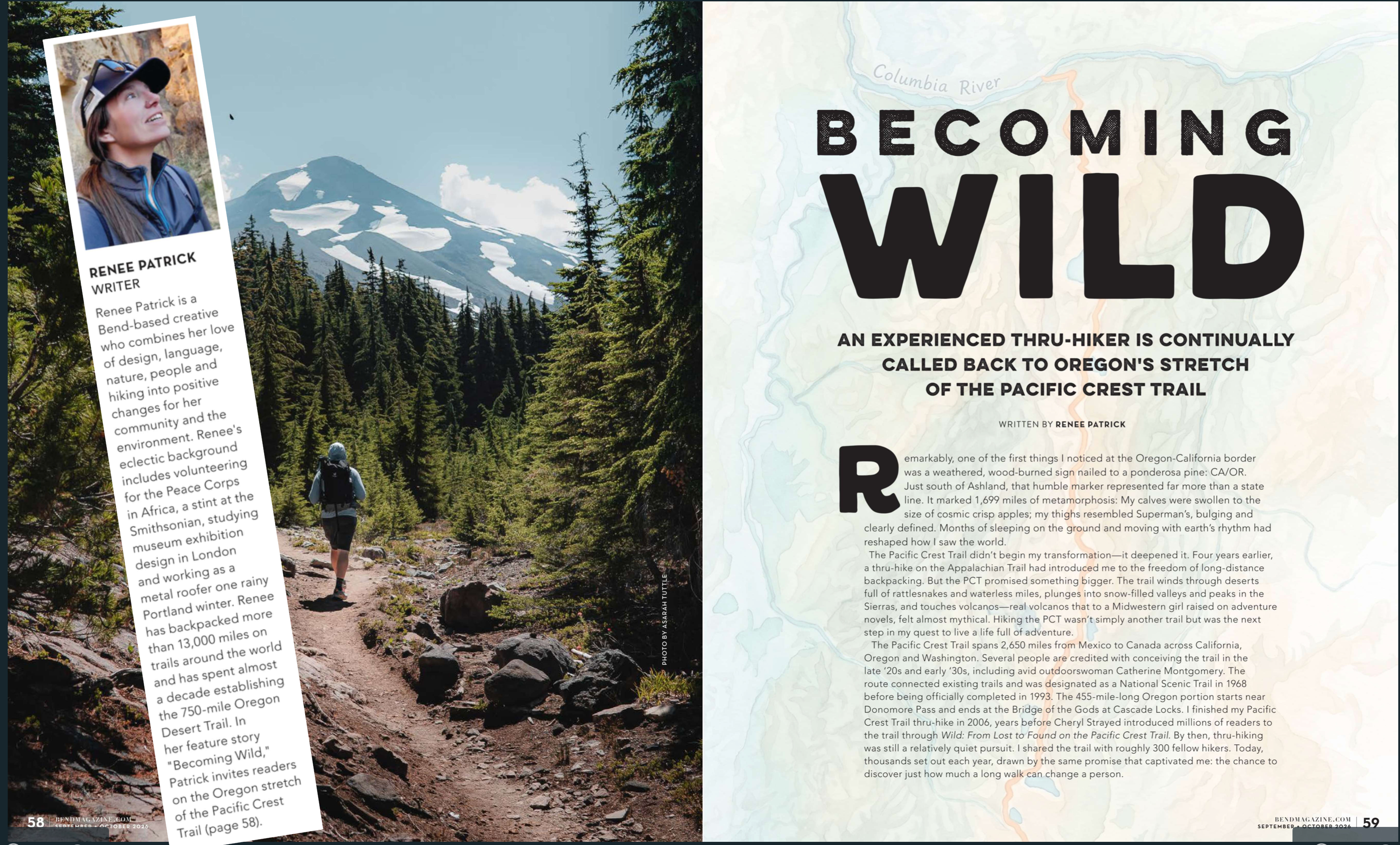
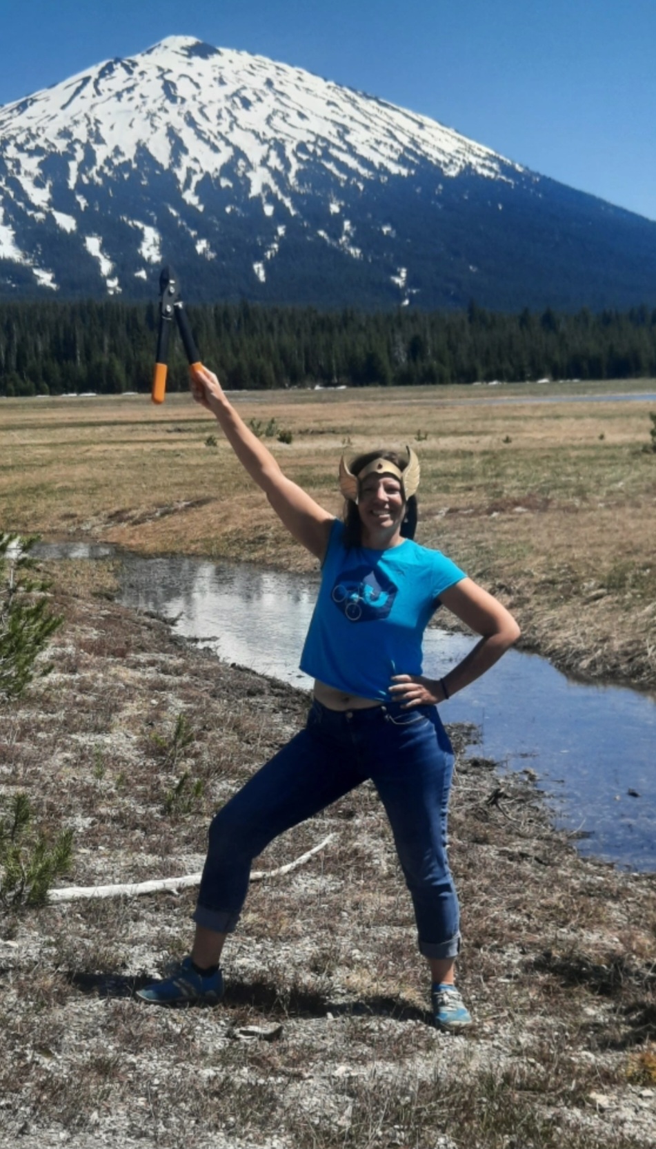
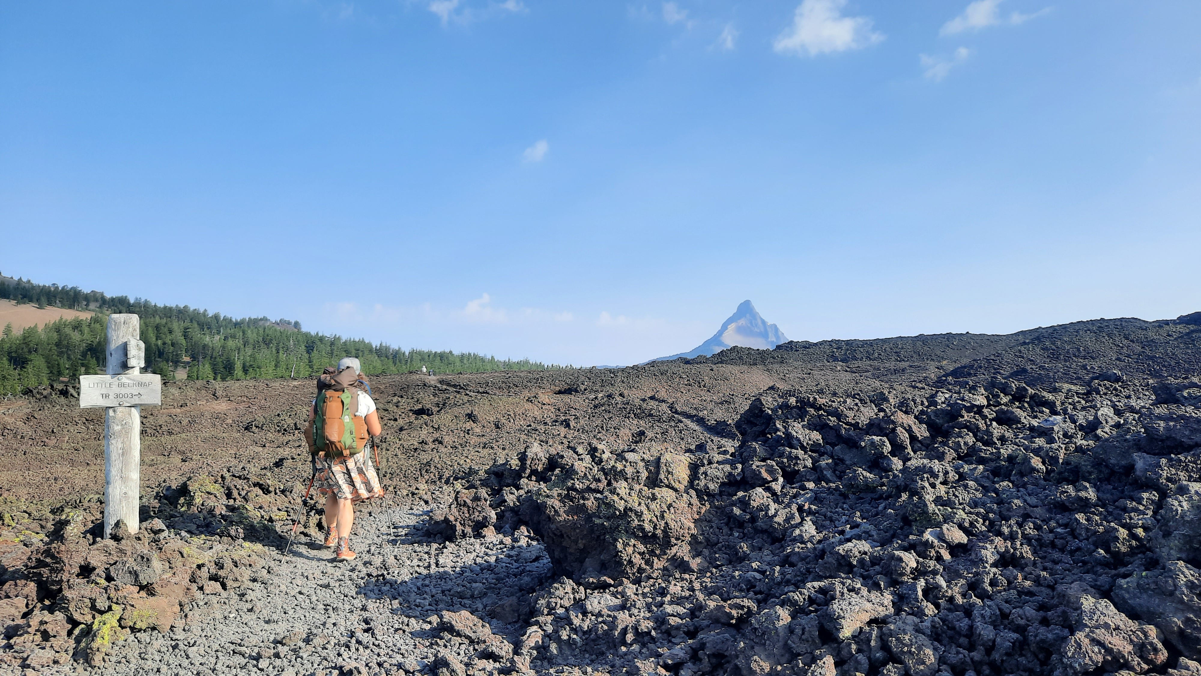
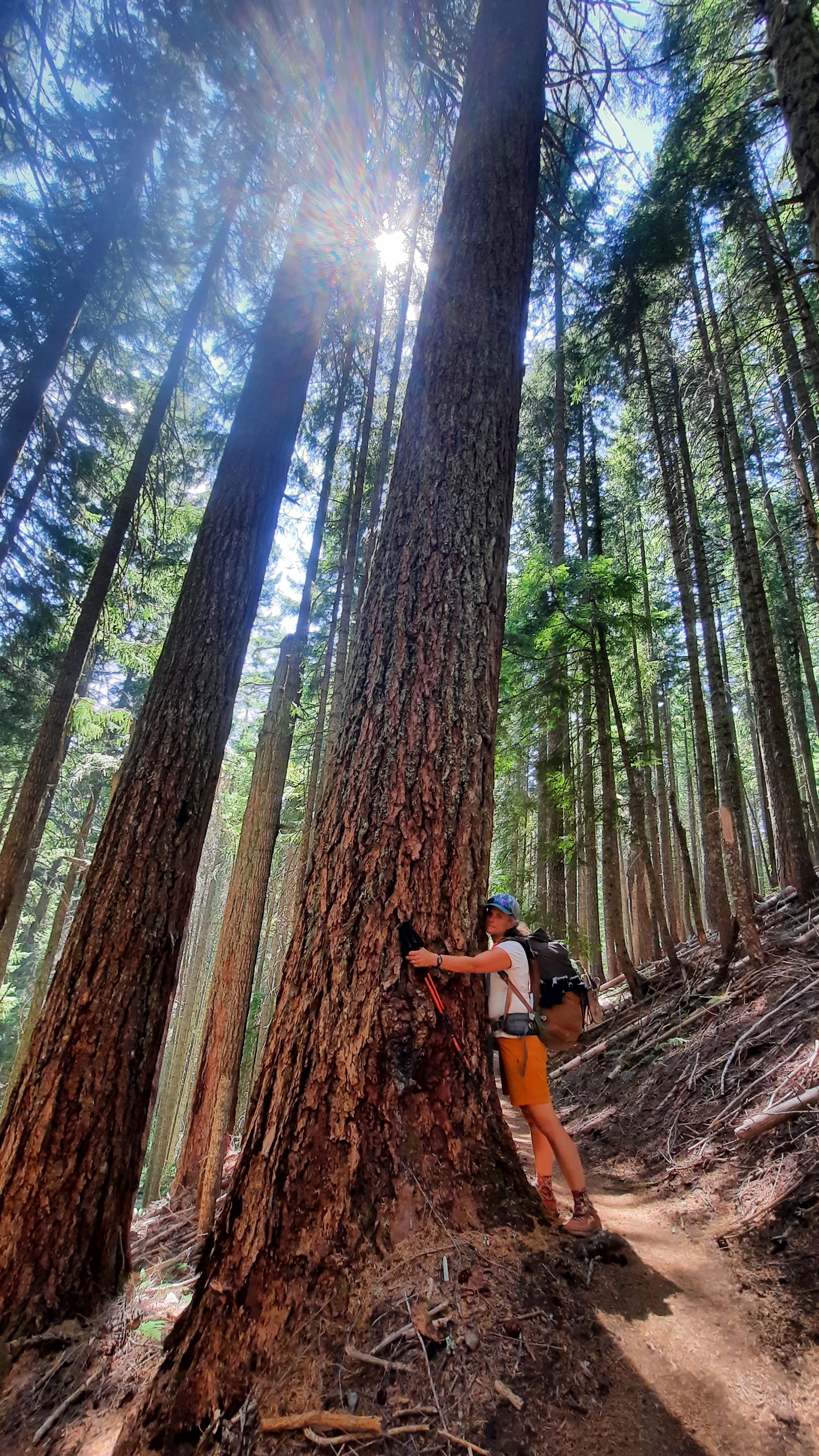
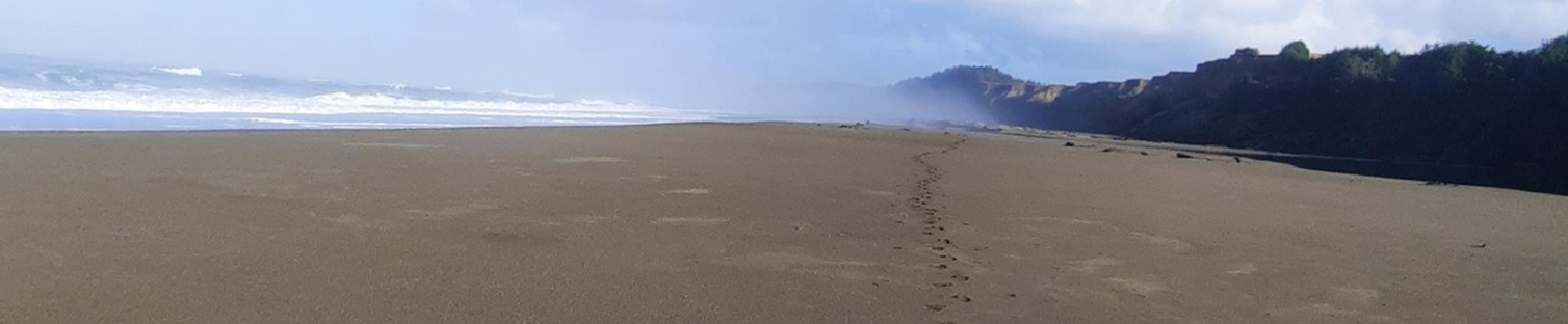
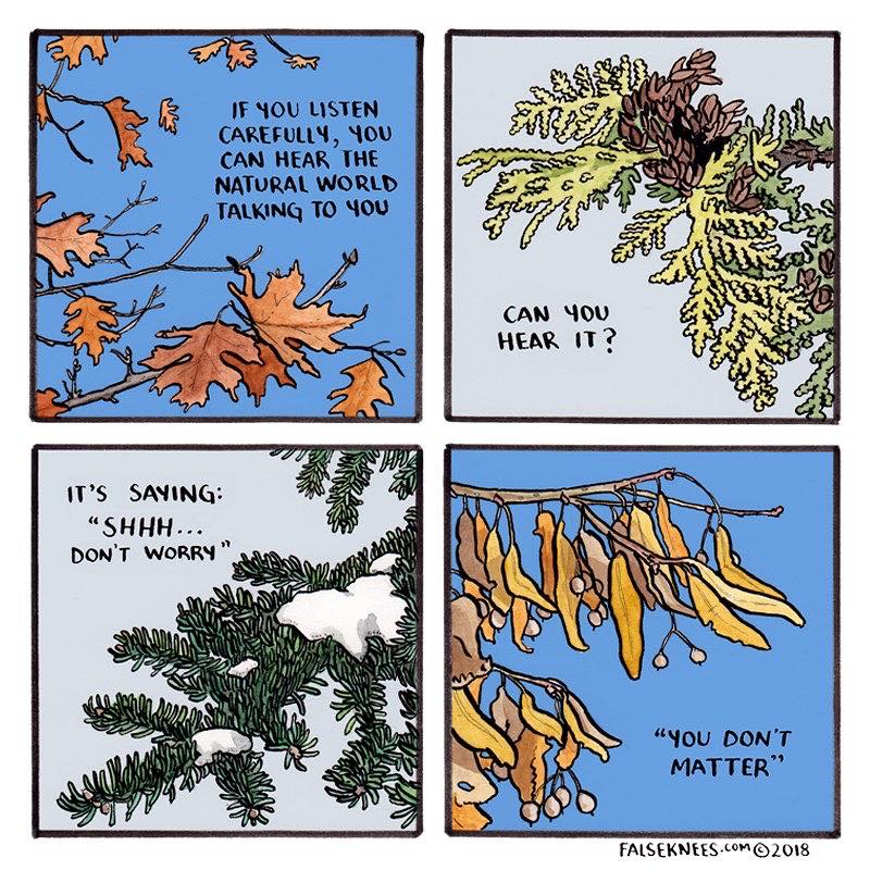
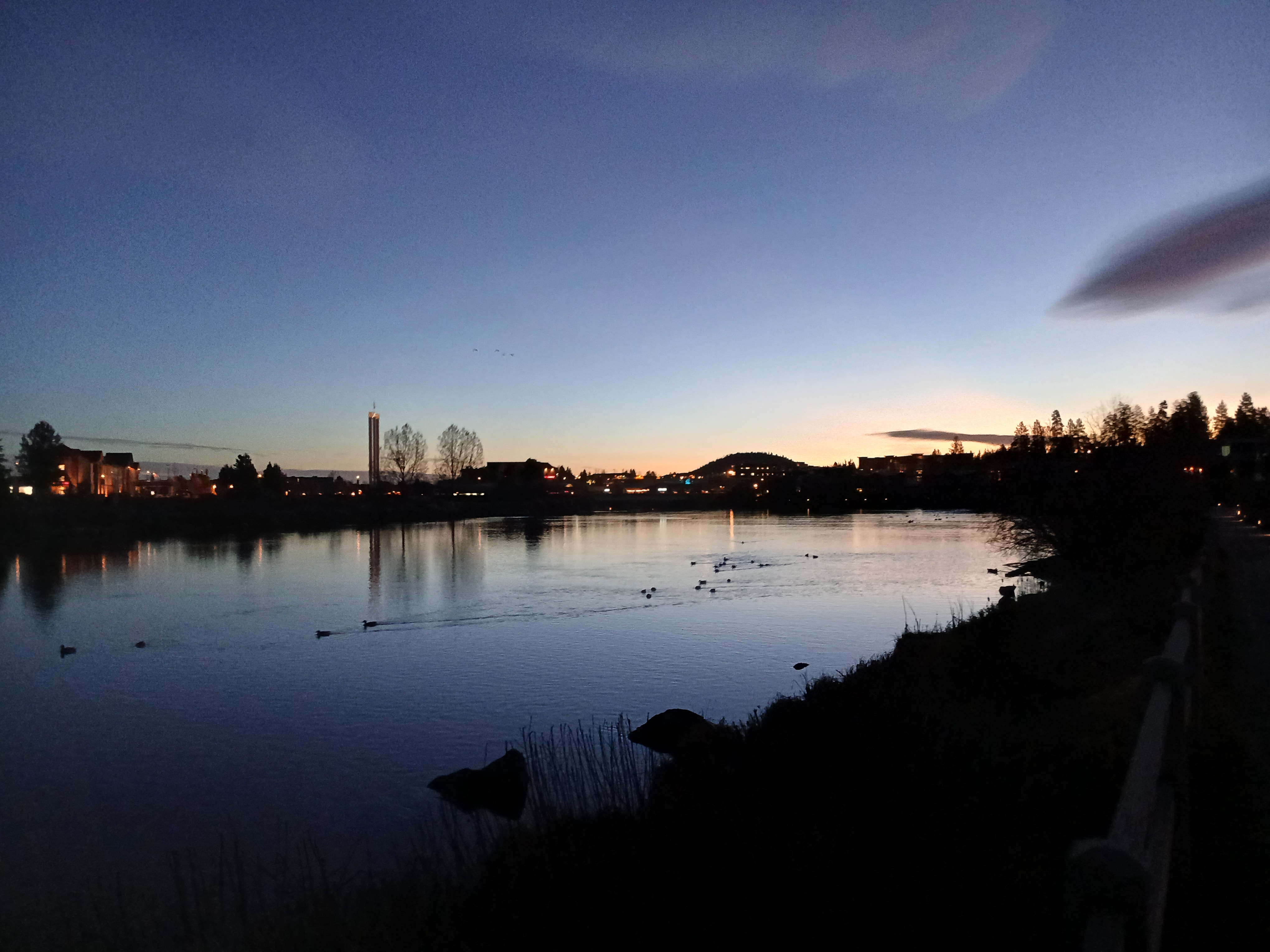
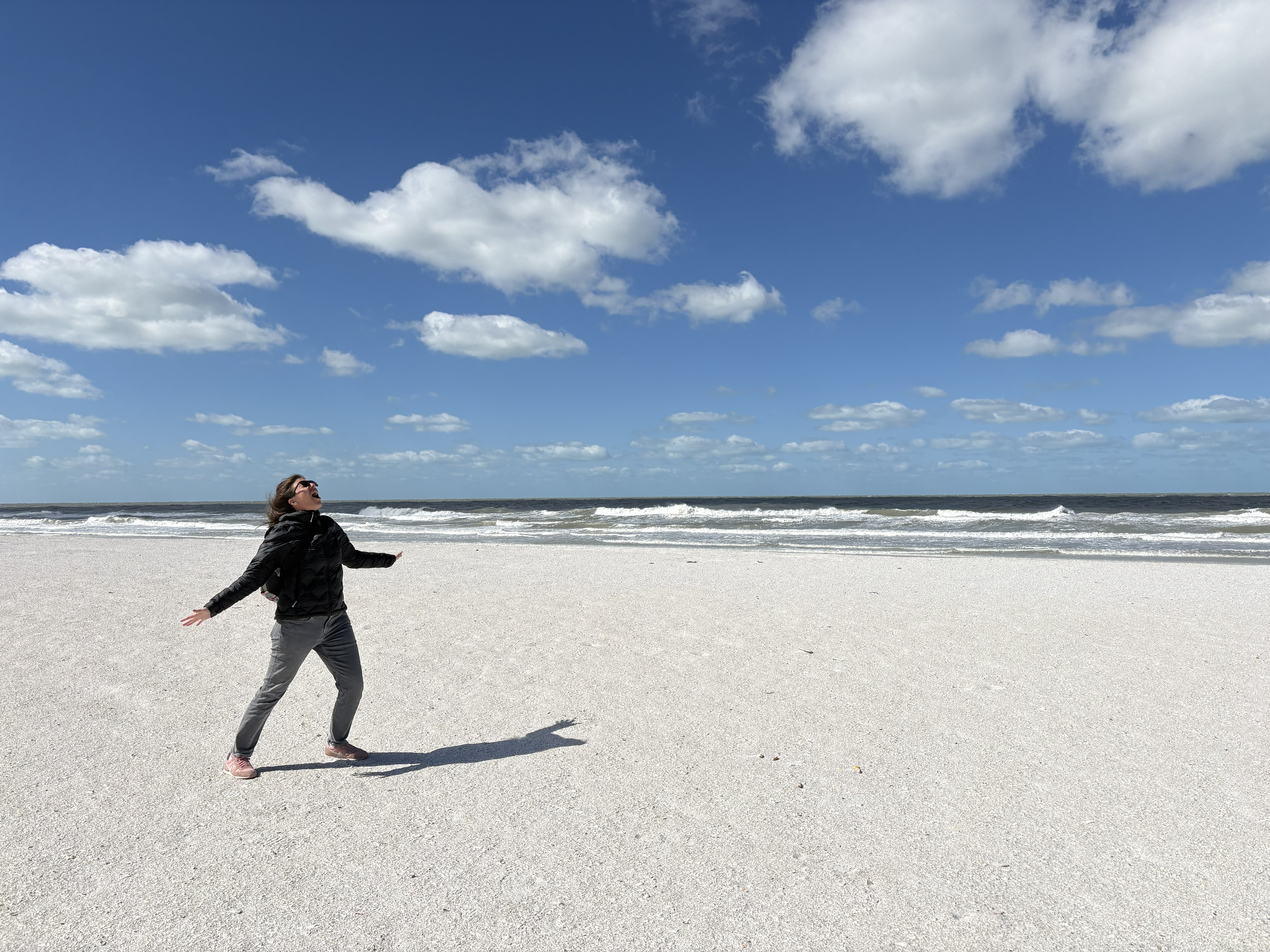


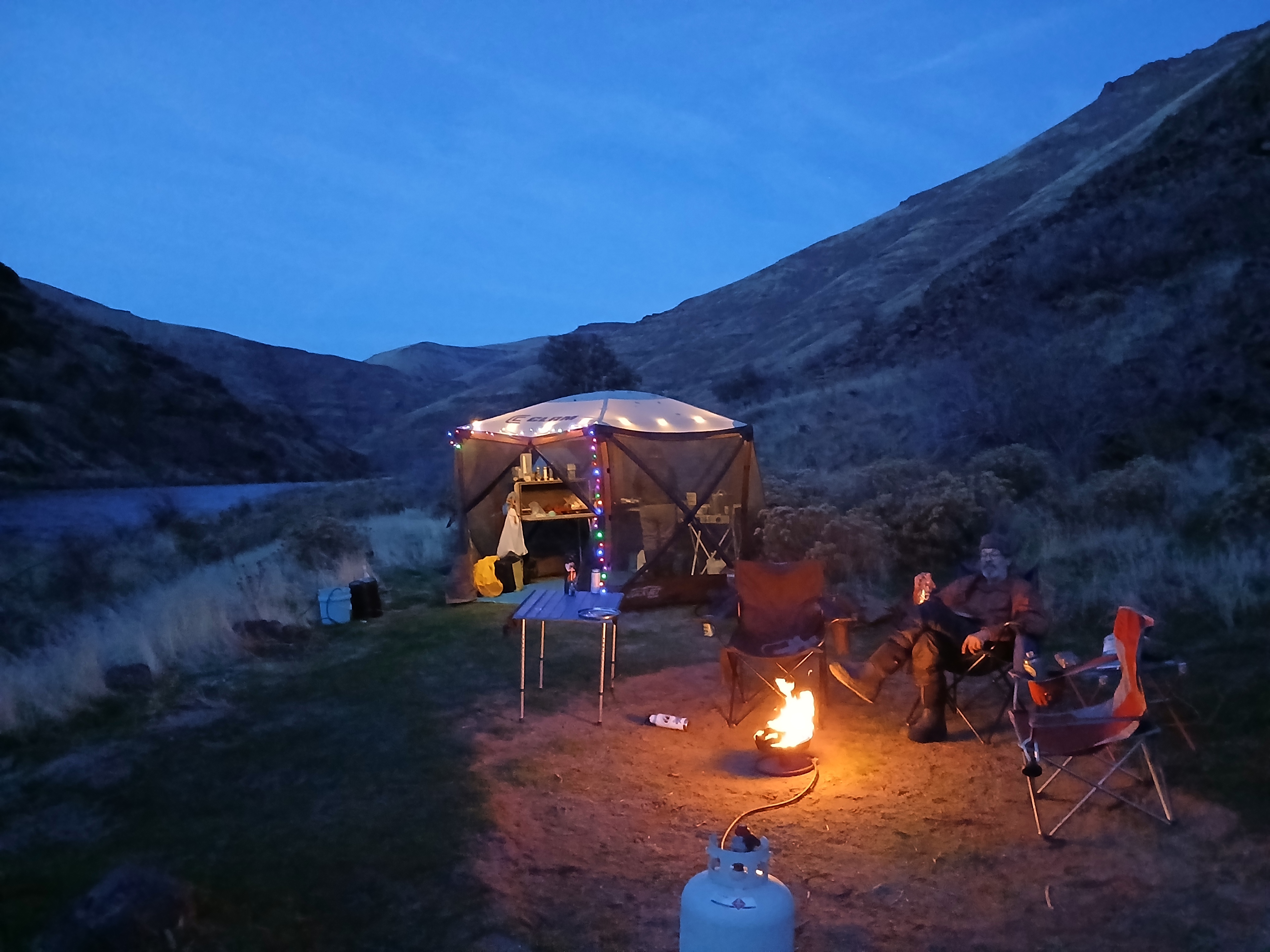


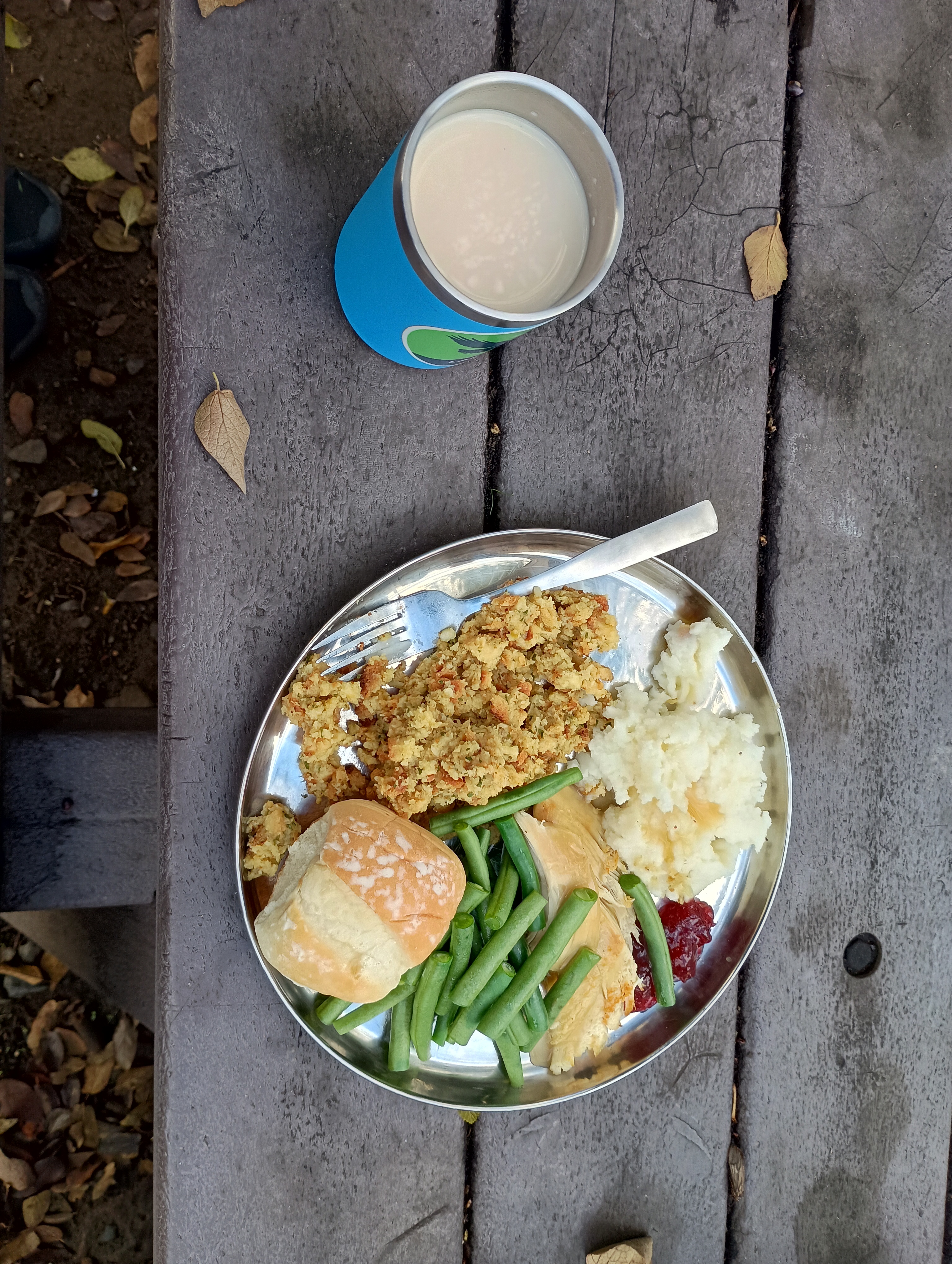




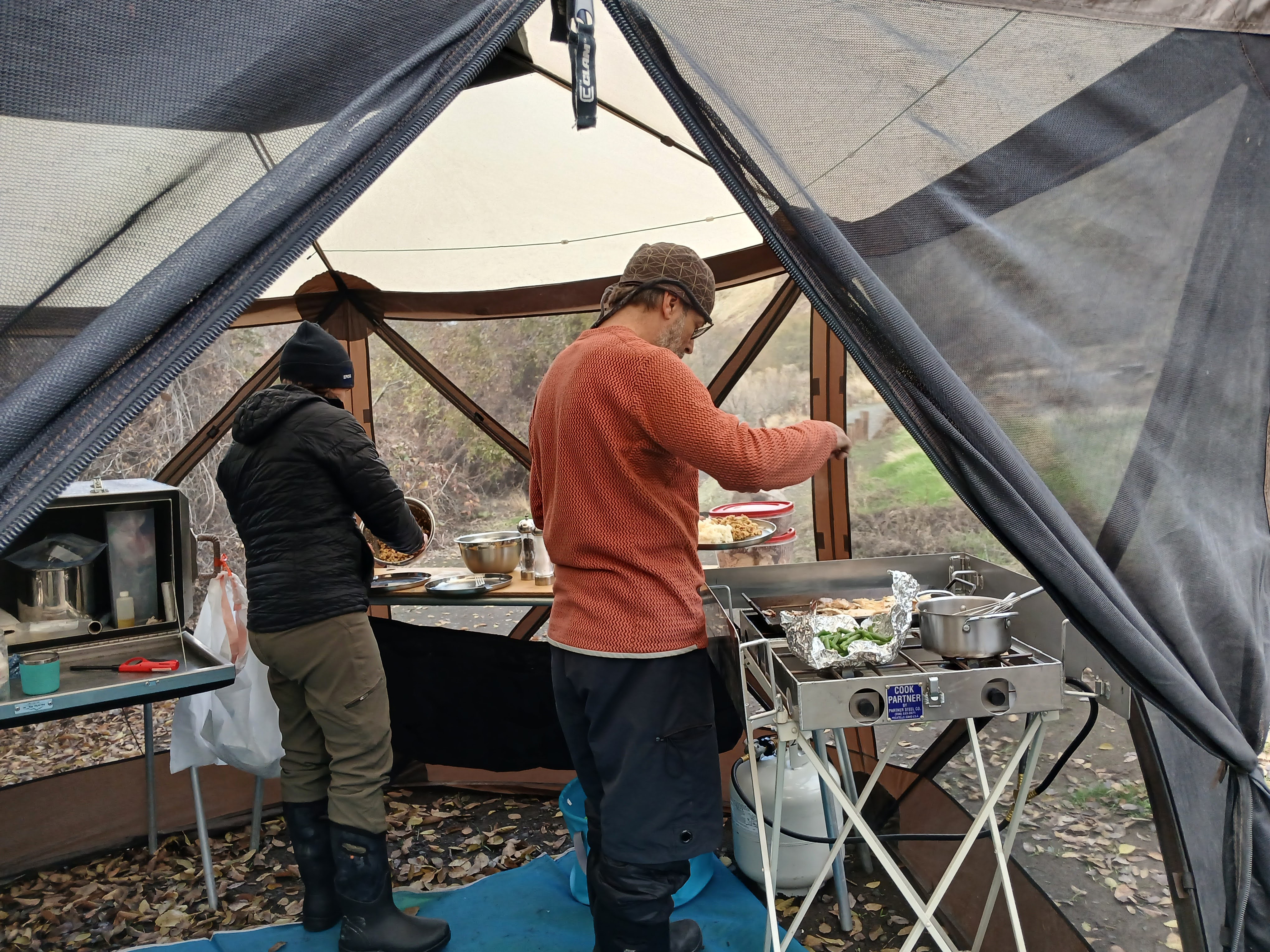


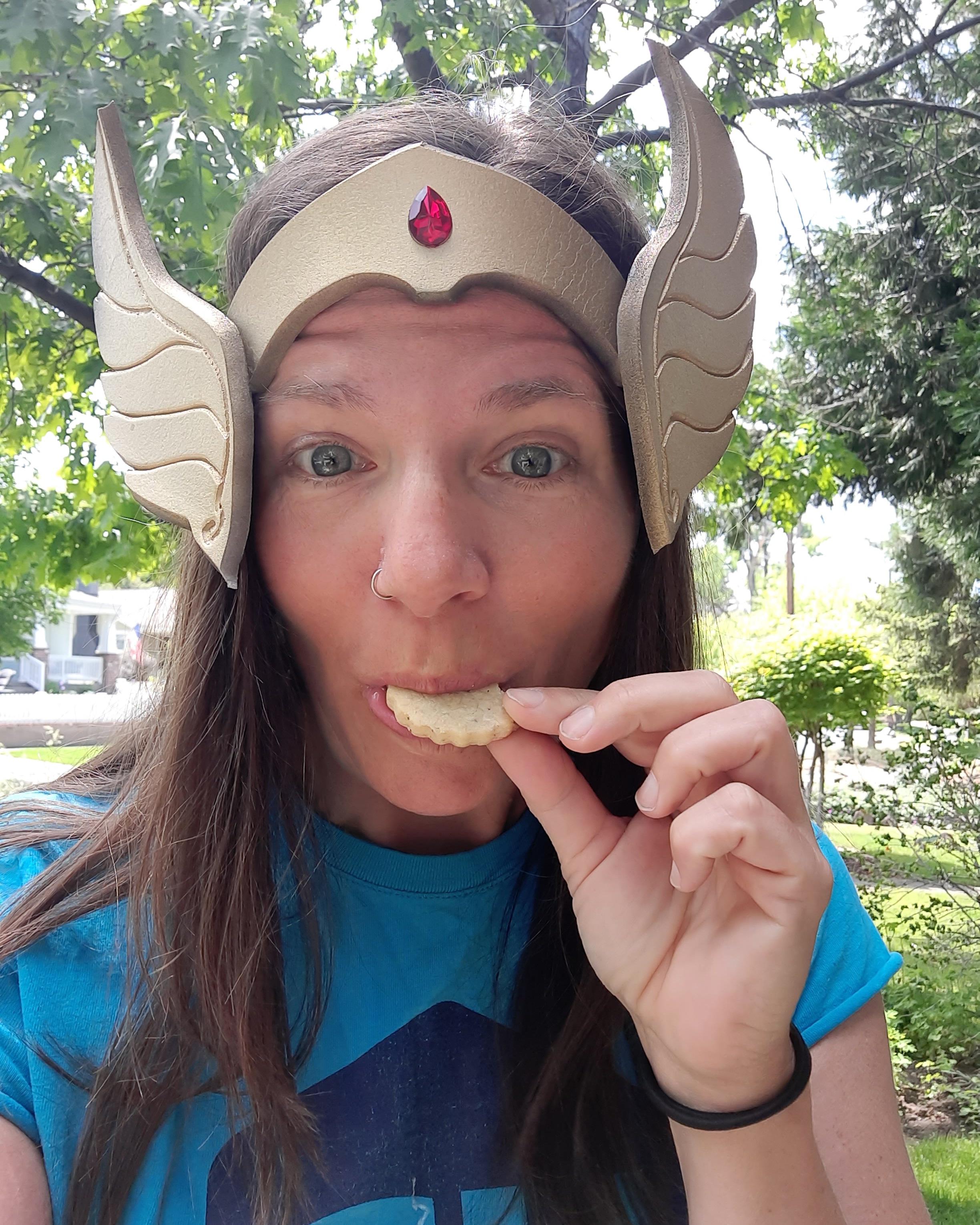


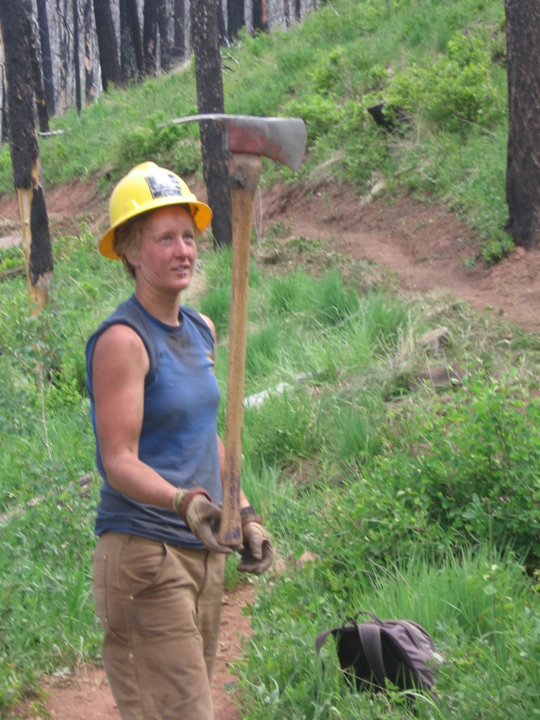

 She-ra Hikes