Blue Mountains Trail (Section 2) – Day 17 – 26.8 miles (312.6 total)

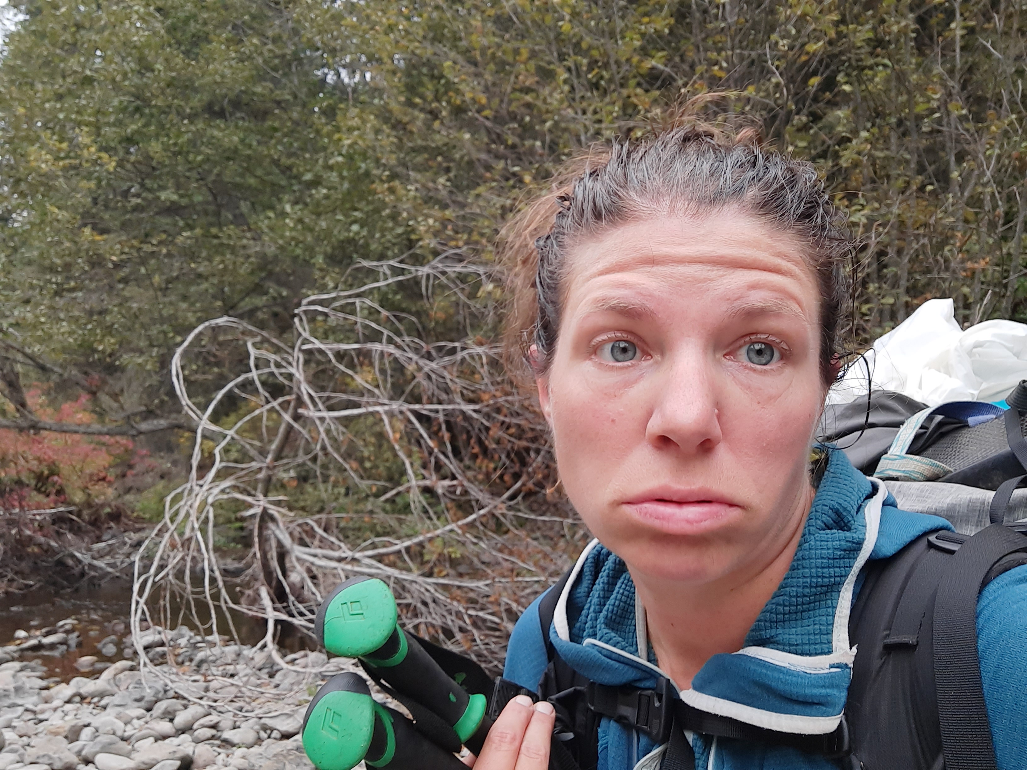
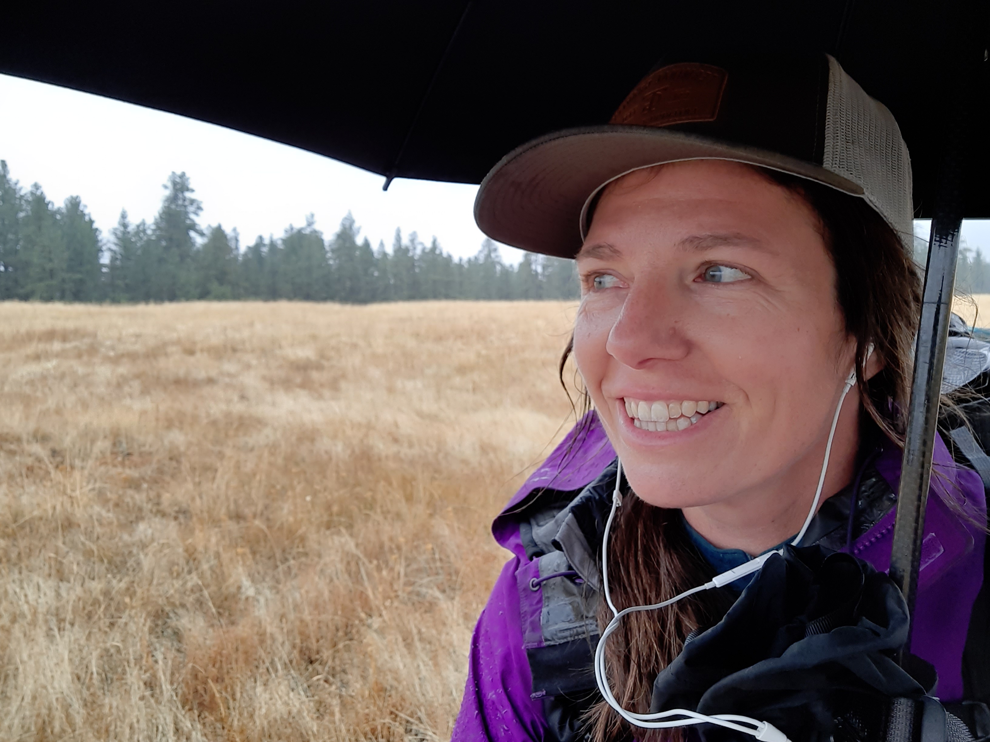
The antidote to great effort is great rest. The need for a great rest was becoming more and more apparent as my energy levels and motivation waivered. 


The route today was to follow a trail in the Bear Creek drainage for over five miles, then pop up at the Summit Guard Station and then drop steeply into the Five Points drainage on a trail that probably wasn’t there. That sounded like a whole heck of a lot of effort, and as I was reviewing the map and terrain last night saw there was another trail that climbed up out of Bear Creek after maybe a mile, and then I could connect back up to the route near the top of Mt Emily just north of La Grande. I decided that I’d let the Bear Creek trail make my decision for me. If the trail was in good shape, I’d take the trail. If not, I’d consider the hike out.


And the Bear Creek trail was the trail that time forgot. I found the tread, but there were trees growing over the trail….thats how long it has been let go, maybe 10 years? It was slow going. It was hard walking.

this is trail, or was trail


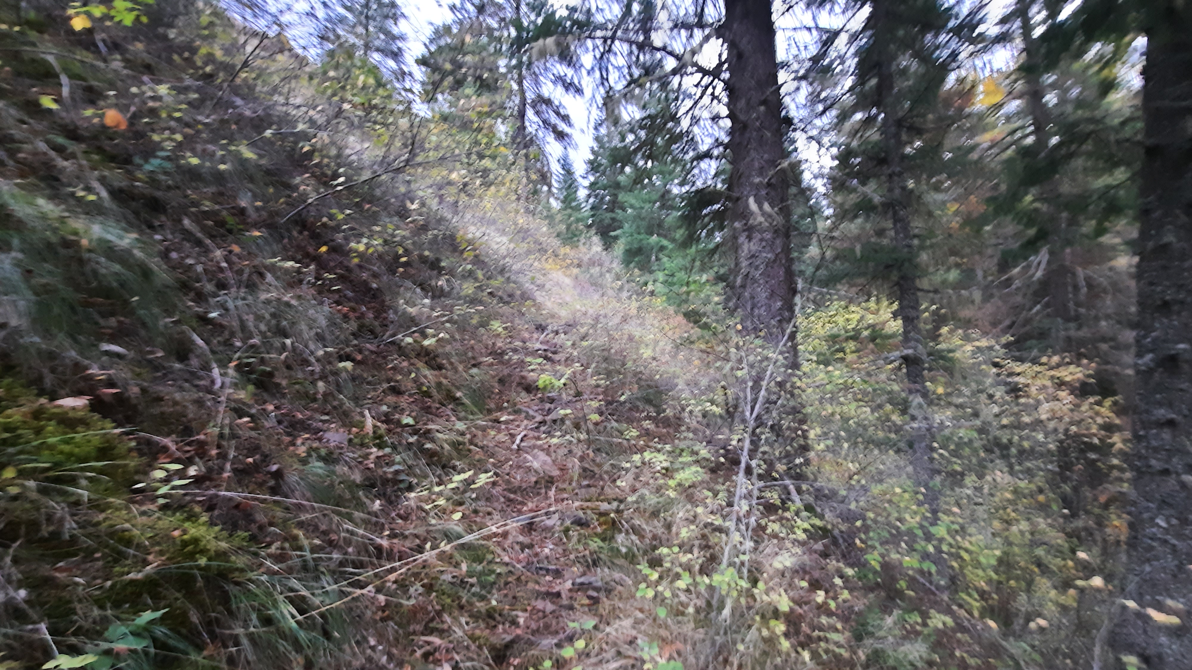
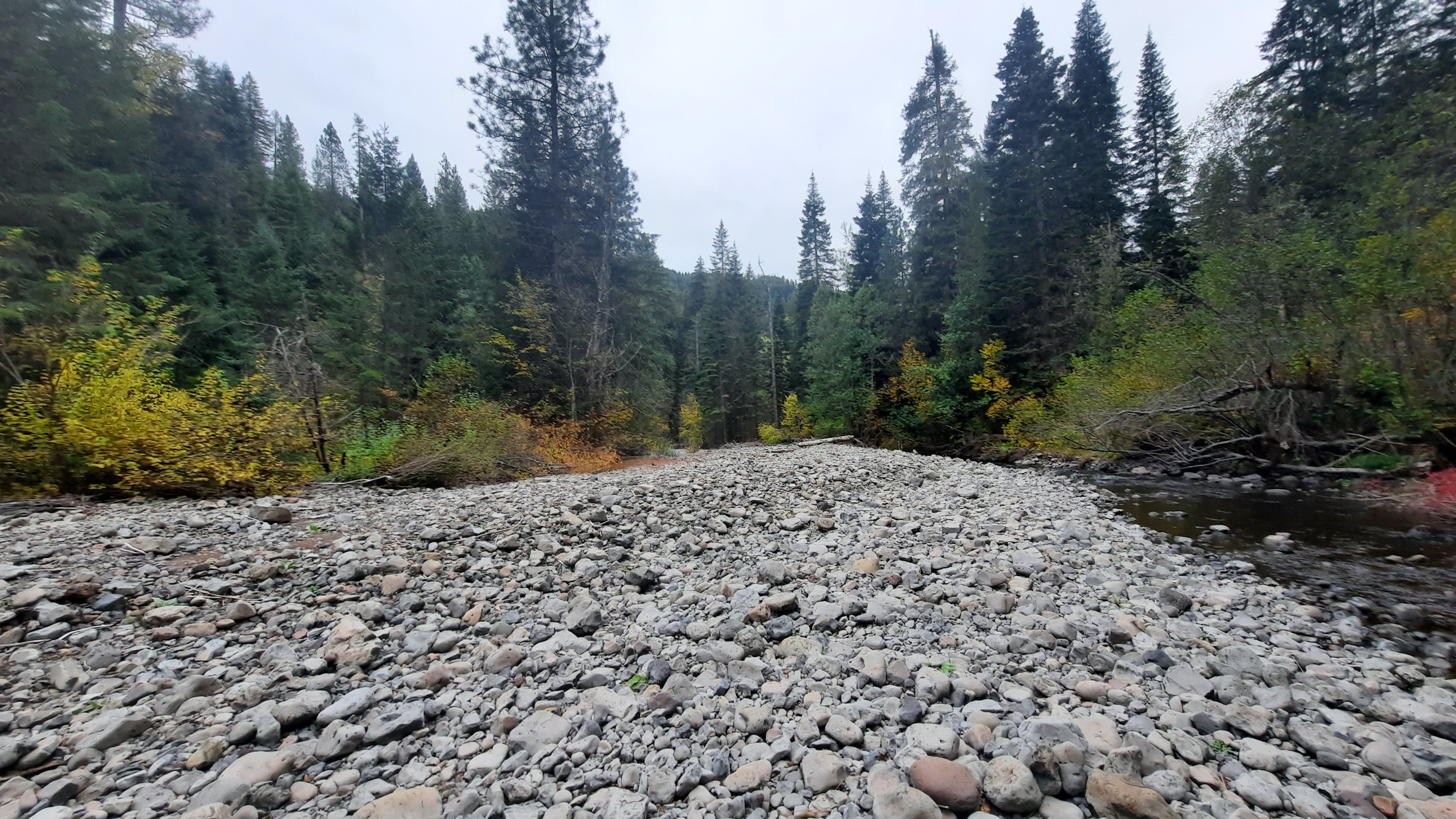
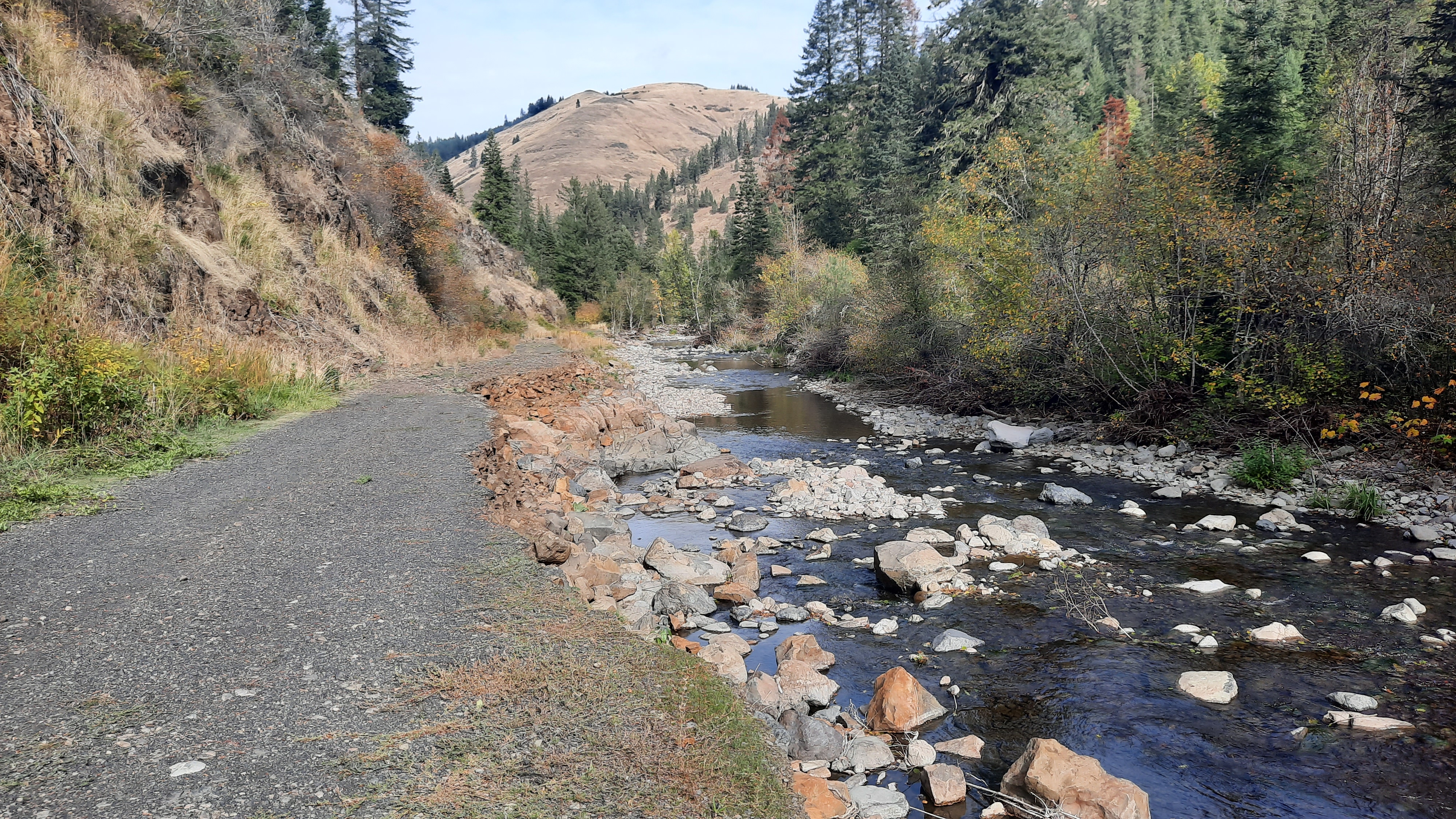
I decided to choose the river gauntlet as opposed to the trail gauntlet. The river had been scoured clean like many of the others in the area, but this smaller creek also contained a lot of log jams, so I had to carefully climb up and over them. Packrafting has given me a lot of great experience with climbing over log jams…and it is easier to do without a boat…but it was still not easy. 


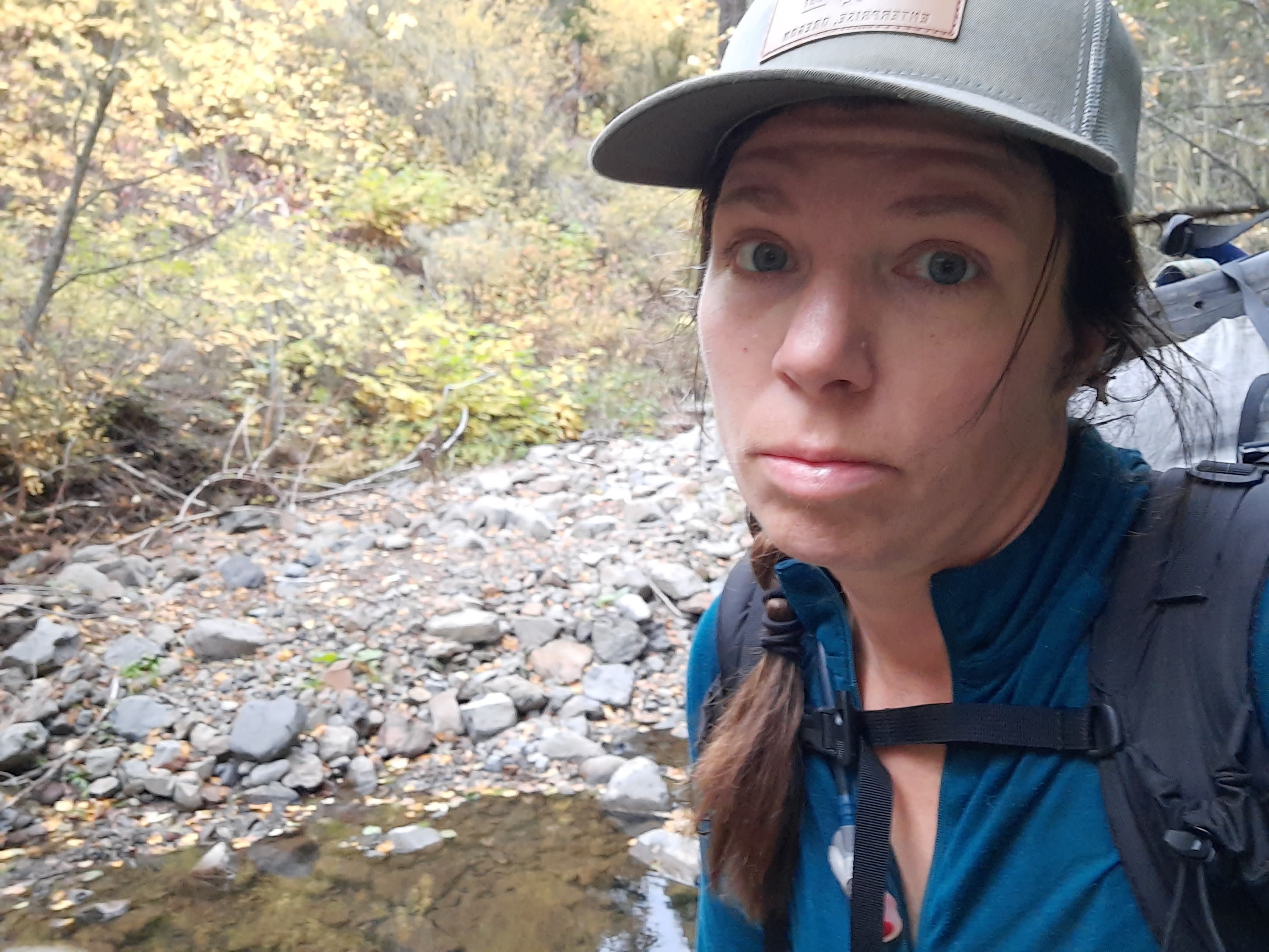
This bushwhack stood between me and the way out. The only thing to do was put my head down and hope I didn’t get poked in the eye. Literally. 


By the time I got to the first side trail I had gone a mile and a half in an hour and a half. By this rate I’d get to La Grande in another week. No good. I saw a way out and I took it. Into the unknown again. 

free of the bushwhacking!


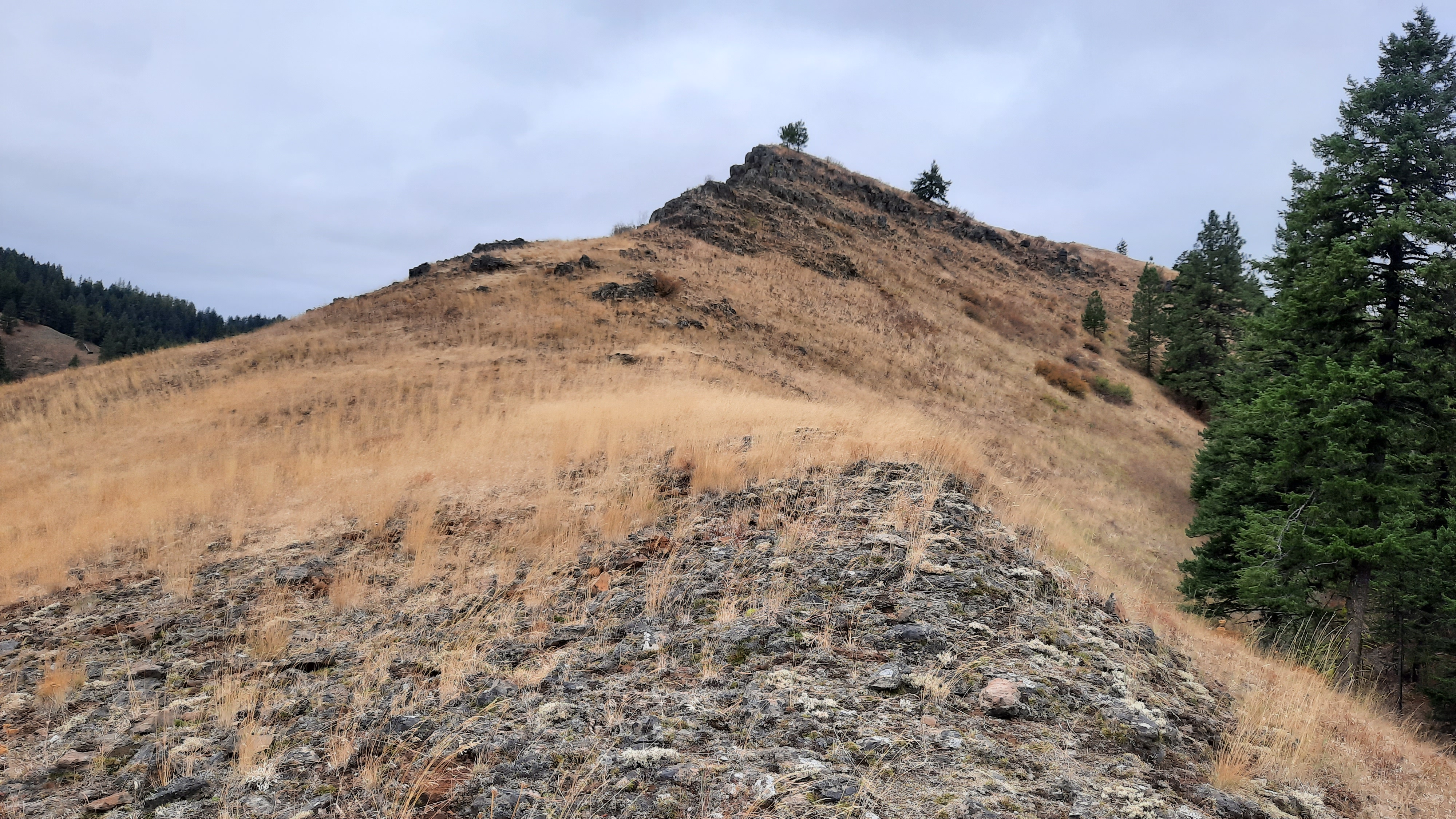
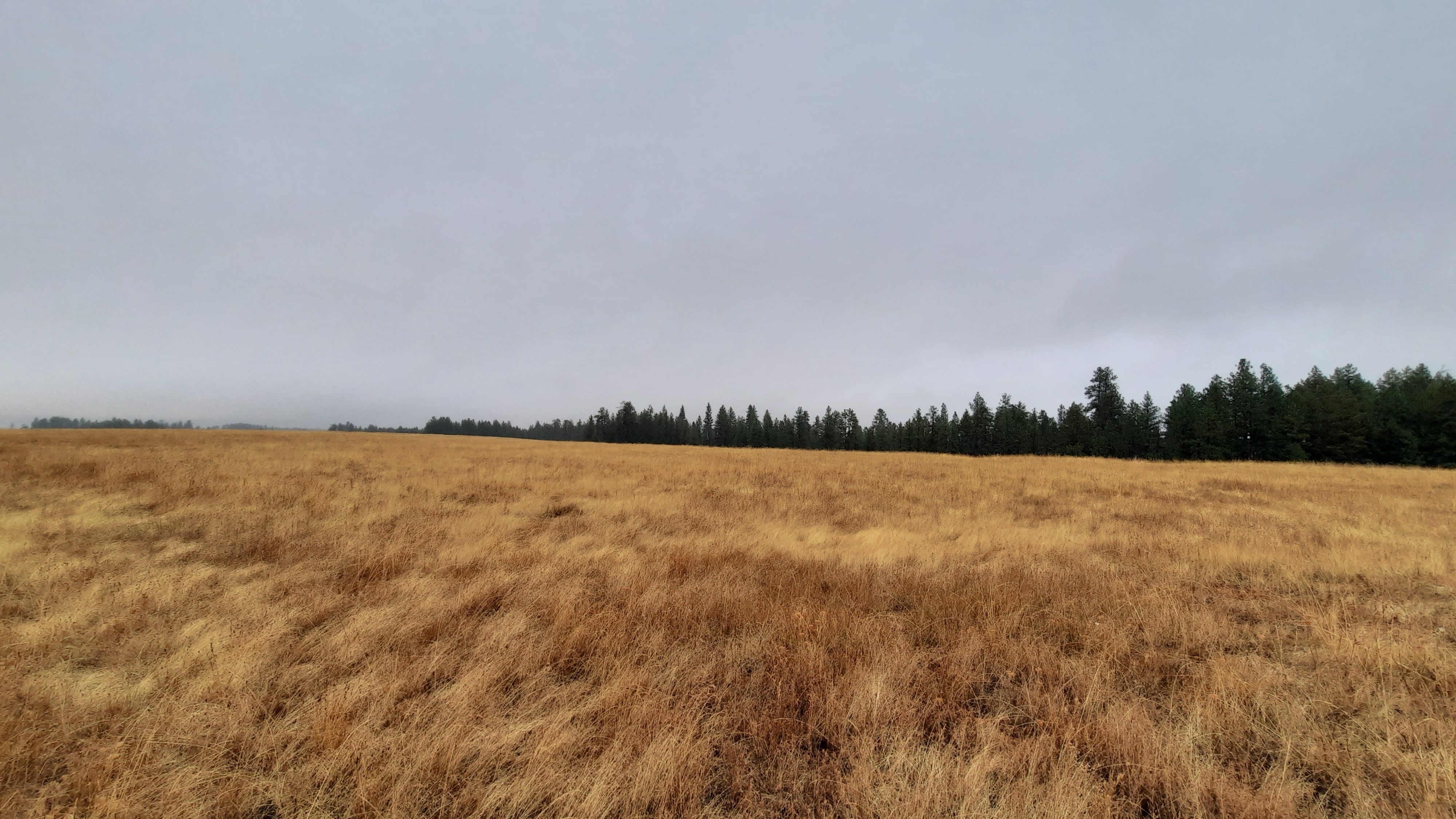
I climbed steeply up the trail that went up the spine of another ridge. Once I reached the two-track road on top, my efforts of hiking the first three miles of the day had taken three hours. So tired. I’m tired. And the road was not flat.

hard but stunning


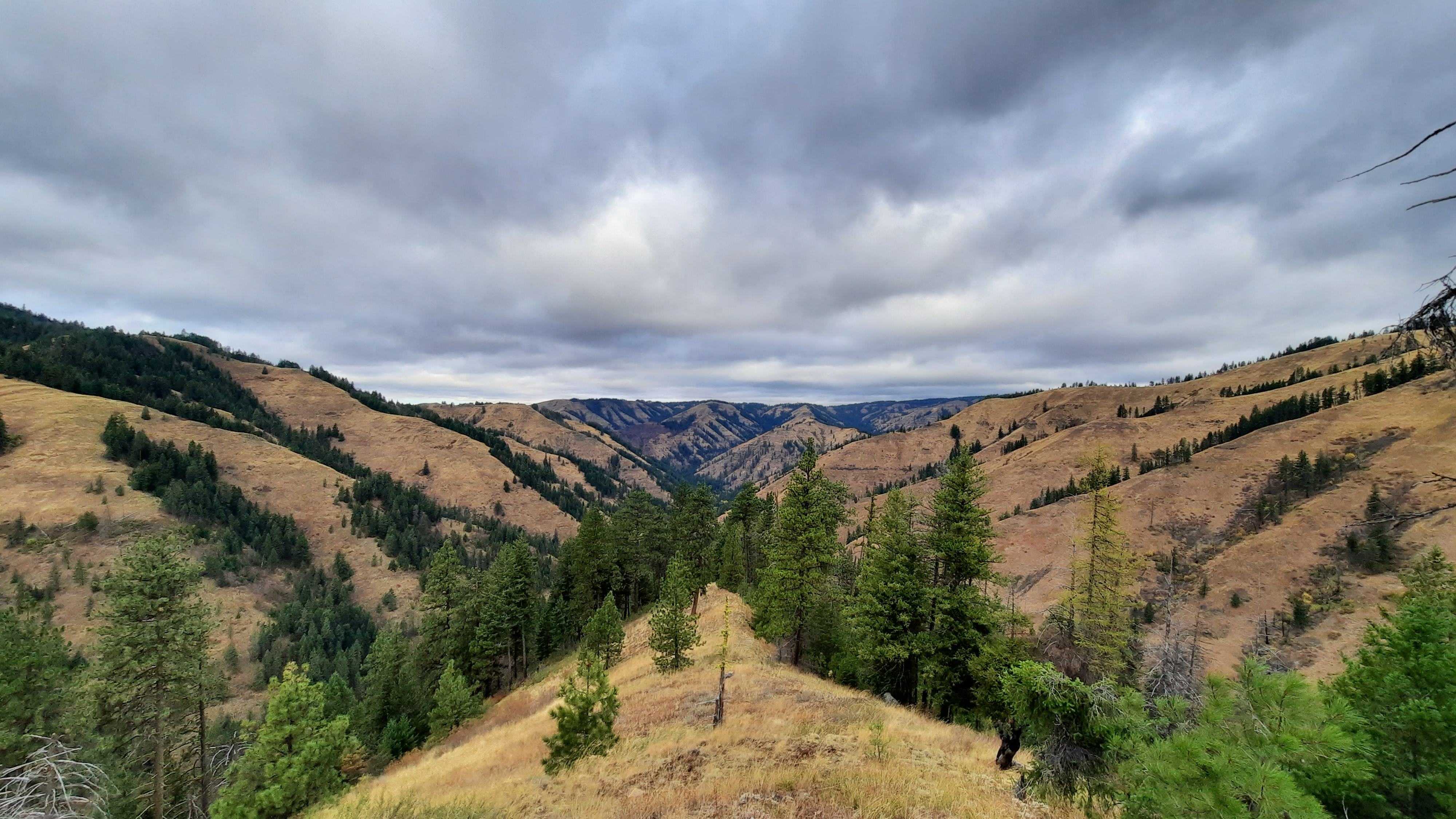
I put on some David Bowie and powered up. My reserves were low and sputtering on empty. That road was a cruel joke. That road took what little effort I had left and ground it under its steep rocky boot. The only thing moving my legs at this point was the magnetic pull of La Grande. The Big. I’ll be there as soon as I can. I put on the Beastie Boys, and substituted “Brooklyn” for “La Grande”. No sleep till La Grande!!


So that was when the thought entered my head that I would just keep moving, whatever the speed and just get where I get (maybe town?) I didn’t look at the mileage between me and La Grande, I knew it was a lot. 

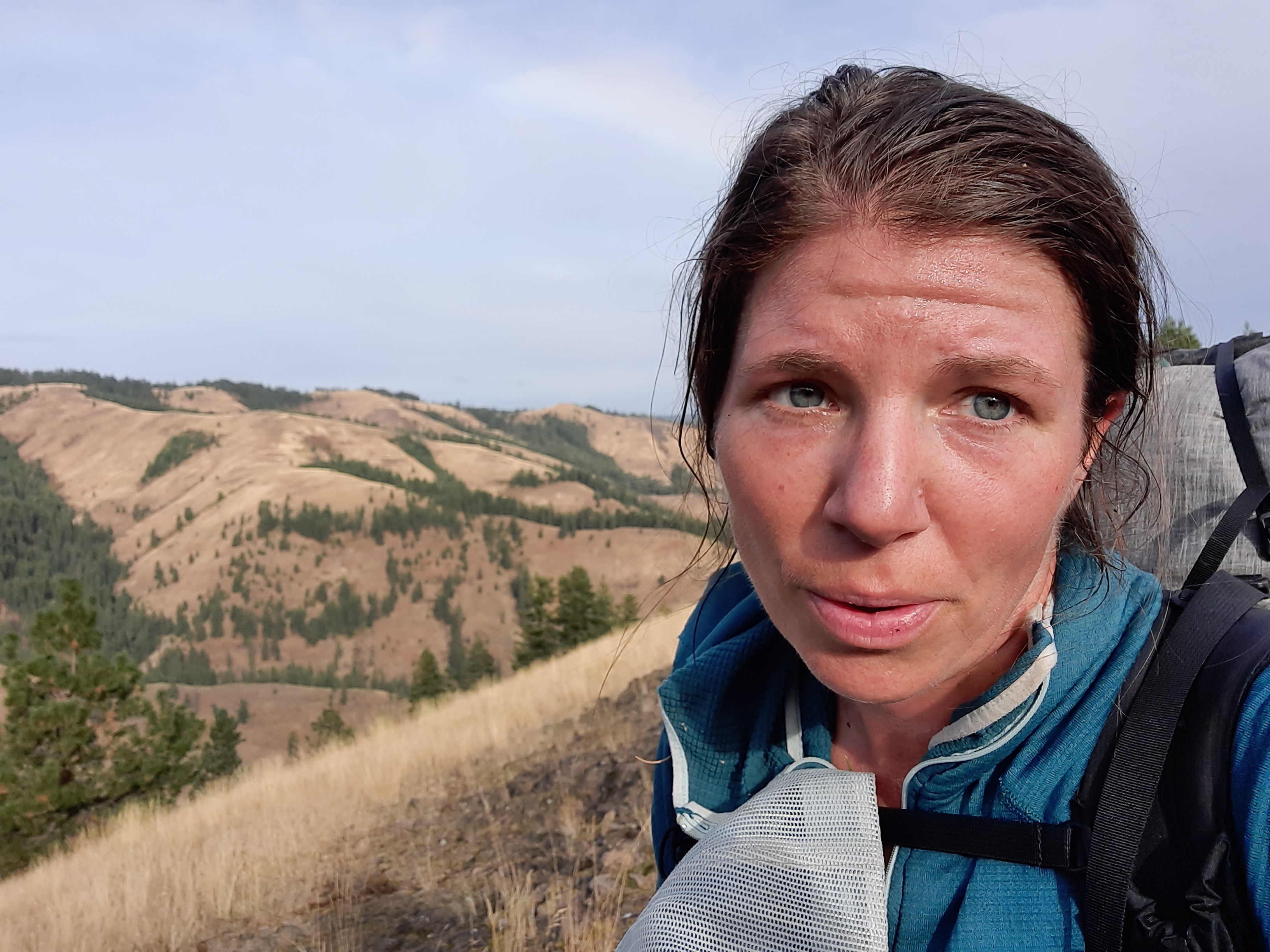
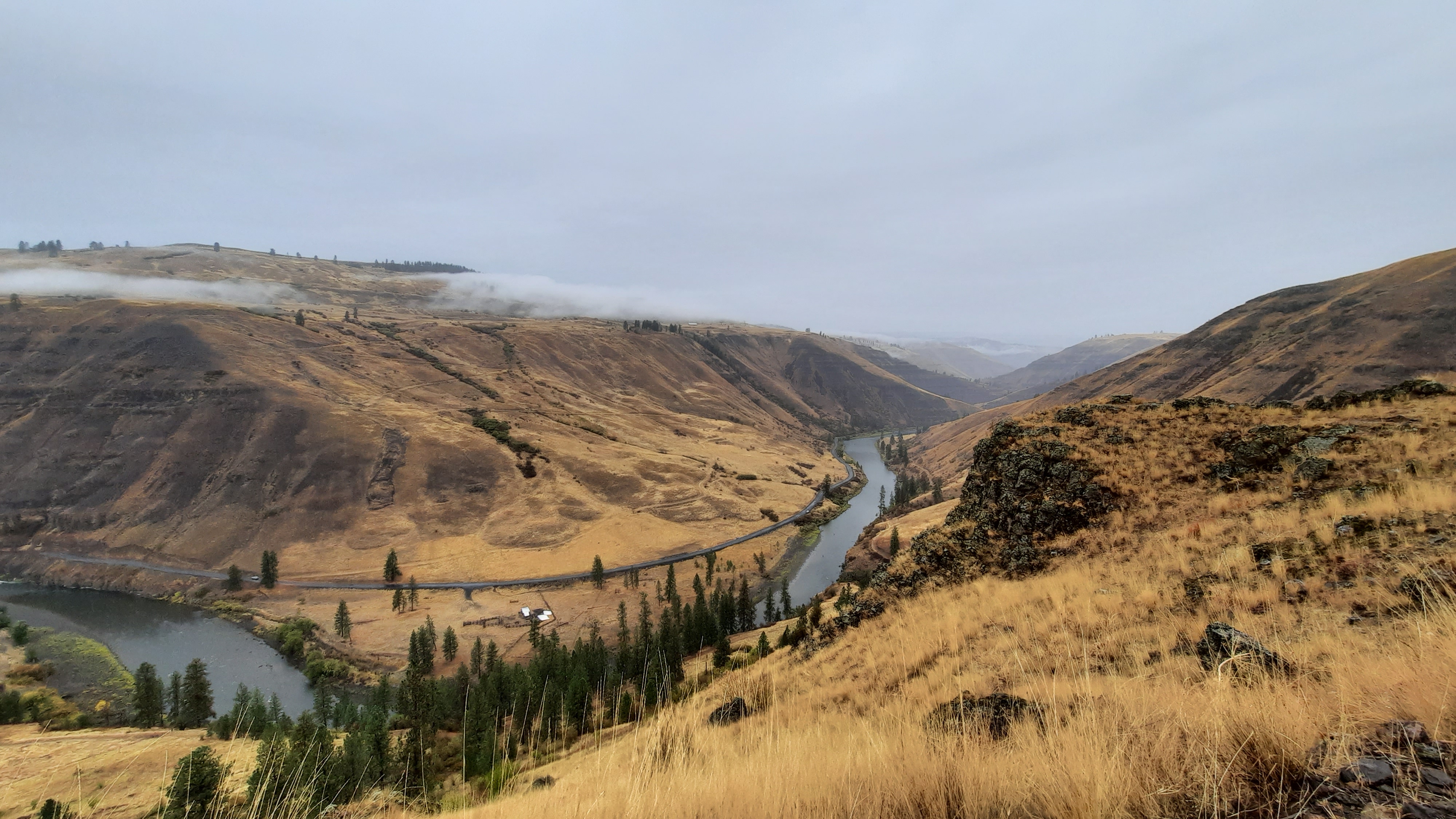
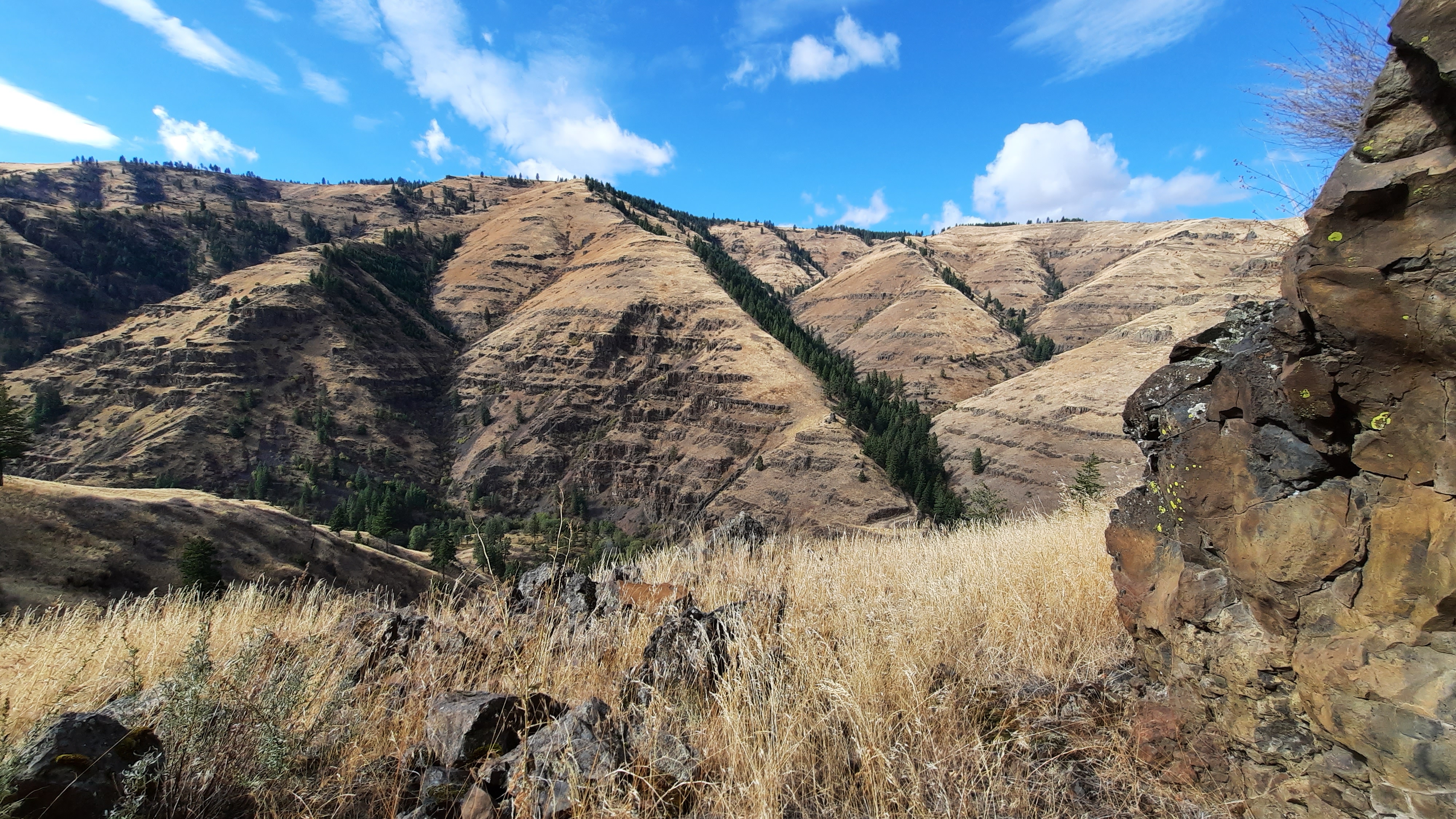
So I walked and walked. I transcended the effort and distracted myself with podcasts…and fortunately Mount Emily was a beautiful amazing distraction. The views up top were INCREDIBLE. No words to do it justice.


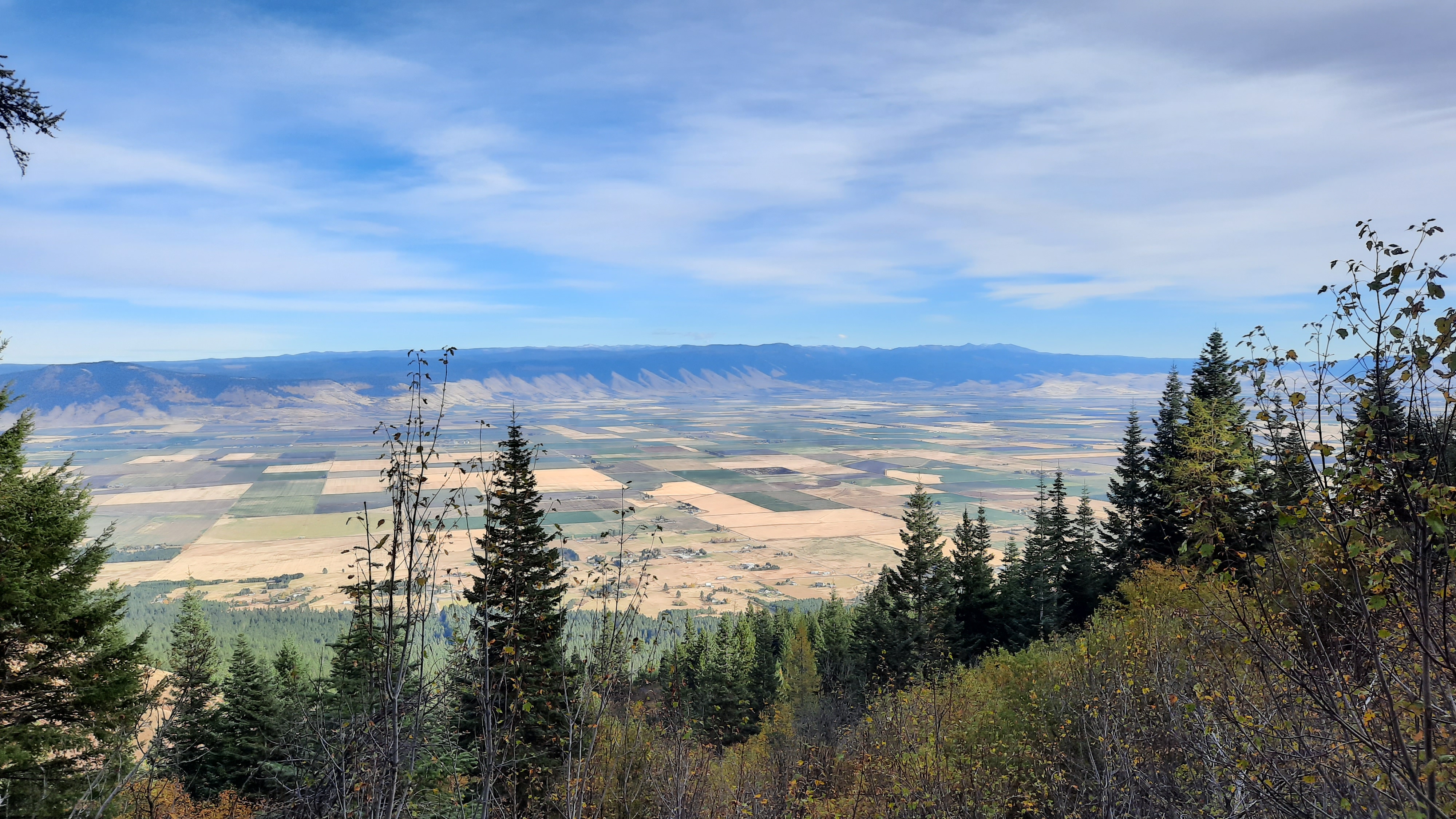
On the south side of the mountain I entered MERA, a system of trails for hikers, bikers, horses, and ATVs. What an awesome recreation infrastructure so close town! I was already getting a serious crush on La Grande.


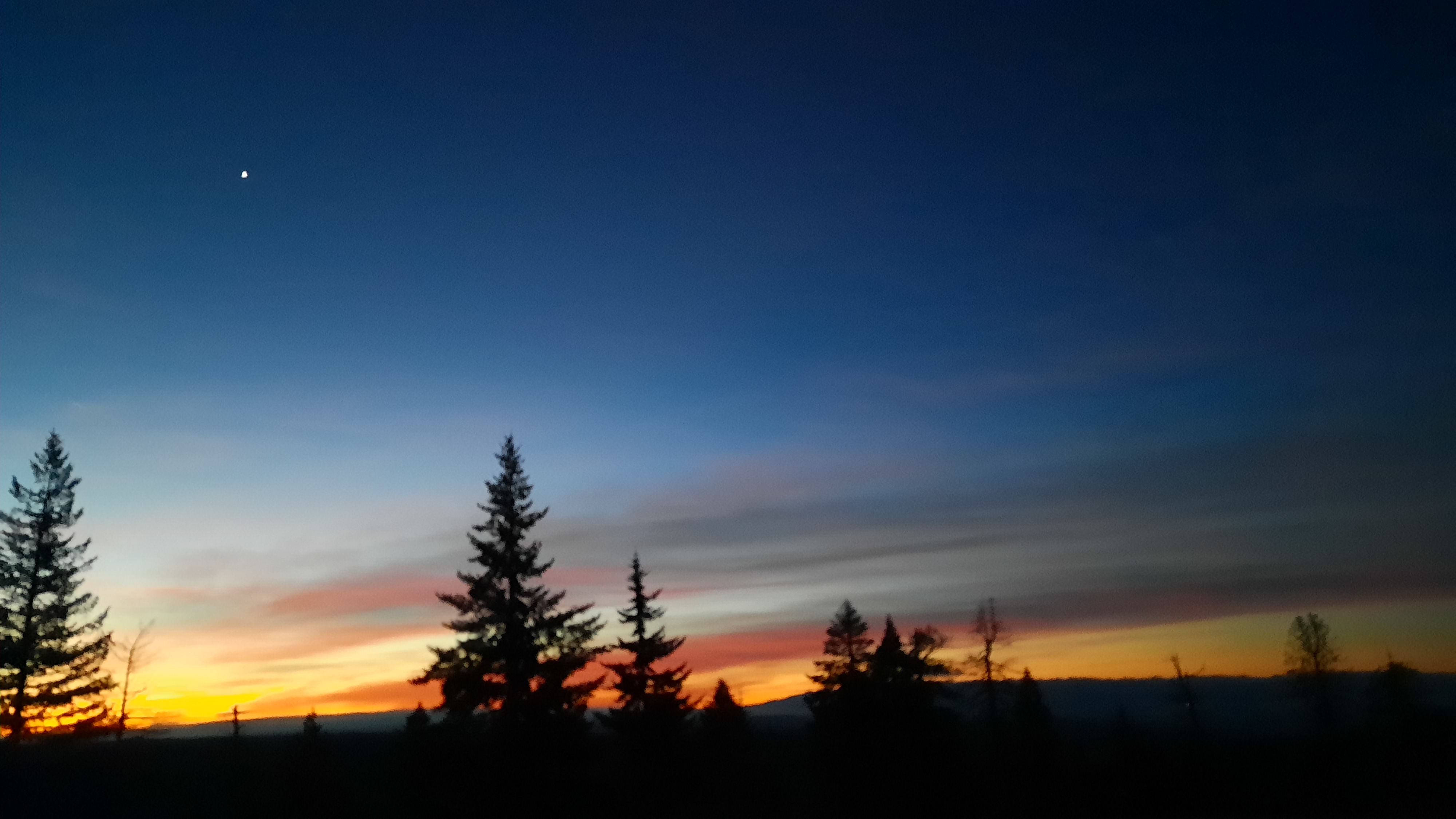
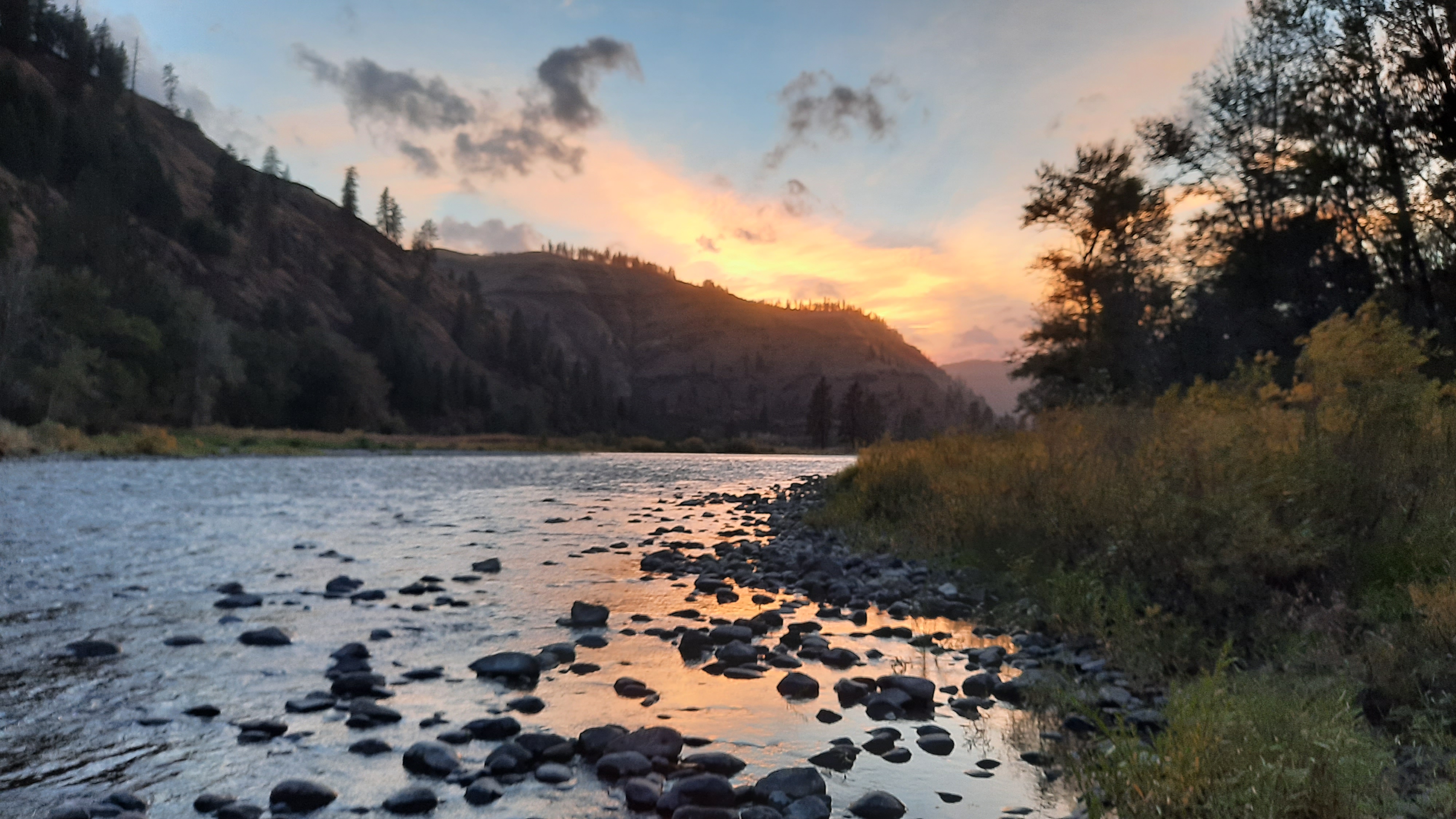
And wow, what an entrance! Damn La Grande! I like! It was one of the most scenic and beautiful entrances to a town I’ve seen. I walked down out of the mountains near dusk with pinks and purples streaking the sky. 


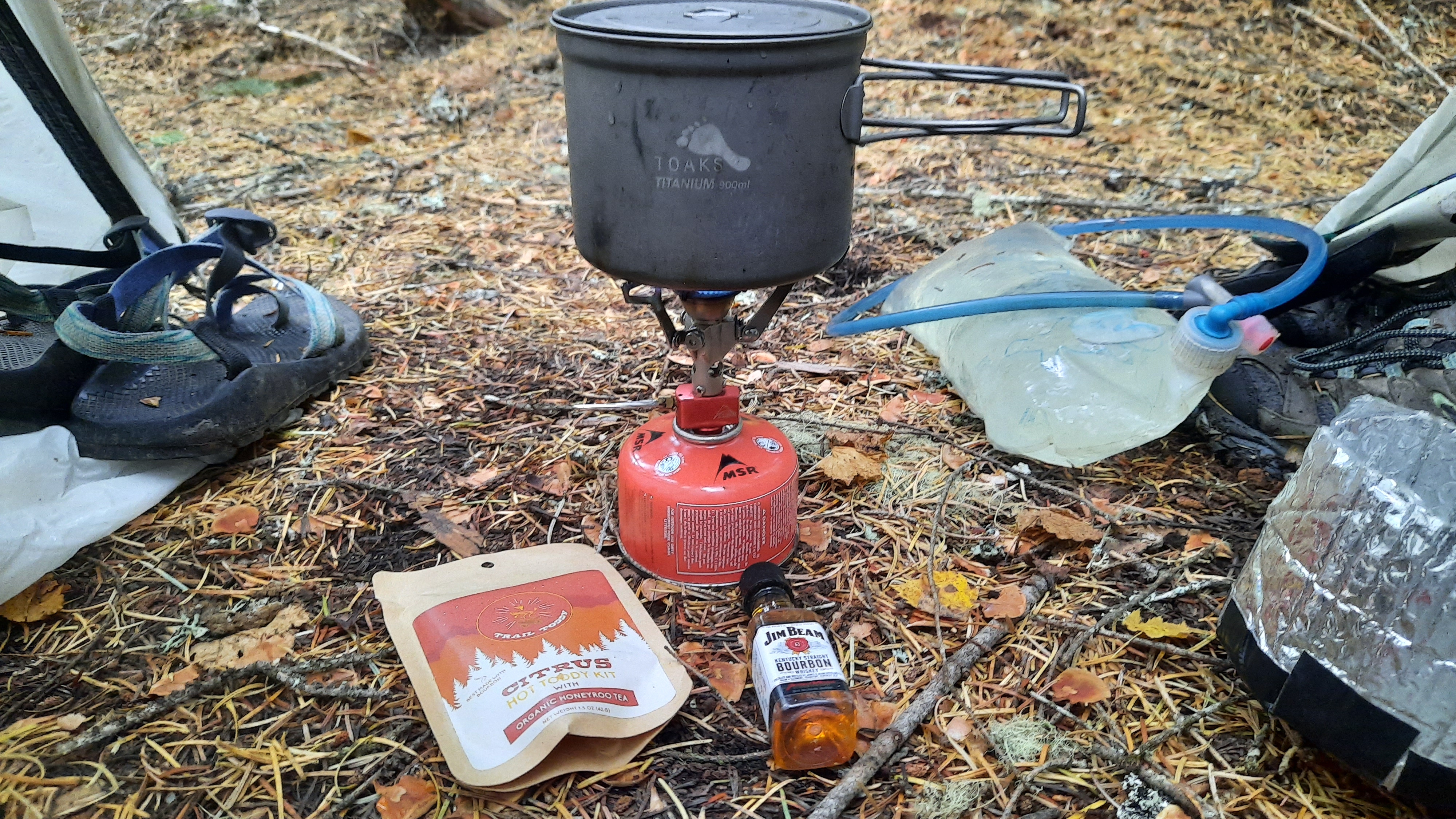
I walked right to the first hotel I could find that had laundry available (very important) and checked in for three nights. The time for great rest had now begun.

View all photos here

Blue Mountains Trail (Section 2) – Day 16 – 15.9 miles (285.8 total)

Yesterday afternoon’s bushwhack climb wore me out, and I actually slept till 6am this morning, a new record for the trip.


My goal this morning was to reconnect to the route after about 7ish miles, then hike an alternate I came up with after seeing some private land issues. It would be almost the reverse of yesterday: walk out on a ridge top and follow it down to the river below by primarily cross country bushwhacking….I just hope the route I picked isn’t too steep. Seeing the actual terrain instead of just topo lines on the map makes it much more real. 


While I was walking on roads this morning, I put on another podcast. This time with the ladies from Her Oddesey.


If you think I’m hard core, get a load of these two ladies: Neon and Fidget have been walking across the Americas over the last five years; they have about two more to go. That means from the tip of South America (Patagonia) to the tip of North America (Arctic Ocean). Wow. It’s really a whole other level. And these ladies are awesome. I got to hang out with Neon last summer when we both went to the Outdoor Retailer show in Denver, and even though I haven’t met Fidget in person, we’ve exchanged lots of messages (we definitely crack each other up) and she comes so highly recommended (NEMO-approved), that I’m just biding my time till we can all hike together sometime (dream team!). And we just happen so share three of the same sponsors: TOAKS Titanium, Gerber Knives, and Gather Nuts. Thanks for sponsoring some bad ass ladies!


It rained off and on while I was hiking, but the low clouds and rain couldn’t take away from the misty beauty of the day. I am surrounded by the colors of fall now. The oranges, reds, yellows, and maroons fill in the gaps between the deep green firs and golden waving grasses. I haven’t noticed a bunch of cheat grass; this Umatilla area seems to have a lot of native bunchgrasses (to my untrained eye). 


The mountains fold into themselves through the horizon, and for being so close to the city of La Grande, the backcountry was quiet.


I got to the alternate I had devised and noticed with amusement that there was a trail partway out on the ridge. It’s rare that you ever really walk somewhere that no one has walked before…it’s just not possible. The going was pretty easy, but the wind was howling which had me paying extra attention as I edged out farther and farther into the unknown. What I had seen on the topo was a narrow ridge that ran about three miles before it plunged down to the North Fork Mecham River below. 


As I got onto the ridge I had to trust that it was the right way to go and not get sucked down something else that looked doable (like in Joseph Canyon). I got to the end of the “trail” and saw why it was the end: a cliff! It was maybe 20-30 feet high (it did not show up on the topo). I thought I could backtrack and drop down from under it, so I did. Don’t do what I did. More very steep side-hilling. (Actually I know there are hikers out there who love the steep exposed stuff…you folks would be just fine out here). When I got around under the cliff it looked like I might have been able to down-climb it, if that’s your sort of thing. 


The ridge kept going! As I got closer to the Mecham River I could see the line I had proposed to get down to the river was too steep for my comfort, so stayed on the left fingers of the ridge as it split and started fractaling down in size. I spied a game trail going my way, so hopped on that (game trails can be steep though!) and followed it every knee-shaking step to the steep (oh so steep) bottom. I popped out at the mouth of Trop Creek and had to bash my way through the riparian tangle of vegetation to get to the river canyon. My LEAST favorite kind of bushwhacking is through a dense riparian area. My second least favorite is thick manzanita. 


I soon found the easiest walking was in the creek. I popped out on the Mecham River to see a huge flow of rocks and gravel….this had flooded too, but it left me large beds of rock to walk on. It was blissfully branch free. I could move!


I thought it would be an early day today, but that down climb took much longer than I had anticipated. It was arduous, and I don’t think should be part of the official route. Too brutal.


I walked on rocks and in the water until I got to Bear Creek, then took a left turn and found a spot to camp in the trees near the mouth.


Exhausted. So exhausted. Over two weeks of hiking, almost 300 miles walked, and no day off yet. I’ve never gone this long at the start of a trail without a day off, and I’m starting to feel it. I had low energy all day and I can practically hear the soft warm hotel beds of La Grande calling my name. Only a few more days…or less? I’m not sure what the day ahead holds…more bushwhacking I think, and my bushwhacking well has just about run dry. We’ll see if I can pull it off.

Soothing the ache with strawberry cheesecake that my friend Treehugger gave me.

And with this hot toddy kit

View all photos here

Blue Mountains Trail (Section 2) – Day 15 – 19.8 miles (269.9 total)


I woke up in a cloud. The wind had been howling, and I hoped a tree wouldn’t come crashing down during the night, or if it did it would be fast and squish me good before I knew what happened. 


I ate one of the cinnamon rolls I had packed out from the store as I sat in my quilt writing yesterday’s blog post, then looked at my maps for the day’s hike. The trail down into North Fork of the Umatilla River was in unknown shape. What was known were reports of the trail being hard to find on the long descent into the canyon, and that there was flood damage in the canyon. The road below which goes to Umatilla Forks Campground was closed due to road damage. OK, well, lets see whats what!


I followed signs for the trailhead, but then my route took me on a closed road before I popped out suddenly on the trail, but no markers or anything. I started walking into the amazing landscape of ridges covered in grasses and peppered with trees. It was beautiful. I immediately saw a hunter, so that was a good sign, someone was using the trail. I could see switchbacks for quite a while and thought this could be a much better hike into the canyon than I was prepared for. 


I was cruising down the trail when I saw three bright figures side-hilling down a slope above the trail. When I reached them, the three woman said, “oh, there is trail!” They apparently had trouble finding it even from the trailhead. The women were from Pendleton out for a day hike, and marveled at what I was doing; they seemed a little jealous.


The trail tread was there the whole way down, and sure, it did get brushy, and it wasn’t exactly where drawn on the map, but I had no problem following it and making good time. The rain even let up, and it would be clear for the rest of the day. Joy!

Once I reached the river I sat down for a break: another cinnamon roll and hot coffee in my hydroflask. It’s humid and warm today. When I lay down on my tyvek at morning break I could see all sorts of buzzing things in the air above and there were at least four types of evergreens in the space towering over my spot. Such a diversity in life down here. I am in wilderness again, and I don’t think this drainage has been logged.


I could immediately see the flood path. Trees were uprooted and jumbled everywhere. It was a big one! But the trail was there, although covered with down trees, but some nice human or humans had been through and had cut the most important branches off (the ones that would prevent you from climbing over), and I could see the path. I just had to think like the trail…where would I go? Climbing up and over dead fall is exhausting, but at least I was going the same direction as gravity.


In a mile or two the clearing was much more pronounced, and most of the trees had been cut from the tread. Thank you! The trail was gone in a few places, ripped away by the raging waters, but always there was a path around.


I got to the bottom and found a patch of sun near the bridge (still standing) over the water to have a nice long lunch.


Then I started down the road for a three-mile road walk, and saw what the flooding had done to the road. Big chunks of pavement were missing and debris covered the road where normally small side channels had ripped free and covered it with mud and vegetation. Then, the road was gone. Just gone. In several places the flood waters had rounded a corner and taken the road out entirely at that corner. I had to find a way to climb down to the now very wide river channel to walk on the river rocks and climb up the other side. This flood was MASSIVE!! I wonder if they will even fix the road; I’m even not sure how they would. At some point I smelled the sulfur of hot springs, but couldn’t see where it was coming from.


When I got to my next turn, I had another short break and decided on my next moves. There was supposed to be a trail that continued on the South Fork of the Umatilla (a much smaller creek). The trail was in unknown condition, then in two miles I would get to another trail that climbed to the ridge above, but that trail was most likely decommissioned, which means not there anymore. There was also a trail that climbed right from where I was, and could be linked to the other route via a series of two-track roads up top. I couldn’t find the trail on the side of the river where it was supposed it be, but I found a signed trail on the other side…so I walked that a total of 100 feet before I lost it in the overgrowth. I couldn’t find the trail that was supposed to switchback 2,000 feet up to the Shimmiehorn (what does that mean?) either. 


So I weighed my options. Bushwhack two miles in a river canyon and then bushwhack up a climb? Or bushwhack up a climb? I chose the latter, thinking it would equal less bushwhacking overall. So I just went for it. Steep. One step at a time. Struggle. Trees down. Struggle. Steep. After about half an hour of very little progress I had inched my way up and sweat was pouring down; I finally intersected what I thought was trail. This trail went straight up the ridge, so I kept going. It was there, then not there, but I kept climbing, and the views got better and better. 


Finally I popped out on a road. Relief! 


It’s important to recognize that we as hikers are vectors for invasive weeds to spread. I had all sorts of seed pods and stickers in my hair and on my clothes, but plucked them off and put them in my pocket to throw them in my trash bag instead of on the ground to grow another weed where it doesn’t belong.

I walked a few more miles on the road up on the Shimmiehorn and found a spot with a view that was tucked under a big tree. Whew. What a day.


Oh, I saw my first bear today! Or its rear end as it ran away.

View all photos here

Blue Mountains Trail (Section 2) – Day 14 – 19 miles (250.1 total)


For those of you out there who are considering a long hike for the first time, I’d highly suggest that you give yourself three weeks. It’s really in week three where you start to feel strong. The first two weeks? Well, they will probably hurt. Bring ibprophen, whisky, candy, whatever you can do to ease the pain and seen it through to the other side.


I woke this morning and watched the first really dramatic sunrise of the trip as I packed up. 17 miles to town! Town in this case was Tollgate, a restaurant/store in a little mountain community that is big into snowmobiling. The hotel was closed for the season (sob), so it would be a strictly food stop. I had mailed them my resupply box, and they seemed really accommodating which is always a relief. 


If you are like me, then at some point on a long hike you give your stomach control of your decision making. You want your body to be happy, right?!? Even though I am trying to eat more intentionally with my health in mind, I do eat pretty much anything in trail towns. Don’t get me wrong, my trail diet has improved drastically over even a few years ago….sooo I started thinking about what I would eat at the Alpine Outpost in Tollgate. This is a favorite past time of hikers, to imagine what we will eat, or remember what we have eaten. Its great fun….especially if you know a restaurant meal is in your near future.


I heard an elk bugle this morning! But then I realized it was probably some hunters practicing when I heard car doors closing after that.


Roaring Fork Trail from Mottet campground was recently reopened after some tread damage was fixed, but the trail at the bottom of the canyon along the South Fork Walla Walla River was still closed. I want to be on the up and up on this hike, and that means respecting trail closures. 

The walking was high along the South Fork of the Walla Walla River. Next time I come back I will hike the river. The road walks are nice, but after two days of it, I’m ready for trail. That’s what I have in store tomorrow! Or more accurately trail that isn’t always there. The drop into the North Fork of the Umatilla is supposed to be frustrating and overgrown. I’m ready!

I got to the store/restaurant about 2:30, and ordered my first meal, a big burger with fries and a beer from A Side Brewery, a brewery just down the way in La Grande. It was GOOD. Then I bought some baked goodies (this is very important: BAKERY.) I perched up on a table outside with easy access to some plugs to charge my electronics…very important to do on town stops. It was a Friday, and guess what they do for dinners on Friday? Prime Rib. So I sat there till 5pm and ordered the prime rib. You have to understand, town stops are an important part of a thru-hiking food strategy. You simply have to eat as much as you can in town to offset the impossibility of carrying enough calories in your pack to hike 20 mile days in the mountains. It’s an acceptable binge…


I waddled away from the restaurant before dark with a goal of finding public land to put up my tent…and about a mile and a half later I was at the edge of a clear-cut, dodging raindrops as I squeezed my tent between two giant trees.

View all photos here

Blue Mountains Trail (Section 2) – Day 13 – 21.3 miles (231.1 total)


It rained a lot from when I put my tent up last night to the morning, but the morning was clear and bright;  I was looking forward to a dry day.


Lots a forest roads today.


Actually, I don’t mind that the Wenaha River trail is in such terrible shape. I am now walking the ridge above the river and had a morning break at an amazing viewpoint, Big Hole. I’ve had probably 8 trucks pass me so far this morning, which is a lot of traffic, so when I look out on the Wenaha-Tucannon Wilderness in front of me and know there are no roads in there, and the trails are fire damaged and difficult thus limiting the number of humans that ever really go that deep into it, I’m glad. It’s a little refuge. From us. From me. And its ok…I’m still experiencing it up here…just in a different way.


This is going to be a short one folks…the terrain was scenic, the miles easy and not easy. I am set up on a highpoint with a view of something…I believe it’s where I’m going next. I’m looking into the future!

View all photos here

Blue Mountains Trail (Section 2) – Day 12 – 16.1 miles (209.8 total)

As we all know, the days are getting shorter, and I’ve found myself in the strange pattern of going to bed about 7pm (dark!) and getting up between 3-4am (still dark!). Some of that has to due with always having to pee about that time, but then when I do the math, that’s an 8-9 hour night of sleep…..so that makes me feel about one percent better. Actually, getting up at 4am, making coffee, and writing for an hour or so is rather nice. As I type this I’m curled up in my quilt. It rained last night, so everything is damp, but not frosty. I’ve been out almost two weeks, it’s the middle of October, and I haven’t had a frost yet. Now that is interesting!


Town days are no different. I was up, writing, then walking back to the lounge at first light. I made sure all of my electronics were charged, but my old reliable Anker only had one lone light blinking…arrrrrrgggg. I have two battery pack chargers on this trip, and having one down will be a bummer…but my next few resupplies are closer together and have power options, so I’ll probably be ok. I went until Troy all on the power I started with, which is pretty good for using my phone a lot. My headlamp and InReach also use the juice. 


I met the manager of the RV Park, Doug, this morning. He had just changed the opening days from Thurs-Sun to Wed-Sun so it looked like I would be getting my first restaurant meal of the trip! Doug was friendly and gracious, and he had heard I was coming. I love how news travels on trails; at some point I crossed paths with hunter friends of his and I had mentioned my rough path through the Blue Mountains because he was half expecting me. He made me a big greasy breakfast that I knew I would regret a mile down the trail, but I didn’t care. 


I was walking by 9am and headed into the Wenaha River canyon. Now there was a fire in the Wenaha five years ago and the whole 20-something mile trail was most definitely not cleared the whole way. The Intrepid Three shared their struggles in here, then I went online to find numerous trip reports about the difficulty of the hiking after about five miles. So going in I was planning to head out of the canyon after about eight miles. I don’t need to struggle when someone else already has…besides, until more trail work gets done, the BMT will need a workaround in this section. The good news about going up out of the canyon is the views…at least I hear the views will be great.


I did struggle some, and had two fords as well. I really do not see folks having to ford the Wenaha in the Spring or early Summer, it will be too high. As it was my legs and feet were numb by the time I got to the other side. Brrrrr.


It rained on and off today, but that didn’t take away from the incredible beauty of the Wenaha River. The canyon walls were hung with basalt hoodoo and castle formations. The river had deep cobble beaches and shrugs of log jams at the corners…both signs of a free flowing river…and it flows big when it wants to!! This area had a lot of flooding earlier this year, and some of the trails and roads ahead are still damaged and closed. The Umatilla River (I’ll walk in that drainage in a few days) had record breaking floods; a lot was lost in the raging waters this February. 


I climbed up about 300 switchbacks when I got to the Hoodoo Trail and caught my first rainbow of the trip when I neared the top.


The road walking was wet, mostly because it was raining. I didn’t really stop much more than a few minutes at a time today since the canyon was slow-going and the cold rain was not conducive to a long sit-down break, so I pulled into camp early and got warm.


My friend Melissa (Treehugger PCT 2006) gave me some of her dehydrated food to try, and I wanted to feel fancy so made her bean and cheese dip…and yeah girl!!!! So good!!! 

View all photos here

Blue Mountains Trail (Section 2) – Day 11 – 11.5 miles (193.7 miles total)

It was another early morning for me…hours before sunrise early…that probably has a lot to do with going to bed when it’s dark. A la 7:30pm.


I had road miles to Troy today, and even though the rain held off all night, as soon as I started to pack up it started again. Go figure. 


It was alright though, I donned my layers of gortex and trash bag and was ready for the day.


Again with the golden grasses in the rain. The walk was absolutely stunning. I saw big flocks of turkeys crossing the road, and deer speeding through fields so picturesque it could have been a Christmas puzzle I was working on with my mom. Pastorally perfect. 


The barns, the fields, the rolling hills, and there…in the horizon…the confluence of the Grande Ronde River and the Wenaha River. My destination. 


I’ve been to Troy before, but to be honest I don’t remember much about it. Kirk and I have both packrafted and rafted the Grande Ronde River from the Minam Store to Troy, but I didn’t experience this place by walking down to the river after backpacking through 200 miles of rugged wilderness. It was different this time, and much more powerful.


The Redmond grade I was walking down had massive switchbacks, and no joke, I think I walked in view of the canyons for almost 10 miles. I listened to the Backpacker Radio episode with Twerk (trailname), the photographer behind the gorgeous Hikertrash Vogue photos. I took Twerk out for lunch when he was in Bend on his 2018 PCT thru-hike…it was a completely random Instagram invitation, I had been following him and his photos that year, and he had posted some down and out stuff about the fires in Oregon that year, so I thought a little trail magic at Wild Rose Thai restaurant might help. 


Please take a few minutes to check out Twerk’s work. I think he’s going to have more copies of his book out soon. I missed out on getting one the first time around. I won’t make that mistake again!


Ok, back to the walking…or not. On long long road walks like this sometimes it’s a deliberate strategy to go deep into your thoughts so you don’t feel the pain of the road. Today I didn’t stop for a break even though I walked almost 12 miles. It was raining, and it was a town day. On town days all bets are off. You can do a 20-miler by noon if you are hungry enough. Today I rolled into Troy at 10:30am.


So this place doesn’t have a store or gas station, but it does have a restaurant that is closed on Mondays and Tuesdays, and today is Tuesday. I knew that going in, so wasn’t crushed by the thought of not getting a real meal. But it also has an RV park with showers and laundry!!!!! (and wifi!) I didn’t need food if I could get clean. I had been offending myself with my smell all week, and could NOT WAIT to get clean. 


First quarters. I didn’t have quarters. I walked around the RV park till I saw someone outside, and wouldn’t you know it, this nice gentleman was from Bend and he happily exchanged my $5 for a bag of quarters. I couldn’t figure out how to use the shower and the folks that run the place were gone (I believe showers are $10 and you get a key), and again my new Bend friend helped me out, and just asked that I pay the kindness forward. I payed it forward into the RV park’s donation box and will do another kindness for a stranger TBD. Wouldn’t that be a wonderful world? For every kind thing someone does for you, you do two in exchange…imagine the ripple effect!! Kindness for everyone!


So there I was, showered and wearing clean clothes. And…for the first time since starting the hike, not wearing any bandaids on my feet. I know! I’ve gone through boxes of bandaids on this trip. In fact friends, I haven’t been completely upfront with you. Remember on day one when I said everything went according to plan with preparations for the hike? That wasn’t exactly true. The day before Kirk and I left Bend I had an unfortunate incident with a nail and the bottom of my foot. I’ll spare you the details, but in an instant that Thursday morning I knew everything had changed. I would have to deal with an open wound on the bottom of my foot while trying to hike 17 miles a day for a month. Now, over two weeks after that day my wound had healed and (knock on wood) hasn’t posed any additional problems, but let me tell you, I had to WORK to keep that thing clean, dressed, and cared for at every break for the first week plus. I almost didn’t tell you, but I do think it’s important that people know you can heal out here. I’ve seen all manners of injuries (and had all manner of injuries from a brown recluse spider bite, to anaphylactic shock after a wasp sting, to second degree burns on my hands after a stove accident), but the real issue is acceptable pain and injury,  and unacceptable pain. I am a wilderness first responder, and have been for years, and really the best thing to do in many of these situations is to see if you can manage it in the field. In all of those above situations I (and those hikers around me) managed them in the field, well, cause we had to. But folks, it all comes down to making good decisions, and just because I hike with an open wound on the bottom of my foot doesn’t mean you have to too. Just make the decisions that are right for you. I’m glad I made my decision to continue with this hike and bring the extra supplies to manage it in the backcountry. 


Ok, back to the day.


Christina came to visit again today with my resupply package and a homemade bloody Mary (she is the best!!! I’ve never had one with real tomatoes….it makes a BIG DIFFERENCE).


Also included was a piece of carrot cake from her birthday yesterday!?!?!


I walked down the street to some free camping on the river, and pitched my tent before taking in the sunset from the rocky shore of the river. This is living.


If I let myself, I feel how sore I am. Trying not to think about it. 

View all photos here

Blue Mountains Trail (Section 2) – Day 10 – 16.8 miles (182.2 miles total)


I had a lazy morning. The rain was supposed to let up about 11am, and having sun for my cross-country descent into Joseph Canyon would make my hike infinitely more enjoyable and safe. Joseph Canyon is a crux in the hike, and if I can find the right route down, should be able to quickly cross it and find myself on an old road that switchbacks up to the rim above. 


Don’t get be wrong, I would LOVE to spend some time in Joseph Canyon, but word of copious amounts of poison ivy is already making me itchy, and I haven’t even gotten there yet. 


Kirk and I packrafted a 40-mile stretch of the Minam River (a river on the NW side of the Wallowas) a number of years ago with Grant,  the owner of the Minam Store. When I heard about the epic bushwhacking, I called up Grant because he had mentioned multiple trips in Joseph Canyon. Turns out he’s hiked into the canyon several ways, and I put him in touch with Jared to figure out some other options for me to hike. 


This morning by the time I finally decided to hike, I was already on the edge of Joseph Canyon. I could look straight up the canyon to the Wallowa Mountains and their new snow caps. This is all Nez Perce land. I would be walking into the canyon where Chief Joseph was born.


I dallied on the way to the descent, taking photos and trying not to worry too much about getting into the canyon. My first move would be to walk a mile on a ridge via a “gap” in the rim rock…I didn’t see the gap, but when I saw the ridge I got really excited. I could do this. The next move would be to choose the right ridge to hike down to the water. Whatever way I took it looked like I would need to navigate around some rocky cliffs, but the line I could see had openings, so looked doable.


The wind was fierce and strong, but the sun was out, and I buttoned up the hatches and got started.


The ridge, or knifes edge, or cat walk….whatever you want to call it, was amazing. Probably the best part of the hike so far. The view into the canyons was stunning, and there were plenty of spots to safely stop and enjoy everything that surrounded me. I did have my mantra going on: one step at a time. Be intentional. 


I crossed over to the end of the ridge and started down what I thought was the right shoulder….it was open and got steep. I took small steps and made sure something was planted before taking the next step. At some point I realized I was going down a different ridge than I had scouted, but it seemed to go, so I did too.


Ugg, cue the “Hello! Wake up! Time to make another decision!” voice in my head, but no. I kept walking.


It got steep. Real steep, and I finally realized this path did not go. It ended in cliffs. I looked up and over to the ridge I wanted to be on, and decided I needed to climb up to get over. And of course, game trails saved the day. I found a path some loping deer probably took, and gingerly made one step at a time on the steep side hill before I got to the correct ridge and to relative safety.


I don’t think i was ever in danger, I’m just disappointed that I didn’t pay attention when I needed to. However I do not think everyone will be game for such a descent, and definitely not had it been raining and the grasses and mud slick. 100% no!


Down at the bottom I walked up to an abandoned camper trailer. How in the world??? There was a road that I would walk out of here, but whatever road had been in the bottom of the canyon was washed out. And it made me a little sad there was a road at all…thinking of the thousands of years of lives that had probably enjoyed this spot before the modern age bulldozed a road thousands of feet to the bottom of this special place, hauled in a camper, and left it. The windows were smashed, the trailer was junk. 


I walked upstream to find a way to cross, and finally just walked in the water with everything on to the other side and found the road I would walk up.


I took a break before the long climb to the top. Had I to do it again I’d spend a night in the canyon. 

Take this ridge down…much better than what I did


Up top I popped out at the Rimrock Inn. Closed. Kirk and I had stayed at the Rimrock Inn eight years ago on my birthday. We slept in teepee on the edge of Joseph Canyon after our first packrafting trip on the Minam River. I remember a wonderful steak dinner, wine, and a special birthday dessert. But now they were closed. I am getting to the point where I need to bathe something fierce, and had held out hope even though the website was down when I checked if I could stop and stay.


I walked. I walked through the very quiet town of Flora. More buildings were fallen-down relics of a previous prosperity than not. It was strange and beautiful. 


I walked a while longer and found shelter in a stand of trees. Tomorrow, Troy where I hear there is a laundromat and that’s it. I’ll take it!!

View all photos here

Blue Mountains Trail (Section 2) – Day 9 – 17.6 miles (165.4 total)

It rained off and on during the night, but I stayed toasty warm and dry. I’ll do a detailed post when I’m done about strategies to hike in the wet and cold. I’m carrying lots more gear than I would on a summer hike, but all these layers mean multiple redundancies to keep me and my gear dry.


The first miles in the morning were along roads dripping with rain, but I was able to put my umbrella on standby for the most part. 


When Fleetwood Mac’s Dreams came on, I was instantly transported to a place where I was cruising on my skateboard, not a care in the world. Oh wait…that wasn’t me. Have you seen this video? I’ve probably watched it 100 times at least. I think it has gone viral for a reason, the pure feeling of freedom and lighthearted joy is what we all need right now. 


I did my best to get a flow going on those rarely used roads, and if I had an audience for my antics, it was a few chipmunks and maybe the odd deer hiding from all the hunters out here. Kirk did get me a long-board for my birthday this year, so I’ll be working on my skating with one particular sequence in mind….


All of the walking was on roads today, so I let my mind wander. 


I stared listening to a Barry Lopez audio book last night….that language! It’s amazing, and his passion and poetry for the natural world resonates deeply with me. I had the opportunity to hear him speak in Bend last year for the release of his newest book Horizon. That was actually the first time I had read his work…I’m not sure how that happened, I tend to gravitate towards writers like him. I know he lives in Finn Rock on the McKenzie River. We boated past Finn Rock probably four times with our friends Brooke and Adryon this year (they are learning how to IK! How exciting!) But Finn Rock is a few miles from Blue River…and those areas were devastated in the Labor Day fires….does anyone know if Barry Lopez is ok? 


The sun came out….it rained….it rained while the sun was out…it hailed…the sun came out. Repeat. I might have gotten my tent more wet when trying to dry it out over lunch. 


The rolling roads are taking me due west to the next river canyons that are so important to this area. 


I had some reception during the day, so posted a few more photos to Instagram. I’ll do a big upload of photos when I get home in November, but for now the Insty is a way to see some pics. 

View all photos here

Blue Mountains Trail (Section 2) – Day 8 – 22.6 miles (147.5 miles total)


The rain was due to start today. 


I was up when the sky began to lighten and transferred the food box I had mailed to Christina into my pack. The rain hadn’t started yet, so I packed up my tent and gear while everything was dry. The forecast forecasted 5 days of rain, so I tried to stay ahead of the wet. The snow levels were dropping, but so was I. For the next few days I would be walking between 4,000-5,000′ on a series of dirt roads until I dropped down into Joseph Canyon, hopefully for a quick crossing and up the other side.


The Intrepid Three had gone a longer route into Joseph Canyon and came back with tales of bushwacking through blackberry thickets and poison ivy. I didn’t need any part of that, so we scoped out a few other ways in. None of them look easy…but that puzzle is for another day.


Christina came over bearing another gift…a smoothie! It was the sort of magic exlier filled with ingredients that make your body want to be better…and it helped. The afternoon of sitting and eating the good food that my trail angel brought had toughened up my blisters and eased the ache in my shins. Even partial days off can be a life saver on a long hike as your body knits itself back together again.


I had a couple of route choices in here, and after hearing from Christina,  decided to take the longer more southerly routes. Why? It would take me to the Zumwalt Prarie, which as I came to understand, is the last of the paulouse (sp??) prairie left in the country. All the rest has been converted into wheat fields. (Someone may need to fact check me here…I should have been taking notes when Christina was talking, and now a day of walking may have altered the facts a bit in my brain.) A chance to walk through the last of a particular ecosystem? That’s a good reason for me.


Christina decided to walk a few miles with me, so we set off under a still-dry sky. She is a wealth of information and good ideas…I’m glad she offered to resupply me again in Troy so we have another chance to connect.


Right after she decided to turn around, the first few drops started to fall. I pulled over under some trees to switch to my rain gear. I should be in good shape to walk through cold rain and snow on this trip, and was pretty happy that I was carrying all that extra gear. I had shoved a synthetic vest in my resupply box, and now I could tell, that vest would be a key piece of gear to keep my core warm in the cold wet.


The walking was quiet in the dripping ponderosa pine forest. I encountered an unknown access problem on one of the roads, so had to find a way around. My cross-country route was also blocked, so I headed north to walk around. The detour added five miles to the day, but it’s something I expect from time to time, and a small price to pay when groundtruthing a new route. 


It rained all day save for a few minutes when I was on top of Cayuse Ridge. The native prairie areas were beautiful, especially in the misty rain that made the golden grasses shine.


I was ready to call it a day after a few more miles, so found a little perch for my tent that would be out of the gusty winds that were expected over night.


It’s a little more work to relax when arriving at camp wet and in the rain, but before long I was warm and ensconced in down and tent.

View all photos here