I woke up in a cloud. The wind had been howling, and I hoped a tree wouldn’t come crashing down during the night, or if it did it would be fast and squish me good before I knew what happened.
I ate one of the cinnamon rolls I had packed out from the store as I sat in my quilt writing yesterday’s blog post, then looked at my maps for the day’s hike. The trail down into North Fork of the Umatilla River was in unknown shape. What was known were reports of the trail being hard to find on the long descent into the canyon, and that there was flood damage in the canyon. The road below which goes to Umatilla Forks Campground was closed due to road damage. OK, well, lets see whats what!
I followed signs for the trailhead, but then my route took me on a closed road before I popped out suddenly on the trail, but no markers or anything. I started walking into the amazing landscape of ridges covered in grasses and peppered with trees. It was beautiful. I immediately saw a hunter, so that was a good sign, someone was using the trail. I could see switchbacks for quite a while and thought this could be a much better hike into the canyon than I was prepared for.

I was cruising down the trail when I saw three bright figures side-hilling down a slope above the trail. When I reached them, the three woman said, “oh, there is trail!” They apparently had trouble finding it even from the trailhead. The women were from Pendleton out for a day hike, and marveled at what I was doing; they seemed a little jealous.

The trail tread was there the whole way down, and sure, it did get brushy, and it wasn’t exactly where drawn on the map, but I had no problem following it and making good time. The rain even let up, and it would be clear for the rest of the day. Joy!
Once I reached the river I sat down for a break: another cinnamon roll and hot coffee in my hydroflask. It’s humid and warm today. When I lay down on my tyvek at morning break I could see all sorts of buzzing things in the air above and there were at least four types of evergreens in the space towering over my spot. Such a diversity in life down here. I am in wilderness again, and I don’t think this drainage has been logged.
I could immediately see the flood path. Trees were uprooted and jumbled everywhere. It was a big one! But the trail was there, although covered with down trees, but some nice human or humans had been through and had cut the most important branches off (the ones that would prevent you from climbing over), and I could see the path. I just had to think like the trail…where would I go? Climbing up and over dead fall is exhausting, but at least I was going the same direction as gravity.

In a mile or two the clearing was much more pronounced, and most of the trees had been cut from the tread. Thank you! The trail was gone in a few places, ripped away by the raging waters, but always there was a path around.
I got to the bottom and found a patch of sun near the bridge (still standing) over the water to have a nice long lunch.
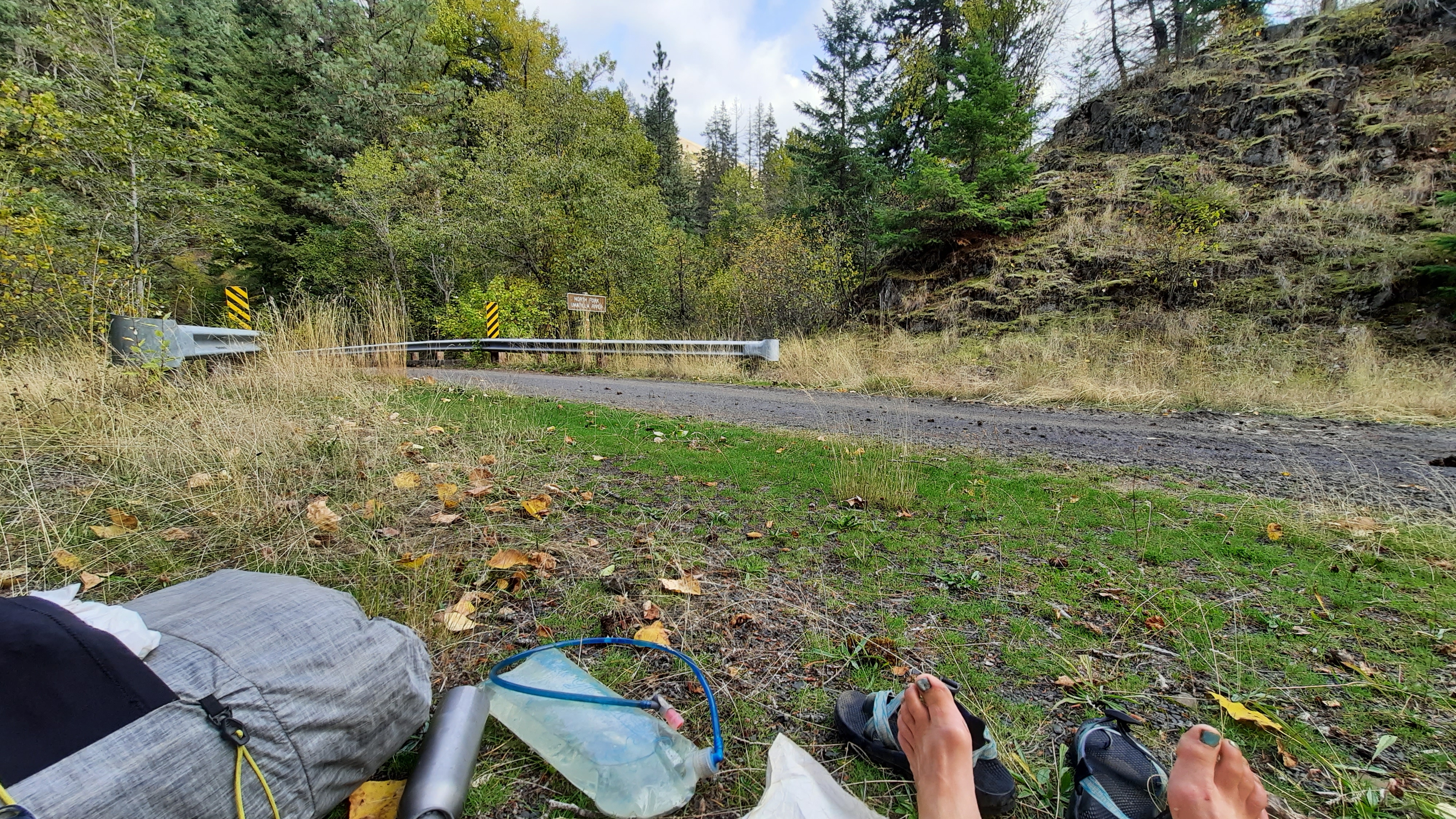
Then I started down the road for a three-mile road walk, and saw what the flooding had done to the road. Big chunks of pavement were missing and debris covered the road where normally small side channels had ripped free and covered it with mud and vegetation. Then, the road was gone. Just gone. In several places the flood waters had rounded a corner and taken the road out entirely at that corner. I had to find a way to climb down to the now very wide river channel to walk on the river rocks and climb up the other side. This flood was MASSIVE!! I wonder if they will even fix the road; I’m even not sure how they would. At some point I smelled the sulfur of hot springs, but couldn’t see where it was coming from.
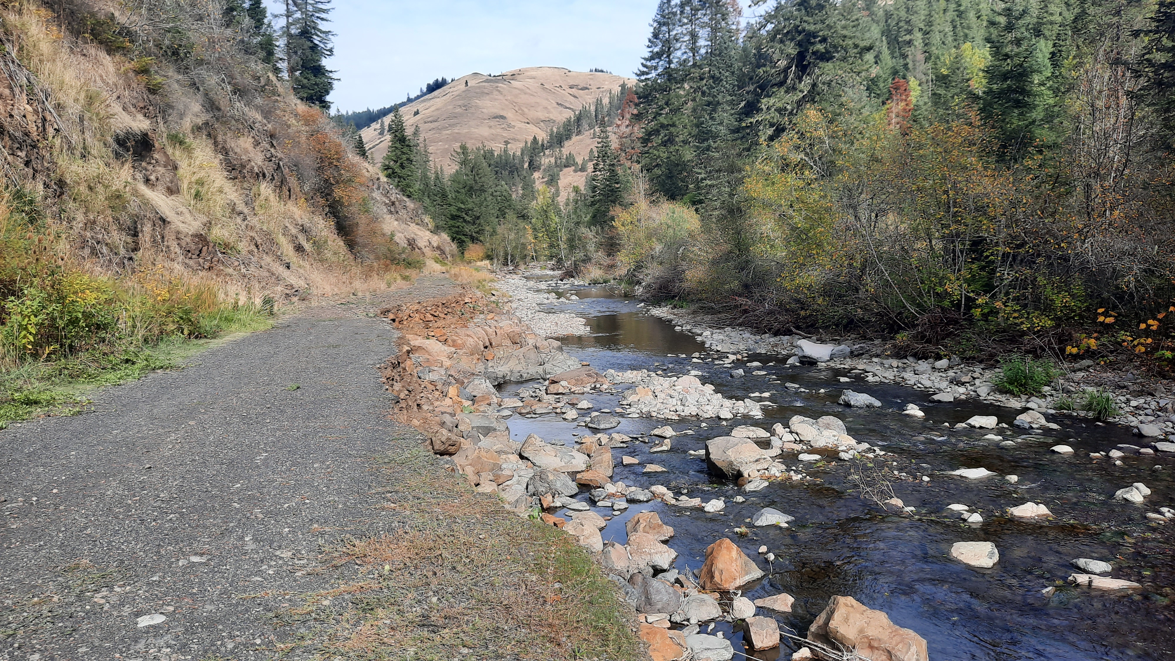
When I got to my next turn, I had another short break and decided on my next moves. There was supposed to be a trail that continued on the South Fork of the Umatilla (a much smaller creek). The trail was in unknown condition, then in two miles I would get to another trail that climbed to the ridge above, but that trail was most likely decommissioned, which means not there anymore. There was also a trail that climbed right from where I was, and could be linked to the other route via a series of two-track roads up top. I couldn’t find the trail on the side of the river where it was supposed it be, but I found a signed trail on the other side…so I walked that a total of 100 feet before I lost it in the overgrowth. I couldn’t find the trail that was supposed to switchback 2,000 feet up to the Shimmiehorn (what does that mean?) either.

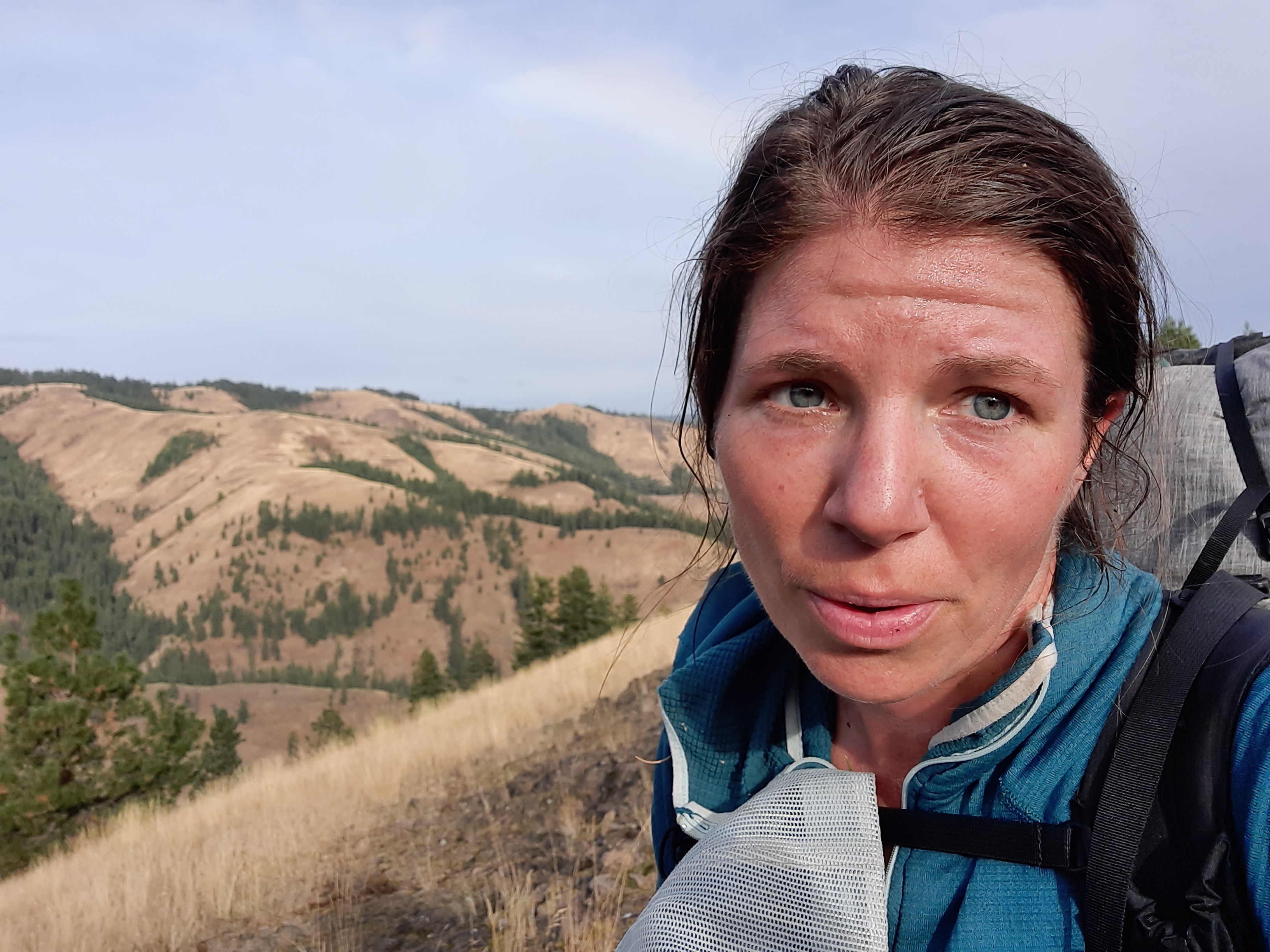
So I weighed my options. Bushwhack two miles in a river canyon and then bushwhack up a climb? Or bushwhack up a climb? I chose the latter, thinking it would equal less bushwhacking overall. So I just went for it. Steep. One step at a time. Struggle. Trees down. Struggle. Steep. After about half an hour of very little progress I had inched my way up and sweat was pouring down; I finally intersected what I thought was trail. This trail went straight up the ridge, so I kept going. It was there, then not there, but I kept climbing, and the views got better and better.
Finally I popped out on a road. Relief!
It’s important to recognize that we as hikers are vectors for invasive weeds to spread. I had all sorts of seed pods and stickers in my hair and on my clothes, but plucked them off and put them in my pocket to throw them in my trash bag instead of on the ground to grow another weed where it doesn’t belong.
I walked a few more miles on the road up on the Shimmiehorn and found a spot with a view that was tucked under a big tree. Whew. What a day.
Oh, I saw my first bear today! Or its rear end as it ran away.

Tough lady! Thanks for persisting against unknown challenges. and congrats! for the bear sighting.
Friend, Mike
LikeLike