Yesterday afternoon’s bushwhack climb wore me out, and I actually slept till 6am this morning, a new record for the trip.

My goal this morning was to reconnect to the route after about 7ish miles, then hike an alternate I came up with after seeing some private land issues. It would be almost the reverse of yesterday: walk out on a ridge top and follow it down to the river below by primarily cross country bushwhacking….I just hope the route I picked isn’t too steep. Seeing the actual terrain instead of just topo lines on the map makes it much more real.
While I was walking on roads this morning, I put on another podcast. This time with the ladies from Her Oddesey.
If you think I’m hard core, get a load of these two ladies: Neon and Fidget have been walking across the Americas over the last five years; they have about two more to go. That means from the tip of South America (Patagonia) to the tip of North America (Arctic Ocean). Wow. It’s really a whole other level. And these ladies are awesome. I got to hang out with Neon last summer when we both went to the Outdoor Retailer show in Denver, and even though I haven’t met Fidget in person, we’ve exchanged lots of messages (we definitely crack each other up) and she comes so highly recommended (NEMO-approved), that I’m just biding my time till we can all hike together sometime (dream team!). And we just happen so share three of the same sponsors: TOAKS Titanium, Gerber Knives, and Gather Nuts. Thanks for sponsoring some bad ass ladies!
It rained off and on while I was hiking, but the low clouds and rain couldn’t take away from the misty beauty of the day. I am surrounded by the colors of fall now. The oranges, reds, yellows, and maroons fill in the gaps between the deep green firs and golden waving grasses. I haven’t noticed a bunch of cheat grass; this Umatilla area seems to have a lot of native bunchgrasses (to my untrained eye).
The mountains fold into themselves through the horizon, and for being so close to the city of La Grande, the backcountry was quiet.
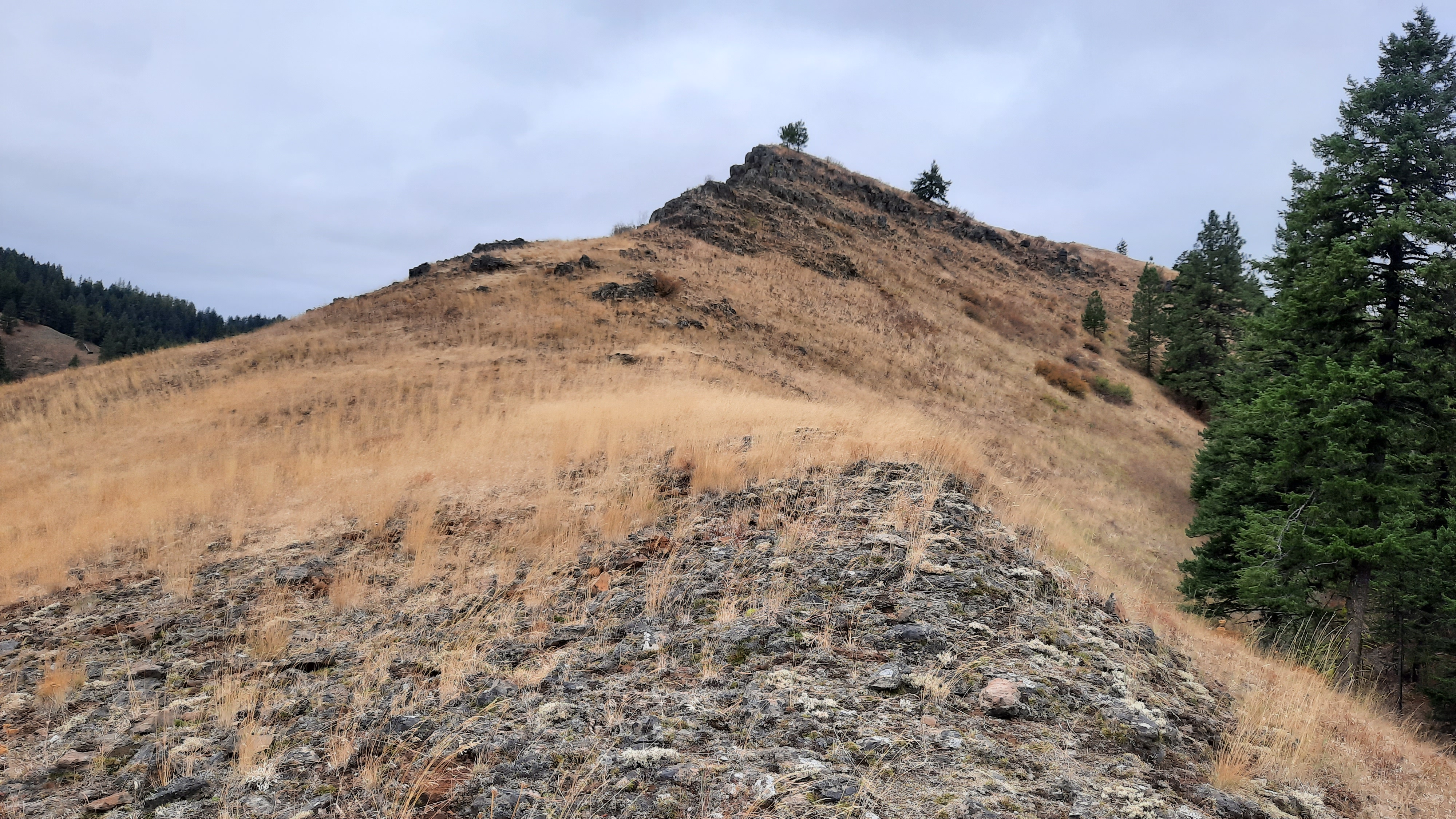
I got to the alternate I had devised and noticed with amusement that there was a trail partway out on the ridge. It’s rare that you ever really walk somewhere that no one has walked before…it’s just not possible. The going was pretty easy, but the wind was howling which had me paying extra attention as I edged out farther and farther into the unknown. What I had seen on the topo was a narrow ridge that ran about three miles before it plunged down to the North Fork Mecham River below.

As I got onto the ridge I had to trust that it was the right way to go and not get sucked down something else that looked doable (like in Joseph Canyon). I got to the end of the “trail” and saw why it was the end: a cliff! It was maybe 20-30 feet high (it did not show up on the topo). I thought I could backtrack and drop down from under it, so I did. Don’t do what I did. More very steep side-hilling. (Actually I know there are hikers out there who love the steep exposed stuff…you folks would be just fine out here). When I got around under the cliff it looked like I might have been able to down-climb it, if that’s your sort of thing.
The ridge kept going! As I got closer to the Mecham River I could see the line I had proposed to get down to the river was too steep for my comfort, so stayed on the left fingers of the ridge as it split and started fractaling down in size. I spied a game trail going my way, so hopped on that (game trails can be steep though!) and followed it every knee-shaking step to the steep (oh so steep) bottom. I popped out at the mouth of Trop Creek and had to bash my way through the riparian tangle of vegetation to get to the river canyon. My LEAST favorite kind of bushwhacking is through a dense riparian area. My second least favorite is thick manzanita.
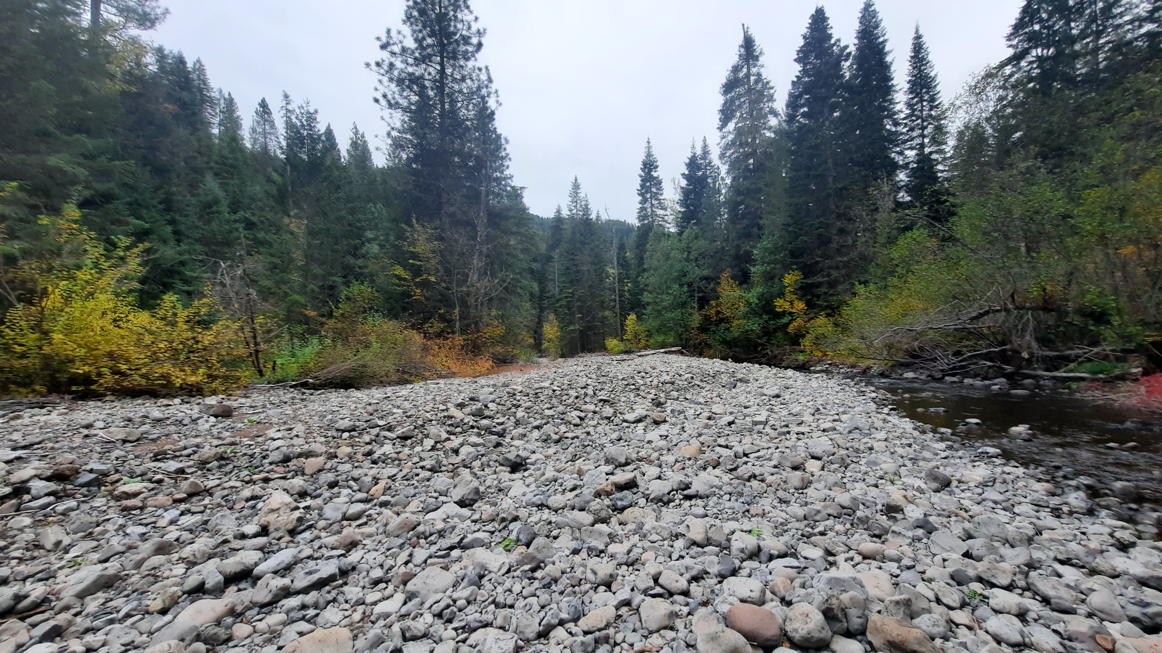
I soon found the easiest walking was in the creek. I popped out on the Mecham River to see a huge flow of rocks and gravel….this had flooded too, but it left me large beds of rock to walk on. It was blissfully branch free. I could move!
I thought it would be an early day today, but that down climb took much longer than I had anticipated. It was arduous, and I don’t think should be part of the official route. Too brutal.
I walked on rocks and in the water until I got to Bear Creek, then took a left turn and found a spot to camp in the trees near the mouth.
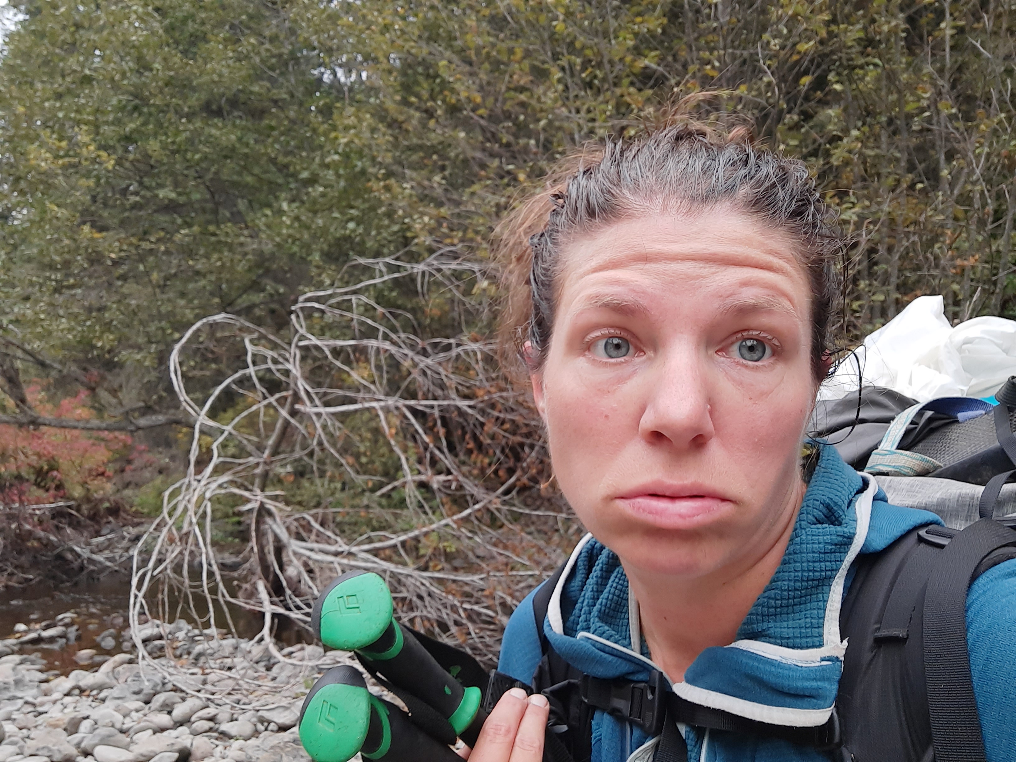
Exhausted. So exhausted. Over two weeks of hiking, almost 300 miles walked, and no day off yet. I’ve never gone this long at the start of a trail without a day off, and I’m starting to feel it. I had low energy all day and I can practically hear the soft warm hotel beds of La Grande calling my name. Only a few more days…or less? I’m not sure what the day ahead holds…more bushwhacking I think, and my bushwhacking well has just about run dry. We’ll see if I can pull it off.


OMG. Hope you survive the cliffs, bears, and bushes to make it alive to La Grande. Many want to meet you.
LikeLike
Glad to hear you’re still in decent shape after several arduous days, Renee. Hope La Grande provides some recoup-time. Stay warm!
LikeLike