My eyes closed well before dark. The afternoon of relaxation in the face of the last few days left me in a wet noodle state, and I wasn’t fighting it, but what that meant was I had achieved a full 8 hours of sleep well before sunrise.
So, I made coffee and wrote about yesterday’s excitement. I was ready for a nap by the time I was finished, so I rested a bit more before it was time to prepare for the day.
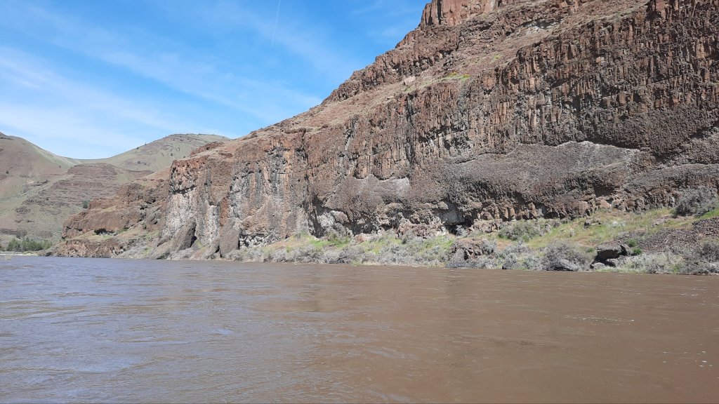
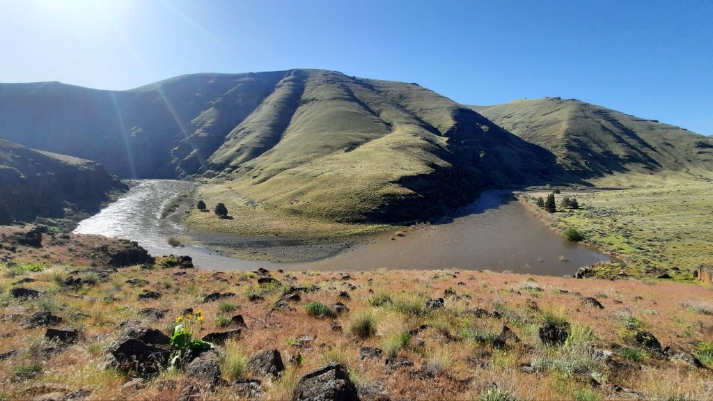
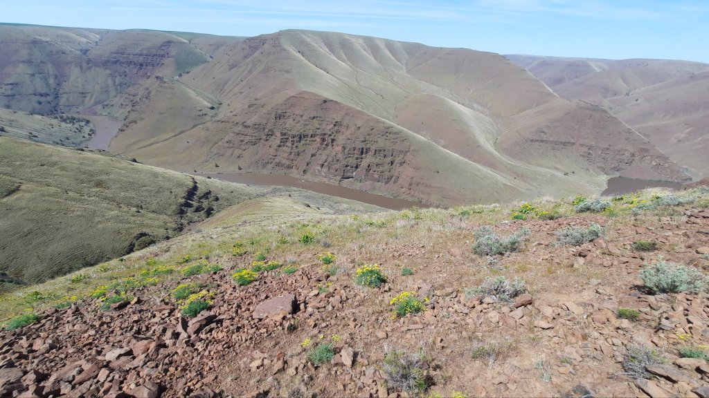
The water had come up again (15,000 cfs by this point), and the sky had clouded – adhering to the forecast from a few days ago. A windy overcast day on snowmelt is very different from a hot sunny day on snowmelt. I didn’t have warm boating clothes, so my strategy was paddle consistently until I reached the boat ramp at Cottonwood Canyon.
That’s a tiny pump!
I rounded a bend and saw the BLM rafts in front of me….the crew I met up with yesterday was inventoring the last few campsites of this section, so I made a beeline for them and asked if I could hitch a ride the last few miles to the end.
I think Monica was relieved that I asked, it was a riskier situation to be a tiny boat in the river today, I definitely felt that. The wind had started blowing gustily upstream, something that often doesn’t happen until the afternoon and is an indication that it’s time to get off the water. It’s hard to battle an upstream wind in an inflatable boat with a delicate paddle.
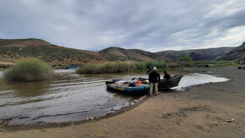
I jumped in the boat with Monica and Austin, Mark was in another raft, and volunteer Kirk was in yet another. (Fun fact: Kirk had originally inventoried the river about 20 years ago when he worked for the BLM….now the crew was doing it again and preparing an updated boater’s guide).
My plan when I got to the boat ramp was to hitch from Cottonwood to Condon, about 20 miles away. The BLM folks were going to Maupin (the other direction), but Kirk was going home to Sisters, so he offered to give me a lift. Brilliant!
I helped the boats unload and then load, and before I knew it, I was in Condon waiting for their burger place to open for lunch. Oh baby!
The boat ramp is now a lakeMonica!
After I had demolished lunch, I walked over to the historic Condon Hotel and got a room. This is a wonderful hotel, and when I walked in my room to see white everything, I made sure not to transfer my dirty funk all over the place. I promptly took a bath and put on one of the hotel’s robes. (A white hotel ROBE???? I am definitely in a different universe than two days ago!)
I spent the afternoon catching up with friends, family, and the internet. I napped and watched cable. This day was so valuable because I could almost feel my body healing itself. The sore muscles and achy calfs were melting away and leaving the starts of a hiking machine in the wake. I would use all those muscles on the second half of the trip. This was just an unexpected interlude!
Kirk and I made plans to come back to do some of the parts of the route I was now skipping. Scott says the highlight is the North Pole Ridge Wilderness Study Area just south of the Thirtymile boat launch. We will definitely return at some point to check that out. As I was explaining the route challenges to Kirk, I could tell he was perking up…he will happily be my plus one for the skipped sections. He loves this exposed mountian-goat type of scrambling.
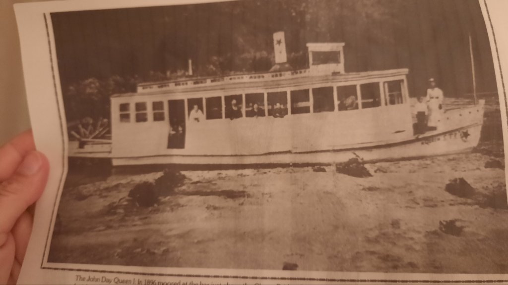
So what I haven’t done a lot of so far on this trip is read some of the history that K’Lynn and Brooklynn from the Condon Chamber of Commerce had sent me, so I spent some time with the pages yesterday and read about the John Day Queen I – a 50′ long pleasure craft that was in operation at Clarno from 1892 to 1899 when it was washed downstream in a flood and destroyed. This free-flowing river floods a lot, as it should.
I’m not too worried about getting myself to Clarno (50 miles away) tomorrow, it is a long ways away, but I’m going to do what is in front of me, and now that’s sleep in this wonderfully soft white bed and be grateful.
The next step forward isn’t revealed until you take the next step forward.
Countless times in the past few days I haven’t been able to see more than a step or two in front of me. Whether in the scree, or on the steep grassy slope, with every step forward the next one always appeared. Mostly. There were a few times when I had to back track, like when faced with a 20′ cliff I couldn’t downclimb. I picked my way back and around the obstacle (30′ above the river) to instead push my way through a skin shredding gauntlet of brush, and my path forward was revealed. And I had to WORK for it.
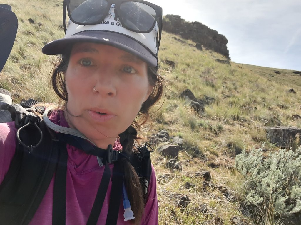
I had a great morning. I psyched myself up with some ra-ra music, enjoyed my coffee and put on my legs (achy and scratched legs….but well rested). I could get stronger as I hiked. Watch me.
The map showed another 3 miles of walking along the river where I would need to tank up. I was due to climb and descend over 1,400′ in 5 miles. I knew I would need a lot of water. That could take me all day (just trying to be realistic). I decided to make it the 3 miles before deciding on my water strategy ahead. One thing at a time. Do what is in front of you.
Some game trails, some walking through a huge grassy flat and behind a boater camp. I kept my distance but waved. Yesterday I would have been offering them money for a cold drink. Today I was good, and was making time!
For a while.
Cliffs and talus.
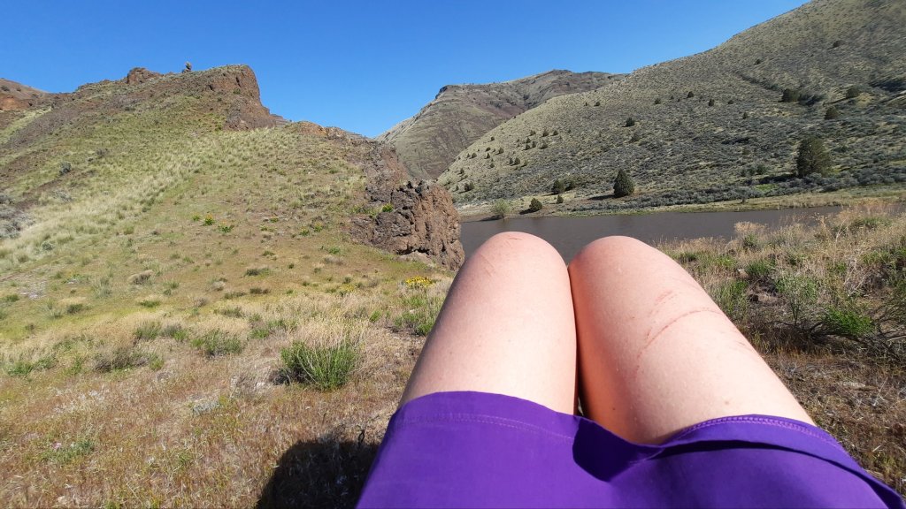
I made one of those wrong decisions when faced with trying to choose the right game trail to follow, and found myself cliffed out. I walked back and around and see my option is to climb up a 6′ wall. There seem to be plenty of handholds and it’s soild rock, so I start to climb, trying to keep my body (and backpack) close to the wall so the extra weight won’t pull me off. I find myself needing to brace my knees at a certain point, and when I pulled myself up, I had a nice gash where skin moved over pointy rock. I should have worn pants! The blood trickled into the top of my gaiter and I looked ahead and kept going.
It took about 2 hours to hike 2.5 miles and I felt defeated. That next 5 miles up and back down to the river could take all day. I needed as much water as I could carry.
The blood from my backcountry bouldering sesh had dried, and I gave voice to a niggling feeling I hadn’t acknowledged yet.
I have a boat.
I had been seeing boaters by this point. I had been a boater on this stretch multiple times. I couldn’t tell you HOW DIFFERENT the experience was between floating it and hiking it.
I could be that boater now.
I was trying to think realistically about my options:
– If I continued move at an 8-10 mile a day pace (the maps revealed rigorous terrain ahead), and I rationed my food, I would be fine to make it to my resupply in Clarno, but probably wouldn’t have the time to finish the trail in Mitchell.
– If I inflated my boat, I could paddle out to Cottonwood Canyon State Park, hitch to the nearby town of Condon, get a hotel room for the night (!!!), talk to K’Lynn who runs the chamber of commerce who may able to help me get a ride to Clarno the next day, and I keep hiking from there on to catch up with my original schedule.
Was that really a choice?
But it was more than that. I also didn’t want to continue to hike this type of route alone. That slick move I pulled back there on the rock could have gone another way. Scott’s notes about the next section (the one with the 1,400′ of climbing) had some class 3 scrambling – if that was your thing.
I decided it wasn’t my thing, not as a solo hiker at least.
What was in my control?
I text Kirk on the InReach to run my plan by him. He reminds me that I don’t have a life jacket.
Hmmm.
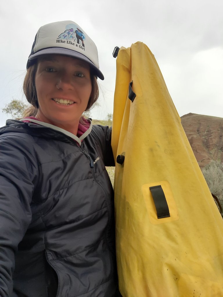
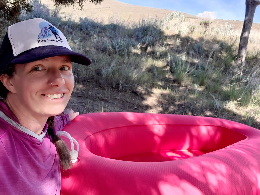
So many boats, it’s about 9am by this point and I figure the rafts will start floating by soon. I gather up all my stuff and move to a spot close to the water. I pack up so that I can place my pack in the bottom of the boat and sit on top of it. Pokey things get tucked inside. Thank goodness I decided to line my pack with one of Six Moon Designs’ dry bags. These bags were part of their Flex Pack (packrafting specific backpack…Kirk and I helped with the redesign!). It was light, and it worked a million times better than a trash compactor bag.
I look up from my repack to see a raft! I wave them close and shout my life jacket request. They have one! The boat has to land downstream where the shore is visable, so I grab all my stuff and start walking to meet them.
My heros!
Karyn and Brenden from Bend. Wooo!
I can’t talk fast enough.
They hand me a life jacket and a few cold drinks. I’m beside myself. The trip did a complete 180 in a matter of minutes. And I am so relieved. I’ll admit, my ability to move efficiently through this rugged terrain had me a little down, but for me this would be something to return to after my legs had come in (usually after about a solid month of thru-hiking).
I make plans to reconnect with Karyn in Bend to return the life jacket.
The trail (river) provides!
I sit down when they pull away and collect myself.
I now have all day to inflate the packraft and make the 23 miles back to the start, or where I want to stop for the night. Actually I see an immense appeal to the proposition. This was how Scott scouted and explored the area when putting this route together…by boat. The brilliance of the juxtaposition had to be experienced in a shorter section hike/float.
I launch.
I could feel the impact of my decision through my whole body. Once I was sufficiently sure that the packraft wouldn’t sink (its so light!) And the paddle could get me where I wanted to go on the water (crazy light!), I relaxed.
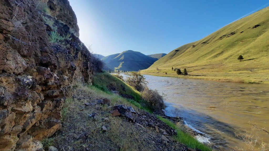
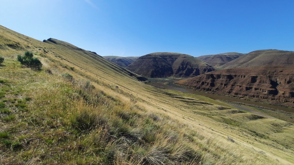
I watched the cliffs float by. Cliffs I couldn’t believe I had hiked over. Canyons I couldn’t believe I had traversed, and hills I couldn’t believe I had climbed.
I ate cheddar pretzel bits and open the Coors Light Karyn had given me. This was bliss.
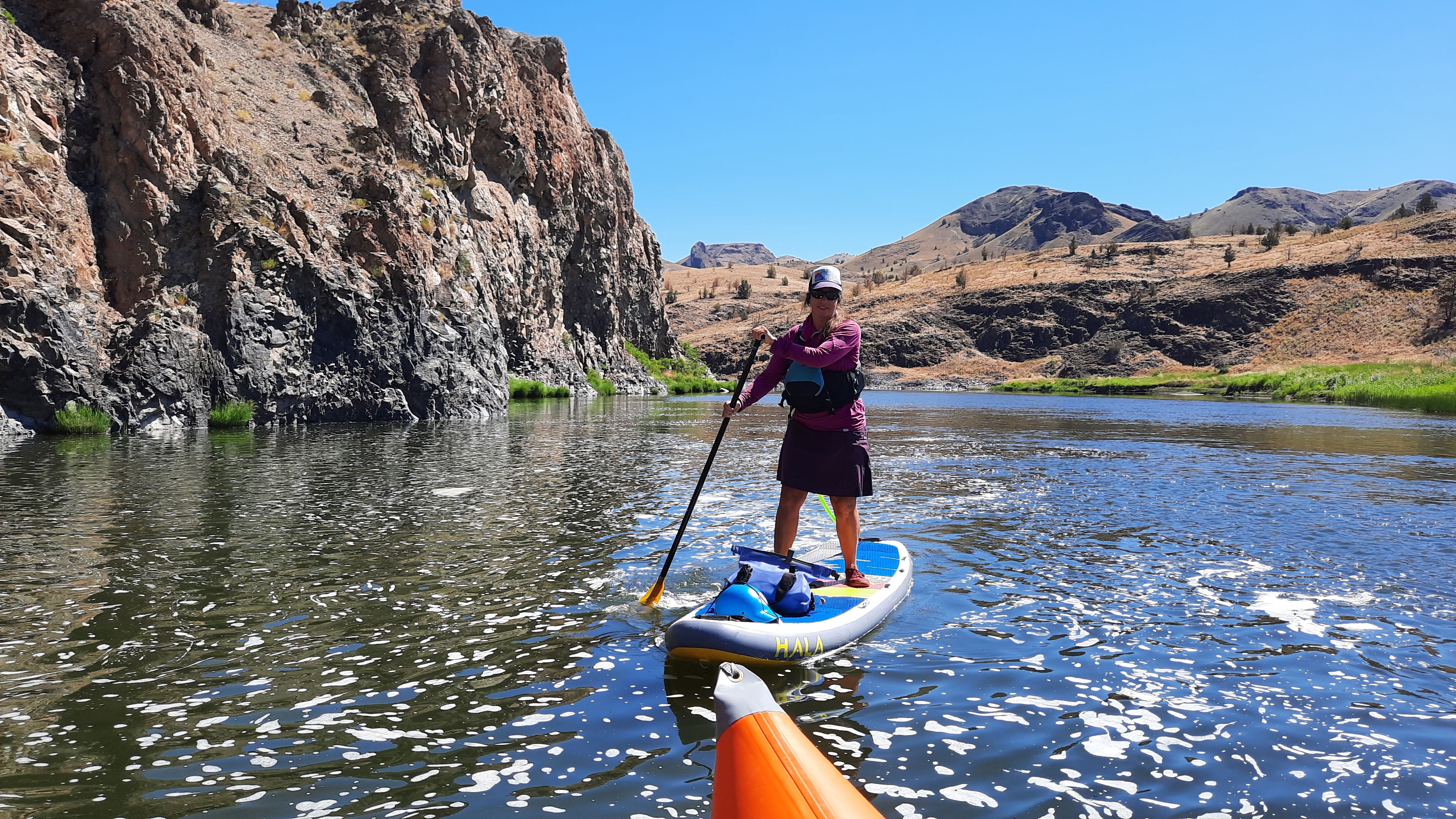
I came around a corner and saw some boats I recognized from yesterday. I had waived at them from a steep sidehill section above the river. They had seen what I had been doing. I paddle over only to find out it was the BLM River Ranger Monica, who I knew! Monica and her crew were monitoring all the campsites on the river…many had been reclaimed by vegetation. I tried to explain what I was doing…and knew Monica would understand – she is a fellow packrafter and even though we had never paddled together before, I was pretty sure she would get it.
We chat some more and I launch off again. By this point I decided I would make camp soon and float out the next day. I had time and food, so I might as well make the most of this unexpected river trip.
I make camp in the shade of a tree. Snacks, naps, and reading…I love this part!
The last three days have been so all consuming that I can’t remember what I was doing before the trip.
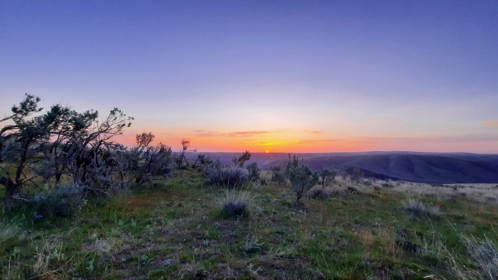
The quiet sunrise didn’t give the secret away: today was going to be HARD.
Instead, I sat blissfully unaware as I drank two cups of coffee and listened to the sounds of the birds waking up and singing their songs.
It’s better not to know anyway.
Was it the terrain? Yes, partially. This was going to be a day of knee shaking descents, a 1,400′ climb in a mile, and picking each step very carefully on narrow game trails above the river.
Was it the heat? Today I remembered what hot was. Radiant heat in the 80’s would reflect off the numerous talus fields to cook me from the inside. I had to take afternoon breaks every hour or so where I would just lie in the shade of a giant ponderosa pine (the trees have started!) and try to calm my racing heart.
Was it me? I was not route ready, that was sure enough. My feet haven’t hardened yet and are feeling the starts of hot spots. Oh yeah. And I’m 45….does that mean anything?
The reality was I could only go as far as I could go. No use moaning that I wanted to make another eight miles today. It is what it is, and I can certainly stretch my food out if it takes longer for me to get to Clarno and my resupply. I can’t seem to put a dent in my food bag, so I’m not too worried about it.
AND the weather is going to cool 15-20 degrees tomorrow with the possibility of a cloud cover on Monday….hiking in 60 degrees is infinitely easier than cook-your-brains-early-summer-sun. So I might be able to make up some time…and Scott says the second half of the hike is easier.
My age and fitness? Nothing I can do about it now, so might as well try to treat myself well and make the time to do what I want to do out here (enjoy the trip), and move forward again tomorrow.
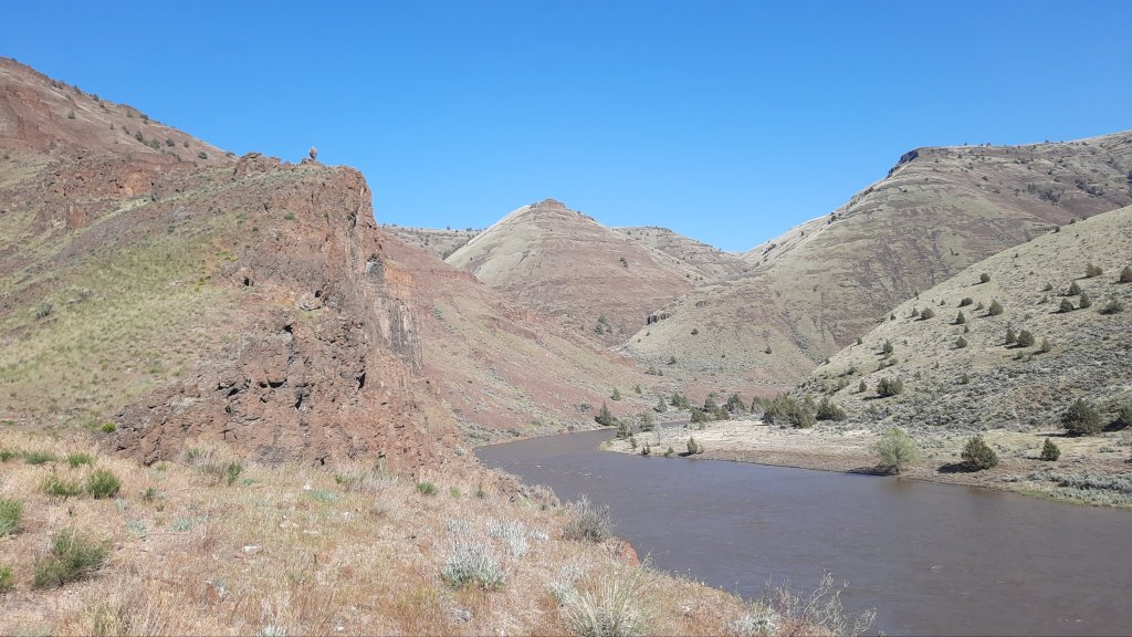
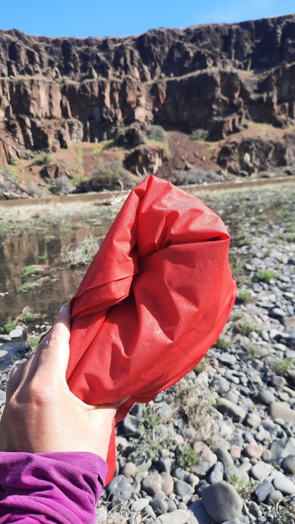
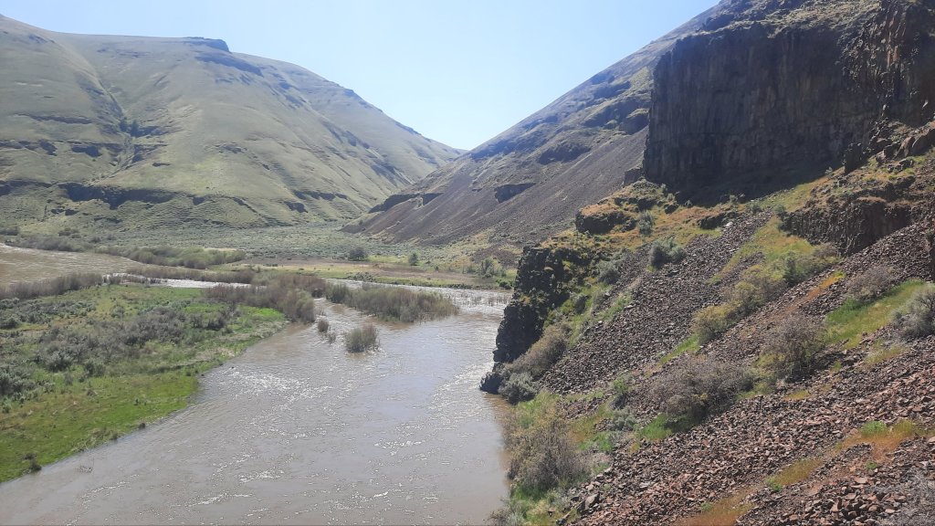
But wait! I didn’t tell you about the first river crossing! I got to the gooseneck about 9am just in time to blow up the boat and have my first break. I had the very light packraft, a tiny usb-powered electric pump, and a carbon paddle that weighed about 3 gummy bears.
The water was trucking, so I put in a short ways upstream of where I wanted to land so I had a better chance of making it to the other side. There was an alternate Scott had drawn out to cross a bit upstream which would save me a lot of climbing another mile or so downriver, but that was a real short ferry, and I didn’t trust myself to make it across in time….no run-out – only cliffs, and if I didn’t make the ferry landing on the other side, I would go backwards.
Not happening.
The river is so wide now, and swift. I decided to wear the backpack and crouch-sit in the boat so I could have one leg free to lurch for land when I got to the other side. You want to look for an eddy or slow water for your landing so that you actually have a chance of getting out of the boat…flood stage waters means the beaches and most cobble-stone benches are gone.
Moment of truth. I’m paddling in the snow-melt (I wonder what the cfs are today with the first 80-degree day?) and the boat is moving. The water is fast, I have to paddle hard at times, but soon I’m across and spreading out on an elusive rocky bench.
Now for the good stuff:
There were some fun features today:
I saw a snake all coiled up in the sun, but it didn’t even move. There were a couple of snake sightings yesterday too, but no rattles to be seen.
My speed of operation this week has been hovering near overdrive, but the promise of meadowlark serenades and long deep days of not talking are on the horizon, and I keep going. All the hustle is a very good and welcome state given that I’m less than two months into my life as a self-employed expert in a very small niche of the world (woohoo!). I’m following my own lead, and that took me to the banks of the John Day River, and I’m so grateful.
Getting to the start of the Columbia Plateau Route at Cottonwood Canyon State Park was aided by my longtime friend Cindy. I drove up to her place in Portland the night before last, and we caught up over tacos and margaritas. In the morning, she drove me to the park, and I was delighted when she ended up hiking in four miles with me… even 1,000′ up the first climb. You rock Cindy! Thanks for your help!
The weather was due to be consistently warm and sunny the next week or so, and the river had already started shedding some of the snow from its upper extremities. It was flooding baby, the question would be how much? I was hopeful that a swollen river wouldn’t affect my plans too much, I had a parkraft for crossing that river, no matter how much extra water was coursing through. The riverside walking though…how would that be impacted?
No matter, it was happening, and I would deal with it when I had to.
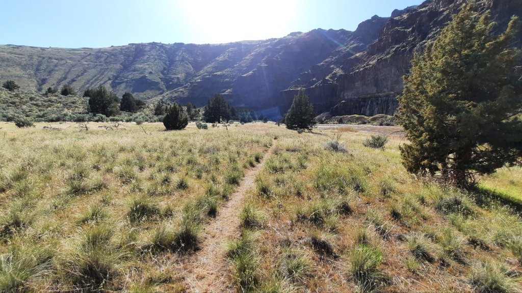
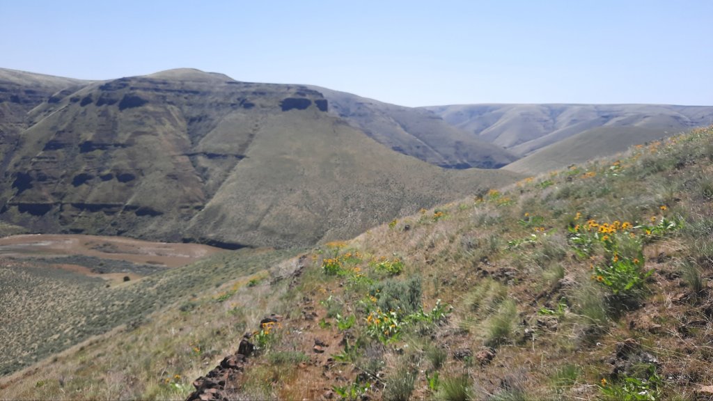
Cindy left me high on a rocky outcropping after we enjoyed snacks… or rather I left her….walking away into the tall green grasses. There were flowers! Oh yes! These warm days would be a boon to the blooms, and I had them as my steady companions as I contoured around the fingers and folds of the river basin.
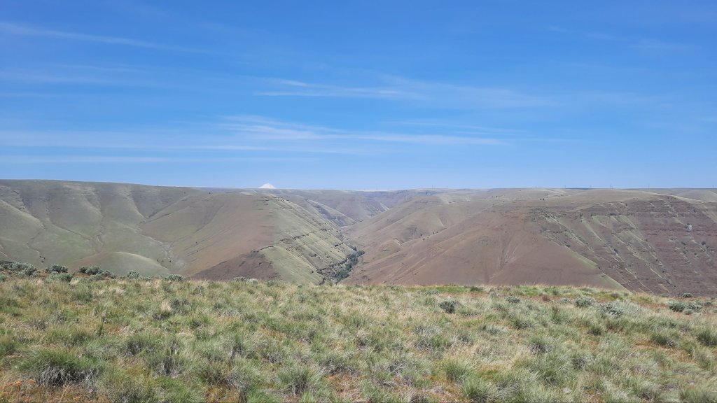
When I was walking high above the water, the wind turbines could be seen along the horizon. When I dipped to the river, it was rimrock and hot, rocky slopes. And brown flood water.
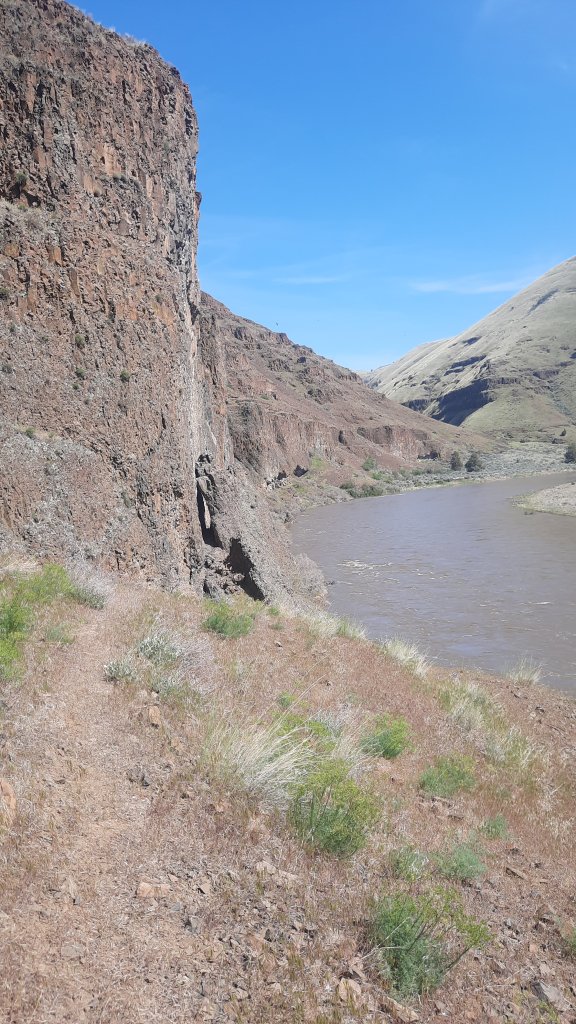
Things got a little spicy when I traversed over pillars of basalt on a scree/grassy game-trail bench 50′ above a roiling eddy of snow melt. I was thankful that I wasn’t too nervous about this kind of exposure. It was an acceptable level, and aided by the fact that Scott had been here before and told me the line goes. I probably wouldn’t have done it otherwise.
At the bottom of the Ruggles Grade I found myself in the land of unusually large sagebrush. The knarled ancients towered over me and I proceed to scratch my knees and thighs real good. Pants would be the better choice here, but I’m a devotee to my purple rain adventure skirt and tall snow gaiters. That left my knees to the mercy of the sun and poky sagebrush, but that’s how I roll.
The dirt roads I’m following out here are really more like hints of dirt roads. The vegetation, though deserty and scrubby, is thick and has done a good job of filling in the grades…all except for the man-made constructed rock berms that lined the tread as it steady climbed or descended a ridgeline. Those were a permanent reminder of industry, even if only until the next rockslide took them out. I was grateful for them. The animals were too. These roads were now wildlife through-fairs, and the plentiful tracks and poop were soild evidence of that.
As this was my first day and I was feeling a bit soft and out of “hiking all day every day shape, ” I took things slowly with the following mantra ticker-tape tracking through my mind:
Go slow to go fast.
This was a hike of intention, and I needed to be intentional with each step on the rocky, remote terrain.
When there were still a few hours of daylight left, I stopped for camp high on a ridge, nestled in a little grove of waist-high sagebrush. It was a good spot…all the cow poop confirmed that.
While my hiker hunger can be minimal on some first days of a hike as my body adjusts to the sudden change from all day computer sitting to all day desert bushwacking, I ate gleefully and with gusto on day one.
I’ve got a new adventure on deck…a 135-mile hike along the John Day River this spring.
This trip will lead me to obscure desert canyons, remote game trails threading through rocky cliff bands, and along the banks of a river I have paddled countless times.
“I didn’t realize there was a trail that long beside Oregon’s longest free-flowing river,” you might be saying to yourself.
Well, there isn’t.
This is a route. A route that has been carefully pieced together over years and many scouting trips (20 and counting!) by intrepid hiker, Scott Nechemias.
Scott and I have been chatting about his Columbia Plateau Route (well, by chatting I mean primarily communicating through Instagram DMs) for years now…our paths originally crossed with the Oregon Desert Trail. He is someone who likes to look at a topo map, find something that looks compelling in the terrain, and then find a way to get there on two feet (or a packraft). That’s in line with what the Oregon Desert Trail tries to do, so we’ve shared different trip ideas over the years. Scott has also been hiking part of what I hope will be an Oregon Desert Trail to Blue Mountains Trail connector…(much excite!)
So the Columbia Plateau Route…when piecing this hike together, he started with an idea to find some stable backpacking weather in Oregon in the off-season, in this case between November and May. This Portland-based backpacker set his sights on north central Oregon. “I realized that if you drew a box from the Cascades, bounded by the Columbia River, all the way east to the Umatilla Forest and south to the Ochocos, you have a quarter of Oregon that has no trail longer than 20 miles,” he explained (this is beside the Deschutes River Canyon where “trail” is an old railroad bed). “This is a massive area where no one writes about backpacking. The John Day River has a whole corridor of wilderness study areas, plenty of access to water, and gives you a way to keep moving on public land.”
Scott is another hiker like myself who sees connections and opportunities everywhere – if you aren’t afraid to get off the trail and wander through a bit of sagebrush. He already has a route scouted from the end of this route from the town of Mitchell to the western terminus of the Oregon Desert Trail at the Badlands Wilderness (I’m so stoked for that!!). There are an incredible amount of options out there to connect all of these trails and routes, and in a way, I think this is just the beginning of route development around the country, especially when planning tools like Cal Topo makes it so easy.
The start to the Columbia Plateau Route (CPR) has 2 options, one from the popular Cottonwood Canyon State Park, and the other from a more obscure spot on Highway 207. From there the path heads south. “Why south?” I asked him, “Part of me feels like if you are going northbound, you should do it in a raft,” he said. “You might feel silly walking that direction when you can just float,” he added.
Agreed.
Why make the trip harder than it has to be? As it is, the CPR has multiple river crossings…which will probably limit the number of people who want to take on this kind of multi-sport adventure. The John Day River can be gentle and shallow in the summer and fall…two years ago when Kirk and I spent the month of June trying to travel from the source to the mouth we watched water levels quickly drop in an early heat wave, but in the spring this free-flowing river can spike to incredible flood heights. A spring hiker along the CPR will need to cross the river in a boat, note: this is not a river to ford. For the task, Scott is going to send me a very small and light packraft (I won’t be using my 8lb heavy whitewater packraft) to use on the fords and I’ll balance precariously over my backpack on these short paddles through the canyon. It should be an adventure!
While I’m on this journey I plan to explore many different aspects of this area. Much of the John Day River is a Wild and Scenic River (and there is current legislation to add more river miles to this program – in fact, I nominated 51 waterways for consideration), ONDA (my former employer, and current client) works in this region and is very interested in preserving the wilderness qualities of the John Day River and uplands – some of that work includes protecting the headwaters which are critical to steelhead, Chinook salmon, bull trout, westslope cutthroat trout, and interior redband trout. They have been building “beaverhoods” and beaver dam analogs at Cottonwood Canyon State Park and Pine Creek Conservation Area (tribal properties of the Confederated Tribes of the Warm Springs), and I’ve even led a “how to hike a route” stewardship trip into Spring Basin Wilderness a few years back.
The hike passes through the following designated areas:
Lower John Day Wilderness Study Area
Thirty Mile Wilderness Study Area
North Pole Ridge Wilderness Study Area
Spring Basin Wilderness
Pine Creek Conservation Area
Pat’s Cabin Wilderness Study Area
Sutton Mountain Wilderness Study Area (there are exciting things afoot for the Sutton Mountain area! Read more here)
In fact, the Greater Hells Canyon Council also works in the John Day River watershed. Remember the Blue Mountains Trail?? I started that hike in the town of John Day, and hiked along the headwaters in the Elkhorn Mountains, and along the North Fork of the John Day too.
I think one of the things I love most about this next adventure of mine is that it isn’t new territory. I’ve hiked, paddled, camped, and explored parts of this area so many times I can’t even begin to count the trips. But, this will also be an entirely new way for me to experience this river canyon: on foot, solo, hiking long days, and spending some quality “deep time” in an area that few have. Of course, that doesn’t include the millennia that people lived and traveled in these canyons since time immemorial; there is a rich cultural history of indigenous peoples in this area, along with the long recent history of settlement in these canyons. There are patches of private land throughout the hike, pieces of old homesteads, farms, ranching operations, and active operations as well. I’ve recently connected with the very helpful folks at the Oregon Frontier Chamber of Commerce and will be taking some local history literature with me on the hike, I’m looking forward to diving into all aspects of the John Day Territory. There are many relationships to this place I want to learn about as I’m building upon my own.
I’ll also pass by many project sites that ONDA has been involved in for decades:
At Clarno, my halfway resupply area, I’ll be walking by the Clarno Nursery, officially named the Clarno Hardwood Propagation Facility. This area is a collaborative project between the U.S. Forest Service and the Bureau of Land Management. Up to 50,000 willows, cottonwoods and other native trees are harvested annually from this facility for restoration projects around the northwest. ONDA volunteers head out to the nursery a few times each spring to harvest cottonwood and willow sticks that will later be used in riparian plantings in places like Cottonwood Canyon State Park, South Fork of the Crooked River, and nearby in the Pine Creek Conservation Area.
A short distance away from Clarno is Camp Hancock, a science camp for middle schoolers, and the location of many years of ONDA’s annual meeting.
The area is also home to the Clarno Unit of the John Day Fossil Beds. This is a stunning local that features volcanic lahars, or mudflows, that formed 54-40 million years ago in a lush semi-tropical rainforest environment. Tiny four-toed horses, huge rhino-like brontotheres, crocodilians, and meat-eating creodonts that once roamed ancient jungles are now found in the rocks of the Clarno Unit, as well as an incredibly diverse range of plant life. Leaves, fruits, nuts, seeds, and petrified wood from 173 species of trees, vines, shrubs, and other plants have been found here thus far. ONDA has partnered with the National Park Service, which manages this area, on many projects in the past – and if you haven’t gone hiking under the iconic Palisades found there, I highly recommend the trip.
Ok, what else…
Let’s go back to my conversation with Scott.
How did he decide where the route would go…other than the obvious: avoid private land areas, and walk along the river until you get cliffed out and either have to go up, or go across.
“All the way down from Cottonwood Canyon I tried to look for the best (or most interesting features) of each area. The routing changed a little bit when I put it together all in one hike because if you have hiked all the way from Cottonwood Canyon, you have been through the river bends and cliffs, so hiking along the river by Spring Basin doesn’t make sense. You may as well have the views and the transition into a more wooded area. I want the route to have a different character as you go,” he said. “I really want people to have a sense of transition into the Ochocos and Blue Mountains along the way.”
So just how did he piece it together? The route maker’s best friend these days is Cal Topo (as mentioned above). Scott would identify cool terrain on the topographic layer of the mapping software, then look at the satellite view to make sure there were no hidden cliffs that don’t show up in the spaces between contour lines or thick vegetation that would be a nightmare to hike through, then zoom out with the slope angle shading on and features would pop out: either features to visit, or features to avoid.
“I think what is there now constitutes the best route along the river, but I’ll probably add a few alternates in places,” he said. “On a personal level, I’m out there again and again because I like to explore – inflate my packraft, float for a few miles, then explore a side canyon that I’ve never done before. There are so many side canyons and so many folds in the terrain that you can keep hiking out there and see something different each time. I have a lot more hiking I want to do out there, but as far as the Columbia Plateau Route goes, this is the best line.”
I did some quick math, and the breakdown of the route reveals 5% of the route is trail, 40% is road (primarily 2-track dirt roads with 4% on maintained roads), and the remaining 55% percent is cross-country hiking…up and down from the river and walking along the water. I don’t see that it will be navigationally challenging, but I’ll still use my smartphone and gps app to make helpful notes, blog each day, and take photos. I’ll also carry my InReach satellite beacon in case of emergencies…especially because I know there will be plenty of areas without cell phone reception.
“The ideal person for the route is someone who is an intermediate to advanced backpacker, is comfortable navigating and being alone, and is looking for something that is a little more of a Hayduke/ Escalante type of experience that is available to them in November through May…that is a time of year that people really struggle to find something to hike,” Scott explained.
“One of the things I want to do is put together some section hike trips as well from some of the access points like Cottonwood Canyon, Thirtymile, Spring Basin, or Sutton Mountain. I think there are opportunities to make really good 2-3 night trips for those who don’t want to hike the whole route.
“Overall I want people to get a better handle on a part of Oregon that is not well-known.”
For me, I want to deepen my relationship to this place, and my favorite way to do that is to walk. Walk day after day at a pace where my brain can play and my body can thrive. I’m not going to be pushing 20-mile days (unless it feels really good!), instead, I’m going to do what I’ve really enjoyed doing on my hikes recently: hike a moderate distance, let my body make decisions, and bring plenty of reading, snacks, and curiosity to fill in the time that the135 miles will take to hike.
I can’t wait!
This hike is also a fundraiser for the Trail Keepers of Oregon (TKO).
If you are so inclined, you can donate on my fundraising page. TKO works to enhance the Oregon hiking experience through stewardship, advocacy, outreach & education. Founded in 2007, TKO began as an all-volunteer effort to maintain and improve hiking trails throughout Oregon, and has since expanded to eleven staff members who lead and manage more than 3,000 volunteer Trailkeepers each year. In 2022, TKO volunteers dedicated more than 17,500 hours to stewarding Oregon’s trails.
I have had TKO trip leaders on my Oregon Desert Trail maintenance trips over the years, and from first-hand experience, they are doing an incredible job training leaders, and managing trails all over the state. They also host the Oregon Trails Coalition non–profit (I’m now the incoming Chair for the organization!).
More coming soon on the Oregon Trails Coalition Signature Trails Report (lots of exciting things to share with you on this), and I also want to plug Scott’s upcoming talk, Ultralight in the High Desert, at the Mountain Shop in Portland on May 16.
There are so many wonderful things happening, and I haven’t even begun to download from the whirlwind of activity from the International Trails Summit last week!
So, stay tuned for blog posts from the Columbia Plateau Route coming soon. I hope you have some fun spring adventures planned as well.
If anyone has any reading/podcast/audiobook suggestions on the area/history/indigenous perspectives – please let me know!
Some of you participated in the panel discussion a few weeks ago about Thru-hiking in a Big Snow Year, and since then Treeline Review published a very detailed blog post written by another panelist, Giggles. I’d highly recommend checking it out!
The video of our chat was recorded and you can watch it here:
Thanks to Treeline Review for providing this critical information!
If you haven’t visited their website before, they offer very detailed reviews on some of the products we all use in the backcountry…their latest is on portable solar chargers…something I have not had success with over the years, but I’m closely following the topic as I’d love to carry an efficient solar charger instead of the very heavy power banks I have been using over the last decade.
Join me and some of my friends and other bad-ass lady thru-hikers for this panel on Thursday, April 13 at 5pm (pacific time) presented by Treeline Review.
I always love chatting with the folks over at The Trail Show. Skip to 20:30 for my interview, but don’t miss the interview right after with Salty on her amazing Grand Canyon Traverse!
I enjoy my conversations with Lori at the Hike podcast. I’ve been on in the past to talk about the Oregon Desert Trail and Blue Mountains Trail, and this time we covered my new business.
I have more podcasts booked this year, so stay tuned!
Well, the American Trails webinar last week went really well! I had an audience from all over the world and was thrilled to learn about all the interest out there from trail organizations and conservation groups about engaging the recreation community in conservation issues.
Have you hiked a trail and wished the planning was easier?
Would a different or improved resource have helped you on the trail?
Are you concerned about environmental issues affecting your trail experience?
What will the future of thru-hiking look like with accelerated climate change?
*A long-distance hiker doesn’t need to have completed a thru-hike. You are the best person to determine if you are a long-distance hiker. Some folks hike 30 miles in a day; others hike 30 miles in 3-5 days. If you spend more than 2 nights on trail, no matter your daily mileage, I’d love to hear from you.
How wonderful to see this article come out in our local business paper!
I worked for Cascade Publications (home to Cascade Business News and Cascade Arts & Entertainment) for over four years, before the last 7+ years of the Oregon Desert Trail, before my hike of the Continental Divide Trail.
I was the A&E Editor and can attribute a lot of my design and writing chops to designing a 40-page art magazine once a month for years, and writing twice as many feature stories for both publications during that time. A hard publishing deadline is one of the best teachers!
I feel so lucky to be doing this work, and I couldn’t have gotten here without years of sweat, tears (yes, those deadlines sometimes provoked tears!), and just showing up day after day. There are so many metaphors I could insert here about how hiking is like life…blah blah blah, but it’s all true.
One step at a time.
Don’t get lazy.
How you live your days is how you live your life. – Annie Dillard