The next step forward isn’t revealed until you take the next step forward.
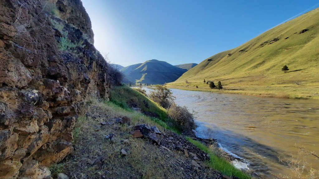
Countless times in the past few days I haven’t been able to see more than a step or two in front of me. Whether in the scree, or on the steep grassy slope, with every step forward the next one always appeared. Mostly. There were a few times when I had to back track, like when faced with a 20′ cliff I couldn’t downclimb. I picked my way back and around the obstacle (30′ above the river) to instead push my way through a skin shredding gauntlet of brush, and my path forward was revealed. And I had to WORK for it.
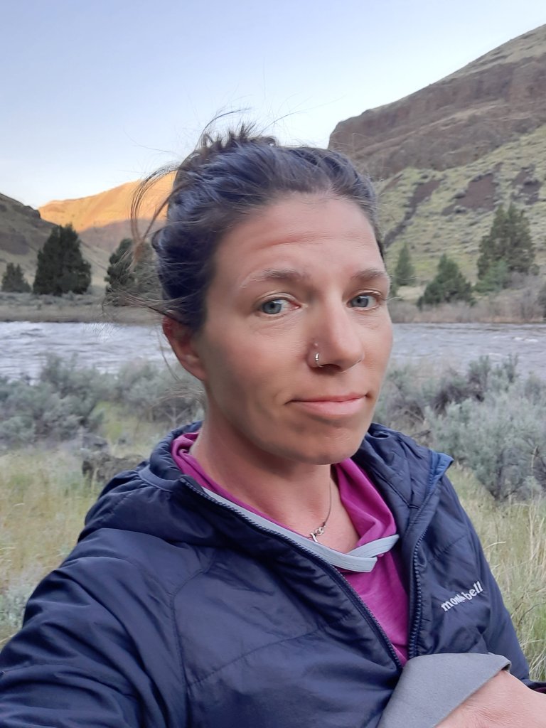
I had a great morning. I psyched myself up with some ra-ra music, enjoyed my coffee and put on my legs (achy and scratched legs….but well rested). I could get stronger as I hiked. Watch me.
The map showed another 3 miles of walking along the river where I would need to tank up. I was due to climb and descend over 1,400′ in 5 miles. I knew I would need a lot of water. That could take me all day (just trying to be realistic). I decided to make it the 3 miles before deciding on my water strategy ahead. One thing at a time. Do what is in front of you.
Some game trails, some walking through a huge grassy flat and behind a boater camp. I kept my distance but waved. Yesterday I would have been offering them money for a cold drink. Today I was good, and was making time!
For a while.
Cliffs and talus.
I made one of those wrong decisions when faced with trying to choose the right game trail to follow, and found myself cliffed out. I walked back and around and see my option is to climb up a 6′ wall. There seem to be plenty of handholds and it’s soild rock, so I start to climb, trying to keep my body (and backpack) close to the wall so the extra weight won’t pull me off. I find myself needing to brace my knees at a certain point, and when I pulled myself up, I had a nice gash where skin moved over pointy rock. I should have worn pants! The blood trickled into the top of my gaiter and I looked ahead and kept going.
It took about 2 hours to hike 2.5 miles and I felt defeated. That next 5 miles up and back down to the river could take all day. I needed as much water as I could carry.

The blood from my backcountry bouldering sesh had dried, and I gave voice to a niggling feeling I hadn’t acknowledged yet.
I have a boat.
I had been seeing boaters by this point. I had been a boater on this stretch multiple times. I couldn’t tell you HOW DIFFERENT the experience was between floating it and hiking it.
I could be that boater now.
I was trying to think realistically about my options:
– If I continued move at an 8-10 mile a day pace (the maps revealed rigorous terrain ahead), and I rationed my food, I would be fine to make it to my resupply in Clarno, but probably wouldn’t have the time to finish the trail in Mitchell.
– If I inflated my boat, I could paddle out to Cottonwood Canyon State Park, hitch to the nearby town of Condon, get a hotel room for the night (!!!), talk to K’Lynn who runs the chamber of commerce who may able to help me get a ride to Clarno the next day, and I keep hiking from there on to catch up with my original schedule.
Was that really a choice?
But it was more than that. I also didn’t want to continue to hike this type of route alone. That slick move I pulled back there on the rock could have gone another way. Scott’s notes about the next section (the one with the 1,400′ of climbing) had some class 3 scrambling – if that was your thing.
I decided it wasn’t my thing, not as a solo hiker at least.
What was in my control?
I text Kirk on the InReach to run my plan by him. He reminds me that I don’t have a life jacket.
Hmmm.
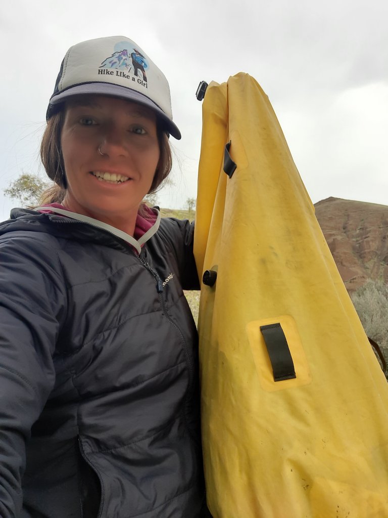
So many boats, it’s about 9am by this point and I figure the rafts will start floating by soon. I gather up all my stuff and move to a spot close to the water. I pack up so that I can place my pack in the bottom of the boat and sit on top of it. Pokey things get tucked inside. Thank goodness I decided to line my pack with one of Six Moon Designs’ dry bags. These bags were part of their Flex Pack (packrafting specific backpack…Kirk and I helped with the redesign!). It was light, and it worked a million times better than a trash compactor bag.
I look up from my repack to see a raft! I wave them close and shout my life jacket request. They have one! The boat has to land downstream where the shore is visable, so I grab all my stuff and start walking to meet them.
My heros!
Karyn and Brenden from Bend. Wooo!
I can’t talk fast enough.
They hand me a life jacket and a few cold drinks. I’m beside myself. The trip did a complete 180 in a matter of minutes. And I am so relieved. I’ll admit, my ability to move efficiently through this rugged terrain had me a little down, but for me this would be something to return to after my legs had come in (usually after about a solid month of thru-hiking).
I make plans to reconnect with Karyn in Bend to return the life jacket.
The trail (river) provides!
I sit down when they pull away and collect myself.
I now have all day to inflate the packraft and make the 23 miles back to the start, or where I want to stop for the night. Actually I see an immense appeal to the proposition. This was how Scott scouted and explored the area when putting this route together…by boat. The brilliance of the juxtaposition had to be experienced in a shorter section hike/float.
I launch.

I could feel the impact of my decision through my whole body. Once I was sufficiently sure that the packraft wouldn’t sink (its so light!) And the paddle could get me where I wanted to go on the water (crazy light!), I relaxed.
I watched the cliffs float by. Cliffs I couldn’t believe I had hiked over. Canyons I couldn’t believe I had traversed, and hills I couldn’t believe I had climbed.

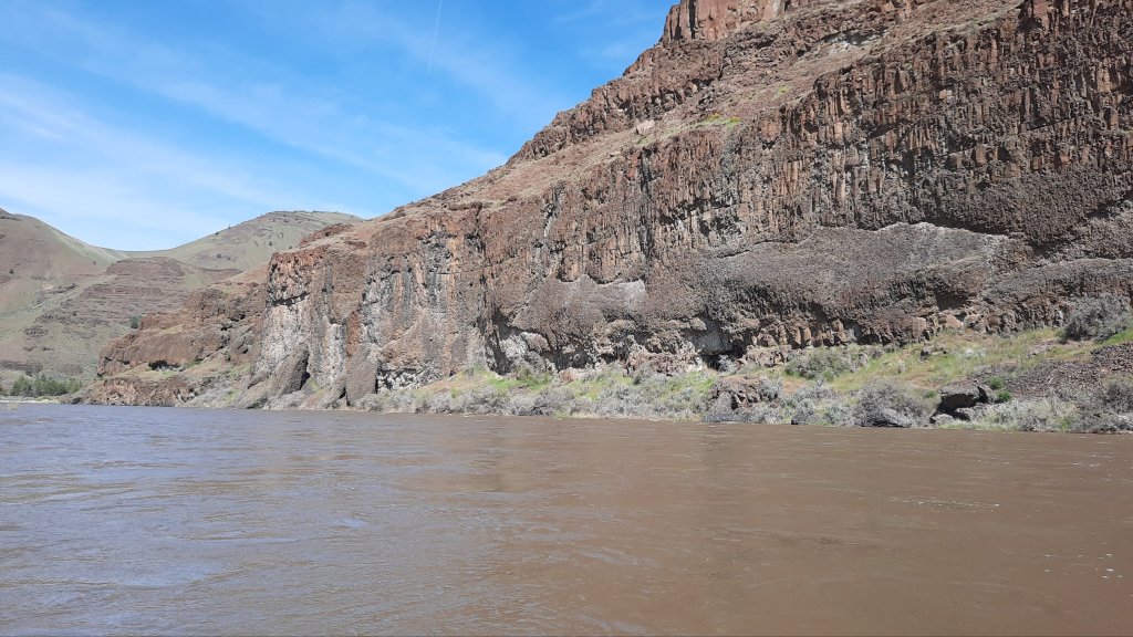

I ate cheddar pretzel bits and open the Coors Light Karyn had given me. This was bliss.
I came around a corner and saw some boats I recognized from yesterday. I had waived at them from a steep sidehill section above the river. They had seen what I had been doing. I paddle over only to find out it was the BLM River Ranger Monica, who I knew! Monica and her crew were monitoring all the campsites on the river…many had been reclaimed by vegetation. I tried to explain what I was doing…and knew Monica would understand – she is a fellow packrafter and even though we had never paddled together before, I was pretty sure she would get it.
We chat some more and I launch off again. By this point I decided I would make camp soon and float out the next day. I had time and food, so I might as well make the most of this unexpected river trip.
I make camp in the shade of a tree. Snacks, naps, and reading…I love this part!

The last three days have been so all consuming that I can’t remember what I was doing before the trip.
There is a reality other than this one??
Na, you must be joking.

Good decision…I’m relieved.
Friend, Mike
LikeLiked by 1 person
Wow, I have always admired your tenacity and badassness, but I am really appreciating here too, your struggle and transparency. Thank you for sharing your human side, as that makes me feel that my own backtracks and pauses on a trail do not make me a weak hiker.
Stay safe, please!!! ❤️
LikeLiked by 1 person
Wise choice. I can’t imagine doing even 10 miles on that route. If you see K’Lynn, say hi. We’re on Bike Rides NW board of directors.
LikeLiked by 1 person
hell yeah!
LikeLike