I’ve got a new adventure on deck…a 135-mile hike along the John Day River this spring.

This trip will lead me to obscure desert canyons, remote game trails threading through rocky cliff bands, and along the banks of a river I have paddled countless times.
“I didn’t realize there was a trail that long beside Oregon’s longest free-flowing river,” you might be saying to yourself.
Well, there isn’t.
This is a route. A route that has been carefully pieced together over years and many scouting trips (20 and counting!) by intrepid hiker, Scott Nechemias.
Scott and I have been chatting about his Columbia Plateau Route (well, by chatting I mean primarily communicating through Instagram DMs) for years now…our paths originally crossed with the Oregon Desert Trail. He is someone who likes to look at a topo map, find something that looks compelling in the terrain, and then find a way to get there on two feet (or a packraft). That’s in line with what the Oregon Desert Trail tries to do, so we’ve shared different trip ideas over the years. Scott has also been hiking part of what I hope will be an Oregon Desert Trail to Blue Mountains Trail connector…(much excite!)
So the Columbia Plateau Route…when piecing this hike together, he started with an idea to find some stable backpacking weather in Oregon in the off-season, in this case between November and May. This Portland-based backpacker set his sights on north central Oregon. “I realized that if you drew a box from the Cascades, bounded by the Columbia River, all the way east to the Umatilla Forest and south to the Ochocos, you have a quarter of Oregon that has no trail longer than 20 miles,” he explained (this is beside the Deschutes River Canyon where “trail” is an old railroad bed). “This is a massive area where no one writes about backpacking. The John Day River has a whole corridor of wilderness study areas, plenty of access to water, and gives you a way to keep moving on public land.”
Scott is another hiker like myself who sees connections and opportunities everywhere – if you aren’t afraid to get off the trail and wander through a bit of sagebrush. He already has a route scouted from the end of this route from the town of Mitchell to the western terminus of the Oregon Desert Trail at the Badlands Wilderness (I’m so stoked for that!!). There are an incredible amount of options out there to connect all of these trails and routes, and in a way, I think this is just the beginning of route development around the country, especially when planning tools like Cal Topo makes it so easy.
The start to the Columbia Plateau Route (CPR) has 2 options, one from the popular Cottonwood Canyon State Park, and the other from a more obscure spot on Highway 207. From there the path heads south. “Why south?” I asked him, “Part of me feels like if you are going northbound, you should do it in a raft,” he said. “You might feel silly walking that direction when you can just float,” he added.
Agreed.
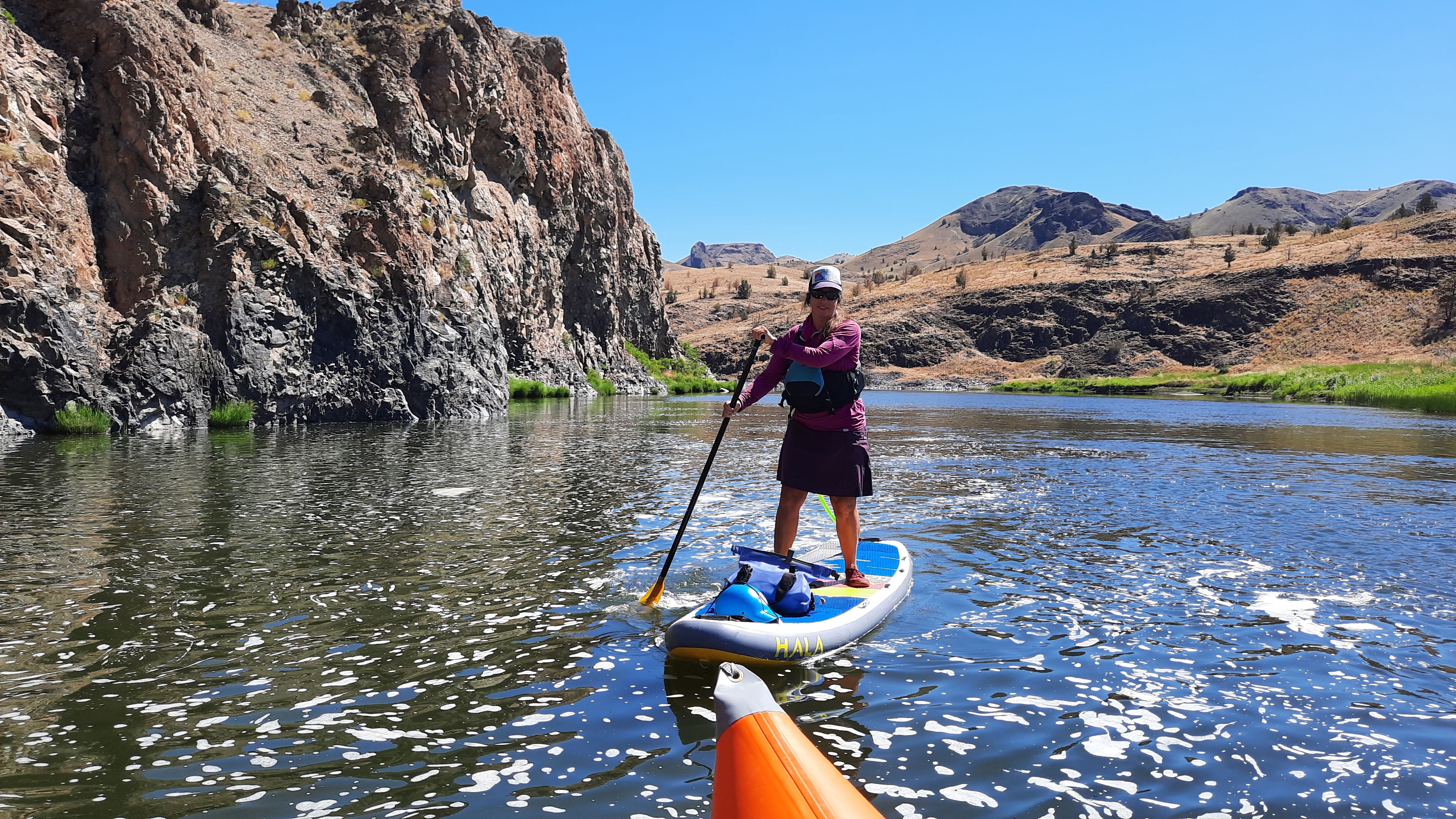
Why make the trip harder than it has to be? As it is, the CPR has multiple river crossings…which will probably limit the number of people who want to take on this kind of multi-sport adventure. The John Day River can be gentle and shallow in the summer and fall…two years ago when Kirk and I spent the month of June trying to travel from the source to the mouth we watched water levels quickly drop in an early heat wave, but in the spring this free-flowing river can spike to incredible flood heights. A spring hiker along the CPR will need to cross the river in a boat, note: this is not a river to ford. For the task, Scott is going to send me a very small and light packraft (I won’t be using my 8lb heavy whitewater packraft) to use on the fords and I’ll balance precariously over my backpack on these short paddles through the canyon. It should be an adventure!
While I’m on this journey I plan to explore many different aspects of this area. Much of the John Day River is a Wild and Scenic River (and there is current legislation to add more river miles to this program – in fact, I nominated 51 waterways for consideration), ONDA (my former employer, and current client) works in this region and is very interested in preserving the wilderness qualities of the John Day River and uplands – some of that work includes protecting the headwaters which are critical to steelhead, Chinook salmon, bull trout, westslope cutthroat trout, and interior redband trout. They have been building “beaverhoods” and beaver dam analogs at Cottonwood Canyon State Park and Pine Creek Conservation Area (tribal properties of the Confederated Tribes of the Warm Springs), and I’ve even led a “how to hike a route” stewardship trip into Spring Basin Wilderness a few years back.
The hike passes through the following designated areas:
- Lower John Day Wilderness Study Area
- Thirty Mile Wilderness Study Area
- North Pole Ridge Wilderness Study Area
- Spring Basin Wilderness
- Pine Creek Conservation Area
- Pat’s Cabin Wilderness Study Area
- Sutton Mountain Wilderness Study Area (there are exciting things afoot for the Sutton Mountain area! Read more here)
In fact, the Greater Hells Canyon Council also works in the John Day River watershed. Remember the Blue Mountains Trail?? I started that hike in the town of John Day, and hiked along the headwaters in the Elkhorn Mountains, and along the North Fork of the John Day too.

I think one of the things I love most about this next adventure of mine is that it isn’t new territory. I’ve hiked, paddled, camped, and explored parts of this area so many times I can’t even begin to count the trips. But, this will also be an entirely new way for me to experience this river canyon: on foot, solo, hiking long days, and spending some quality “deep time” in an area that few have. Of course, that doesn’t include the millennia that people lived and traveled in these canyons since time immemorial; there is a rich cultural history of indigenous peoples in this area, along with the long recent history of settlement in these canyons. There are patches of private land throughout the hike, pieces of old homesteads, farms, ranching operations, and active operations as well. I’ve recently connected with the very helpful folks at the Oregon Frontier Chamber of Commerce and will be taking some local history literature with me on the hike, I’m looking forward to diving into all aspects of the John Day Territory. There are many relationships to this place I want to learn about as I’m building upon my own.

I’ll also pass by many project sites that ONDA has been involved in for decades:
- At Clarno, my halfway resupply area, I’ll be walking by the Clarno Nursery, officially named the Clarno Hardwood Propagation Facility. This area is a collaborative project between the U.S. Forest Service and the Bureau of Land Management. Up to 50,000 willows, cottonwoods and other native trees are harvested annually from this facility for restoration projects around the northwest. ONDA volunteers head out to the nursery a few times each spring to harvest cottonwood and willow sticks that will later be used in riparian plantings in places like Cottonwood Canyon State Park, South Fork of the Crooked River, and nearby in the Pine Creek Conservation Area.
- A short distance away from Clarno is Camp Hancock, a science camp for middle schoolers, and the location of many years of ONDA’s annual meeting.
- The area is also home to the Clarno Unit of the John Day Fossil Beds. This is a stunning local that features volcanic lahars, or mudflows, that formed 54-40 million years ago in a lush semi-tropical rainforest environment. Tiny four-toed horses, huge rhino-like brontotheres, crocodilians, and meat-eating creodonts that once roamed ancient jungles are now found in the rocks of the Clarno Unit, as well as an incredibly diverse range of plant life. Leaves, fruits, nuts, seeds, and petrified wood from 173 species of trees, vines, shrubs, and other plants have been found here thus far. ONDA has partnered with the National Park Service, which manages this area, on many projects in the past – and if you haven’t gone hiking under the iconic Palisades found there, I highly recommend the trip.
Ok, what else…
Let’s go back to my conversation with Scott.
How did he decide where the route would go…other than the obvious: avoid private land areas, and walk along the river until you get cliffed out and either have to go up, or go across.
“All the way down from Cottonwood Canyon I tried to look for the best (or most interesting features) of each area. The routing changed a little bit when I put it together all in one hike because if you have hiked all the way from Cottonwood Canyon, you have been through the river bends and cliffs, so hiking along the river by Spring Basin doesn’t make sense. You may as well have the views and the transition into a more wooded area. I want the route to have a different character as you go,” he said. “I really want people to have a sense of transition into the Ochocos and Blue Mountains along the way.”
So just how did he piece it together? The route maker’s best friend these days is Cal Topo (as mentioned above). Scott would identify cool terrain on the topographic layer of the mapping software, then look at the satellite view to make sure there were no hidden cliffs that don’t show up in the spaces between contour lines or thick vegetation that would be a nightmare to hike through, then zoom out with the slope angle shading on and features would pop out: either features to visit, or features to avoid.
“I think what is there now constitutes the best route along the river, but I’ll probably add a few alternates in places,” he said. “On a personal level, I’m out there again and again because I like to explore – inflate my packraft, float for a few miles, then explore a side canyon that I’ve never done before. There are so many side canyons and so many folds in the terrain that you can keep hiking out there and see something different each time. I have a lot more hiking I want to do out there, but as far as the Columbia Plateau Route goes, this is the best line.”
I did some quick math, and the breakdown of the route reveals 5% of the route is trail, 40% is road (primarily 2-track dirt roads with 4% on maintained roads), and the remaining 55% percent is cross-country hiking…up and down from the river and walking along the water. I don’t see that it will be navigationally challenging, but I’ll still use my smartphone and gps app to make helpful notes, blog each day, and take photos. I’ll also carry my InReach satellite beacon in case of emergencies…especially because I know there will be plenty of areas without cell phone reception.
“The ideal person for the route is someone who is an intermediate to advanced backpacker, is comfortable navigating and being alone, and is looking for something that is a little more of a Hayduke/ Escalante type of experience that is available to them in November through May…that is a time of year that people really struggle to find something to hike,” Scott explained.
“One of the things I want to do is put together some section hike trips as well from some of the access points like Cottonwood Canyon, Thirtymile, Spring Basin, or Sutton Mountain. I think there are opportunities to make really good 2-3 night trips for those who don’t want to hike the whole route.
“Overall I want people to get a better handle on a part of Oregon that is not well-known.”
For me, I want to deepen my relationship to this place, and my favorite way to do that is to walk. Walk day after day at a pace where my brain can play and my body can thrive. I’m not going to be pushing 20-mile days (unless it feels really good!), instead, I’m going to do what I’ve really enjoyed doing on my hikes recently: hike a moderate distance, let my body make decisions, and bring plenty of reading, snacks, and curiosity to fill in the time that the135 miles will take to hike.
I can’t wait!

This hike is also a fundraiser for the Trail Keepers of Oregon (TKO).
If you are so inclined, you can donate on my fundraising page. TKO works to enhance the Oregon hiking experience through stewardship, advocacy, outreach & education. Founded in 2007, TKO began as an all-volunteer effort to maintain and improve hiking trails throughout Oregon, and has since expanded to eleven staff members who lead and manage more than 3,000 volunteer Trailkeepers each year. In 2022, TKO volunteers dedicated more than 17,500 hours to stewarding Oregon’s trails.
I have had TKO trip leaders on my Oregon Desert Trail maintenance trips over the years, and from first-hand experience, they are doing an incredible job training leaders, and managing trails all over the state. They also host the Oregon Trails Coalition non–profit (I’m now the incoming Chair for the organization!).
More coming soon on the Oregon Trails Coalition Signature Trails Report (lots of exciting things to share with you on this), and I also want to plug Scott’s upcoming talk, Ultralight in the High Desert, at the Mountain Shop in Portland on May 16.
There are so many wonderful things happening, and I haven’t even begun to download from the whirlwind of activity from the International Trails Summit last week!
So, stay tuned for blog posts from the Columbia Plateau Route coming soon. I hope you have some fun spring adventures planned as well.
If anyone has any reading/podcast/audiobook suggestions on the area/history/indigenous perspectives – please let me know!
