This year has been a crash course in mortality, and I’m barely getting a passing grade.
My brain, and the body that follows it, doesn’t realize things have changed. That I’m farther away from death now. That the pain I’m feeling is damage, not danger. So I have to find a way to get the message across to that lump of sponge in my skull. It’s damage, not danger.
My brain isn’t so easily convinced.
It is a good brain, and has served me well for 48 years. When it was surrounded by dozens of tumors floating in the fluid inside my skull, it was somehow able to resist the sticky tentacles of a roaming cancer that was multiplying in my unchecked body. I was there when it realized how much worse it could have been if my treatments had started with radiation. It recoiled with fear and disgust.
I’ve been able to trust my brain so far in this traumatic turn of events, but that relationship has changed in the past few months.
The reality: my PET scan and MRIs showed no new cancer growth, so I was left with the question, “Why had my pain been increasing? If it wasn’t cancer, what was it?”
The mystery became deeper when my neck pains were validated by a scary MRI result. The first specialist I saw said all was stable, so I got another opinion. Well, the first guy was right, but the second guy said there was something to be done about the pain. That there are structural reasons for what I’m feeling. That it’s damage, not danger.
How do I get that through my thick skull?
My brain doesn’t accept that the alarm is false. That my spine is so complicated and I’ll probably always have pinched nerves and compressed vertebrae.
My neck and shoulders respond to the alarm by tightening up, by guarding the spinal cord and vertebrae from further degradation or threat. Sure, I’m thankful that It’s doing what it is supposed to be doing; it’s tensed and bracing for movement, for impact, or for the potential of a neck unable to hold up the weight on top. But, brain, please let up!
I should be familiar with suffering, after all, much of thru-hiking can be explained by a willingness to suffer. We accept blisters on blisters on blisters. We accept bruised hip bones and gnawing hunger that comes from eating more than you should on day three of a six-day food carry. But it’s the suffering from a brain/body disconnect that I am dealing with now.
The good news?
There are some medical interventions that I’ll be trying soon.
The bad news?
I will probably have to learn how to live with some of the pain.
I remember one time, when I was on a hike in the rain, and was ok getting wet because I knew the day would end. I knew I would be dry on the other end. I was open to being slightly uncomfortable because I knew it would end, so that allowed me to be open to the moment. Yes, I got splashed with water, yes, my coat would be a task to dry out, but did you see that beaver swimming through the raindrops?? Did you see the clouds hanging over the mountains??
It would be quite lovely to know the pain would end. Very lovely indeed.
Its early morning where I am. I have a cup of coffee sitting next to me, balanced on a book so I won’t mess the bed. The lodge Kirk and I are staying at for our anniversary is rustic, in the cozy yet lacking amenities way (no chairs in our room), and it’s just right for us. So I have time. Time to read, and what I first started reading this morning were some of my old hiking stories.
Part of this phase of my illness/injury is to revist my former life (or the 22 years when backpacking and thru-hiking was my everything) and extract stories and adventures that I might want to revist in new writings or musings….and it also might help in the grieving process for a life I will never live again. Either that or I keep it at arms distance and try not to think about it at all. This dark morning I go back.
There will be several podcasts/articles coming out this spring that touched on my former life, and I enjoyed each interview with the creators as we delved into making trails, connecting communities, and trying to create experiences for others to thrive in the outdoors. When we talk I can almost forget my current limitations until the inevitable question comes up: “What is your next big thru-hike?”
It’s like I am thrown to the ground, barely able to breath from the impact when that question comes. Do I tell these complete strangers that I will probably never thru-hike again? That my expertise is all in past experiences, not future ones?
I need to find a way to transition to my current state without reliving the trauma that a single question can reveal. I was honest with the interviewer yesterday when he asked, and the conversation immediately turned on a dime and he started sharing stories of his friends who had faced similar traumas of going from professional athlete to not, after injuries or illness. It’s not just me, and writing through this transition and being open with all of you keeps me in touch with so many others who are experiencing similar loss. I am not alone. Sometimes I feel so very alone, but then my willingness to be vulnerable brings others into my life again and again, reminding me I’m not alone, and I feel a spark of what thru-hiking gave me: connection to the world.
Maybe that’s my transition, moving towards connection. It just looks different now.
Anyway, I digress. I meant to repost a story I wrote about the Blue Mountains Trail (the focus of one of the articles coming out this spring). So, here it is, a history that I penned for Katabatic Gear in 2020.
Click on the link for photos…I’m writing this with my thumbs in bed…my editing capabilities are limited at the moment!)
I’ve been learning a lot about the history of the Blue Mountains Trail since setting out in August to ground-truth 100 miles of this potential 600-mile route. The current alignment of the route appears like a swirl around the stunning granite mountain ranges in north eastern Oregon, but diverges significantly from the original vision for this trail, born in 1960 on a horsepacking trip in the Blue Mountains.
In fact, what I initially thought of as a recent effort by the Greater Hells Canyon Council to create an immersive backpacking experience designed to engage the recreation community in conservation issues has a much longer and varied history than I could have imagined.
As with many good ideas, this one grew out of a love of place. Blue Mountains Trail founder and Oregon conservation icon Loren Hughes had a long and active relationship with the forests and rivers in the Blue Mountains. Just a few of his monikers include director of the Hells Canyon Preservation Council (now the Greater Hells Canyon Council), director of the Oregon Wilderness Coalition, and “Mr. Five Cent-er” a nickname bestowed after he successfully used one 5-cent stamp to appeal six US Forest Service timber sales. In addition, this tireless environmentalist was active in efforts to form the Eagle Cap Wilderness and North Fork John Day Wilderness…an incredible resume for a man who spent a significant portion of his livelihood as a jeweler in La Grande.
Loren’s vision gained steam when he appealed to friend Dick Hentze, an avid backpacker and Baker City school-teacher, to help him with the trail idea. The two spent the next several decades dreaming up their route, exploring possible alignments in the mountains, and with Dick’s love of maps, they created the first iteration of the trail, an 870-mile loop originally conceptualized as the Blue Mountain Heritage Trail.
What these men proposed was a circular route that touched Hillgard Station; a state park just north of La Grande (and a stop on the Oregon Trail in the mid-1800’s); followed the snaking river canyons of the Umatilla, Wallowa, and Wenaha Rivers; took a turn along the rim of Hells Canyon (the deepest river canyon in the country…yes…deeper than the Grand Canyon); to skirt the southern edges of the Wallowa Mountain Range and back into the mountains via the Burnt River and over to the John Day River drainages and back around to Hillgard Station.
Just a quick glimpse at a map reveals miles and miles of trails crossing all through these mountain ranges. It was surely a difficult task to decide what would be the best routing for their vision…I would guess there are hundreds of route options that would give hikers an immersive journey into the heart of north eastern Oregon. In fact, their research revealed the original route would encompass 2,000-miles of additional trails. Can you imagine?
At the heart of this trail effort was the Hells Canyon Preservation Council (which later was renamed as the Greater Hells Canyon Council or GHCC). The group was created in 1967 to stop Hells Canyon and the Snake River from being dammed, actions that later led to the protection of the area as the Hells Canyon National Recreation Area. The men played key roles in the efforts to honor the natural wonders of the area, and those who knew them well will be thrilled to know the trail is routed through the Wenaha-Tucannon Wilderness, Eagle Cap Wilderness, North Fork John Day Wilderness, North Fork Umatilla Wilderness, Strawberry Mountains Wilderness, Monument Rock Wilderness, Elkhorn Mountains, and Hells Canyon National Recreation Area.
2010 marked a big year for the Blue Mountains Trail. By that time the men had engaged another passionate outdoorsman and life-long eastern Oregonian, Mike Higgins. Mike had also been intimately involved in local environmental efforts, and served on the board of the Oregon Natural Resources Council (now called Oregon Wild) prior to getting involved in the resurrection of the Hells Canyon Preservation Council. Together the men had formed a nonprofit, partnered with the Forest Service, engaged interested parties in Baker City, and had generated considerable excitement in the local and recreation communities.
In fact, when looking back at several articles written about the trail in that time-frame, I was curious to find a major motivating factor for all parties involved was to help diversify the economy in the area and develop the recreation infrastructure that would attract foreign tourists to these far reaches of Oregon. A European backpacking-style experience was envisioned, and the route was designed to lead hikers to roads or trailheads every 10-12 miles or so where they could be picked up by a local inn or bed and breakfast, shuttled around each day, and essentially slack-packed the entire route (hiking with just a day-pack). Inspirations for this style of hiking can be found all over Europe like the Camino routes in Spain and different footpaths in England and Scotland.
However, routing hikers to roads and trailheads frequently meant they wouldn’t be experiencing the deep wilderness areas where bears, wolves, elk, and cougar still roamed freely. Trails can be designed with many different user experiences in mind, and this one was a noble effort at getting more people out in approachable sections of trail while spending time and money in the communities that serve as the backbone of this region. (I would definitely stay in some of those bed and breakfasts if they are still on the route today!)
Despite all the energy and excitement around the trail two-decades ago, a series of tragic events derailed the efforts, including a deep and personal loss in Dick’s life. The trail idea was still alive on the backburner, but major efforts to move it forward were at a standstill until 2016. At Loren’s unfortunate passing, the Greater Hells Canyon Council renewed their efforts to realize the Blue Mountains Trail and included it in their strategic plan.
Enter GHCC board member Jim Kennedy. Jim and his family loved exploring different landscapes on trails, and with the GHCC’s renewed sense of purpose to complete the Blue Mountains Trail, he shared the vision with his son, Jared Kennedy. It sounds like Jared positively jumped at the chance to continue the dream, and the two of them poured over the previous trail materials with Mike Higgins.
Jared explained that he noticed some of the most iconic, scenic, and remote parts of the Blues were missing from the original route, so he set to work rerouting and revising the alignment to find a new way to tie the ecoregion together into a thru-hike. That’s about the time that I got involved in the effort, and over a series of phone calls and emails with Jim and Jared, I encouraged them to think of a route concept, similar to what the Oregon Natural Desert Association had created in the Oregon Desert Trail (or ODT, a 750-mile route that I have been working to establish for the last five years). I shared examples of the numerous resources that I had created for the ODT, and learnings from the relatively fast trajectory of the Oregon Desert Trail from idea to reality in just a handful of years.
An additional objective that Jared brought to the table was including the high peaks of the Wallowas, Elkhorns, Greenhorns, and Strawberry ranges. The three men also identified key peaks, wilderness areas, state parks, and towns they wanted to include in the alignment, and the current spiral shape of the now 600-mile path formed in response to these highlights.
Another reality set in when Jared, Jim, and Mike looked at the current landscape to find numerous fires had burned through some of the stunning sections of the route, and many miles of trails and roads had been neglected, ignored, or deliberately decommissioned. A tricky issue is that many of these routes still appear on maps, when in fact they don’t exist in a hikeable form today. Mining claims have popped up along sections of the trail (this area has a long long history of gold mining), private land boundaries have changed, and poison oak, blackberries, and deadfall create additional barriers on the ground.
The original Blue Mountains Trail is shown here in gray, with one of the first alignments of the “new” BMT overlaid in color.
This year Jared had a line on the map, and the goal was to find enough hikers willing to brave the unknown conditions to hike and document what was actually on the ground. I volunteered at first mention, and enticed some other experienced hikers I know to try and hike the entire route as well.
And what are we finding? An amazingly scenic and remote outdoor experience. Yes, some of the trails have been damaged by fire, are overgrown, and are blocked by tree-fall, but since there are several of us out hiking this year, we are exploring different options with the hope of finding an alignment (or as I like to say, the path of least resistance) that “goes.” If the Blue Mountains Trail can be hiked through a series of trails that are still in passible shape, connected to roads which bring hikers to and from towns, then later down the line some sweat can go into opening and clearing some of those neglected trails once again. As with many long-distance trails, each year brings changes in the mileage and in the alignment. This effort will be ongoing, but by using the route concept, the Greater Hells Canyon Council should be able to get folks out there hiking sooner rather than later and slowly work towards the deeper wilderness experience that still touches on the incredible communities found along the way. Although the European-style hiking concept will likely be modified from the original 10-12 miles between trailheads vision, I can easily imagine a scenario where a hiker can still get picked up from a trailhead, shuttled back to a cozy bed and hearty meal for the night, and whisked back to the Blue Mountains for the next leg of their journey.
There is so much more I want to explore about the Blue Mountains Trail concept, including the love of place this route hopes to inspire in the recreation community; the understanding of the Native American and homesteading histories of this region; the geology, habitat, and important ecological lynchpin nature of this area; the roles hikers can take if they are moved by their experience to get involved in the many conservation issues facing this corner of Oregon…there is so much more to say. Stay tuned for more explorations into the story of the Blue Mountains Trail…it will help prepare you for your hike out there when it’s ready to go!
All the turmoil in the world and in my body has me asking again and again: What can I do? What in the world can I do to make it stop, or fix it, or support others who are hurt?
It’s probably no surprise that I’ve been spending more time on Substack lately since stepping away from other social media platforms, and this post caught my attention, so I had to add to it:
The uncertainty.
It always comes back to the uncertainty. Can we be ok with it? Will accepting the uncertainty make everything more bearable?
I used to think so. I used to be sure that I could adapt to whatever came my way. One of my favorite bits from the poem The Waking by Theodore Roethke goes:
This shaking keeps me steady. I should know. What falls away is always. And is near. I wake to sleep and take my waking slow. I learn by going where I have to go.
I would repeat these lines to myself when in my village in West Africa, stunned by my decision to live in a country where my do-gooder desire to “change the world” met with reality. I repeated the lines after my first big heartbreak when the guy I had moved to London to be with broke up with me and I was left living in a massive city where I didn’t know anyone. I repeated the lines when I fell in love with thru-hiking and didn’t know how to make that transformative experience last.
But somehow, the shaking this past year has me reeling in a way that I haven’t experienced before. I’ve discovered that I can’t tough it out, muscle through it, or ignore it like I might have done in other situations. BUT I have experienced something this past week that helps: genuine human connection.
My blog post last week was filled with uncertainty about my body, about what was going wrong, about trusting myself to understand the pain, and get to the root cause of it all. But when I uploaded the post and made doubts and fears public, what I did was let others see my vulnerability (scary!), and several of you responded in ways that helped me tremendously. I felt seen. I felt understood. I was taken seriously.
And I think that is the answer.
For all the problems with the healthcare system (and the world), a simple fact remains that a small group of people who are willing to listen to you, hear you, and genuinely want to help, can have a profound effect.
What happened? On Friday my physical therapist assured me that she would help me find the right kind of help. On Tuesday a former trail work volunteer of mine, who is also a retired physiatrist, took a look at my scan and assured me that help was possible. Throughout the week many of you responded with things that have helped you through similar situations of self-doubt and uncertainty. I feel seen, and know that care and connection is one of the most beautiful, human, and inspiring things you can do for another person.
What is the point of this life if we don’t try to alleviate the suffering of those around us? Can helping to alleviate suffering be the answer to all of it?
I think the real power is taking it one step further: what if we all actively worked to bring out the best in other people?
I’m a member of a creative freelancing group. We meet every other week on zoom and share struggles and tips for how to navigate the life of a creative freelancer. I’m still taking part even though I haven’t been working since my cancer diagnosis because the ladies are awesome. One of the items we’ve been designing for ourselves this year is a creativity bingo card (google it! you will find a ton of interesting results). I put one together with things on it like: buy myself flowers, go to coffee with someone new, and move at least 10 minutes every day. But the one that has blown everything out of the water so far has been: do acts of random kindness.
I was getting a coffee from a local place this week, and noticed a lovely tattoo on the barista’s arm. I complimented her on it, and her response was a beautiful smile that literally beamed back at me. As I was waiting for the coffee, I turned to see a man at one of the tables wearing a shiny gold puffy coat. I told him I loved it, and that the sun filtering through the window on it brightened the place up. And he beamed! He started talking and couldn’t get the words out fast enough because I had shown interest in him. It was an amazing experience, and I walked away thinking this is it! We need to see people, acknowledge them, listen to them, recognize their humanity, and in doing so, we can start to bring out the best in people.
On that vein, I have a show recommendation for all of you: Queer Eye. It will restore your faith in humanity. I promise. (Season 10 just dropped!) Every time I feel depressed, I put on an episode, usually cry a bit, and feel immensely better. The fab five really do bring the best out in people.
So I’m going continue with random acts of kindness, even when I fill my bingo card, and try to really see people, and try to bring the best out in those around me.
I finally had an appointment with my oncologist to go over all the great test results from the weeks before, but when I described the increasing pain I had been experiencing for months now (8-10 seconds after I stand up, a throbbing pain pulses through my lower skull and shoulders and lasts 5-10 seconds….often I have to close my eyes and grimace to get through it), she discounted my working theory that it had something to do with low blood pressure.
Frowning at my description, she said, “Lets order a cervical spine MRI to see if something else is going on.” I was relieved that she took the pain seriously and wanted to help me figure out what was going on.
I don’t have cancer right now, but something is going on that doesn’t seem right.
I had gone to yoga that morning, modifying greatly as I do lately, but after meeting with her, decided that I would minimize extraneous movements in my neck for now. The MRI was scheduled for Friday morning, and I had my surgeon follow up on Tuesday. I was going to get some answers.
Wednesday, January 14
I walked to my acupuncture appointment in the balmy 50-degree weather that had been plaguing Central Oregon this June-uary. Kym found my neck to be incredibly tight, but my shoulders were the most relaxed she had encountered during the year I had been visiting her. Hmmm, strange, I thought.
I reiterated my complaint of throbbing pain in the lower half of my skull and shoulders when I stood up, the same thing I told my oncologist on Monday, and that a neck MRI had been ordered. While I was resting with her needles tapped into my muscles and meridians, Kym consulted a physical therapist in her office and came back with the suggestion to tuck my chin into my chest when standing up, using only my legs. I practiced the movement and was delighted to feel less pain upon standing. The theory was that something in my neck was getting pinched when I was standing up, causing the pain. I walked home, and every time I stood up the rest of the day tucked my chin into my chest.
Ok, so what was causing the pinching?
Thursday, January 15
I was up in the wee morning hours again. This time it wasn’t the steroids that woke me up like last year during my chemo treatments; this time I was worried about my neck. I woke up and couldn’t get my sore neck off my mind. I had additionally started to feel a “pulling” on the back left side of my skull. It felt like things were progressing.
I kept replaying that week’s appointments and pain in my head in an infinite loop when I finally decided to get out of bed. I put on an episode of Poledark, a show both my mom and I had been watching on Netflix.
One particular scene and line stood out, and I rewound the episode enough times to write it all down:
You can not fight all the world. You can only make your own small corner a fairer place.
We are living in such a tumultuous time, I was living in such a tumultuous body, that I found real solace in that passage.
We can only do what we can do in our small corner of the world.
It’s easy to throw up our hands in despair when we see things on a world scale. That shared story has been true always and everywhere. It really doesn’t matter if it is the 1790s mining communities of Cornwall, or today in the streets of Minneapolis. We have to do what we can do in our corners. I was happily ruminating on that line and its implications when suddenly the potential of my situation hit me like a ton of bricks.
My body was trying to tell me something and I hadn’t been listening. It’s time to put my neck brace back on.
My brain had been playing doctor’s appointments over and over in my head, I kept focusing on my pain and the really tight and sore neck, not seeing the trees for the forest. I even had the audacity to tell a few people that I didn’t trust my body anymore…it didn’t know acceptable pain from damaging pain. I didn’t have cancer so why is my neck pain increasing?
Duh!
My neck pain was increasing because something was wrong in my neck.
My neck muscles were sore from trying to stabilize the bowling ball that was my head.
The pulling feeling in my skull had to be related from my body trying to stablize itself.
I had started to move my body instead of my head when looking to cross the street.
I had ordered a $90 “Level 5” CBD pain ointment for my neck and shoulders.
When I let my brain catch up to what my body had been telling me the last month, and I admitted to myself that something was very wrong in my neck, I was devastated.
I heard Kirk’s 4am alarm go off, and went into the bedroom sobbing so hard that he jumped from the bed in alarm. I pointed to the closet and was finally able to eke out the words “I need to wear my brace again, it’s in the closet.”
Something was wrong.
I was convinced my condition could be an emergency, so I messaged my surgeon to give him a heads up on my symptoms and to prepare him for the MRI coming in the morning. I also mentioned we had planned to drive to the coast for a friend’s birthday weekend, but I could cancel the trip if my neck was too vulnerable.
I didn’t hear back from the doctor that day, but the neck brace and pain meds were helping tremendously. I felt safer. The muscles that had been working overtime were able to relax, and I took my pills without wondering if I should.
My concerns were legitimate.
Friday, January 16
Thank goodness my MRI was at 6:55am. I didn’t have to wait long, and once I was in the machine surrounded by the clicking and buzzing, I almost relaxed.
Something was being done.
I expressed my sense of urgency to the MRI tech. Last time I felt this way I had been wisked away to the emergency room and surgery. She assured me if it was an emergency someone would get in touch.
I went home in a strange calm.
The My Chart results came in an hour later.
It sounded bad, real bad, and I couldn’t decipher most of it. Parts of my spine were mentioned that had never been mentioned before. “Severly compressed vertebral body fracture,” was a phrase I knew, but the severely part was new. A “mildly compressed vertebral body fracture” in a completely new part of the spine was recorded, my pain was likely due to a “degenerative marrow edema,” and other “scattered degenerative findings” told me one thing: my spine is crumbling.
I waited for a doctor’s call, but none came.
I slowly packed and prepared to head to the coast. During the drive I kept my phone close, but no call came. By 5pm on Friday night I decided I wouldn’t be getting a call, and I’d need to wait until my appointment with the surgeon on Tuesday afternoon.
The Weekend
I kept the pain meds on deck, and let myself experience the joy of fabulous company in a beautiful part of the world. Oh, and I ate a cheeto for the first time in a year! And a strawberry starburst! I wasn’t fighting cancer at the moment, so I let my guard down and ate some food because why not! My spine is collapsing!
The pain and throbbing continued, but as long as I wore my brace and took my pills, It was manageable and I was able to keep the demons at bay.
We walked on the beach, ordered pizza, put puzzles together, ate birthday cake, watched football, and walked on the beach some more. It was perfect.
On Monday morning I realized the “pulling” I had described at the back of my skull was really a spasm that was by this point, throbbing rhythmically at the back of my head. If I took pain meds the spasming stopped, so I kept on a steady regimine of drugs.
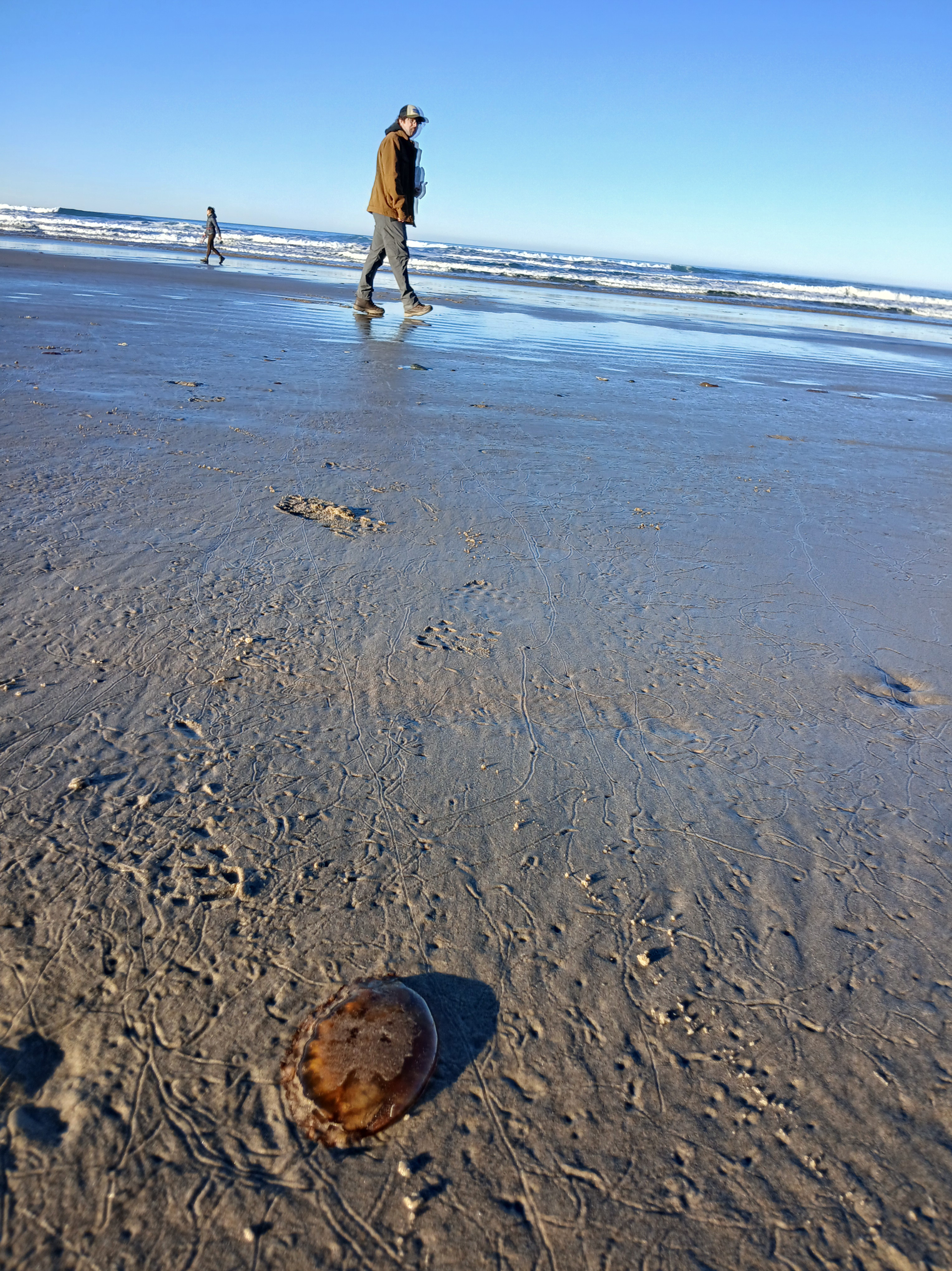
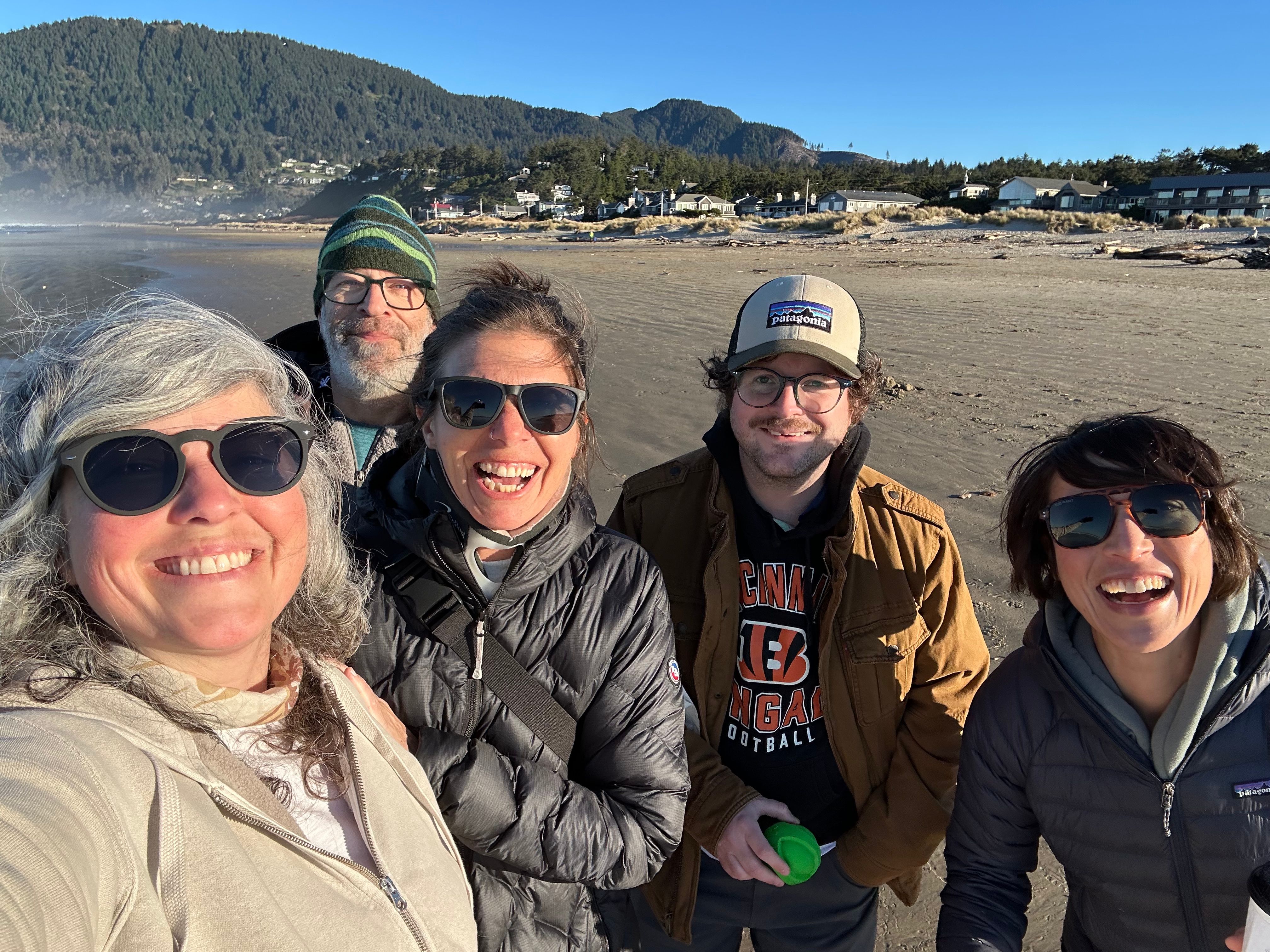
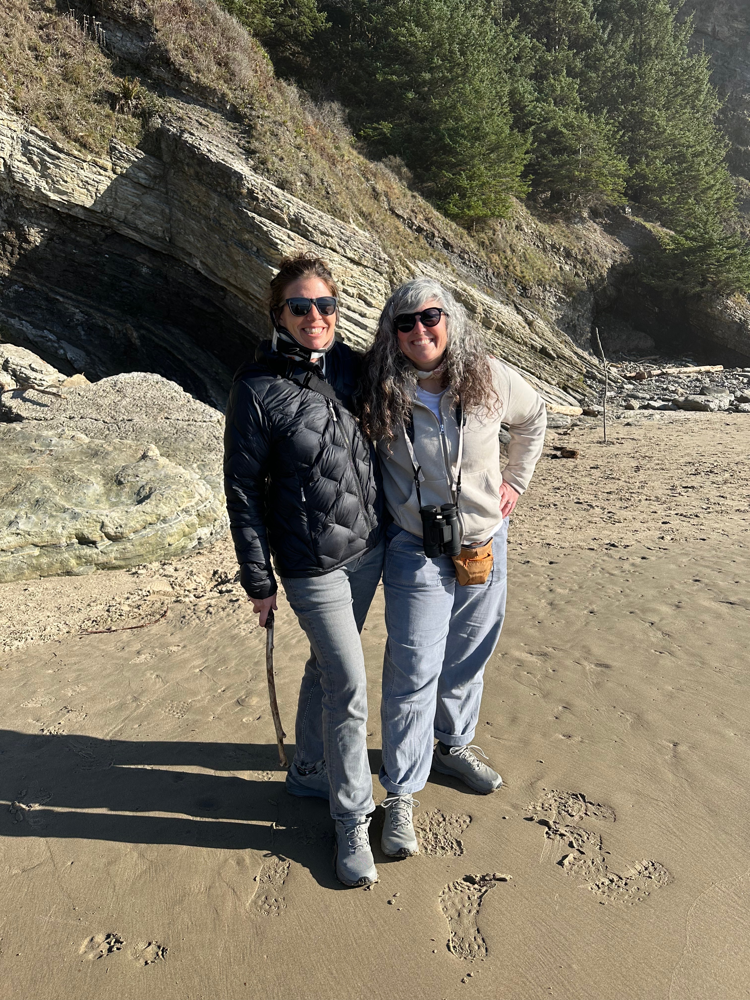
And this was it. This was the moment to put the “live now” blathering into action. If I was faced with a crumbling spine, which probably meant surgery, radiation, or some other combo of hospitals and extended bed rest, then I was going to have this day with the people I love and only focus on what was in front of me. That morning, it was a marionberry scone and delight at the jelly fish we found washed up on the beach. It was walking with the love of my life, my heart bursting with joy at spending the weekend with Brooke, Adryon, and Alex (Brooke’s brother).
I would die happy if today was my last day.
Tuesday, January 20
I was calm.
I woke, drank coffee, and made plans with Kirk to go to the surgeon’s appointment together later in the day. I slid into an easy morning.
I would have answers today. There was no reason to fear.
I had a phone interview with a woman working on a story about the Blue Mountains Trail, had a zoom with my creatives freelancing group, and heated up leftover curry for lunch while I watched more Poledark.
I started to get a little agitated when we got in the car to head to the hospital. I surveyed the clock to make sure we would get there on time…or early, I do like to be early. And by the time we walked into the waiting room my name was being called.
Yes!
Kirk and I sat waiting for the doctor to arrive and I surveyed the graphic of a spine on the wall. Ok, now my T3 was collapsing. The T3 supports upper body movement and respiratory function, and affects the lungs and upper chest.
Ok, got it.
The doctor came in, noted my c-collar, and I explained that I feel more comfortable with it on. I go over what I’ve been feeling, and he takes a big breath and explains that my spine looks stable in the imaging. I stammer, “But more vertebrae are collapsing, I feel like it’s crumbling.” He assured me I am not crumbling, and says again, “Everything looks stable, it looks really good in fact.” I look at Kirk in disbelief. “But, the pain?” Somehow, he doesn’t address the pain and the head and shoulder throbbing, and the skull spasms, other than to say nothing is wrong in the imaging.
It’s a short appointment. We walked out of there completely bewildered. “But!” I start again and again, “That doesn’t make sense!!”
I’m suddenly questioning everything.
Am I really feeling pain?
Is it all in my head?
But the My Chart results sounded so bad!
Even my oncologist said they looked bad, but she isn’t a spine specialist.
Am I making it up?
But what about the pain?
We drive in silence to Deschutes Brewery. I took off my neck brace. We walked in and ordered some food.
I’ll get a second opinion.
Maybe it’s not related to my spine.
Something must be wrong.
Maybe nothing is wrong?
But the pain? Is that real? I know it’s real!
I text my mom and some friends who were in the know. I hadn’t wanted to blog about my situation for this very scenario: maybe nothing was wrong. Maybe I was wrong.
This experience had been a week-long mindgame. I was convinced I was crumbling, then told I wasn’t crumbling.
What the %$##^$$#%!
Wednesday, January 21
Ok, maybe it isn’t my spine that is the problem
Google, what do you have to say about it?
I spent some time going through the MRI results, copying and pasting each finding into the search bar to decode the medicalese.
The plain truth of terms like “new sclerosis of the left C4 articular pillar” became much more innocuous when worded as “new hardening and increased density in the bone of the left C4 vertebra’s facet joint, usually a sign of osteoarthritis or wear-and-tear degeneration in the neck. It causes potential pain, stiffness, and reduced movement, and can be managed with conservative care like PT, anti-inflammatories, or sometimes injections.”
“Degenerative marrow edema,” became “fluid buildup in the bone marrow, often from degenerative joint diseases that causes pain, swelling, and restricted movement. It is treated with rest, anti-inflammatory drugs, physical therapy, and sometimes core decompression for severe cases, typically resolving over months.”
“Scattered degenerative findings in the cervical spine without thecal sac stenosis,” is “common, age-related wear and tear in your neck, but this wear is not compressing the main spinal canal where the spinal cord sits. This is a very common MRI finding, particularly in individuals over age 40, and often represents the normal aging process of the spine.”
Well shit.
Should I have googled all of this before letting my mind go hay-wire? Should My Chart results be shared without a doctor’s interpretation? Should I still get a second opinion?
In the last week, I had a PET Scan that surveyed my neck down for cancer, a Brain MRI to look for changes from my last scan, and lab work. And they were clear! Clear of cancer I mean. There are still tumors (masses of dead cells), there is still damage to my spine, and there is still abnormal labwork, but it’s abnormal in the ways it has been abnormal for the last year, so in essence, normal for me.
Am I relieved? Of course! So relieved!
Am I back to my optimistic, positive, pollyanna self? Well…I seem to need to sit with this news for a while, and it’s not like you just bounce back from thinking the cancer is growing again…there is the whole “well, why has my pain been increasing” question. And I have to accept that there will always be pain, that managing it is my new reality, and that some of it could have been stress-related from the PTSD over the last year.
So friends, all this means I have another 6-month lease on life!
So, I pulled the trigger on some more trips. In fact, there are still a few openings for a yoga and writing retreat in March with Anish if any of you are interested.
I had intended to write this post yesterday after all the test results had come in, but it turns out I needed a day.
I woke up like normal, drank my coffee with mushroom powders, and picked up and finished The Word for the World is Forest by Ursula K. Le Guin. When looking for the next book to read, I surveyed the shelves filled with cancer-related books, and just had to stop.
So if I’m not going to die yet of cancer yet, I’m going to go read about cancer and dying? No. Not today.
Cancer just hijacks your life. Especially with the chronic pain I’m experiencing now, well into remission. There is not a day that I’m not reminded that I could die soon, or not. Could be 1 year, maybe 5, maybe even 15! Good luck NOT thinking about that every day.
I needed a day to marinate in it, and I gave myself a 100% unstructured, uncommitted day yesterday, where I only tried to ride the wave of existence, knowing I don’t have an active cancer, and If that doesn’t elicit joy, then what are we even doing here?
I took a walk. This week I haven’t been doing yoga, in fact, I haven’t done yoga in about a month…the fears and all, but I have been going on walks: early morning walks before the sun is even up. I talk walks in the icy morning, stepping gingerly down the road with my yak tracks on, knowing my spine is like a pretzel stick, brittle and prone to breaking when it falls to the floor.
Yesterday I went walking just after sunrise and was rewarded with light and color. It was one of the first days in Bend with a dusting of snow on the ground, and even though the paths were treacherous with ice, it was so worth it to have those views and that reframe. The day before, darkness; today, I was walking out of the dark.
Can I surf the roller coaster of emotions instead of sink into them?
Ride the wave of being alive today.
Ride the wave of being alive today.
Ride the wave of being alive today. Became my mantra as I gingerly walked the world awake.
Ride the wave of being alive today.
What will 2026 look like now? I have decided I need some more structure to my days, and the many groups that I’ve joined will help in that: writing groups, book clubs, creative freelancing groups, and cancer survivor groups. A renewed commitment to adding more structure to my days may help erect some scaffolding and assist in giving me a way to pull myself out of the listlessness that was December. Periods of time where I explore deep ideas and read a lot. And I’ll continue taking walks, lots of walks. Reading, walking, thinking, writing; I’m kind of designing the perfect life. I can’t adventure as much, but I’m living a version of my life that’s pretty good right now. I know challenging and scary things are around the corner, ready to jump out at me and knock me down. (That goes for all of us. The world is just plain SCARY right now!) But today I’m standing and walking in the light.
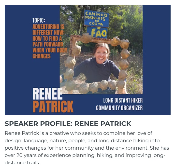
For our final 2026 Speaker Series we welcome back a previous speaker, local triple crown thru-hiker Renee “She-ra” Patrick. In late 2024, Renee was diagnosed with advanced cancer that left her in a wheelchair and unable to carry a backpack due to extensive neck and spine damage. Now in remission and walking again, Renee is exploring how to continue hiking and adventuring in a body that has dramatically changed. She successfully completed a 170-mile hike of the Portuguese Camino by using a luggage transport service, and continues to investigate alternative forms of travel so she can continue to find solace and connection in the outdoors.
Join us to re-connect with Renee and explore a topic that so many of us can relate to in our own way, what it looks like to adventure when our body changes.
How am I doing? Let’s see. It’s the last day of 2025. It’s the eve-eve of my next PET scan, or the first PET scan since my cancer has been in remission. I’m not doing well. In a way, my remission has been haunting me, especially fiercely the past month or so.
I’ve been dismal and down in this season of laughter and joy, but I’ve been high too…these emotions rollercoaster through me, sometimes on an hourly basis, where I can be delighted and hopeful, followed by a deep sorrow that drips off me and weighs my body in heaviness.
Ask me to my face, and yes, I’m doing fine, “Grateful to be here!” I reply cheerfully. To a few, I’ll say, “I’m struggling,” like when Kirk comes home to find me in tears and just enfolds me in a big hug. To myself, I say, “What is the point?” I’m finding this listlessness is manifesting in me forgetting to take my meds. I’ll have breakfast or lunch and then realize two hours later that my pillbox is still full. I hurriedly eat a handful of nuts or a spoonful of peanut butter to soften the landing of the gel caps on my stomach lining.
I am haunted. Haunted by what these next few scans will reveal.
If the scans show there are no new growths, then I have to accept that the increasing pain and discomfort I’ve been feeling over the last month is either in my imagination or my body still coming to terms with being irreparably damaged.
If the scans show there are new growths, maybe it’s a relief? Then these next months will be a series of appointments, and I don’t need to think too much. I will just need to go with it and renew my low-sugar, low-processed food habits.
It’s like I’m just now figuring out how to live with this disease, and it’s not going smoothly. I know all the tricks and tools: go for a walk, get coffee with a friend, read a book, go to yoga, tell Kirk and my closest friends the truth, take a bath. And it all works, for a short while. It pulls me up and out of the funk, but now it seems my default state is in the muck when before it was in the air, floating on thermals above the fray.
And there has been joy….really, there has been – islands of happiness, or just plain contentedness.
Christmas with my mom and brother.
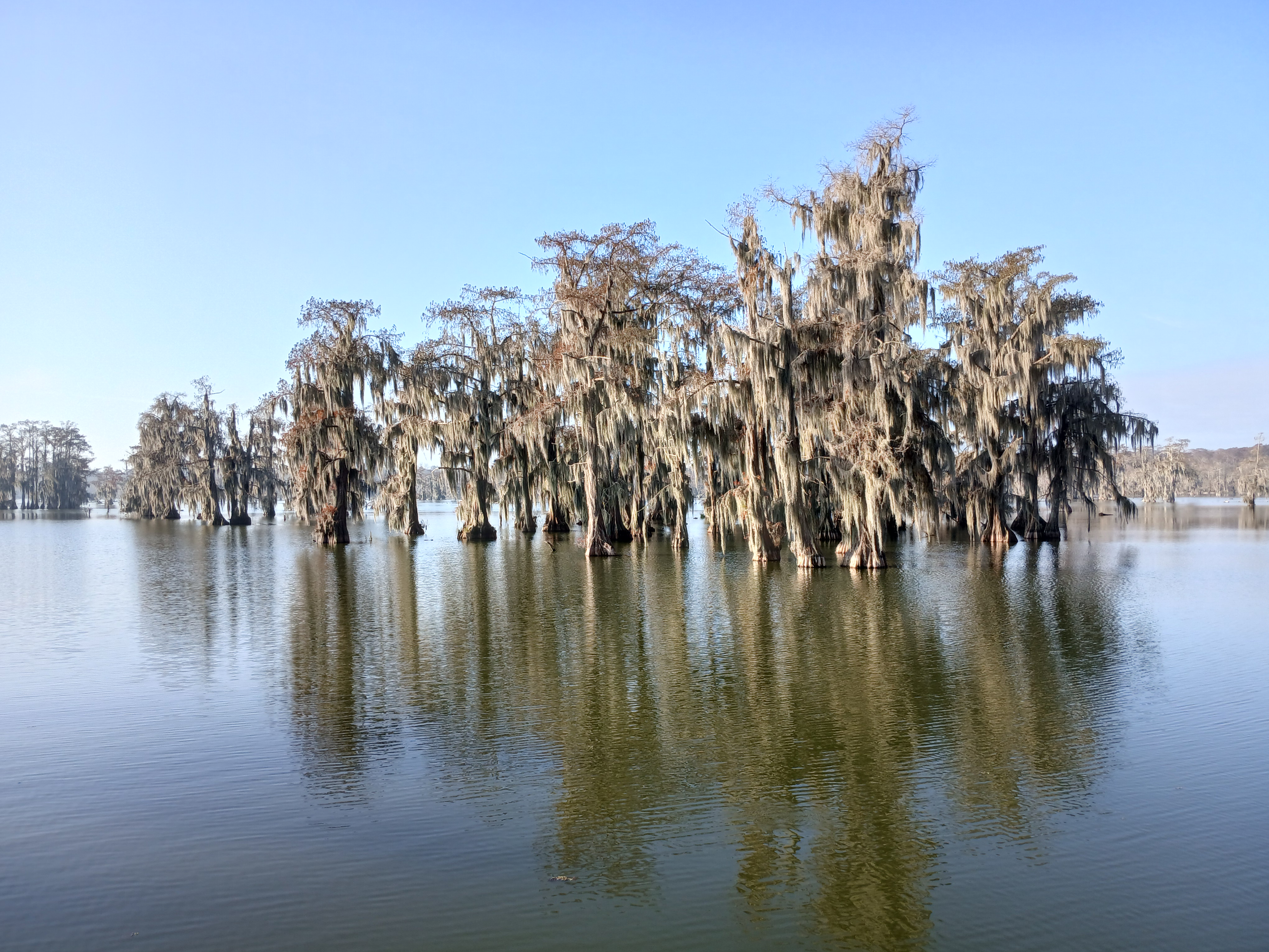
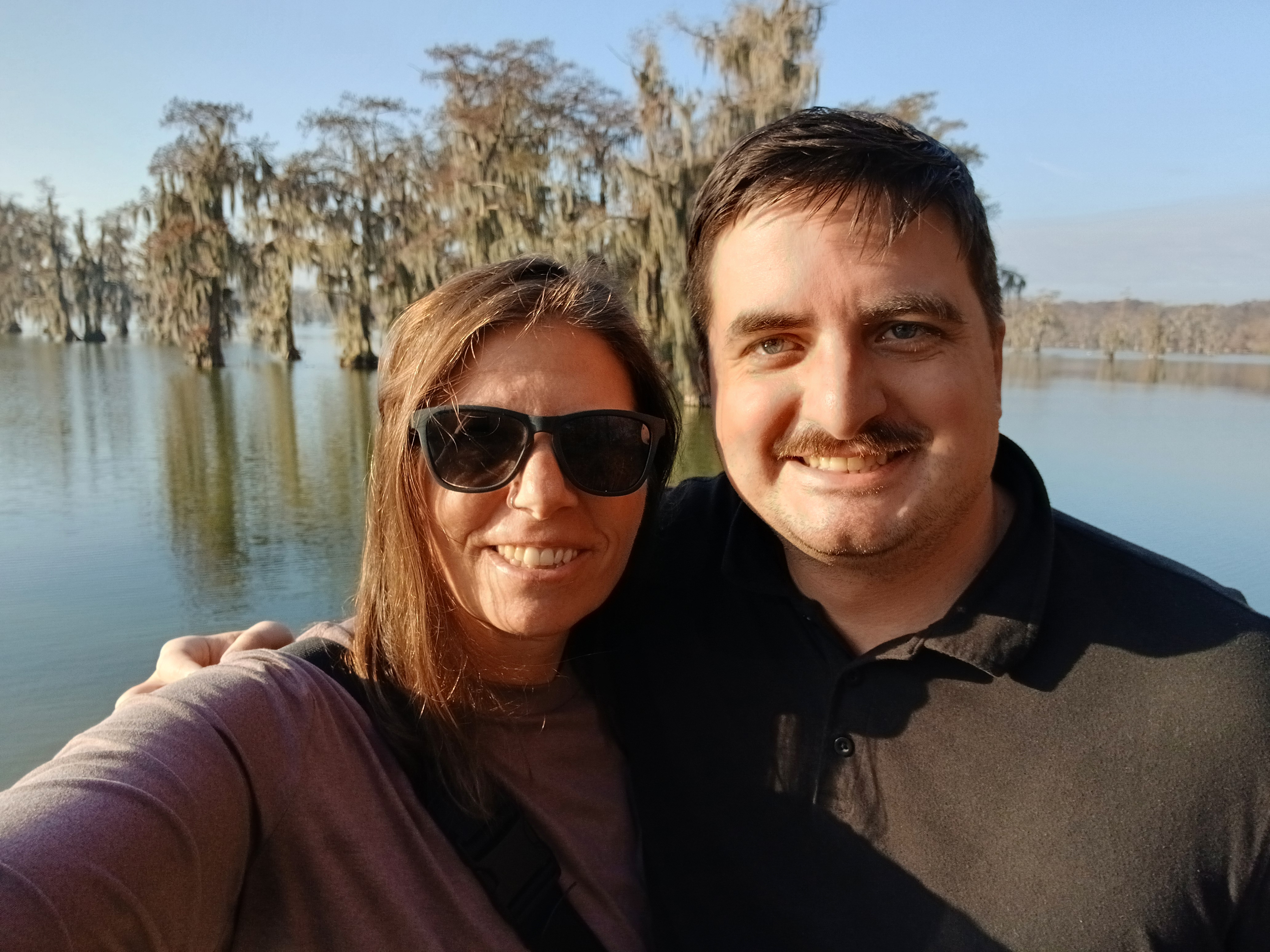
Dan and I walking along the Lake Martin swamp where we saw a huge gator sunning himself on a log.
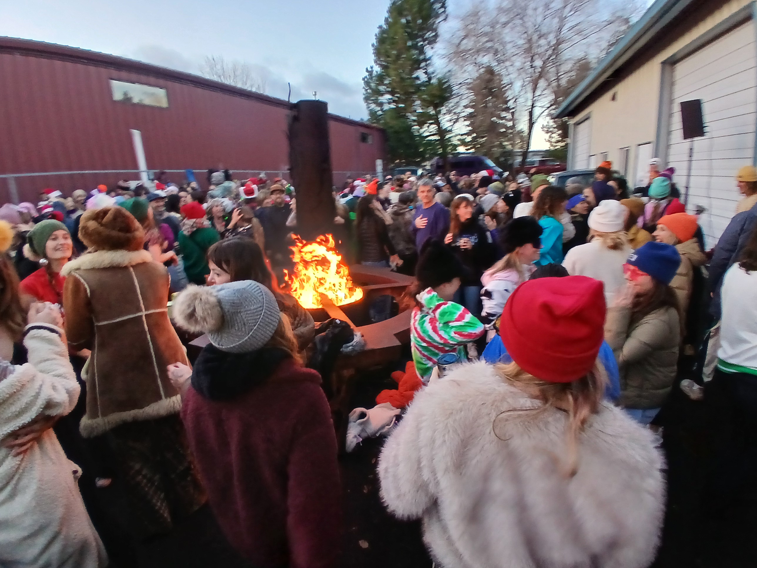
Brooke and Adryon meeting us for dinner and my first sip of a Red Chair beer in a few years.
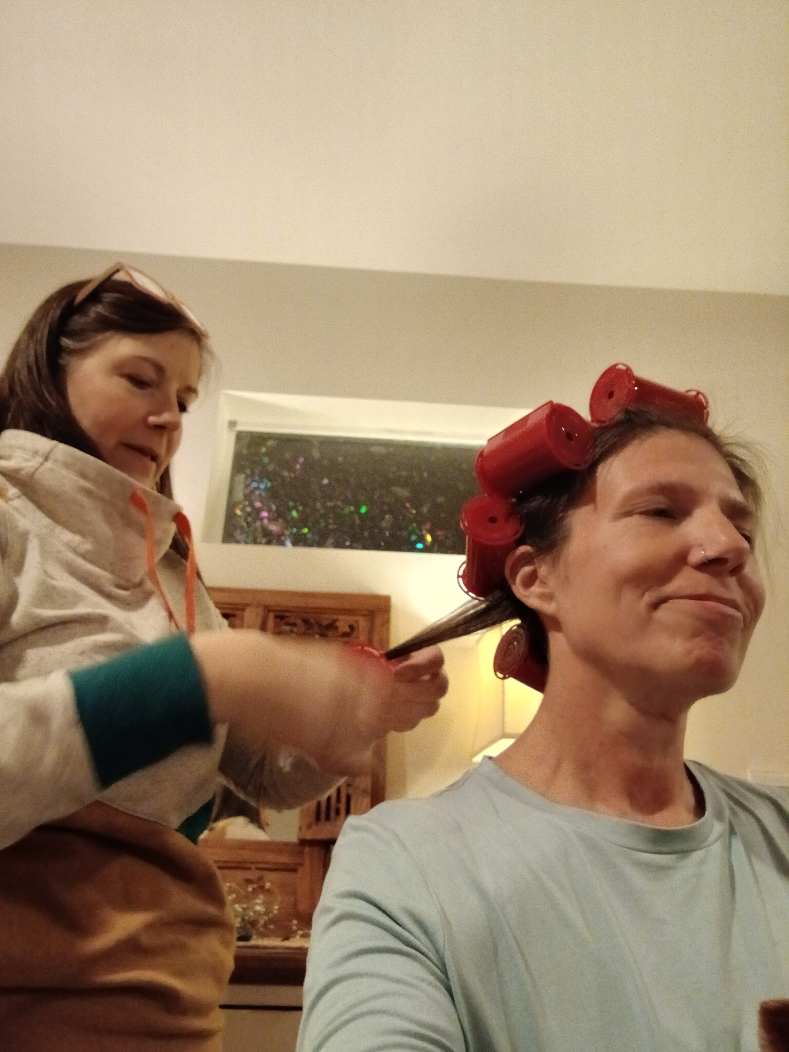
Carrie giving me a make-over.
Marina having us over for quiche and cheesecake.
Cross country skiing again.
Kirk bought me new cross-country skis with metal edges for Christmas. They are quite a luxury as I have only ever owned garage-sale skis from decades past. We took them out to our favorite snow park the day after I got home from Louisiana; the sun on my face, and the quiet swooshing of the skis in the tracks were a balm to my overthinking brain.
Before we left the parking lot, I couldn’t seem to remember how my ski boots worked. It had only been two years since I had skied last, but it was like I had never worn these boots before. Turns out I had grabbed Kirk’s boots, which I had in fact, never worn before. Ha! I can still laugh at myself. The skiing was good, until it wasn’t. It turns out that I can’t use my left pole, and I can’t go uphill. The pressure of the poles, especially when trying to climb anything, hurts my left shoulder too much. In fact, four days after the last ski, my neck and shoulders are so sore that I’m taking daily pain meds again. Is this cancer? Or is this skiing for the first time in two years?
Keep going. I just have to tell myself to keep going.
Maybe the pressure valve that is questioning my damaged body will be released after these next scans, and then I can keep going. I have a number of things I want to do in the new year, but am waiting for these scans to make any plans… I want to be grateful, but I am not sure how to feel most days. Sometimes my morning walk will be enough to trick my brain into being hopeful, and I come home and make my smoothie of broccoli sprouts, spinach, ginger root, flax, chia, hemp seeds, nuts, and strawberries, but sometimes the hope masks itself in feeling normal and takes me to the bakery where I stand in line for something sweet.
I investigate other hiking options: llamas! I could hike with llamas! Or do a car-supported hike, as many people do on long trails when they meet friends or family at road crossings, the car filled with camping gear, water, and food. Or I could do another Camino – I’ve already started outlining what the Camino Ingles would look like. Or tap the friends who said the would sherpa for me. Oh, and then there are the carts. I asked Reddit about hiking with carts, and after a lot of “you’re stupid for asking that question,” I got a few helpful replies, but ultimately I think carts work best on pavement, and that’s not the kind of hiking I’m hoping to do right now.
Is this clinging to hiking an unwillingness to give up the last 24 years of my life when hiking was my all and everything? Probably. I was one of those lucky few who found what lit them up inside, who found what I wanted to do for the rest of my life, who found true freedom and purpose in a life lived on trail. I’m not quite willing to give that up, which may be, or probably is, at the root of my despair.
There are many disabled folks who continue to hike: Bill Irwin hiked blind. Wheelchair Bob is out on the PCT all the time, and a local friend, Geoff Babb, even invented the Advenchair, an all-terrain wheelchair, so he could still get around after his stroke. Hiking with a disability takes more time and more effort, but it’s possible. It’s possible. It’s possible.
Oh, the effort though. I’m getting caught up in the effort of doing all the “right” things to help mitigate my body feeling like a 500-pound elephant sinking into the sea. A part of me knows I will get through this, and may even return to my resting disposition in the clouds. A part of me knows letting myself feel the feelings may be the only way through, and a part of me needs to keep finding the effort that leads to small joys.
This isn’t a cry for help, I’ve done that already. This is an effort to be real with you about those “How am I doing?” questions.
I guess the next update will be in the aftermath of my PET scan, brain MRI, and labs. I’ll be a completely different person then.
Finding joy on the PCT was part of why I kept hiking and made it my career.
Maybe I’ve been going about this year all wrong. Ok, I’m going to backtrack a bit…I don’t think I’ve done it all wrong, there have been a lot of beautiful moments, like when Amber opened up her house to us to have an exuberant birthday party with about fifty wonderful souls who rallied around me even when I spent the day puking. Like when Kirk and I went snorkeling in warm Gulf waters this May, or when I finished the Camino in Spain with two new friends. Is it this book project that’s tethering me to the pain of the year? What if I let that thread go for a while? What if I let the scab grow, which might be faster to do if I’m not picking at it all the time by trying to write too soon?
I’m going to choose joy for a while and see where that leads me.
And yes, that still involves writing, surprise!
Yesterday, I was working through an exercise from Ursula K. Le Guin’s Steering the Craft book, the one about reading your work aloud and having fun with the sound and play of words, and something blossomed inside. I was writing around a scene on one of my hikes, a day filled with laughter and play, and I kept returning to that story again and again over the day. I wanted to be in it. I wanted to keep that scene fresh in my mind because the feeling was so different than writing about how my radiation has made my lower back perpetually painful and tight, or how a different approach to the tumors that surrounded my brain could have left me with memory loss or cognition problems. I want to think about something else for a while.
The hangover from that joy has been growing. I decided shortly after writing that exercise that I wouldn’t feel guilty about having christmas cookies for breakfast. I did eat a few nuts so that I got the protein that I need while taking my morning medications, but I ate cookies. I ate cookies dipped in whipped cream and I didn’t feel guilty about it at all! I decided to take the rest of the year off from guilt as well. If life is indeed short, what would it feel like to search for and create joy while saying goodbye to guilt?
Anyone want to give it a try with me?
Let’s make this a fun experiment…because that’s what I like to do! Let me know how it goes for you: the seeking joy and forgetting guilt for a while part. Perhaps in this next phase of trying to figure out who I am now, I will write about how my experiment is going, and also tell some stories from some of your experiments. When I worked at the publishing company for four years, that time was primarily filled with writing profiles on artists and businesses around town. It wasn’t quite journalism; it was finding what was interesting, compelling, and unique about these community members and sharing that through my writing. What if we do some of that with these stories?
I’m posting this over at Substack as well where commenting is easier.All my posts are FREE. Just click ‘none’ on the subscription options.
In happier times…just a few days ago in fact! At the ONDA Christmas party with Phyllisand Mary, two amazing women.
I’m so tired. Maybe it’s the ghost of the impending anniversaries from December 2024 and learning the truth about my injuries, but what’s my excuse this year? I’m discombobulated. I’m depressed. I’m in pain, and I’m grieving for something. I think it’s for who I used to be.
Yesterday I sunk into the depths of a dispair that I didn’t know existed, but today I woke up determined to have a better day. That looks like standing up without bracing for the rushing pain of low blood pressure in my head and shoulders, and instead slowly moving through it, anticipating the other side of the dizzyness, not getting derailed by the dizziness. That looks like leaving the house to write at a coffee shop where I can type these sentences with the accountability of being a human in public.
I don’t yet have the words to explain why I dip into these deep chasms of weeping, but when I try to understand, when I type out the sentiment behind the feeling, I can at least distance myself from it enough to see it a bit more objectively. That perspective takes on more weight as I circle around and around the idea of writing a book about my cancer experience. “Write from the scar, not the wound,” author Cheri Kephart said in her workshop, and that makes sense for a book. My book will be written from the scar, but this blog is written from the wound. From the bloody front lines of a life torn apart and knitting itself back together. At times I think I’m healing and toughing up, but yesterday reveals that I’m still raw and bleeding. The wound is tender and sore.
Bits from this blog may end up in the book, but I imagine the book will look back on this experience from a larger scale (hello fractal, my old friend). It will be putting all the pieces back together as a work of art, with thought and craft and structure… but now I’m still discovering what the pieces are, and what shapes they take. Writing here is sometimes messy, unshaped, uneven, and scattered, but it’s helping me find the pieces far faster than if I were stewing in this malaise and pain without getting it out into the open and letting it breathe. Writing from the wound is completely appropriate to this phase where I’m trying to make sense of what it means to almost die, to get a second chance at life, to confront my limitations in this new body, all within the context of losing my Dad just a few months ago.
Saw this on Substack and thought it appropriate, is depressed almost the same as stressed? In dessert speak, that is.
In a way, remission has been harder than treatment. At least during the treatment phase, I had a reason for being tired all the time, I had an excuse for staying in bed and not answering my emails. But after? Maybe it’s the scanxiety (the anxiety of the cancer coming back…all to be revealed in my next scans in early January, and every three months after…for the rest of my life) or it could be PTSD from my close brush with death a year ago. Or maybe there is no reason, and it’s just one big pile of shit that threatens to suffocate me each day.
Some days I don’t feel better, and wonder, is this the new normal? Now I’m starting to understand why people give up, why they don’t want to be alive with cancer anymore. But just thinking that thought scares me into thinking that thought will invite it back. If our minds are that powerful, can thinking about it coming back open the door? (proceeds to tear hair out)
Writing here has been such a lifeline; that’s a reason not to tear my hair out. Fun fact: my hair was thinning during the chemo process, but now it’s growing back, and in certain mirrors I catch a glimpse of myself with 2 inch hairs standing up from my part line; it does make me giggle (actually, you can see it in the photo above!). Through writing, I’ve been in conversation with myself and with you, and these connections have been everything. I’m sending out holiday cards this year, and it’s truly overwhelming. I look at the list of people who donated to my go fund me, who sent cards and care packages, who dropped off meals and stopped by for a visit, and there is not enough stationery or stamps to write enough cards. Hundreds of you came through for me this year, and even if you don’t get a card in the mail, please know how important you were and are to me. I’m so rich in friendship, true connection, and love that I know none of this has to be faced alone, even when I feel alone.
So let’s end this blog post on a high note. Thank you for listening. Even if it feels like I am screaming into the void, I know you are listening and care. That helps so much.
For today’s walk I listened to music. It’s a simply wonderful combination: walking and song.
I want you to have an experience with these posts; there are links to songs, videos, other websites, and many various adventures. So here is your invitation to leave the tab open and return to find the link to the podcast or watch the movie. Take a walk and play the song. Think some thoughts and make some notes, or just leave space to let them emerge as the morning or afternoon unfolds. You may need an hour, or two…sometimes you might need a week for your brain to untangle and release. At least that’s how I work. You do you.
Today’s song is Frank Sinatra Jr’s Black Night. If you liked that one, you also might like The Ocean by Richard Hawley, The Rip by Portishead, or Empire Ants by The Gorillaz. The crescendo of each song echoes somewhere deep inside. You know how I wrote about using sound vibrations earlier this year to help kill the cancer? I think that’s what these songs do too. They vibrate something vital inside me, and the result is elation and joy. I hope for you too.
Today I want to talk about creativity as a force for survival.
When my neck started spasming last year, the aspen trees in the glaciated gorges of Steens Mountain had just started to turn gold. I was leading a trail maintenance trip for National Public Lands Day, and I knew something was very wrong. I was due to fly out the very next day to start a 400-mile thru-hike of the Pinhoti Trail, which I would connect to the Benton MacKaye Trail, turn east, and hike to its terminus at Springer Mountain (also the start of the Appalachian Trail). I planned to bookend the hike with a visit to Pinhoti Fest before I started walking, and finish with the Benton MacKaye Trail Association’s Annual Meeting and Hike Fest at Unicoi Lodge in Helen, Georgia. I intended to make further connections with the founders and stewards of both trail organizations to explore how I could add my expertise to their trails with my long-distance trail consulting business. This was a working hike, but also my vacation. Where do I stop and my job begin? I’ve never really known, having always (or most of the time) worked within a passion.
That beautiful fall day changed everything. Once my neck started to spasm on the last evening of the trip, the jolts continued to shock me, racing from my brain, down my spine. I had no clue what was going on, and quickly said an early goodnight to my volunteers as tears streamed down my face. I thought rest and lying down might ease the bewildering condition, but no. My neck spasmed about every five minutes during the long, late-September night. I cried with fear and pain, hoping the others couldn’t hear the extent of my anguish. Something was very wrong.
I avoided facing the truth even after I managed to make the five-hour drive back to Bend and directly to an urgent care. An exam showed nothing of concern, so we blamed the spasms on a few nights of a poor pillow. I could still hike, right? Meanwhile, on the East Coast, Hurricane Helen had just hit land, tearing up the communities, towns, trails, and mountains where I had planned to hike. I rebooked my flight for a few days hence to see how my neck and the storms would play out.
This wasn’t supposed to happen, to my body or the inland communities along the Appalachians, but one thing was clear: much of the region I was planning to hike in was devastated. On the bright side, the Alabama portion of the Pinhoti Trail was spared, but it seemed in poor taste to frolic down the trail when people were suffering just a short distance away in Georgia.
The east coast hike wasn’t going to happen, so I fixated on the Oregon Coast Trail. This 413-mile hike was close to home, had many towns (meaning I could find an easy out if my neck continued to give me grief), and I had already planned to be away from work for a month, so I threw myself into last-minute planning to walk a month along the sea.
I planned to travel to and from the trail all using public transportation; it would be a cool experiment! Since my passion is my work, I started to turn this trip into another opportunity to evaluate the resources and infrastructure of the trail to see how I could improve it from a hiker’s perspective. I decided to start my hike a week out from that urgent care visit, which would give me time to get a few sessions of acupuncture and massage, and push past the pain in my neck to keep going and hike anyway. I’ve done it before, hiked through fresh and recent injuries, that is.
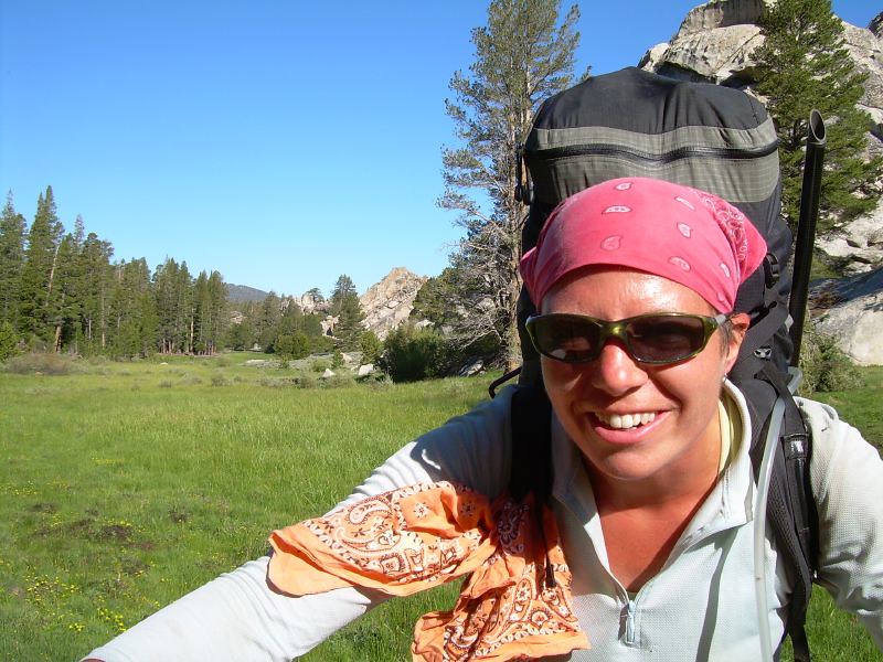
The day before I started my October groundtruthing hike of the Blue Mountains Trail in 2020, I walked out of the house barefoot, and a stray nail sticking up from the door frame tore a fourth-inch chunk out of the sole of my foot. The flapper was deep enough that I had ripped through a significant portion of skin and callus. I panicked, immediately cleaned out the wound, put some antibiotic ointment on it, and elevated my foot until Kirk came home from work. I shook as I showed him the wound, but slowly convinced myself and him that I could keep it cleaned and protected as I hiked for a month solo on a difficult backcountry route in north eastern Oregon. And I went, and I was fine. So I’d be fine this time too, right?
After a week of treatments, I was convinced this Oregon Coast Trail thing was a go. Kirk and I decided to head up to Waldo Lake for the weekend in our camper so he could foilboard while I read in a chair in the sun. I still wasn’t 100 percent, but I had convinced myself I would heal on the hike, much like I had done on the Blue Mountains Trail. The morning we were set to leave, I was stretching when something twinged in my back and I instantly knew I wasn’t going hiking anywhere. All the progress I thought I had made was gone in that twinge. I didn’t tell the rest of my body, though, and I packed up my backpack and headed out for the weekend. Over the next two days, it was apparent that I was having trouble moving normally. Carrying much of anything caused more pain, and I finally voiced out loud that I wouldn’t be hiking the Oregon Coast Trail. I returned home in a slump. Two hikes had now been thwarted in the last week.
Now what?
It wasn’t until I was on a morning walk recently that last year’s hiking (or non-hiking) saga gained more shape. I headed out into the frosty morning with freshly charged earbuds in place and strolled along my normal route along the Deschutes River. That morning, I listened to Rich Roll’s podcast featuring author and fellow cancer navigator Suleika Jaouad, and I saw my decisions in the wake of my physical limitations in a new light.
Suleika has experienced survival as a creative act. I read her first book, Between Two Kingdoms, this year, shortly after my diagnosis, and quickly pre-ordered her second book, The Book of Alchemy. The more I learned about her story, the more I identified with her struggles. When I heard her leukemia returned for the third time before the launch of her new book, my heart just bled for her. For us.
Back to last October: when I realized that I would not be hiking the Oregon Coast Trail, I decided to go ahead and do it anyway, but from home. I decided to embark on a virtual journey and pretend that I was out plodding through the sand and feeling the rain sting my cheeks in groves of old-growth trees that rim the bluffs over the Pacific Ocean. I would virtually hike the Oregon Coast Trail.
Ever since I set foot on the Appalachian Trail back in 2002, I kept a daily journal. Those hand-written missives from the AT are lost, but from then on, I wrote and posted them online. From my hike during a break from grad school along the West Highland Way, to my thru-hike of the Colorado Trail and the culmination of my summer of leading trail crews, I chronicled the rain, sleet, and snow. The blisters, spider bites, and those few times I caught myself on fire from my beer-can stove. Yes, there were multiple times. Over the years, I shared my joys and struggles with a small group of loyal blog-readers, but more importantly, I found great joy in writing for the love of writing. I didn’t care if anyone else read about day 56 on the Pacific Crest Trail or day 5 on the Sunshine Coast Trail, I loved waking up in the early morning and capturing the feeling of the day before.
So when my body wouldn’t let me hike last fall, I decided to wake up early each morning, read the guidebook (shout out to Bonnie Henderson and her excellent resource), reference the FarOut app for real-time updates from other hikers, study the weather, decide how many miles to walk, where I would camp or find lodging, where I would eat, what interesting things I’d see during the day, and how I would navigate the many gaps in the trail. I wanted to turn this virtual hike into a visual journey as well, so I planned to create a story map that I would build on, publishing each new day on the story map as I would on an actual thru-hike. The Oregon Coast Trail is a logistical melange of hazards like high tides, which make certain sections undoable, or eroding cliffs from a perpetually stormy sea. I wanted to experience those hazards, even if remotely, and decide how I would proceed if I were actually there.
Story mapping had become another passion by this point, and over the past few years, I had been creating them professionally for other organizations. The medium harkened back to my college days where I dove into multi-media projects, combining images with prose, sounds, and even videos. And since my virtual hike was quickly becoming another work/passion project, I decided to add on elements from a second business I had started recently, called Intentional Hiking.
Yes, the title gives it away – with Intentional Hiking, I hosted several conversations a month about ways hikers could cultivate a deeper engagement with the world around them as they were out for a day hike, week-long backpacking trip, or a long thru-hike. I invited experts to talk about things like collecting data for Adventure Scientists, learning how to identify plants and animals to contribute to research projects on iNaturalist, or even how public land management agencies are integrating Traditional Ecological Knowledge of indigenous peoples into federal planning processes. To apply this to the Oregon Coast Trail, I decided I would identify several aspects hikers (and I) could engage with as we walked. Those items were categorized and marked on the maps as: Fun Facts, Trail Stuff, Environment, Military History, Exploration History, Tribal Nations, Art and Culture, and Take Action. Each morning, I would wake at my usual 4am, spend the next 4-5 hours researching, writing, and adding on to my story map, and publish that day’s hike on my blog.
By the second week, my creative act had become a bit oppressive, given the sheer amount of time it was taking me to create each day’s exploration. The added weight of my painful body didn’t make things much easier. After my morning creation, my days were filled with appointments. They ranged from sessions with a physical therapist, massage therapist, chiropractor, acupuncturist, and my primary care doctor, with little result. I could barely move.
I kept going because that’s what I do. I finished the project on October 31 to reflect when I would have finished in real time. I remember my neck and back were feeling a hair better…in fact, everything was feeling a tad better, that is, until I slipped and fell on a wet floor while shopping on November 1. It was the kind of fall that you knew would be bad on the way down. As my feet flew out from under me, I had long enough to notice the “caution wet floor” sign by my right leg, and also know I was in trouble. I landed hard on my right glute, whiplashed my head, and passed out.
I will tell you the rest of the story another time, but needless to say, my troubles were only getting worse, and I was still about two months out from my cancer diagnosis. Life sucked, but it sucked less when I could focus on things like the virtual Oregon Coast Trail by ignoring my pain as much as I could to do something that brought joy.
I want to say many more things about how the creative act is survival. Many of you have seen it play out in real time through my blog this year, so stay tuned as I unpack more layers of pain and being so that I can continue to not just survive, but thrive through my creativity.
Slueika was in remission for 10 years before her cancer started growing again. The road ahead seems so long that I think the only thing that can get me through this is exploring what it means to be alive, creatively. And what a gift to the world that Slueika and her husband and musician Jon Baptist are giving to the world by doing the same.
Check out American Symphony on Netflix if you want to learn more about these two, they take my breath away.
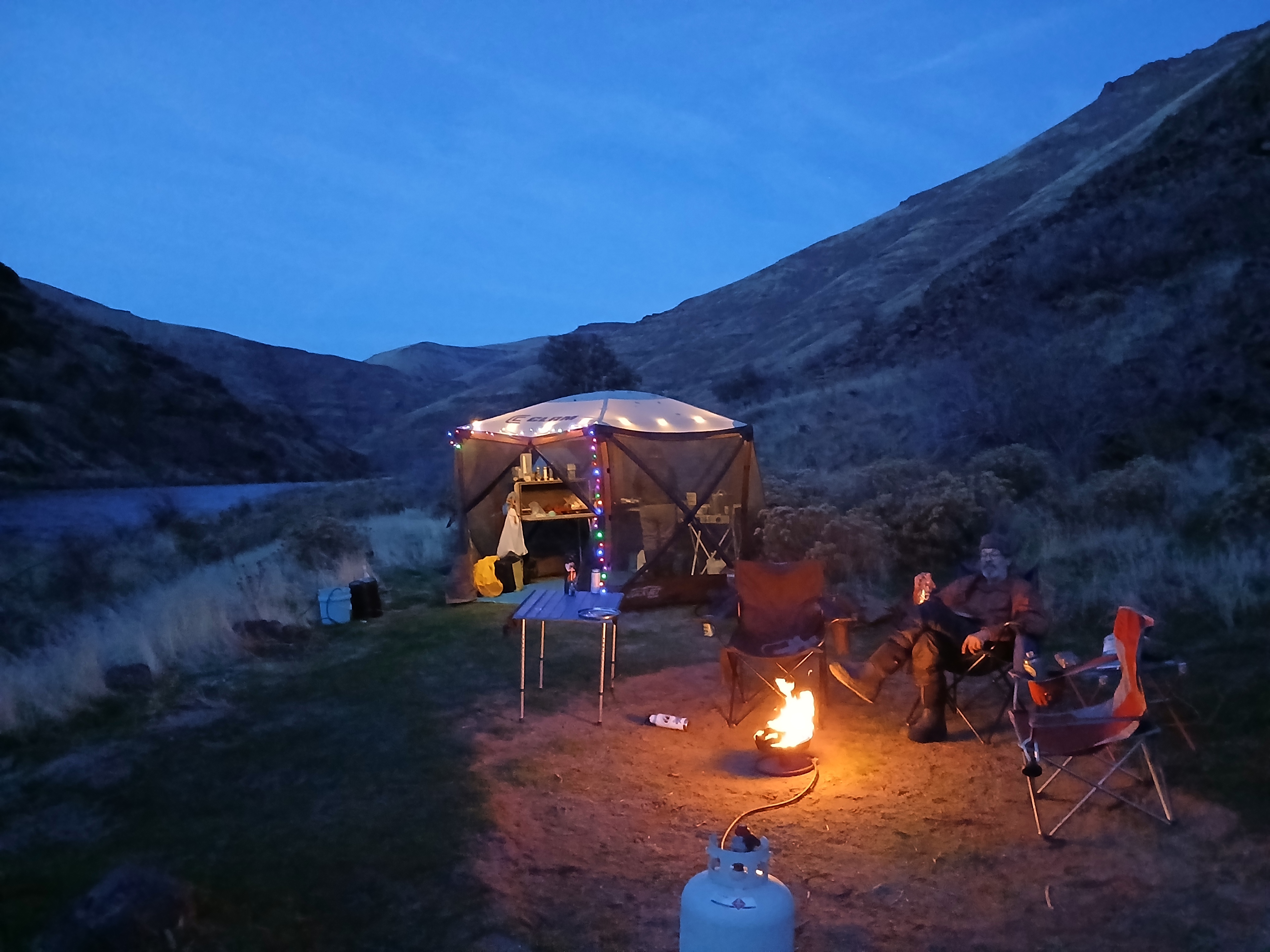
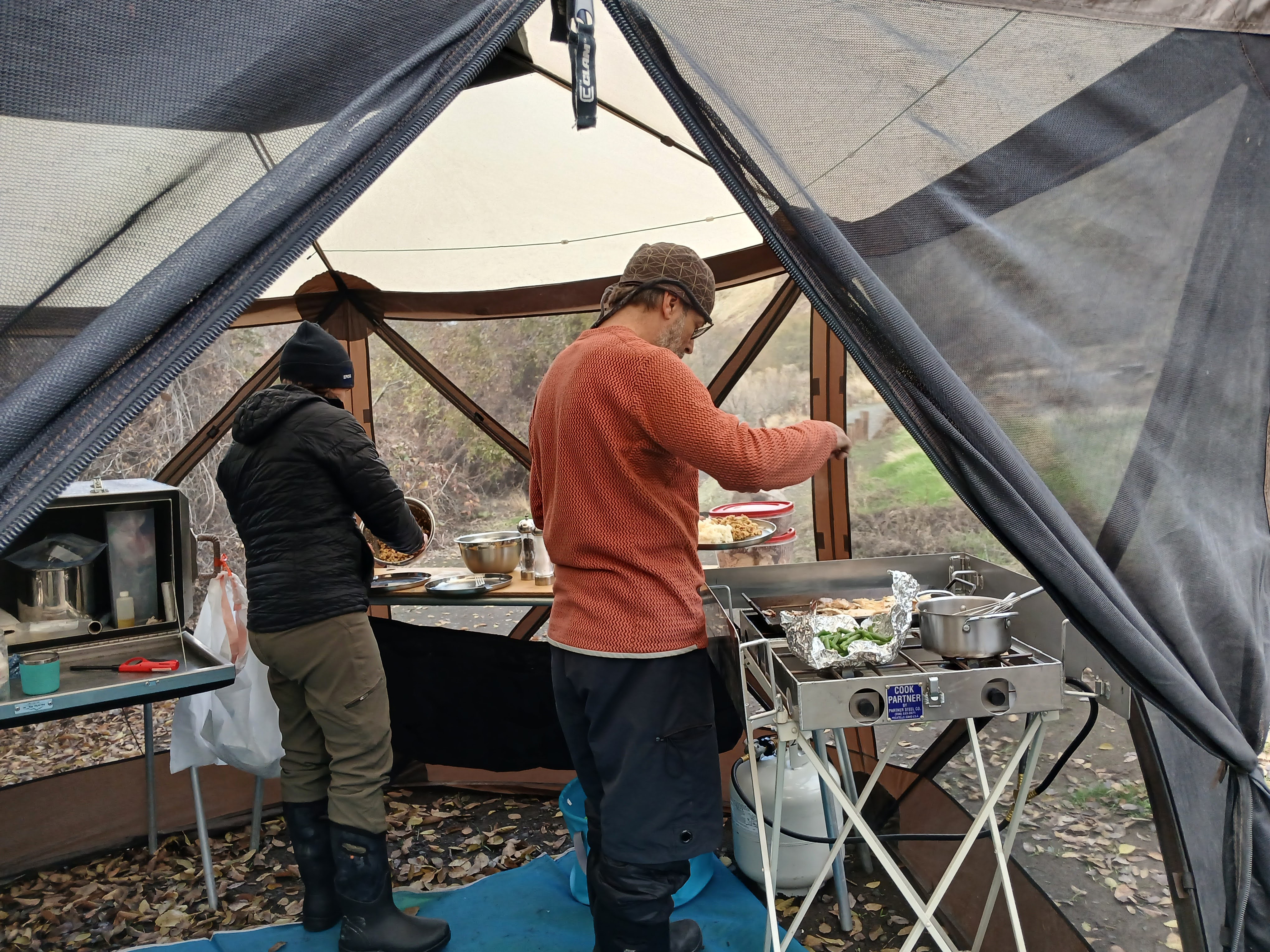
2025’s Thanksgiving on the River Crew – Cindy, Kirk & Moi (photo courtesy of Cindy)
Kirk and I have had a Thanksgiving tradition of heading to water for the last 10+ years. It probably started because he just loves a flowing river, and even though my river time had been limited before we met, I quickly took to the eddies and riffles as he showed me the ropes of paddling, rafting, and floating downstream.
One of our first trips was a packraft adventure on the North Fork of the John Day River. You can read all about it here:
click for the full post…
We had many other adventures on the water, most frequently coming back to the banks of the Lower Deschutes River as it usually had the most water of any of Oregon’s rivers in late November. We would invite various friends, sometimes it would snow, sometimes it would drop into the single digits, and sometimes those friends never returned for another water-logged Thanksgiving trip…the cold really highlights how a four-day sufferfest can drive people indoors, even if we bring multiple pies.
This year my longtime friend Cindy decided to brave the unknown, and possibly rainy weather to accompany us on our float, and she was rewarded with mild temperatures and minimal splashing as I had asked Kirk to find the smoothest and driest lines through the rapids – my neck and spine still can’t tolerate much jostling.
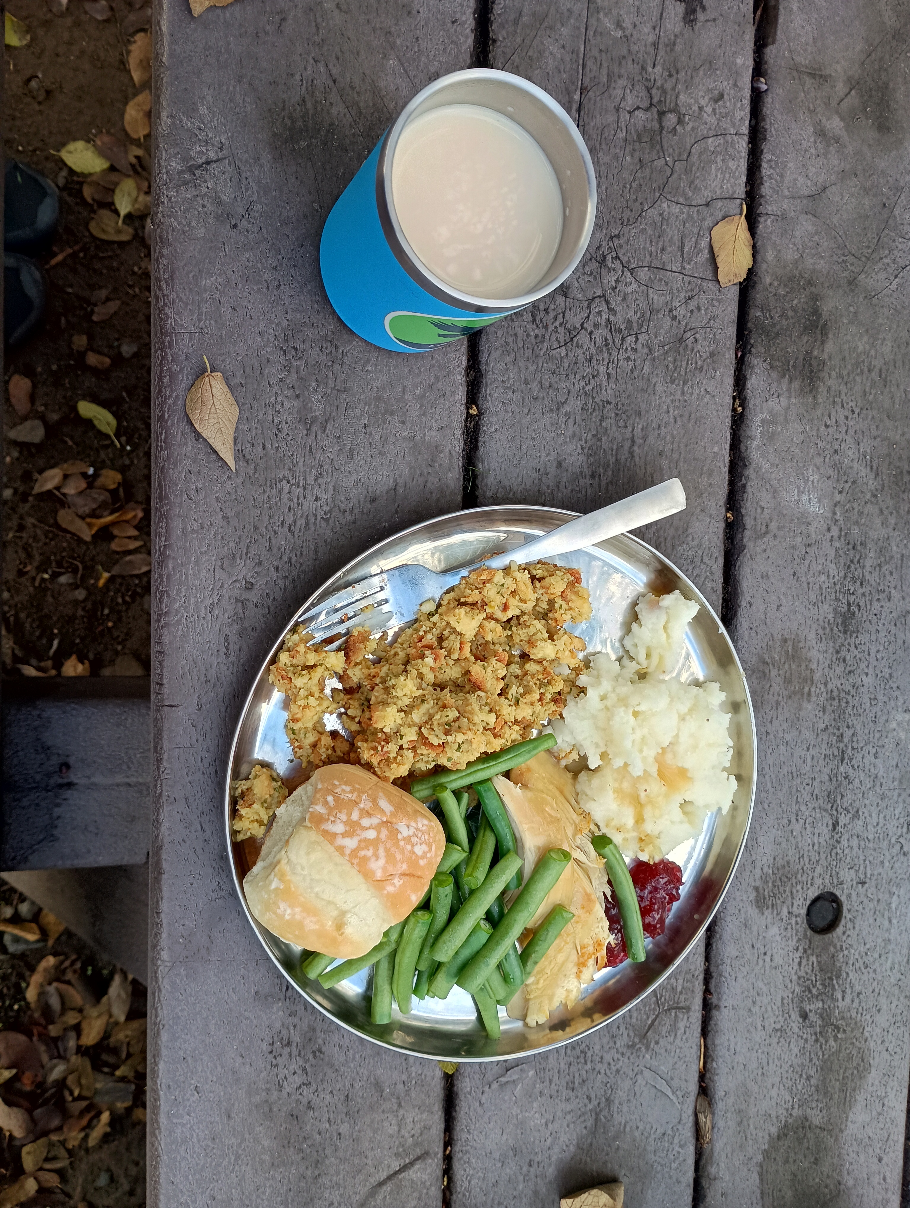
We launched on Thanksgiving morning and pulled over a few miles later to reheat our feast. I don’t think it was the best of our efforts as my turkey cooking the day before was a bit too zealous and left the meat on the dry side, and we skipped the fancy side-dishes for instant potatoes, stovetop stuffing, canned cranberry sauce, and store-bought pumpkin pie, but it was all gravy. As Edward Abby says, “Hunger is the best sauce,” and the smell of the cooking turkey had started my mouth watering a full day before our dinner.
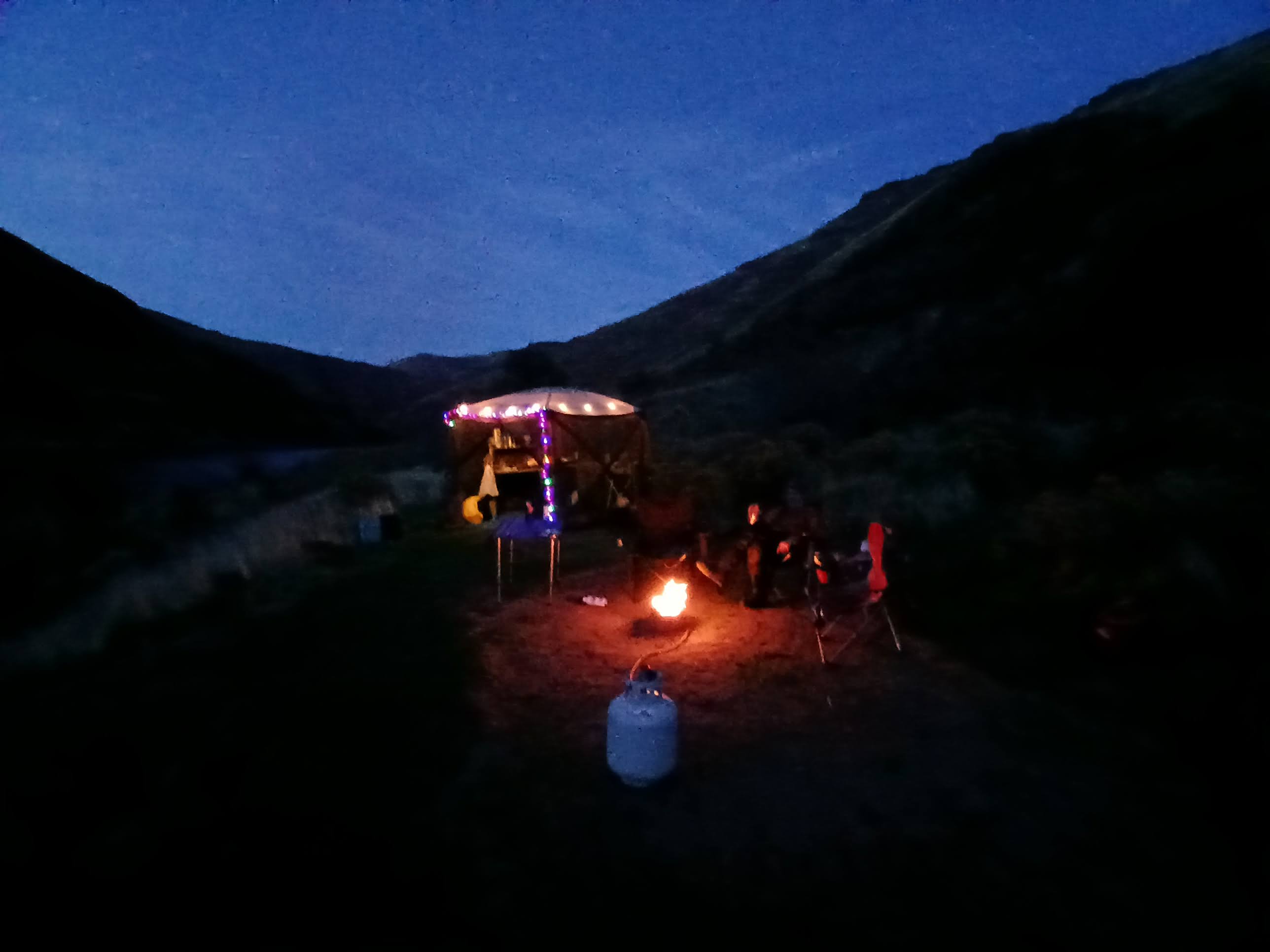
Dark comes early in late November, but I added some festive cheer with some battery-powered lights and hot cider.
The skies were blue and the nights dark, and we all got a solid 10 hours (or more!) of sleep each night.
It is such a gift to be on the river during this time of year. The blue heron was our steady companion each day on the water, and the sound of the current hushed any background noise that we carried over from day-to-day life.