Connecting the Recreation Community to Conservation Issues: It Works!

Since starting my work on the Oregon Desert Trail, I always thought the most unique thing about this 750-mile route was our conservation mission. I know of no other trail with the express purpose of encouraging hikers to develop a deeper relationship with the land they are hiking through, and building on that connection to engage them in participating in our conservation work.

So it’s immensely exciting to see it happening, especially among my friends who decide to hike the ODT.

I wrote this profile on my good buddy Allgood. We’ve been friends for at least a decade, he was the Continental Divide Trail Coalition’s trail ambassador after I was for his 2016 thru-hike, he thru-hiked the Oregon Desert Trail in 2018, and he is now the VP of sales and marketing for Six Moon Designs…my employer for a while a few years ago. Now I am one of their current hiking ambassadors, and it’s thrilling to see an outdoor company I love support our conservation work with proceeds from a new tent they launched yesterday…the Wild Owyhee.

I passed the CDT Trail Ambassador torch (or trekking pole) to Allgood in Silver City before his thru-hike in 2016

Read the full profile below:


Member Profile: Whitney “Allgood” LaRuffa

If you have been following the development of the Oregon Desert Trail (ODT) over the past few years, you are probably aware that one of its primary goals is to engage the recreation community in conservation issues across the high desert. An excellent example of how the ODT has helped harness the passion and drive of the long-distance hiking community can be found in the story of 2018 ODT thru-hiker Whitney “Allgood” LaRuffa.

Spoiler alert: Whitney has created a fundraiser for our work on the Owyhee…scroll to the bottom for more details!

Whitney “Allgood” LaRuffa

Whitney was first introduced to ONDA’s long-distance route when he attended a presentation by our first Oregon Desert Trail hiker, Sage Clegg. He was no stranger to long-distance hiking, having completed the entire Appalachian Trail in 1996 before entering college on the east coast.

Over 20 years later after that first AT hike and with several more thru-hikes under his belt, Whitney was ready to give the Oregon Desert Trail a try. “A big draw to hiking the ODT was getting to see the state I have called home for 20 years at human speed,” he explained. “Bonus: I got to visit places in Oregon I had only read about, but had always wanted to see. It was amazing!”

His thru-hike of the almost 3,000-mile Continental Divide Trail in 2016 was great training for the challenges of the Oregon Desert Trail. In 2018, Whitney decided to undertake a west-bound thru-hike in the fall with two friends and experienced backpackers, Katie “Salty” Gerber and Katlyn “Swept Away” Pickett.

The group expected challenges like long distances between reliable water sources, exposure, heat, and difficult bushwhacks, but in reality, those difficulties made the sweet moments even sweeter.

“The day we walked out of McDermitt we were pretty heavy with a big load of food and water for the next stretch…we had to trudge through some pretty thick bushwhacks and ended the day with a butt-kicker of a climb. As we were setting up our camp we walked out to edge of the mountain and watched one of the most stunning sunsets I have ever seen, and I remember thinking to myself, this is why I do this!”

The three hikers had a fairly short time-frame in which to complete their hike, and in order to finish before their other commitments, had a steady schedule of 30-mile days —  mileage that led to a whole other set of challenges.

“We had so many difficult moments, but the one that sticks out the most to me was the day we went across Diablo Rim. We had been pumping out 30+ mile days for over a week straight, and this day we were all a bit sluggish. With each ankle-rolling step on the cross country section, we winced at our slow progress and aches and pains. That night as we sat on the rim watching the sunset I received news that an old friend had passed on to that great hiking trail in the sky. I sat by myself below Diablo Peak, shed tears, and said goodbye to a legendary hiker. In a way, it was really hard. On the other hand, I felt embraced by the wildness around me on that spot.”

Whitney, Katie & Katlyn at the Tumulus Trailhead

Whitney, Katie and Katlyn finished their thru-hike at the Tumulus Trailhead in the Badlands Wilderness on September 30, just 30 days after they departed Lake Owyhee State Park. All had various minor injuries, but it turned out that Whitney had aggravated an old tendon tear on his right foot, a result of those punishing 30-mile days, and spent the next four months in a walking boot.

But the desert continued its siren call, and Whitney and Katlyn returned to the ODT last summer to join ONDA on a trail maintenance stewardship trip in the Steens Mountain Wilderness.

“My work trip to the Steen was one of the most rewarding vacations I have had in years,” he explained. “ONDA does a great job of organizing the trip and having a great balance of fun times, hard work and free time to explore while out there. As a hiker, it will help you appreciate how much work goes into the trails you get to use, and it feels good to be doing something physical while leaving the resource in better shape for future users.”

Katlyn and Whitney on an ONDA stewardship trip

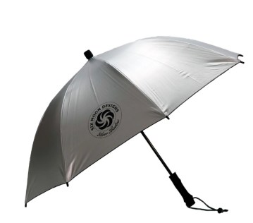
Whitney’s engagement with the high desert didn’t end there, however. Right before leaving on his 2018 hike, he had started a new position at Oregon-based backpacking company Six Moon Designs.

“Hiking shaped my career,” he said. “I went from being a commodity broker in the wood products industry to now selling tents and backpacks, and even designing new gear. While I am out hiking now, I listen to other users so that I can identify problems that need to be solved. I am constantly thinking about new gear ideas and jotting them down in my notebook so that when I get home I can do some design work and get on the sewing machine.

And now…for the good stuff!

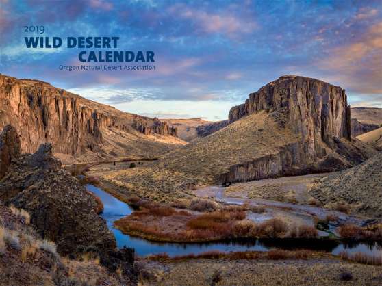
“I feel that one of the best parts of my job is being able to leverage our company’s success to help the greater good by supporting non-profit groups and the work they do to protect the wild places we get to explore,” Whitney explained. “On my thru-hike of the Oregon Desert Trail, I was absolutely blown away by the rugged wilderness of the Owyhee. It is truly one of the most remote and wild places I have ever hiked through. The work that ONDA is doing to permanently protect this area for future generations is something we feel strongly about and we wanted to create a way to help support the effort.”

Whitney’s experiences in the Owyhee Canyonlands and drive to give back our conservation community led to Six Moon Designs launching a new tent: the Wild Owyhee.

“Naming a new shelter after one of Oregon’s most amazing landscapes was a no-brainer, especially since the idea for it came up while hiking through the Owyhee Canyon. Having a portion of each shelter sale going to help its namesake just made perfect sense to us.”

$20 from each Wild Owyhee tent that Six Moon Designs sells will be donated to ONDA, and our work to preserve this incredible landscape. Visit the website to learn more.

Whitney left us with these parting thoughts; we have a feeling we’ll be seeing more of him in the future:

“We are in some crazy times right now and there is a lot of uncertainty out there, however, I know that once the dust settles myself and many others are going to need some much-needed nature therapy,” he said. “I take solace in knowing that when the time is right I will be able to once again go explore the remote areas of Oregon’s desert, soak in its hot springs, and hike among the sagebrush.

“Now more than ever is the time to keep supporting groups you believe in, or a small business you care about and want to see survive. I hope everyone is staying safe and healthy and using this time to plan their next trip in the wild regions of Oregon once we can get back out there.”

I love design

I love making things, especially graphics. Even better? Graphics revolving around my true love: thru-hiking. I had a freelance design business for a while, and while I’m more in the hobby phase now, I’m still creating here and there, mostly for fun. Then when I started the business Hikertrash in 2014, I got to translate some designs into actual products. But really, I just want to make things.

My most recent logo collaboration was launched last week.

Anish is a true badass. She thru-hiked the Pacific Crest Trail in 60 days, 17 hours, 12 minutes, then wrote a book about it; then I got to hang out with her a bunch when she thru-hiked the Oregon Desert Trail in 2017. Anish returned to the triple crown trails in 2018 and hiked all THREE in one year (called the Calendar Triple Crown), and that trip also meant she had completed the triple triple crown, meaning she had now hiked all three long trails (AT, PCT, CDT) three times each. (I’m not worthy). Anyway, She is a truly lovely human being, and it was great fun to work with her on her logo redesign.


I’ve made logos for some outdoor companies, the most recent was also for a product I’ve been using since the lovely Mandy “Purple Rain” Bland (another fabulous thru-hiker) started her business in 2014, Purple Rain Adventure Skirts:

With a few different versions

My good friend Whitney “Allgood” LaRuffa started working for the hat company Crown Trails Headwear after his thru-hike of the Continental Divide Trail in 2016, and the business was looking to create a series of designs for the National Parks, so I whipped up some concept designs:

Then when I worked for the lightweight gear company Six Moon Designs a while back, they were looking to brand their ultralight sun umbrella. I was given the name: Silver Shadow, and came up with this (which you can get on any umbrella you order even today!)


So the company hikertrash that I started with Brian Frankle (and have since sold to Matt “Boomer” Romero) was great fun, and I made some of my favorite designs to this day for the brand.

I think my favorite product was the first one we made…the original hikertrash trucker hat.

And all of the hikertrash designs were proceeded by my brief business: Bike Bend Wear. I came up with about a bunch of different bike designs, made a series of screenprinting screens, then printed the images on thrift store clothing.


I’ve served on the board of several non-profits in town and had the opportunity to help these new organizations create their brand identity.

The Oregon Outdoor Alliance was first started with a few folks drinking beer around a picnic table, and now is a state-wide organization with a mission to unify and inspire Oregon outdoor industry businesses. I offered to make their logo and first, second, and even third versions of their website (I am NOT a website designer, but can make it look good). Our gatherings around the picnic table turned into the Beer:Thirty events, and I made a logo for that too, which we first printed on Silipints (another Bend company).

While I worked at a local publishing company as the arts magazine editor, I was an early board member of the Arts & Culture Alliance, and made their logo too.

I got really involved with the Continental Divide Trail Coalition before, during, and after my thru-hike in 2015. I was their first trail ambassador that year, and worked closely with Executive Director Teresa Martinez. She loved the hikertrash brand, so I used the font I created for hikertrash for a few logos for the CDTC. All of these ended up on t-shirts and hats!


I have been putting my graphic design skills to work for the Oregon Natural Desert Association, and really like these two logos:


Finally I work on logos for friends. Here are a few:

Logo love.

Gear Review: TOAKS Alcohol Stove & TiStand

Stoves have come a long way since I started backpacking…or maybe I’ve come a long way. Regardless, I now have a system that far outshines the whisperlite stove I started with. When thru-hiking the Appalachian Trail in 2002 I often started the picnic table on fire when there was too much fuel in the line, finding and filling the bottle with white gas wasn’t too hard, but the weight and hassle (cleaning it…don’t get me started) of it all seems hilarious when I think back on it.

I started using alcohol stoves for my next thru-hike on the Pacific Crest Trail. My homemade beer can stove worked, but this time I started myself and my sleeping bag on fire, had the jb-weld that I used to fuse it together fail on me half way through the trail, and watched the top of my stove pop into the air when it finally failed…I was truly a danger to myself and the forest around me.

Now, I have the TOAKS Titanium Siphon Alcohol Stove, and it’s astonishingly easy to use, efficient, safe, lightweight, and yes, I might even say sexy.

Some of the things I love about the TOAKS alcohol stove?

You can turn it off. The big problem with most alcohol stoves is that once you pour the fuel in and light it, you have to wait until the fuel is all burned off to either add more fuel, or put the stove away. You definitely do not want to put a stove in your pack that still has traces of denatured alcohol in it only to have it run over the food in your food bag or over your gear. You REALLY do not want to try and add more fuel to the stove if it’s still lit. Yes, I’ve made that mistake, and yes I burned myself. The TOAKS stove has an open reservoir that you pour the fuel into which includes a barely perceptible double wall design that helps to pressurize the fuel into hot jets of fire so you can cook your meal, but once your water is boiling, or you dinner is ready, you can take the lid from your pot, cover the stove, and extinguish the flame. Once the stove has cooled off a few minutes, you can pour the extra fuel back into your bottle. This alone would make me use the stove, but there are some other very fine features:

It is efficient. I told a friend about this stove last summer, and being the gear-head he is, decided we should do a stove-off and test the TOAKS stove against a few other alcohol stoves on the market (and one of my old homemade versions) to see how they performed. Bill has been using the Trail Design Kojin stove, and the Trail Designs 12-10 stove, and in his words, “The TOAKS kicked my ass for boil time.”

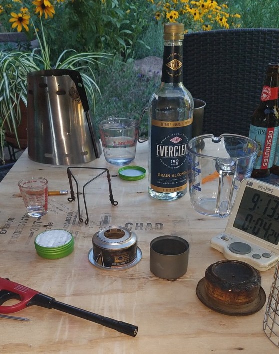
We used 300ml of 50 degree water for each test, One ounce of 190 proof Everclear grain alcohol, and the same pot and windscreen to keep things equal.

The results to a rolling boil were:

TOAKS: 3 m 50 s
Trail Designs Kojin: 4 m 20 s
Trail Designs 12-10: 5 m 20 s
Renee’s homemade stove: big fail

The flame the TOAKS version pumps out is impressive. I was demoing the stove for some folks at the OR Show last summer in front of several gear-jaded hikers, and I was able to knock them out of their trade-show daze by setting the stove alight and boiling some water…to gasps and awes. Yes, it’s powerful.

I even took it on a ski tour trip recently and melted snow for water. I never would have taken an alcohol stove in cold temps when I needed a workhorse of a stove to melt water, boil water, and cook my dinner, but I was able to accomplish all three tasks with fuel to spare.

At .7 oz (20g) it’s incredibly lightweight, and fits into any pot or cup you may want to use. The new TOAKS TiStand Titanium Alcohol Duel Stand and Windscreen far surpasses the previous stand and windscreen they offered. I often will use the 550ml pot with this set-up as it fits just enough water to make a dinner or cup of coffee for one, and most of my trips are solo anyway.

I made a little video about how to put it together and use it:

So in conclusion:

  • It’s light: Stove – .7 oz, TiStand – 2.5 oz, 550ml Pot 2.6 oz, equals a total of 5.8 oz for your entire cook system. (the whisperlite stove ALONE weighs 15.2oz)
  • It’s efficient: 300ml of water boils in under 4 minutes
  • It can turn off: the lid snuffs out the flame
  • It’s sexy: the clean and simple lines and look of titanium are very visually appealing to this designer 🙂
  • It’s affordable: The stove retails at $39.95, the TiStand at $24.95, and the 550ml pot at $33.95

I’ll be using this stove most of the year on the backpacking and packrafting trips I have planned. It’s important to note that in fire restriction conditions you need a stove that can be turned off. This version would not qualify for an actual off-switch even though you can easily extinguish the flame, but above all else, please don’t start a fire with whatever stove you are using. For most conditions this will be my go-to stove.

Brain on Fire

I so enjoy getting up early. For the past, oh, eight years I’ve been going to yoga before work. It started when I was at a purely desk job at the publishing company, and it made sitting in a chair all day in front of a computer bearable. And I think it helps me be more creative.

Over the past year I’ve been using the mornings that I don’t go to yoga to read. I used to flip through internet stuff on those mornings, and inevitably I came away with an incredible overwhelming sense of despair, so instead lately I’ve been reading books and feeding my brain.

I can’t even list all of the wonderful books I’ve been able to read during these mornings, but a recent one, The Traveling Feast by Rick Bass, really helped me grow the list of other books and authors I want to read. And by the way, if you like writing, nature, food, wine, and the company of inspiring people, I highly recommend this book. All his books in fact.

Anyway, The Traveling Feast took me to Barry Lopez, an Oregon author, whom I had never heard of. The foremost travel nature writer??? How did I not know him? I checked Horizon out from the library, and also got a ticket to a reading he is giving next week in Bend. Score! Did I know if I liked his reading? Not yet, but yes. I do.

I’m only a third through Horizon, and this morning his words hit me hard.

Movement and words. Yoga and books. My favorite things right now are a morning routine that is helping me be more creative and is helping to catch my brain on fire.

To books, nature, movement, and contemplation!

More Wild and Scenic Rivers!

So I realized there are 51 waterways along or near the Oregon Desert Trail that don’t have Wild and Scenic designation. So I nominated them all.

Oregon’s Senator Wyden has open nominations for new Wild and Scenic Rivers until January 20. This is historic! What rivers do you want to nominate?? Get it!

Read my submitted 51 river nomination and submit your own today:


51 Rivers That Could Be Wild and Scenic

Owyhee River packrafting

Dear Senator Wyden,

Thank you for your visionary leadership to preserve Oregon’s wild rivers, clean water, and wildlife for the future. I sincerely appreciate this opportunity to help develop legislation to protect my favorite rivers.

For the past four years, I’ve been working to establish the 750-mile Oregon Desert Trail, a project of the Oregon Natural Desert Association. Since your announcement of this Wild and Scenic nomination process, I realized that 51 different unprotected rivers, streams, and creeks are found along our immersive desert backpacking route.

In 2016, I hiked and packrafted the entire 750 miles of the Oregon Desert Trail. After six weeks of walking and paddling through the desert from Bend, through the Fremont-Winema National Forest, Hart Mountain National Antelope Refuge; Steens Mountain Wilderness; the Pueblo, Trout Creek, and Oregon Canyon Mountains; to the most dramatic of all of our high desert treasures: the Owyhee Canyonlands, I came to understand firsthand how important these natural water sources are to the health of the desert landscape. These waterways support important intact habitats and sensitive species and are also crucial to that thirsty long-distance backpacker after a 20-mile day of hiking in the sagebrush sea.

Clean water sources are not only important to the safety of hikers, but they support other primitive recreation opportunities across eastern Oregon. Sections of the Oregon Desert Trail can be packrafted, kayaked, or rafted, and paddling these desert rivers presents an incredible opportunity to view the landscape from a different perspective. Much of the Owyhee River is already protected as Wild and Scenic, but the stretch below the dam which continues through dramatic rock formations and past enticing side canyons is also an excellent section to explore from an inflatable packraft. I’ve also paddled the lovely Chewaucan River in the spring snowmelt, enjoying the stately Ponderosa pines and early-blooming balsamroot lining its banks. I believe that rivers are trails too, and I am always on the lookout for other remote paddling experiences along the Oregon Desert Trail.

I would like to advocate for the inclusion of the 51 different unprotected waterways along the Oregon Desert Trail in your upcoming legislation. I nominate these rivers for Wild and Scenic River designation:

1. Chewaucan River
2.  Honey Creek
3.  Little Honey Creek & Tributary
4.  Poison Creek
5.  Deep Creek
6.  Guano Creek
7.  Guano Slough
8.  West Road Gulch
9.  East Road Gulch
10. Rock Creek
11. Dry Creek
12. South Ankle Creek
13. Little Fish Creek
14. Mud Creek
15. Bridge Creek & Big Bridge Creek
16. Riddle Creek
17. Coyote Creek
18. Mann Creek
19. Castle Rock Creek
20. Little McCoy Creek
21. Cottonwood Creek
22. Big Alvord Creek
23. Little Alvord Creek
24. Pike Creek
25. Indian Creek
26. Willow Creek
27. Little Cottonwood Creek
28. Arizona Creek
29. Vanhorn Creek
30. Denio Creek
31. Kings River
32. Big Trout Creek
33. Sage Creek
34. McDermitt & NF McDermitt Creek
35. Willow Creek
36. Little Whitehorse Creek
37. Antelope Creek
38. Fifteen Mile Creek
39. Doolittle Creek
40. Whitehorse Creek
41. Cottonwood Creek
42. Oregon Canyon Creek – East Fork
43. Oregon Canyon Creek & Tributary
44. Indian Creek
45. Rattlesnake Creek
46. Antelope Creek
47. Middle Fork Owyhee River
48. South Fork Carter Creek Tributary
49. Succor Creek
50. Dry Creek
51. Owyhee River

Thank you again for this once-in-a-lifetime opportunity to advocate for desert river protections. On behalf of myself and the hundreds of other hikers and paddlers who explore eastern Oregon each year along the Oregon Desert Trail, I hope you consider these suggestions in your upcoming legislation.

Sincerely,

Renee Patrick
Oregon Desert Trail Coordinator
Oregon Natural Desert Association


Nominate your favorite waterway in Oregon for Wild and Scenic River designation today!

A Hiker’s Relationship with the Land

I wrote a blog post for Six Moon Designs last month on a very important topic:

A Hiker's Relationship with the Land, by Rennee "She-ra" Patrick

Prepping for my ski of the CDT in 2015 with home-made shoe bindings.

As avid backpackers and hikers, we spend countless days, months, even years of our lives outside. Sleeping under trees, swimming in creeks and lakes, cresting saddles and summiting mountains…it is no understatement that significant portions of our lives are spent away from walls, canned air, and artificial light. That extensive time outside can give you a different perspective on what makes a rewarding and fulfilling life. I often hear, “thru-hiking ruins you for normal life.” Spending five months watching your body transform into a hiking machine at the same time watching the ecosystems change again and again is certainly transformative, and I’m not just talking about the transformation of your calves.

All this time spent in nature works on you…in you. Instead of placing a majority of your self-worth in a 9-5 job and quest for accumulating more things and stuff, we start to value the places our legs can take us, and the determination it took to get up on day 145 to keep hiking and see what’s over that next ridgeline.

So much love for trails…and now the ground beneath

As I hiked year after year, the mountains, rivers, and sunsets did infiltrate my desire to live a “normal life,” but I hadn’t spent much time thinking about the land: the forests and deserts, and bodies of water that make epic treks across the United States possible for dirtbags like me and my friends.

It was after completing the triple crown and a bunch of other trails; after about 10,000 miles hiked and at least 500 days sleeping outside, that I started working for a conservation organization and began paying attention to the land and the people that make our long trails possible. Ok, those things were written into my job description, that’s true, but I was a bit embarrassed that it took a job description to get me thinking about these issues. I had the great fortune to start working to establish the 750-mile Oregon Desert Trail (ODT) for the Oregon Natural Desert Association. My role would be to engage the long-distance hiker in knowing the eastern Oregon landscape in a deeper way during and after their hike through the sagebrush sea; to create opportunities for them to see value in the land and intact habitats enough to join the organization in our work to protect, defend and restore the land they were walking on.

She-ra has her dream job to connect hikers to the conservation issues through the Oregon Desert Trail.

And that’s when I realized I already had a relationship with the land, I felt like the out-of-doors was an extension of the indoors, I knew that the health of the landscape that I walked directly supported the life I wanted to live, but I hadn’t spent any energy thinking about our system of public lands, the land managers out there who are charged with the health and vitality of those places, and the countless organizations and people who live and breath trying to defend our trails and landscapes from degradation, exploitation, destruction and more.

That’s when I got excited to help other hikers engage with our trails, routes, and landscapes in a deeper way. Just who are the local, state, and federal agencies that say what can and can’t happen in these places? Just what do these designations mean when I see a sign on the tree that says “Wilderness Study Area” or “Area of Critical Environmental Concern?” What makes these places special, and how are they different from the next area I will hike through tomorrow? What are the threats to these places, the animals, water, and even the views? And what can I do if I want to get involved?

There is so much to it all. And in Oregon where I’m working on the Oregon Desert Trail, most of the land east of the Cascade Mountains (and Pacific Crest Trail) are public, that means those lands are owned by you and me.

It’s time to start paying attention because as it turns out, there are threats, very real threats to our ability to hike on a long trail and trust that the water in the creek is clean enough to drink. That the animals we enjoy watching along the trail have the habitat they need to survive and thrive. That the people whose job it is to make decisions about what’s best for these places have the money, resources, and our support to do so.

Ask yourself: What is your relationship to the land? Let’s just start with the land underneath your favorite local trail. Who owns it, who manages it, what is it managed for, who are the animals and plants that live there; are any endangered? From what? Is there something you can do if you want to have a say in how this place makes it into the next decade? I bet there is. And then try it out on the next long trail you want to hike. What are the issues there? It’s enlightening, and I’ll admit a bit frightening, to look underneath the hood of your next long-distance trail, but I bet the trail organizations who are tasked with its management and development would be happy to engage you in some of the issues.

Whether we like it or not our chosen life (yes, I’ll say life, because it’s a life-long goal of mine and many of my friends to hike ALL THE TRAILS), is not guaranteed, and if we don’t get involved in what makes these trails possible, who will?

My relationship with the land is evolving; it excites and scares me, but thru-hiking has ruined me for normal life. I want to keep hiking, and I wouldn’t have it any other way.

A Summer of Stewardship

About the time the leaves fall from the trees and the first snow or two has hit the mountains, I am again astounded at how fast the year has passed. Granted I’m looking forward to ski season and the slower pace of the fall and winter months, but where did the year go?

20191020_122420

Oh wait! We went skiing last weekend for the first time this year. Exciting!

I didn’t get to any big thru-hikes this year (Sad), but I did get to do quite a bit of hiking, some paddling, a good amount of rafting, a lot of car camping, completed one short thru-hike, and lead a bunch of stewardship trips on the Oregon Desert Trail.

Ok, not too bad of a year I guess.

Kirk and I took 5 days to hike the 40-mile Timberline Trail (5 days!). We dillied and dallied our way around Mt. Hood. Took naps and got late starts to the days. It was wonderful.

We also circumnavigated Broken Top with my good pal Cindy (my Appalachian Trail hiking partner) and her friend Peter.

But the majority of my time was spent leading trail work trips with volunteers. So rewarding. Here’s a quick photo journey into those trips this year.

Fremont National Recreation Trail (and ODT) Work

Steens Mountain Wilderness Trail (and ODT) Work in Big Indian Gorge

Steens Mountain Wilderness Trail (and ODT alternate) Work in Little Blitzen Gorge

Fremont National Recreation Trail (and ODT) Work for National Public Lands Day

I also joined the Oregon Timber Trail (a long-distance bike route in Oregon that has been developing about the same time as the Oregon Desert Trail) for two trail work projects in the Fremont-Winema National Forest on sections that diverge from ODT route in the area.

Oh, and did some hiking and scouting for trails in the Malheur National Wildlife Refuge.

It’s pretty rewarding to be able to put these hours into improving our trails. I may not have hiked as much as I would have liked (is anything less than 1,000 miles on a long trail a year satisfying? not really), but doing so much trail work comes pretty close.


An INCREDIBLE story

When I began to develop the Oregon Desert Trail, one of the important tasks I started to undertake was to connect with some of the private land owners who had parcels on or near the route. While the ODT is primarily on public land, I wanted the people living near it to know who these homeless-hippy types were that they might encounter in the middle of the desert.

County data shows where the private land is, and when I found my favorite app, GaiaGPS, offered a private land layer, I discovered I could easily research who owned what along the route.

Most of the 200-miles of the ODT in the Owyhee Canyonlands region is public land, but I discovered a few small pieces of private in there. When I was researching one particular plot in the West Little Owyhee River near the main confluence of the river, I discovered the owner, David Rumsey, was a big-time map collector. So big in fact, that he had a map library at Stanford University named after him. Wow. I contacted David to give him an update on what I was doing with the ODT, and he responded…offering that hikers were welcome to pass through his land to access the river, and even camp there if they needed. (Note: I’ve been finding a lot of generous land owners along the route who offer hikers access to important resources like water and camping on their private land)

David also explained that he got lost in the Owyhees in the 1970s and it completely changed his life.

I wrote up a story for ONDA’s blog about David’s experience, and I think you might enjoy it too:


An Owyhee Mis-Adventure Inspires Life-Long Mission

When a young David Rumsey’s car broke down in the far reaches of the Owyhee Canyonlands in the late 1970s, he didn’t have any of the devices we’ve come to rely on today. No GPS, no smart phone, no satellite locator beacon.

Rumsey had a map, but at the time the USGS 1:250,000 scale only outlined the vaguest of features. Nearly a decade would pass before a detailed USGS map of this remote area would be published. He had to walk out, unaware of the deep canyon walls and boulder-choked rapids that loomed between him and rescue.

“The nearest habitation was fifty miles ahead of me but only reachable by walking through a roadless wilderness, following the road back out would have meant walking almost twice as far, so I chose the more direct, though uncharted path,” Rumsey explained in the forward to his 2002 book, The History of the American West in Maps.

“It is daunting to look out over a fifty-mile vista and realize that one’s life depends on dead reckoning and that the route one takes is based mostly on hope. Walking those miles was the most frightening event in my life and my closest brush with death. As I stumbled late at night through the silently beautiful landscape, I gained an admiration verging on awe for the explorers who had had no maps at all to guide them.”

The arduous four-day excursion to find his way out of this remote corner of the high desert turned out well in the end. It also ignited a passion.

When detailed maps of the Owyhee region were finally available in the mid-1980s, Rumsey “…filled an entire wall with 1:24000 maps so I could visually re-walk my escape whenever I liked and see the location of my rescue. Maps became the mnemonic devices I used to recall the uncharted wilderness that had changed my life.”

Over the next 25 years, Rumsey collected upwards of 150,000 maps. Many of these maps focused on the American West including early non-Native explorer’s maps of the western territories, maps created by trappers, military expeditions and scientific surveys. His quest to visualize the deep canyons of that experience led him to amass one of the largest map collections in the country.

Today, many of Rumsey’s maps can be found on his free digital portal to the collection, the David Rumsey Historical Map Collection or at Stanford University where they are housed at the David Rumsey Map Center in the Stanford Library. He is also collaborating with the Library of Congress on the map division of its American Memory website.

When a reporter from The San Francisco Chronicle asked him Why?, Rumsey responded, “Some people might think [historical maps are] an arcane subject, but I disagree. Everyone can relate. Everyone is curious about where they live. And every map is like a little snapshot of history; each is a visual history.”

In this case, a visual history that started in Oregon’s remote and iconic Owyhee Canyonlands.

David Rumsey has since purchased a piece of land in the Owyhee region along the Oregon Desert Trail near 5 Bar, the confluence of the West Little Owyhee and main Owyhee river, and generously offers passage through his land to ODT hikers in the area. We are jealous of his view.

Story by ONDA’s Oregon Desert Trail Coordinator Renee Patrick.

This photo of 5 Bar taken by Devin Dahlgren graced the cover of ONDA’s 2019 Wild Desert Calendar. 

Paddling Anxiety

Anxiety. I’m not normally an anxious person, but paddling rivers can bring those feelings up out of the depths of my normal confident nature.

I recently found myself telling a friend that I Iike to paddle rivers in spite of the rapids, not because of them. Maybe this is because I came to rivers in my 30’s, a bit more hesitant to pick up a new extreme sport, or maybe it’s because rivers hold more consequences than trails.

Learning to read a river is like learning to read a new language. Where do you want to put yourself in a river with potential hazards like holes, strainers, undercut rocks and log jams? The risks are bigger and the consequences can end your adventurous life in a second.

But meeting Kirk, an experienced Class V whitewater boater (and guide), was probably the only way I would have approached this new sport. Through Kirk I was able to start learning the language and trust him in the water.

It was been fun and exhilarating, and I love broadening my skill set.

I’m not comfortable in a hardshell kayak… not comfortable upside-down under water, but with the advent of packrafts (lightweight inflatable kayaks) I’ve enjoyed our paddling adventures all over the Pacific Northwest.

I have seen a change in my comfort levels. The first few years I would start many of our trips white knuckled and tense, afraid to make a mistake and swim out of my boat, but I would see Kirk and his friends approach the trips very differently. Instead of a mine-field of potential hazards, they saw a playground full of features to try out moves, surf the waves, and have fun. Could I get to that point where I saw fun instead of angst?

It is so empowering to paddle a section of river that will challenge your skills and be successful, but every time I feel like I’m being put to the test, me against the river. I’ve done some big trips, successfully paddling Class IV rapids, and solo packrafted the 140-mile water alternate to the Oregon Desert Trail on the Owyhee River, but lately we’ve spent more time on rivers I’ve become comfortable with, and I find myself entering that place of enjoyment instead of dread.

There is still that little voice in my head that berates myself for taking the easy way out and not rising to the challenge. I don’t know how to quiet that voice entirely, but I’ve gotten better at not listening to it. Why are we our own worst critics?

So this weekend we paddled a section of the North Umpqua River that I’ve paddled 20 times before, the same section we paddled yesterday in fact! Today I’m going to marvel at the blue-green water, do some more river snorkeling (my new favorite thing in clear river waters) and leave the white knuckling for another day.

River Love

One of the best antidotes after a week filled with people is to get outside. I spent last week in Denver for the Outdoor Retailer show, representing the Oregon Desert Trail, ONDA, and thru-hiking in general. (I talked TRAIL SO HARD). So many good things came out of the week, but being “on” all the time comes with consequences. I’m drained.

So to the river!

Watching water flow in nature is one of my recoup strategies. It’s as simple as that. Throw in some adventure, and bam! I’m back to new in no time.

In honor of our river trip today, please enjoy this flash back to a similar trip on the North Umpqua River a few years ago when Kirk and I R2’d his raft.

…And this one is another one of my favorite river adventures of all time…