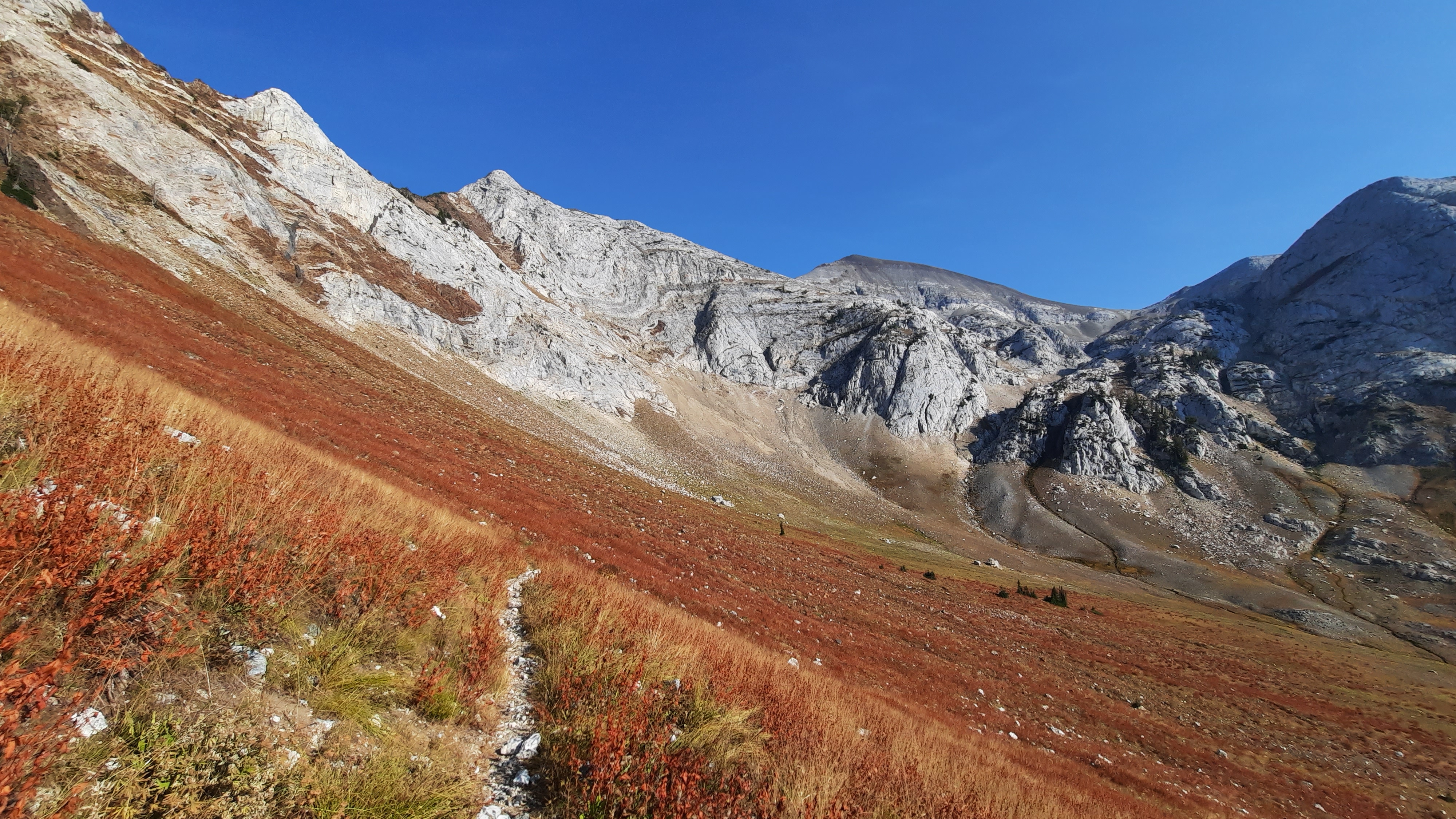
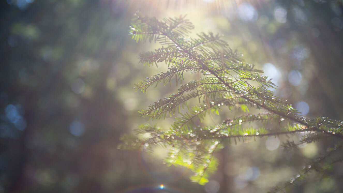
The morning was blustery. Rain fell in sheets on my tent as I peeked outside, and I opted to hunker down just a little longer. Today was the day I would drop over 2,000’ into Joseph Canyon, the literal crux of the developing long-distance hike, the Blue Mountains Trail.
I was ground-truthing the 600-mile route in northeastern Oregon this fall, and walking off an unpredictable and traumatic year. The five weeks I spent navigating, strolling, bushwhacking, jaunting, and practically dancing my way through the remote mountain ranges and deep canyons of this corner of the state was going back to the “real world” for me. As thru-hikers come to know first hand on a long hike, what is real are the climbs, the cold springs, the sunsets the color of flowers. The real world is a tangible place and has been real for time immemorial.
A day welcomes me
My very real challenge that morning the rains wouldn’t let up was to touch the creek and canyon that was the birthplace of Cheif Joseph of the Nez Perce tribe, or the Nimiipuu people. A steep cross-country descent down an untested path would be much easier if I waited for the rain to stop and the sun to dry the mud and grasses; mud and grasses which would surely send me sliding down uncontrollably if I tried to hike it too soon. So I waited in my tent…waited for the sun and the wind to tell me it was time to go.
My escape from a global pandemic, from economic uncertainty, social unrest, and political theatrics was to find my rhythm in walking. In walking through a landscape that had been explored on foot for tens of thousands of years. My going back to the “real world” was based in a time frame that we can’t even begin to imagine. I may have been the first solo hiker to walk the proposed Blue Mountains Trail, but I was not the first to walk these canyons. I owe much to those who came before me, those who called these places home. And I wonder, can I call these places home?
To thru-hike is to know a place intimately, to know many places intimately. Experiencing the landscape at a three-mile an hour pace is to absorb the folds and tucks of a mountain ridge, to feel the change in air patterns as you drop into a drainage that flows through eons of rock and shifting fault lines. When I’m hiking, I feel like I am home, and for most of humanity, this was literally home. We lived so close to the trees and wildlife that we viewed them as family, and I am starting to as well.
A rare non-selfie on the Blue Mountains Trail
Thru-hiking opened my mind and body to the rhythms of the seasons and patterns of the landscape, and when I read indigenous author Robin Wall Kimmerer’s book Braiding Sweetgrass, I started to truly understand what I was already coming to know: that I could call these landscapes home. That the way forward through and out of our current modern-day traumas hinged on learning how to exist and thrive in these places. My ancestors did not live in Joseph Canyon, were not chased by the US Army over 1,000 miles from their birthplace in the Wallowa Mountains, but I am comforted by the sun, nurtured by the rains, and soothed by the trees in the Nimiipuu homelands.
I recently listed to a talk Robin gave, and she echoed words from an elder who told her that many descendants of colonizers seem to act like they “still have one foot on the boat. ‘They’re acting like they’re not really here. That they’re just going be here and to take what they can get and go somewhere else.’ Well, there isn’t any ‘somewhere else’ anymore.” To become “native to place,” she explained, is “to live as if your ancestors were from here and live as if your grandchildren are going to grow up here.”
The mindset of many who followed the false narrative of manifest destiny was an extractive one. The westward expansion was fueled by a desire to “tame” the wild places, the wild beasts, and the people who had lived in the wild longer than western civilization had existed. The mindset of many was to view the land as a resource to be used and profited from.
Thru-hiking has helped me understand these truths and look beyond them. I understood when I walked through a clear-cut, then walked through a lush and diverse stand of old-growth trees. I understood when I walk above the dammed Snake River and then along the free-flowing John Day River. Thru-hiking has helped me become native to place, not just along the Blue Mountains Trail, but to all the places I’ve hiked through over the past 20 years.
The Appalachian Mountains were teachers of persistence as I labored up the roots and rocks of the 480-million old range that had once towered to heights rivaling the Rockies and Alps. The sky islands of the Arizona Trail taught me resilience as I marveled at the biological refugias interspersed between vast tracts of desert. The extensive playas and sagebrush sea of the Oregon Desert Trail taught me humility as I placed myself in time with the oldest (known) evidence of human habitation in North America. These places are home, and to know that is to have a relationship with the land.
I get so much from spending weeks and months of my life walking and sleeping on the earth. What am I giving back? I start with gratitude. I thank the sun for warming me, and the springs for their cold water. I talk to the deer and elk, and even the rattlesnake and bear. I try not to face any part of nature with fear, but with humility and an open heart. We are not pitting ourselves against nature. That paradigm does not help us find a way through an environment practically poisoned by our antics of the past few hundred years, but we are a part of nature. We are supported by these very same living ecosystems that we have been extracting “resources” from to live in our walls and drive our cars.
We thru-hikers have something to teach and something to learn. We can teach others how to see these lands as home, and how to treat these lands as family. We can learn from the land when it’s an appropriate time to hike 2,000’ down into that canyon, and how to coexist within a network of life. We may not have grandparents and great grandparents that slept in these canyons and caves, but we can be native to place. We can help the world see what Robin Wall Kimmerer so eloquently teaches: reciprocity. And we can continue to learn from those who have lived here since time immemorial.
Read about the history of the Blue Mountains Trail in a blog post I wrote for Katabatic Gear.
I’ve been learning a lot about the history of the Blue Mountains Trail since setting out in August to ground-truth 100 miles of this potential 600-mile route. The current alignment of the route appears like a swirl around the stunning granite mountain ranges in north eastern Oregon, but diverges significantly from the original vision for this trail, born in 1960 on a horsepacking trip in the Blue Mountains.
In fact, what I initially thought of as a recent effort by the Greater Hells Canyon Council to create an immersive backpacking experience designed to engage the recreation community in conservation issues has a much longer and varied history than I could have imagined.
As with many good ideas, this one grew out of a love of place. Blue Mountains Trail founder and Oregon conservation icon Loren Hughes had a long and active relationship with the forests and rivers in the Blue Mountains. Just a few of his monikers include director of the Hells Canyon Preservation Council (now the Greater Hells Canyon Council), director of the Oregon Wilderness Coalition, and “Mr. Five Cent-er” a nickname bestowed after he successfully used one 5-cent stamp to appeal six US Forest Service timber sales. In addition, this tireless environmentalist was active in efforts to form the Eagle Cap Wilderness and North Fork John Day Wilderness…an incredible resume for a man who spent a significant portion of his livelihood as a jeweler in La Grande.
A young Loren Hughes – photo from GHCC
Save the Minam Crew – photo from GHCC
Loren’s vision gained steam when he appealed to friend Dick Hentze, an avid backpacker and Baker City school-teacher, to help him with the trail idea. The two spent the next several decades dreaming up their route, exploring possible alignments in the mountains, and with Dick’s love of maps, they created the first iteration of the trail, an 870-mile loop originally conceptualized as the Blue Mountain Heritage Trail.
What these men proposed was a circular route that touched Hillgard Station; a state park just north of La Grande (and a stop on the Oregon Trail in the mid-1800’s); followed the snaking river canyons of the Umatilla, Wallowa, and Wenaha Rivers; took a turn along the rim of Hells Canyon (the deepest river canyon in the country…yes…deeper than the Grand Canyon); to skirt the southern edges of the Wallowa Mountain Range and back into the mountains via the Burnt River and over to the John Day River drainages and back around to Hillgard Station.
Just a quick glimpse at a map reveals miles and miles of trails crossing all through these mountain ranges. It was surely a difficult task to decide what would be the best routing for their vision…I would guess there are hundreds of route options that would give hikers an immersive journey into the heart of north eastern Oregon. In fact, their research revealed the original route would encompass 2,000-miles of additional trails. Can you imagine?
At the heart of this trail effort was the Hells Canyon Preservation Council (which later was renamed as the Greater Hells Canyon Council or GHCC). The group was created in 1967 to stop Hells Canyon and the Snake River from being dammed, actions that later led to the protection of the area as the Hells Canyon National Recreation Area. The men played key roles in the efforts to honor the natural wonders of the area, and those who knew them well will be thrilled to know the trail is routed through the Wenaha-Tucannon Wilderness, Eagle Cap Wilderness, North Fork John Day Wilderness, North Fork Umatilla Wilderness, Strawberry Mountains Wilderness, Monument Rock Wilderness, Elkhorn Mountains, and Hells Canyon National Recreation Area.
2010 marked a big year for the Blue Mountains Trail. By that time the men had engaged another passionate outdoorsman and life-long eastern Oregonian, Mike Higgins. Mike had also been intimately involved in local environmental efforts, and served on the board of the Oregon Natural Resources Council (now called Oregon Wild) prior to getting involved in the resurrection of the Hells Canyon Preservation Council. Together the men had formed a nonprofit, partnered with the Forest Service, engaged interested parties in Baker City, and had generated considerable excitement in the local and recreation communities.
Mike Higgins – photo from GHCC
In fact, when looking back at several articles written about the trail in that time-frame, I was curious to find a major motivating factor for all parties involved was to help diversify the economy in the area and develop the recreation infrastructure that would attract foreign tourists to these far reaches of Oregon. A European backpacking-style experience was envisioned, and the route was designed to lead hikers to roads or trailheads every 10-12 miles or so where they could be picked up by a local inn or bed and breakfast, shuttled around each day, and essentially slack-packed the entire route (hiking with just a day-pack). Inspirations for this style of hiking can be found all over Europe like the Camino routes in Spain and different footpaths in England and Scotland.
However, routing hikers to roads and trailheads frequently meant they wouldn’t be experiencing the deep wilderness areas where bears, wolves, elk, and cougar still roamed freely. Trails can be designed with many different user experiences in mind, and this one was a noble effort at getting more people out in approachable sections of trail while spending time and money in the communities that serve as the backbone of this region. (I would definitely stay in some of those bed and breakfasts if they are still on the route today!)
Despite all the energy and excitement around the trail two-decades ago, a series of tragic events derailed the efforts, including a deep and personal loss in Dick’s life. The trail idea was still alive on the backburner, but major efforts to move it forward were at a standstill until 2016. At Loren’s unfortunate passing, the Greater Hells Canyon Council renewed their efforts to realize the Blue Mountains Trail and included it in their strategic plan.
Enter GHCC board member Jim Kennedy. Jim and his family loved exploring different landscapes on trails, and with the GHCC’s renewed sense of purpose to complete the Blue Mountains Trail, he shared the vision with his son, Jared Kennedy. It sounds like Jared positively jumped at the chance to continue the dream, and the two of them poured over the previous trail materials with Mike Higgins.
Jared explained that he noticed some of the most iconic, scenic, and remote parts of the Blues were missing from the original route, so he set to work rerouting and revising the alignment to find a new way to tie the ecoregion together into a thru-hike. That’s about the time that I got involved in the effort, and over a series of phone calls and emails with Jim and Jared, I encouraged them to think of a route concept, similar to what the Oregon Natural Desert Association had created in the Oregon Desert Trail (or ODT, a 750-mile route that I have been working to establish for the last five years). I shared examples of the numerous resources that I had created for the ODT, and learnings from the relatively fast trajectory of the Oregon Desert Trail from idea to reality in just a handful of years.
An additional objective that Jared brought to the table was including the high peaks of the Wallowas, Elkhorns, Greenhorns, and Strawberry ranges. The three men also identified key peaks, wilderness areas, state parks, and towns they wanted to include in the alignment, and the current spiral shape of the now 600-mile path formed in response to these highlights.
Another reality set in when Jared, Jim, and Mike looked at the current landscape to find numerous fires had burned through some of the stunning sections of the route, and many miles of trails and roads had been neglected, ignored, or deliberately decommissioned. A tricky issue is that many of these routes still appear on maps, when in fact they don’t exist in a hikeable form today. Mining claims have popped up along sections of the trail (this area has a long long history of gold mining), private land boundaries have changed, and poison oak, blackberries, and deadfall create additional barriers on the ground.
The original Blue Mountains Trail is shown here in gray, with one of the first alignments of the “new” BMT overlaid in color.
This year Jared had a line on the map, and the goal was to find enough hikers willing to brave the unknown conditions to hike and document what was actually on the ground. I volunteered at first mention, and enticed some other experienced hikers I know to try and hike the entire route as well.
And what are we finding? An amazingly scenic and remote outdoor experience. Yes, some of the trails have been damaged by fire, are overgrown, and are blocked by tree-fall, but since there are several of us out hiking this year, we are exploring different options with the hope of finding an alignment (or as I like to say, the path of least resistance) that “goes.” If the Blue Mountains Trail can be hiked through a series of trails that are still in passible shape, connected to roads which bring hikers to and from towns, then later down the line some sweat can go into opening and clearing some of those neglected trails once again. As with many long-distance trails, each year brings changes in the mileage and in the alignment. This effort will be ongoing, but by using the route concept, the Greater Hells Canyon Council should be able to get folks out there hiking sooner rather than later and slowly work towards the deeper wilderness experience that still touches on the incredible communities found along the way. Although the European-style hiking concept will likely be modified from the original 10-12 miles between trailheads vision, I can easily imagine a scenario where a hiker can still get picked up from a trailhead, shuttled back to a cozy bed and hearty meal for the night, and whisked back to the Blue Mountains for the next leg of their journey.
There is so much more I want to explore about the Blue Mountains Trail concept, including the love of place this route hopes to inspire in the recreation community; the understanding of the Native American and homesteading histories of this region; the geology, habitat, and important ecological lynchpin nature of this area; the roles hikers can take if they are moved by their experience to get involved in the many conservation issues facing this corner of Oregon…there is so much more to say. Stay tuned for more explorations into the story of the Blue Mountains Trail…it will help prepare you for your hike out there when it’s ready to go!
The eating habits of thru-hikers can be quite abysmal. We typically look for calorie-dense, easily accessible, and cheap options. This is where you can insert the ongoing joke of thru-hikers eating a snickers bar a day (but seriously, I have eaten a snickers bar a day for some of my adventures).
Access and price are often determining factors when filling your food bag, especially when you decide to resupply on the way, meaning for the duration of a hike your provisions come from the next grocery store you encounter. Sometimes that grocery store is a gas station or remote wilderness outpost where you are lucky to find ramen, pop tarts, chips, and candy at three times the usual cost.
For many of the 13 different long-distance trails I’ve hiked over the last 20 years, resupply along the way has been my strategy. It massively cuts down on the logistics of putting together food boxes before you go (can you imagine how many food boxes you would need for a 2,000-mile trail?). Buying your food along the way can lead to more flexibility, for example: if you send your food box to a post office, you are tied to the post office’s open hours (which can be quite minimal in very small towns), where most grocery stores (and gas stations) keep much longer hours. Buying along the way also allows you to change up your diet as your tastes change. I’ve met more than one hiker that got a deal on 200 energy bars of a certain brand only to find by week two that they couldn’t stomach eating even one more….and…as luck would have it…those bars were in every pre-made resupply box for the whole trail.
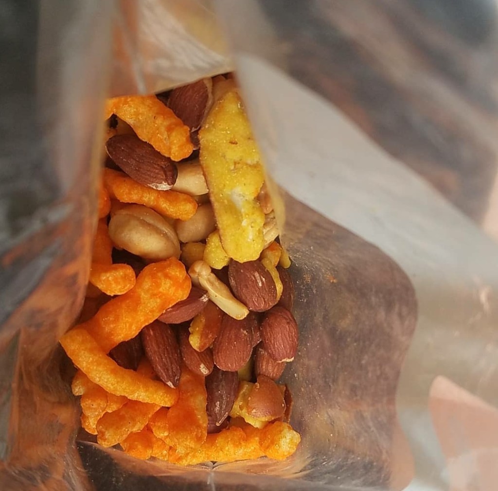
Now that I’m in my 40s, I’ve started experimenting with eating more nutrient-dense and healthy foods off-trail, so accordingly have begun to experiment with how I could eat that way on the trail. No more She-tos for me! (The She-to mix combines cheetos – a long staple in my trail diet – with nuts and cheddar pretzel bits. If your blood pressure just went up reading that, then you get the salt-bomb intent of the snack.)
She-to mix
I’ve had some hikers try to impart the wisdom of nutrition on the trail over the years; probably the most passionate food-aware hiker I know is Zoner, who I met in 2006 on the PCT. Zoner created his 2,000-mile Hot Springs Trail with the express purpose of routing you through towns with farmers markets. His real agenda for this route was to help hikers eat better. Wow!
Katie Gerber is a nutritionist who hiked the Oregon Desert Trail a few years ago and is a frequent guest on hiking podcasts to talk about eating and nutrition on the trails, she also has a hiker nutrition consulting business. So the knowledge and resources have been there for a while, I just needed to listen.
Last year I started to experiment with a plant-based diet. I was given the nudge by my good friend Carrie and her journey in exploring how food can improve different aspects of life.
What changed my perspective about my eating habits was considering food as medicine, that everything I put in my mouth could be working for me instead of against me.
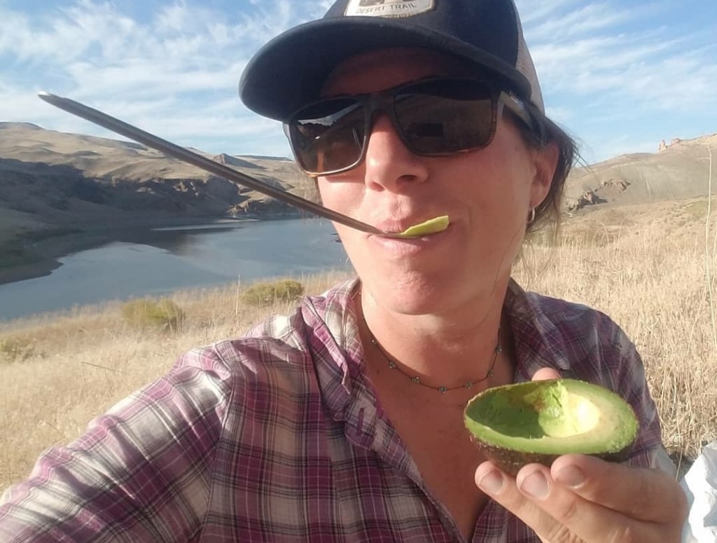
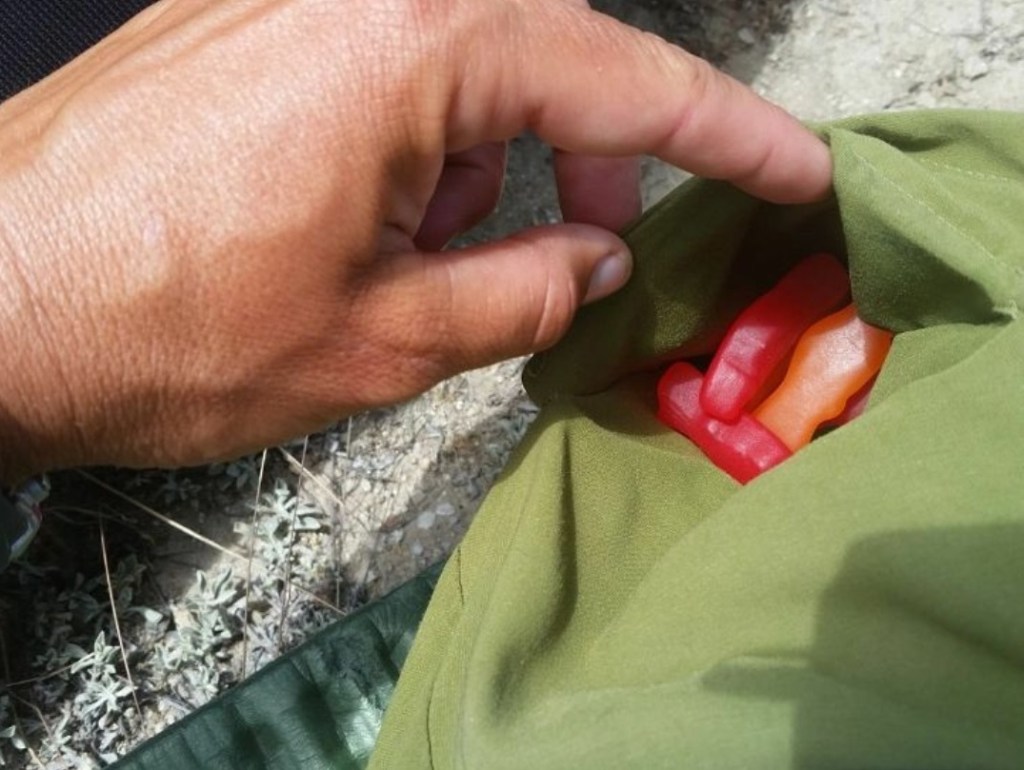
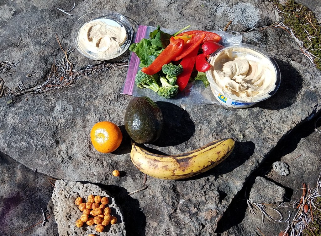
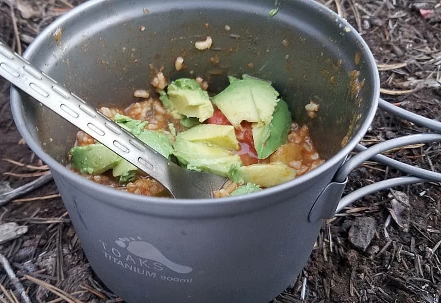
Once I started eating this way I would bring actual fruit instead of gummy bears on a hike (I used to say I would eat something from the gummy family every day on a thru-hike). Instead of chips, I choose roasted chickpeas or veggies and hummus. Instead of a potato bomb (ramen with instant potatoes to soak up the salty msg soup), I would eat meals from Food for the Sole (a vegan and gluten-free backpacking food company started in Bend), or something that had a list of ingredients that contained real food (can’t pronounce an ingredient? Don’t eat it).
Pocket of gummies
the way lunch can be if you try…
I know, I needed to do this years ago.
For short trips this strategy works great! Kirk and I hiked the Timberline Trail around Mt Hood last year, and for the 5 days we were out I could eat and carry lots of fresh foods, but for longer trips fresh gets heavy, and the availability of good fresh fruits and vegetables in gas stations or very small remote towns can be hard to come by.
Then the pandemic happened…I let the global pandemic derail my new-found good habits, and I’m still not quite where I’d like to be with treating everything I put into my mouth as a performance enhancer or detractor. (It really can be that simple).
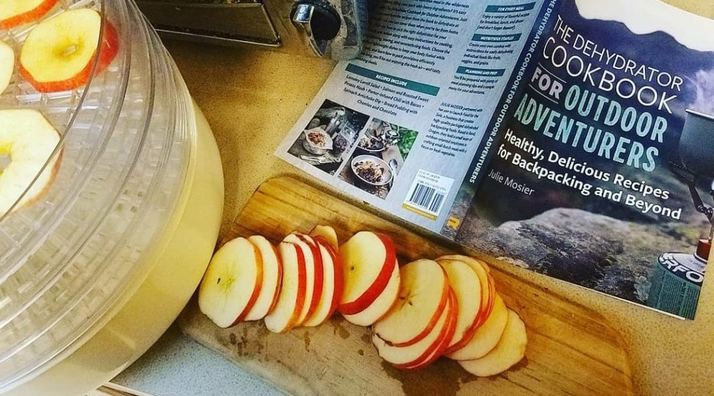
But I’m trying to pay attention to how my body feels and acts when I eat certain foods and think critically about changing my resupply strategy thanks to COVID. On a recent 100-mile section hike to ground-truth part of the Blue Mountains Trail, I hiked out of town with 7 days of food. 7 days is really the longest stretch I’ll do between resupplies. It’s just an almost unbearable weight and quantity if you try to carry much more than that. I spent some time dehydrating food and making my own cold-soak lunches and hot dinners. I carried dried fruit, dried veggies, and tried to find bars and other snacks with as few ingredients as possible.
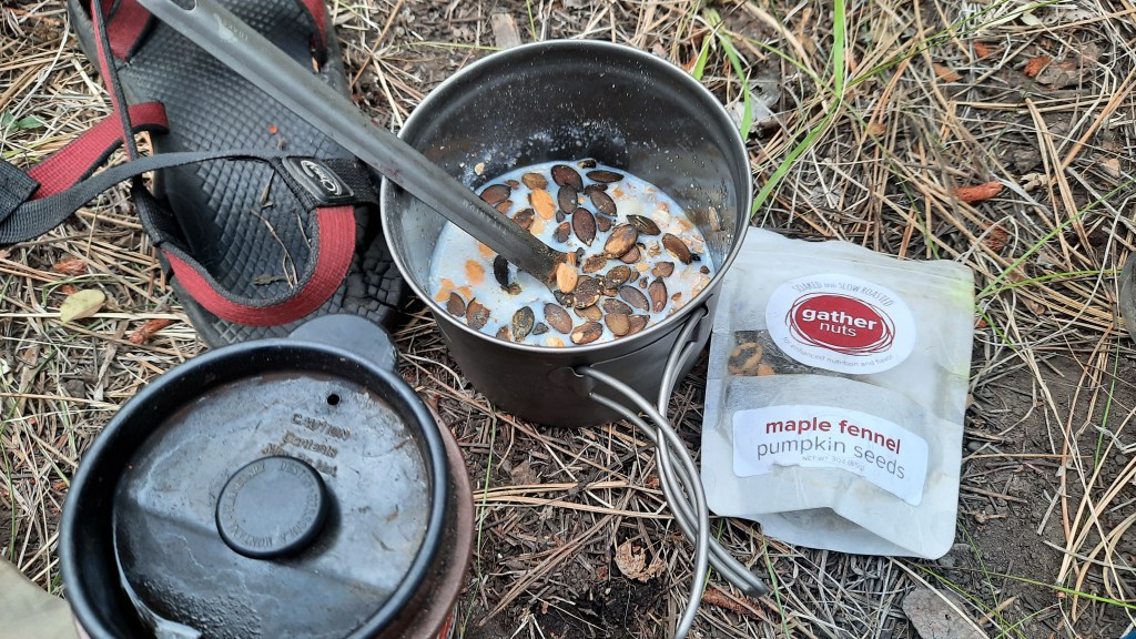
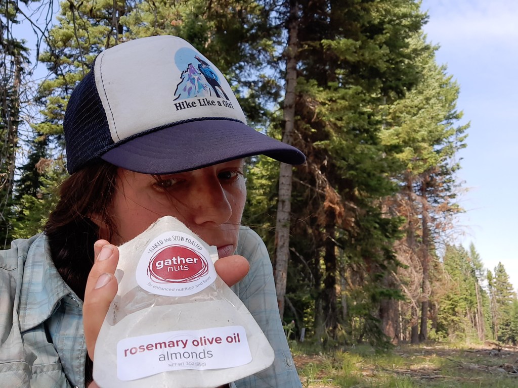
I’ve always eaten a lot of nuts, and they can provide a powerful punch of calories and protein on a hike. A lovely and tasty addition to my diet has been to carry Gather Nuts, a soaked and then roasted line of very flavorful nuts and seeds. I met the owner, Shanna, this summer and was taken with her process of soaking each batch for 24-hours then slow roasting them on a low temperature… which all allows for better digestion and nutrient absorption…and they taste AMAZING! The nuts and seeds come out super crunchy (I love a good crunch), and the variety of flavors can satisfy both my sweet and salty tooth. (I have a trail “happy hour” with the Rosemary Olive Oil nuts, and the Maple Cinnamon Brasil Nuts are….well…you’ll just have to try them for yourself.)
Good with breakfast
Good until they are gone 😦
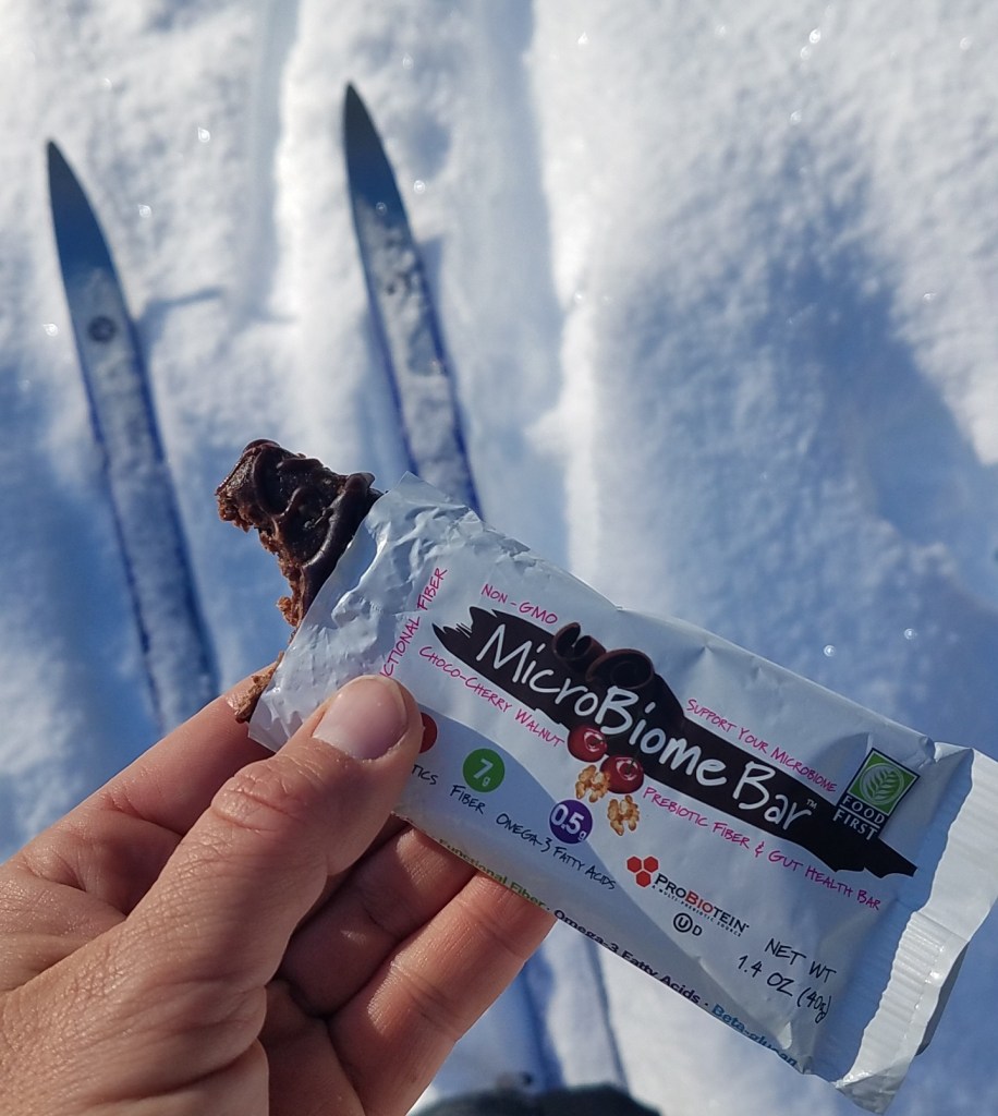
I have also found MicroBiome Bars which includes four prebiotic fibers, omega-3 fatty acids, beta-glucans and fermented protein (that’s all to say they include whole foods like organic wheat, oats, flax, and barley malt) and other ingredients like chocolate, cherries, oats, honey, peanut butter, cranberries, raspberries, apples, and almond butter. YUM.
MicroBiome bars are good on a ski tour too!
So finding healthy foods that have a shelf-life, or dehydrating whole foods (check out this great dehydrator cookbook by Julie Moser, founder of Food for the Sole) has become part of my food resupply strategy, and with COVID in our lives for the foreseeable future, making my own food boxes and avoiding extraneous contact on a hike is the new normal.
And lucky you! You can try some of this too. Gather Nuts has created a coupon code so that you can get 20% off an order of $25 or more at their store using the code: WEAREHIKERTRASH (my instagram handle).
Food for the Sole has a one-time use code you can use to get 20% off your order by using the code: SHERAHIKES.
So join me on my journey to be more intentional about what I put into my mouth, I can’t promise that cheetos and gummies will never pass these lips again, but I want to make them the exception, not the rule.
I love unconventional gear. Things you take on a backpacking trip or thru-hike that never make a gear list or line the shelves of your local outdoor store.
The piece I’m bringing on all upcoming backpacking trips is my pagna (think pawn-ya) from Burkina Faso. Twenty years ago I lived in a small village in the northern reaches of the West African country…drinking from the firehose of a Peace Corps experience… I was a recent college grad blundering my way through learning two new languages, working with local health staff to evaluate and address the pressing health needs of 15 small villages, and soaking in the culture of a place I never imagined I’d find myself.
In Africa, or at least West Africa, richly patterned and colored bolts of cloth were the foundation of the African wardrobe. Six-foot lengths of cotton, or pagnas, would be taken to the village tailor and sewn into shirts, dresses, brightly colored business suits, and any fashion we peace corps volunteers wanted (well kind of). We would tear out pages from a catalog, buy pagnas of flowers, intricate designs, or even historical figures (there were so many pagnas featuring Thomas Sankara…Burkina’s legendary leader from the 1980s…what a story there!), and take it to the tailor who would measure us for the fashion we desired, and two weeks later we turned up to get our new duds…sometimes a far cry from the beautiful dress we coveted in the catalog page.
These pagnas were also used to transport crops to market… giant bundles of mangos or onions would be tied up in the cloth and balanced on one’s head for the three-mile walk to the market. Babies would be tied to mother’s backs, and they could often be seen dozing as the moms worked the earth in the plots next to their mud and thatch huts….their little baby feet hanging out of the cloth, flopping around as they snoozed through the backbreaking work of subsistence farming.
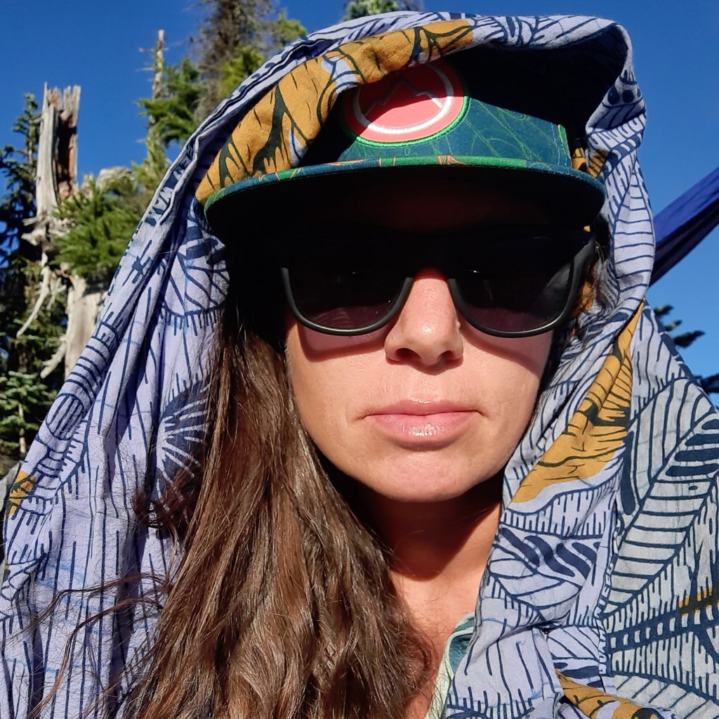
Pagnas are a blanket when you need it, a towel after a swim, a skirt, dress, a way to keep the sun off your shoulders….and now, backpacking, it’s my luxury item.
Lately I’ve been using it to keep the most vicious mosquitoes away from my head, and drop it over me when it’s too hot to put on another layer. It’s a sheet when the hot nights make me dread my down sleeping bag. It’s a towel and wrap after a dip in a trail-side lake. It’s what I wear while doing laundry in a trail town. It’s a cape when I’m channeling my inner superhero.
I’m down to my last Burkina Faso pagna. Its been squirreled away for the last 20 years, and now I need this touchstone to the experience that jumped my life off the tracks of a typical Midwestern upbringing. I’m grateful I had the chance to live in the sub-Saharan desert village and see that life had infinite possibilities (especially with all my privileges)…and it was up to me to imagine the unimaginable.
Today it’s walking all day, every day through the world and trying to see it for what it is….
A new podcast is on the scene…Andy of The Hiker Podcast found hiking recently, and is completely immersing himself in conversations with all sorts of hikers to dive deeper into what makes hiking such a transformative experience.
I shared some of my thoughts with him here…and I have to admit, it was one of the most engaging conversations I’ve had on the subject!
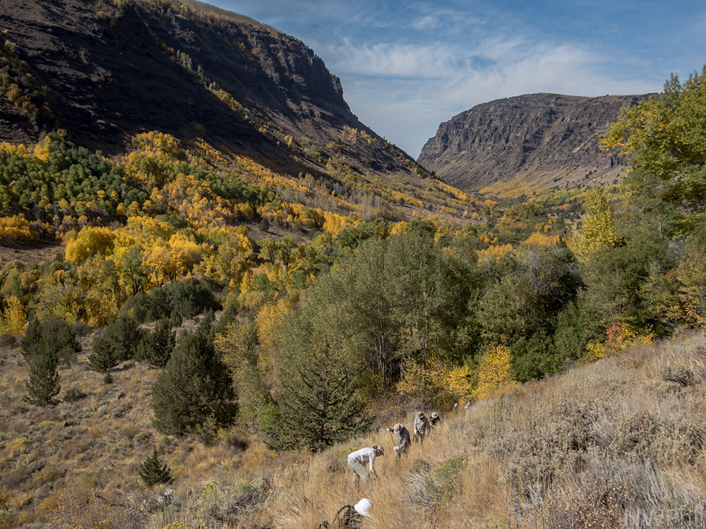
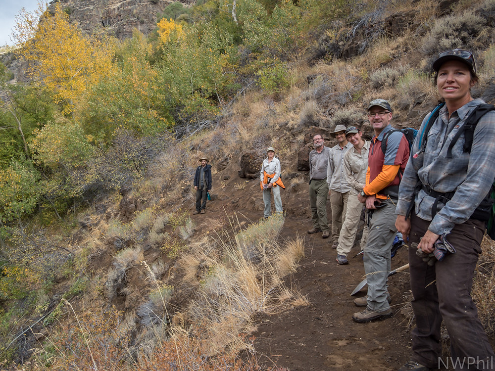
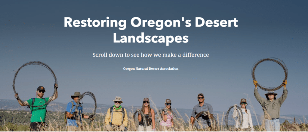
I’m incredibly proud to work for the Oregon Natural Desert Association. We make a tangible difference in the health of Oregon desert ecosystems thanks to thousands of hours of volunteer work each year. I’ve been fortunate to lead trail maintenance projects across the high desert with our dedicated members, primarily on trails that have had no record of trail maintenance…ever!
By creating and improving recreation opportunities across eastern Oregon, we are working to connect people to these landscapes and help them see the importance of intact ecosystems, of the value in a diversity of wildlife, of the value of our place within these biological systems. We are not apart from nature we are a part of nature.
Now in the times of COVID, I haven’t been leading hikes or trail work trips, but I have been reliving my multi-media and storytelling past through the creation of storymaps.
This is the first of many that I’ll be working on:
I had a blast talking with my cousin Sherry on her podcast: Pod, Sweat, and Tears with Sherry East about hiking, yoga, fitness, peeing standing up, helping everyone become comfortable and connected to nature, David Bowie, beer, thru-hiking, finding a regular sense of awe in your life and more. Give it a listen:
The Desert Trail is cutting edge. That may seem strange to say about the efforts of an organization that has been around for 48 years, an organization that has just recently decided to wrap up their efforts to establish another 2,000+ mile long-distance backpacking option, but I truly believe it. What the Desert Trail Association created is cutting edge.
I hiked part of the Desert Trail with the Desert Trail Association in Death Valley, 2018
Perhaps it’s just cutting edge for those of us who have grown up hiking trails, who have had the safety and security of precise GPS devices and apps that make navigation and route finding so much easier. As someone who is on the earlier side of my 40’s and has been backpacking long trails for almost 20 years, I do remember what it was like to get lost without a SPOT or InReach emergency beacon, but, that is a distant memory. Those pre-emergency beacon days were the norm though for all people throughout all time until recently. When the Desert Trail was founded by Burns biology teacher Russ Pengelly in the early 1970’s, there were no trails close to town. The places to play and roam and explore were remote desert landscapes, and the best way to discover their secrets was to hike. Hike without trails, hike without gps devices, hike with only your wits, good decisions, and strong legs.
Today, I and other hikers who have grown up on trails and technology find this type of hiking to be liberating. To hike without a trail, to look at the landscape and let your curiosity drive your feet is what freedom feels like. And it feels cutting edge to those of us who are just finding it for the first time.
Since I started working to establish the 750-mile Oregon Desert Trail (which is not a trail either…a la Desert Trail!), I’ve become convinced that the way forward for the long-distance hiking community is to embrace routes. Or maybe it’s the way back. It’s the way back to understanding how to travel up and down a mountain ridge in the most efficient way. It’s the way back to having to make your own decisions about macro and micro navigation…trails do that for you. It’s the way back to feeling a part of a whole landscape. You belong, you are a part of it, you have a role to play in these places. It’s the way back to understanding that you may not be the most important thing in these landscapes, and that ego-check is incredibly healthy.
Your desire to have a backpacking trip does not rise above the snowstorm battering the top of Steens Mountain or the six inches of mud that accumulate on the bottom of your boots as you try to walk across the Alvord Desert. Hiking a route means adjusting to the conditions, and the conditions aren’t always right for you to have a fun and enjoyable adventure. As Gary Snyder says, “Nature treats us as adults,” and that lesson is easily found on a route.
To hike a route like the Desert Trail, you need to rise to the occasion. You need to show up with your skills developed, the willingness to carry immense loads of water, and with the prospect that you may never see another human on your trip. BUT you may see incredibly rich ecosystems teeming with life. You may see the elusive bighorn sheep. You may see that all you need is very little to be comfortable and safe in this world.
The Desert Trail is cutting edge. Going back to hiking routes is the way forward to create an engaged, thoughtful hiking community and backpacking experience.
Read more about the Desert Trail and how the Oregon Desert Trail will continue their good work over on the ONDA blog.
A New Chapter
for the Desert Trail in Oregon
By Renee Patrick, Program Coordinator for the Oregon Desert Trail
When ONDA looked east in 2011 with the thought of establishing a desert hiking route that would connect into the important sagebrush steppe ecosystems they had been working to protect, defend, and restore since 1987, they looked to the Desert Trail.
The Oregon Desert Trail and Desert Trail? Yes, they are two separate long-distance hiking routes. The Desert Trail was founded by Burns biology teacher Russ Pengelley in the early 1970’s. Russ stood on the top of Steens Mountain five decades ago and envisioned a hiking route that stretched through the great basin and into the remote deserts of the west all the way from Mexico to Canada. Instead of building a trail, he envisioned a quarter-mile wide corridor suitable for hikers, mule packers, and equestrians. Read more here.
Black Lives Matter: I have been STRUCK by the systemic injustice that the recent #BlackLivesMatter movement and protests have highlighted over the past few weeks. I have been protesting and trying to understand what my role is to play in dismantling the power dynamics in place in this country that allows for people of color to feel unsafe on our streets, in our parks, and on our trails. More soon, but please spend some time on this yourselves. This is up to all of us to end the harmful and deadly effects of a country that was built on oppression.
I had planned to write a blog post for Food for the Sole this spring. And things got not-normal. Things got (are) uncertain, bewildering, overwhelming, disappointing… and I found I couldn’t write about hiking, or packrafting, or any of the numerous things I wasn’t doing this spring.
In normal times, we would look to Renee for long distance hiking advice, fun tales from the trail, or bits of vicarious living through the unbelievable amount of time she gets to spend outside hiking. (As program coordinator for the Oregon Desert Trail we suppose it only makes sense..)
But, these aren’t exactly normal times are they? As many of us remain stuck in social isolation, without any normal structure or access to our normal activities, we need to find ways to bring joy to our lives.
Read on as Renee joins us with her thoughts on finding stillness inside, while we remain… still, inside.
Bits of Calm
This time will pass, or maybe it won’t.
What always passes, even if we are not there to see it, is the wind passing through the aspen trees. The sun arcing into a new day. The waves rippling around a lily pad in the pond.
Where do you find your calm? When getting outside far enough to watch clouds blend into dragons and whales is replaced by washing the dishes…yet again…how do you soothe the ache of every day showing up just like the next?
There are bits of calm to be found. I’m gathering them.
This song. Lay on the floor, close your eyes, and sink into the carpet while this plays.
This poem. Sip a mug of hot tea and let these words steep.
Bread baking. The smell alone is almost as good as the melting butter on the first slice.
Bare feet in the dirt. My yard and I are becoming more intimate with each day, just ask my feet.
Wearing silly hats. Even if no one is there to see how ridiculous you look, you know.
Sounds of night. Bring the night inside (put it on loop all night long).
I’m collecting bits of calm, will you share yours with us?
Oh, and Food for the Sole is donating 1% of all online sales to Corona Virus Relief