Oregon Desert Trail Section 7 – Day 1 – 16 miles

The air is so soft! Slight whiffs of sweet blossoms met me right out of Paisley, and the low clouds lend a sense of moisture in the air. It’s not humid per say, but it’s not the usual dry parched air either. It’s soft, and envelops me as I walk the 8 miles of road along the Chewaucan River this morning.

I’ve found more reasons to come out and hike another section of the Oregon Desert Trail this week… (funny how that happens!) this time to hike the trail between Paisley and Lakeview. I’ll be leading a trail crew out here next month, and I came to scout out the conditions prior to the trip. Since my volunteers will probably only work on about 3 miles of trail, why am I hiking 50? Well after my hike I’m meeting up with a group from the Oregon Timber Trail, a bike route from California to Washington, that shares the tread with us and the Fremont National Recreation Trail. I will be helping that group out to maintain a section of their route that continues where the ODT veers east, on top of the epic Winter Rim. If there is extra time the crew might backtrack to the section I’m hiking to clear any trees I might find, and/or I’ll be able to pass the list of needed maintenance in to the Forest Service who might send their own crews back out this summer. I’ll also hike past the trail work that we’ve been able to fund for the Lakeview Alternative high school this year and last. I’ll be able to scout out their work and identify what could be done in the future.

Multiple reasons for a 50 mile hike!!!

After lunch at Chewaucan crossing, I crossed the bridge for trail… the next 60 miles are primarily trail (with one big section of road that the Timber Trail and Forest Service want to turn into trail… I’ll be walking the proposed section with them later this week). It is a slow meandering climb, and the only living things I saw were pronghorn, lizards and birds. Ahhhhh, so nice.

Lots of water, even more than is on our water chart, and the afternoon passed lazily by as I made my way south. I wasn’t out to crush any miles, so took my time and made camp on the side of a slope hidden from the trail and tucked under a huge ponderosa pine. The ground was drying out, enough that I wasn’t making any footprints, but some horseback rider had been through and sunk a good 6” into the trail. Grrrrrrr. Don’t travel on muddy trails people!! Especially a heavy horse or a bike (there were a few bike tracks that had sunk in an inch or two, but the major transgression was from the horse.) I hiked about half a mile of the trail that my ONDA volunteers cleared last year, but it wasn’t very apparent. Bummer. Again horse hooves and new green growth in the tread. At least there was only one new down tree so far in my hike.

The imminent wet weather is supposed to hold off so I’m cowboy camping tonight.

mmm, dinner!

Hiking a Route vs. Hiking a Trail: Part 1

I wrote an article for MSR’s blog the Summit Register. I’ve been wanting to write this for at least 2 years, as a lot of what I do is help people figure out how to hike a route like the Oregon Desert Trail.

This one was fun as I was able to poll some other route creators (and incredible hikers, and pretty awesome people): Liz “Snorkle” ThomasCam “Swami” HonanJustin “Trauma” LichterSage Clegg, and Paul “Mags” Magnanti.

Give it a read!

Routes vs. Trails Part 1

20180429_111848

By Renee Patrick, Oregon Desert Trail Coordinator for the Oregon Natural Desert Association

Let’s say you’ve already tackled a long hike like the Appalachian Trail, Pacific Crest Trail, Colorado Trail or one of the other well-established long-distance backpacking trails around the world.

Where do you go from there?

Making the leap to hiking less defined routes can provide the next big challenge.

Route vs Trail - MSR Summit Register
Photo: HagePhoto

Routes, unmarked and often undefined, offer a totally different backcountry experience, and they tap into a different set of skills. An impressive thru-hiking resume alone doesn’t prepare one for the route-finding, remote and rugged terrain, and navigational demands of a long-distance route.

Still, it’s those very challenges that can make route hiking alluring to experienced backpackers.

Developing solid backcountry navigational skills gives hikers the freedom to travel with confidence and safety when the going gets tough, and opens up the possibility of exploration beyond well-trodden trails.

I’ve slowly been building my backcountry skill-set since first setting foot on the Appalachian Trail for a thru-hike in 2002. Fast forward 10,000 miles and 16 years, and I now find myself working as the Oregon Desert Trail Coordinator (hint: it’s a 750-mile route, not a trail). One of my primary goals has been to help backpackers figure out how to successfully hike a route, so I decided to check in with some of the most accomplished route creators and hikers I know for their tips.

Liz “Snorkle” ThomasCam “Swami” HonanJustin “Trauma” LichterSage Clegg, and Paul “Mags” Magnanti have not only spent extended time hiking away from established trails, they all take an active role in educating hikers new to the backcountry. I’ll talk more about how to develop a good skill-set in part two of this post; for now let’s start with identifying the differences between a route and a trail, and the reasons you might want to try a route.

Route vs Trail - MSR Summit Register
Photo: Scott Rinckenberger

What’s the difference between a route and a trail?

Some of the best-known routes in the country are the Hayduke TrailOregon Desert Trail and Grand Enchantment Trail. Lesser-known routes include the Hot Springs TrailDesert Trail and Northern New Mexico Loop. If they’re all just routes, why do they have “Trail” in their name?

The truth is there’s no “rule-book” defining a route versus a trail, but, if there were, some of the qualifying factors might be:

  • No dedicated signage: Many routes exist only as a line on the map and a series of waypoints, not as a physical representation on the ground. These routes might tie into existing trail systems that have signage, but you won’t find any dedicated signage on most routes.
  • Often no trail: Most often, the goal of a route is landscape-driven (such as hiking the length of a geological feature like the Grand Canyon or hitting as many hot springs as possible).
  • Road walking is to be expected: After a challenging cross-country bushwhack, a 10-mile road walk can be a welcome prospect for its ease, a brief respite from navigation, and an efficient way to move from one section to the next.
  • Navigational skills required: Established single-track trails are linear. In contrast, routes demand solid navigational skills. You must be able to read a topo map and translate the lines and symbols to what you see on the ground and vice versa. Reading a map and reading the terrain are both essential to route hiking—and finding!
Route vs Trail - MSR Summit Register
Photo: The Comfort Theory

The benefits of tackling a route versus a trail

  • Flexibility and exploration: Hikers may find themselves sizing up the landscape and deciding to take an alternate path. They might do this to avoid deep snow, explore what looks like a cool feature on the map, catch an epic sunset, or simply to hike the shortest way to town because of a gnawing hiker hunger. Experienced hikers view routes as a suggestion of travel, and they can make small route adjustments as they hike, making for a highly flexible and personalized experience in the backcountry. Instead of following a pre-determined trail, someone hiking a route can move through a landscape in the most efficient way. Mags explains, “You are no longer on a crowded trail but are truly immersed in the backcountry.”
  • It can take a lot longer: Hiking off-trail can take much longer to tick off the miles than on an established path. “Time spent in all types of conditions (e.g., snow, bushwhacking, mud, boulder hopping, swamps, soft sand, flat easy terrain, etc.) will teach you how fast (or slow) you can hike in any given environment,” Swami says.
  • No “one way” to hike a route: When appropriate, route travelers also have the freedom to choose how to travel through a landscape. Sage was the first hiker to complete the Oregon Desert Trail (ODT) in 2013, but she did so on a bike as well as on foot. Likewise, I’ve known hikers to packraft part of the Hayduke Trail on Utah’s rivers, and I paddled a “water alternate” on the 140-mile Owyhee River when completing the ODT a few years ago.
  • Opportunity for deeper engagement: Hikers need to pay attention, really pay attention, to their surroundings to be successful on a route. That heightened level of attention allows for a deeper engagement with the landscape and ecosystem around you. You could carry a plant guide and spend some time learning about all the flowers you keep stepping around, or perhaps carry some reading material about the Native Americans that used to travel the same ground thousands of years ago.
  • Anyone—including you—can make a route: “I don’t have any specific formula or preferences when creating a route,” Swami says. “Sometimes I look for pure wilderness experiences. Other times I’m drawn by historical, cultural and culinary elements.” Snorkle has become an expert at creating urban routes, where she hikes a path through a city and makes a point to visit local breweries, bakeries, and other points of interest. Creating routes like this might sound a bit arbitrary, but the only way to experience off-the-beaten-track places is to get, well, off the beaten track.
Route vs Trail - MSR Summit Register
Photo: Jeremy Fox

Important considerations for hiking a route

  • Routes aren’t appropriate everywhere: “Be ready for some Type 2 fun. Bushwhacks can be miserable at the time, but in retrospect they make good memories,” Trauma advises. Trees can play a big role in whether a cross-country section is doable or not. Cross-country in a heavily forested area can be extremely difficult if the vegetation is thick, or down trees create huge obstacles. Likewise, I learned cross-country hiking in southern Arizona can be next to impossible. It wasn’t for the trees, but the cacti. I tried to hike what looked like a fairly straightforward short cut, but after 30 minutes I had covered only 30 feet of desert terrain. I turned around, having already lost a fair amount of blood to the thick stands of Cholla and other various kinds of cacti.
  • Route ethics: Hiking off-trail can be empowering, but be sure to use common sense and practice good ethics when deciding if you should leave the trail. Mags has some great tips including: respect local regulations and rules for the area you are hiking through, keep group sizes small, and spread groups out to avoid tramping down a trail. Heavily impacted areas or high alpine zones are usually not the best terrain to explore off-trail because established trails provide an important way to consolidate use in sensitive areas.

I’ve heard it said that true adventure is when you are uncertain of the outcome. That is certainly true of routes when they have so many variables, but I would add that the key to a successful adventure is making good decisions. This includes carrying the 10 essentials and adhering to all of the safety precautions you’d normally take—plus more.

In part two I’ll cover tips from our seasoned hikers to help you acquire the skills to make those good decisions so that you can hike these routes or start making some of your own.

Oregon Desert Trail Section 25 – Day 3 – 8 miles

I slept so well down tucked out of the wind and exhausted from sub-par sleep from the night before, and the miles of yesterday. Before sunrise it started to rain again, and I knew our agreed-upon start time of 7am was less and less likely to happen. While on a thru-hike the need to constantly make miles despite the rain is really important, but on shorter hikes that need kind of goes out the window….however I wanted to usher people back to the shuttle cars waiting at Leslie Gulch before making the 3 hour drive back to their cars at Lake Owyhee State Park, and then home. Some hikers came out from SW Oregon & Portland, long drives!

I made coffee with my woodburning stove instead of getting up for the hot water Tim has been making us in the mornings…it’s nice to be self sufficient, especially when it’s raining! I packed up and was under Tim’s big shelter by 7am…and saw all the other tents still up. Oh well. I sat down to drink some more coffee and watch camp slowly come alive when the rain petered out.

We were walking by 8:30.

In the first few miles it looked like I could take a short cut between two waypoints, so climbed up and over a ridge, to see we would have a steep-ish sidehill to get down the other side. The problem with shortcuts and topo maps is that you don’t always see those minor 5-10′ cliffs that the topo lines don’t show. We maneuvered down the slope carefully and started walking up our long ascent of the day. We would climb 2,000′ to the top of Juniper Gulch, before descending steeply down to Leslie Gulch. We took a break at the start of the steeper section of canyon, and relaxed a bit before the climb.

The rocks were stunning along the unnamed canyon, and I suggested that the hikers come up with a name for this canyon, as there was nothing on the map. We started up the more cliffed out section, but soon the canyon widened out enough that the climbing was quite gradual and much easier than I anticipated. Andrea picked up a rock and came up to us  in excitement, a thunder egg! Being the good geologist she is, Sarah had been carrying her rock hammer, so Andrea pulled it out and cracked open the rock as we all looked around in anticipation. It wasn’t a thunder egg, it was a geode! Beautiful crystals inside…Andrea said she found it in the drainage, so it probably washed down from some feature in the high rock walls. So cool! The geode broke into pieces, so many of us hiked out with a piece, and I saved one for MJ, one of the board members for Friends of the Owyhee who had been helping set up camp and such..it was her birthday. How about a birthday geode!

We hiked on, following very well defined cow trails. The cows made a better path than we could, and each time we came to a bend in the canyon, the cows would find the straightest line between canyons, making for a very efficient path. Now cows are a mixed blessing. I’m starting to monitor for human impacts along the ODT this year, but am finding many more animal impacts. I’m not sure how we will be able to determine that human feet made a path on a cross country section versus animal feet. I guess it’s easy to see from the poop who is using the trails!

We stopped for lunch, but it was raining again, and it wasn’t long before everyone was shivering and we wanted to keep moving. The last of the climb went up an unnecessary few hundred feet according to the waypoints, but I followed them, and soon realized my error as the group was slowing and getting more and more tired. I could have kept following the drainage around before the climb, saving us a descent…another protip to hiking a route: hike smarter, not harder. If you see a better way that isn’t waypointed, go! We continued up the near-by drainage to the original ODT waypoints, and the group was slowing. I pointed out the last of our climb up to the right of a pointy rock formation, but it was still 1,000′ up. We took our time, again on some steepish sidehilling. There is lots of sidehilling folks! Be prepared….

Finally we crested the ridge and dropped our packs by the lone juniper tree at the top. Someone still had energy, for Andrea climbed up to the highpoint with camera in tow and motioned us over. AND the group named the canyon we just climbed up…”Let ‘er Rip” canyon. I’ll include that in the next update 🙂

Views.

Views for miles!

This.

This is why we are here.

We had less than two miles to the cars, but a very steep descent had us slow going. The canyon is gorgous and the urge is to look around, but if you looked up from your feet, that could land you on your butt.

We inched our way down, and finally most of the group took off for the cars, and cold beer in the cars.

And success!!!!! We made it through without any major mishaps, lots of sore legs and feet, a few blisters, an epic adventure, and possibly some folks interested in doing another section.

I gave MJ her geode, and unfortunately she discovered a screw in her tired, so they had to change her tire before we could shuttle back to everyone’s cars. Another board member, Sammy, came out, so it turned out I didn’t need to make the shuttle run. I was headed to the Nevada border to meet an Outward Bound group the next day down in the Pueblo Mountains who has been hiking a section of the ODT, so it would save me hours of driving if I could just head south. We all said our goodbyes, and jumped in our cars for distant destinations.

Section 25 done! I plan to come back this fall and hike the other Owyhee sections I haven’t done yet because of my paddle trip in 2016, and perhaps we’ll offer Section 24 as a hike to folks next year. Stay tuned…

Oregon Desert Trail Section 25 – Day 2 – 12 miles

The wind flapped our tents and tarps all night long and the full moon made the night seem like dawn for most of the hours we all tried to sleep. In the morning we were all a little blah with the lack of sleep, but the day promised mostly downhill terrain and the epic painted canyon and three finger gulch… A bit of incentive to get going.

I overshot one of our first waypoints, but hiking a parallel route gave me the opportunity to share route wisdom: you don’t have to follow the exact waypoints…the beauty of a route is that there is no one way, the waypoints are a suggestion of travel… so now let’s figure out how to reconnect! We found a road that wasn’t on the maps that led right to the next water source, and in fact I think we saved .2 or .3 miles with the altered path.

There is no “one way” on a route, find the path of least resistance

The mystery road


We got to painted canyon late morning and soon we were taking off packs and down-climbing multiple pour overs. Huh, I didn’t know we were in store for the scrambling, but it was fun even though it did take us a long time to get through. The colors were amazing and once the canyon opened up it was simply astounding. I want to come back with a week of food and just explore.

We have to go down what?


I felt bad hurrying us along as the area was so epic, but we needed to keep moving to get to camp. We were definitely not going at my usual pace, and I was finding it was a little challenging to figure out how fast we were going to get through some sections.


But we motored after a nice extended break, and even though we were supposed to be walking a cross country section, the wild (feral) horse and cow trails were so well defined it seemed like a real trail. The late afternoon was all downhill, and once we got to Three Fingers Gulch and the canyon choked up with rocks below the towering walls of rock, we were all feeling the miles. There were rock corrals and walls going up the steep canyon walls, and it was definitely one of the coolest areas we’ve hiked. A highlight of the ODT for sure.

Right before we got to our camp spot where Tim had once again driven in, it started to rain a cold rain. We hurried to see he had started a fire and had a big shade tarp up that everyone was huddled under.

Home for the night


So good.

By Land

I had the opportunity to take part in another podcast recently and the episode was just posted yesterday. I talked with Emory from the By Land podcast about the Oregon Desert Trail, hiking philosophy, barriers to entry and a whole lot more.

I really enjoyed the conversation and think this captured a lot of unique angles on walking long distance, especially as Emory is a newer hiker, and I’ve been doing it so long sometimes I forget everyone is not as immersed in it as I am.

We talked about:

  • Introduction to Renee and the Oregon Desert Trail
  • Renee’s background prior to being the Trail Coordinator for the ODT
  • What the Oregon Desert Trail offers and its history
  • How the ODT compares to other trails in the US
  • How Renee began backpacking and what made her start long distance backpacking
  • How Thru Hiking has impacted Renee’s backcountry trips
  • What Long Distance backpacking means to Renee
  • How the ODT manages relationships with land owners to retain access to the trail
  • Where and how to begin planning a hike of the ODT
  • Renee’s thoughts on the future of hiking
  • What Renee has learned about backpacking after all these years
  • How Renee has changed since her first long distance trail
  • The future of the Oregon Desert Trail
  • How to find and support the ODT

Here are a couple of different ways to listen :

iTunes

Stitcher

Google Play

Podbean

Oregon Desert Trail Section 25 – Day 1 – 8.5 miles

In 2016 it was my plan to packraft to Leslie Gulch and hike the final 30ish miles to the Eastern terminus of the Oregon Desert Trail at Lake Owyhee State Park. Temps well over 100 degrees changed my mind, so I ended up paddling the last stretch to the dam. So there are some miles I haven’t hiked yet in the Owyhee and this year it is my plan to complete the Owyhee section on foot.

The perfect opportunity arose to finish section 25, or the final stretch of the route, this April. I’ve been working with Tim Davis and a group he founded, Friends of the Owyhee, for while. Last April I came out and led a hike with him for a group of interested folks around Leslie Gulch. This year we decided to step it up a notch and I would lead a group of 12 on the final 27 miles for a 3-day backpacking trip.

I met Tim and 2 of his board members, MJ and Becky, on Thursday evening after I drove down from La Grande where I had given an ODT presentation the night before at Eastern Oregon University. We camped in Leslie Gulch under a huge moon and got up early the next day to drive to the park. Three of us left our cars at the end of the section so we could run shuttle on Sunday, and drove the 3 hours around to the start. Yes, that’s right folks, a 27 mile hike had a 3 hour shuttle.

We met the group in the parking lot of Indian springs campground and all hiked out to the rock jetty together, the finish (or start) of the route, depending on how you want to go.

We put packs on and immediately made a route change. We had 2,000’ to climb up, and could either walk the original route up the steep Birch Creek Canyon, or walk a road along side that was slightly longer due to switch backs. I personally wanted to walk the road because of the warnings of poison ivy other hikers had warned me about (I’m extremely sensitive… I hate that plant) and the others were more than happy with that decision. As we walked up and saw how brushy it was we were all glad.

Our group was a mixed bag, some had hiked a lot, but never cross country, and others had not hiked much and soon thought they had bitten off more than they could chew. I had only planned 7ish miles for the day, so kept encouraging water, breaks, and an easy pace.

When we made it to the top of the first climb we broke out the map and compass and did a little practice at setting a bearing to reconnect to the ODT route and talked about route choices, micro adjustments, and fence hopping. We would cross a few fences, all on public land, but that required some finesse.

We were joined by Sarah and Andrea who were geologists for the Vale BLM district, and they talked rocks while we took a break, I learned some stuff!

The last few miles were on a gentle uphill, but folks were fading and we slowly made our way up. A few clouds gave us some relief from the heat, and by the time we made it to our high point at 4,800’ the wind was crazy strong.

Owyhee clover

Tim and MJ drive some back roads and were waiting for us at camp with coolers full of cold drinks, and hot water for our dehydrated meals.

Ahhhhh. First day backpacking for me of the season… Feels so good.

Food for the Sole

Back in November my friend Boomer brought some food samples to a presentation Anish was giving in Bend about her Oregon Desert Trail hike. The food came from a new company that was started by a fellow Search and Rescue member of his, Julie Mosier. There were so many hikers around that night that I didn’t take a sample at that time, but a few months later ordered their sample pack….and…WOW.

I made the Food for the Sole cold-soak Peanut Super Slaw before a ski Kirk and I were heading out on this winter, and it was so good I literally licked the bag. SO GOOD. Now I do struggle to eat healthy on trails…my pack certainly contains a fair amount of processed sugar and flour, so as I worked my way through these vegan and gluten free samples, I was hooked. These are super tasty, and I am sure better for my body than

super-peanut-slaw

cheetos! These are dehydrated meals instead of freeze dried, which allows for a certain amount of texture and flavor to carry through the re-hydrating process. And as I’ve been doing so much desert hiking, I think the cold salads will really be a game changer during the heat of the day when I often don’t feel like eating something heavy like peanut butter or cheese.

I was so interested in helping to spread the word about this new company that I’ve decided to come on as their first Brand Ambassador! I’m stoked to eat these meals on all my various adventures this year (trail work, hiking & packrafting trips, Sunshine Coast Trail Thru-hike, and anything else I might get up to this year). Did I tell you I’m planning on hiking the Sunshine Coast Trail this summer with NEMO??

If you are interested in checking out Food for the Sole I’d recommend starting with their sample pack of all 7 meals they make, and I’m pretty sure you will make another order shortly after. 🙂

Oh and use SHERAHIKES code for 20% off!

A Day in the Life of a Trail Coordinator

I would say at least a third of my time as the Oregon Desert Trail Coordinator is spent in eastern Oregon. Much of what I’m trying to accomplish on the ODT revolves around creating a trail culture in the small desert communities of Oregon’s dry side, and also working within those communities to see how the ODT can meet their recreation needs, or perhaps identify other recreation opportunities in those areas.

Wednesday morning I woke at 6am, sipped at several cups of hot black coffee, and packed for a few days on the road. I loaded up the 1994 Jeep Cherokee (one of the only ONDA rigs with studded tires) and by 7am was pulling away from the house. The highway south towards La Pine was busy with morning commuter traffic, and as the miles sped by and the elevation slightly increased, the snow started to blanket the forest with white. We’ve had a very mild winter this year, but the snow and rain have started to fall this March, providing some much needed moisture in the desert.

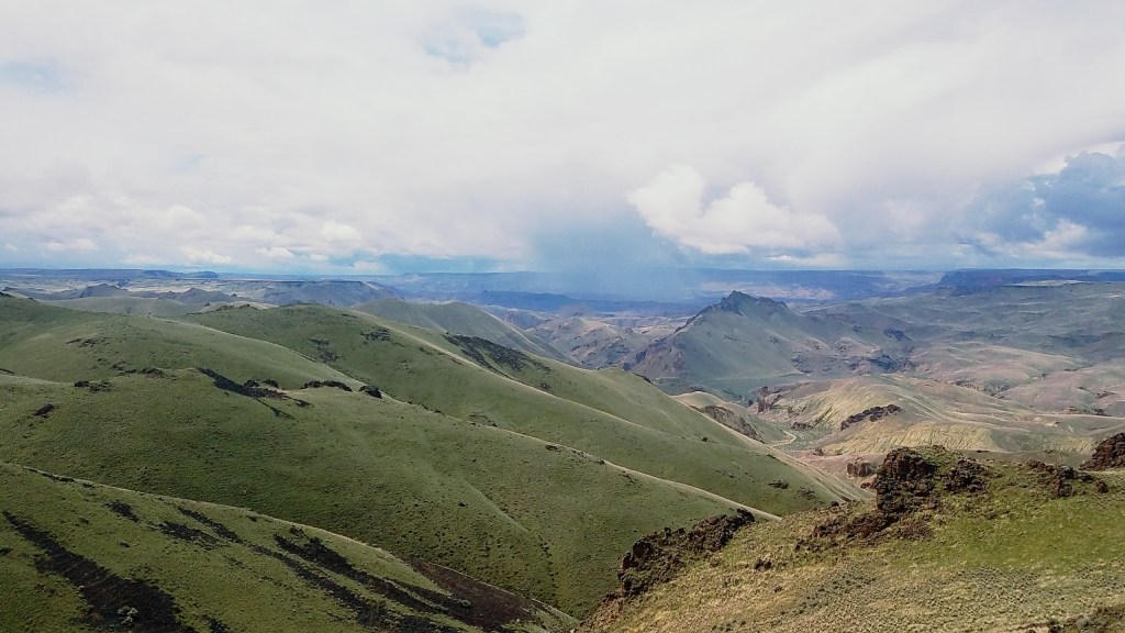
Just south of the small forested town of La Pine, I made a left turn onto highway 31, one of the few paved roads that heads south east. If you keep following this road, eventually it will dump you out in Reno, NV, but before that some of the iconic scenes of the desert appear: Fort Rock (where 10,000 year old sagebrush slippers were found in a cave in 1938), Hagar Mountain (a pointy iconic mountain with a fire tower lookout you can rent), Summer Lake and Winter Rim (words can’t do this area justice, just EPIC) and the popular Summer Lake Hotsprings, the town of Paisley (a charming little town at the base of the massive Fremont National Forest) and Abert Rim (one of the largest fault block mountains in the country, a 30 mile long fault that rises 2,500’ above the highway below). I turned before the highway reached the tall town of Lakeview (Oregon’s highest elevation city) and took road 140 towards Adel, a spot on the map not many will pass.

The goal of this trip was to check in with some of the small communities that provide services to hikers in Adel and Plush, meet with a new trail angel in Plush who wants to help out hikers, hike a potential alternate route into the Hart Mountain National Antelope Refuge from the base of Hart Mountain, soak in the Hart Mountain Hotsprings, head to Lakeview for to give a presentation about the Oregon Desert Trail to the Lakeview Chapter of the American Association of University Women, and then head back to Summer Lake the next day for a meeting with another potential trail angel who wants to help with water caching in one of the drier sections of the ODT.

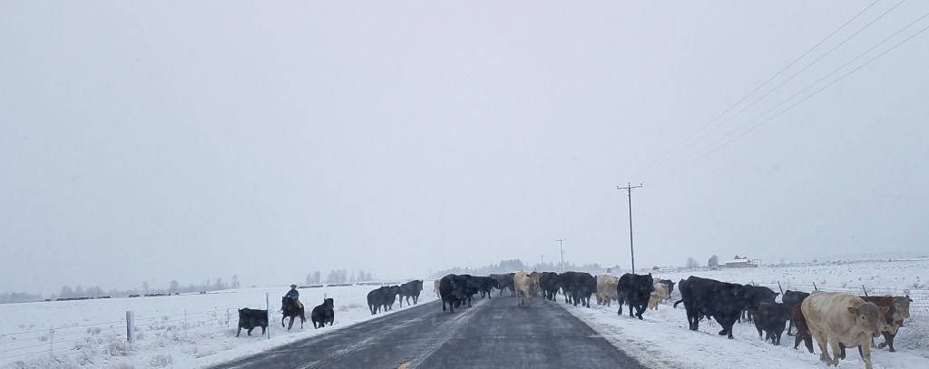
A lot of driving, yes, but of the many trips I’ve made to this part of Oregon in the past 2.5 years, I never get tired of the drive. After leaving the last bits of forest behind on Wednesday morning, the snow became deeper and highlighted all the ruffles of sagebrush that carpeted the landscape, and BOOM made the ridges and faults of Winter Rim and Abert Rim just explode with beauty. Before I got that far though, outside of Silver Lake I had to slow for a group of cows being ushered down the highway by four cowboys moving their stock to some spring grazing grounds (probably). Ranching is still one of the dominate industries in south east Oregon, although I think recreation will continue to help diversify the economy out here.

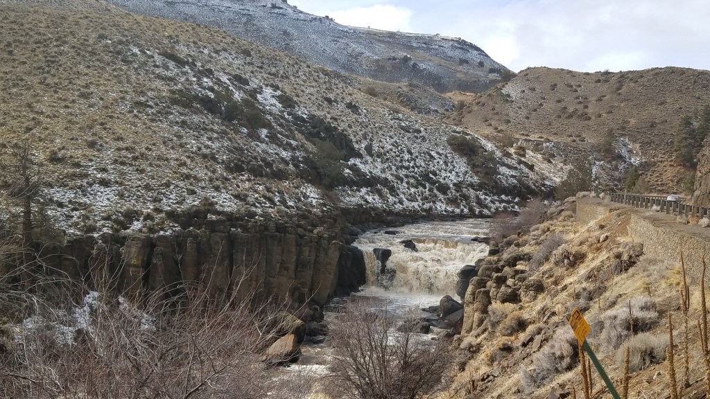
When I turned off on the road to Adel, I started to look at my phone for reception. I needed to call in for a conference call for a new organization I was a part of, an organization of conservation, recreation, and outdoor industry folks intent on advocating for more funding and protection of our landscape. Although the remoteness of this part of Oregon is real, there is an awful lot of cell phone reception out here (Verizon!). I passed the Warner Ski Area, but the lift wasn’t running today. I don’t think they’ve had enough snow to open more than a few days this year. The road followed Deep Creek, a waterway Kirk and I have had our eyes on for a few years; just a few miles before Adel the creek plunges over a 20’ tumble of boulders in a waterfall that Kirk is itching to run in his kayak.

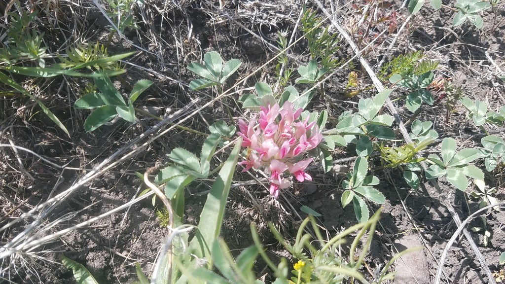
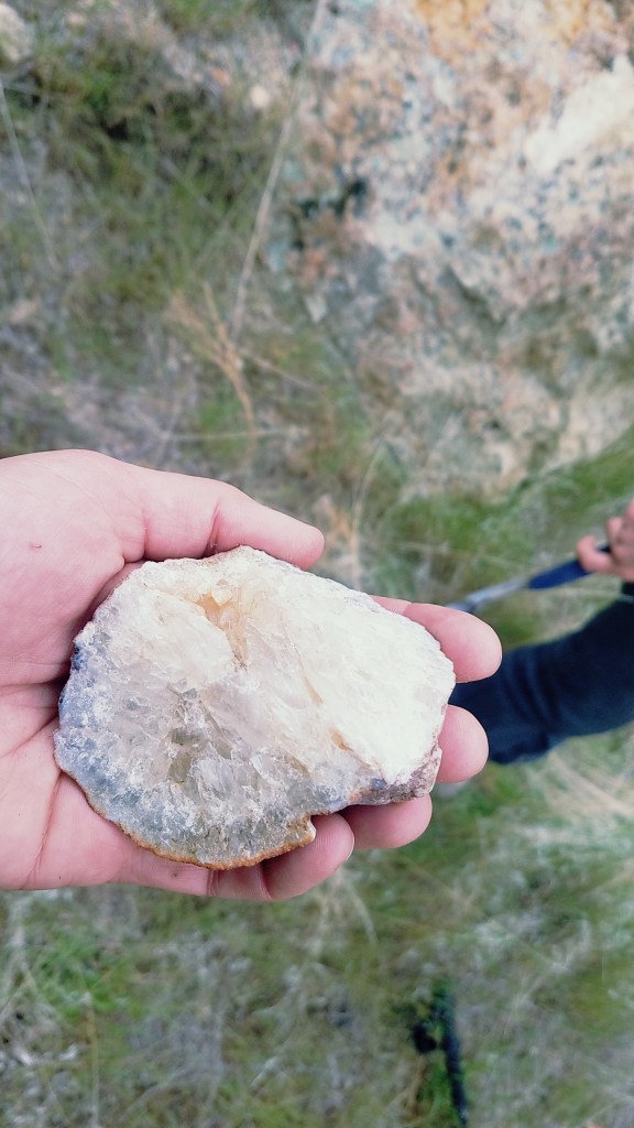
I found my sweet spot for the cell phone, and noted the pull-off on the road. I would return after my lunch in Plush for my phone call. On to the Hart Mountain Store. This little oasis is an important stop on the Oregon Desert Trail. The route essentially goes through town, and has almost everything a hiker would need…all in one place. The store can be your resupply (if you aren’t picky), restaurant, bar, post office, gas station, and community gathering place. When I hiked through in 2016 I spent the better part of a day here eating a massive double bacon cheeseburger, drinking a few beers, and reading a book I grabbed from their take-one-leave-one shelf before heading off to the cozy tiny house a local couple rents out (Hart Mountain Cabin). Plush is also close to a hot spot for the Oregon Sunstone, a orangish/pinkish stone that features in many pieces of local jewelry. In the store you can buy some of the sunstone creations, in addition to a variety of other random and interesting items.

I ordered the French Dip, and Joelle, my trail angel to be, the chilli mac. Joelle was volunteering nights this week to help the refuge trap and monitor sage grouse, our iconic “canary in the coalmine” bird that indicates the health of the Sagebrush Steppe landscape. As a biologist her previous work was primarily among shore-birds, but she was enjoying this new drier landscape and the different life found within.

After lunch I left Dave (owner of the Hart Mountain Store) with a few more ODT brochures for the store counter, and a fresh copy of the Town Guide.

I jumped back in the Jeep and headed back towards the pull-out near Adel for my conference call (Plush is one of the only communities out here with absolutely no cell phone reception. Which is quite refreshing I must say!). Ah technology. Many of the folks were calling in from Portland, some from Bend, and others, I’m not sure where. We talked policy, the new Oregon Office of Outdoor Recreation, future events, and so forth.

About two hours later I drove up to the Adel store to fill up the tank with gas. Cody, the new owners’ son, poured me one of the Oregon IPAs they had on tap, and I caught up on a little laptop work and ate a few tater-tots. I also gave him a copy of the Town Guide; his parents had purchased the store last fall and soon after I had stopped in to say hello, and explained they were now an ODT trail town. The family had moved down from Redmond (near Bend) and were enjoying the quieter pace of life in the Oregon Outback. I had updated the information on the store, and wanted to leave them with a copy of the guide.

Then back to the car. I had my sights set on camping at the Hart Mountain Hot Springs, a free campground deep in the Hart Mountain Refuge, but the snow had been falling, and I wasn’t sure if I’d be able to drive into the spot. The hot springs are on top of Hart Mountain, another large fault block mountain, and Plush and Adel sit in the valley below. I drove up the long grade to the refuge Headquarters almost 2,000’ above the valley. The snow was falling heavily and I couldn’t see any car tracks ahead of me. At the headquarters I would turn off onto a smaller road for another 5 miles to the campground, but after looking at the large flakes falling heavily from the sky, decided not to go. While I knew I could get in there, and the forecast only said about an inch of snow was expected…the snow doesn’t always obey the forecast, and I decided to head to a campground at the base of the mountain instead. No soaking for me this time, but I’ve enjoyed the steaming waters before.

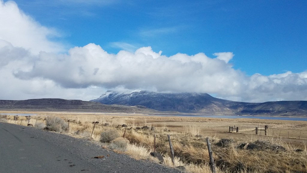
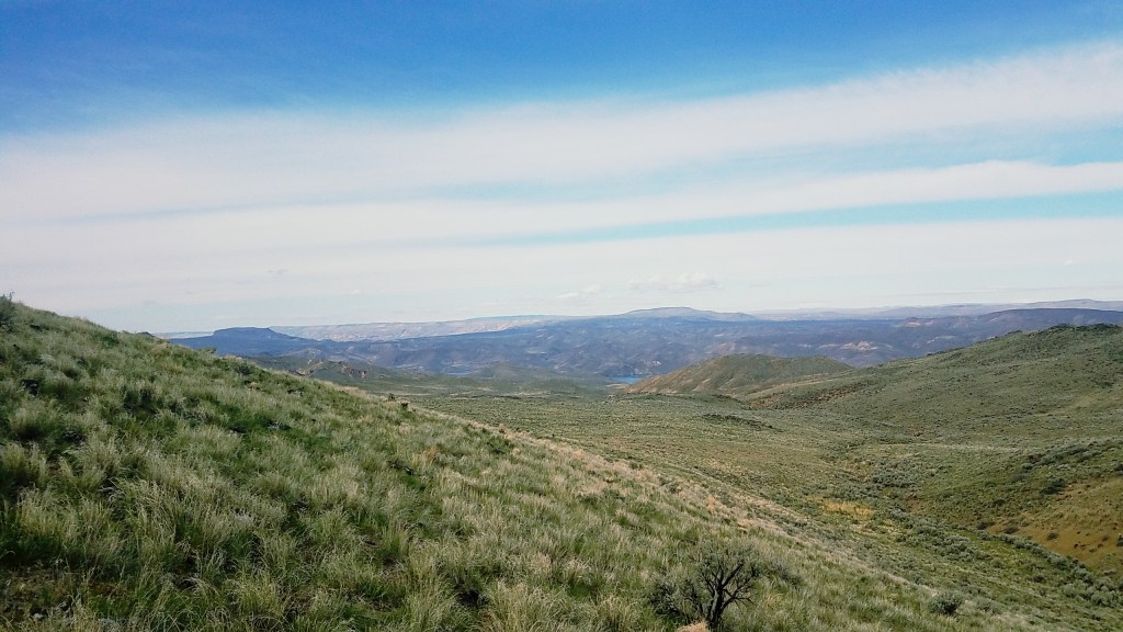
Hart Mountain blanketed in clouds…the view from Adel.

I pulled into the quiet site just before dark to park and get all cozy in the back of the jeep. I brought my -20 degree sleeping bag, paco pad (4” inflatable foam pad Kirk and I use for river trips), and down pillow. Roughing it? Not really! I read for a few hours before turning off my headlamp for the night. There were no lights in any direction, and if it hadn’t been snowing, I would have been able to see the stars brighter than many places in the country.
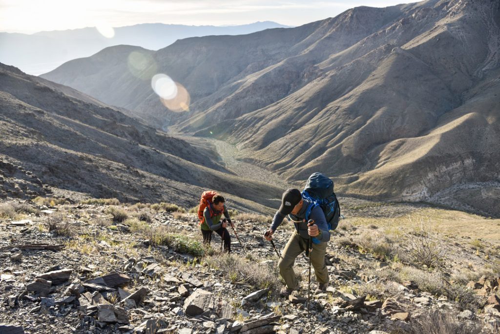
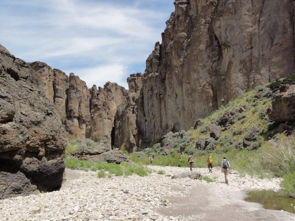
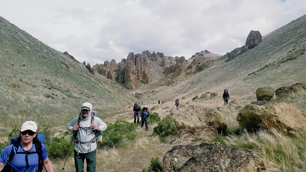
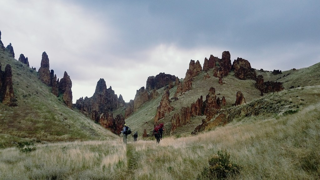
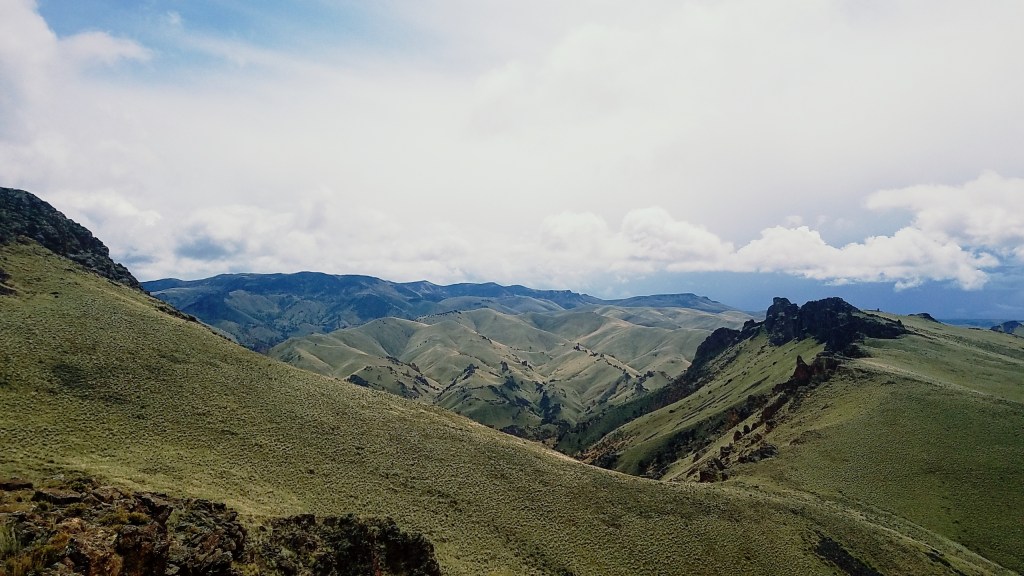
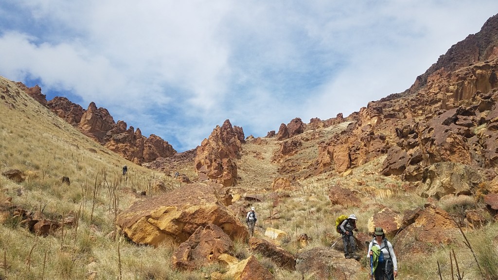
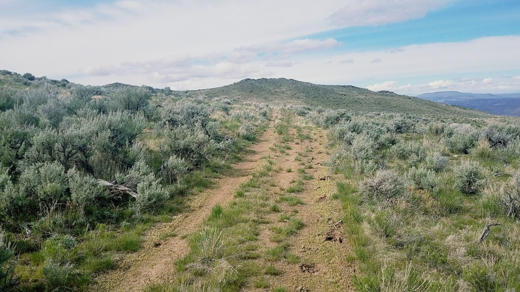
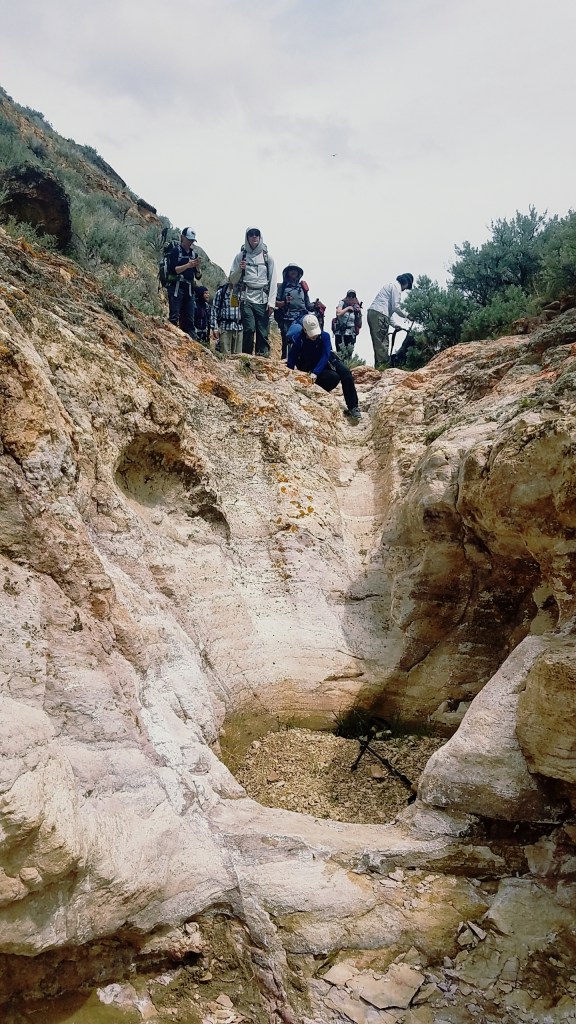
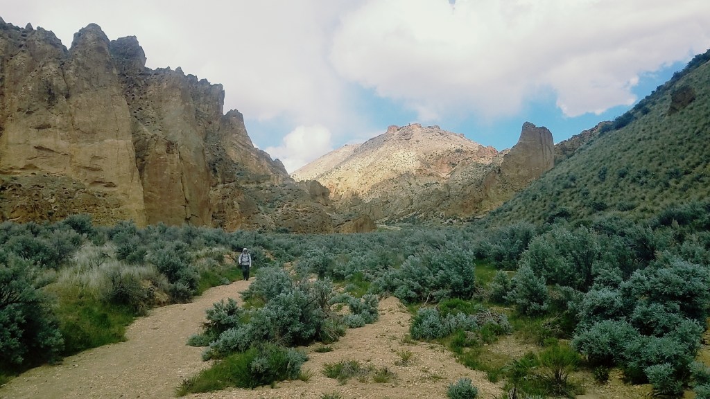
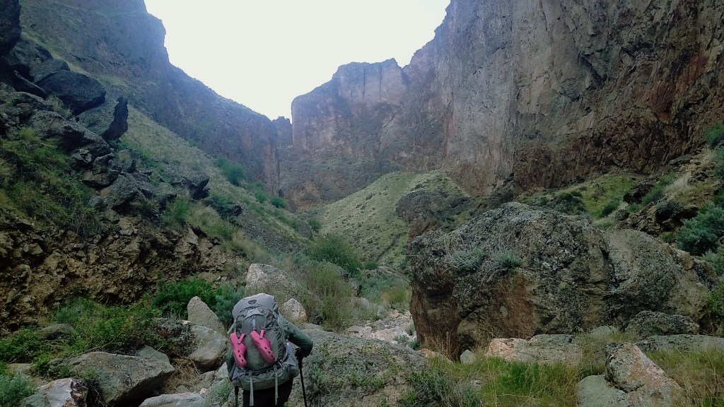
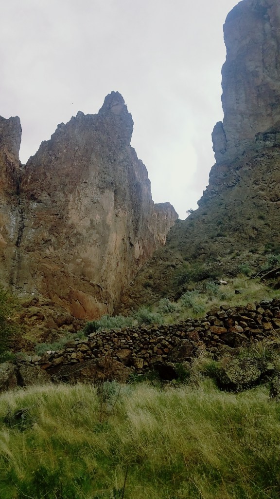
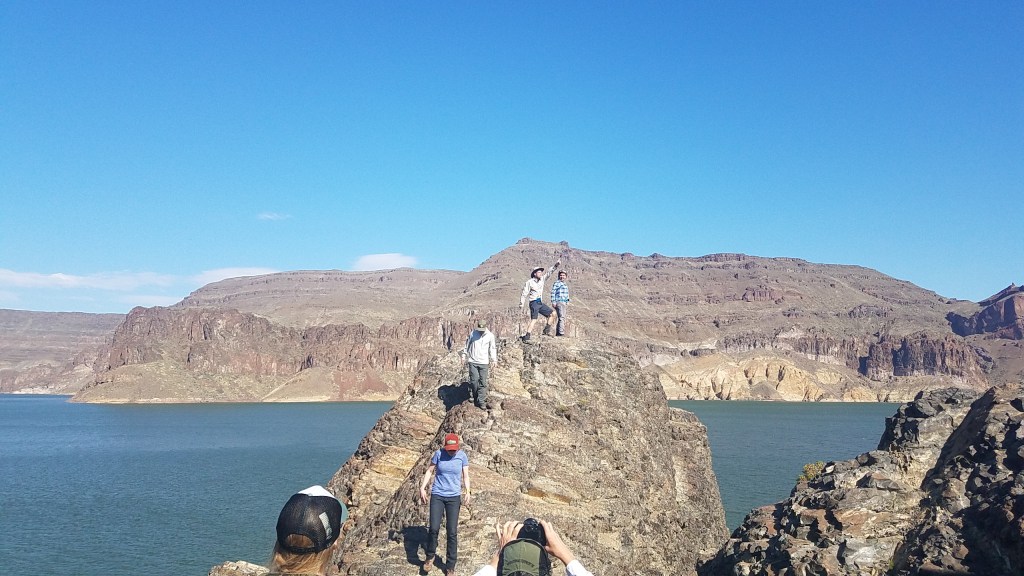
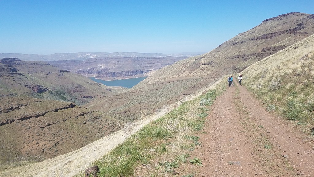
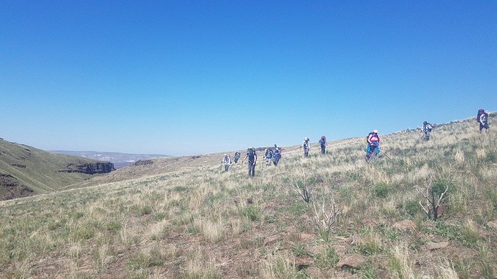
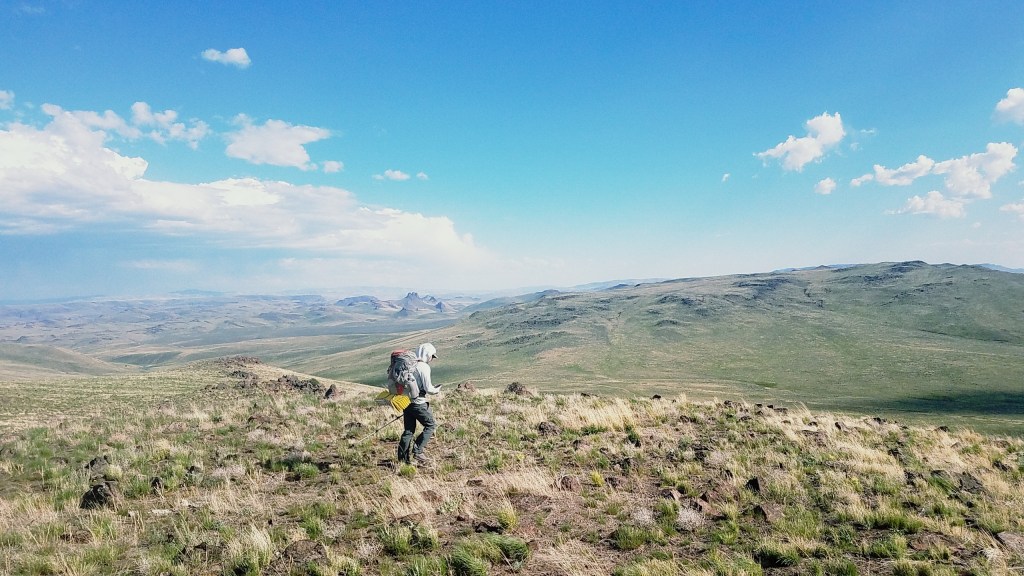
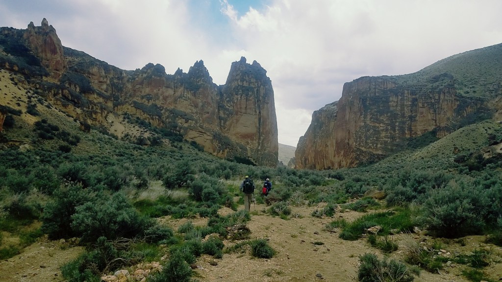