The trail unfolded before me, but first, breakfast!
I had already been up a while, drinking my coffee and writing (as I like to do), when I heard Hilary rustling in the next tent.
We got up and put bags into bags, and those bags into other bags, and into our respective vehicles. My pack was looking bigger….I had 5 days of food to reach Jo Mary Road where my trail angel Ron would be meeting me….more about Ron later.
Hilary scrambled up the rest of the eggs with some homemade pesto. I put it on a bagel with some of the left over French fries from the lobster roll lunch a million days ago. I included a banana to the growing belly before calling it quits.
Way too soon, and we had ourselves packed. I guess it was time to hit the trail.
We see the campground’s helpful park ranger on our way out, and he taks a few photos of us by the AT sign…soon we are hugging out goodbyes.
Thank you for everything H! Best start to an AT Sobo hike ever!
Then, walking.
I walk through dappled green forests, I walk through a soft carpet of bright green moss, and I walk next to lakes and water and rivers. Wow!
The trail was gentle through the rest of Baxter State Park, and I was happy for the soft touch after such a demanding summit day. I breaked next to Little Niagra Falls, and lunched next to Pine Point. There were plenty of opportunities to soak the problem foot (which wasn’t having many problems by the way!)
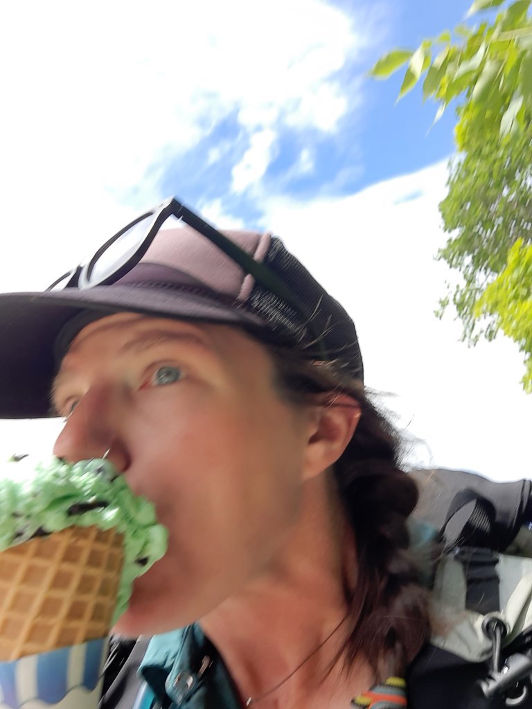
I rolled out of the park mid-afternoon and up to the Abol Bridge Store for a giant ice cream cone and bug spray. The bugs were out, and having been kind of caviler about them so far, was finding welts all over the place.
Soon mint chocolate chip was dripping down my chin…I couldn’t keep up with the melt!
I met a father getting ready to say good buy to his 17-year-old son who was going to be hiking the 100-mile wilderness solo to Monson. I reassured him that we look out for each other on the trail, and got excited by the thought that I’d only be seeing backpackers on this section…there were almost no roads, so it was to be a solid backcountry week.
Yes!
The route got considerably rockier and suddenly I recognized the AT. This: rocks, roots, large thigh-busting steps you wern’t sure you could make, and mud.
I’ve never been as strong as I was on the AT, and I was looking forward to that again….if I could make it through the breaking-in-phase.
I came to Hurd Brook Shelter when I was ready to sit down, and then sat down. There was a guy ready to finish his section-hike up with the Katadhin summit in the next day or 2. Oh yeah, and I met Clutch at the lunch break who was finishing his 10-year section hike….so fun!
The evening was filled with stuff you do when camping, and I chatted briefly with some other hikers.
Will everything be this much harder than I remember?
The 4,000′ 5-mile trip up Katadhin took us a solid 10 hours to hike up and down…this mountain is made of granite boulders, and this trail makes you climb up and over them like we were ants looking for the honey trail.
Sometimes we would find help in rebar holds that were drilled into the rock, sometimes the help came from a friend pushing your behind up a ledge, or leaning down to give you a hand and pull you up.
Whew!
On a trail like this you and your fellow hikers are all in this together. You start to make friends- giving little encouragements, laughing with them when their shoe falls apart or they make a funny little sound when preforming their own style of acrobatics to scale the next feature, because this is a full contact hike, and it becomes a community triumph when you all make it to the top and offer to help take each other’s summit photos.
But I’m getting ahead of myself.
As expected, I don’t sleep well. It’s probably the heady combination of starting my hike, that extra beer I should have forgone, and the thermarest that I’m convinced has a broken valve. No matter, I’ve been here before…on the CDT I didn’t sleep for the first week and somehow managed to move my body through space and time for over 100 miles. Determination and excitement alone can be a powerful fuel source.
Hilary whips up a tasty spread of steak and egg tortillas (homemade tortillas I might add, how did I get so lucky with this one?) and deep, dark coffee.
We ready our day packs as more and more hikers walk past our campsite to the start of the trail…the first ones having started just after 4am (and folks: start early for this one…the earlier the better!). When we were fed and caffeinated it was go time.
Aren’t we cute in our matching Hikertrash hats?
The Hunt Trail can be broken up into three parts: trees, boulders, and summit (all three sections have boulder gauntlets though).
We made good time on the first mile of the trees, and when the stair stepping rocks started going straight up, when the trail turned into a creek bed for a time and the next step required larger and larger steps to proceed, we became much more intentional with each footfall. If you tried to walk and look around at the same time you risked a faceplant, so we kept our eyes on the task in front of us. We started cracking jokes as the sweat soaked our shirts…then we reached the boulders.
One little boy refused to go any further, the exposure and sheer physical challenge of the section was painted on his red tear-streaked little face. As we passed his group by, all astonished at the task in front of us, he did get the courage to continue, and we would leapfrog with that group the rest of the day…he was in much better spirits after that.
When we could look up the rocky ridgeline and see the boulder section stretching up, up, and away into the sky, we sighed and worked on each boulder problem as it came. Each one required a handhold we weren’t sure would hold, and a leg stretch just beyond our comfort level (In 2002 this climb was a blur…the memory of this grand finale of the 2,175-mile hike was the people: Average Joe, Banjo, and Noodle and I were a tramily (trail-family), and I just remember laughing and dancing with them at the top of the mountain).
The day was clear and blue as promised, but there were some puffy clouds casting large shadows across the forest below. We could see lakes, so many lakes! And at one point, rain. We started to get a little worried about what rain would do to these vertical granite surfaces, and sighed with relief when we saw the wind blow the squall away from Katahdin. I would not climb this mountain in the rain.
Our old lady noises were getting getting louder and more frequent with each hour of the ascent, and finally we topped out of the boulder section to see over a mile of clear trail (trail still meaning boulders here…just smaller ones) to the summit.
Ok, but first lunch. We hadn’t had a proper break yet and we were starving. PB and J bagels never tasted so good.
After a quick feeding time we continued on. With eyes on the prize we worked our way to the summit…throngs of our new mountain friends coming and going. We celebrated with the ones already on their way down, and encouraged the ones still stumbling their way up (all of our legs were shaky regardless of the direction and speed with which we hiked).
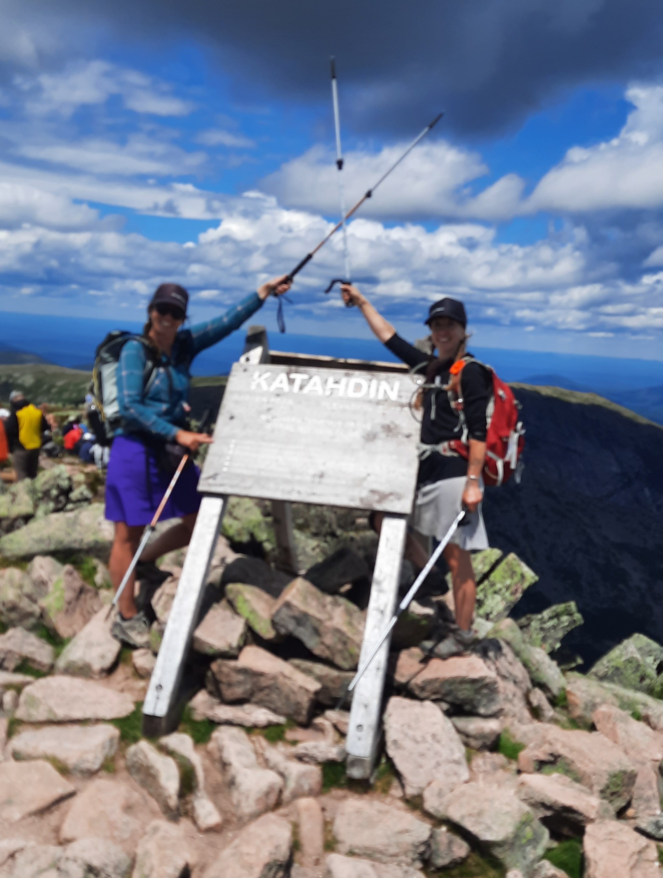
And finally, the sign.
Now my hike could start! The Appalachian Trail officially starts (or ends) up here, but I’m going to count each mile I hiked today. One gentleman shared his story of finally finishing his 20+ year AT section hike at the sign today, he looked a little choked up….hiking all 2,175 miles can be a herculean effort, especially if you can only hike in the weeks between raising children, taking work vacations, and the march of time that 20 years brings to your body.
I met a few flip floppers: folks who hiked from Georgia to the halfway point at Harper’s Ferry, West Virginia, and then hopped up to Katadhin to have a more leisurely hike south back to WV, so I’ll probably be seeing quite a lot of them as we head south together.
Hilary and I took our turns posing with the sign, marveled at the gorgeous day we had in front of us, and murmured astonishments at the even more difficult looking descent of the Knifes Edge trail (no thank you!) going down the north side of the mountain. Then we turned around for the 5-hour descent.
I’m going to breeze through the efforts it took to climb, slide, and inch down that boulder section, but it is worth knowing our knees were screaming, and a fair amount of skin was left scraped on the unforgiving granite rock faces.
We had a quick (and relieved) snack break when we reached treeline, but remembered our celebration was premature when the rocks continued to elicit grunts and groans as we hiked around down and through them.
The last mile took forever, and we were convinced there had been a rip in space and time. Surely this trail was longer now….someone or something had stretched out this section into an unbearable last few miles.
Then: chairs, beer, splashing off the sweat and fatigue in the cold water of Katadhin Stream, and snacks.
Oh the bliss of food and drink after a day like that was amazing. I broke out goat cheese and crackers and cut out pieces of cork from the chilled bottle of white wine we had (oops, no corkscrew). Hilary prepped our dinner of fresh salad, corn on the cob, and pork chops, and we merilly passed the evening hours until the comfort of tent and sleeping bag called to us:
“Come rest your weary heads. Close your eyes. Good job my friends.”
Of course there were delays, but what was most important was getting all the way across the country without getting hung up in the throng of summer travelers. I kept texting Hilary:
“I’m boarding the flight!”
“Oh no, some mechanical problem…they say an hour delay?”
“People are getting off the plane now, maybe 3 hours?”
“Oh, boarding again! Lets see if this actually happens!”
And finally, I arrive in Portland, Maine…weary and bleary-eyed, and I find Hilary outside the airport with her handsome new puppy, Dill.
We pile into her car and try to catch up on 10 years of happenings, or is it eight? We can’t exactly remember how long it has been…but I guess that will be the theme for this reunion hike….not quite remembering all the details and pulling out vague recollections of places and faces…or just letting go of all that and being present to the now as it unfolds.
After a fabulous time touring her little pocket of paradise near the coastal fingers of the Maine coast, we eat good food and remember our time as roommates in the other Portland about 17 years ago. We lived in an old craftsman near Hawthorne Ave with a few other roomates: the bartender at a fancy Peruvian restaurant, and a bike mechanic with about 30 bike frames in various states of disrepair in the damp basement.
Hilary and I drank a lot of tall boy PBRs on the porch of that house, and played a lot of pool at our neighborhood hangout, the Goodfoot. Ah, Portland, Oregon in the mid 2000’s was quirky and fun.
After waking up to rain the next day we make our plan: shop for the last few items I needed for the hike, stock up on groceries for the few nights we’d be camping at Baxter State Park, and driving up the 3.5ish hours to Katahdin and the start of my Sobo Appalachian Trail hike.
When we pulled out of Hilary’s house early afternoon, we decided to take the scenic route….stopping for a lobster roll on the way (when in Maine…!)
Turned out we made a wrong turn, not having noticed the error as we belted out Ray LaMontaine songs into the sunny afternoon with the windows rolled down. So the long drive took longer, but it really didn’t matter….we were on a road trip, and had all day to get to our campsite at Katahdin Steam Campground.
The evening consisted of tacos, campfire and stories of hiking injuries. I wonder what my AT hiking injuries will be this year? There are always a few…
We went to bed too late; I don’t think I’ll sleep tonight.
I’ve been making lists for months now, and even though my summer hike is getting closer and many things have been crossed off, more are added.
It’s been a while since I’ve planned for a multi-month adventure, especially one with such a different climate. Hot, humid and rainy…that’s about as different as it gets to the Oregon desert. There are lists of gear to dos, work to dos, home to dos, to do to dos…
And in my final few weeks before I fly out there are work trips….so many work trips.
I am days away from departure and the to dos haunt me when I try and concentrate on other things, but this last work trip has been a good lesson in “be here now.”
I am out working with our Tribal Stewards crew, a group of 8 young adults from different tribal nations around the country. The Steward program started in 2019 (a partnership between ONDA and Northwest Youth Corps) and is designed to engage tribal members in learning about careers in conservation, stewardship and public lands management while working on restoration projects across Oregon.
This week we are repairing Beaver dam analogs…weaving branches of lodgepole and ponderosa pine in between posts that had been sunk in the creek bed….an effort to mimic the water retaining magic of a beaver dam in these desert creeks…in hopes of enticing Oregon’s state animal to move back into the area (most were trapped out of existence during the fur hat craze of the late 1800s.)
After work we go swimming in a high lake deep within the forest, finally cooling off from the 90 degree day.
And as the morning breaks on the calm surface of Magone Lake and the birds flit about looking for breakfast, I am here. Now.
The lists will be there when I get back, the things will get done, and for a day or so I am able to focus on what is important…these people and this work.
The wind was cold last night. I thought about taking the rainfly off the tent because its mind-numbing flapping was barely tolerable, but the thin nylon was shielding me somewhat from the chilling wind. As it was I snuggled deep into my 40 degree quilt.
My morning route took a right onto a road as it crossed over another drainage, but I walked by the area, failing to see the road. I thought I could spy where it met the rise a couple hundred yards away, so turned around and looked closer. I finally noticed the gate. This road hasn’t been used as such in many decades. The tracks were gone where it crossed the drainage (with water of course) and thick vegetation obscured the way.
Here I go soaking my feet again, I thought. It wasn’t exactly the bog of eternal stench, (Labyrinth anyone?) but I was rock hopping just the same and got to the other side, dryness intact.
I’m glad I put my gaiters on this morning. The road walking was essentially cross country walking, then the next span of cross country walking was cheat grass walking.
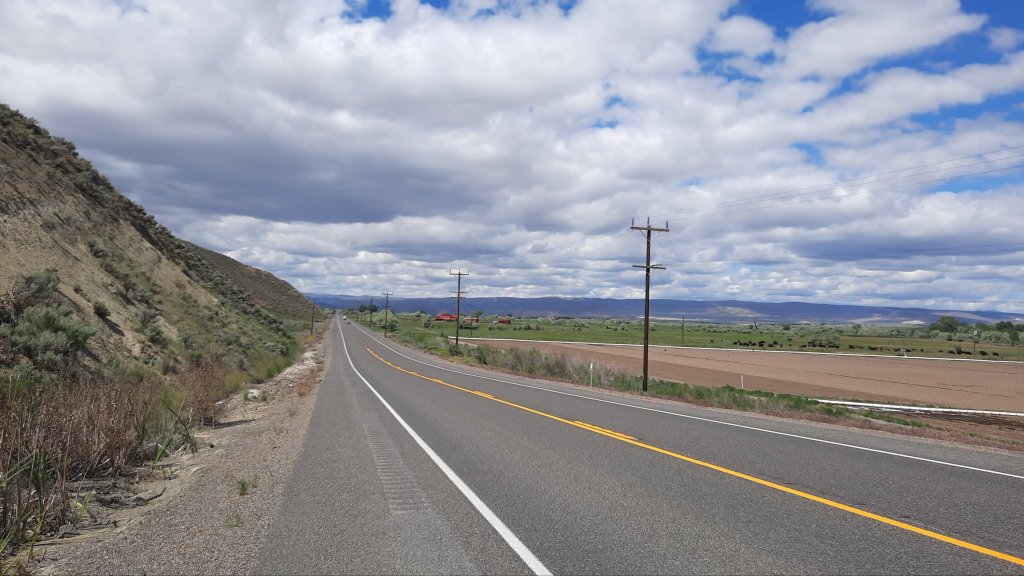
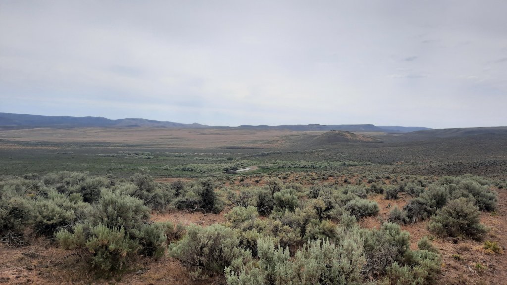
I could see the lush farmland of the Malheur River valley below. I was working my way towards the highway where i would walk the last 5 miles to my car at Harper.
For the last bit I followed the contours of an open canal…with water! I can’t get over all the water I’ve come across on this trip.
Then the road. Just as I step onto the pavement a semi blasts me with air and send my hat flying. I walk carefully after that, moving far away from traffic as I slowly inch around a looong corner, listening to a podcast to take my mind off speeding vehicles.
Then, a car pulls over. I thought I might see some sympthatic recreationists on their way from the Skull Grinder bike race in Burns that weekend; I had spent the day there Wednesday as part of an Eastern Oregon Recreation Summit (talking trails and bikes) and the summit hosts were expecting hundreds of people for the race and festivities that weekend.
Ok, the car. Out gets Kate! Kate was with me at the summit and is the recreation lead for Eastern Oregon Visitors Association. I told the group I’d be out here walking, and here I am. Kate asked if I need anything, and I suggest getting a ride the last 1.5 miles to my car would be most excellent. She agreed and I hopped in. A short and lovely encounter on the side of the road. Thanks Kate!
I changed into my chacos and went inside to tell Brian about my trip. On Thursday when I showed up I convinced the owner of the gas station and store/bar to let me park my car there. Backpacking wasn’t a traditional past time in Harper, but I must have made a convincing argument because he agreed. In fact, my judgement may have been hasty. As I was walking away he waved me over to another Harper local to meet Jeanie. Jeanie’s brother had thru-hiked the Pacific Crest Trail and most of the Continental Divide Trail. Love it!
I enter the bar, remembering Brian had said he sells sandwiches. Rootbeer and sandwich…yes please! A few locals were nursing drinks, and Brian welcomed me with a Coors Light, then a rootbeer. Some of the cows belonged to a rancher at the counter, and I delicately mentioned how nice it would be if the cows were kept out of the springs… the conversation centered on the land, and I quizzed them on features and names of things. All and all, it was a great way to end the trip.
Ah, but it wasn’t over! At least I didn’t want it to be over. I had another day to play with, as my long miles on day 3 had me finishing ahead of time. So what is a big part of the hiking experience on a long trail? A town day! I decided to go the extra little bit to Ontario, Oregon and get myself a hotel room and nice dinner.
I wasn’t ready to go home yet. Home means the end of the trip.
But getting in the car means the end of this blog….see you soon when I start writing about the Appalachian Trail! The countdown is on 😁
On my last few outings this spring, the moon has been out and the birds don’t know to stop singing. Surely they know, but just don’t care? Do birds pull all nighters on a full moon?
I walked up the grade I saw the horseback rider on yesterday and found a better road to the spot. There was no way a big cattle truck would have taken the road I walked in on, but then again, you find astonishing things via these rough 4wd roads.
My next water source was a pleasant cruise down a grade filled with soft green hills. Patches of cloud cover rolled over the scene and the idealic setting took me to a beautiful tire-filled spring. These are the water sources we dream of. Little did I know this would be the best water of the day. I only took a liter and couldn’t resist holding it up to the light. Clean and clear.
I walked next to and through a creek the rest of the day. It was nice.
Is it the cottonwood trees that are so fragrant? Their perfume sweetens the air.
I lunched at a spot called Hanging Rock Spring. I failed to see the hanging rock, but then I wasn’t about to go rooting in the brush for a view. It must have been a modest hanging rock.
Speaking of rock, the near-by drainage was named “Hoodoo Canyon” and the terrain did become very south-westish. Definitely Utah or New Mexico vibes.
Again, I should have filled up my water when the road crossed the creek and I walked about 30 feet through it. I had already tried walking around, but once I was on the sandy talus above the drainage, the view showed me that I’d be trading a clean walk through the water for a marshy mud-foot crossing. No thanks. That’s a good way to lose a shoe.
Then I evaluated. My end of day water source wasn’t far off, as the crow flies, so decided on a cross country option up and over a few rises…such a cool way to hike! You can go anywhere out here…it’s wide open. Partial fire scars cleared the sagebrush and left cheatgrass in its wake….terrible for the ecosystem, but ok for walking.
The spring is hammered. Cows protest my approach to check it out and I find nothing but a cow paradise…there are flowers and green all around. It must be a lovely place to wallow if you are a cow.
Ok, next one looks to be a mile or so of cross country hiking. This is the part where the hills start looking like mesas and the soil turns an ashy white. Definitely a different look for this hike so far. Oh, and cactus! Blooming catus 🙂
This next spring is the worst by far.
No way. Not drinking that.
Now it’s 3 miles cross country, up and over a long climb. It’s early, walking only 10 miles is a big challenge for me when my pace is 3 miles an hour. I slow way down on a cross country sections, and in general am hiking slower on this trip, but I was cruising on this morning’s road walk.
I decided it had to be done. I could camp with what I had, but only if I eat a cold dinner and skip coffee in the morning. No thanks! Onward. One step at a time.
Ooo, there it is, my first blister of the trip. Day 3, not bad! And only when I pushed it over 10 miles. Good job body! By the way, my problem planter fasciitis foot was feeling good too.
On the other side of the saddle that sat between the water sources I came to a spring cut deep into a narrow ravine filled with grasses and flowers. I found a way down on a cow trail (#^@%^$), but the cows haven’t mucked this one up too bad, so was able to get some cleanish water.
Whew.
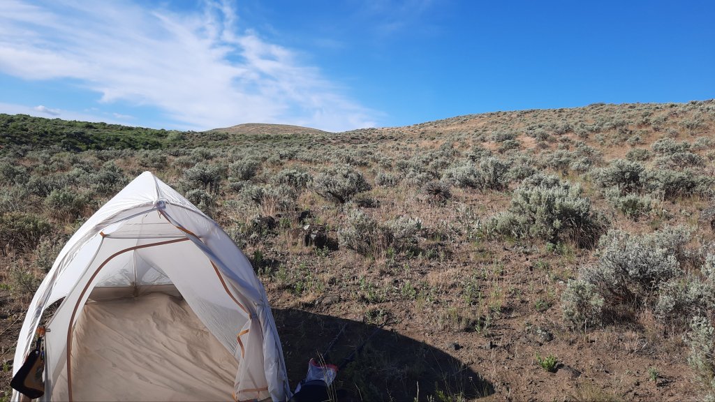
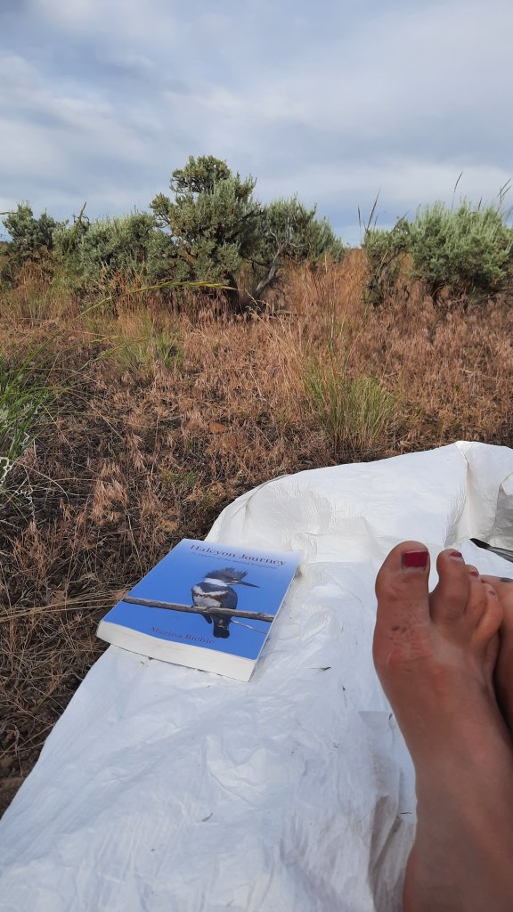
Camp, eat, hide from the sun, read, close my eyes while the birds chirp me to sleep.
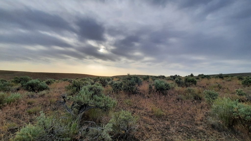
Morning was clouded up, and I was excited for the prospect of a day without sun. Temps would be much cooler and good for hiking.
A gradual cross country section brought me to a pinch-point and I scouted around a bit to find a good way down, twisting my ankle in the process.
“Walk it off,” we say, and that works…sometimes.
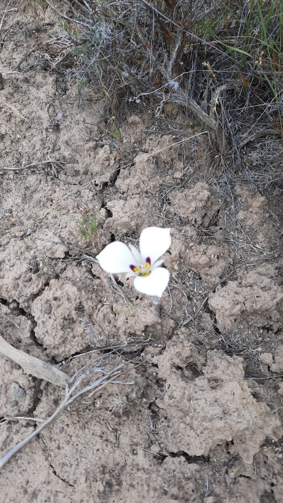
With the uneven and rocky weaving around sagebrush and the odd white mariposa lily, walking through cheatgrass just dried out enough to start sticking in my socks, but protected by my gaiters for just that reason, I found I wasn’t walking it off. I was slowly and methodically watching each footstep so I didn’t repeat the twist, and the ache remained.
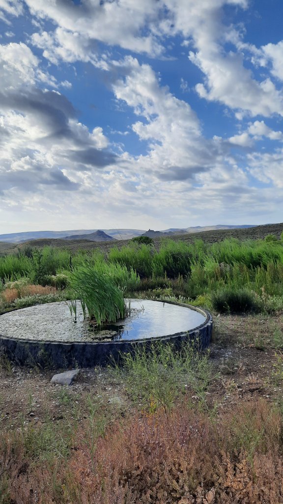
Then road! But a rocky one, so the attention now went to avoiding the fresh cow pies. Oh yeah, the cows are out, and we are all going the same place: water.
The road exits a dramatic cut in the ridgeline and descends to a fenced and quite lush looking reservoir with piped water into a cattle tank. Score! This set up can provide some of the best water if it’s piped from a spring – or a cattle-free source. (Note: the danger remains that it might be pumped from the dirty cow tank behind you. I filter or treat most water when I don’t see it coming out of the ground….maybe thats just because I do so much hiking in cow country.)
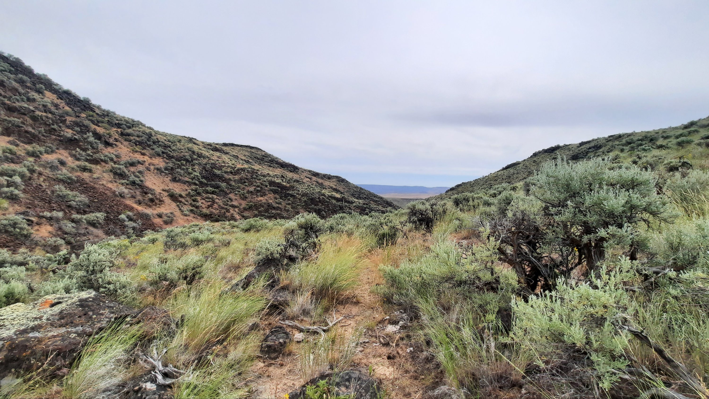
Back to roads. I walked slowly up towards the top of something again. Basin and range: true sagebrush steppe walking. Except for the road that disappeared into the folds of sagebrush as far as the eye could see, it was unbroken.
The sun never came out and I walked happily under the bluish-gray moody day.
And then: a cattle truck. I knew I might run into a rancher or two with all the mooing on the landscape, but this one was really far away, I wasn’t quite sure until I got closer…thinking it could all be a mirage.
Then…a rider on horseback racing up the grade of the next climb. The human is going home.
I am pleased that I’ll have my solo bubble intact for this 24 hours. It’s been a while since that has happened.
Another creek, and then camp. The birds are chirping away and I set up expecting a bit of rain overnight.
Shake off the time between my last solo backpacking trip and now. Those months have been filled with one unsettling event after another; my sweat is toxic with them the first day.
I am headed into the desert with modest but exciting goals: hike 10 miles a day, find water, and piece together some dirt roads stitched with cross country sections. Why? To groundtruth ideas I’ve had about linking together the Oregon Desert Trail in the Owyhees to the Blue Mountains Trail in the Strawberry Mountains, a personal plight…you might say for curiosity’s sake.
June provided a rare mild week right before summer solstice. Add in some well-deserved time-off after a week of work in the backcountry, and I had the time and good weather for a solo adventure.
This was also to be an experiment: can my rehabilitated planter fasciitis foot hold up to 10 miles a day for 5 days? I was optimistic, but am hedging my bets by going slow and stretching constantly. Oh, that, and the stick roller in my pack.
It was a shakedown hike!
I leave for the Appalachian Trail in a few weeks, so am testing my gear setup for the first time. Bits and pieces of gear always change between long trails. Each trail has it’s own gear needs, and I was preparing for hot and humid and maybe rainy weather.
I couldn’t possibly replicate those conditions in the dusty and scrubbed desert northwest of Lake Owyhee State Park, but enough pieces were in place for me to realize I was packing way too many clothes. It will take a while to dial in my AT pack…but with many options to ship things home or have Kirk send them ahead to me on the trail, I was giddy with excitement at how different a hike on the AT will be. I’ll find actual trail, people, (lots and lots of people), towns, different ecosystems and geology, trail angels all over the place, shelters, lots of water, lots of shade, lots of memories.
20 years ago from March 20 to August 22 I called the Appalachian Trail home, and I will be going home again for 2 months.
But back to the sagebrush sea.
I wandered 10 miles on rocky dirt roads that hadn’t seen any traffic in weeks if not longer. These roads are my favorite. They are everywhere in the desert and take you to water, cool things, and they are usually too rough to drive, so walk them!
Many many miles are like this on the Oregon Desert Trail. Sometimes they are whispers of a former road and you have to read the contours of the ground in front of you, and look for the ghosts of missing sagebrush. Last weekend when I was backpacking with my volunteers up into the Trout Creek Mountains, we turned onto one of those roads and the spaces where the road had been was filled with flowers. There are so many flowers in the desert right now!!! Our very rainy and snowy spring is soaking the ground frequently, so I’m hiking with great optimistim that the water marked on the map will be there…I also viewed the potential water sources on Google Maps…the detail in the satellite imagry is downright astonishing.
Even when I take my time it doesn’t take me long to hike 10 miles, so I need to purposefully slow down, take epic long breaks, linger over coffee, and read one of the 4 books I brought with me (3 digital of course!).
It’s a vacation hike! A belated birthday hike? I turned 45 on that volunteer trip last week, I ate cake with 20 people in the desert, which was amazing, but now I was treating myself to a little hike.
I intensly enjoy walking through the folds of the earth and knowing with 96% certainy that I won’t see any other humans. I am of this place and sometimes I feel this most intensily when I am alone.
Bring me back to the present, here and now. That’s what backpacking is good for. And I was brutally reminded of this when I stepped shin-deep in a mud-cow pie wetland at a desert spring. The rare desert nectar was stomped to death by their large, thirsty bodies. They wallowed in this spring, so I’m definitely filtering and treating it. 100% fecal contaminated.
Fence all the springs please!
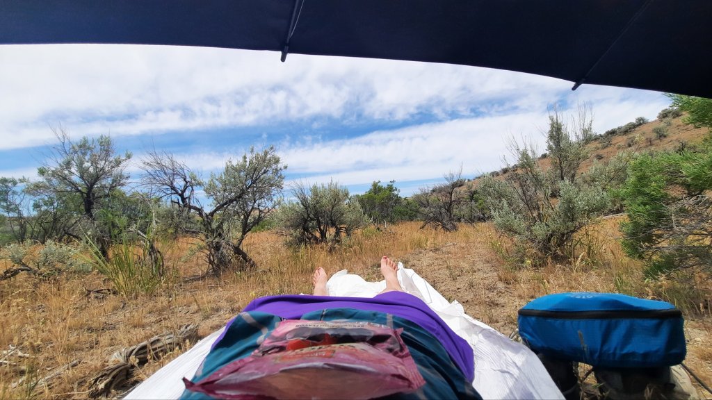
Back to it: the walking was hot, I deployed my sun umbrella much of the afternoon, and my pale and pasty legs turned red in my new purple rain adventure skirt.
Breaks were taken in the old roadbed where my footprints joined those of deer, pronghorn, and cows, i was all spread out on new and crinkly tyvek.
It will take me at least a day to sweat town away, maybe longer. I have 5 days. Happy birthday to me!
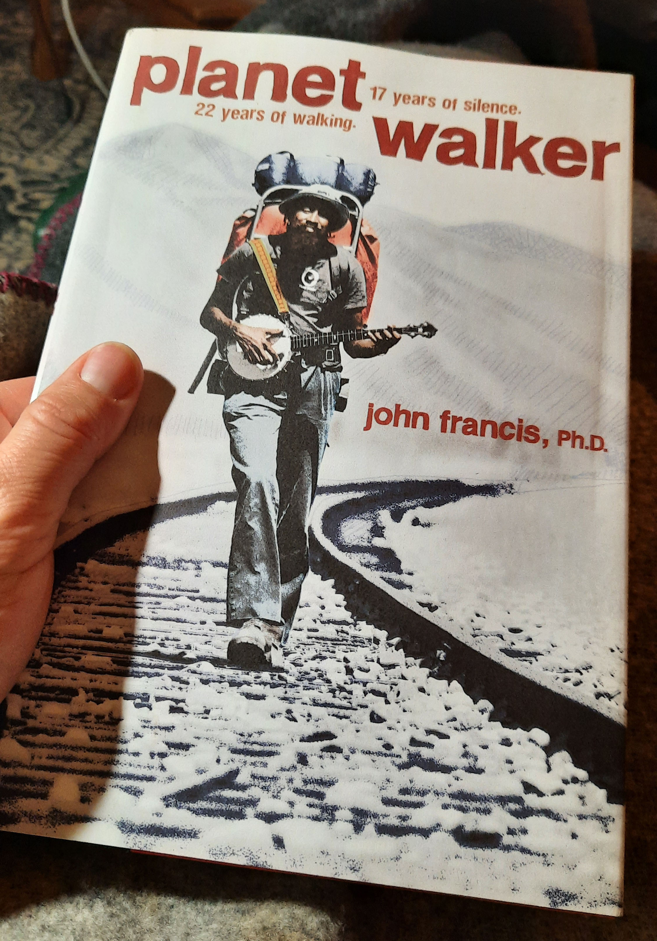
If you have ever listened to the podcast, The Tim Ferriss Show, you know that he likes to ask his guests a series of the same questions at the end of each show. I finally know the answer to one of those questions:
What is the book you have given most as a gift?
I will be giving this book to everyone I know from now on. Consider this me giving it to you…
The other question I love to hear the answers to is: If you could put anything on a billboard for millions of people to see, what would it be?
My answer is one of my favorite quotes from Annie Dillard:
“How you live your days is how you live your life.”
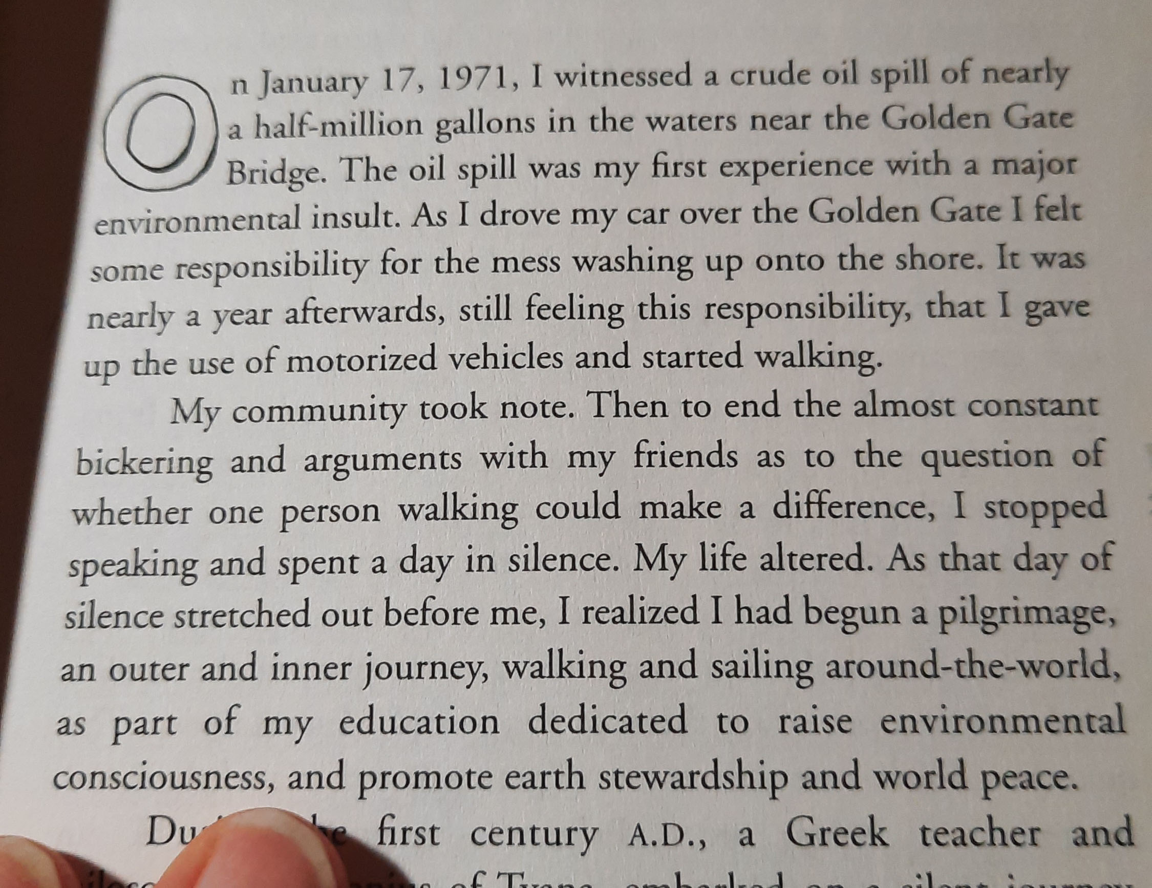
It was in the first few pages that John Francis really captured me, and held my respect and excitement until the end of the book. (I’m still excited.)
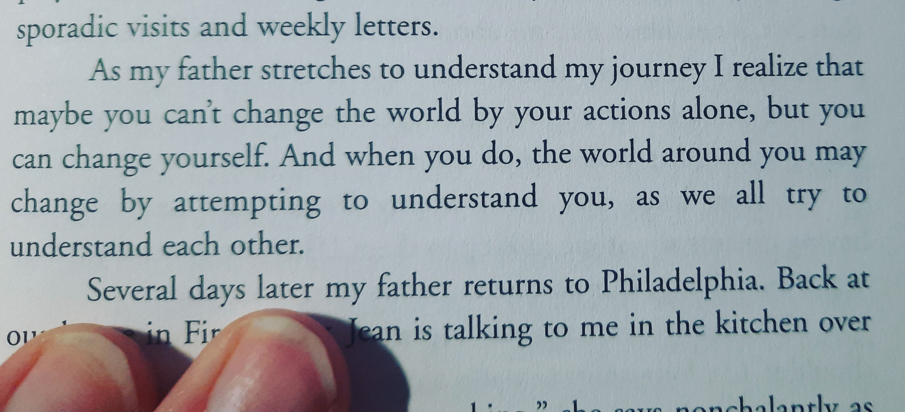
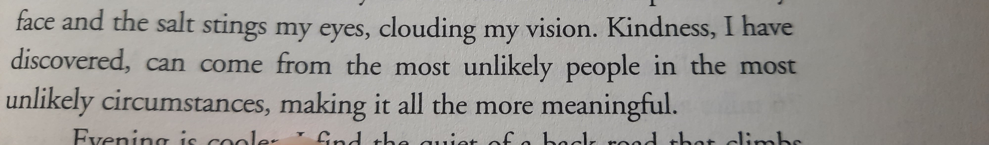
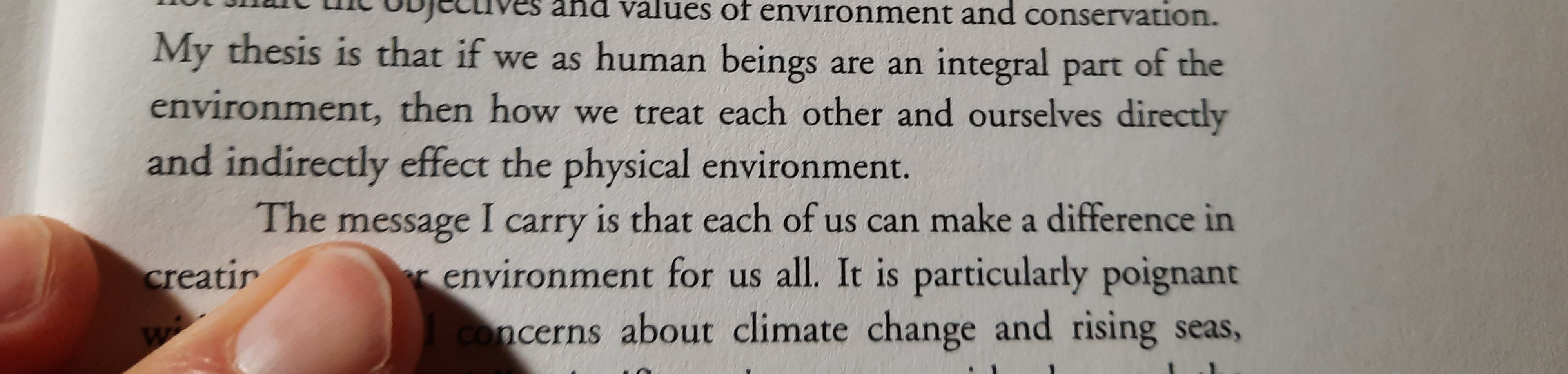
Here are a few more fabulous excerpts:
Your actions do matter. Your actions have a ripple effect. Your actions are fractals in the world (see adrienne maree brown’s book Emergent Strategy for more on this line of thinking.)
I’ll be giving another presentation next week for the American Long Distance Hiking Association – West (ALDHA-WEST) for their annual ruck on March 9.
This will be a one of several break-out sessions about using maps and apps on routes and trails. The keynote speaker will be from “LarryBoy” who hiked a 2,500 mile desert route connecting Arizona, Utah, and Idaho.
I’ve been participating in rucks for years…they are usually in person and help prepare hikers for the upcoming thru-hiking season, but because of COVID the event will be virtual this year.
What is a ruck you might be asking? Ruck is the German word for backpacking, and has been used through the trail community as a name for an event that helps you get out and backpack.