Desert Trail (Death Valley Section) Day 1- 5.5 miles


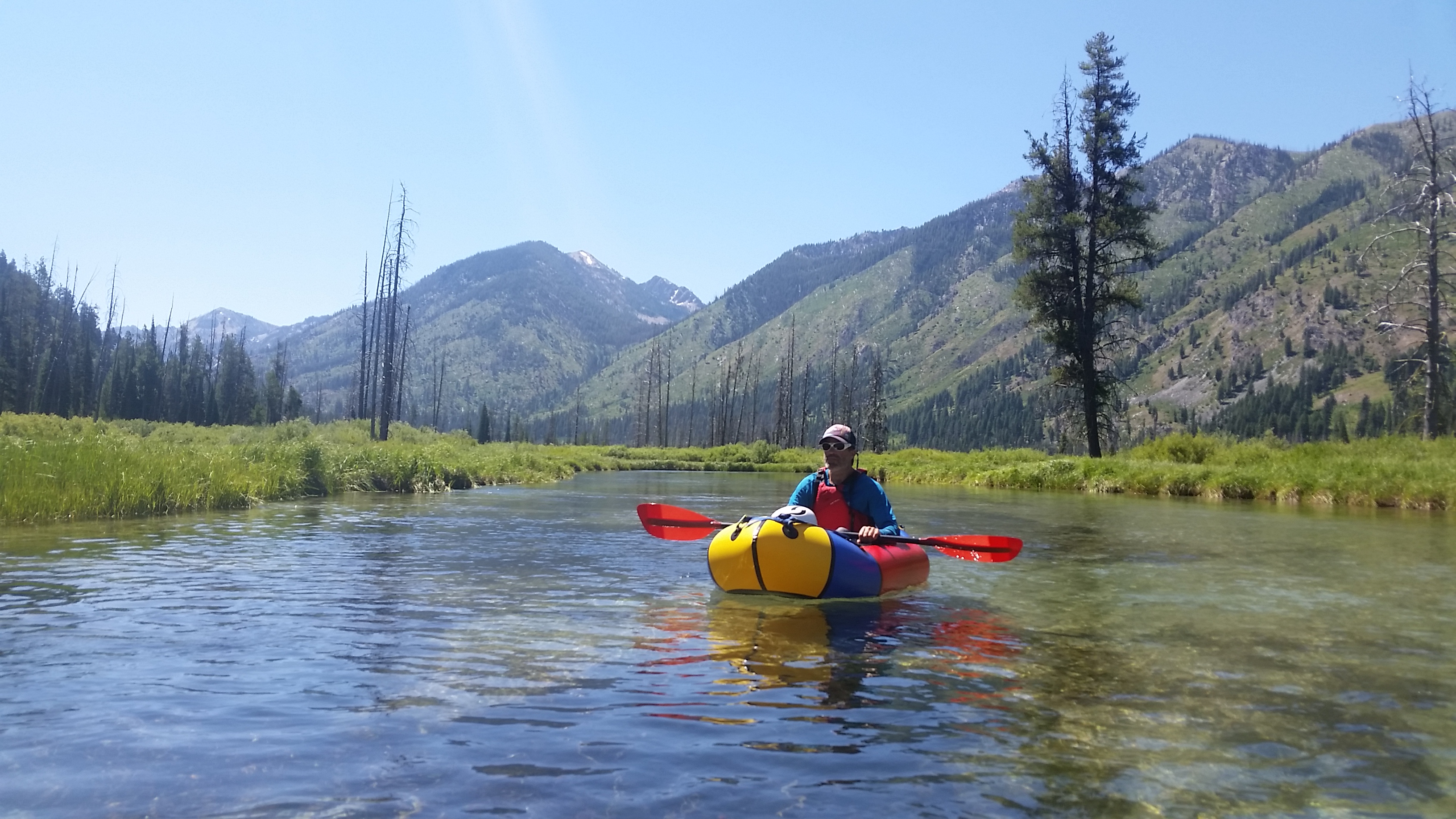
Since starting work on the Oregon Desert Trail I’ve been working with the Desert Trail Association. Also known as the DTA, this group of hikers had been working on creating a Mexico to Canada route in the deserts of California, Nevada, Oregon and Washington since the 70s. Fast forward over 40 years and the group has been successful in designating several sections as national recreation trails, particularly in Oregon in the Pueblo and Steens Mountains. The Oregon Desert Trail ties into their sections here, and first brought me in contact with the group, based in Madras, Oregon.

Now many of the original members have passed, and many others are old enough that the Desert Trail has lost a lot of the energy and drive to continue refining the route and telling hikers about it. Now the members like to go on hikes along the route several times during the year, and I’ve started leading some of those hikes for them. I love the stories from this group, and especially the fact that many of the hikers are in their 70s or even older. When one of the board members, Skip, asked if I wanted to co-lead a few sections of the route through Death Valley in California, I jumped at the chance. I have never been to Death Valley and have heard marvelous things about the hiking there.

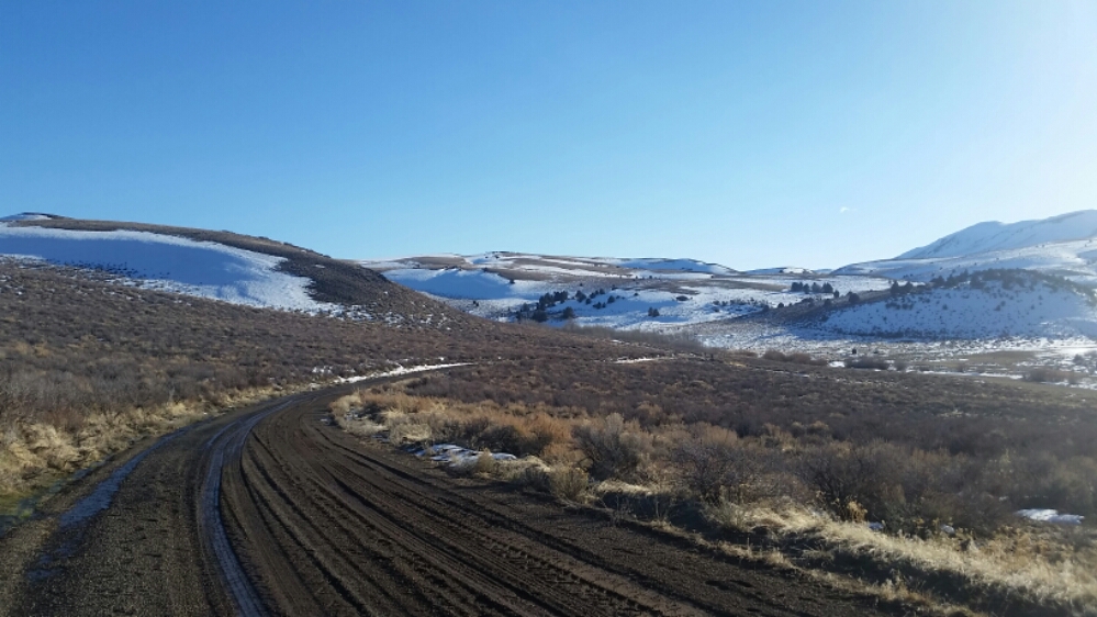
The Desert Trail is very much the precursor to the ODT, and much like my route, this has almost no trail, and that’s how this group likes it. There have always been bad ass desert rats wanting an immersive wilderness experience, and I very much identify. The ODT can learn a lot from this OG route, and has.

We chose November as the summers are an inferno, and it was their traditional time to meet and go hiking. When I looked at the forecast and saw 90 degree days, I knew the trip would be like one last hurrah of summer. I left Bend after work on a Friday and drove about 5 hours to just outside of Winnemucca and pulled over on a BLM road to park and sleep in the back of the car.


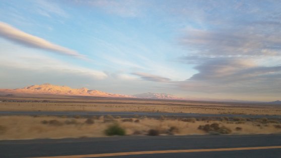
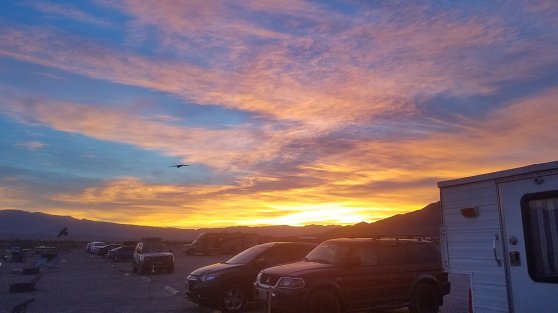
The next day I drove through the middle of Nevada and past many mountain ranges I was itching to explore. I pulled into stovepipe wells mid afternoon and found the group in the campground. Several folks I had met before, and several I hadn’t. We were joined by some other people from the Death Valley Hikers Association, and spent the first night camped together. Not everyone would be hiking, and some would be helping to cache water and shuttle cars.

We started at the Racetrack, a large alkali playa where the rocks have an eerie way of moving on their own. Our plan was to hike back to Stovepipe Wells in 4 days. About 40 miles. Because I was the youngest hiker (and the only woman) by about 30 years, we had planned some modest mileage. Skip had hiked this section several times before, although from the other direction. We figured between us we would have our bases covered. I had the guidebook to the desert trail in death valley, and the route waypointed on Gaia. Even though I haven’t been here before, we had enough resources and first hand knowledge to do the trip.

The drive to the Racetrack took 3 hours even though it was only 72 miles. About half was on a rocky washboarded road, although the group told me it was in much better shape than they had seen it before. Two cars went to drop off a vehicle at our night 2 spot as one of the hikers would have to leave early. We had water cached inside – there is no water available for the 4 days otherwise.

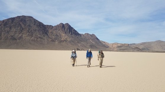
We all met at the Racetrack and started hiking. The Playa was beautiful and the Temps were a much more pleasant low 80s. We checked out the grandstand, a rocky outcropping in the middle of the flat, and then made our way up the climb of the day through a series of washes.


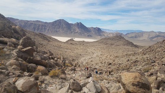
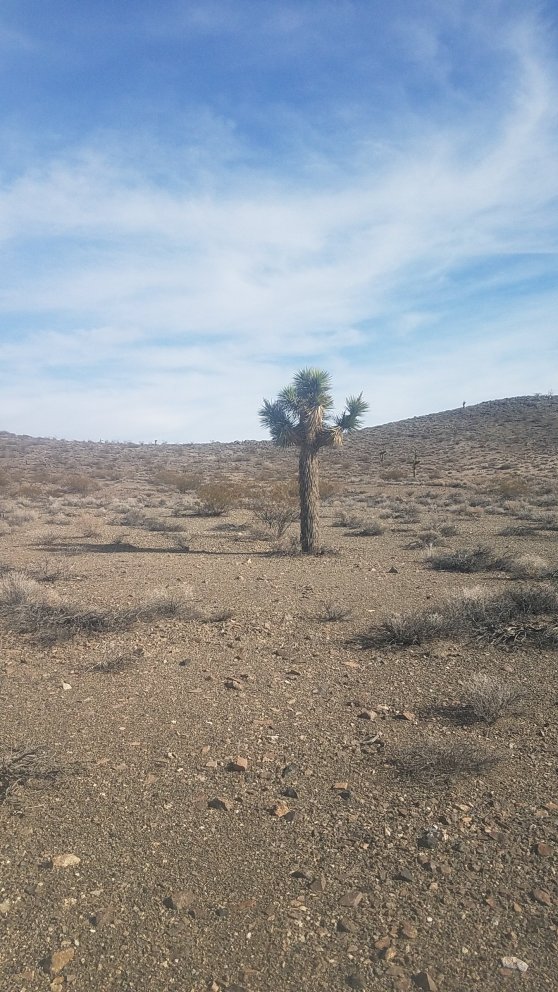
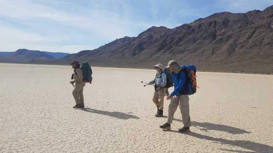
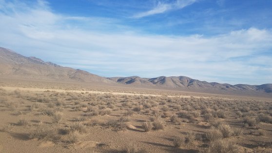
The mountains are enormous here, and I loved it all. After huffing and puffing up the climb we had lunch on top. The rest of the way we wound our way back down past Joshua trees and creosote bushes. We descended down to Hidden Valley, which didn’t seem so hidden because we saw a bunch of cars cruise by on the dirt road that passes through the middle. We took a lay-down break before crossing the valley to find camp at the mouth of the next climb. Basin and range baby!


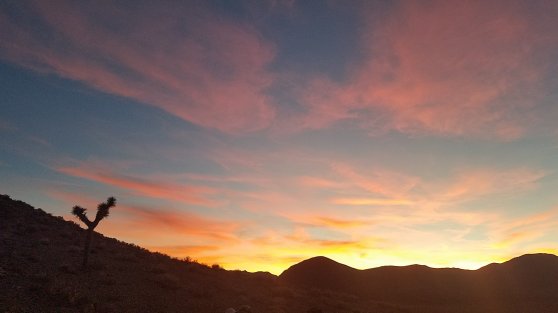
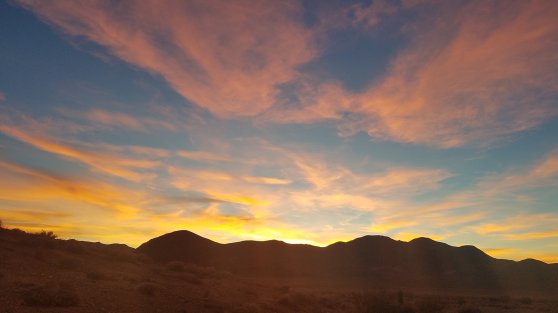
I’m cowgirl camping tonight and it’s fairly warm… so nice to be out here.

July in the Mountains – Waptus River

Repost from Adventures with Packraft

Kirk and I had the first week of July slated for a week of vacation, and we still hadn’t decided on where to go until the day before we left.I figured: draw a 10-hour driving circle around Bend (I didn’t want to drive farther than that), but turns out that includes the whole Pacific Northwest. Not much help.

We looked at packrafting the Bruneau and Jarbidge rivers in SW Idaho, but at low flows the rocks are reported to be tearrrrifying…tear…if..ying…tear. No thanks.

We thought about the Olympics, but we would be looking at a 4,000’ climb to get up the good alpine stuff, and we weren’t feeling THAT ambitious.

We thought about rafting the lower main Salmon River, but it is a very popular stretch, and open to jet boats… With July 4th happening during our week off, we knew it would be one of the busiest vacation weeks of the summer.

So, when Kirk came up with a combo backpacking and packrafting trip in the Alpine Lakes Wilderness in Washington, it sounded perfect. I had hiked through the Alpine Lakes area 12 years ago on the Pacific Crest Trail, but that September the whole stretch was drenched in rain and fog and I really didn’t see much. I was excited to go back and hike a little bit on the trail, check out some high alpine lakes, and do some packrafting.

It was hard to decide where to go even then. The area is massive and so full of mountains, rivers, lakes and trails that it really makes Central Oregon and our Cascade range look like child’s play.

We let the rivers decide where we would go.

We drove to Cooper Lake on Friday and camped on the side of the road (Washington has so many free roadside campsites!). Kirk has been checking out the Cooper River, a short, stout whitewater run, that was over my head, so next we drove up the Cle Elum River. It looked promising, then we hiked in to the river Kirk really wanted to check out, the Waptus.

We were worried it wouldn’t have enough water, but when we got to the confluence, it looked doable. It would be a mellow river with a few gorges…unknown gorges involving extensive scouting… so it would be a real adventure!

We left the parking lot with a week’s worth of food, boats, backpacking gear, and if we had weighed our packs I bet we were both tipping 60-70 pounds. It was painful. So painful that I wasn’t sure my body could do it, and I have rarely felt that! We were to hike in 9 miles with the full load. Eeeeeee!

We made camp the first night about 4 miles in at the top of one of the gorges with what looked like a fun granite slide and drop. We had already passed a waterfall with a series of no-go drops, so we already knew the river would hold more surprises, and we would have to portage some stuff.

We huffed and puffed our way to Waptus Lake (on the PCT) and cached our boats.

We spent the next few days hiking to some incredible lakes including Spade lake (holy cow, the trail goes straight up and reminded me of the Appalachian Trail…no switchbacks up the 2,000’ climb. Brutal.)

Then we went up to Deep Lake.

And Peggy’s Pond by Cathedral Pass. Wow!

This was on the PCT but I didn’t remember any of it.

Peggy’s pond was still under snow but we found a dry patch under the towering Mt. Daniel for an incredible view. I must say, PCT hikers don’t know how good they have it. The minute the trail intersects a path that doesn’t continue to Mexico and Canada, the character changes immediately…no switchbacks, quick elevation changes, scree. But on the other hand it is efficient.

We made our way back to Waptus Lake and our boats on a hot sunny afternoon, so I had to dive into the lake. COLD. Yes the lake is fed by snowmelt, and yes it was unbearably refreshing. We inflated our boats and paddled around a bit and enjoyed the bliss after some pretty challenging backpacking.

The next morning we loaded up the boats to see what Waptus River had to offer.

The calm and pleasant paddle out of the lake lasted about a mile before the first gorge.

We got out river left to scout, and could tell the entrance was clean, but we didn’t climb the next bluff to see deeper into the canyon. It’s crucial to scout these places because they are so committing. Once in a granite gorge like this, there is no out. Often sheer cliffs prevent portages or walking around rapid, and narrow canyon walls can easily trap logs and make deadly barriers. So, since we couldn’t see farther in, we decided to do the smart thing and walk around.

The portage on river right looked more doable, so we picked up our fully loaded boats and walked around.

On top on the river right side we dropped boats to get a better look at the rest of the gorge, and to our dismay saw it was a go. The gorge was clean and runnable, but we were already mostly around and wouldn’t go back. Bummer, but we should have either taken the time to scout the whole thing, or be happy we made a smart choice with the unknowns we were facing.

The next 4ish miles were a braided river channel complete with several knarly log jams and gorgeous deep aquamarine pools.

We huffed and puffed over the log jams and had several clear miles before the next gorge.

First we ran the granite slide and drop that we had scouted on the hike in. Fun!

We pulled over and had lunch, and decided to scout the next gorge, the whole gorge, this time. It looked to be about a mile long, so we left our boats and bushwhacked up and down the steep cliffs.

We were able look down the steep wooded slopes for most of it, and it was clean. No logs blocking the way, but a few of the rapids were in the Class IV/-V range with no portage  / scouting potential, and I didn’t feel comfortable running them.

Kirk wouldn’t boat it alone (any Class V packrafters out there that don’t mind some brutal backcountry wilderness river trips? Kirk could use a big water adventure partner). Anyway the whole gorge ended with a series of waterfall drops (35′ triple drop) that looked good if you had a hardshell (not so good for a packraft), but no way to set safety on the second crux drop of the triple drop .

So we walked back to our boats while dodging a quick thunder storm, and picked up our boats to  make the whole journey back again.

We made camp with a view.

For our last day of paddling it appeared from the topo lines on the map that we might have another gorged section on our hands, but after launching that morning and padding for a short while, we realized the terrain wasn’t as narrowing as it looked, and it was all a go.

We were in some fun Class II/III water!

Beautiful pools of water peppered with fun rapids marked most of the run that morning. Towards the end of the run the drops started to get bigger, in the Class III+ range, but all were clean and good splashy fun.

I wore my gopro for the boating, so got a lot of footage of the river, stay tuned for a video!

Idaho Sawtooth Adventure: Day 5 – 1 mile hike, 9 miles packraft

The morning was chilly, and again I woke up on the ground. I have to patch this sleeping pad.


We downed the last of bits of our coffee (weak tasteless coffee at that, but on the flip side we’ve had dark french press the first 3 mornings), and hiked back to where we had cached our boats.

Oooo, that must be a big bear

Ensue bushwack. Getting to the river from the trail was a bit of a willow bashing fest, but we finally made it and transitioned to packraft mode. All gear stored inside the boat, day bag with sunscreen, lunch (in this case one packet of hickory smoked tuna. That’s it. Sucks.), and water.

We launch on a swift little current on a narrow log-congested river, gravely braids of river channels everywhere.

The water was clear and blue and green and it felt like we were flying through the canyon, until we got to logjam, after logjam, after stupid logjam. It was still worth it though. I actually expected more in an un-dammed river in the heart of the Sawtooth Wilderness.

The 4.5 miles of trail turned into 9 miles of river with all the meandering channels, but still worth it.

We were worked by the time we made it back to the car mid-afternoon. We had a short rapidy section about half way, but it was mainly the numerous log jams we had to portage with full boats and careful walking to not impale ourselves on dead trees, or break a leg in a beaver hole. So much fun!! Really!

Idaho Sawtooth Adventure: Day 4 – 10ish miles

It felt like I was sleeping on rock…that’s cause I was. My air beam sleeping pad must have sprung a slow leak, cause I woke up on a lack of air, and it was hard.


We packed up under the granite towers above us, and started down the many switchbacks to Ardeth Lake. It was beautiful and buggy. We walked down down down the thousands of feet we had hike up a few days before. We were down to the last bits of food, carefully rationed out to get us to the car tomorrow afternoon.

Hammocks came out again for a lunch break, and a train of mules and horses passed us. We’ve seen several mule trains on the trail each day, and because there are still a fair amount of downed trees across the trail, the horses and mules have been forging some huge bypasses up and around them. It’s impressive where horses can go off trail without breaking a leg, but also has me a bit pissed off at the destruction they are causing on the side of the trail. Most of the horse packers carry a saw, and clearing some of the trees would only take a short while. Seems to me if they are using the trail so heavily, that they should help out and clear some of the downed trees as they pass by each day. There are fewer and fewer resources for the forest service to maintain trails…as it is most are done by volunteers. I know the folks from the Idaho Trails Association have their hands full.


Back to the trail…we continued on and by mid afternoon we were quite stumbly. The more we dropped in elevation, the warmer it got. In fact it was down right tropical around Fern Falls. We had hit prime wild flower season.

Smith Falls

We stumbled into camp, the same camp as night one, and went down to immerse ourselves in the cool water and wash away the heat.


Relief.

Idaho Sawtooth Adventure: Day 3 – 4ish miles

Last evening we climbed the rest of the way up to Edna Lake and what had to be the best campsite in the area. The headwall of the south fork drainage still had snow, in fact a few patches of snow were all around. We decided to make camp here tomorrow morning and spend the day exploring the high alpine lakes.

So this morning after our coffee we packed up and headed to the granite jetty where we wanted to make our camp, set up, and left a few things in the tent while we explored during the day. We decided to hike cross country around one side of the lake to reach the next 2 lakes, and soon had to climb high to get away from mosquito hell.


We popped up over the upper two lakes and almost to an unnamed pass that held its own little lake. As soon as we were up there we knew we had to move camps. It was just stunning with shallow green water and big slabs of granite floating like little islands throughout. We sprawled out on one of the granite islands and I decided I would hike on the trail back to the camp we just set up and bring the gear back here. It wasn’t that far, right?

But then we saw this little lake!

Well by taking the trail back I had doubled the distance to the lower lake, so 2 hours later I arrived back from the errand and decided it was the perfect time to jump in the lake. At almost 9,000’, it was still hot enough for a swim…kind of. Piles of snow were still melting into the water. Brrrr!

Blue line, cross country. Yellow line, trail.

I took a siesta and Kirk went exploring, to come back a short while later with the news that epic views in all directions were just a few hundred feet above the lake. I followed him back up and….

Dude.

Idaho is something else!


We made some mac and cheese high on the ridge and looked at all the world below.

Dude.


Later back at camp we played a rousing game of cards as night drifted down around us.

Idaho Sawtooth Adventure: Day 2 – 3,000 feet of elevation gain and 11 miles

When we woke up it was Kirks birthday! Idaho birthday trip is proving to be a success so far…including waterfalls, and some carrot cake I packed out that is only slightly pulverized.

We were drinking our coffee and looking at the river when a hiker passed by, or he almost passed by before I saw his small pack and tan legs and asked if he was thru hiking the Idaho Centennial Trail. Gentle Ben had been section hiking the trail, getting pushed back by snow and swollen rivers. I was stoked to see a long distance backpacker. He said he had seen no hikers. Almost no hikers at all on the trip.

We continue up the river canyon, stopping periodically for views of the river and various waterfalls. Kirk is living up to his trail name of “I’d rather be kayaking” because he squealed with delight at many of the drops. I may have committed to coming back at lower flow and hiking our boats up further to run some rock slidey sections.

We took a long siesta at a river crossing and strung up our hammocks for a nap.

Then onward. We had 3,000 feet of elevation today, no real destination either, but we figured we would continue to go up the South fork…might as well hike up to the headwaters.

Mid afternoon I look down, and in a beacon of light, there sat a fully wrapped orange starburst. Birthday trail magic for Kirk! The trail provides, I always say. I handed him the sun-warmed treat and after unwrapping it, he claimed we needed to bring more starbursts on our hikes.

Early evening found us at Virginia Lake, over 8,000’, and we found a sweet gravel bar to perch our camp at midway up the drainage to Edna Lake. 

Idaho Sawtooth Adventure: Day 1 – 5 miles

We woke up high on the cliff above the Middle Fork of the Payette and decided to head to the south fork and try our luck on a backpack/packraft adventure into the Sawtooth Wilderness. The fact that it also happened to be along the Idaho Centennial Trail was an added bonus, and oh so convenient.

By the time we made it to Geandjean, the trailhead up the South Fork of the Payette, it was about noon, and a hot sleepy Tuesday afternoon. There were almost no people about, which was awesome for the middle of the summer. We repacked our backpacks and packrafts with 4 days of food and the hope that we would be able to float at least 5 miles until the river canyons up and becomes waterfall and wood-ladened. Something Kirk was looking forward to seeing. He has wanted to boat/packraft the south fork for a long time, and here we were. 

20170718_152634

Hot hot hot start to the trail. We walked up about 5 miles, deciding to go for our chacos for the river crossings at Baron Creek and Goat Creek. The river looked tranquil and full of wood. It would be a float on blue-green water through a very green valley. As the canyon started to gorge up we decided to drop our boats and paddling gear to pick them back up for the packraft out. It wasn’t long before we saw a portion of the river forced into a narrow slot in the granite and found a sweet little campsite in view of a massive pour-over. We set up camp, took snacks and the can of PBR i had packed up, and sat with our legs dangling in the water on a big slab of granite. 

Short trips & lots o luck on the Oregon Desert Trail

I wrote this post a few weeks ago but didn’t get around to posting it till now. Lots of options for short trips along the ODT. Another post coming soon about my recent ski tour in the Steens!

Early March…

I spent the last 2 days visiting a few of the trail towns along the Oregon Desert Trail, meeting with businesses and several folks from the Forest Service and BLM. On my way down I was able to connect with Kyle, an ODT hiker who had first left Bend in January about 2 months ago. We’ve had a crazy snow year, and when he left he was on snowshoes and pulling a sled. It was slow going through the snow and by the time he made it to Paisley, was suffering from the strain of an unusual gait due to the snowshoes, so took a month off to heal and ended up working for a bit at the Summer Lake Hotsprings. Not a bad place to rest up and watch the snow fall!

He just happened to be getting back on the trail the day I was passing through, so I picked him up and took him to breakfast in Paisley. A big order of biscuits and gravy later, I was dropping him off at the Chewaucan Crossing so he could start again.(update, the snow and mud had Kyle rethinking his hike, he’ll be back in the fall to finish the ODT)

It’s really feeling like spring, and while there is plenty of snow still in the mountains, I think he will have a much easier time of it now, spring is right around the corner.

I had a GREAT series of meetings in Lakeview, and came away excited by the town’s eagerness for recreation. I think big things may be happening here!

I made my way out to Plush, driven by memories of an awesome burger that Dave, the owner of the Hart Mt Store, had fixed for me last summer. I was just in time for lunch and Dave was at the grill again. I’m feeling lucky! Sounds like there are some new lodging options for hikers, so I was really glad I had made the trip to check in.

The day was freaking beautiful and warm, I could practically see the snow melting off the mountains around me. Hart Mountain was looking mighty fine, so I decided to drive up to the refuge and see if the road to the hotsprings was open. I had planned to spend the weekend somewhere on the trail and brought skis and my backpacking gear so I could have more flexibility.

I arrived at the refuge headquarters to find the road closed due to wet muddy conditions, but it was still open to hikers, so I loaded my pack up and headed in the 5 miles intending to camp at the hotsprings campground.

The day was so warm I took off my fleece for my sunshirt, and even then still had some sweatyness. Oh how I’ve missed the sun and warm weather!!! There is still quite a bit of snow on the landscape, but it made for dramatic views as I walked away the afternoon.

The campground was slumbering under patches of snow, but I found some dry ground to set up my tent, and headed to the hotsprings for a soak. What luxury to have this place all to myself!  

Tomorrow I’ll head out and see if I can find a place to ski in the Warner Mountains, and maybe the day after try to climb up the 2,500’ lift of Abert Rim. So many options out here!!