Oregon Desert Trail in the Washington Post

Ummmm, this is pretty exciting! The Washington Post covered the Oregon Desert Trail!

Read the article here: The Oregon Desert Trail is just that, complete with canyons and rattlesnakes

Screenshot_2018-10-19 hikertrash ( wearehikertrash) • Instagram photos and videos

The Oregon Desert Trail is just that, complete with canyons and rattlesnakes

By Emily Gillespie

October 19, 2018 at 7:00 a.m. EDT

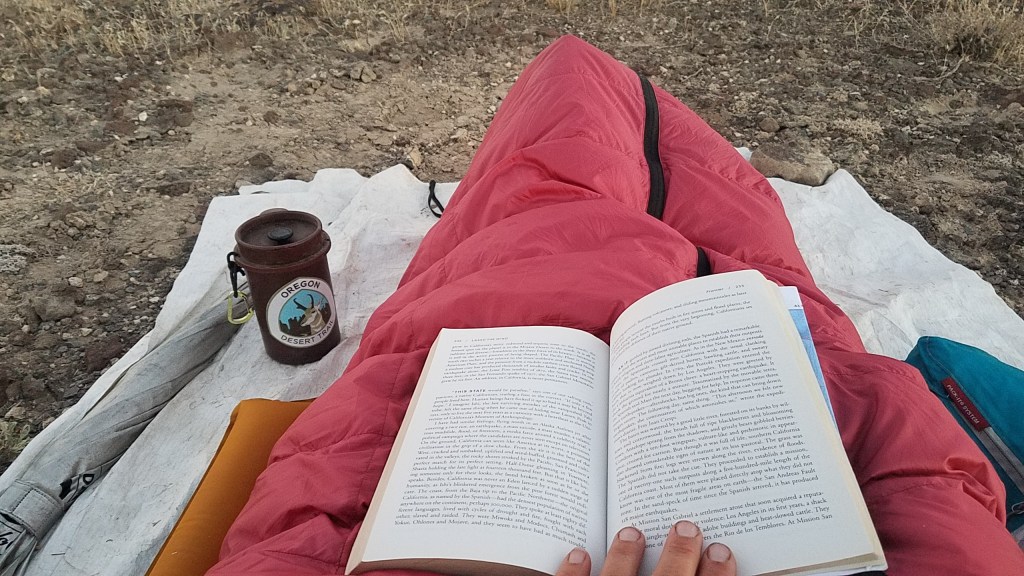
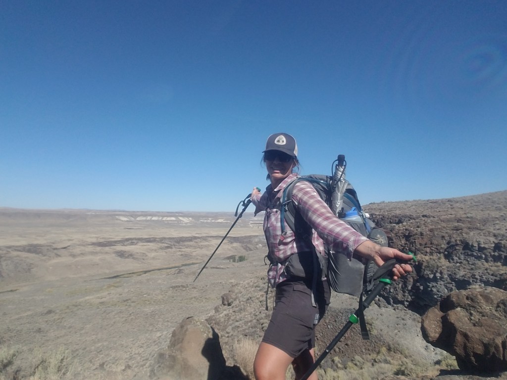
I felt every drop of sweat make its way down my face, neck and back as I stared down the rattlesnake, its beady eyes locked with mine, daring me to move. At this point, a few miles into my solo-backpacking trip through Oregon’s remote desert, I considered turning around and heading the several miles back to my car. After I caught my breath, I shook off the idea. Testing myself, I thought, is exactly what I signed up for.

I’d had the idea for the trip a few months ago. Travel Oregon had released an elaborate animated advertisement featuring lush rivers, snow-peaked mountains, miles of vineyards and coastline, and breathtaking Crater Lake. When I watched it, I couldn’t help thinking: false advertising.

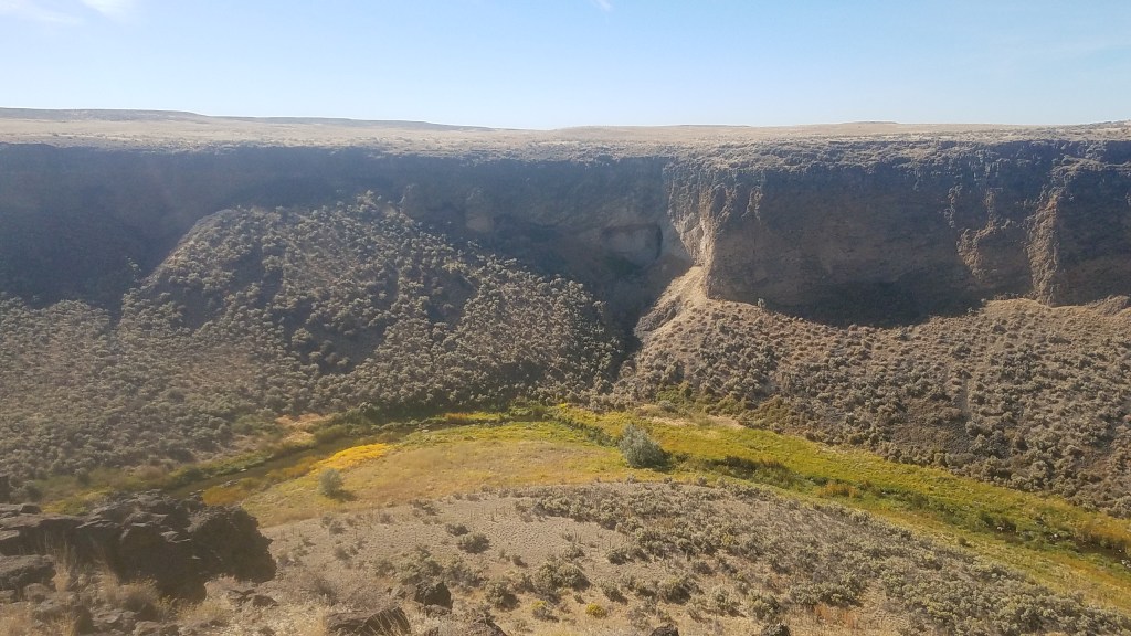
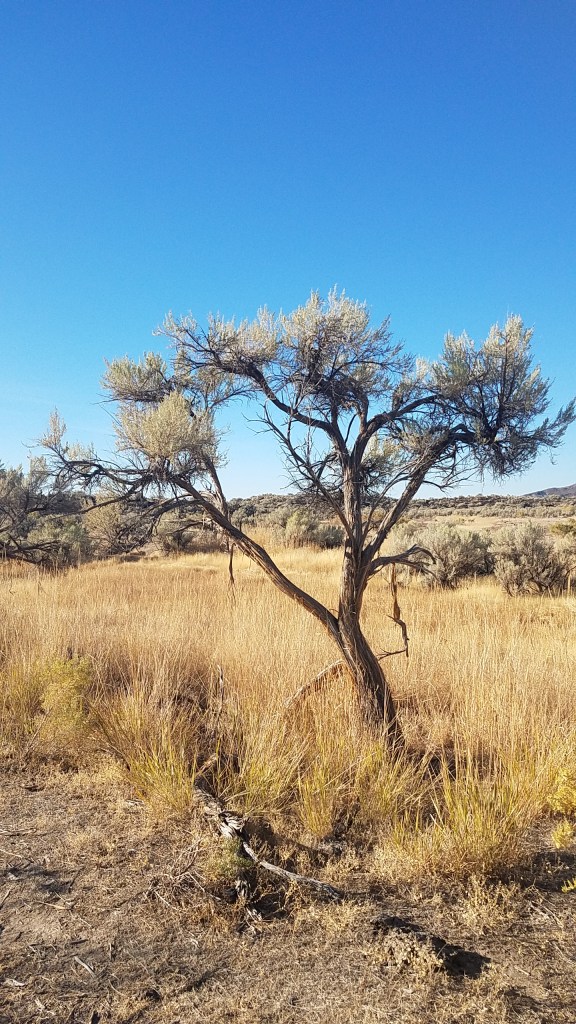
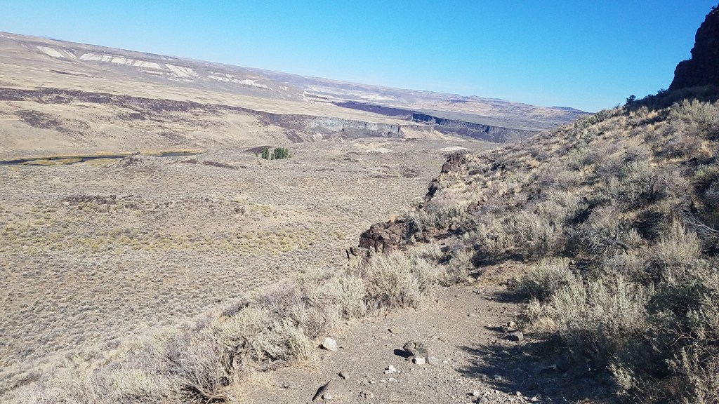
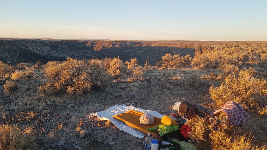
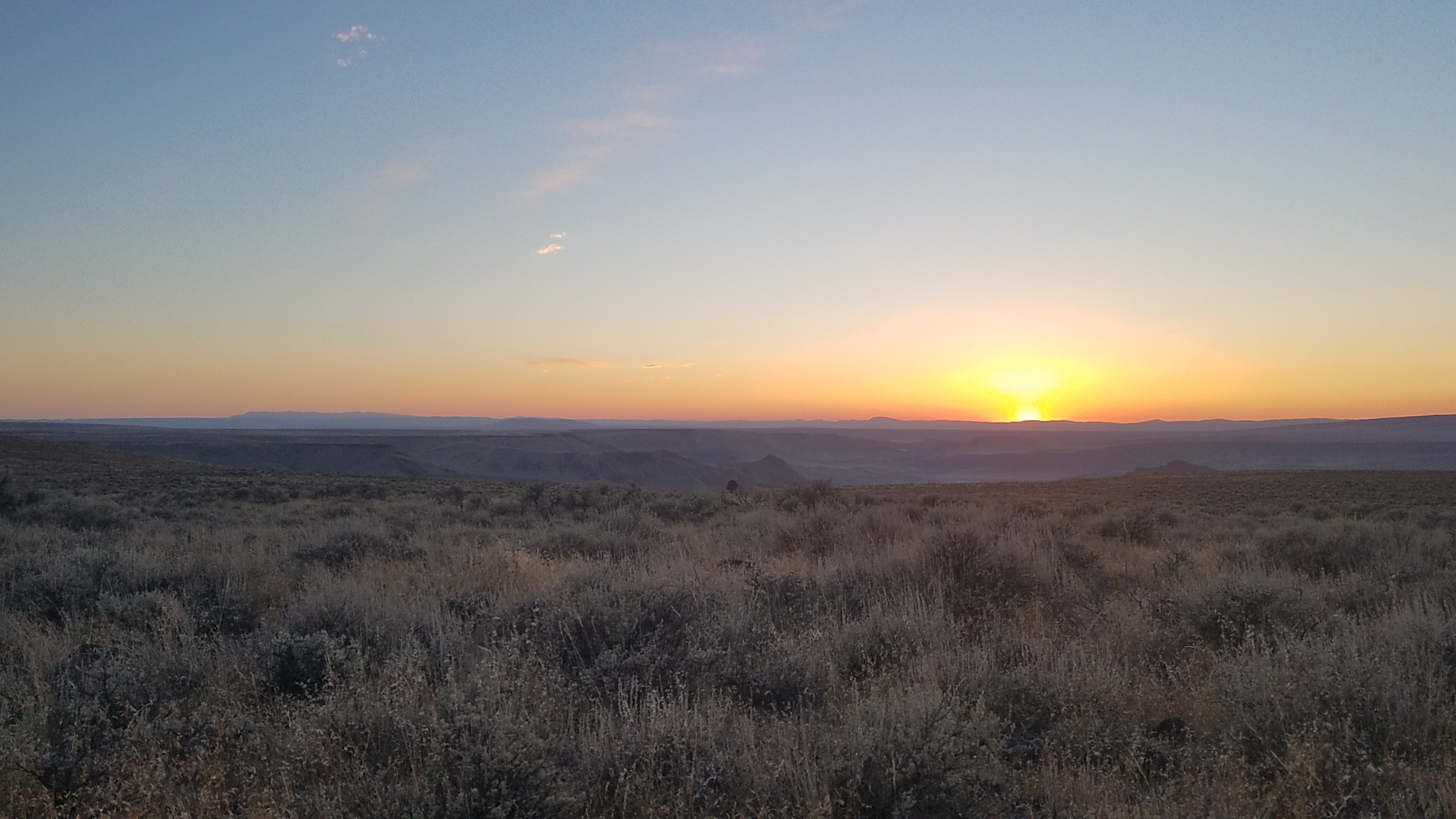
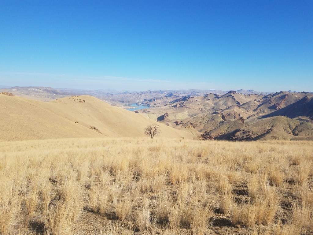
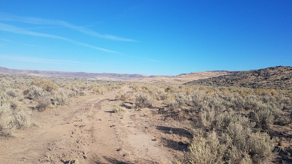
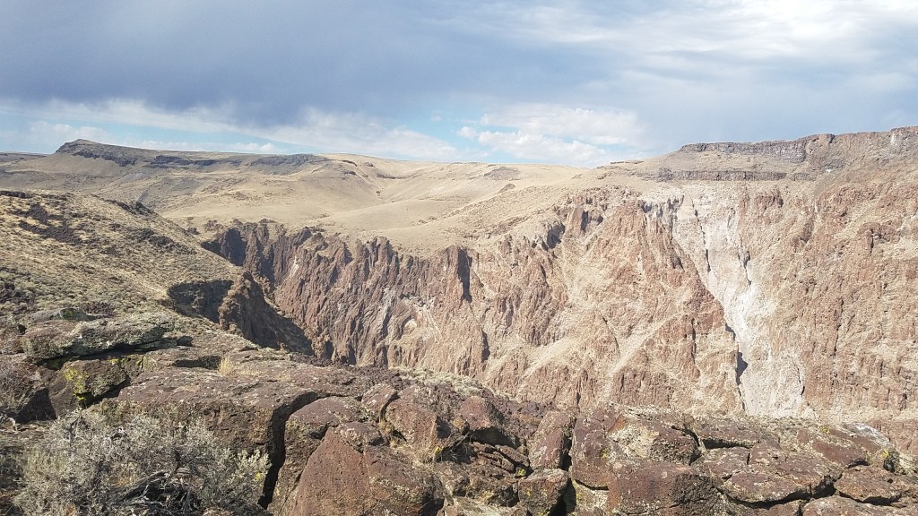
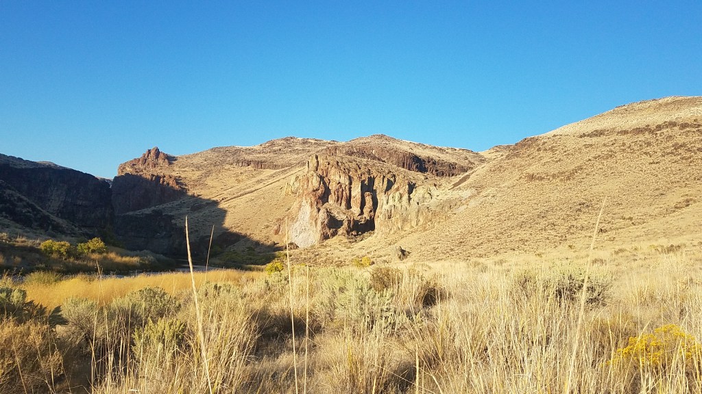
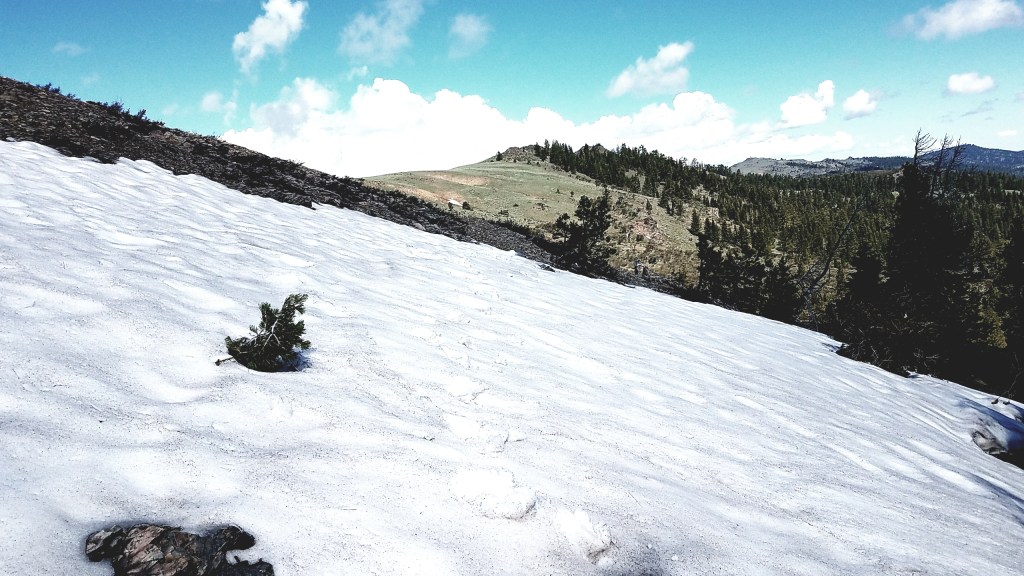
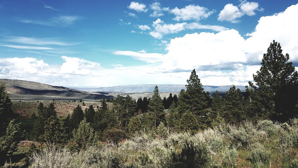
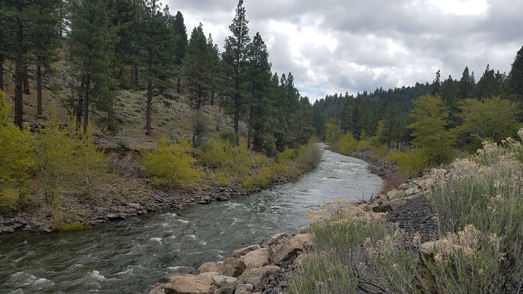
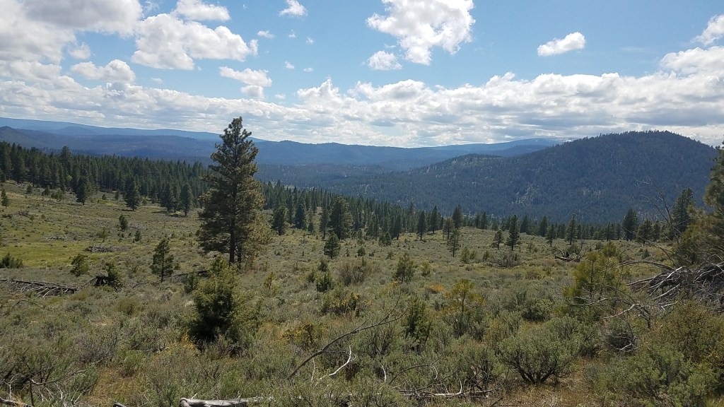
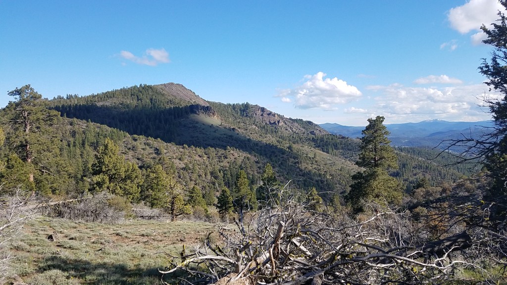
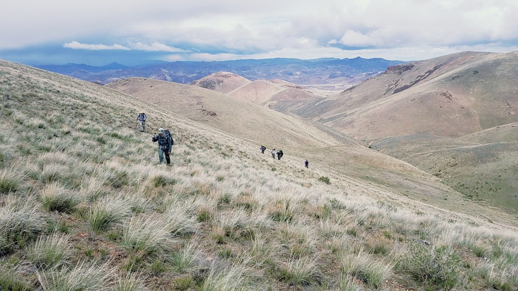
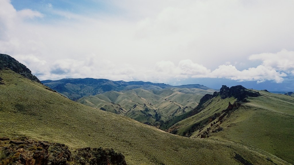
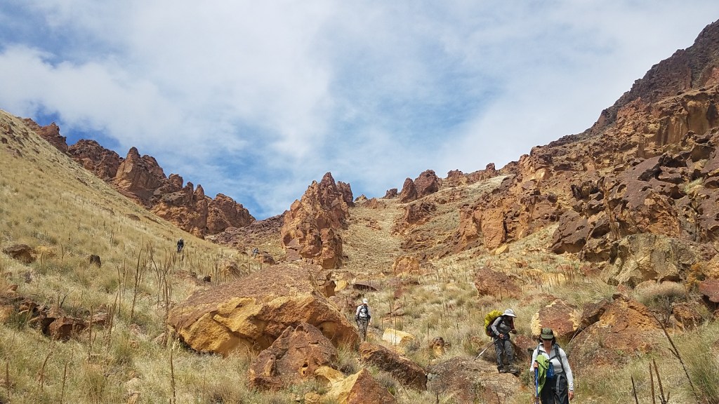
Though Oregon is often depicted in terms of Douglas fir-filled forests, the truth is that half the state is a water-starved desert. Even I, after calling Oregon home for 20 years, am guilty of green-washing: Although I knew the desert was within Oregon’s borders, I had never explored it. Then I learned of the Oregon Desert Trail , a 750-mile, W-shaped path that weaves through the state’s most arid landscape. The trail shows off some of the state’s unsung attractions, including the Oregon Badlands, Lost Forest, Owyhee Canyonlands and picturesque Steens Mountain, a single mountain that stretches more than 9,000 feet high and 50 miles north to south.

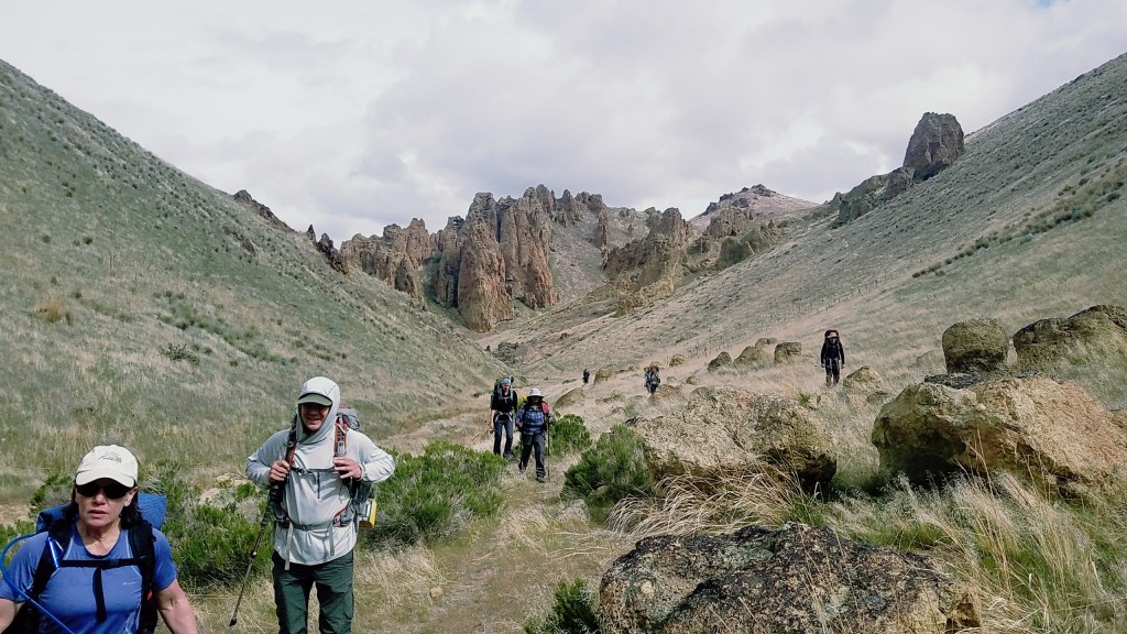
Created by the Oregon Natural Desert Association (ONDA) conservation group as a way to spur appreciation for the lands it is trying to protect, the trail is unusual in many ways. A big one: It isn’t really a trail. Waypoints on a map will help guide you, but the route isn’t marked. One-third of the route is cross-country, so a GPS device and compass skills are necessary; finding your own way gives the journey a choose-your-own adventure quality.

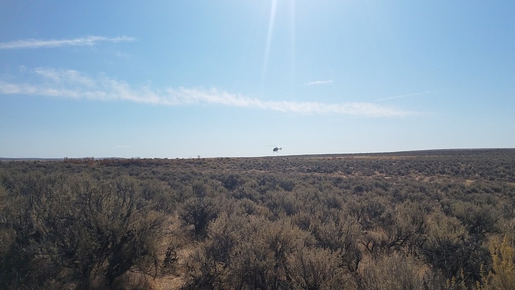
Carving through the least-populated areas of the state, the trail is also remote — but that’s part of its appeal. Wildlife biologist and thru-hiker Sage Clegg , the first person to hike the trail end-to-end, said she really only saw other people when she went into a nearby town to resupply. Because she’s witnessed hikers clogging the Pacific Crest and Appalachian trails — in what’s known in the hiking community as the “Wild” effect, in reference to the popular book-turned-movie — she appreciated the contrast. “I love a lonely trail,” she said. “It helps me be able to interact with the natural world as if it were something that I could actually communicate with.”

The trail’s stewards also see its location as part of its charm. “You might hear people say, ‘There’s nothing out there, it’s a wasteland,’ ” trail coordinator Renee Patrick said. “We don’t think its wasteland. It’s one of the most remote places left in our country, and we want people to experience that firsthand.”

Sent for a loop

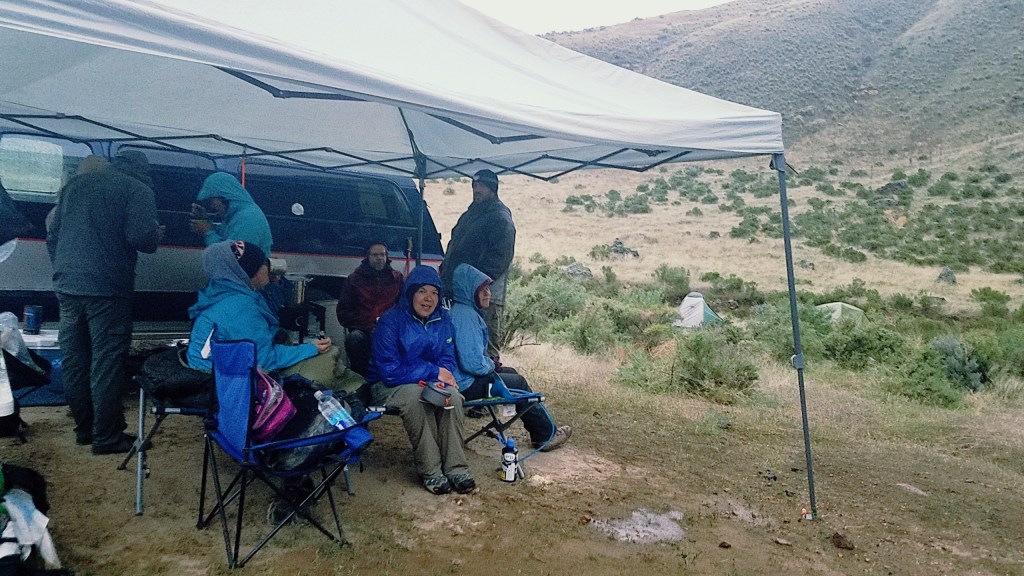
Because I’m not a thru-hiker, I settled on a 22-mile loop that traversed one of the canyons that makes up the Owyhee Canyonlands, an area affectionately called “Oregon’s Grand Canyon.” Tucked in the southeast corner of the state, the undeveloped area is also one of the largest unprotected areas in the American West. I planned three days for the loop. In preparation for the desert conditions, I went on an exposed six-mile hike near Portland on an unusually hot day and barely went through a liter of water. To be safe, though, I planned to drink about three liters of water a day and would carry more than twice that amount for one stretch of the hike.

Remnants of Morrison Ranch, homesteaded around 1900, still stand near where the author started her journey at Birch Creek Historic Ranch on a bend of the Owyhee River. (Emily Gillespie/For The Washington Post)

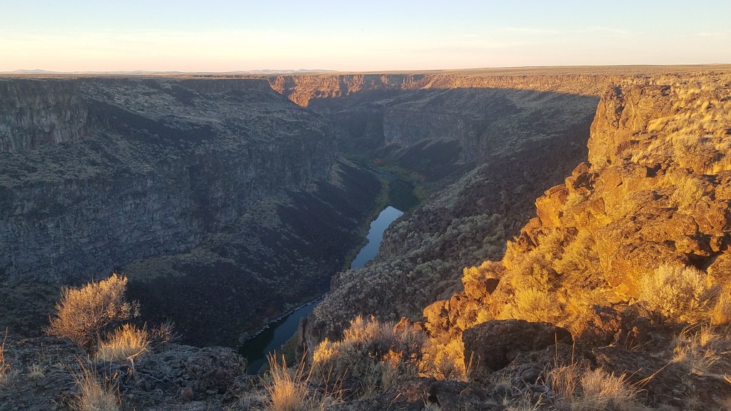
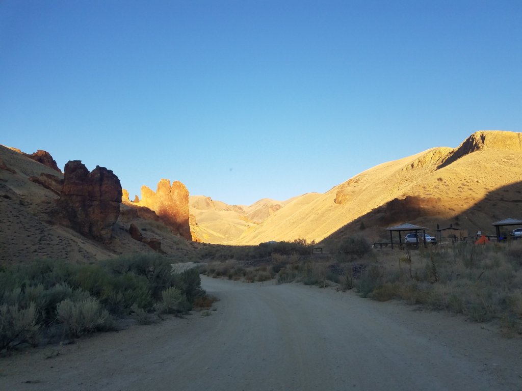
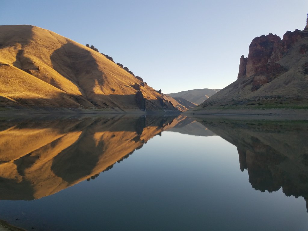
I spent the night before my hike at Birch Creek Historic Ranch. Homesteaded around 1900, the property along the Owyhee River is now a popular spot for rafters. I was disappointed that it was cloudy when darkness fell, because the region is one of the largest pockets of land untouched by light pollution, according to a 2016 analysis of artificial light called the New World Atlas of Artificial Sky Brightness . In the middle of the night, however, loud bullfrogs alerted me to the cloudless sky overhead. The dark, empty backdrop allowed the stars the perfect stage to dazzle and the moon shone down on me like a headlight.

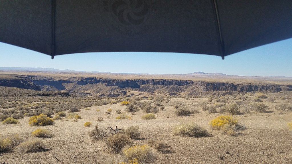
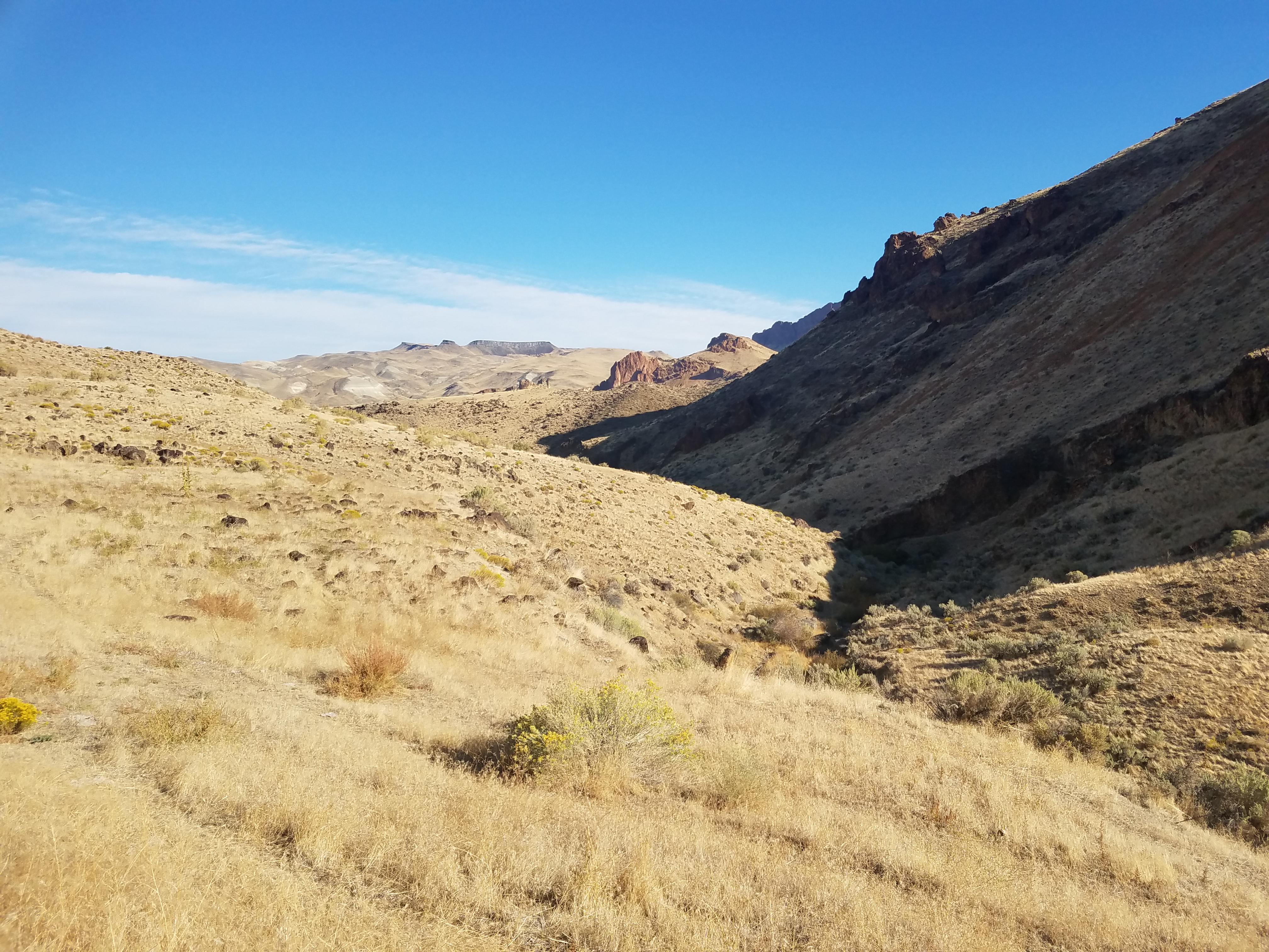
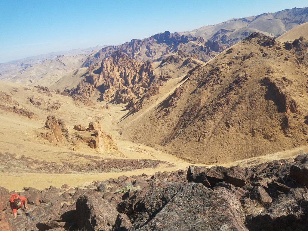
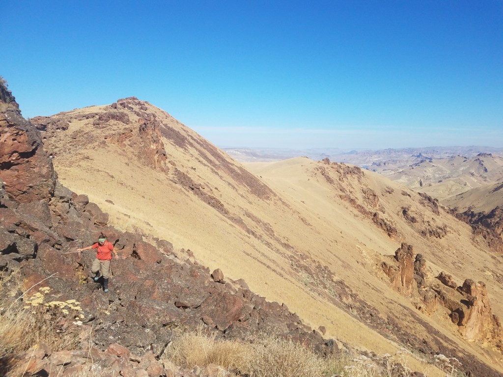
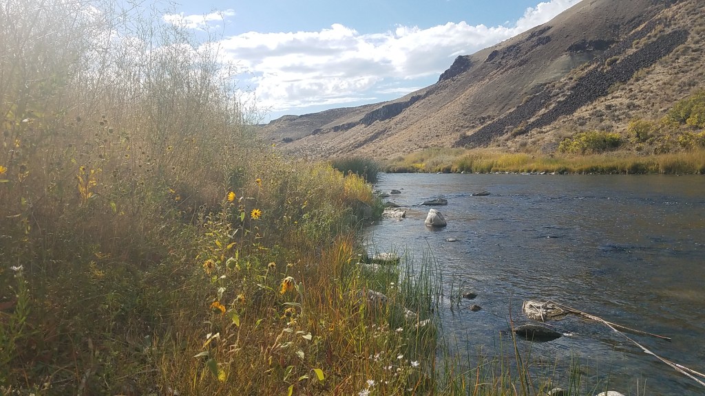
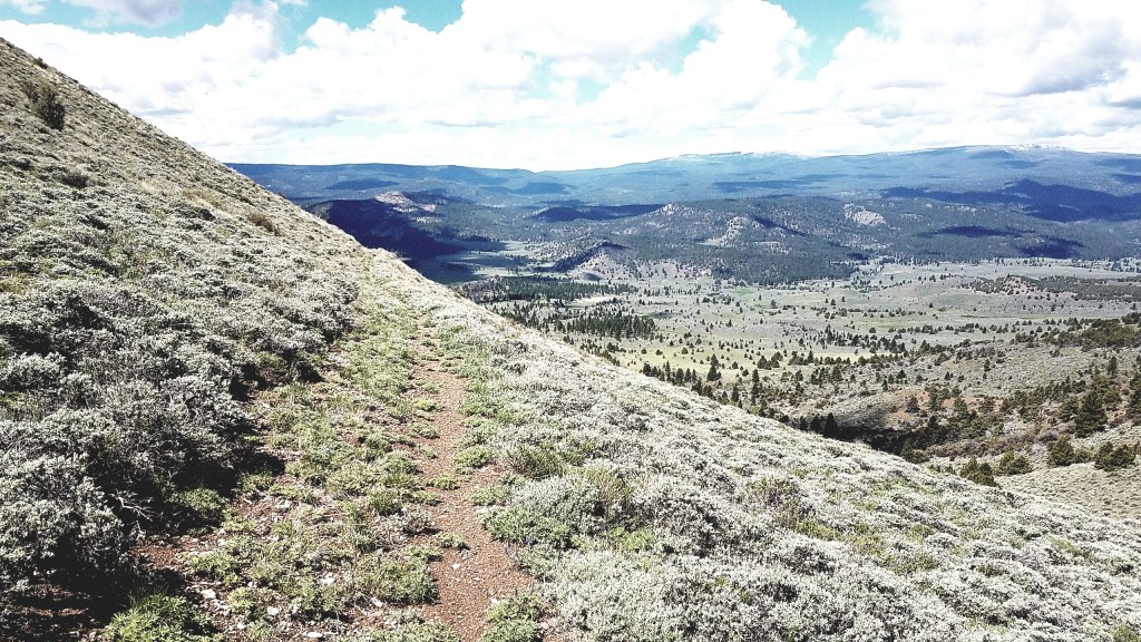
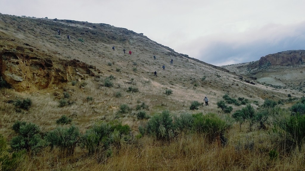
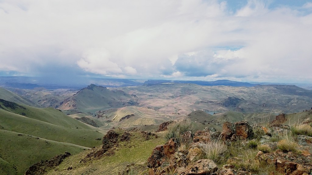
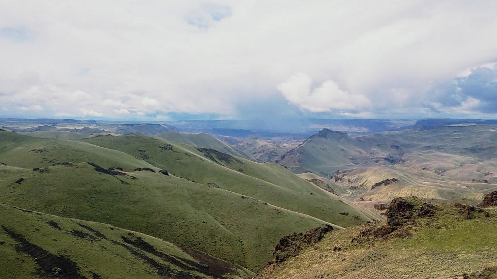
The next day, I left the ranch on foot and followed an old jeep road to an open field before reconnecting with the river. The scenery was so breathtaking that more than once I stopped abruptly and said “wow,” even though no one was around to hear it. Craggy red rocks jutted out from the sloped canyon wall, creating magnificent spires and rock formations that looked like a petrified crash of a wave.

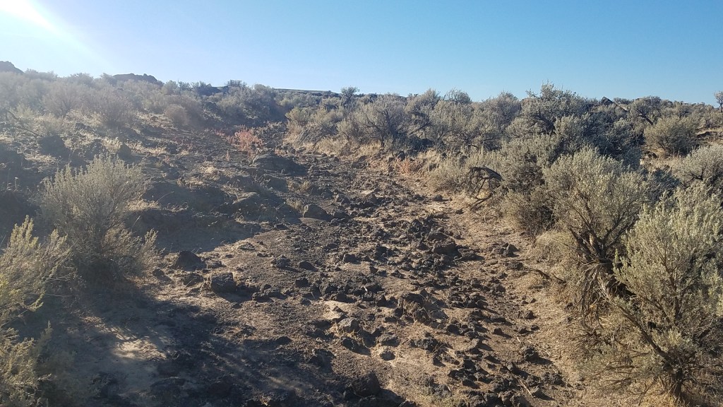
After only a few hours of hiking, though, I felt the desert’s ruthless effects. It was, in a word, grueling. The first six miles, which on a path would normally take me about three hours, took eight. At times, the steep canyon walls emptied straight into the river and my options for moving forward were to hop along boulder-sized lava rocks, machete my way through thick reeds of grass taller than myself or scramble up the hillside and walk at a slant, using the sagebrush to help keep me perpendicular to the ground. Each proved difficult in its own way.

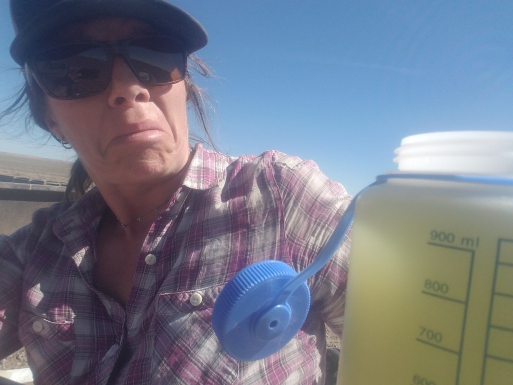
With the glaring sun beating down on me, rattlesnakes restarting my heart and extra time and energy spent calculating my next step, I was exhausted by the end of the day. I was also out of water. In practice, instead of three liters a day, I’d gone through three liters in half a day. I could refill, but the next night of my planned loop was nowhere near a reliable water source, meaning the seven liters I could carry wouldn’t be enough to see me through.

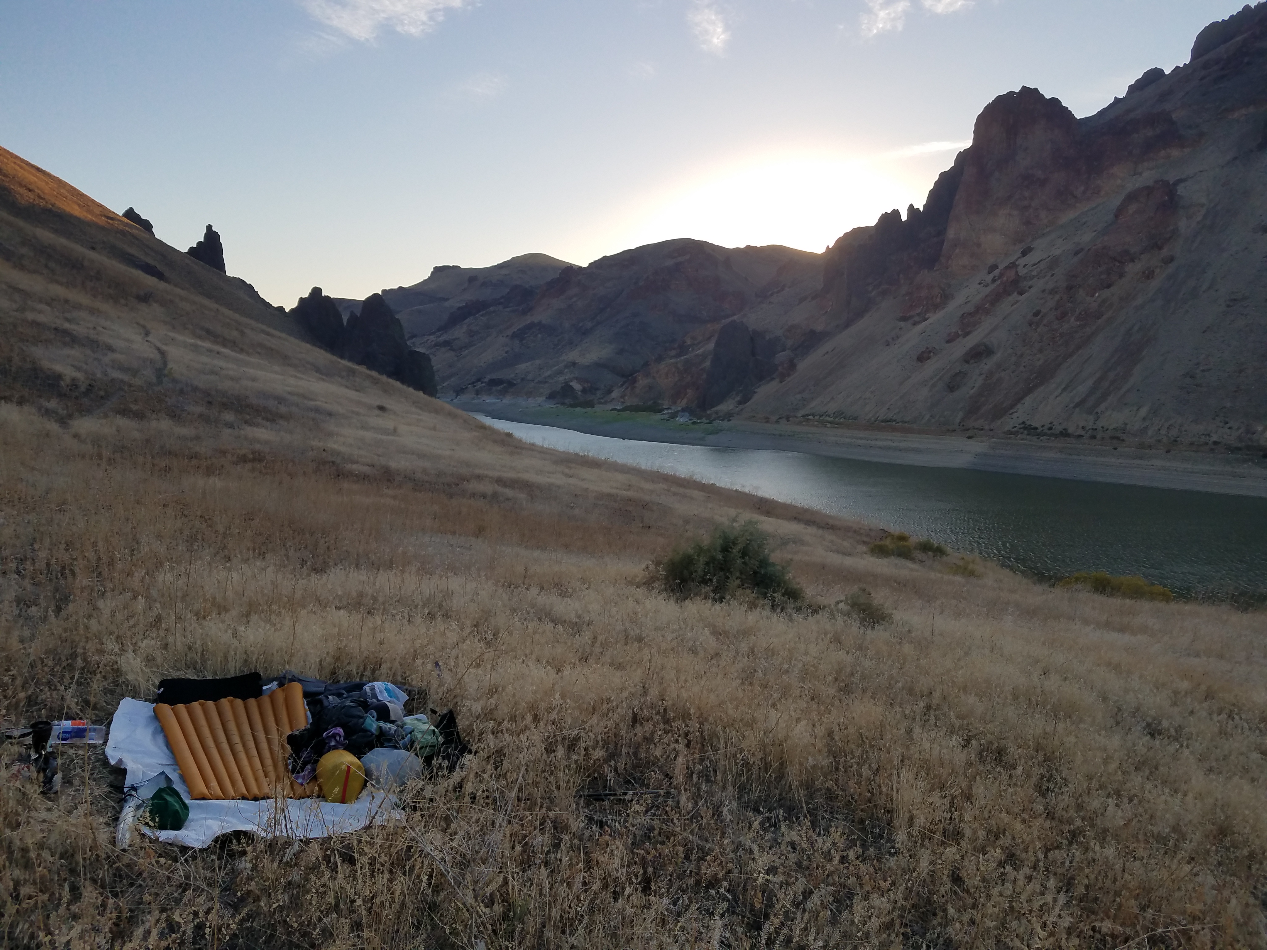
After setting up my tent along a rare bit of flat, sandy ground, I decided to turn my three-day trip into an overnight out-and-back. I was learning firsthand an important lesson of the desert: Water is king. Clegg and other hikers who have done the entire trail had to cache water throughout, especially in the more remote pockets.

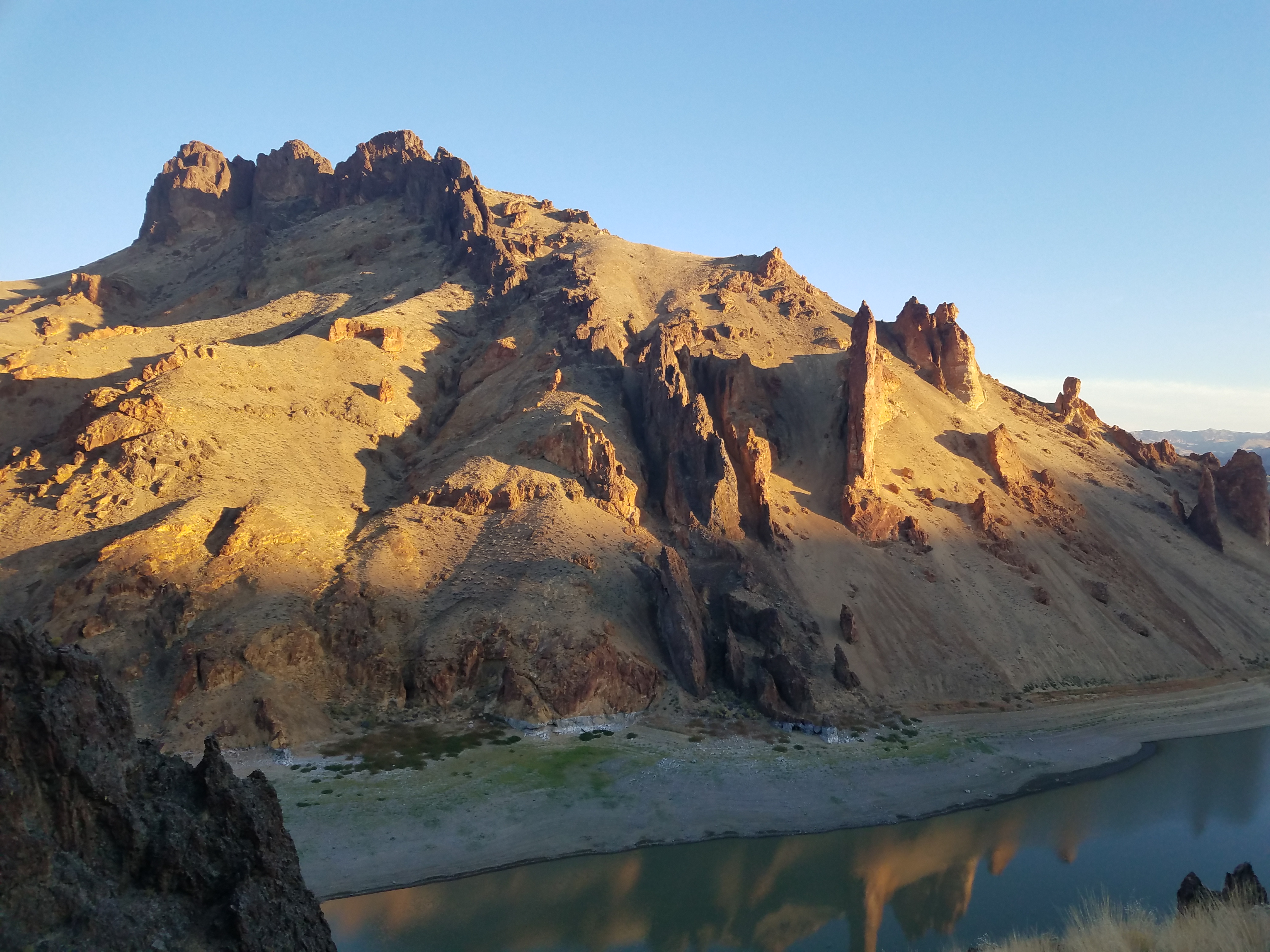
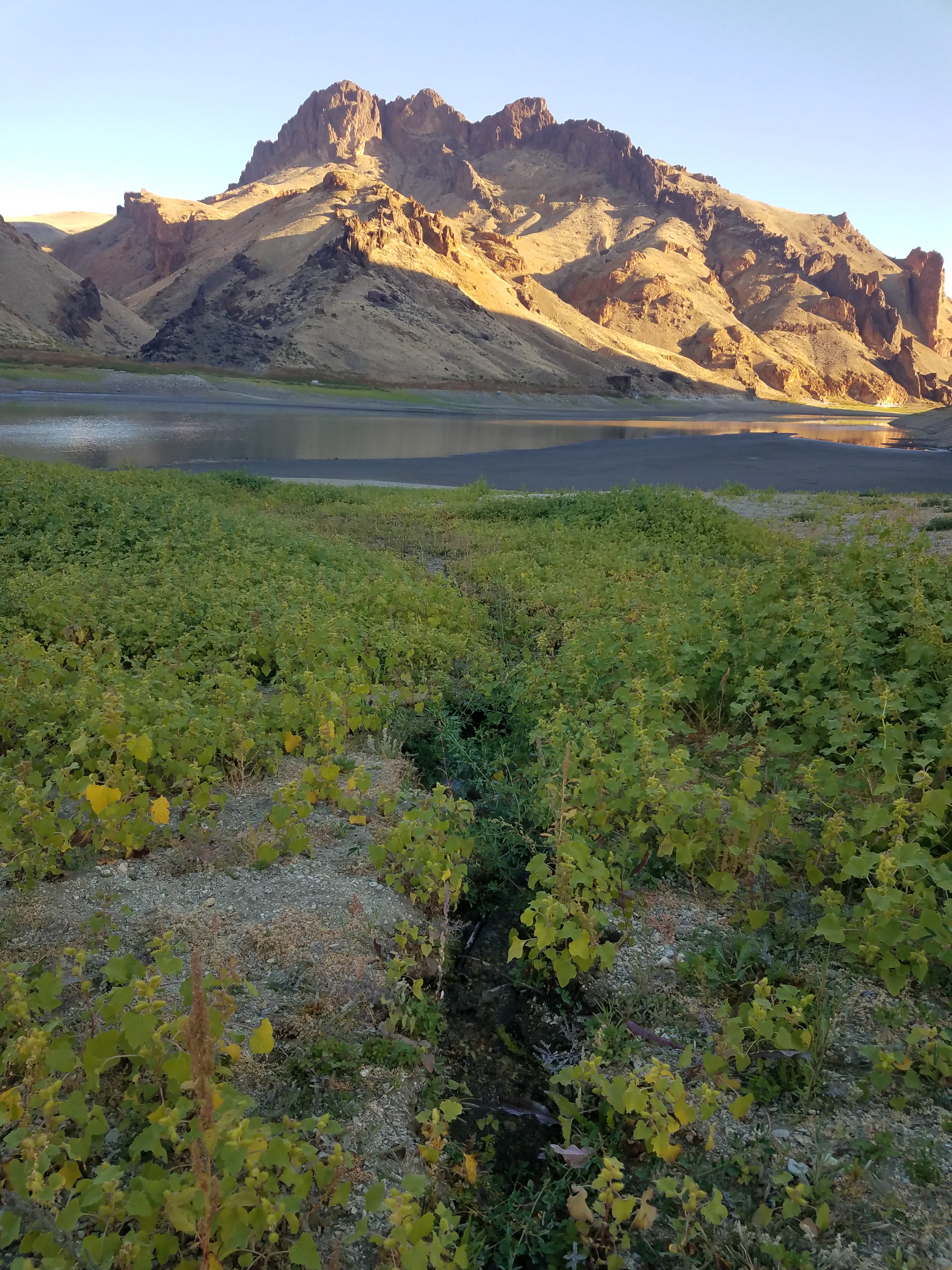
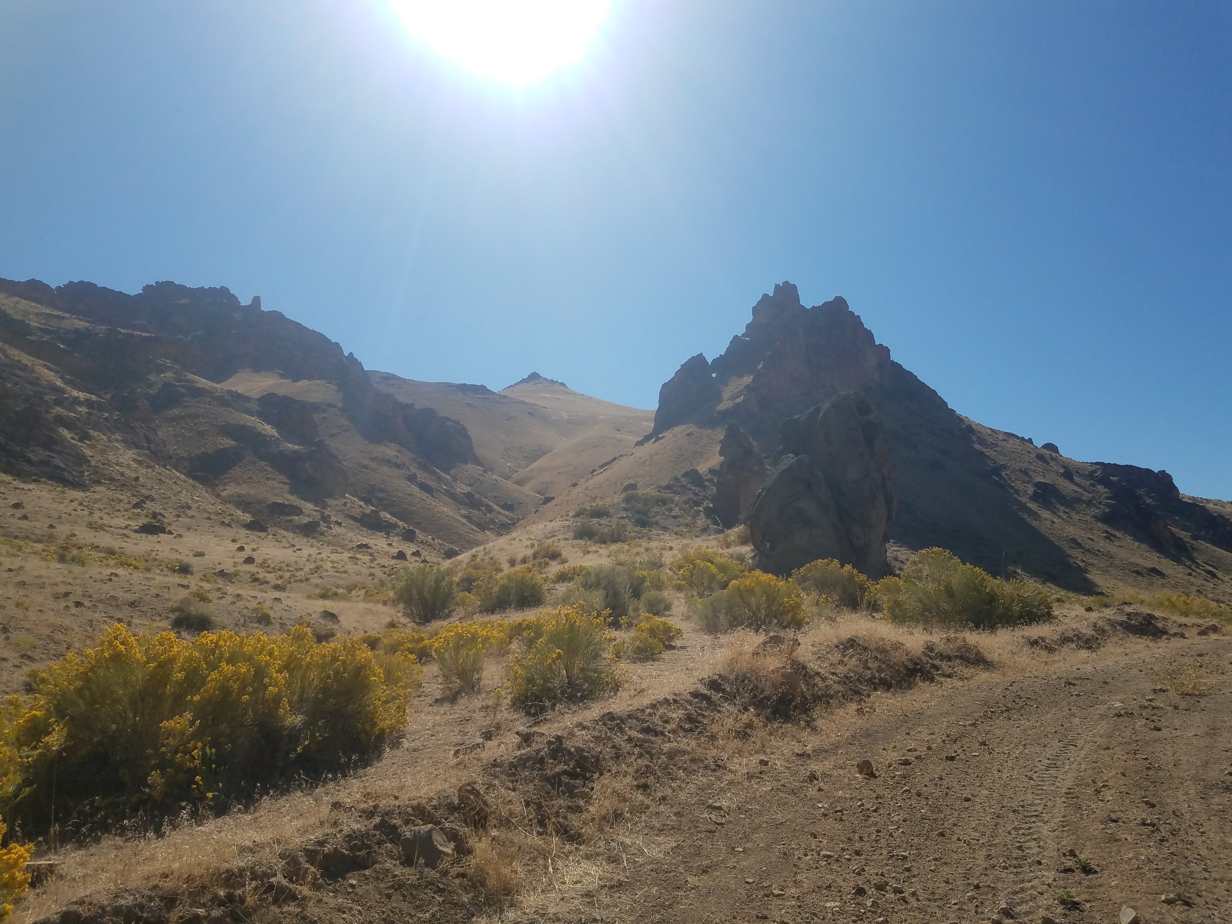
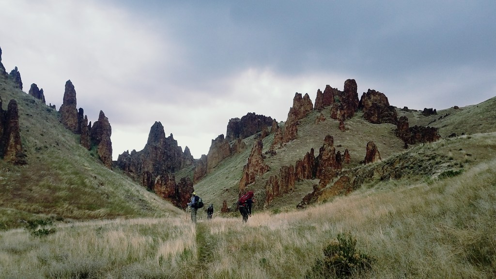
Sitting at camp and feeling a bit clobbered by the hostile landscape — I would encounter three more rattlesnakes on my way back — I looked up to catch the sun setting on a circular rock towering on a hill across the river. In the golden hue, it reminded me of the Colosseum. Rock formations like this one, and another in the region reminiscent of ancient pillars, make it easy to see why a nearby town is named Rome. After hiking out the next day, I drove in that direction, stopping for a night at a bed-and-breakfast.

When in Rome

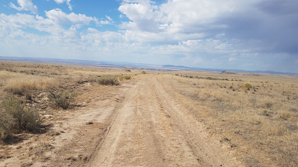
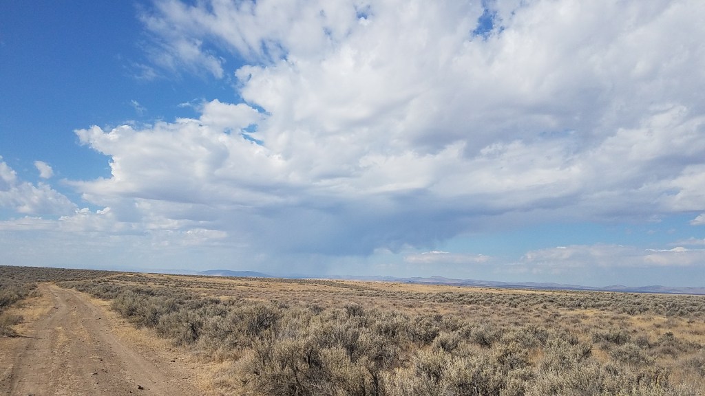
On what would have been the third day of the original loop plan, I set out to find an area that would give me a taste of the cross-country hiking I had missed by cutting that trek short. I settled on a stretch of the Oregon Desert Trail near Rome — which turned out to be a dot on the map that I would have blown by if not for a lone business along Highway 95.

Sagebrush stretches across miles of flatland outside of Rome, Ore., making it difficult to navigate the unmarked Oregon Desert Trail. Hikers are encouraged to take a map, compass and GPS device. (Emily Gillespie/For The Washington Post)

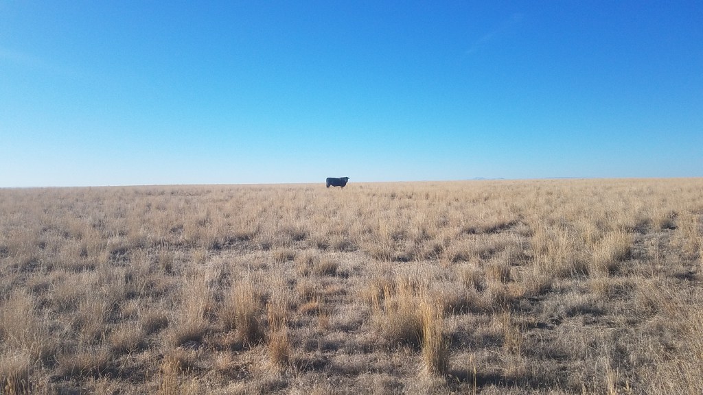
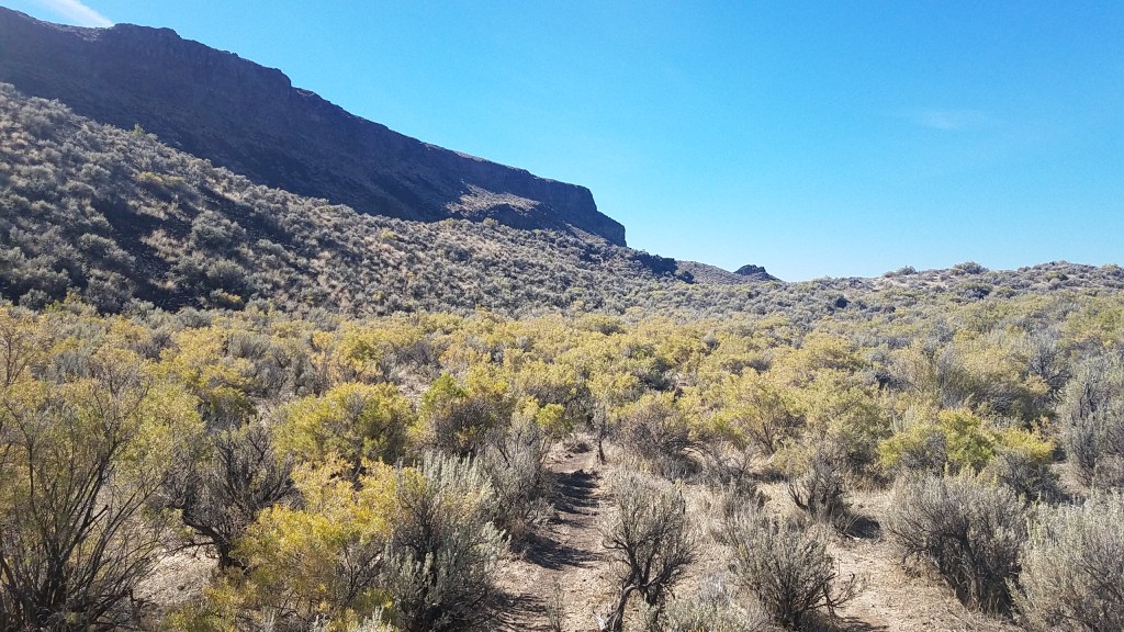
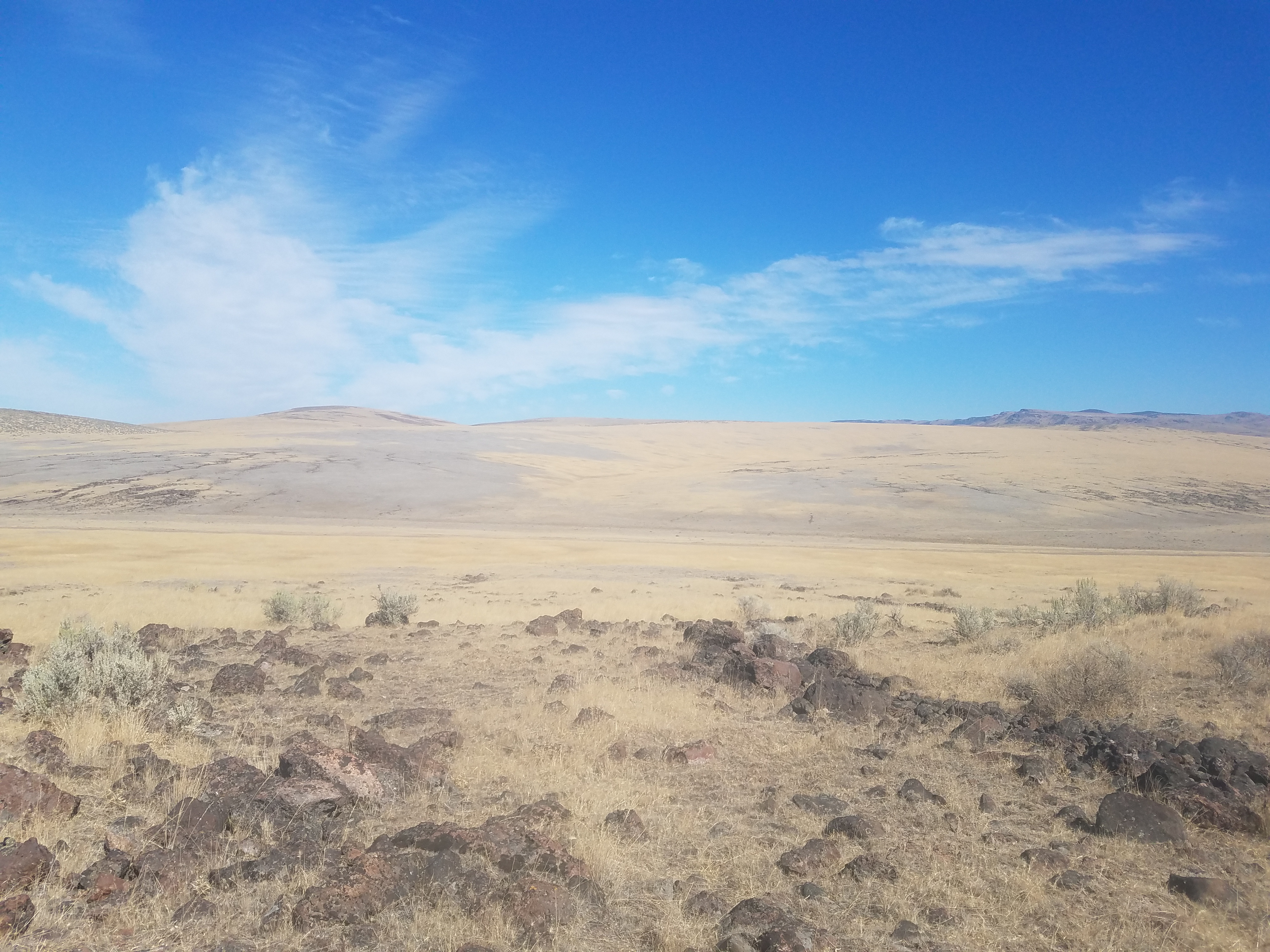
After scaling a hill, I was met with flatland. The only thing in sight was miles and miles of sagebrush. The level ground made it a much easier hike, but after about an hour into my journey, I picked up on what made this part of the trail difficult: keeping track of where you are going. Moving left and right to navigate the sagebrush, and without a mountain, river or highway as a reference point, it was hard to maintain my intended direction. More than once I glanced down at my GPS to learn I was headed in the opposite direction of where I wanted to go.

After my hike, I stayed the night at Rome Station, a part-convenience store, part-diner with a few cabins, which caters to regional ranchers and truckers traveling between Nevada and Idaho. Over a burger and beer at the bar, I chatted with owner Joseph McElhannon and a fellow patron, a self-proclaimed cowboy-poet from Texas who wore his long, gray hair tucked under a wide-brim straw hat and a leather vest over his long-sleeved black T-shirt.

McElhannon told me that he likes the trail, but doesn’t like ONDA. Over the years, the conservation group has made land-use proposals that have left ranchers worried about grazing rights and business-owners like McElhannon concerned about access for hunting, a sport that keeps his business going in the winter. (ONDA is aware of its reputation, trail coordinator Patrick said, and hopes the trail creates opportunities for conversations with local stakeholders about the best path forward.)

Despite his reservations, McElhannon agreed to have Rome Station listed among the trail resources and was holding a few resupply packages for hikers due to stop by in the coming months. He said he likes hikers; he used to be a backpacker. Even more, he loves showing people the beautiful slice of world he calls home.

The experience left me with a new appreciation for this part of the state and for hiking without the ease and comfort of a trail. Doing just a small portion of the Oregon Desert Trail reminded me of nature’s riotous side and challenged me in the best way. It pushed me out of my comfort zone and forced me to trudge a path full of lurking rattlesnakes and stunning star-filled skies that was uniquely mine.

Gillespie is a writer based in Portland, Ore. Find her at emilygillespie.com and @emilygillespie.

More from Travel:

Watching wine happen during Oregon’s annual grape harvest

Things to do in Eugene

Sip your way through the teahouses of Portland

Birch Creek Historic Ranch

From Highway 95, eight miles north of Jordan Valley, turn west at the Jordan Craters sign onto Cow Creek Road. Follow BLM Owyhee River access signs 28 miles to the ranch.

541-473-3144

blm.gov/visit/birch-creek-historic-ranch

This ranch owned by the Bureau of Land Management has five free campsites along the Owyhee River. The property has a water source and restroom that is open year-round, however the best access is between May and October. The road into the ranch is filled with potholes; vehicles with four-wheel-drive are recommended.

Rome Station

3605 Highway 95 W

541-586-2294

A welcomed sight on a long drive, Rome Station offers full breakfast, burgers, chicken fried steaks as well as beer, soda and milkshakes. Open from 7 a.m. to 8 p.m. daily. Meals cost an average of $7. It also rents three small cabins ($50 a night, $2 per additional person), campsites ($5 per tent per night) and RV spots ($15 per night).

Ouzel Outfitters, Raft the Owyhee River

63043 Sherman Rd., Bend, Ore.

800-788-7238

oregonrafting.com

The Owyhee River is arguably best experienced by water, though availability depends on water levels. Ouzel Outfitters offer several-day trips that take rafters through the remote desert canyons, offering close-up looks at desert wildlife and ancient petroglyphs. Five-day excursions from $1,299.

Pillars of Rome

From Rome Station, head north on Rome Road for about a mile and a half, turn right on Old Ion Highway, then turn a left on Kiger Road. Follow the road for a mile and a half to the rock formations on your right. Standing 100 feet high, five miles long and two miles wide, the picturesque Pillars of Rome is free to see and worth the detour. The community of Rome is named after the unique rock formation that is reminiscent of ancient Roman architecture.

For more information on the Oregon Desert Trail, visit onda.org/regions/oregon-desert-trail.

ODT Section 23: Day 4 – 12 miles (71 total)

I didn’t fall into the canyon for the night…the walls held for another day. As dawn broke I watched birds float above the abyss.

I wasn’t in a hurry to go, so I finished the book I had started on the hike, Timothy Egan’s Lasso the Wind. I think it was published around 2000, and there would be much to add to his survey of the “new west” if he were to do a part two. I enjoyed it immensely and it was incredibly depressing at the same time.

I headed off for a short stint on dirt roads, and the rest of the morning I hiked cross country across a vast expanse of golden bunch grass. Two cows watch me go. I wonder if this is a new grazing area because most of the public land where cows are allowed are quite simply hammered. This was different, and the walking was quite pleasant.

By late morning I faced my last big obstacle: Jordan Creek and the canyon that contained it. Several hundred feet of steep basalt walls stood between me and the end of this section, so I walked to the end where the map directed me, trusting there was a way down. And there was.

I picked my way down the steep slope, crossing the shallow creek carefully. Hikers had warned of rattle snakes in the tall grasses, so I thrashed the thick brush with my hiking poles, no snakes! In fact I haven’t seen any rattle snakes on this whole trip.

And then up. Up the other steep side. Ooofta.

I got to the top and flopped down sweaty and exhausted on my tyvek for a short lunch break. Rome was calling, and at only 4.5 miles away, it was a siren call of food and a long shower.

I got plenty of wondering looks as I walked the last 2 miles to the store on the side of the highway, and one guy who had pulled over in his semi had plenty of questions. He had no idea what the slow, lazy river that passes through Rome was capable of just a short distance away. In fact many of the people I meet out here have never been to Leslie Gulch or any of the other stunning landscapes within this area.

The rest of the afternoon was like any afternoon in civilization, and not what I came here for.

It was an incredible week, and I will do what I can to make sure this area doesn’t get drilled, extracted, exploited, or loved to death.

ODT Section 24/23: Day 3 – 16 miles (59 total)

I was lulled to sleep by the gentle flow of the Owyhee River, but woke with a panic a few hours later to the smell of smoke.

Fire can scare me quicker than almost anything else, and I sat up under the bright moon, heart racing. Since I was in the bottom of the canyon I had no vantage point to see if something was close, and had to remind myself that smoke could be coming as far as the next state, carried by the winds. What was disconcerting was that there had been no other smoke yet this week. No smells, no haze. This could be something new, and close. There wasn’t much I could do, my spot by the river was probably the best place to be even if it was close. Finally my heart returned to its normal pace, and I actually slept really well the rest of the night.

In the morning I tanked up with water in preparation for a water carry the rest of the day, tonight, and about 7 miles tomorrow. I would cross Bogus Creek in a few miles, but with the Owyhee water relatively clear, I figured I would fill up when I knew the water would be good.

The morning I walked across a lava landscape called Lambert Rocks and could spy the stunning chalk basin across the river. I finished Section 24 and started on 23. There isn’t really access to the section end, there is a road of sorts, but it was so full of jagged lava rocks that it would mean certain death for almost any tire out there. This is really a 60 mile section from Leslie Gulch to Rome, if you are talking about something vehicle accessible for a section hike. Or you could break it up at Birch Creek, a pretty good road and popular rafting take out.

The road that wasn’t a road came to an end and I crossed country-ed over to the towering basalt wall where there was supposed to be access to the top of the rim. I had already noticed the databook said there was a road there, but my map said cross country. I was very relieved to see a “road” steeply climbing up to the top. It’s good when I can catch little discrepancies like this that I can fix later. I would never in a million years drive on this road, ride a bike, motorcycle or horse on it. On foot was the only way to go. Beautiful views!!!

This started the on and off again walking of the Owyhee Rim, at hundreds of feet above the river below.

Then some cross country. I visited some dry dirt reservoirs and some nasty neon green cow trough water. I took a liter of that just for an emergency and hoped I wouldn’t have to drink it. The hue made me think maybe there was something chemical or toxic going on.

More rim, more hot exposed desert. I used my sun umbrella most of the afternoon and took breaks under it too.

I made a stop at a water trough in between a bend in the route and found good clearish water. I dumped out the day-glow green in favor of clear. Whew. I will definitely drink it.

Back to the rim where I found camp right on the edge. So close in fact that after about an hour I changed my mind and moved farther back from the edge. Thousands of years of rock fall from the vertical cliffs was apparent below and I didn’t want to be the trigger for the next big release of rock.

Last night of the section, I’ll be staying in a cabin in Rome tomorrow! Burger, beer and bed!!!!

And no evidence of fire, haze or smoke today. Nice.

ODT Section 24: Day 1: 15 miles (26 total)

Last night I had climbed up on the arm of the potentially sketchy game trail portion of the problem area and cowgirl camped in a flatish spot. There was a slight downhill tilt to the area, so I put all my extra gear on that side so it would block me from sliding into the dirt. I bet of all my nights outside a good quarter of them are in less than ideal spots. In this case the benefit far outweighed the tilt for I had an incredible view of the Owyhee reservoir.

20180917_192452

The night was incredibly quiet and still. Once the waxing half moon set the stars gave any planetarium out there a run for their money.

In the morning I ate my cold soak oatmeal (a Katie Gerber idea… she is a nutritionist who is currently hiking the ODT with my good friend Allgood and another lovely thru-hiker I know, Swept Away.) It’s my goal to find them after my hike this week and bring them treats.

I headed up the trail that looked more legit than just a game trail. I bet people from Leslie Gulch hike up here to check out the canyon. I went slow and reminded myself of my CDT mantra: one step at a time. Each time I rounded a rocky outcropping I saw the path continued, but it most definitely was a game trail by about half way through. The earth was dry and crumbly and I had to be intentional with many steps, although some sections were in great shape. As I neared spring creek the going got tougher and at one point I was downright scared as I had to cross a steep washed out section… I sat down, braced my hiking pole on a rock below me and willed my feet to stay put as I tried for purchase to cross the void. I was sweating a little. But all went well to the bottom of the next drainage. The high game trail goes, if you don’t mind one hairy section. From water level again it looked easier to walk the steep edge of the water than it had from the other side, I’m pretty sure Allgood and crew crossed this low way two weeks ago.

20180918_081314

Spring creek was running, and I crossed over it to walk the muddy banks of the water to my next landmark, Willow Creek.

20180918_084238

The guidebook advised to stay higher on the west side of the drainage, but I walked up the middle following the braided cow trails that had pushed trails through the brush. After a while I decided to go up as the canyon narrowed, and spent the next 2+ miles up and down, on cow trails and off. Nothing terribly difficult, just taxing. The upper end was choked with willows and a few bigger trees, and the canyon was lined with incredible rock formations.

20180918_100428

I met up with a dirt road next. Relief! I freaking love walking on an easy dirt road after an arduous cross country morning. I took a short break in some shade and switched to my chacos for some blissful road walking.

20180918_114838

I got to the turnoff point for the alternate route I had wanted to connect with what Becky and I had hiked yesterday, but it looked narrow, brushy, and exactly what I didn’t want to hike at the moment. Seeing it now in person, I doubted this side of the alternate would work, but I do think a higher elevation option could do the trick. I know I can get some good detail on Google earth as I could see a way up (or down) from my vantage point, and from looking closer at the topo maps, think it could be doable. I just didn’t have the energy to climb a few thousand feet to scope it out all the way.

I continued on and had lunch in the shade of am incredibly large sagebrush. Next was a fabulous spring that was pouring cold clear water into a cattle trough. Yum! I tanked up and took 6 ½ liters which would have to get me to tomorrow’s night camp some 20+ miles away. Not a huge water carry by ODT standards.

I trudged up a break in the Rimrock and took a moment to take some photo monitoring images in a narrow pinch point in the terrain. This year I’m getting some baseline photo data for places on the trail where hikers are funneled through the terrain. I want to gauge if we are having impacts on cross country sections within Wilderness Study Areas along the route. In this instance I was walking on a well defined cow trail…and the evidence was all around. Cow pies of various ages, and grasses chewed within inches of the ground. No sign of hiker impacts. We’ll continue to get photos from about 20 different spots along the route each year and see what is happening. So far, the cows have a dramatic impact, hikers, none.

The top of the Owyhee Canyon is flatish and dry. I hiked cross country by a few dirt reservoirs, two with water, one with cows, and a couple dry ones. The rest of the afternoon was on two track dusty roads before I pulled off at a viewpoint down into the Birch Creek area. I’m far enough away that I can’t quite tell what I’m looking at, but it’s gorgeous!

20180918_14543320180918_16354420180918_195254

Oh! And I can see the Steens from here! The unmistakable Kiger Notch marks the presiding hulk of the 50-mile mountain over the rest on the Oregon desert. That’s only about 300 ODT miles from here.

ODT Section 24: Day 0 – 11 Miles

You may remember this spring I headed to the Owyhee Canyonlands to lead a hike on Section 25 of the Oregon Desert Trail for the group Friends of the Owyhee (FOTO). That was also the first time I had hiked that section because in 2016 I had packrafted the river and reservoir as part of a water alternate to the ODT from Section 21ish (I put in at 5 Bar) to the end at Section 25. Essentially I paddled 141 miles as opposed to hiking 142 miles. I don’t know how the numbers are so close, but pretty cool that they are!

I hope to continue guiding hikes for FOTO, so decided to give myself and the future hikers on these trips a break and hike it first. While the trip this spring went really well and we made it on the 27-mile (primarily cross country) section just fine, I was doing a lot of micro navigation as we were hiking. I found that since I was leading people who might be on their first cross country hike ever, that ideally I wanted to have a mental lay of the land before getting out there all together.

So I connected with Becky, a FOTO board member, to see if she wanted to hike with me and help shuttle a car at the very least. Becky was the co-leader on my spring trip and we got along great, so was stoked when she was free and wanted to come along for a day of hiking.

Becky was able to pick me up in Rome yesterday where I left my car, and we drove around to the incredible Leslie Gulch. If you want to know why it’s incredible, check this out:


I decided we would hike a potential alternative that would bypass a steep and challenging bit of trail between Spring Creek and Leslie Gulch. At high water hikers have been flummoxed by this section as the map shows the route going on the banks of the river…a bank I have never seen since I started working for ONDA. Apparently when this section was originally scouted the water was so low that you could easily walk on the edge. Not so in the past few years. Even well seasoned athletes like Jeff Browning and Heather “Anish” Anderson have had problems here: Anish backtracking and finding a route inland, and Jeff, basically ended his attempted ultra run of the Owyhee after getting here in the middle of the night and not finding a way around until day time, precious hours he needed to finish on time. Watch the Patagonia film about his attempt here.

So Becky and I took off behind the Slocum Creek Campground to see what we could see. The canyon was awesome walking, until it wasn’t, and we climbed up a thousand feet to the rolling ridgeline above and tried our luck up top. It went! It went with one kind of sketchy talus field, that wasn’t too sketchy once we got there. We continued on, found some various things of interest (I’m being vague on purpose!) and when I could see the rest of the high route was clean, we dropped into a drainage to see if we could get back out.


And we did! We didn’t hike the whole alternate I had scoped out on Google earth, as Becky had to get back to Boise, and I would try and connect the route tomorrow from the original ODT.

So that would leave me trying to walk game trails high above the river to make my way around the problem area like most of the other hikers have done. There is no flat path along the water again, and for September in a dry year that is interesting…it must have been incredibly low when Jeremy (my predecessor) was creating the route.

ODT Section 24: Day 2 – 17 miles (43 miles)

I didn’t sleep much, or at all. When dawn came I sat up and made my coffee and a freeze dried egg breakfast I picked up on a whim. Not a fan.

Today would be mostly road walking, and when I say road, I mean this:

For all the exposure and zero trees, the day wasn’t too hot. I could see clouds forming and each time I thought the rain drops might catch me the road took a turn or they stayed just out of reach. As it was it didn’t look like any of the rain was hitting the ground, instead was evaporating before it could touch the parched earth.

Mid morning I noticed a helicopter flying pretty low. To my surprise it circled me twice and went to land in the dry reservoir I happened to be walking by at the time. I had a jolt of worry that I had accidentally push my help button on the satellite beacon I was carrying. Ooooo no!!!

I walked over within shouting distance of the copter when four people got out. I soon found out they were with the Vale BLM and were surveying the earthen damns of some of the reservoirs out here. Whew. They were surprised to see me and offered snacks, but I had packed too much food as it was and passed on the helicopter trail magic.

I continued on and was so tired at lunch that I lay out flat on my tyvek and closed my eyes for half an hour… setting my alarm in case I fell asleep for real. I wasn’t sure I would wake up since I hadn’t slept last night.

Slightly rejuvenated, I ate the avocado I’ve been carrying (so worth it) and continued on the roads. I listened to a bunch of podcasts today. I was feeling a bit lonely and the voices helped to fill the space. This will be my last multi-day hike for a while (not counting another 5-day trail work trip next week and a week in Death Valley this November) and I’m ready to be home for more than a few days at a time.

Mid afternoon I dropped down the rim to cross country to the Owyhee River for water and camp. I didn’t recognize the area from my packraft trip two years ago till I got to water’s edge and spied a huge cave surrounded by greenish spires of rock. Oh yeah! I was right around the corner from one of the most stunning sections by Iron Point and Montgomery Rapid.

The river was beautiful and much clearer than the reservoir at Leslie Gulch had been. I stripped down and washed myself and most of my clothes and soaked in the river as much as the extremely annoying flies would let me. I hope they die, or disappear, when the sun sets. As long as they leave me alone.

I thought I might have to set up my tarp tonight with all the heavy clouds from earlier in the day, but there is nothing in the sliver of sky that I can see from in the canyon.

Oregon Desert Trail Section 7 – Day 3 and beyond

The Oregon Timber Trail basecamp on Winter Rim was epic

If I don’t write these hiking journals while I’m on the trail life intercedes and it gets away from me. It’s been 2 weeks since my Section 7 hike and in between I helped lead trail crews for bikepacking route, the Oregon Timber Trail, of which the ODT shares 50 miles of single track in the Fremont-Winema Forest, and then led trail work for a group of Oregon Natural Desert Association volunteers in the Badlands Wilderness for National Trails Day, and now I’m down near Denio, NV scouting a way around the brushy and fantastically frustrating bushwack in Denio Canyon and meeting with some landowners in the area.

Whew. This is my job!

I stayed the night at the Running G Farm near Denio Canyon with an awesome couple, Katie and Garrick. They rent out a bunkhouse to hikers and others, and as I found out, that stay may come with a steak fed from the grass right outside the window. So delicious. (check out the town guide I put together for info on the farm and a ton of other places to stay and visit in SE Oregon http://www.onda.org/OregonDesertTrail it’s on the Plan a Trip page under Trail Resources)

Also the Diamond Inn in Denio is open again. It’s been closed about 6 years, but Jeff the owner just got it going about 2 weeks ago. I felt welcomed right away when I stopped in, and before I knew it the rest of the patrons were buying rounds and filling me in on some local history.

I missed seeing Dirtmonger by a few days on his Mexico to Canada Desert Trail hike (the Desert Trail overlaps with the Oregon Desert Trail in the Pueblo Mountains and Steens Mountain). He will be the second person to ever thru hike this route that’s been around about 40 years.

Lots going on, and when trying to decide what I wanted to do for my birthday this weekend, I think instead of the usual camping trip or outdoor adventure I might just play it close to home and have a Bend birthday. When I’m out all the time for work. It’s a luxury to be home!

Oregon Desert Trail Section 7 – Day 2 – 20 miles

Not a good night of sleep, but that is my normal on night one now. Sigh.

I whipped up a meal replacement drink for breakfast, just to try it out… and I decided that I will continue to eat solid foods. I really like eating, and drinking my calories just doesn’t do it for me.

My legs felt heavy and slow, probably the lack of sleep and minimal breakfast, but I was still moving at a decent pace. When I took my first break I gave Kirk a call, he had been rafting on the John Day and we missed each other before I left town. The morning was hot so I took off some layers to get a little sun on some white skin, but it looked like the clouds were moving in. A quick check of the weather confirmed that, in fact rain and lightning is in store for the whole week… That could make for some interesting trail work.

a tiny patch of snow was still clinging to the trail

the views…

I had lunch at Moss pass, and after about a mile the trail tread started to go downhill. Literally and figuratively. The next 5 miles or so were in poor shape, at times the tread completely covered with vegetation. It’s daunting to stay on top of this stuff! The Forest Service has a hint of the budget they really need to be able to do their job like trail work, and they rely heavily on volunteers to make up the difference. A lot of the trails aren’t hikeable because the maintenance has been deferred so long. Many of them around the country were built by the civilian conservation corps when the government put people to work around the time of the great depression, and we have this amazing legacy of trails now. I would love to see a modern CCC so we could maintain them. Or we could adequately fund our land management agencies so they can do the jobs they are mandated to do…

More hiking. I didn’t get rained on, but walked into an area that must have gotten hammered because everything was soaking wet and I was sliding around in the mud. I got some water from a cow infested creek before climbing up a little to find a camp spot.

I only left home yesterday but I smell like I’ve been out for weeks, I’m muddy, sweaty and bloody from a few scrapes… it doesn’t take long out here and I’m even dreaming of pizza even though I didn’t earn it yet!

Oregon Desert Trail Section 7 – Day 1 – 16 miles

The air is so soft! Slight whiffs of sweet blossoms met me right out of Paisley, and the low clouds lend a sense of moisture in the air. It’s not humid per say, but it’s not the usual dry parched air either. It’s soft, and envelops me as I walk the 8 miles of road along the Chewaucan River this morning.

I’ve found more reasons to come out and hike another section of the Oregon Desert Trail this week… (funny how that happens!) this time to hike the trail between Paisley and Lakeview. I’ll be leading a trail crew out here next month, and I came to scout out the conditions prior to the trip. Since my volunteers will probably only work on about 3 miles of trail, why am I hiking 50? Well after my hike I’m meeting up with a group from the Oregon Timber Trail, a bike route from California to Washington, that shares the tread with us and the Fremont National Recreation Trail. I will be helping that group out to maintain a section of their route that continues where the ODT veers east, on top of the epic Winter Rim. If there is extra time the crew might backtrack to the section I’m hiking to clear any trees I might find, and/or I’ll be able to pass the list of needed maintenance in to the Forest Service who might send their own crews back out this summer. I’ll also hike past the trail work that we’ve been able to fund for the Lakeview Alternative high school this year and last. I’ll be able to scout out their work and identify what could be done in the future.

Multiple reasons for a 50 mile hike!!!

After lunch at Chewaucan crossing, I crossed the bridge for trail… the next 60 miles are primarily trail (with one big section of road that the Timber Trail and Forest Service want to turn into trail… I’ll be walking the proposed section with them later this week). It is a slow meandering climb, and the only living things I saw were pronghorn, lizards and birds. Ahhhhh, so nice.

Lots of water, even more than is on our water chart, and the afternoon passed lazily by as I made my way south. I wasn’t out to crush any miles, so took my time and made camp on the side of a slope hidden from the trail and tucked under a huge ponderosa pine. The ground was drying out, enough that I wasn’t making any footprints, but some horseback rider had been through and sunk a good 6” into the trail. Grrrrrrr. Don’t travel on muddy trails people!! Especially a heavy horse or a bike (there were a few bike tracks that had sunk in an inch or two, but the major transgression was from the horse.) I hiked about half a mile of the trail that my ONDA volunteers cleared last year, but it wasn’t very apparent. Bummer. Again horse hooves and new green growth in the tread. At least there was only one new down tree so far in my hike.

The imminent wet weather is supposed to hold off so I’m cowboy camping tonight.

mmm, dinner!

Oregon Desert Trail Section 25 – Day 3 – 8 miles

I slept so well down tucked out of the wind and exhausted from sub-par sleep from the night before, and the miles of yesterday. Before sunrise it started to rain again, and I knew our agreed-upon start time of 7am was less and less likely to happen. While on a thru-hike the need to constantly make miles despite the rain is really important, but on shorter hikes that need kind of goes out the window….however I wanted to usher people back to the shuttle cars waiting at Leslie Gulch before making the 3 hour drive back to their cars at Lake Owyhee State Park, and then home. Some hikers came out from SW Oregon & Portland, long drives!

I made coffee with my woodburning stove instead of getting up for the hot water Tim has been making us in the mornings…it’s nice to be self sufficient, especially when it’s raining! I packed up and was under Tim’s big shelter by 7am…and saw all the other tents still up. Oh well. I sat down to drink some more coffee and watch camp slowly come alive when the rain petered out.

We were walking by 8:30.

In the first few miles it looked like I could take a short cut between two waypoints, so climbed up and over a ridge, to see we would have a steep-ish sidehill to get down the other side. The problem with shortcuts and topo maps is that you don’t always see those minor 5-10′ cliffs that the topo lines don’t show. We maneuvered down the slope carefully and started walking up our long ascent of the day. We would climb 2,000′ to the top of Juniper Gulch, before descending steeply down to Leslie Gulch. We took a break at the start of the steeper section of canyon, and relaxed a bit before the climb.

The rocks were stunning along the unnamed canyon, and I suggested that the hikers come up with a name for this canyon, as there was nothing on the map. We started up the more cliffed out section, but soon the canyon widened out enough that the climbing was quite gradual and much easier than I anticipated. Andrea picked up a rock and came up to us  in excitement, a thunder egg! Being the good geologist she is, Sarah had been carrying her rock hammer, so Andrea pulled it out and cracked open the rock as we all looked around in anticipation. It wasn’t a thunder egg, it was a geode! Beautiful crystals inside…Andrea said she found it in the drainage, so it probably washed down from some feature in the high rock walls. So cool! The geode broke into pieces, so many of us hiked out with a piece, and I saved one for MJ, one of the board members for Friends of the Owyhee who had been helping set up camp and such..it was her birthday. How about a birthday geode!

We hiked on, following very well defined cow trails. The cows made a better path than we could, and each time we came to a bend in the canyon, the cows would find the straightest line between canyons, making for a very efficient path. Now cows are a mixed blessing. I’m starting to monitor for human impacts along the ODT this year, but am finding many more animal impacts. I’m not sure how we will be able to determine that human feet made a path on a cross country section versus animal feet. I guess it’s easy to see from the poop who is using the trails!

We stopped for lunch, but it was raining again, and it wasn’t long before everyone was shivering and we wanted to keep moving. The last of the climb went up an unnecessary few hundred feet according to the waypoints, but I followed them, and soon realized my error as the group was slowing and getting more and more tired. I could have kept following the drainage around before the climb, saving us a descent…another protip to hiking a route: hike smarter, not harder. If you see a better way that isn’t waypointed, go! We continued up the near-by drainage to the original ODT waypoints, and the group was slowing. I pointed out the last of our climb up to the right of a pointy rock formation, but it was still 1,000′ up. We took our time, again on some steepish sidehilling. There is lots of sidehilling folks! Be prepared….

Finally we crested the ridge and dropped our packs by the lone juniper tree at the top. Someone still had energy, for Andrea climbed up to the highpoint with camera in tow and motioned us over. AND the group named the canyon we just climbed up…”Let ‘er Rip” canyon. I’ll include that in the next update 🙂

Views.

Views for miles!

This.

This is why we are here.

We had less than two miles to the cars, but a very steep descent had us slow going. The canyon is gorgous and the urge is to look around, but if you looked up from your feet, that could land you on your butt.

We inched our way down, and finally most of the group took off for the cars, and cold beer in the cars.

And success!!!!! We made it through without any major mishaps, lots of sore legs and feet, a few blisters, an epic adventure, and possibly some folks interested in doing another section.

I gave MJ her geode, and unfortunately she discovered a screw in her tired, so they had to change her tire before we could shuttle back to everyone’s cars. Another board member, Sammy, came out, so it turned out I didn’t need to make the shuttle run. I was headed to the Nevada border to meet an Outward Bound group the next day down in the Pueblo Mountains who has been hiking a section of the ODT, so it would save me hours of driving if I could just head south. We all said our goodbyes, and jumped in our cars for distant destinations.

Section 25 done! I plan to come back this fall and hike the other Owyhee sections I haven’t done yet because of my paddle trip in 2016, and perhaps we’ll offer Section 24 as a hike to folks next year. Stay tuned…