Connections – The Shakedown Hike, Day 4: 8 miles (43.7 total)

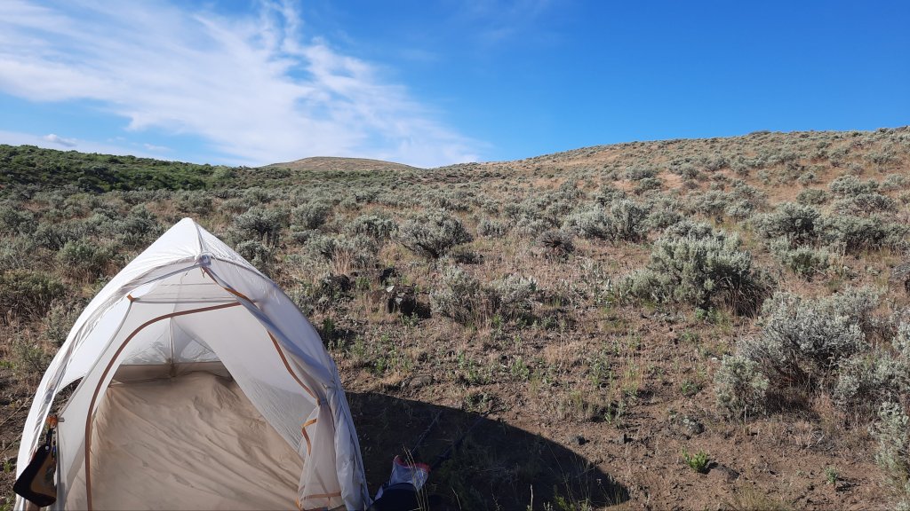
The wind was cold last night. I thought about taking the rainfly off the tent because its mind-numbing flapping was barely tolerable, but the thin nylon was shielding me somewhat from the chilling wind. As it was I snuggled deep into my 40 degree quilt.

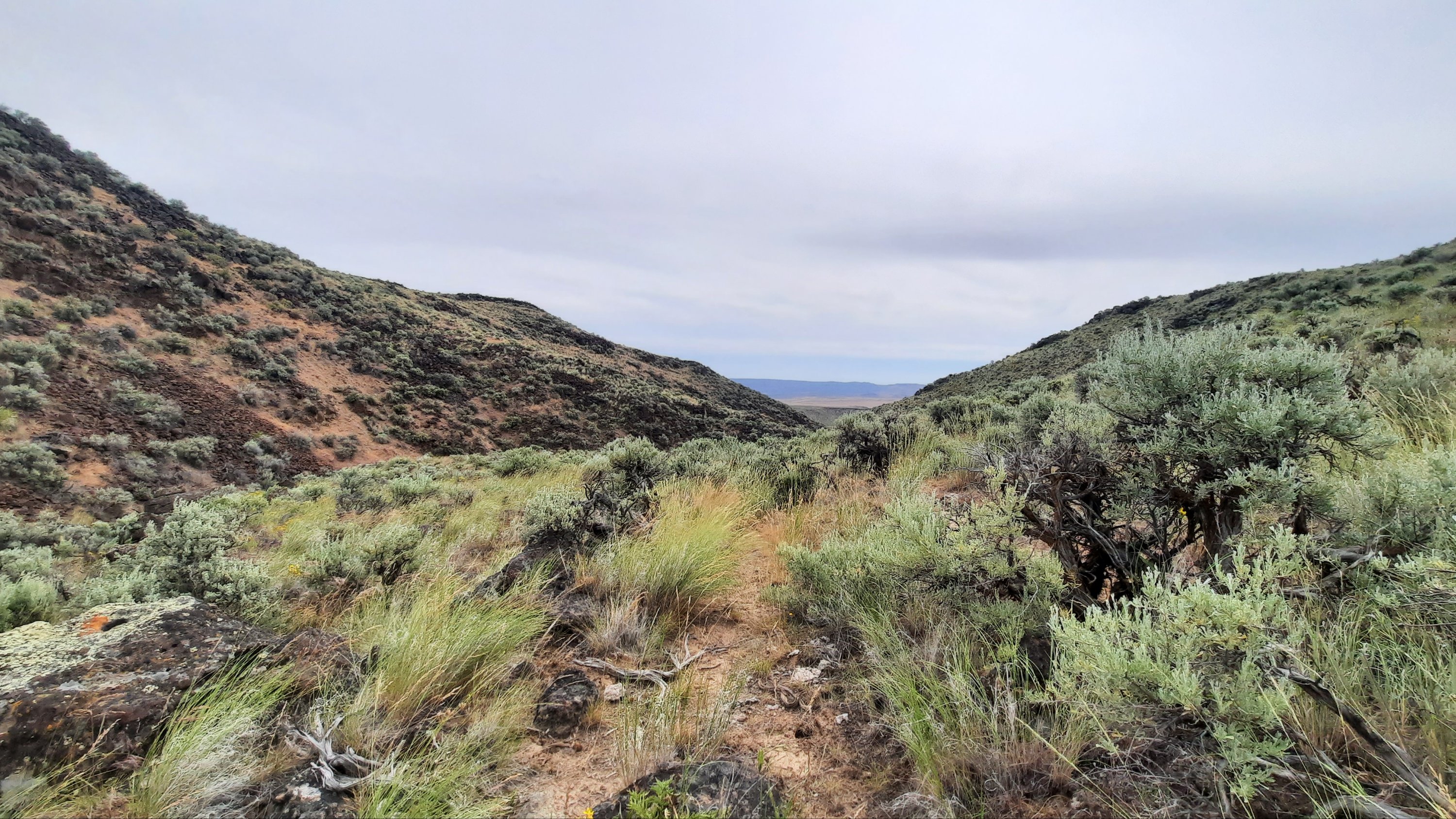
My morning route took a right onto a road as it crossed over another drainage, but I walked by the area, failing to see the road. I thought I could spy where it met the rise a couple hundred yards away, so turned around and looked closer. I finally noticed the gate. This road hasn’t been used as such in many decades. The tracks were gone where it crossed the drainage (with water of course) and thick vegetation obscured the way.

Here I go soaking my feet again, I thought. It wasn’t exactly the bog of eternal stench, (Labyrinth anyone?) but I was rock hopping just the same and got to the other side, dryness intact.

I’m glad I put my gaiters on this morning. The road walking was essentially cross country walking, then the next span of cross country walking was cheat grass walking.

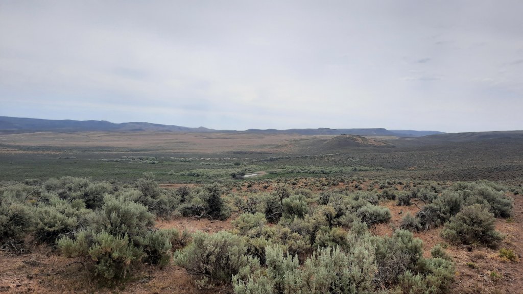
I could see the lush farmland of the Malheur River valley below. I was working my way towards the highway where i would walk the last 5 miles to my car at Harper.

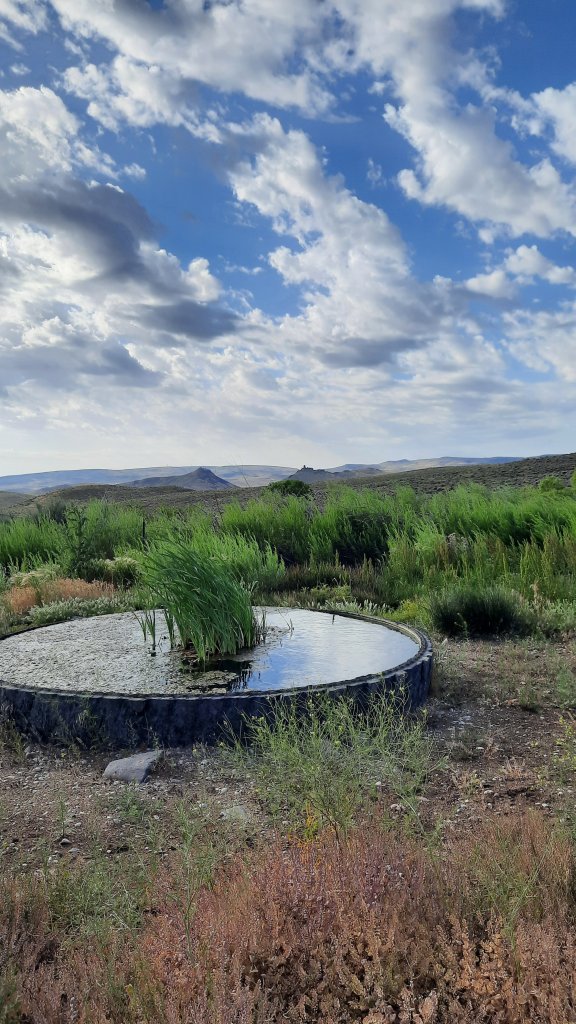
For the last bit I followed the contours of an open canal…with water! I can’t get over all the water I’ve come across on this trip. 

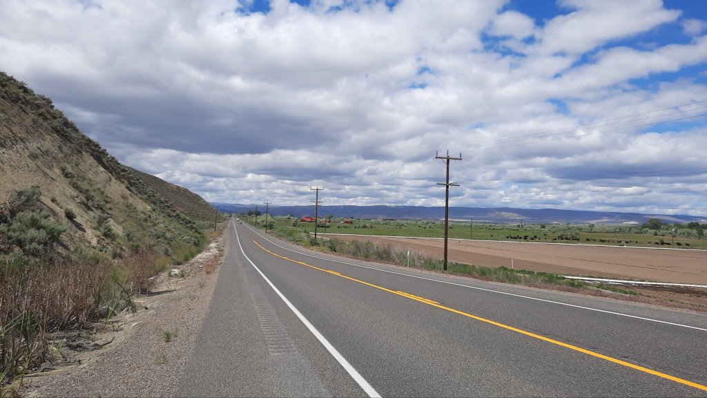
Then the road. Just as I step onto the pavement a semi blasts me with air and send my hat flying. I walk carefully after that, moving far away from traffic as I slowly inch around a looong corner, listening to a podcast to take my mind off speeding vehicles. 

Then, a car pulls over. I thought I might see some sympthatic recreationists on their way from the Skull Grinder bike race in Burns that weekend; I had spent the day there Wednesday as part of an Eastern Oregon Recreation Summit (talking trails and bikes) and the summit hosts were expecting hundreds of people for the race and festivities that weekend.

Ok, the car. Out gets Kate! Kate was with me at the summit and is the recreation lead for Eastern Oregon Visitors Association. I told the group I’d be out here walking, and here I am. Kate asked if I need anything, and I suggest getting a ride the last 1.5 miles to my car would be most excellent. She agreed and I hopped in. A short and lovely encounter on the side of the road. Thanks Kate!

I changed into my chacos and went inside to tell Brian about my trip. On Thursday when I showed up I convinced the owner of the gas station and store/bar to let me park my car there. Backpacking wasn’t a traditional past time in Harper, but I must have made a convincing argument because he agreed. In fact, my judgement may have been hasty. As I was walking away he waved me over to another Harper local to meet Jeanie. Jeanie’s brother had thru-hiked the Pacific Crest Trail and most of the Continental Divide Trail. Love it!

I enter the bar, remembering Brian had said he sells sandwiches. Rootbeer and sandwich…yes please! A few locals were nursing drinks, and Brian welcomed me with a Coors Light, then a rootbeer. Some of the cows belonged to a rancher at the counter, and I delicately mentioned how nice it would be if the cows were kept out of the springs… the conversation centered on the land, and I quizzed them on features and names of things. All and all, it was a great way to end the trip.

Ah, but it wasn’t over! At least I didn’t want it to be over. I had another day to play with, as my long miles on day 3 had me finishing ahead of time. So what is a big part of the hiking experience on a long trail? A town day! I decided to go the extra little bit to Ontario, Oregon and get myself a hotel room and nice dinner. 

I wasn’t ready to go home yet. Home means the end of the trip.

But getting in the car means the end of this blog….see you soon when I start writing about the Appalachian Trail! The countdown is on 😁

Connections – The Shakedown Hike, Day 3: 15.7 miles (35.7 total)

The birds chirp all night. 

On my last few outings this spring, the moon has been out and the birds don’t know to stop singing. Surely they know, but just don’t care? Do birds pull all nighters on a full moon?

I walked up the grade I saw the horseback rider on yesterday and found a better road to the spot. There was no way a big cattle truck would have taken the road I walked in on, but then again, you find astonishing things via these rough 4wd roads.

My next water source was a pleasant cruise down a grade filled with soft green hills. Patches of cloud cover rolled over the scene and the idealic setting took me to a beautiful tire-filled spring. These are the water sources we dream of. Little did I know this would be the best water of the day. I only took a liter and couldn’t resist holding it up to the light. Clean and clear.

I walked next to and through a creek the rest of the day. It was nice. 

Is it the cottonwood trees that are so fragrant? Their perfume sweetens the air.

I lunched at a spot called Hanging Rock Spring.  I failed to see the hanging rock, but then I wasn’t about to go rooting in the brush for a view. It must have been a modest hanging rock. 

Speaking of rock, the near-by drainage was named “Hoodoo Canyon” and the terrain did become very south-westish. Definitely Utah or New Mexico vibes. 

Again, I should have filled up my water when the road crossed the creek and I walked about 30 feet through it. I had already tried walking around, but once I was on the sandy talus above the drainage, the view showed me that I’d be trading a clean walk through the water for a marshy mud-foot crossing. No thanks. That’s a good way to lose a shoe.

Then I evaluated. My end of day water source wasn’t far off, as the crow flies, so decided on a cross country option up and over a few rises…such a cool way to hike! You can go anywhere out here…it’s wide open. Partial fire scars cleared the sagebrush and left cheatgrass in its wake….terrible for the ecosystem, but ok for walking.

The spring is hammered. Cows protest my approach to check it out and I find nothing but a cow paradise…there are flowers and green all around. It must be a lovely place to wallow if you are a cow.

Ok, next one looks to be a mile or so of cross country hiking. This is the part where the hills start looking like mesas and the soil turns an ashy white. Definitely a different look for this hike so far. Oh, and cactus! Blooming catus 🙂

This next spring is the worst by far.

No way. Not drinking that.

Now it’s 3 miles cross country, up and over a long climb. It’s early, walking only 10 miles is a big challenge for me when my pace is 3 miles an hour. I slow way down on a cross country sections, and in general am hiking slower on this trip, but I was cruising on this morning’s road walk.

I decided it had to be done. I could camp with what I had, but only if I eat a cold dinner and skip coffee in the morning. No thanks! Onward. One step at a time.

Ooo, there it is, my first blister of the trip. Day 3, not bad! And only when I pushed it over 10 miles. Good job body! By the way, my problem planter fasciitis foot was feeling good too. 

On the other side of the saddle that sat between the water sources I came to a spring cut deep into a narrow ravine filled with grasses and flowers. I found a way down on a cow trail (#^@%^$), but the cows haven’t mucked this one up too bad, so was able to get some cleanish water.

Whew.

Camp, eat, hide from the sun, read, close my eyes while the birds chirp me to sleep.

Connections – The Shakedown Hike, Day 2: 10 miles (20 total)

I slept well under the waning strawberry moon.

Morning was clouded up, and I was excited for the prospect of a day without sun. Temps would be much cooler and good for hiking.

A gradual cross country section brought me to a pinch-point and I scouted around a bit to find a good way down, twisting my ankle in the process. 

“Walk it off,” we say, and that works…sometimes.  

With the uneven and rocky weaving around sagebrush and the odd white mariposa lily, walking through cheatgrass just dried out enough to start sticking in my socks, but protected by my gaiters for just that reason, I found I wasn’t walking it off. I was slowly and methodically watching each footstep so I didn’t repeat the twist, and the ache remained.

Then road! But a rocky one, so the attention now went to avoiding the fresh cow pies. Oh yeah, the cows are out, and we are all going the same place: water.

The road exits a dramatic cut in the ridgeline and descends to a fenced and quite lush looking reservoir with piped water into a cattle tank. Score! This set up can provide some of the best water if it’s piped from a spring – or a cattle-free source. (Note: the danger remains that it might be pumped from the dirty cow tank behind you. I filter or treat most water when I don’t see it coming out of the ground….maybe thats just because I do so much hiking in cow country.)

Back to roads. I walked slowly up towards the top of something again. Basin and range: true sagebrush steppe walking. Except for the road that disappeared into the folds of sagebrush as far as the eye could see, it was unbroken.

The sun never came out and I walked happily under the bluish-gray moody day.

And then: a cattle truck. I knew I might run into a rancher or two with all the mooing on the landscape, but this one was really far away, I wasn’t quite sure until I got closer…thinking it could all be a mirage.

Then…a rider on horseback racing up the grade of the next climb. The human is going home. 

I am pleased that I’ll have my solo bubble intact for this 24 hours. It’s been a while since that has happened.

Another creek, and then camp. The birds are chirping away and I set up expecting a bit of rain overnight.

Mooooo.

Connections – The Shakedown Hike, Day 1: 10 miles

I’ve got to shake it off.

Shake off the time between my last solo backpacking trip and now. Those months have been filled with one unsettling event after another; my sweat is toxic with them the first day.

I am headed into the desert with modest but exciting goals: hike 10 miles a day, find water, and piece together some dirt roads stitched with cross country sections. Why? To groundtruth ideas I’ve had about linking together the Oregon Desert Trail in the Owyhees to the Blue Mountains Trail in the Strawberry Mountains, a personal plight…you might say for curiosity’s sake.

June provided a rare mild week right before summer solstice. Add in some well-deserved time-off after a week of work in the backcountry, and I had the time and good weather for a solo adventure.

This was also to be an experiment: can my rehabilitated planter fasciitis foot hold up to 10 miles a day for 5 days? I was optimistic, but am hedging my bets by going slow and stretching constantly. Oh, that, and the stick roller in my pack.

It was a shakedown hike!

I leave for the Appalachian Trail in a few weeks, so am testing my gear setup for the first time. Bits and pieces of gear always change between long trails. Each trail has it’s own gear needs, and I was preparing for hot and humid and maybe rainy weather.

I couldn’t possibly replicate those conditions in the dusty and scrubbed desert northwest of Lake Owyhee State Park, but enough pieces were in place for me to realize I was packing way too many clothes. It will take a while to dial in my AT pack…but with many options to ship things home or have Kirk send them ahead to me on the trail, I was giddy with excitement at how different a hike on the AT will be. I’ll find actual trail, people, (lots and lots of people), towns, different ecosystems and geology, trail angels all over the place, shelters, lots of water, lots of shade, lots of memories.

20 years ago from March 20 to August 22 I called the Appalachian Trail home, and I will be going home again for 2 months.

But back to the sagebrush sea.

I wandered 10 miles on rocky dirt roads that hadn’t seen any traffic in weeks if not longer. These roads are my favorite. They are everywhere in the desert and take you to water, cool things, and they are usually too rough to drive, so walk them!

Many many miles are like this on the Oregon Desert Trail. Sometimes they are whispers of a former road and you have to read the contours of the ground in front of you, and look for the ghosts of missing sagebrush. Last weekend when I was backpacking with my volunteers up into the Trout Creek Mountains, we turned onto one of those roads and the spaces where the road had been was filled with flowers. There are so many flowers in the desert right now!!! Our very rainy and snowy spring is soaking the ground frequently, so I’m hiking with great optimistim that the water marked on the map will be there…I also viewed the potential water sources on Google Maps…the detail in the satellite imagry is downright astonishing.

Even when I take my time it doesn’t take me long to hike 10 miles, so I need to purposefully slow down, take epic long breaks, linger over coffee, and read one of the 4 books I brought with me (3 digital of course!).


It’s a vacation hike! A belated birthday hike? I turned 45 on that volunteer trip last week, I ate cake with 20 people in the desert, which was amazing, but now I was treating myself to a little hike.

I intensly enjoy walking through the folds of the earth and knowing with 96% certainy that I won’t see any other humans. I am of this place and sometimes I feel this most intensily when I am alone.


Bring me back to the present, here and now. That’s what backpacking is good for. And I was brutally reminded of this when I stepped shin-deep in a mud-cow pie wetland at a desert spring. The rare desert nectar was stomped to death by their large, thirsty bodies. They wallowed in this spring, so I’m definitely filtering and treating it. 100% fecal contaminated.


Fence all the springs please!

Back to it: the walking was hot, I deployed my sun umbrella much of the afternoon, and my pale and pasty legs turned red in my new purple rain adventure skirt.

Breaks were taken in the old roadbed where my footprints joined those of deer, pronghorn, and cows, i was all spread out on new and crinkly tyvek.


It will take me at least a day to sweat town away, maybe longer. I have 5 days. Happy birthday to me!

Exploring Oregon’s Outback One Step at a Time

Our weekly newspaper in Bend featured the Oregon Desert Trail last week! Read all about it here:


The Oregon Desert Trail connects people to place

By Damian Fagan in The Source Weekly

The Oregon Desert Trail, better known as the ODT, is a 751.7-route that traverses eastern Oregon, connecting the Badlands Wilderness to Lake Owyhee State Park. The trail slips through dense sagebrush steppe and ancient juniper forests, across lava flows and through canyons incised deep into an old land. There’s wild and wilderness and plenty of opportunities for solitude and solace.

“The story begins in 2010 when our former executive director Brent Fenty had the idea of connecting places where ONDA had been working in and to highlight some of the success such as the Badlands Wilderness and Steens Wilderness,” said Renee Patrick, Oregon Natural Desert Association program manager who oversees development and stewardship of the ODT. “In between those two areas, we have done a lot of conservation work and thought we could help people connect to this landscape through a trail or route and help them see these lands first hand.”

Descriptors such as the Oregon Outback, High Desert and Sagebrush Sea do justice to this desert landscape of sweeping vistas, rolling hills, fault-block escarpments and deep canyons.

As Patrick puts it, “You’ll see more pronghorn than people.” The concept of spending time exploring and getting to know this remote section of Oregon may be foreign to some more accustomed to exploring the Cascades, Oregon’s verdant spine. However, the desert landscape’s subtle beauty reveals itself to those who wander.

Author Ellen Waterston writes about living in and exploring the High Desert in “Walking the High Desert: Encounters with Rural America along the Oregon Desert Trail.” When asked about her experience, Waterston said, “The high desert is inscrutable at best, but during the winter especially so. I relish the palpable sense of all that’s brewing beneath the surface of the desert’s vast expanses. And while I’m waiting, nature puts on a show: hoarfrost exquisitely tracing the slimmest blade or branch, a coyote plowing its snout through the snow as it tries to rout a rodent out of hiding or pronghorn kicking up a wake of wintery glitter as they speed across an open savannah carpeted in white.”

The task of designing the route fell to Jeremy Fox, Patrick’s predecessor. He began the arduous task of sketching out the trail, utilizing existing resources such as trails, two-tracks, dirt and paved roads for most of the route. Private property and highly sensitive wildlife areas or habitats were skirted. Blank spots on the map were connected by cross-country travel; nearly 35% of the trail includes trailless sections where a hiker’s navigational skill will be challenged.

“Long-distance backpacking is not a traditional pastime in eastern Oregon in the desert,” said Patrick. “There’s a lot of curiosity and disbelief.” Patrick has worked hard at informing land and business owners about the trail that passes by their properties and towns. Now, landowners living in the outback have a different take for Patrick. “They don’t ask why; they tell me stories of hikers that have passed through—so it’s really rewarding to see that trail culture developing.”

Whitney LaRuffa hiked the ODT with a couple of friends in the fall of 2018. “I picked that trail because it’s a part of Oregon that I’ve visited and always wanted to see more of,” said LaRuffa, a seasoned long-distance trail hiker and vice-president of sales and marketing for Six Moon Design. “There was a true sense of adventure hiking the ODT compared to some of the more established long-distance trails that are more plug-and-play,” LaRuffa added.

For LaRuffa, it wasn’t just about being a thru hiker. “People we met along the way were all very friendly, making sure we had food and water and that we knew where we were going,” LaRuffa said. After his hike, LaRuffa spent time on an ONDA trail stewardship project, giving back to the area he had passed through.

Though the trail exists to hike in its entirety, day hiking or shorter overnighters are possible. ONDA provides excellent resources such as maps, GPS waypoints, information about water resources, and other trip-planning details on its website, along with information about the wildlife, geology and history of the region.

Central Oregon day hikers looking to go somewhere COVID-19 safe may enjoy exploring unique geologic features in the Christmas Valley and Fort Rock area or “the backside” Pine Mountain. ONDA also initiated the Badland Challenge to encourage exploration of over 50 miles of trails in the Badlands Wilderness, located just east of Bend, where the ODT starts or ends—depending upon your sense of direction.

Walking the High Desert: Encounters with Rural America Along the Oregon Desert Trail

Walking+the+High+Desert+Encounters+with+Rural+America+along+the+Oregon+Desert+Trail

This is the book I would have written if I could have.

Thank goodness Ellen Waterston did first, it’s much more eloquent 🙂 AND she was a rancher in Eastern Oregon and has an incredible perspective about the ODT and the issues facing the high desert (and rural America).

I had the chance to read one of Ellen’s drafts about a year ago during a week-long raft trip on the John Day River (our only undammed river in Oregon). I’ve literally been excited about this for a year!

I went to grad school at Goldsmiths (University of London) for design futures (trying to make the world a better place through thoughtful design) concentrating on museum exhibition design. I wanted to take the museum out of the museum, and for the last four and half years have been doing just that. The Oregon Desert Trail is my museum exhibit, and reading this book will help facilitate your journey through a three-dimensional space: eastern Oregon.

The book is available for preorder now on Ellen’s website, and join in for a virtual book launch on June 17 with the High Desert Museum.

Look at these recommendations!

“There is no better guide to Oregon’s high desert than Ellen Waterston. Her sense of place, her lyrical love of this sometimes hard to love place, her balanced yet passionate dissection of the issues roiling the big land of junipers and open sky is a wonderful match for her subject. While the West is full of poets who love the land, few of them are as intellectually nimble as Waterston.”
— Timothy Egan, author of A Pilgrimage to Eternity

“Walking the High Desert grows right out of the relatively new and little-traveled Oregon Desert Trail, but it is no trail guide, much less a braggadocious through-hike log. Ellen Waterston has given us her own very personal Baedeker to a little-known landscape that she knows well as both rancher and writer, hitting all the high points of the heart as well as in elevation. In language as crisp as the desert air, her book serves equally well as a primer on Western conservation, a lure into difficult but hugely rewarding country, and a who’s who and what’s what of high desert life and culture. Woven out of her own remarkable stories, her trek becomes an insightful research for how we might all get along, here and elsewhere, in a perilously shifting world.”
— Robert Michael Pyle, author of The Thunder Tree, Mariposa Road and Magdalena Mountain.

”Since time immemorial, humans have been living, loving and exploring the West’s high desert. In turn, those of us living here are influenced by how the desert is subtle, nuanced and rich. Ellen’s Walking the High Desert is at once profound and worthy of all these descriptors of the high desert. Uniting stories from across this diverse landscape—the humans and non-human voices—Ellen weaves an incomparable narrative of wonder, science, history and prose. This book deeply and cleverly explores the desert landscape and the complexity of the interplay of humans and this amazing piece of the Intermountain West.”
— Dana Whitelaw, Ph.D., Executive Director of the High Desert Museum

High Desert Academy

Updated 5/5 with links to the recorded presentations


I had a full slate of presentations I was planning to give this spring, but like everything else lately, I’ve had to adjust to the new realities of a home-bound existence. I am lucky enough to still be working full-time, and have plenty of fun engaging projects to work on. I’m definitely pining for the hikes I was supposed to do this spring in eastern Oregon, and the communities I was planning on visiting. I am scheduled to led a number of stewardship trips this year, and it’s looking less likely that I’ll be able to do that.

So it’s exciting that ONDA is looking for ways to bring Oregon’s high desert to you.

We launched our High Desert Academy last week. This series will include stunning tours of high desert highlights, informative workshops that will teach you new advocacy skills, and tips to plan a safe and enjoyable desert adventure once it’s advisable to do so.  So grab a quaranTINI and join us at these High Desert Academy offerings.

Check out the full lineup here and join us!

I’ll be giving three talks in April:

Desert Hiking Tips & Trips

Do you have concerns about water, navigation, camping, animals, desert driving and more? We’ll answer your questions and offer ideas for your next adventure in Oregon’s Owyhee Canyonlands and beyond.
View the recording

Multi-Sport Adventures on the Oregon Desert Trail

The Oregon Desert Trail is not just made for hiking. Did you know there are sections that you can bike, paddle, horseback ride, and even ski in the winter? Join us as we dive into different options for “quiet recreation” on the public lands throughout Oregon’s high desert.
View the recording

Boots, Bikes, and Boats in Eastern Oregon

Go east on this virtual tour for a new desert adventure and a sense of solitude. You’ll learn about recreation and conservation opportunities in and around the Steens Mountain Wilderness, Fremont-Winema National Forest and the John Day River Basin.
View the recording

Maybe I’ll see you there!

Wear the Oregon Desert Trail

Since I’ve started working on the Oregon Desert Trail (almost 4 years ago!!!), I’ve wanted to make some shirts or hoodies for the trail. After running the shirt and swag company, hikertrash, for a few years, I knew how much time and energy went into ordering, shipping, figuring out popular colors and sizes…it was a lot of work.

From the years I ran hikertrash:

So when Ultralight Jerk created a fundraiser earlier this year to sell some of their shirts to benefit the Oregon Desert Trail and it raised over $2,000, I started paying attention! There are multiple websites out there now that will do the work of printing and shipping shirts and other things when you upload a design, and I really liked the process over at Bonfire, so I decided to finally make some ODT stuff for sale.

Each of the 4 designs has options between tshirts, long sleeve shirts and hoodies, and a variety of colors to choose from.

The promotion ends in 19 days, and will ship on December 3, just in time for gift giving (even if it’s a gift to yourself).

All can be found here and sales will go to benefit the Oregon Desert Trail.

pronghornclassic odtodt multi sportget ONDA trail

Cut Toothbrushes Not Switchbacks

Ultralight Jerk is a social media account that likes to poke fun at the ultralight backpacking community through their accounts, but in a very un-jerky move, they decided to donate the proceeds of their “Cut Toothbrushes Not Switchbacks” shirts to ONDA and the Oregon Desert Trail! In just over a day they’ve raised almost $1,000 for us. Impressive! There are 12 days left of the fundraiser, so head on over to https://www.bonfire.com/cut-toothbrushes-not-switchbacks/, get a shirt and help support our conservation and recreation efforts.


Screen Shot 2019-05-21 at 9.37.36 AM

Take the Badlands Challenge

I have recently found myself saying: “I am only limited by my imagination,” and it’s true! I have an incredible opportunity at ONDA to dream big and then make it happen. This past weekend we celebrated 10 years of a wilderness area that ONDA was pivotal in helping to designate, the Oregon Badlands Wilderness. Over the past two years I’ve led some trail work trips with volunteers to help build some new trail…new trail that helped to link together other existing trails…and that work helped to create a 50.1 mile network of trails in the Badlands (9 of which are along the Oregon Desert Trail).

20180602_112852

Renee Patrick 20170603_161106_34995282492_o.jpg

Then I had the idea of creating a challenge to hike all 50.1 miles. Turns out there wasn’t a map with all the trails and mileages, so I made one. And now it’s live!

Badlands Challenge Map_for web_Page_1Badlands Challenge Map_for web_Page_2

The Badlands Challenge: hike all 50.1 miles in the wilderness; write a desert hike-u (haiku) and identify three new species (new to you!). Read all about it here.