Late March is the perfect time to be out here. At least that’s what I’m saying on day one before the rain comes. A soild week of sun on earth started the annual cycle of green growth…even in the depths of this Idaho desert.
I was headed into one of the most remote places in the country…the Jarbidge Wilderness. It has been a fairly smooth trip in, though, and will be a cruisy 100 miles out.
I left Bend, and after six long hours in the car yesterday, crashed in a hotel room an hour from Hammett, Idaho, where the next day I would leave my car and get a ride to the Nevada border and the start of the trail.
I was meeting Dennis there, my shuttle driver and trail angel to be. I connected with Dennis on the Idaho Centennial Trail Facebook group. (About all fb is good for anymore are the trail groups. When you want real-time information on conditions, past experiences, or offers of assistance, you go to the group).
The page provided, and I quickly found a ride to the start of the trail. The drive in would also figure into my water cache strategy.
There is very little natural water in the first 100 miles of the Idaho Centennial Trail, so much like the Oregon Desert Trail, hikers must place their own gallon jugs on the way in.
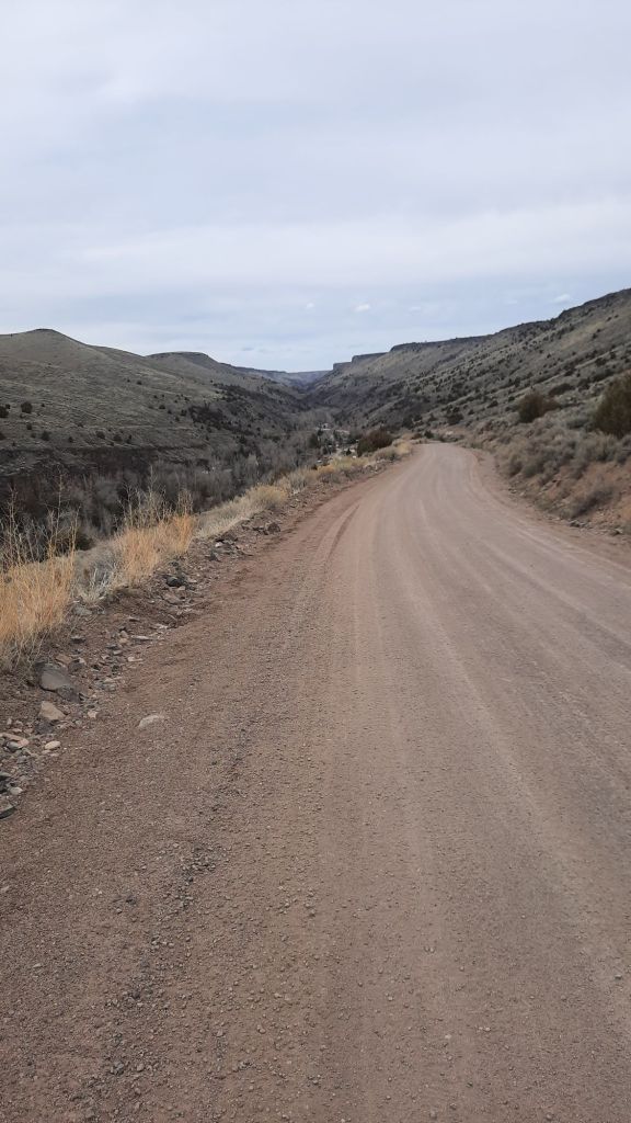
A dirt road from the small ranching town of Breneau stretched 70 miles down to the state line…and served as the caching backbone. (There is also a paved road that gets you within 2 miles of the start, but then no water caches).
We were lucky, the road was dry today…with rain and wet it could turn dicey in spots, but today it was firm and fast. The same can not be said of the side roads one would use to cache. Those were two tracks that disappeared into the sagebrush sea…and were referenced as rough and tumble type roads…only suggested for high clearance vehicles on the driest of soils.
I didn’t want to deal with that, plus, it was March where my average temps would be in the 50s and 60s. Perfect for hiking long distances between water sources. In fact, since I wasn’t bothered by 20-mile water carries, and I had the time to make a key 9-mile round trip down to the Breneau River a few days in, I only needed to place one cache….near where the trail crossed the main road. Easy peasy.
Dennis has a ranch near Fairfield, Idaho, at the end of the next section of the trail, at the transition zone into the Sawtooth Mountains. He wants to help hikers as a potential resupply stop, and wants to thru-hike the trail himself in a few years. We had lots to talk about, especially around funding for trail maintenance. He is in the midst of working with other ICT advocates on legislation to create a funding source within the state. Brilliant!

He also suggested I stop by the winery next to the BLM Guard Station right off the trail by Hammett. Dennis had a feeling the owners of Cold Springs Winery might be interested in supporting hikers as well, so I was planning on capping off my spring hike by telling trail stories and drinking wine with potential trail angels….pinch me.
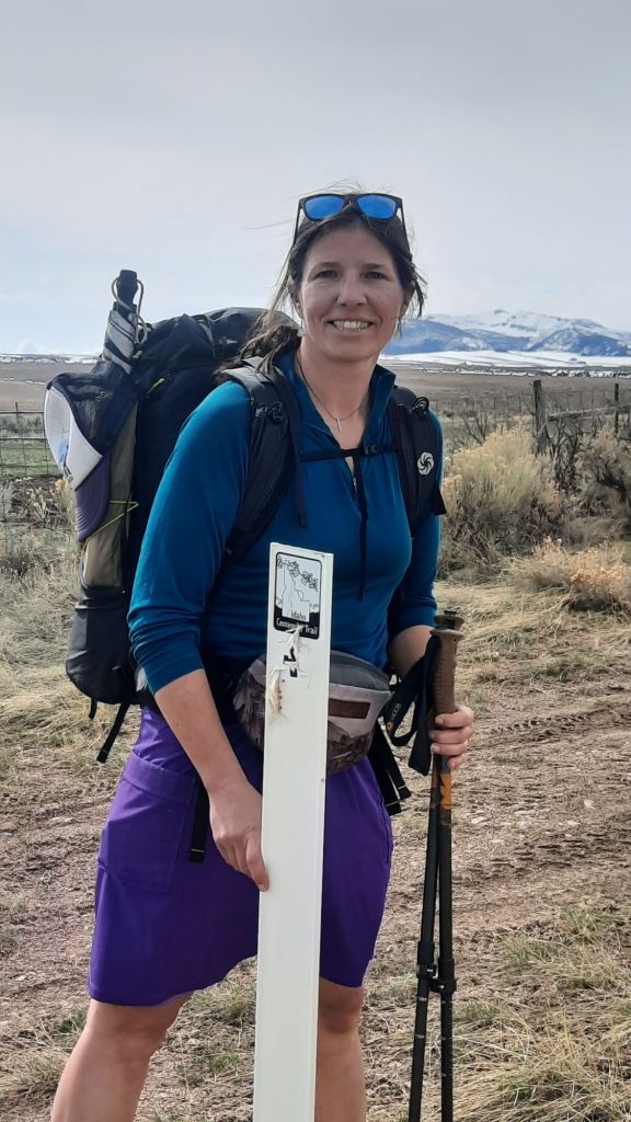
We finished the drive into the desert, and Dennis dropped me off at the first white carsonite post that would be my guide that week. The Jarbidge Mountains still held her winter coat of white, although the recent warm weather had started the spring sloughs. It was officially spring after all (as of last week), and even though blades of grass were sprouting up everywhere, the temps were due to drop 20 degrees by tomorrow and start raining.
I was prepared for the drop, and carried rain gear, cold weather gear, and even a tank top just in case things started to warm again at the end of the week. Those systems and a 7-day food carry meant I had a heavy pack. But my walking forecast was slow and steady with lots of snacks. This desert section has very little elevation gain (other than the two alternates I was taking into the canyon), so many hikers blast through this section…afterall, the stunning spines of Idaho’s densely forested mountains made up the rest of the 800+ miles. Just to the north were challenging and rugged miles, some in fire-affected forests with blowdowns for days, thus a main reason Dennis was working on trail maintenance solutions. It was a constant and persistent problem…the problem of keeping the trail cleared and in good shape.
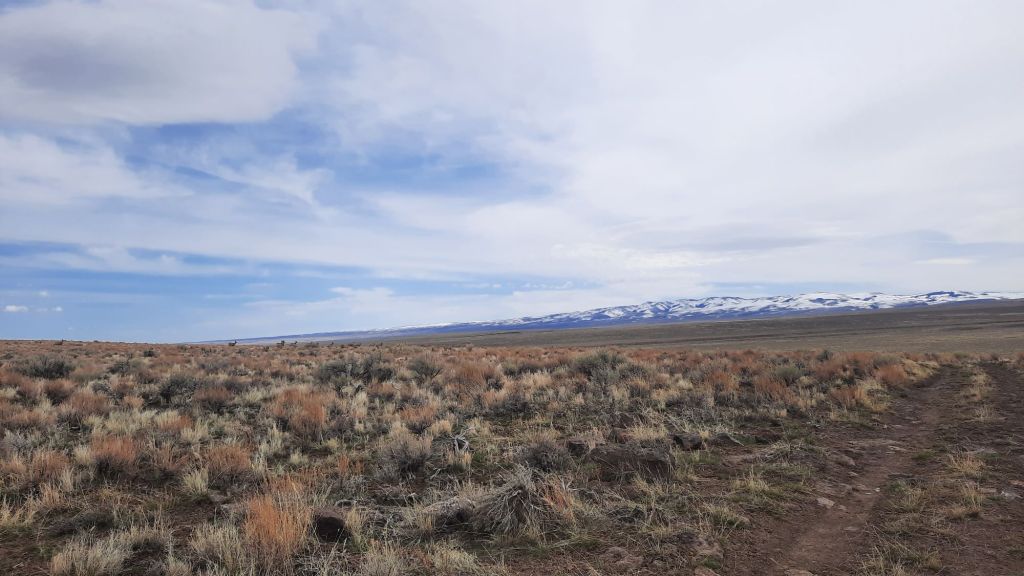
But this section, the desert section, is a land that is mostly sky. Sky, punctured by deep drops into the Jarbidge and Breaneu Canyons. These were wilderness canyons with big horn sheep, whitewater rapids, and steep basalt columns…very reminiscent of the Oregon Desert Trail, except the ICT had carsonite posts.
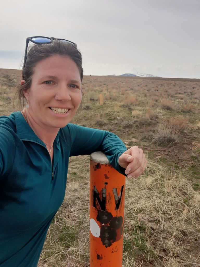
When we got to the drop-off point, I got out of the truck, took some photos, and started waking to Nevada. I would do a quick out and back to the border, and then take my first alternate down into the canyon next to the East Fork of the Jarbidge River.
I was hungry. The leftover burrito I had packed out from lunch yesterday was sounding better and better….but kept going because I had decided to eat lunch in Nevada. As I walked down the rocky two-track road to the border, I chased a herd of 50 mule deer down the slope before me….I was already excited about the wildlife I had seen on the trip so far. Multiple pronghorn and mule deer herds had sprinted from the truck as we drove in.
At the orange border sign I plopped down on my fresh piece of tyvek and reveled in the quiet.
This is the life.
By the time I had finished my first trail-side nap, an extra chill had entered the air, and only walking would warm me up.
I was to take my first alternate soon.
I pulled up photos I had taken of this section in the guidebook. Lisa and Jeremy were the authors of a new and excellent guidebook for the ICT, and had suggested hikers take an alternate right from the start down into the Jarbidge River canyon… and that was an obvious yes for me…Yes I will take the route into the canyon and sleep next to the sounds of the rushing river before climbing out later to hike along the top. Yes. Yes I will.
I had been in touch with Jeremy via email for a year or so by this point, and was fortunate enough to have met the couple in November when I was giving a talk at Idaho Mountain Touring on the Blue Mountains Trail.
I trusted their alternate suggestion, and after my 4-mile round trip visit to Nevada, I was back to the pullout where Dennis had dropped me off, and I started walking the down the long grade to the river and the small community of Murphy Hot Springs. I hadn’t been able to determine if there were soakable hot springs for the likes of me down there, and the absence of information led me to believe there wasn’t.
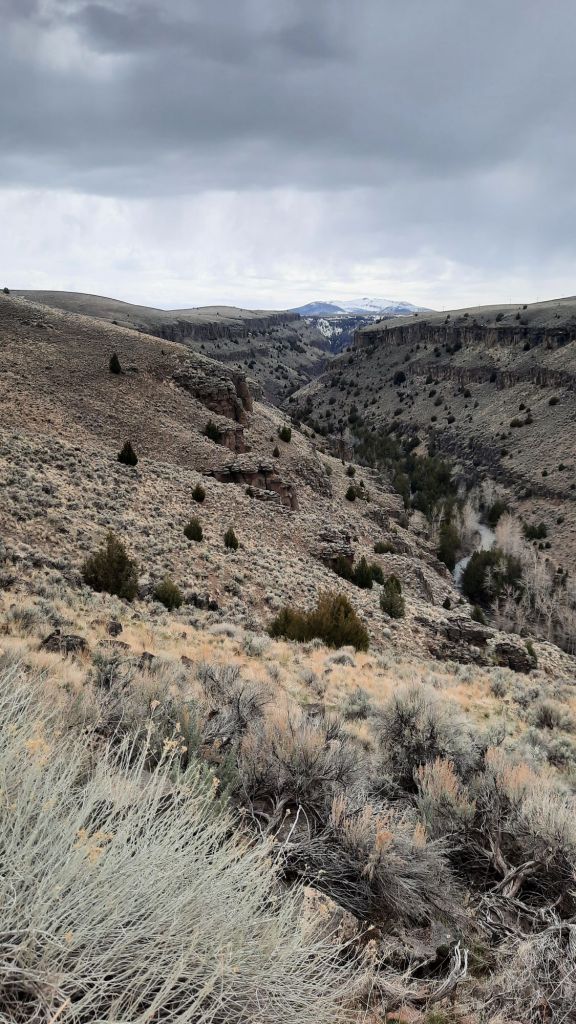
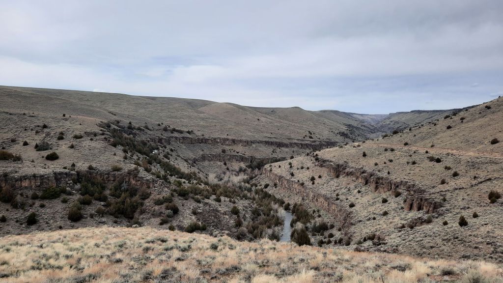
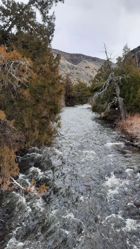
I was surprised at how big the “town” was…maybe 50+ houses and buildings huddled in the bottom of the narrow canyon. I was baffled to see so much infrastructure next to a canyon river. They didn’t have problems with flooding? Many of the other free-flowing desert river canyons could flood spectacularly every few years, but it was apparent from the scene before me that that didn’t happen here. By the time I started walking next to the river, I saw how low-volumn it was. I’d packraft that! Soon, I saw log jams blocking the flow and determined that while it could be done in a packraft, you would have to be careful of pointy sticks and scrapey sharp rocks.
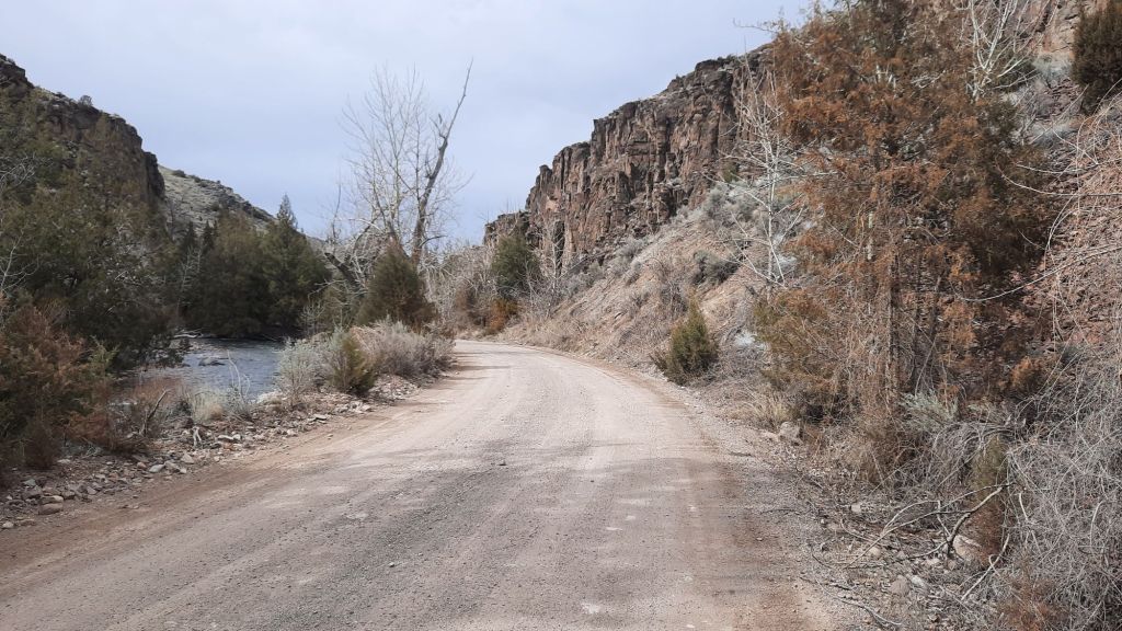
At the end of the road I was walking was a popular boat launch, the whitewater only got more whitewatery from here down, especially after the confluence with the Breneau River. I wouldn’t be paddling through, instead I would be walking the rim of these remote canyons to the Snake River.
I ambled down the dirt road and passed several campgrounds, all with fire rings and pit toilets. Everything was very clean and nice…no bullet holes in the signs either! And the boat launch, wow, I had never seen one so nice with platforms for rafts and stairs down to the water. Color me impressed.
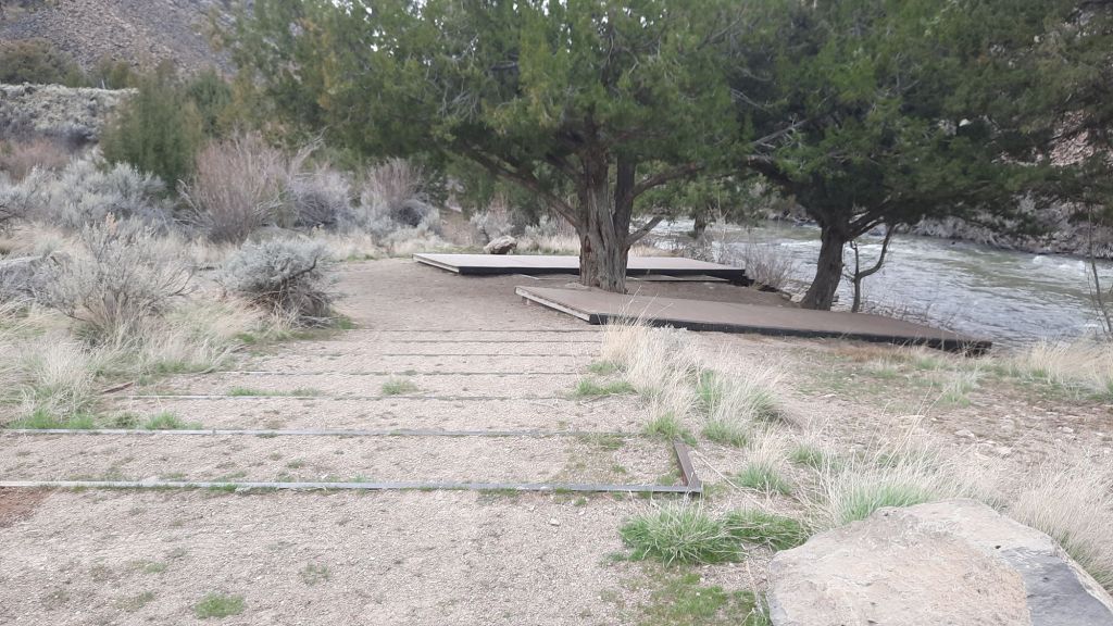
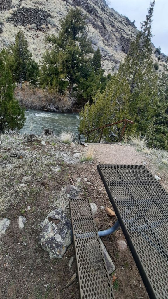
I found a campsite tucked into some trees across from the launch and enjoyed having a picnic table in camp. It’s the little things!
The Jarbidge lulled me into a post-dinner stupor and I closed my eyes.

Will be great following your hike. Beautiful pictures. I have backpacked part of the Sawtooths and will especially enjoy that section.
LikeLiked by 1 person
Hi Renee’
<
div>
LikeLike
That pretty river canyon reminds me the lower Deschutes. 🤩
LikeLiked by 1 person
So wonderful to again read of a She-ra adventure. Thank you
LikeLiked by 1 person
Hello Chas, so good to hear from you too!!
LikeLike
This is going to be a great resource for future hikers, for trail funding and continued development. Thanks for sharing.
LikeLiked by 1 person