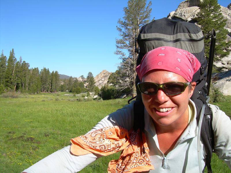
Finding joy on the PCT was part of why I kept hiking and made it my career.
Maybe I’ve been going about this year all wrong. Ok, I’m going to backtrack a bit…I don’t think I’ve done it all wrong, there have been a lot of beautiful moments, like when Amber opened up her house to us to have an exuberant birthday party with about fifty wonderful souls who rallied around me even when I spent the day puking. Like when Kirk and I went snorkeling in warm Gulf waters this May, or when I finished the Camino in Spain with two new friends. Is it this book project that’s tethering me to the pain of the year? What if I let that thread go for a while? What if I let the scab grow, which might be faster to do if I’m not picking at it all the time by trying to write too soon?
I’m going to choose joy for a while and see where that leads me.
And yes, that still involves writing, surprise!
Yesterday, I was working through an exercise from Ursula K. Le Guin’s Steering the Craft book, the one about reading your work aloud and having fun with the sound and play of words, and something blossomed inside. I was writing around a scene on one of my hikes, a day filled with laughter and play, and I kept returning to that story again and again over the day. I wanted to be in it. I wanted to keep that scene fresh in my mind because the feeling was so different than writing about how my radiation has made my lower back perpetually painful and tight, or how a different approach to the tumors that surrounded my brain could have left me with memory loss or cognition problems. I want to think about something else for a while.
The hangover from that joy has been growing. I decided shortly after writing that exercise that I wouldn’t feel guilty about having christmas cookies for breakfast. I did eat a few nuts so that I got the protein that I need while taking my morning medications, but I ate cookies. I ate cookies dipped in whipped cream and I didn’t feel guilty about it at all! I decided to take the rest of the year off from guilt as well. If life is indeed short, what would it feel like to search for and create joy while saying goodbye to guilt?
Anyone want to give it a try with me?
Let’s make this a fun experiment…because that’s what I like to do! Let me know how it goes for you: the seeking joy and forgetting guilt for a while part. Perhaps in this next phase of trying to figure out who I am now, I will write about how my experiment is going, and also tell some stories from some of your experiments. When I worked at the publishing company for four years, that time was primarily filled with writing profiles on artists and businesses around town. It wasn’t quite journalism; it was finding what was interesting, compelling, and unique about these community members and sharing that through my writing. What if we do some of that with these stories?
I’m posting this over at Substack as well where commenting is easier.All my posts are FREE. Just click ‘none’ on the subscription options.
In happier times…just a few days ago in fact! At the ONDA Christmas party with Phyllisand Mary, two amazing women.
I’m so tired. Maybe it’s the ghost of the impending anniversaries from December 2024 and learning the truth about my injuries, but what’s my excuse this year? I’m discombobulated. I’m depressed. I’m in pain, and I’m grieving for something. I think it’s for who I used to be.
Yesterday I sunk into the depths of a dispair that I didn’t know existed, but today I woke up determined to have a better day. That looks like standing up without bracing for the rushing pain of low blood pressure in my head and shoulders, and instead slowly moving through it, anticipating the other side of the dizzyness, not getting derailed by the dizziness. That looks like leaving the house to write at a coffee shop where I can type these sentences with the accountability of being a human in public.
I don’t yet have the words to explain why I dip into these deep chasms of weeping, but when I try to understand, when I type out the sentiment behind the feeling, I can at least distance myself from it enough to see it a bit more objectively. That perspective takes on more weight as I circle around and around the idea of writing a book about my cancer experience. “Write from the scar, not the wound,” author Cheri Kephart said in her workshop, and that makes sense for a book. My book will be written from the scar, but this blog is written from the wound. From the bloody front lines of a life torn apart and knitting itself back together. At times I think I’m healing and toughing up, but yesterday reveals that I’m still raw and bleeding. The wound is tender and sore.
Bits from this blog may end up in the book, but I imagine the book will look back on this experience from a larger scale (hello fractal, my old friend). It will be putting all the pieces back together as a work of art, with thought and craft and structure… but now I’m still discovering what the pieces are, and what shapes they take. Writing here is sometimes messy, unshaped, uneven, and scattered, but it’s helping me find the pieces far faster than if I were stewing in this malaise and pain without getting it out into the open and letting it breathe. Writing from the wound is completely appropriate to this phase where I’m trying to make sense of what it means to almost die, to get a second chance at life, to confront my limitations in this new body, all within the context of losing my Dad just a few months ago.
Saw this on Substack and thought it appropriate, is depressed almost the same as stressed? In dessert speak, that is.
In a way, remission has been harder than treatment. At least during the treatment phase, I had a reason for being tired all the time, I had an excuse for staying in bed and not answering my emails. But after? Maybe it’s the scanxiety (the anxiety of the cancer coming back…all to be revealed in my next scans in early January, and every three months after…for the rest of my life) or it could be PTSD from my close brush with death a year ago. Or maybe there is no reason, and it’s just one big pile of shit that threatens to suffocate me each day.
Some days I don’t feel better, and wonder, is this the new normal? Now I’m starting to understand why people give up, why they don’t want to be alive with cancer anymore. But just thinking that thought scares me into thinking that thought will invite it back. If our minds are that powerful, can thinking about it coming back open the door? (proceeds to tear hair out)
Writing here has been such a lifeline; that’s a reason not to tear my hair out. Fun fact: my hair was thinning during the chemo process, but now it’s growing back, and in certain mirrors I catch a glimpse of myself with 2 inch hairs standing up from my part line; it does make me giggle (actually, you can see it in the photo above!). Through writing, I’ve been in conversation with myself and with you, and these connections have been everything. I’m sending out holiday cards this year, and it’s truly overwhelming. I look at the list of people who donated to my go fund me, who sent cards and care packages, who dropped off meals and stopped by for a visit, and there is not enough stationery or stamps to write enough cards. Hundreds of you came through for me this year, and even if you don’t get a card in the mail, please know how important you were and are to me. I’m so rich in friendship, true connection, and love that I know none of this has to be faced alone, even when I feel alone.
So let’s end this blog post on a high note. Thank you for listening. Even if it feels like I am screaming into the void, I know you are listening and care. That helps so much.
For today’s walk I listened to music. It’s a simply wonderful combination: walking and song.
I want you to have an experience with these posts; there are links to songs, videos, other websites, and many various adventures. So here is your invitation to leave the tab open and return to find the link to the podcast or watch the movie. Take a walk and play the song. Think some thoughts and make some notes, or just leave space to let them emerge as the morning or afternoon unfolds. You may need an hour, or two…sometimes you might need a week for your brain to untangle and release. At least that’s how I work. You do you.
Today’s song is Frank Sinatra Jr’s Black Night. If you liked that one, you also might like The Ocean by Richard Hawley, The Rip by Portishead, or Empire Ants by The Gorillaz. The crescendo of each song echoes somewhere deep inside. You know how I wrote about using sound vibrations earlier this year to help kill the cancer? I think that’s what these songs do too. They vibrate something vital inside me, and the result is elation and joy. I hope for you too.
Today I want to talk about creativity as a force for survival.
When my neck started spasming last year, the aspen trees in the glaciated gorges of Steens Mountain had just started to turn gold. I was leading a trail maintenance trip for National Public Lands Day, and I knew something was very wrong. I was due to fly out the very next day to start a 400-mile thru-hike of the Pinhoti Trail, which I would connect to the Benton MacKaye Trail, turn east, and hike to its terminus at Springer Mountain (also the start of the Appalachian Trail). I planned to bookend the hike with a visit to Pinhoti Fest before I started walking, and finish with the Benton MacKaye Trail Association’s Annual Meeting and Hike Fest at Unicoi Lodge in Helen, Georgia. I intended to make further connections with the founders and stewards of both trail organizations to explore how I could add my expertise to their trails with my long-distance trail consulting business. This was a working hike, but also my vacation. Where do I stop and my job begin? I’ve never really known, having always (or most of the time) worked within a passion.
That beautiful fall day changed everything. Once my neck started to spasm on the last evening of the trip, the jolts continued to shock me, racing from my brain, down my spine. I had no clue what was going on, and quickly said an early goodnight to my volunteers as tears streamed down my face. I thought rest and lying down might ease the bewildering condition, but no. My neck spasmed about every five minutes during the long, late-September night. I cried with fear and pain, hoping the others couldn’t hear the extent of my anguish. Something was very wrong.
I avoided facing the truth even after I managed to make the five-hour drive back to Bend and directly to an urgent care. An exam showed nothing of concern, so we blamed the spasms on a few nights of a poor pillow. I could still hike, right? Meanwhile, on the East Coast, Hurricane Helen had just hit land, tearing up the communities, towns, trails, and mountains where I had planned to hike. I rebooked my flight for a few days hence to see how my neck and the storms would play out.
This wasn’t supposed to happen, to my body or the inland communities along the Appalachians, but one thing was clear: much of the region I was planning to hike in was devastated. On the bright side, the Alabama portion of the Pinhoti Trail was spared, but it seemed in poor taste to frolic down the trail when people were suffering just a short distance away in Georgia.
The east coast hike wasn’t going to happen, so I fixated on the Oregon Coast Trail. This 413-mile hike was close to home, had many towns (meaning I could find an easy out if my neck continued to give me grief), and I had already planned to be away from work for a month, so I threw myself into last-minute planning to walk a month along the sea.
I planned to travel to and from the trail all using public transportation; it would be a cool experiment! Since my passion is my work, I started to turn this trip into another opportunity to evaluate the resources and infrastructure of the trail to see how I could improve it from a hiker’s perspective. I decided to start my hike a week out from that urgent care visit, which would give me time to get a few sessions of acupuncture and massage, and push past the pain in my neck to keep going and hike anyway. I’ve done it before, hiked through fresh and recent injuries, that is.
The day before I started my October groundtruthing hike of the Blue Mountains Trail in 2020, I walked out of the house barefoot, and a stray nail sticking up from the door frame tore a fourth-inch chunk out of the sole of my foot. The flapper was deep enough that I had ripped through a significant portion of skin and callus. I panicked, immediately cleaned out the wound, put some antibiotic ointment on it, and elevated my foot until Kirk came home from work. I shook as I showed him the wound, but slowly convinced myself and him that I could keep it cleaned and protected as I hiked for a month solo on a difficult backcountry route in north eastern Oregon. And I went, and I was fine. So I’d be fine this time too, right?
After a week of treatments, I was convinced this Oregon Coast Trail thing was a go. Kirk and I decided to head up to Waldo Lake for the weekend in our camper so he could foilboard while I read in a chair in the sun. I still wasn’t 100 percent, but I had convinced myself I would heal on the hike, much like I had done on the Blue Mountains Trail. The morning we were set to leave, I was stretching when something twinged in my back and I instantly knew I wasn’t going hiking anywhere. All the progress I thought I had made was gone in that twinge. I didn’t tell the rest of my body, though, and I packed up my backpack and headed out for the weekend. Over the next two days, it was apparent that I was having trouble moving normally. Carrying much of anything caused more pain, and I finally voiced out loud that I wouldn’t be hiking the Oregon Coast Trail. I returned home in a slump. Two hikes had now been thwarted in the last week.
Now what?
It wasn’t until I was on a morning walk recently that last year’s hiking (or non-hiking) saga gained more shape. I headed out into the frosty morning with freshly charged earbuds in place and strolled along my normal route along the Deschutes River. That morning, I listened to Rich Roll’s podcast featuring author and fellow cancer navigator Suleika Jaouad, and I saw my decisions in the wake of my physical limitations in a new light.
Suleika has experienced survival as a creative act. I read her first book, Between Two Kingdoms, this year, shortly after my diagnosis, and quickly pre-ordered her second book, The Book of Alchemy. The more I learned about her story, the more I identified with her struggles. When I heard her leukemia returned for the third time before the launch of her new book, my heart just bled for her. For us.
Back to last October: when I realized that I would not be hiking the Oregon Coast Trail, I decided to go ahead and do it anyway, but from home. I decided to embark on a virtual journey and pretend that I was out plodding through the sand and feeling the rain sting my cheeks in groves of old-growth trees that rim the bluffs over the Pacific Ocean. I would virtually hike the Oregon Coast Trail.
Ever since I set foot on the Appalachian Trail back in 2002, I kept a daily journal. Those hand-written missives from the AT are lost, but from then on, I wrote and posted them online. From my hike during a break from grad school along the West Highland Way, to my thru-hike of the Colorado Trail and the culmination of my summer of leading trail crews, I chronicled the rain, sleet, and snow. The blisters, spider bites, and those few times I caught myself on fire from my beer-can stove. Yes, there were multiple times. Over the years, I shared my joys and struggles with a small group of loyal blog-readers, but more importantly, I found great joy in writing for the love of writing. I didn’t care if anyone else read about day 56 on the Pacific Crest Trail or day 5 on the Sunshine Coast Trail, I loved waking up in the early morning and capturing the feeling of the day before.
So when my body wouldn’t let me hike last fall, I decided to wake up early each morning, read the guidebook (shout out to Bonnie Henderson and her excellent resource), reference the FarOut app for real-time updates from other hikers, study the weather, decide how many miles to walk, where I would camp or find lodging, where I would eat, what interesting things I’d see during the day, and how I would navigate the many gaps in the trail. I wanted to turn this virtual hike into a visual journey as well, so I planned to create a story map that I would build on, publishing each new day on the story map as I would on an actual thru-hike. The Oregon Coast Trail is a logistical melange of hazards like high tides, which make certain sections undoable, or eroding cliffs from a perpetually stormy sea. I wanted to experience those hazards, even if remotely, and decide how I would proceed if I were actually there.
Story mapping had become another passion by this point, and over the past few years, I had been creating them professionally for other organizations. The medium harkened back to my college days where I dove into multi-media projects, combining images with prose, sounds, and even videos. And since my virtual hike was quickly becoming another work/passion project, I decided to add on elements from a second business I had started recently, called Intentional Hiking.
Yes, the title gives it away – with Intentional Hiking, I hosted several conversations a month about ways hikers could cultivate a deeper engagement with the world around them as they were out for a day hike, week-long backpacking trip, or a long thru-hike. I invited experts to talk about things like collecting data for Adventure Scientists, learning how to identify plants and animals to contribute to research projects on iNaturalist, or even how public land management agencies are integrating Traditional Ecological Knowledge of indigenous peoples into federal planning processes. To apply this to the Oregon Coast Trail, I decided I would identify several aspects hikers (and I) could engage with as we walked. Those items were categorized and marked on the maps as: Fun Facts, Trail Stuff, Environment, Military History, Exploration History, Tribal Nations, Art and Culture, and Take Action. Each morning, I would wake at my usual 4am, spend the next 4-5 hours researching, writing, and adding on to my story map, and publish that day’s hike on my blog.
By the second week, my creative act had become a bit oppressive, given the sheer amount of time it was taking me to create each day’s exploration. The added weight of my painful body didn’t make things much easier. After my morning creation, my days were filled with appointments. They ranged from sessions with a physical therapist, massage therapist, chiropractor, acupuncturist, and my primary care doctor, with little result. I could barely move.
I kept going because that’s what I do. I finished the project on October 31 to reflect when I would have finished in real time. I remember my neck and back were feeling a hair better…in fact, everything was feeling a tad better, that is, until I slipped and fell on a wet floor while shopping on November 1. It was the kind of fall that you knew would be bad on the way down. As my feet flew out from under me, I had long enough to notice the “caution wet floor” sign by my right leg, and also know I was in trouble. I landed hard on my right glute, whiplashed my head, and passed out.
I will tell you the rest of the story another time, but needless to say, my troubles were only getting worse, and I was still about two months out from my cancer diagnosis. Life sucked, but it sucked less when I could focus on things like the virtual Oregon Coast Trail by ignoring my pain as much as I could to do something that brought joy.
I want to say many more things about how the creative act is survival. Many of you have seen it play out in real time through my blog this year, so stay tuned as I unpack more layers of pain and being so that I can continue to not just survive, but thrive through my creativity.
Slueika was in remission for 10 years before her cancer started growing again. The road ahead seems so long that I think the only thing that can get me through this is exploring what it means to be alive, creatively. And what a gift to the world that Slueika and her husband and musician Jon Baptist are giving to the world by doing the same.
Check out American Symphony on Netflix if you want to learn more about these two, they take my breath away.
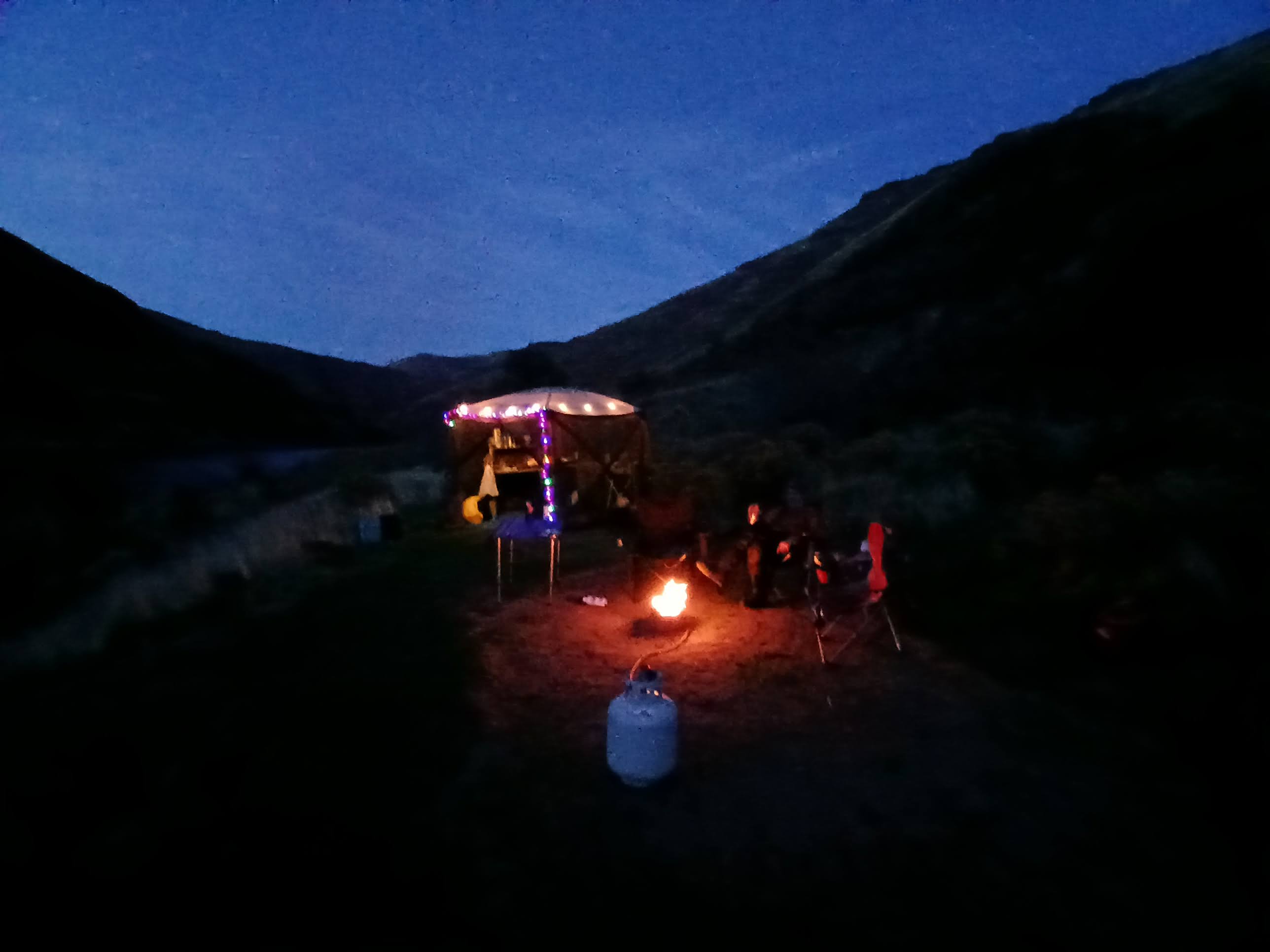
2025’s Thanksgiving on the River Crew – Cindy, Kirk & Moi (photo courtesy of Cindy)
Kirk and I have had a Thanksgiving tradition of heading to water for the last 10+ years. It probably started because he just loves a flowing river, and even though my river time had been limited before we met, I quickly took to the eddies and riffles as he showed me the ropes of paddling, rafting, and floating downstream.
One of our first trips was a packraft adventure on the North Fork of the John Day River. You can read all about it here:
click for the full post…
We had many other adventures on the water, most frequently coming back to the banks of the Lower Deschutes River as it usually had the most water of any of Oregon’s rivers in late November. We would invite various friends, sometimes it would snow, sometimes it would drop into the single digits, and sometimes those friends never returned for another water-logged Thanksgiving trip…the cold really highlights how a four-day sufferfest can drive people indoors, even if we bring multiple pies.
This year my longtime friend Cindy decided to brave the unknown, and possibly rainy weather to accompany us on our float, and she was rewarded with mild temperatures and minimal splashing as I had asked Kirk to find the smoothest and driest lines through the rapids – my neck and spine still can’t tolerate much jostling.
We launched on Thanksgiving morning and pulled over a few miles later to reheat our feast. I don’t think it was the best of our efforts as my turkey cooking the day before was a bit too zealous and left the meat on the dry side, and we skipped the fancy side-dishes for instant potatoes, stovetop stuffing, canned cranberry sauce, and store-bought pumpkin pie, but it was all gravy. As Edward Abby says, “Hunger is the best sauce,” and the smell of the cooking turkey had started my mouth watering a full day before our dinner.
Dark comes early in late November, but I added some festive cheer with some battery-powered lights and hot cider.
The skies were blue and the nights dark, and we all got a solid 10 hours (or more!) of sleep each night.
It is such a gift to be on the river during this time of year. The blue heron was our steady companion each day on the water, and the sound of the current hushed any background noise that we carried over from day-to-day life.
I’m writing this as much for me as for you. I strive to understand how to be in this body now, and it is constantly changing. But one thing remains the same: I am fragile now. I do have moments when I forget what I’ve been through in the last year, but those are really just fragments of moments. I don’t get to forget for long.
I get head rushes almost every time I stand up; the black spins and pounding at the base of my skull are dazing, so I make sure to go slowly or hang on to something for a few seconds before moving. When I forget and jump to my feet, I meet the errors of my ways: speed. I have to be a slow turtle these days.
The same goes for yoga; I’ve been back at it since August. In the dark morning, I roll up my mat and walk a few cold blocks down to the studio. The 90-degree heat feels delicious. After a slow half hour of movement, I can usually make my way into a true downward dog. I still get dizzy a time or two during the classes, and it’s almost always when my head is below my heart. To recover, I reverse the position and make my way to child’s pose. I think holding the downward dog pose alone could help everything. My glutes and hamstrings have been incredibly tight since returning from the Camino almost two months ago. I can’t fully stretch my legs without gently coaxing them loose for half an hour. Deep twisting of any kind is a no-go.
My spine is stiff with multiple tumor scars, but I am healing, and each scan shows more bone growing back. The name of the game is patience. I’ve never had to have this kind of patience with my body before. I’m looking at years of healing to slowly re-engage with my physical self.
I plan to cross-country ski this winter, but need to be careful because I still have a fracture risk. Downhill skiing is off limits, so is skate skiing, so I plan to immerse myself in pillows of white on blue diamond cross-country ski trails. I’ll visit the ones that don’t have too many big hills to lessen the chance of a fall. The trails at Ray Benson near Hoodoo Ski Area are perfect. That’s where I go to ski on the Pacific Crest Trail. The terrain on the south side of Santium Pass is ideal for what I’ll want and need this winter.
But balance, though. Feeling solid on classic cross-country skis (that is, scaled skis without a metal edge) is a tremendous help if you have good balance. Alpine touring skis, the narrow metal-edged ones, are perfect for someone like me, and make you feel stable overall.
You know what helps develop your balance? Yoga. A regular yoga practice has helped me stay young over the 15 years I’ve made it a part of my life. And balance is what has kept me skiing confidently in the backcountry. Do you remember when I skied part of the Continental Divide Trail in homemade shoe bindings? I had the added risk of skiing while wearing a full backpack in low-top trail shoes; my exposed ankles were the weakest part in the whole setup. I became incredibly cautious by taking safe lines, especially when I was solo.
How else do I feel fragile? There’s the head rushes, weak bones, and oh yeah, the thought that every little ache or pain could be a new tumor. There’s that.
What I mean by every pain, is every single pain. From a headache (at diagnosis, I had 27 tumors around my brain and in my skull) to shoulder and neck aches (those aches are almost constant – I live under my heating pad). Every new or recurring twinge could mean a new growth.
Why am I this touchy? Well, I attended a virtual conference for EGFR19 last weekend. EGFR19 is the lung cancer gene mutation that I have. The sessions were sobering. None of the information covered was new to me, but it was information that I hadn’t fully absorbed. The facts are that Tegresso, my daily med that targets the EGFR receptor, blocking the signaling of the gene to suppress cell growth and induce programmed cell death in cancer cells, has only been around for 10 years and has changed our survival rate drastically. Now over half of patients live for four years.
And I’m eternally grateful for that time. The med works, until it doesn’t. The med is so new, that the data is new, and we don’t know long-term survival rates…it’s anyone’s guess, but I choose to believe I’ll live longer than four years. I’ve been on it for eight months now, and it’s still working. Missy, my best friend in high school and college, was only on it for a few months when it stopped working. It chills me to be reminded of this. I’ve stayed closer to the living side of this narrow path I’m on, but find that the closer I can walk to the center… keeping in mind the fragility of it all…the more alive I feel. Everything is very simple now, and for that reason, I like it on this side of getting sick.
I repeat myself so much these days, but I do feel like shouting it from the rooftops: “It’s all going away all the time. Live now. Live hard. Go big.”
Example? Kirk and I have never really done Christmas. I might put some lights up and hang a few ornaments on one of our bigger plants, but that’s it. Oh, and maybe I’ll make some gingerbread cookies, but this year I want it. I want it all, because last Christmas is where it all went down for me.
I was visiting my parents for the holidays last year. If you remember, it was on that trip that a sports rehab and chiropractic doctor advised me to get some imaging done at an urgent care when my body wasn’t responding as expected after a few appointments with him. It was at the urgent care that we discovered my neck and spine were covered in tumors, and I was at risk of my spinal cord snapping. I was immediately taken to the hospital and had emergency surgery to cut out the tumor that had completely consumed my C4 vertebrae and pressed into my spinal cord. That gap in my spine is now a titanium screen, and I will most likely feel its unnaturalness in my body for the rest of my life.
So I’m grateful. Grateful and immediately sobered again to the real fragility of it all. My physical container could go away soon. And then?
So we are doing Christmas. This weekend, we’ll head to the deep forests along the Cascade Mountains with our tree permits and saws to find a little scamp of a tree to bring home with us. It needs to be small to fit the room, but we’ll be sure there is room for presents. We don’t usually do Christmas presents because spending the day together or having an adventure was always more important. But this year I want presents, especially ones that are wrapped up combinations of little things we already own: like a gadget with fresh batteries in it, or a silly wrapping of everyday objects.
Laughter is key to a good Christmas. We are going tree cutting with some dear friends and their Great Pyrenees puppy, Remy, this weekend. They are a silly bunch – we are a silly bunch together, and that’s why I love them so. There might, just might, be a dusting of snow. The air is cold now, so there could be a nip of spirits in someone’s pocket flask, and there will most definitely be lunch at a mountain lakeside resort. How much better could that be? Then, we’ll go home to put the tree up with lights and ornaments. My mom always gave us an ornament each year at Christmas. Oh we did it big back then. We made gingerbread houses and strung popcorn and cranberries on thread, and made paper chains to hang on the tree. Mom gave me an ornament of a little reindeer standing on a soccer ball to commemorate the years I played soccer in high school. There is a hiking related one, and a running one from when my Dad and I trained for the Chicago Marathon together. The tree decorating will be accompanied by music (I am partial to the Nutcracker Suite or the John Dever and the Muppets Christmas album) And there will be cookies. Yeah, most definitely cookies.
Then I’ll watch my favorite Christmas film: The Snowman. It’s about freedom and death. No matter how old I was when I watched it, I always felt pangs of longing and sadness at the closing credits when the boy experiences loss for the first time. Maybe I’ve always been closer to the center of the line than I knew. Living big has always been my path forward, and in that way, I haven’t changed.
I was admitted to the hospital after that urgent care visit on December 18, my mom holding my neck and C-collar steady as the ambulance raced us to the hospital. Each bump on those terrible roads sent electric shocks through my body, and we cried harder. Kirk flew in to Louisiana on the 19th, my surgery happened on the 21st, and my discharge from the hospital on the 24th. Yes, I’m gonna celebrate Christmas this year.
It’s very easy to take myself too seriously. Especially when starting something new like writing a book. After the Central Oregon Writers Guild conference last month, I was totally humbled and walked away from the weekend with my brain full of words and concepts, straining to remember what I could from college literature classes 30 years ago. It took four days and a walk in a tangerine sunrise before an inkling of confidence came back. After all, I’ve been writing constantly for those 30 years; I wasn’t starting from scratch, was I?
Then I thought about my story: the months and years of living the dirtbag hiker lifestyle, discovering my love of strangers in strange lands, and how illness changed my relationship to all of it, and hope returned. I’ve lived through so many hilarious and scary moments that I could easily write an entire book about almost dying – like the time I could have slipped down a frozen ice shoot of snow on the Continental Divide Trail when approaching Gray’s Peak in Colorado. If I can walk across that icy death trap with bald trail runners, then I can write a book, right?
What helps is knowing that I didn’t start this book process just to place a shiny cover on my bookshelf, but to live the life of a writer, and to be a student again. I love the learning, I love the challenge of trying to condense 48 years of living hard into something bite-sized. I mean, how often do we let ourselves start at something new, knowing the journey will be filled with uncertainty and stumbles? Hmmmm, kind of a thru-hike? But what is different this time is that I never questioned my ability to finish a thru-hike. Not even on that first 2,000-mile one in 2002. I knew I would do it. Why is writing a book any different? I’m in a daily wrestling match with myself…but what a luxury to have this conversation with living me, when in an alternative universe I didn’t make it? This is all a bonus. This is all the icing on top.
I was in one of those self-doubting funks when a friend sent me this interview with author Ursula LeGuin, and watching it immediately turned my attitude around.
It lit my brain on fire in a couple of different ways and really got me excited about trying my hand at fiction. There are so many takeaways from this interview, but at one point, she mentioned that you don’t want to talk to a writer at the end of the day if they haven’t been writing. Even the best of us struggle. In a workshop I attended this week with author Cheri Kephart, she rattled off a few other quotes like this one from Hemingway: “There is nothing to writing. All you do is sit down at a typewriter and bleed,” and then I found this one from George Orwell: “Writing a book is a horrible, exhausting struggle, like a long bout of some painful illness.” But then I stumbled upon this Emerson quote that helped: “The only way to write is to write.” True dat. This blog is helping to serve that purpose. It’s giving me something other than the obvious task at hand to have fun with. I keep a running list of things I’d like to explore, or that struck me, and have come to enjoy the cadence of writing a blog post a week, sometimes about writing, sometimes not. I think it’s the writing that is key here. Just doing it.
I’ll leave you with this song that always helps lighten the mood when I’m bogged down by gerunds or trying to wrap my head around how to use the past perfect tense.
Here is my favorite part of the song, 100% Endurance from Yard Act:
“It’s all so pointless, ah, but it’s not though is it? It’s really real and when you feel it, you can really feel it Grab somebody that you love Grab anyone who needs to hear it And shake ’em by the shoulders, scream in their face
Death is coming for us all, but not today Today you’re living it, hey, you’re really feeling it Give it everything you’ve got knowing that you can’t take it with you And all you ever needed to exist has always been within you Gimme some of that good stuff that human spirit Cut it with a hundred percent endurance.”
It’s 0-dark-30 in Pendleton. My room sits eye-level to busy Highway 84, and I try to drown out the sound of trucks breaking and cars racing through the city by turning the fan on high.
I arrived in the late afternoon and shook off the four-hour drive. A pain had just started to take hold of my lower back, but some light stretching and walking helped to ease the stiffness that had set in.
It’s time for the yearly Oregon Outdoor Recreation Summit, and arriving here brings back all sorts of memories of my body last year. What do I mean? Last year, I was in such debilitating pain, still blaming my condition on slow-healing injuries, that I was jacked up on pain meds and moved so deliberately that many people noticed something was wrong. Only weeks later would I be diagnosed with cancer, which explained the constant neck and back spasms that had been plaguing me for months.
The Summit is designed and hosted by the Oregon Trails Coalition, the group I have been leading as Chair of the Steering Committee for the last three years, and this is my final summit in this volunteer role.
That first night I stopped in distillery where about 50 other summit folks milled about. Entering this room was both exciting and daunting. Many people knew of my challenging year because I’ve been quite public about it, but others had no idea. It was as if I was breaking out of a cocoon…a cocoon that had been smashed and thought destroyed, but not. I had emerged on the other side of my brush with mortality to find myself on a similar path I had been on before. It was both exciting and confusing.
But I digress. I wanted to write this blog post to talk about volunteering and how remaining involved in the Coalition has been a vital part of my healing. My fellow board members cheered me on this year, they ran the monthly meetings until I was able to engage again, and gave me lovely gifts like home-made granola, books, and a bright yellow t-shirt that I wear constantly.
To have a purpose greater than yourself and to be of service to your community is a powerful motivator and force for healing. I was deathly ill a year ago, and now I’m walking upright. I still have the glow from the Portugal sun on my cheeks, and am reimagining my future. This summit doesn’t represent my swan song; it’s a re-awakening. It’s a rebirth. BTW, this seems an opportune time to mention Renee means “reborn” in French. How can it be the first time I’m drawing this connection?
So volunteering. Volunteering has helped pull me out of my self-focused fog. Sure, I could have dwelled on my pain, quit the Coalition, and sulked about my inability to backpack, but I decided to use what energy I had to continue supporting, promoting, and advocating for the preservation, development, and stewardship of a statewide network of trails. Using my precious hours in this world for good has always been vitally important to me. When I was faced with a million career options after college, I pushed that all away to become a Peace Corps volunteer in West Africa. I wanted my time to mean something to someone. I found that direct aid was the best way to disentangle myself from the rampant consumerism and individualism that modern society primes us for. Volunteering connects us to the collective, much like I believe hiking connects us to the land. And connection is healing.
My mom will be spending Thanksgiving and Christmas at a diner serving dinner to those in need. And with the SNAP benefit disaster, I expect this small act of kindness will have a dramatic impact on her community, and her outlook in the wake of my dad’s death.
Are you volunteering?
My brother has always loved animals, so I’m encouraging him to look into animal shelters in his area and explore if they need help walking dogs or petting cats. Volunteering could look like anything. You could show up for children, the elderly, the sick, or the natural areas around you. You could pull invasive weeds or plant milkweed for migrating Monarch butterflies. It’s endless! And when it feels like everything is falling apart, volunteering can connect you with the beauty of what is working, what is alive around you.
If you are in Oregon, we are in our recruitment period for the Oregon Trails Coalition Steering Committee and Advisory Board. The Advisory Council strives to be truly representative of the Oregon Trails community of professionals, advocates, volunteers, and trail users. It advises the Steering Committee on coalition advocacy positions and campaigns, and helps implement and promote events and programs. The Steering Committee provides oversight and guidance to the Coalition Director, is responsible for carrying out the Coalition’s mission, and generally acts in accordance with the Advisory Council’s recommendations.… and you get to work with fabulous people. Please join us!
I’ll leave you with this post from my friend Jess, and I’d love to hear from you. How do you volunteer? How would you like to volunteer? I bet we could connect you with a meaningful opportunity that helps you see the beauty and richness of an engaged life.
Since commenting has been so buggy on this website, I’ve decided to share these posts on Substack , where commenting will be much easier.
I flew down to see my Mom recently and got the heady experience of hanging out in the clouds for a while. The plane hit a bit of turbulence after takeoff, but that was because we entered the world of fluffy white poofs; I was glued to the window. I’m sure I’ve taken other plane rides like this one, but we kept going in and out, parting the mist and vapor, and it would all close in around us again. And always there was more floof and always more poof. It was exciting and took me back to childhood dreams of flying. You know, if I could fly like superman: point up and go up. This is what I imagined it to be.
I was torn between watching the clouds and re-reading a classic. I kept going back and forth, both were so rich and exciting that I couldn’t decide which to concentrate on. I didn’t remember 1984 as an exciting book when I read it as a high schooler. Sure, there were the main takeaways of gaslighting and control, but there was so much more in my reading this time around. Do I need to revisit all the classics that I’ve already crossed off my list? Time and experience are opening new portals into the sentences.
1984 is an amazing book to read as a study of the craft. I kept turning the pages, wanting more: the plot pulled me forward, sometimes pushing, and it was difficult to put it down to wonder at the sky that passed by my window. I want to create a work of art that compels readers along in the same way. It won’t be a world of thought police; our phones do a good enough job there now (in fact, reading about a world where thought police exist helps me find gratefulness for the freedoms and pleasures that I do have – for now). And it holds up. Wow this book holds up. So, yes, it’s time to reread everything I’ve ever read… to think that I might be capable of creating something half as beautiful is a dream. But flying through these clouds is a dream too.
Since commenting has been so buggy on this website, I’ve decided to share these posts on Substack where commenting will be much easier.Note: My substack is free, so please choose “no pledge”.
As I have experienced the destruction and reconstruction of my body this year, I’ve had to face the hard truth: I will die. My dad died this year. We are all going to die, some sooner than others.
Writing through my illness has helped me focus on what is left: life. I am still alive, my mom is alive, many of my friends are alive, and even though the world looks different through that lens now, I am still alive, so how am I going to live with the knowledge of death?
We all have to face this, no matter how much we ignore the simple fact that humans don’t live forever. Add in some other truths: like many other systems around us are on the brink of collapse as well, and the futility of it all easily opens the door to despair. I struggle with it, and I know many of my friends struggle with it too, so when I saw a link to this video, I clicked on it more out of curiosity than out of the expectation of an answer.
I came away electrified. Sarah Wilson had come to the same conclusion that I had with my cancer.
As Sarah said, “I feel more alive and connected than ever before. The urgency of what is going on has forced me into living fully and living fully now.”
Yes. This.
Conveniently, on my “living fully now” list, is the desire to create my own TED talk. I don’t love public speaking, but over the ten years I spent developing the Oregon Desert Trail, I gave at least 100 presentations about the trail and faced my fear of forgetting how to talk in front of crowds of people. I still get sweaty palms, but by speaking in front of strangers, I have been able to build connections and foster curiosity in others, something that compels me to keep going. A TED talk is on another level than speaking at a small library… it could get filmed and posted like Sarah’s was (if I’m lucky), but I’m not going to let that stop me.
There is something here I want to say, and I’m still figuring out how to say it. The workshops, conferences, and books I’ve immersed myself in the last month are helping me pull memories and insights from the fog of my experiences and throw them into the soupy mess that will become my memoir. I think creating a TED talk will help me solidify my intent while putting pen to paper.
Luckily, the Bend TEDx conference is coming back next year. I will apply, and if chosen, will try out some of the content I’ve been working on for this book project. Deadlines can cause panic, but they can also force action, especially when I’m in the formless shape of an unstructured life. I definitely strive to bring structure to my days, but sometimes that all falls apart and I’m left a puddle on the couch, staring at the wall.
So if you find yourself staring at the wall too, overwhelmed by the impending collapse of everything we know, it is helpful to ask yourself:
If this was my last day, last week, last month, what would I want to do?
And then do one of those things. And write them all down on a list, and do more of those things, and so on and so forth. Before long you may be living fully in the present or maybe you will discover you have already been doing that. What I’m trying to say is, please do those things now instead of waiting to act until the day when everything is perfect…that day may never come. It’s cancer; it’s a climate catastrophe in your city; it’s an authoritarian government that takes your rights away. It almost doesn’t matter what it is.
Live now. It’s all we have.
Since the commenting has been so buggy lately on this website and an upgrade would be very expensive, I’ve decided to share these posts on my new Substack where commenting will be much easier. So head over there if you want to leave me a message.Note: My substack is free, I am not accepting payments at this time, so feel free to choose “no pledge”.
I’ve been home from the Camino for about three weeks now, longer than I was away on the walk, but time did that sneaky thing again, and months of life seemed to happen in 18 days. Time distorts when you step away from your normal routine. It extends your life. And I find that returning from travel helps me find comfort in my daily habits and favorite things – like the hot mug of green tea I bring into the office for my morning writing sesh while snuggling into the blanket that has a little foot pocket to warm my feet. Going away helps reorder life when you get home.
Just what have I been up to these past three weeks, other than rearranging everything to live the life of a writer? Well, doctors’ appointments, of course. It takes a lot of work to monitor and heal from this incurable disease. Note: many of the people I’ve known who have passed from cancer did so within a year of their initial diagnosis. I’m almost at month 10…and continue to feel I will be in the minority.
So, in the spirit of oversharing…here are all the details. Since getting home, I’ve had:
An appointment to replace my metal nose ring with a glass one, so it wouldn’t interfere with my brain MRI the next day
Metal rings in noses are an issue for MRI machines. Did you hear about the guy who died when his large metal necklace dragged him into an MRI room? Kirk can’t have an MRI because he’s been a metal worker for so long that a small piece might be embedded in his body, and could get ripped out when he approaches the big magnet. Yikes! Anyway, I ordered a nose ring that will be easier to remove for future scans because the one I have now is a full circle of metal with a ball on one end. To remove it, I need to twist it open enough to pop one end of the post from the ball and then pull the ring apart to make an opening big enough to twist it through my nostril. That hurts. And I couldn’t get the loop closed when putting it back in after the MRI because my fingernails are now breaking, and even a slight bump will cause fractures and splits. I understand this is because they have finally grown out to reveal the effect chemo left on my body nine months ago. Also, Tegresso, my daily cancer med, can cause weak nails as one of the side effects.
A brain MRI
A motorized tray slid me into a circle of magnets the day after I got home. Usually, I see test results the same day in My Chart, and when I get them, I am often tempted to type words or phrases that I don’t understand into a search engine (as you already know from this section: Interpreting a My-Chart test result in the middle of the night with no doctor supervision). But when I finally did get the results, there wasn’t anything to worry about because the tumors are still shrinking. THE TUMORS ARE STILL SHRINKING!!!
Labs
The day before every appointment with my oncologist, Dr. Tiffany, I have labs drawn. My neutrophils absolute and hemoglobin are monitored, and we have a sharp eye on my platelet levels. Another of Tegresso’s side effects is low white blood cell and platelet counts. That means I’m more susceptible to infections. This time, most of my numbers were similar to previous labs, but my liver enzymes were up, which I attribute to all the wine I drank in Spain. No one is worried, though. I brought up the results with several of my doctors, and all thought the health benefits of drinking wine in Spain while I walked 170 miles outweighed the negatives; plus the numbers are still on the low side of high. So these results have been placed in the “don’t worry” column of “bad things that might happen.”
A trip to the gynecologist
Since my body got nuked with chemo and radiation at the start of the year, I haven’t had a period, and was quite perimenopausal before (think hot flashes and brain fog). I had my hormone levels tested a few months back, and found numbers hovering around non-existent. My doc prescribed progesterone and estrogen (both in a patch and cream form), and the change was dramatic. No more hot flashes, a clearer brain, softer skin, and as I described it one day on the Camino, it felt like my body was waking up, that I was coming alive again.
My first Zometa infusion
Since I had so many tumors along my vertebrae from neck to pelvis and femur, I am at risk for fractures. The swiss cheese effect of the hungry cancer put me in a wheelchair until radiation could harden some of the bones that would keep me walking, particularly in my pelvis. But good news: the bone is slowly growing back now. The bad news: combined with the osteoporosis risk of menopause, I still have a fracture risk. Fortunately, the hormones that work for hot flashes also work to strengthen bones.
Now Zometa is a bisphosphonate medicine that alters bone formation and breakdown in the body. This can slow bone loss and may help prevent fractures. Since my chemo port was removed in August, I’ll get my infusion the old-fashioned way – needles and tubes in my arm. Every three months I will head up to the transfusion room at St. Charles Hospital to get a vein poked while looking at the Cascade Mountains. Back in the day when I worked at the art magazine in town, I made one of the first tours of this facility when it opened…it was state-of-the-art, and hosted works of many local artists. I never imagined I’d be back a decade later to sit in one of those chairs.
Dental clearance prior to taking Zometa is needed as one of the nasty side effects could be bone loss in the jaw, and those of us who have been treated with chemotherapy, radiation, or steroids might be more likely to develop it. I got the dental clearance a few months ago, and I’ll be flossing regularly, thank you very much!
A massage
My neck continues to struggle holding my head in the right position. I especially feel it on walks and at the end of the day. I expect my muscles tightened when I got home and sat down more than I moved, so when the massage therapist found a lot of knots under my shoulder blades, I was grateful for the release.
An appointment with my naturopathic oncologist
During my check-in with Dr. Neubauer, we discussed ramping up the dosage in my mistletoe injections…the goal is to have a 1” rash at the injection site most of the time. And if you don’t remember from one of my previous posts, mistletoe has a host of beneficial effects, like helping the immune system recognize and destroy the cancer by activating tumor-killing cells such as macrophages, dendritic cells and natural killer cells.
One of Dr. Newbaurer’s suggestions this time was to increase to my calcium citrate each day. More calcium will offset a loss when the Zometa draws the mineral from my blood to deposit it in my bones.
And now that my body is in a stable state, she wanted me to get another set of labs to measure the levels of copper and zinc in my blood. An imbalance can cause tumor growth.
More labs to measure copper and zinc
Results pending.
A visit to my palliative care doctor
Dr. Blechman is wonderful. This woman was the first doctor I could get an appointment with after returning from Louisiana and my emergency surgery after diagnosis. She immediately saw the urgency in getting me in to see an oncologist, so much so that she walked down the hall, had a few words, and I was talking with Dr. Schmit a short while later…chemo started the next day. Dr. Blechman has my back; they both did. One of the first things she shared with me when we met last week was that she, too, went on a Camino-style hike in Italy this summer. Complete with hotels and cafes and luggage transport… and she thought of me and my Camino. I expressed my gratitude to her, and we shared a few tears of joy. My pain is very manageable right now, and I’m at such a steady place that we agreed our appointments from now on would be TBD. Magic.
A trip to see my oncologist
I had a smooth transition from Dr. Schmidt’s care to Dr. Tiffany this summer when the cancer wing at Summit Health closed down, and Dr. Tiffany has been nothing but supportive of my recent activities. At the appointment, we reviewed my labs and brain MRI, talked about Zometa, and covered a few various other small issues I’ve been having. All signs point to stability, so I am moving from monthly labs to an every three month schedule along with my scans. Winning!
A physical therapy appointment
Melissa Carlton is supportive and gentle. She works on my shoulders, back, and legs – stretching, assessing, and determining how to best address my current aches and pains. Right now, that looks like a sore and tight lower back. Melissa reminded me that I had weeks of daily radiation pointed at that part of my body, so the stiffening is not surprising, and wearing a lumbar pack for two and a half weeks probably helped set it off. The discomfort is bearable, but it also feels like a spring that’s loaded and ready to pop, so the strategy is to strengthen my core, use topical creams like magnesium at night to soothe it, and add in hot epsom salt baths and heating pads during the day. Melissa also wants me to try wearing a light backpack to see if a little weight on my shoulders might help both my posture and my lower back. Lets do it!
An acupuncture appointment
The lower back work continued with my acupuncturist, Kym Garrett. Again, a knowledgeable, compassionate, and supportive practitioner that I’ve been seeing since early this year. This time, Kym used her needles to help ease my lower back and shoulder tightness and suggested other methods of anti-inflammation. I know I need to eat less inflammatory foods… I’ve slowly slipped sugar and refined flours back into my diet lately (mostly in the form of pastries and breads), so I want to cut back. I’m still taking so many pills that I don’t want to add another unless absolutely necessary (see below). Ahhh, I still remember the days when I didn’t take any. Most of my life, I’ve never needed to take any medication, so this new reality is still an adjustment. My daily pillbox now carries 17 gelcaps and tablets that I take spread out between morning, noon, and night. Yikes.
A neurosurgery appointment
I’ve been seeing Dr. Tien for follow-ups on my neck surgery, and because it can take such a long time to heal (and I still have a collapsed vertebrae) he wants to continue to see me every three months or so. Usually, I have an x-ray done so he can see how the screws and mesh are doing in my neck, but since I had the brain MRI recently, he was able to reference that and didn’t have any concerns, in fact he was quite impressed with how my body is healing. Good job neck 🙌
So what medications am I taking in this maintenance phase? Things keep changing as my body is changing, so this list of drugs is a snapshot in time.
I’m taking 17 pills a day, and then there are also shots, powders, and creams.
Mistletoe
According to the National Cancer Institute, mistletoe is one of the most widely studied complementary and alternative medicine therapies for cancer. In certain European countries, extracts made from mistletoe are among the most prescribed therapies for cancer patients. (This is a Dr. Newbauer-prescribed medication)
I give myself an injection of mistletoe on Mondays, Wednesdays, and Fridays, and I’ve been slowly ratcheting up the dose so I get an immune system reaction of a 1” rash at the injection site. So far, I have no other side effects other than the lack of active tumors.
Estrogen
One of my hormone vectors is an estradiol patch that I replace twice a week. I place these small, clear disks of sticky below the belt, alternating between my left side and the right.
The other estrogen product is a cream that I use nightly on my lady parts.
Magnesium
I apply a magnesium cream on my lower back every other evening before bed to help it relax during the night.
Astragulus
I take powdered astragulus mixed in water every day. This tonic helps my bone marrow, blood counts, kidney support, and has shown increased survival in clinical trials. (A Dr. Neubauer medication)
Mushroom powders
I put a powdered turkey tail and reishi mushroom mix into my coffee in the mornings (Note: only one cup of coffee most days). Turkey Tail mushrooms are known for their high levels of beta-glucans—compounds studied for their ability to help maintain a healthy immune system, and the benefits of reishi mushrooms are listed as: supports immune health and resilience, supports mood and emotional well-being, promotes restful sleep and relaxation, supports energy, vitality, and healthy aging, helps maintain general wellness and resilience to stress, promotes cardiovascular and circulatory health and helps maintain healthy blood sugar metabolism. Of course, these benefits are from a label, but these mushrooms are Dr. Neubauer-approved. Note: next time she wants me to buy the 5 Defenders brand due to its 100% hot water-extracted process. The hot water method ensures that the powder contains more than 20% beta-glucans, which are known for their immune-supporting properties, and it unlocks the full spectrum of beneficial compounds.
Nail polish
To help harden my nails from the chemo and cancer med side-effects, I’m now using a clear strengthening polish.
Now for the pills:
Keppra
Since I had a few seizures earlier this year, I’ve been put on this anti-epileptic drug. I have been thinking of coming off of it, and when I do so, I’ll need to avoid driving for three months because the lack of keppra can also cause seizures (ironic!). But I still have a couple of tumors around my brain – they are shrinking, so I’m not sure if/when I’ll start the tapering process. After meeting with Dr. Tien he said it was too early to stop taking the drug, and I’d need to be referred to a neurologist for further consultation.
Calcium citrate
As explained before, I increased my calcium intake recently from 600mg to 1200 due to my Zometa infusions. Calcium can help maintain bone density and prevent osteoporosis, and it also plays a role in muscle function, blood vessel contraction, blood clotting, nerve transmission, and hormone secretion.
Vitamin D3
In experimental studies of cancer cells and of tumors in rodents, vitamin D has been found to have several biological activities that might slow or prevent the development of cancer, including promoting cellular differentiation, decreasing cancer cell growth, stimulating cell death, reducing tumor blood vessel formation, and decreasing tumor progression and metastasis. Vitamin D was also found to suppress a type of immune cell that normally prevents the immune system from responding strongly to cancer (source).
Peak K2
I take this with every meal, as it is shown to support the activation of bone-building cells, is involved in calcium distribution to bone, and promotes normal blood clotting and vascular health. (A Dr. Neubauer medication)
Tegresso
This is my daily cancer med that I’ll take for the rest of my life (or as long as it works). It is used to treat adults with non-small cell lung cancer whose tumors have a certain abnormal epidermal growth factor receptor – that’s my mutation of EGFR19. It is used to help prevent my lung cancer from coming back, especially metastatic cancer…meaning it has spread far and wide across my body. Some people become immune to Tegresso after a few months or a few years, while others have stayed on it for a decade. We’ll see how long it lasts for me. Tagrisso works by targeting the EGFR receptor, specifically the T790M mutation that blocks the signaling of EGFR, which suppresses cell growth and induces programmed cell death in cancer cells with these specific mutations. Tagrisso is considered a targeted treatment and is not chemotherapy, but it works well with chemotherapy, like the rounds of pemetrexed and carboplatin that I had earlier this year.
Boswellia
Boswellia serrata has been used in traditional medicine for centuries, particularly in Ayurvedic practices. Its active compounds, particularly boswellic acids, are believed to contribute to its therapeutic effects, including anti-inflammatory and anticancer properties. (A Dr. Neubauer medication)
Magnesium glycinate
Magnesium glycinate is formed by combining elemental magnesium with the amino acid glycine. This form of magnesium is highly bioavailable, meaning the magnesium is easily absorbed through your small intestine. It can promote bone health, help regulate blood sugar, help maintain regular heart rhythms, amplify exercise performance, and reduce pain.
Progesterone
Without enough progesterone, as often happens in perimenopause, women start experiencing symptoms like irritability, anxiety, poor sleep, and fatigue, so progesterone helps to improve those symptoms, and it supports bone and heart health too.
Meletonin
While melatonin is best-known as a sleep aid, it also regulates the immune system and tissue repair and has cancer-related benefits like increasing survival rates, improving the likelihood of responding to chemotherapy, activating the “self-destruct” process in tumor cells, and blocking the ability of cancer cells to grow new blood vessels and to spread to other tissues. (A Dr. Neubauer medication)
Senna
Because of all of the above, I can have trouble with my bowels. Senna is an herb, scientifically known as Senna alexandrina, commonly used as a laxative to treat constipation and works by stimulating bowel movements. I’ve been taking this since my diagnosis, but Dr. Neubauer warned that prolonged use can cause gi parastalisis, meaning paralysis of the stomach. It’s a functional disorder affecting your stomach nerves and muscles which can lead to making your stomach muscle contractions weaker and slower than they need to be to digest food and pass it on to your intestines. So, I’m starting to wean myself off Senna, and instead take more:
MiraLax
I have been taking more MiraLAX powder (mixed in water), which increases the amount of water in the intestinal tract to stimulate bowel movements.
It seems that all I’m doing to keep the cancer from regrowing is working, but it’s not just through the doctors’ appointments and medications mentioned above, either. I attribute my growing health to these factors as well:
Walks
I take walks, almost every day if I can. Living so close to the Deschutes River means I never have to get in the car, and I make a loop on the river trail most days. Sure, I could walk one of the hundreds of trails we have on public land around Central Oregon, but again, that would mean getting in the car. Why do that when I have a wonderful walk along the river right out my front door? Now that snow has started to fall in the mountains, I get occasional glimpses of that lovely skyline from the river trail, too. Of course, sometimes I head out before sunrise to meet the day on its way up. That reminds me: winter is coming, and with that, my hopes to ski this year. I won’t go downhill yet because of my heightened fracture risk, but I can’t wait to cross-country ski and glide through the silent woods in the sparkling snow.
Yoga
I’ve been going to yoga again over the past few months; the 6am classes are my favorite. The room is never full that early in the morning, and it is heated to a balmy 90 degrees where the muscles practically melt with our gentle movements. I don’t do every pose…I have to modify many of them for my stiff back and compromised neck, but I have been able to loosen up some of my joints…I had to take almost a year off from my practice since getting sick, and fortunately there is a noticeable improvement in my balance and flexibility just over the few months I’ve been back.
I’ve been going to the same studio for 15 years now, and wouldn’t you know it, Pam, my cancer mentor, was my first yoga teacher there. I love my 6am yoga, the teachers, and the familiar faces I see week after week. The best part about Namaspa is that it’s within walking distance from home, so again, I don’t have to get in a car. Are you noticing a theme here? In fact, I didn’t own my first car until I moved to Bend at age 32. I love a walkable/bikeable community.
Daily stretching
My at-home physical therapy exercises have been a light lift so far. Much of what I was doing was aimed at opening up my shoulders, helping my neck find the right alignment, and working my upper body, like bicep curls with one-pound weights. Now I have a series focused on my lower back, and I’m motivated to do them every day with the promise of more strength and less pain. I know I’ll need both to ski this winter, so I do my exercises.
Food
Many of the changes I’ve made in my life this year revolve around food. I’ve always eaten fairly healthy, but now I pay much more attention to my nutrition with the help of Dr. Neubauer’s suggestions. I’m not eating vegan or vegetarian right now, but I still limit my dairy intake and avoid red and processed meats. Every day (or every other day) I try to have some:
Ground flax
Chia
Hemp seeds
Fruit (berries especially)
Avocado
Nutritional yeast
Green tea
Ginger
Broccoli
Broccoli sprouts
Nuts
And protein with every meal
I could go into the specific health benefits of all the above, but this blog post is already becoming novel-length, so I’ll let you do your own research there.
Sleep
Since finishing the steroids I was on at the beginning of year I haven’t had any more problems with sleeping through the night. What a relief! This body needs all of those hours to work it’s internal healing magic. I’m sure the sleep is helped by the 10mg of melatonin I’m taking every night too.
Community
Taking part in community activities, surrounding myself with friends, and laughing have all been extremely important to me this year. A few things that have brought joy lately include:
One of my dear friends, Adryon, is on the board of the BendFilm festival which takes place in October each year. Adryon and her wife Brooke always attend the festival, and this year and I got the double pleasure of watching a few films and catching up with them this past weekend. Even better? Adryon’s brother Aaron is a filmmaker, and has promised to help me should I want to think about writing screenplays at some point. Aaron and his wife Katrina had a little girl, Jules, about a year ago and I was able to catch up with both of them at BendFilm.
Many of the people I used to work with at the Oregon Natural Desert Association now work at Central Oregon Land Watch, including Ben Gordon, who hired me for the Oregon Desert Trail job ten years ago (Ben and his wife Serena hiked the PCT in 2006 too, but we never met on the trail!). My friend Lorainne, who is their Development Director, asked if I wanted to volunteer at an aid station halfway on one of COLW’s fun runs this week, so I joined her in the gorgeous fall sunshine to distribute water, bananas, and banana bread to the runners. Friends, the conservation community, and sunshine? Sign me up! If you are local, check out the wonderful lineup of events they have coming up this fall. The Livable Future Forum will be hosting Chuck Sams, the first Indigenous National Park Service Director and Cayuse and Walla Walla tribal citizen next month. In November I’ll be attending a talk by longtime High Country News contributing editor Michelle Nijhuis who will share insights into essential environmental reading. I’ll miss the Chuck Sams talk, but he is our keynote speaker at next month’s Oregon Outdoor Recreation Summit in Pendleton (on his homelands).
A sauna sesh
One of my besties, Carrie, has access to a sauna and I’m going to partake with her this week. There are a long list of health benefits to the sauna, and I’m excited to overheat and catch up with her. Carrie and I have weekly hang-outs, and her friendship has been an amazing gift to me this year. Friends are essential to the healing process.
More cards and emails from you
Thank you!!! The love keeps coming and I can’t say thank you enough 💖💖
Mutual aid
I don’t have much, but when people who have less and are suffering from environmental injustices and their entire communities are lost to floods, like what is happening in Alaska right now, I try to donate something. You can help too by contributing to the Alaska Community Foundation.
Taking action on behalf of my community, the environment, and the country.
Taking action is a form of healing. Doing anything beyond paying attention to what is right in front of my face has been leading to spiraling despair lately, especially as the dystopian nightmare is getting closer and closer to home. So, I’m getting active. I got out my paints in preparation to participate in democracy this weekend. I hope to see some of you out there!
Again, I’m so grateful to be healthy(ish) 10 months out from diagnosis, but the reality is, two more of my classmates from the Dunlap High School class of 1995 died this year of cancer. My best bud Missy, died 2 years ago from the same exact cancer that I have, so far I know two of us from that class that have survived…but there are so many people I don’t know about. Most people aren’t public about their health problems. Does anyone know of a study going on in Central Illinois about the massive number of cancer cases happening in young people? Other than those already listed, Missy lost her first husband to cancer, another friend’s husband died of cancer, another friend’s sister and brother-in-law died of cancer… all were younger than I am now. Was it the spraying of alfalfa and corn fields? Was it radon in the ground? Was it air pollution? Anyone? I know, I know, we’ll never know for sure because the poison is coming from all around us all the time. It’s everywere. Even newborn babies have microplastics in their bodies.
A woman I’ve been following for some time now just announced her recent cancer diagnosis. Jen Gurecki has stage 2 breast cancer and has been a hard charger in the outdoor industry for years. I’ve purchased several things from the ski and snowboard company she started, Coalition Snow, and even bought a basket from Zawadisha, a Kenyan-based social enterprise she started whose mission is to provide small loans to rural Kenyan women to help finance their livelihoods. She is sharing her cancer journey over on her blog Redefining Radical. You can also donate to her Go Fund Me here.
Thank you for reading to the end, you rock!
Since the commenting has been so buggy lately on this website and an upgrade would be very expensive, I’ve decided to share these posts on my new Substack where commenting will be much easier. So head over there if you want to leave me a message.Note: My substack is free, I am not accepting payments at this time, so feel free to choose “no pledge”.