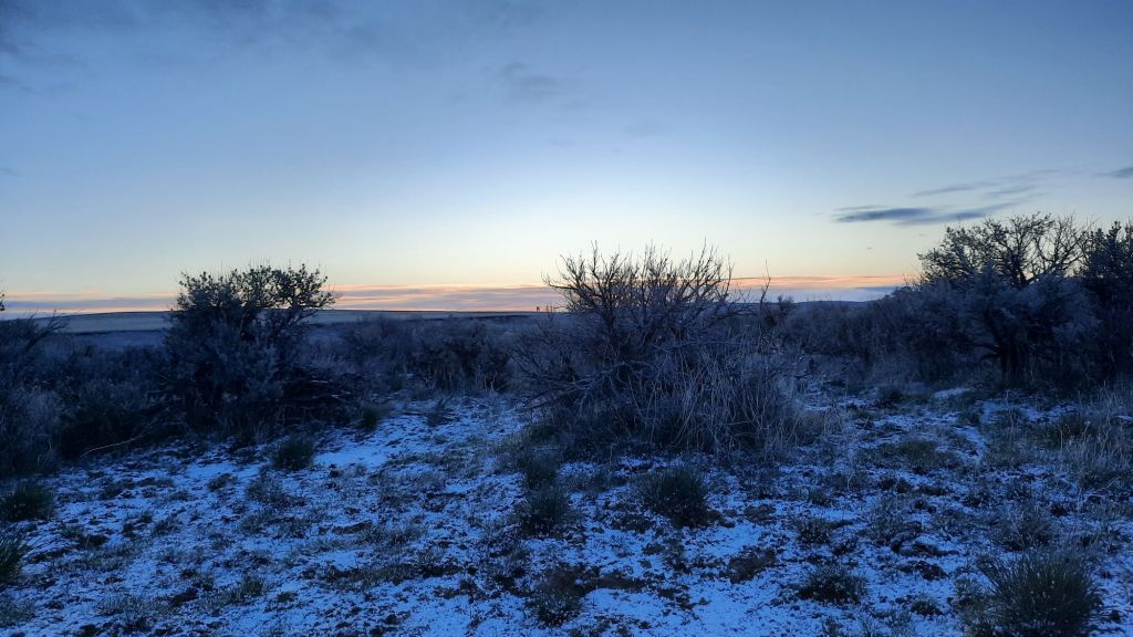
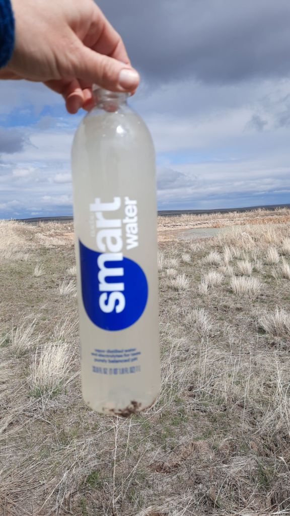
I woke up to more snow and partially frozen water bottles and thought of my down booties, at home. Ok, maybe I would have swapped out some layers if given a chance.
I didn’t want to move until the sun was actually out, and it was for a few minutes. I could feel that today might actually warm up some, the the clouds seemed much more benign.
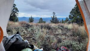
I walk a quick five miles to Clover Creek and a reliable water source. I move quickly though and my excitement at a natural water source dimmed when i saw the 200 cows wading in the creek. I should have gotten water upstream.
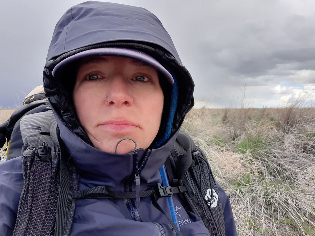
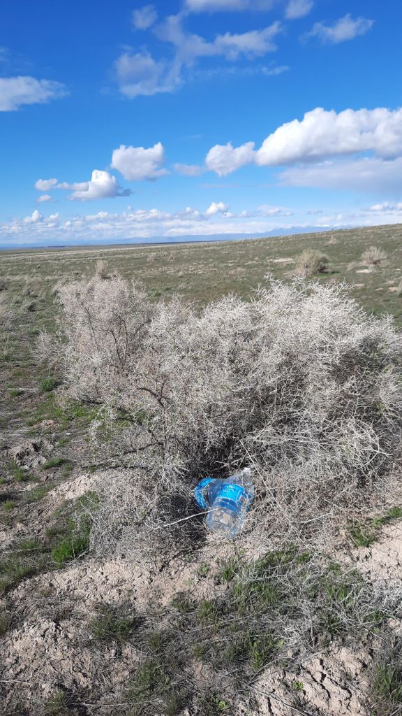
Up into the wind for lunch where I tucked myself between the sagebrush to find any kind of windbreak.
Wind. Really really cold wind.
The afternoon was overshadowed by the piercingly cold wind. A daydream started that featured a hotel hot tub at the end of this hike. I bet I can make that dream come true.
I reached my water cache, called it a day, and tried to get out of the wind.
Each day peels off heavy layers of the other life. The life that has deadlines and commitments, goes grocery shopping and has to make appointments. The self I find out here is different. She is getting older, getting better, but also more me than ever. Does that make sense?
Slow and steady up the grade, and something clicks into place: the climb…the flow. I found it.
My legs start floating my body and heavy water-ladened pack up the grade, and the music is banging, and it is fabulous.
I tend to do better on the climbs and here I am, finally feeling this walking thing on a long and protracted 1,000′ climb. Ok, let’s go!
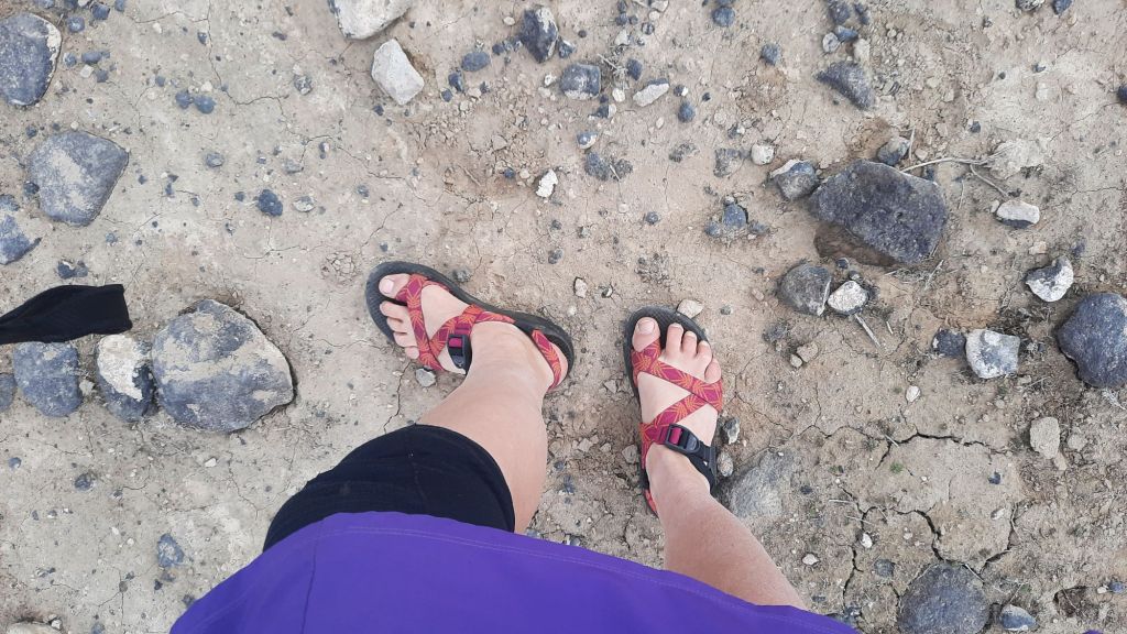
Up top I transition to chacos. Over the years I have found that chaos are a superb dirt road walking choice for my feet. They love it. The air dries out the one linering hot spot, my toes wiggle with glee, and the cold air doesn’t give them any bother…except to maybe give them more vigour.
Have I said “let’s go!” Yet?
It was a morning of smooth and silky miles where my brain sat back and watched the world move by as my body walked and danced down the road. If there isn’t a dirt road dance, did you even hike?
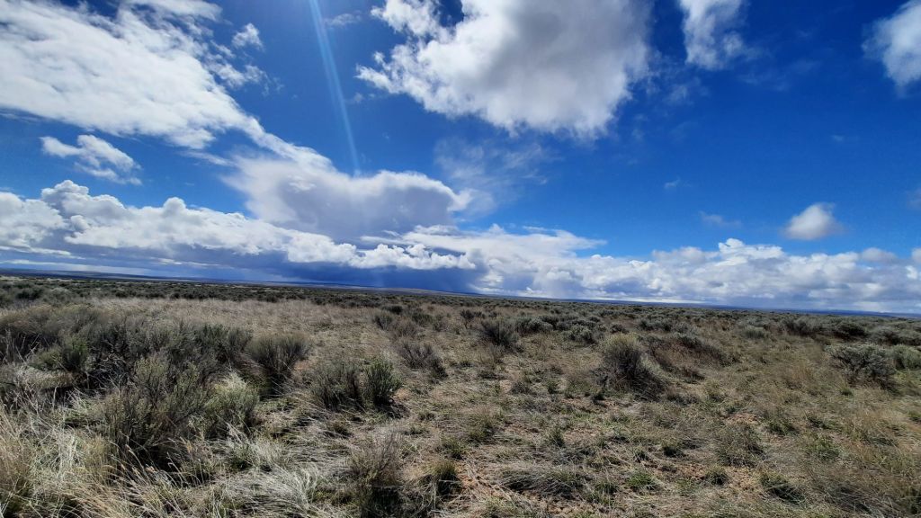
I tried to read the sky today but finally gave up. There was too much movement. The dark clouds full of rain and snow were intermingled in the sky so that it could be sunny and sideways snowing at the same time. What was inevitable was the snow, sun, and bitter, bitter cold.
At the first large patch of sun, I stopped for a morning break. Maybe the sun would ward off the biting cold enough so that I could to stay still for a few minutes. And it worked! I could feel the vitamin D coursing through my veins, or whatever happens when the skin sees the sun for the first time in a while. Basking might have happened. Then, four minutes later, it started snowing. I packed up and kept moving.
By this time, I had already gotten pummeled by a few of the snow storms. They came in fast and hot…only lasting five or ten minutes, but wow, when they hit… I would have to cover half my face to protect it from the sharp stinging flakes. Then it would stop, and the sun would come out, and the snow would melt, and the dirt would get sticky on my chacos for a minute before it dried out again.
Repeat.
I found another of those sunny patches for lunch. The very satisfying lunch I’ve been having this week is a garlic nann with hummus and a packet of hickory smoked tuna on top. Delicious!
Then the storm. I covered up with my tyvek (I usually sit on my tyvek at every break…I’m a dirt sitter, but the tyvek keeps me a bit cleaner…and is waterproof!) and wait it out.
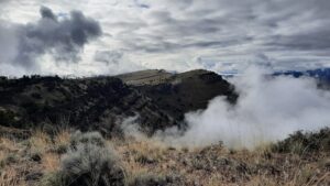
It made for some stunning skies today…so dramatic.
My head was down for much of the afternoon, hiding my face away from the biting wind, so I didn’t get to take in a lot of my surroundings, but I did see a few more pronghorn, no people. The birds though! Every day there are more meadowlarks.
I am contributing to several iNaturalist projects on this trip. In an effort to be intentional on this hike, I searched for iNaturalist projects in the Idaho desert and came up with many more than expected. I joined 5 or 6, although there are overlapping studies going on.
Two of them you may be interested in: the Idaho Flora project and Idaho Amphibian and Reptile project. I will take photos of flowers for the flora one; that data gets reviewed by the Ray Davis Herbarium and Idaho Museum of Natural History. Frogs and toads? Those observations are for the curator of herpetology, again at the Natural History Museum.
Cool, right? But I haven’t seen any reptiles, and just one type of flower. The cold and snow are taking a toll on the number of my observations.
Back to the walking.
I was reaching the end of my desire to walk for the day. The desire to sit was growing. Sit and snack and read. These were the other elements of backpacking that I loved: the chillaxing.
I found a patch of ground in a sagebrush neighborhood. As soon as I got tucked in, another storm rolled in. Then sun, and repeat. It’s a perfect time to read.
The book? I downloaded several books, and the one that is hitting a chord on this trip is Pachinko by Min Jin Lee.
Dinner was provided by Itacate Foods, dessert by Stroopwaffle.
P.S. thank goodness I brought my old lady stick roller….the ghost of my former plantar fasciitis past is visiting, and I’ve been rolling out my calves and shins to keep him at bay.
There were no windblocks up on the rim. The wind started and stopped throughout the night, and about 2am came back with a vengeance.
Today was to be a purely road day, but it wouldn’t be an easy one on the feet. The mud had hardened part way – then cattle, elk, mule deer, and pronghorn walked through the clay-like mud, churned it up into a jumbled mess right before it solidified into hard ridges.
Did I tell you I saw a herd of elk yesterday? They were majestic! And large herds of pronghorn too. This morning, a group ran around and around in the hills off to the right, maybe just for the love of it.
Was I out here walking for the love of it? Yes, but it’s hard to love all the moments… like when I twist my foot weird on the jumbled and uneaven mud road.
Oh, then there was the coyote! I look back to see a handsome fella maybe 20 yards away. He has a thick whitish, gray, creamy coat and doesn’t notice me, then walks over to the road, poops, and carries on. So there is poop mixed into the hard mud I’m walking on as well. I play dodge the poop. In fact, there is so much poop it reminds me of the Oregon desert.
I look at my maps and see that today is the day I will walk back down into the canyon for the night. A dirt road into Indian Hot Springs is the easiest place to access the Breneau River in the whole hike, but easy is all relative. Thank goodness I’m on foot because I would probably have a heart attack if I had to drive it, or was even in the car with someone else driving it. In short: don’t drive it.
Back to the map. I also see that I could add in a little cross-country hiking and cut off 3-4 miles of road walking. I’m game, let’s go!
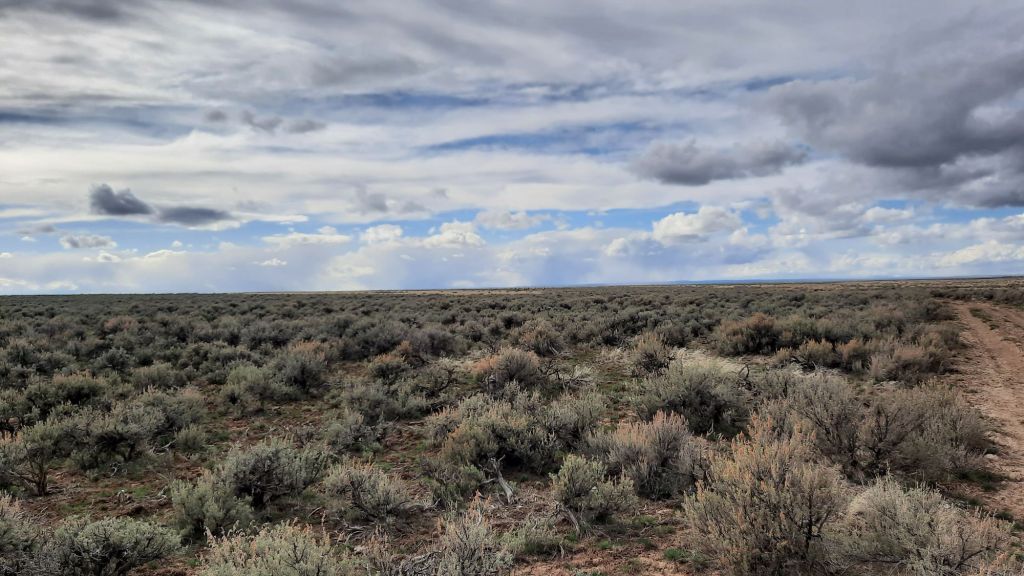
There was lots of evidence of fires in this desert…in some areas the sagebrush was entirely gone and replaced with grasses (easy walking), and other times the sagebrush grew thick (sharp and pokey walking). On my cross country jaunt, I hoped for the first, but as luck would have it, i got both. Before i knew that, my plan had been to hike cross country a mile to meet an old road for another 1.5ish miles to another road, which would take me another 3 miles to the river.
All was going well until it was time to find the old road. There was no old road. And it’s extremely unusual to find a road in the desert that has been completely reclaimed… especially in an area of thick sagebrush. This road would have had to predate the growing of this sagebrush.
I grunted.
At one point in the now two-mile bushwack, it’s impossible to keep a stright bearing in this kind of landscape because I am weaving in and around the sharp pointy everything, I see by my app that I’m right on the old road grade. But there is nothing. Later, a certain hint of patterns in the sage stop me, and I notice an old rusty tin can. The old road! Always the tin cans.
I finally emerged onto a dirt road that is so braided and wide that four trucks could be driving side by side. Year after year, trucks must have slid around in the mud and rocks, making this monstrosity in the desert.
Still happy to see road again.
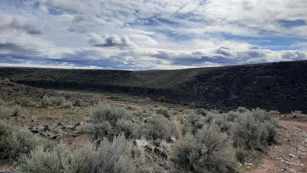
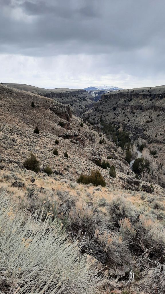
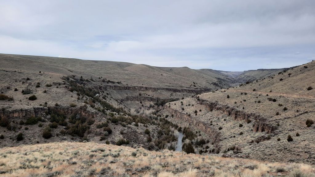
I walk this veritable highway and note that I’m supposed to be dropping suddenly into the river canyon, but I look all around and can’t see the canyon. Desert rivers can be sneaky like that. It’s flat, flat, flat, then boom! 700 foot drop off to a river below. The other side? Flat, flat, flat for 100 miles.
That was today walking down to the Breneau River.
I pick my way down the panic-inducing road and turn a corner to see some ATVs next to an old abandoned truck. I walk up expecting some questions, I haven’t seen another human since the start, but I pass by without receiving so much as a glance.
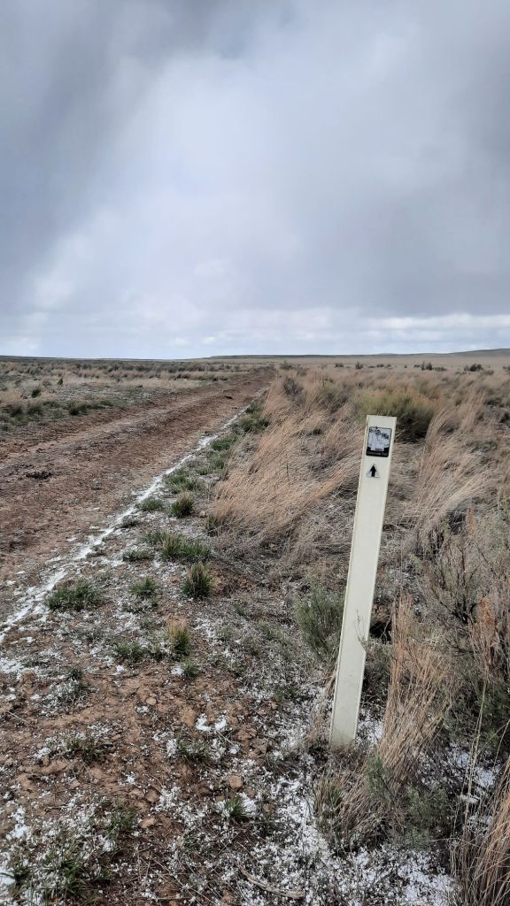
At the bottom, I see several choices of roads and another BLM kiosk. I must say, again, Idaho BLM, you do a good job of recreation infrastructure. I’ve passed several intact map kiosks along the route, and the fact that these signs are intact continues to be impressive.
I take the road that heads into the trees, hoping to find a camp. And I do! The river is running a muddy shade of brown. I am camped just downstream of the Jarbidge and Breaneu confluence, and the two rivers pump up the volume… this section is popular with rafters and boaters, too. I don’t see any boats though, the periodic hail and grapple storms I’ve been walking through today tell me the mountains are probably locking up and adding to the snow in the high country. After the next warm spell, though, or rain on snow event, and boom! Boating season!
Then: pitch camp, filter water, and into the tent for some R & R.
Something fell from the sky in the middle of the night, but the pattering on the tent didn’t last long.
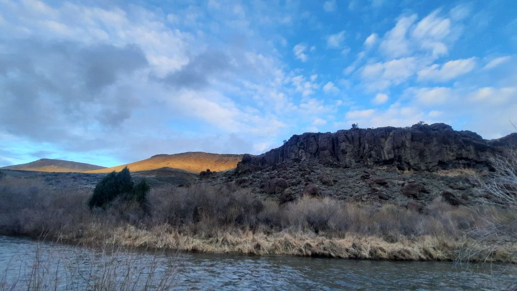
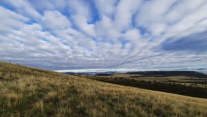
I slept long and deep, and in the morning when the light started illuminating the rimrock across the way, I knew the forecasted storm day could as easily be a non-storm day, or one of many types of days. The weather out in the desert does its own thing, but at least dramatic skies were a guarantee.
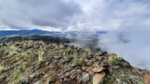
The trail entered the Wilderness and wasn’t a trail so much as a haphazard user trail with old footprints. At the footings for a once-there footbridge, I turned my sights up: it was time to climb. The guidebook said something about an old trail, and partway up I found a path and followed it to the top. Glimpses back at the canyon were lovely, especially as patches of blue swirled in the cloudy sky.
Up top I met the wind…my hiking companion today. I put wind layers on and battened down the hatches…even getting my fleece and rain mits out. It wasn’t too long before snow started flying, then it took on a sideways slant and started building up in leeward piles on my coat and pack.
I battled through it for a bit before seeing a depression in the earth that could serve as a windbreak while I put the tent up. The wind was trying to blow me over by this point. I put it up, climbed inside, and into my sleeping bag as the snow accumulated. I decided to have an early lunch…I had a feeling the storm would last a while.
About two hours later I emerged to a quickly melting landscape, and not long after the sun had sucked it all up. The squall was gone.
All the better for the skies.
Today had long road walking miles. Actually, this whole section is a dirt road walk.
One tire tank was dry. One dirt tank had water, and since I decided to rely on this water source, I sucked it up and dipped into the muck. It wasn’t as bad as some water I’ve had, I was able to step on the frozen shore and dip without getting my feet wet, but it was close to the worst. 🤢
I left three liters as is to filter later and groaned my pack back on. Whose idea was it to do 20 miles between water sources with a 7-food carry? That decision by an optimistic previous version of myself was delusional. This was a lot.
I plodded down the road and slowly walked my way around Poison Butte, and was saved by a full tire tank of water. I replaced the foul stuff with much less foul stuff.
The sun was out, but the wind was windy, and cold.
My energy and willingness to be blasted by the wind was waining, and I knew it was time to make camp before I tripped on the chaos of the chunky hard mud disaster once called a dirt road. The walking on this mess was challenging.
I waddled over to an overlook of the Jarbidge River, and finally put the beast of burden down.
I made camp with a view and started my progression to horizontal, snug as a bug, but first, food. I needed to lighten this pack.
Late March is the perfect time to be out here. At least that’s what I’m saying on day one before the rain comes. A soild week of sun on earth started the annual cycle of green growth…even in the depths of this Idaho desert.
I was headed into one of the most remote places in the country…the Jarbidge Wilderness. It has been a fairly smooth trip in, though, and will be a cruisy 100 miles out.
I left Bend, and after six long hours in the car yesterday, crashed in a hotel room an hour from Hammett, Idaho, where the next day I would leave my car and get a ride to the Nevada border and the start of the trail.
I was meeting Dennis there, my shuttle driver and trail angel to be. I connected with Dennis on the Idaho Centennial Trail Facebook group. (About all fb is good for anymore are the trail groups. When you want real-time information on conditions, past experiences, or offers of assistance, you go to the group).
The page provided, and I quickly found a ride to the start of the trail. The drive in would also figure into my water cache strategy.
There is very little natural water in the first 100 miles of the Idaho Centennial Trail, so much like the Oregon Desert Trail, hikers must place their own gallon jugs on the way in.
A dirt road from the small ranching town of Breneau stretched 70 miles down to the state line…and served as the caching backbone. (There is also a paved road that gets you within 2 miles of the start, but then no water caches).
We were lucky, the road was dry today…with rain and wet it could turn dicey in spots, but today it was firm and fast. The same can not be said of the side roads one would use to cache. Those were two tracks that disappeared into the sagebrush sea…and were referenced as rough and tumble type roads…only suggested for high clearance vehicles on the driest of soils.
I didn’t want to deal with that, plus, it was March where my average temps would be in the 50s and 60s. Perfect for hiking long distances between water sources. In fact, since I wasn’t bothered by 20-mile water carries, and I had the time to make a key 9-mile round trip down to the Breneau River a few days in, I only needed to place one cache….near where the trail crossed the main road. Easy peasy.
Dennis has a ranch near Fairfield, Idaho, at the end of the next section of the trail, at the transition zone into the Sawtooth Mountains. He wants to help hikers as a potential resupply stop, and wants to thru-hike the trail himself in a few years. We had lots to talk about, especially around funding for trail maintenance. He is in the midst of working with other ICT advocates on legislation to create a funding source within the state. Brilliant!
He also suggested I stop by the winery next to the BLM Guard Station right off the trail by Hammett. Dennis had a feeling the owners of Cold Springs Winery might be interested in supporting hikers as well, so I was planning on capping off my spring hike by telling trail stories and drinking wine with potential trail angels….pinch me.
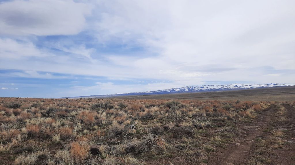
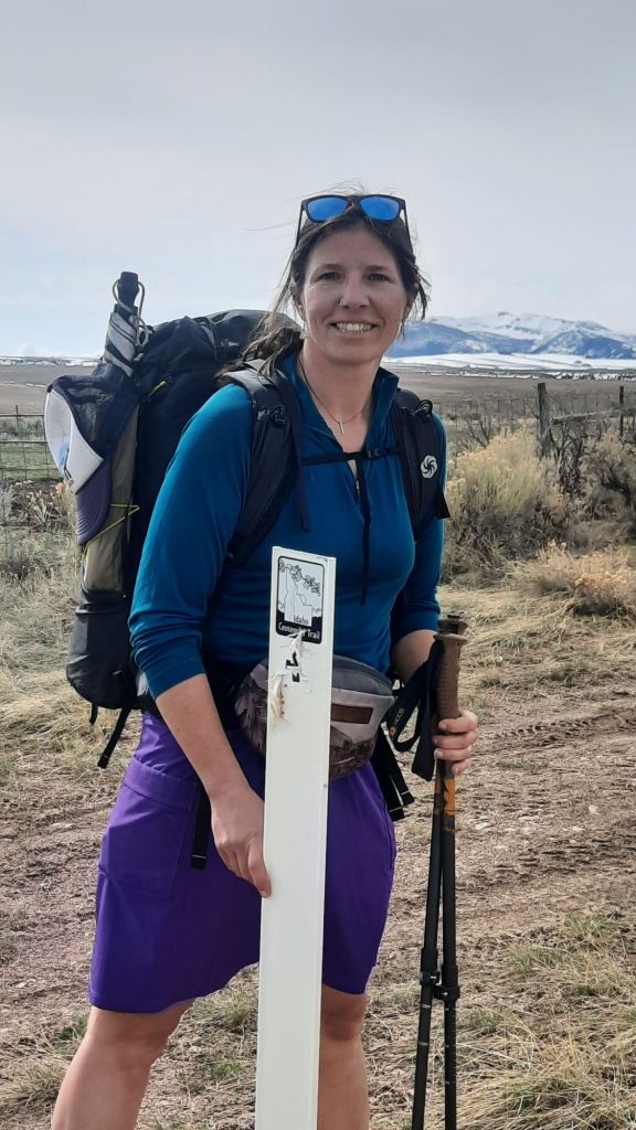
We finished the drive into the desert, and Dennis dropped me off at the first white carsonite post that would be my guide that week. The Jarbidge Mountains still held her winter coat of white, although the recent warm weather had started the spring sloughs. It was officially spring after all (as of last week), and even though blades of grass were sprouting up everywhere, the temps were due to drop 20 degrees by tomorrow and start raining.
I was prepared for the drop, and carried rain gear, cold weather gear, and even a tank top just in case things started to warm again at the end of the week. Those systems and a 7-day food carry meant I had a heavy pack. But my walking forecast was slow and steady with lots of snacks. This desert section has very little elevation gain (other than the two alternates I was taking into the canyon), so many hikers blast through this section…afterall, the stunning spines of Idaho’s densely forested mountains made up the rest of the 800+ miles. Just to the north were challenging and rugged miles, some in fire-affected forests with blowdowns for days, thus a main reason Dennis was working on trail maintenance solutions. It was a constant and persistent problem…the problem of keeping the trail cleared and in good shape.
But this section, the desert section, is a land that is mostly sky. Sky, punctured by deep drops into the Jarbidge and Breaneu Canyons. These were wilderness canyons with big horn sheep, whitewater rapids, and steep basalt columns…very reminiscent of the Oregon Desert Trail, except the ICT had carsonite posts.
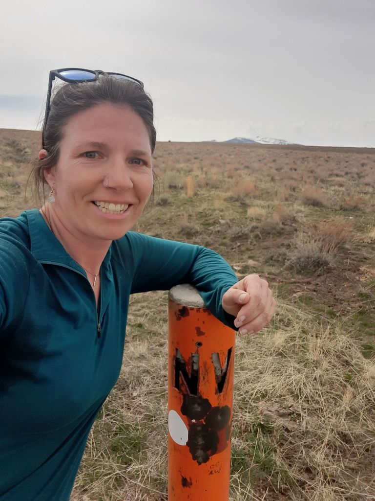
When we got to the drop-off point, I got out of the truck, took some photos, and started waking to Nevada. I would do a quick out and back to the border, and then take my first alternate down into the canyon next to the East Fork of the Jarbidge River.
I was hungry. The leftover burrito I had packed out from lunch yesterday was sounding better and better….but kept going because I had decided to eat lunch in Nevada. As I walked down the rocky two-track road to the border, I chased a herd of 50 mule deer down the slope before me….I was already excited about the wildlife I had seen on the trip so far. Multiple pronghorn and mule deer herds had sprinted from the truck as we drove in.
At the orange border sign I plopped down on my fresh piece of tyvek and reveled in the quiet.
This is the life.
By the time I had finished my first trail-side nap, an extra chill had entered the air, and only walking would warm me up.
I was to take my first alternate soon.
I pulled up photos I had taken of this section in the guidebook. Lisa and Jeremy were the authors of a new and excellent guidebook for the ICT, and had suggested hikers take an alternate right from the start down into the Jarbidge River canyon… and that was an obvious yes for me…Yes I will take the route into the canyon and sleep next to the sounds of the rushing river before climbing out later to hike along the top. Yes. Yes I will.
I had been in touch with Jeremy via email for a year or so by this point, and was fortunate enough to have met the couple in November when I was giving a talk at Idaho Mountain Touring on the Blue Mountains Trail.
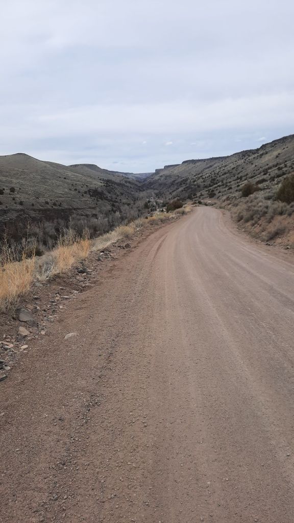
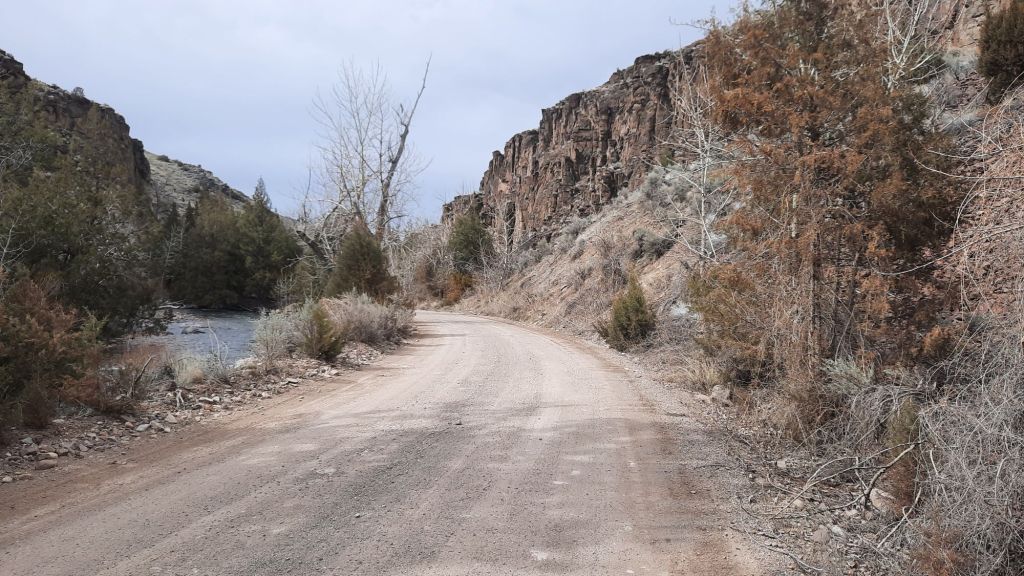
I trusted their alternate suggestion, and after my 4-mile round trip visit to Nevada, I was back to the pullout where Dennis had dropped me off, and I started walking the down the long grade to the river and the small community of Murphy Hot Springs. I hadn’t been able to determine if there were soakable hot springs for the likes of me down there, and the absence of information led me to believe there wasn’t.
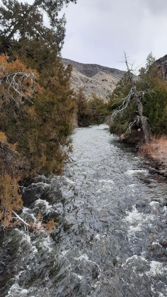
I was surprised at how big the “town” was…maybe 50+ houses and buildings huddled in the bottom of the narrow canyon. I was baffled to see so much infrastructure next to a canyon river. They didn’t have problems with flooding? Many of the other free-flowing desert river canyons could flood spectacularly every few years, but it was apparent from the scene before me that that didn’t happen here. By the time I started walking next to the river, I saw how low-volumn it was. I’d packraft that! Soon, I saw log jams blocking the flow and determined that while it could be done in a packraft, you would have to be careful of pointy sticks and scrapey sharp rocks.
At the end of the road I was walking was a popular boat launch, the whitewater only got more whitewatery from here down, especially after the confluence with the Breneau River. I wouldn’t be paddling through, instead I would be walking the rim of these remote canyons to the Snake River.
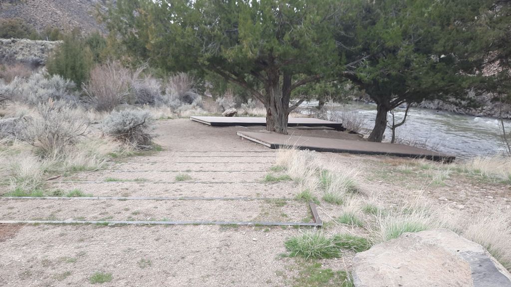
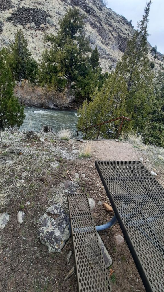
I ambled down the dirt road and passed several campgrounds, all with fire rings and pit toilets. Everything was very clean and nice…no bullet holes in the signs either! And the boat launch, wow, I had never seen one so nice with platforms for rafts and stairs down to the water. Color me impressed.
I found a campsite tucked into some trees across from the launch and enjoyed having a picnic table in camp. It’s the little things!
The Jarbidge lulled me into a post-dinner stupor and I closed my eyes.
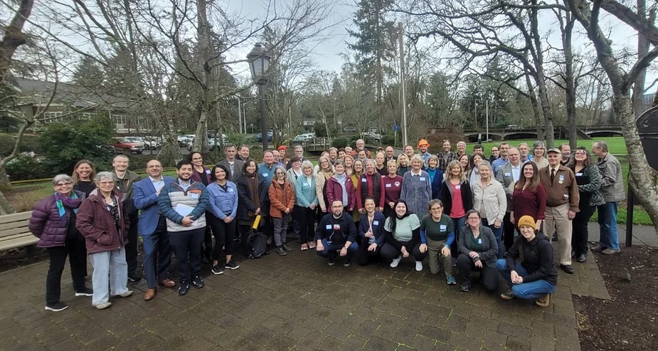
Nope, this isn’t a joke about trail conflict or politicians…it’s the scene from our first-ever Oregon Trails Coalition Trails Day at the Oregon Capitol in mid-February.
All photos by Oregon Trails Coalition
Over 70 of us traveled from all corners of Oregon to learn more about face-to-face advocacy with our elected officials.
Many of us have never stepped into legislative chambers before, had never been moved to take such a big step to advocate for our interests, but we’ve had a galvanizing issue in Oregon that has transcended the many different trail user groups in the state…our trails are closing, and many more are at risk.
You see, there is a law called recreational immunity which encourages landowners to open lands to the public for recreational use by protecting the landowner if a recreational user seeks damages after an injury. A court ruling last fall changed all of that when a woman slipped on a wooden footbridge on an improved trail accessing a beach and filed a lawsuit against the City of Newport. She alleged the city was negligent in maintaining the bridge and not putting up warning signs, and the courts agreed with her. You can read more about the issue on our blog, watch this recorded webinar for an overview, or read this article.
Since then, some local governments have proceeded to close trails (I think the number is over 20 now), and other land managers are scrambling to decide how to address this new level of liability.
Because the Oregon Trails Coalition is the state-wide cooperative body of broad-based, statewide trail interests dedicated to supporting, promoting, and advocating for trails, we decided to act.
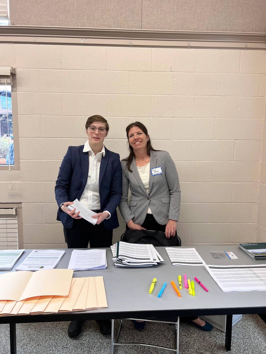
As chair of the OTC steering committee for the next few years I was excited to take my advocacy game up a few notches as well. Because I was making the transition from writing letters, sending emails, signing petitions, and making phone calls to having face-to-face meetings with my electeds, I had a fair bit of nervousness about making my voice heard in this official way, but with the amazing leadership of our Executive Director Steph Noll, she organized a thoughtful training session for all of us to get tips on holding meetings, delivering clear messaging, and following through with a clear ask.
Are we ready? We are ready!Representative Helm welcomed us and helped set the stage for the day
A few of us from Central Oregon banded together to speak to our state representatives, and it came as a little thrill when we realized while speaking to Representative Jason Kropf that the three of us were there on behalf of hiking, biking, and equestrian users….and we were all women…a power team! Emmie Andrews, Kim McCarrel, and I had met many times at Oregon Trail Coalition functions, and it was quite fun to all be taking this first step in our advanced-advocacy journey together.
So what happened after 70 of us descended on the capitol to ask for a legislative fix to recreational immunity in the short session this year? First, you can read the recap from the day here, the bill we were supporting (SB 1576 A) passed on the Senate Floor last week, and the bill is now scheduled for a public hearing in the House Judiciary Committee at 8am today, followed by a committee work session on Thursday when we hope it will be passed to the House Floor. And who is chairing the House Judiciary Committee? None other than Representative Jason Kropf.
So now what?
Update!!
On March 5, Senate Bill 1576 passed the House 50-0! Read more here.
Thanks to Oregon Trails Coalition, some clear steps have been outlined:
Send a short email to your Oregon Representative letting them know that recreational immunity is important to you, and ask them to vote yes on SB 1576 A. You can find some talking points here, but it’s best just to send a brief note in your own words about why keeping local trails open and trail improvement and development projects on track is important to you.
By the way, this day of action was a wonderful follow up to the January 10 Intentional Hiking event I held with American Trails and Partnership for the National Trails System about what your role can be in speaking up for trails with our elected leaders. Funny how that works!
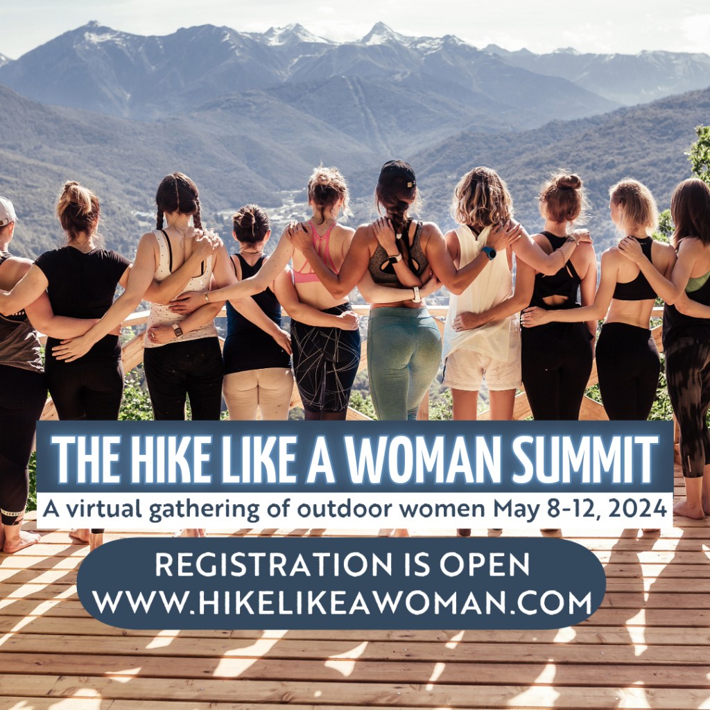
I am thrilled to be participating in the first ever Hike Like a Woman virtual summit, happening online from May 8-12.
I’ll be one of 41 speakers from 7 different countries, and after looking at some of my co-presenters bios, I’m quite thrilled to be among such good company.
You can tune into the talk at my scheduled time – Friday, May 10 at 9am (Pacific) – or you can watch my and all the 40 other presentations on-demand after the fact.
Hike Like a Woman is an organization founded by Rebecca Walsh, and the summit, well, I’ll let her explain where the idea came from:
“Two years ago, I was sitting in the chemotherapy chair. My head was bald. My body was weak and tired. I was angry, sad, and discouraged. I felt so alone. I was so isolated from adventure, travel, the career I’d had to put on pause, and the outdoor community. I thought, “I can’t be the only one who feels disconnected and discouraged.”
During treatment, I made a promise. That when I was healthy and strong again, I’d do everything I could to amplify women’s voices in the outdoor and wellness space to build community and show the Hike Like A Woman community that we are not alone.
A few months later, as I was walking through the park and slowly regaining my strength, a podcast about virtual conferences somehow ended up on my playlist. Right then and there, I had my answer. We needed a summit.
This summit is what I needed and didn’t have when I was at the lowest point of my life. It’s inspiring messages from 41 women who believe in you, who support you, and who want you to feel brave as you pursue your big dreams.
This isn’t your typical virtual summit full of sleazy sales pitches and guilt trips. No, this is a virtual gathering of women who’ve got your back.
When you register for our summit, you can attend any of our sessions live or access them on-demand after the event so you can watch, learn, and be inspired until 10/1/24.”
This blog has been quiet. I haven’t had any epic or not so epic extended adventures to chronical…and honestly I can’t seem to access the wonder, words, or desire to write extensively when I have a million distractions in the “real world.” Nature tends to even me out, smooth down the sharp pointy reminders of my to-do list, and leave me with the space to let my mind wander over the scenes and musings of the day. I need at least an overnight excursion to shake off the incessant access to the information superhighway and my weak resolve to find focus in a day filled with distractions.
I must go outside.
And here I am. Outside. A brewing cup of french press coffee waits outside the tent in the early morning darkness as a rising John Day River expands its capacity to hold all the water from rain and rain on snow.
It’s raining in January. In fact, it’s 50 degrees in January. It has been a disconcerting winter so far. One of warmth, ice, snow, rain on snow, then cold…thus more ice. The skiing has been dismal. And as we were looking at another depressing warm spell in the mountains, Kirk and I went to the river.
To our favorite section of our beloved river. In fact, you visited it with me last year on the Columbia Plateau Route….well, not this exact section… a hike is never the same as a river trip. They are entirely different trips in the same geography. A reason to visit a place more than once.
As we floated today, I pointed out all the places that I had packrafted or hiked in the canyon.
Our friend Brian had joined us. And it was his first time down this stretch of the river; I could see the effect of this magnificent place on his face and in his voice. It was simply too grand for photos. There was too much to take in; you could only sit back and grin.
I needed this trip so badly. I have been working from home now for almost a year, and the dreary winter kept us home more weekends than not over the past few months. I haven’t had any big trips, and paired with several ice storms and gray skis that practically shut the state down for weeks, I was bursting at the seams for a change of perspective.
We knew rain was on the menu for the weekend, but there was also the hint of sun and 50 degree tempatures. It could be positively balmy out there.
As we drove in, the muddy roads gave a little warning of what awaited us ahead, and clumps of snow still wedged in deep cracks of rock and shady folds of the earth gave the eye a bright how-do-you-do in the browns and gray of the darkening day.
It was dark by the time we parked the truck at the top of a muddy and washed-out grade down to the river, and we walked our packrafts and gear to a lovely little camp below.
Flash forward: putting up the tent in the rain and mud is a test of patience and relationships. Fortunately Kirk and I passed the test….by a slim margin. We tried to make the best of bringing half the wet and mud with us inside. Of course we could be at home in a cozy bed instead of in the mud, but this was way better. This was living… finding comfort in the uncomfortable. We were soon dry, though…as long as we didn’t move from our sleeping-pad islands.
We played cards and went to bed when it felt late. It had been dark for hours, and we had no time to keep. But one glance at my airplane-mode pocket computer showed some glowing numbers starting in the 7s.. Sunrise is about 7:30am, so we were in for a long night.
It rained and throughout the dark hours we slowly turned over and over in our sleeping bags, settling deeper into our muddy nook of a campsite; the sounds of the rushing water working its way deeper into our dreams.
Shortly after the day lightened, the rain stopped.
We broke open from our long night and started the river prep.
But first coffee.
Bags in bags, drysuit gaskets stretched, and packraft zippers zipped. River shoes and pfd’s on, and when all the pieces and parts were assembled, we had liftoff.
And really, isn’t boating like flying?
The feeling of weightlessness and smooth speed immediately depressurized my brain a few notches. I was so full of ideas and conversations and planning and budgeting and contracts and taxes, that I desperately needed to open a release valve in my brain to let that excess mental heat out. An overnight trip could only accomplish a fraction of the relief needed; a long hike is the better cure, but I had to table that carrot for a while. It wasn’t time for the type of trip where I could really shake off the excess. And there is so much excess in the world right now. Ok, excess isn’t the right word. Maybe weight is a better word? The weight of war, climate change, injustice, the upcoming election, ice storms, gray days…all the things.
What this weekend indicates is that I need to be better about taking these short bursts of joy and freedom so that I don’t blow a gasket from going too hot for too long.
Noted!
Words fail us here. The sun came out and we floated the day away with giant smiles on our faces.
Camp had a view of an intricate basalt wall and mountains all around…but then all the campsites do out here.
Tents drying in the sun, camp chairs, and puffy coats. Ahhhh.
An afternoon stroll up to a ridge hundreds of feet above the river helped me relax into the day even more.
I think a river trip is one of the most calming things out there. The rushing river acts as metronome to the day, and tends to smooth out most frictions.
Did I say Ahhhh yet?
The trip is too short, but has once again proved that the more time I spend outside, the better. I’m better.
Hiking for a plan to permanently protect this landscape.
When I pitched my tent on the edge of the lumbering Sutton Mountain, the views were obscured by heavy rain clouds. My dry island of nylon was an escape from the drenching spring rains, and while I lamented missing out on the scenic vista that was buried in layers of hazy moisture, I knew a good soaking rain was something to encourage and even celebrate in this desert landscape. Some bright bloom or newborn babe would grow an extra inch in this wet, and for that I was grateful.
Luckily enough, my optimism for a dry morning and relief from the low-lying clouds was realized, and when I zipped open the tent fly the next day, the world revealed itself. I could see the brilliant Painted Hills, fresh and vibrant as if the rain dialed the hues up a notch, and beyond, in layers of ridgelines, sat the far reaches of the Ochoco Mountains…with a dusting of fresh snow! Even though I was backpacking in early May, winter’s grip lingered.
I celebrated the views, one: because I would be able to hike the edge of this fault block sentinel and enjoy the unique vantage point that the ancient geology and plate tectonics provided, and two: because I would be ending my exploratory nine-day backpacking trip through the John Day River Basin on a high note. Hiking up and over Sutton Mountain was to be the grand finale.
View from tent atop Sutton Mountain. Photo: Renee Patrick
What is it to know the land? To our hiking hearts, it is to walk through it, to sleep between stands of bunchgrass, to drink from elusive desert springs, and climb up to rocky bluffs only previously traversed by bighorn sheep. Folks fortunate enough to spend time in this area become intimate with the plants, animals, geology, and human history unique to the area. We come to understand the importance of the largest intact expanse of federal public lands in the John Day River Basin, and why it needs to be permanently protected, with Sutton Mountain as the pinnacle of these lands.
I prepared for this hike by printing out pages of text to read in the evenings when my legs wouldn’t cooperate after 15 miles of walking up and down the steep (so steep) terrain along the John Day River. I had information on geology, history, public lands, and even a little poetry. I wanted bits of inspiration and intrigue to help me understand the place I was walking through. I wanted information that would help illustrate why the John Day River basin was so important, and places like Sutton Mountain, so unique.
Clouds on Sutton. Photo: Renee Patrick
And what did I learn?
Geologically speaking, I had to imagine myself standing here millions of years ago when this landscape was being buried by ash, lava, and volcanic mud, solidifying and preserving ancient plants and animals.
Ecologically speaking, I learned that Sutton Mountain was the nexus of important migration patterns of elegant creatures like the Rocky Mountain elk, sleek pronghorn antelope, and the nimble mule deer. Above, equally intricate patterns emerge from winged fauna drafting in the air currents; golden eagles and ferruginous hawks soar, while sage sparrows and red-naped sapsuckers flit in the wooded brush below.
Culturally speaking, I was walking through the original homelands of the Warm Springs Tribes and the Northern Paiute peoples, homelands that probably appeared much as they did thousands of years ago, for this area, in particular Sutton Mountain, hasn’t been disrupted by extractive industries, expansive development, or intrusive management. Sutton Mountain is as it has been, and that is why permanent protection for this area is so important: so it stays that way.
Hikers walking the length of the dramatic Sutton Mountain fault line will sometimes keep company with the clouds, other times with expansive views. Photo: Renee Patrick
Each year, hundreds of thousands of visitors travel to the Painted Hills National Monument just across the road from Sutton Mountain. In fact, the iconic painted hills don’t end at the monument’s boundary. If we step back into the imagination machine when I watched layers of ash and basalt build into the hulking ridgeline of Sutton Mountain, those compounding layers would also resemble the colorful neighbor across the street, as the lower reaches of the mountain continue to reveal.
Clouds on Sutton Mountain. Photo: Renee Patrick
If visitors turned around to consider Sutton Mountain as their next destination, they would find more than just a stunning backdrop, they would find secluded valleys, rolling grassy hills, and outcrops of impressive volcanic rock…all the things I love to explore on a hiking trip into this special area. But without more consideration and planning, it is easy to imagine the destruction that unmanaged recreation or development could bring and already has to nearby desert destinations. That is why a thoughtful and inclusive plan to permanently protect Sutton Mountain will be so important. It is through improved conservation management that we can sustain the values that make a hike here today, and in 100 years, so compelling.
I think the wonderful thing about visiting Sutton Mountain is that much is left to the imagination. This is a place prime for following your curiosity as very few established trails will tell you where to go. Instead, you can ramble at will, and if you keep the values of ecological diversity, intact habitats, and respect for cultural, historic, and local communities in mind, recreating with respect and intention can be in harmony with this place and its future.
I invite you to climb up to the rolling grasslands of Sutton Mountain’s flank, walk the edge of the dramatic fault, and when you arrive at the 4,700-foot summit, picture what this place will look like in a few hundred years. You won’t have to imagine it, it will look like this.