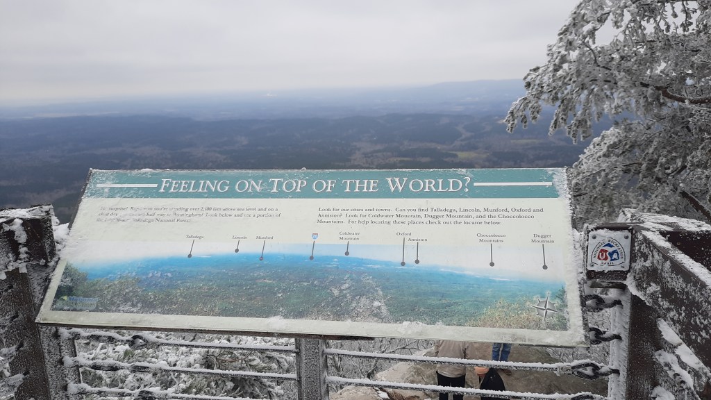
Day 3 is up on the story map. View it here.
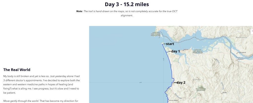
Day 3 is up on the story map. View it here.
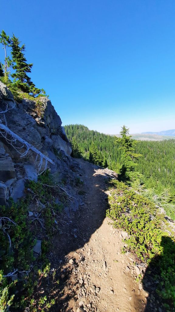
Day 2 is up on the story map! View it here.

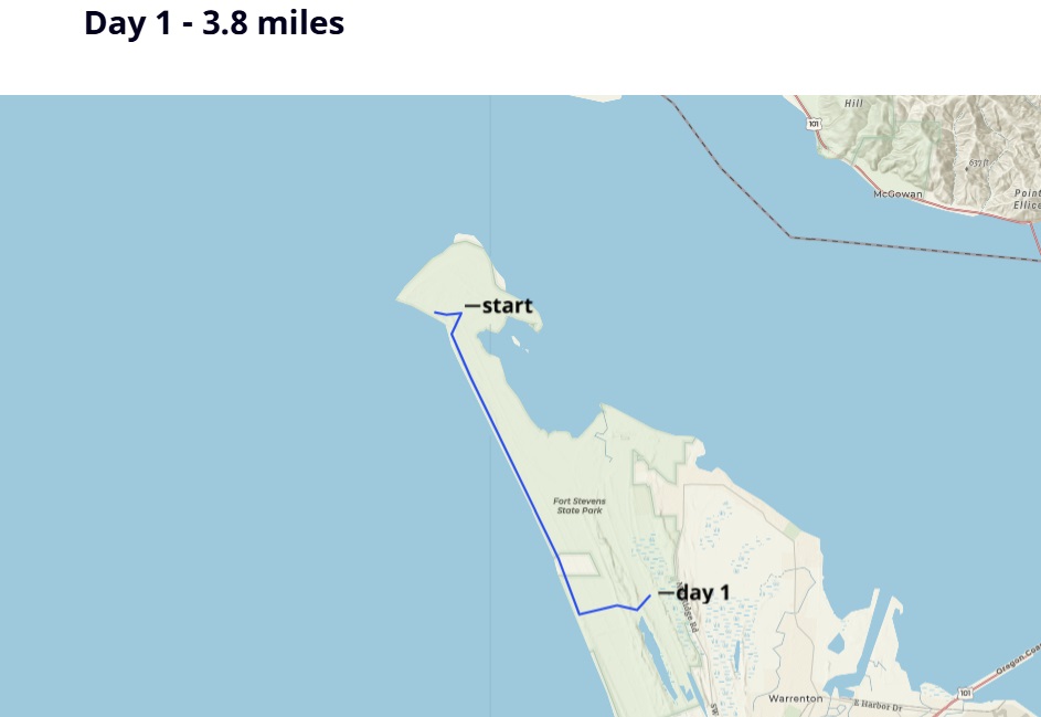
Day 1 is up on the story map! View it here.

I woke up about midnight in excruciating pain. My neck and shoulders were on fire, and I could barely move without setting off waves of muscle spasm. Imagine if this was happening in my tent, 10 miles from the nearest out.
I couldn’t.
This was the reason I wasn’t out hiking this October. I would not be watching the colors slowly change in the trees as the trail tread gradually disappeared under splashes of gold, red, orange, yellow, and maroon. This was the reason I had to distract myself from the huge gaping hole left in the wake of what I love to do more than anything and can’t do…so much so that I designed my whole career around it…what was I going to do if I wasn’t thru-hiking?
The answer is obviously to try and fix the body. But that will require rest and very little movement for the near future…something I’m not so good at.
My neck and shoulders have been painful for two weeks now, and I think that pain was triggered by a rib injury that I sustained almost a month ago now. Several trips to urgent care and lots of epsom salt baths later and now I’m trying the chiropractic route. Last night was probably the most pain I’ve been in this whole time, but after the first two adjustments I finally feel like there is progress in my quest to return to backpacking condition. And yoga! I haven’t been able to do yoga for a month now, or much of anything else. I’m turning into jello with every passing day. How does anyone stand the inactivity?
If I had been hiking the Pinhoti right now, where would I be? Lets see. I would have started walking the Sunday after Pinhoti Fest ended…that was a little over a week ago now, and at a 15 mpd pace, I would have hiked about 135 miles.
Instead of making my first cup of coffee in the zero-dark hours on trail, hunkered in my sleeping bag, trying not to spill it all over myself as I start writing this blog on my phone, I am in front of my laptop in my office at home, drinking coffee through a straw. It hurts too much to bend my neck to sip, so I have to bring the coffee to me.
This not-hiking is agony, and I have weeks of it ahead of me. I am not working during this time; my brain needed a good long walk as much as my body did. Walking is what feeds it with new ideas, hiking causes it to play parkour with ponderings and musings. I need to give this hardworking brain of mine a rest too, so I am going to play a little game with myself while I heal. I’m going to give myself a virtual hike along the Oregon Coast Trail.
Wait, the Oregon Coast Trail? Yes, well, after I had pushed my departure off for the Pinhoti Trail for a second time, I stewed in self-pity for a few days before glomming onto the idea that I could rest another week and still go hiking. The Oregon Coast trail was close, had plenty of towns (outs) to bail if my body couldn’t take it, and I could talk a lot about real-time trail issues our long trails in Oregon are facing (a la Oregon Trails Coalition ).
I could even take public transportation! Walk out my front door, hop on a bus, then another, and arrive in Astoria. From there I could walk as far as my body would let me, and bus back home from wherever I made it to on the coast. A true masterpiece in connectivity. And talk about connectivity! The Oregon Coast Trail ties into other trails that are included in the Oregon Signature Trails project. There’s the Salmonberry Trail , a work in progress that will connect Portland with the coast, and potentially share some tread with the Oregon Coast Trail, and also the Corvallis to Sea Trail …the route Amber and I walked three years ago to its western terminus at Ona Beach. I’d walk right past it!
Then there are all the bazillion times I’ve been to the coast in the 20 years I’ve lived in Oregon. The first time I went to Beverly Beach with some new friends, we whipped ropes of seaweed like 13-year olds. Then there was the time Cindy and went hiking for New Years, and some hoodlums shot a bullet into our rental car. Or the time I taught a light-weight backpacking course at Portland Community Collage and we overnighted on the coast.
With a virtual hike of the trail, I could imagine and research what I would be experiencing in real time. What would that look like? What would I see and learn about the area? Where does the trail go, and why? What are the issues facing the Oregon Coast Trail and the coast itself? For the rest of my convalescing time, I’ll take myself on a virtual journey and share it with you like I usually do in my daily blog. BUT since I’m at home and love maps and multi-media storytelling, I’m going to make a story map of my virtual hike so you all can learn alongside me, in real time.
Each day I’ll “hike” my miles, and the next day will keep up my morning writing routine with you here. I’ll cover 400ish miles, create a story map, and share it with you.
Ok, lets go. (click below to start the journey- This story map is best viewed on a desktop, laptop, or tablet.)

I’ve been planning my Pinhoti thru-hike for most of the year, and now it’s not happening.

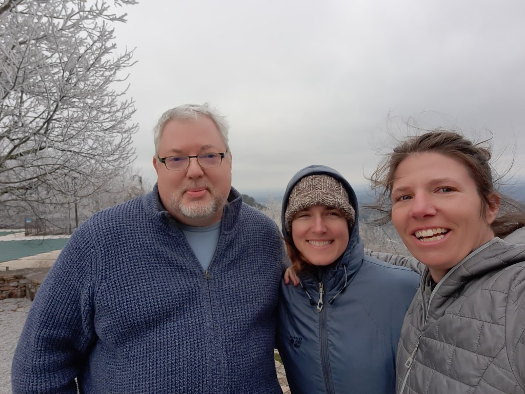
The Pinhoti Trail has been on my radar since 2022 when Cindy and I visited our Peace Corps friend Richard and spent a rare snowy Alabama afternoon at Cheaha State Park.
I’ve been hiding from the reality that this is not the right time to hike for about a week now…an injury (actually a series of injuries) and the devastating hurricane that battered the East Coast have contributed to this change in plans, and oh how I’ve been resisting all of it!
Fortunately, the Pinhoti Trail has been spared the destruction of hurricane Helene, but the Appalachian Trail has not. A full third of the trail is now closed, and it could take a looooong time for a full recovery. There are many ways we can help in sending money and support for the communities affected along the East Coast, and I’ll be modifying my fundraiser soon to recognize East Coast recovery efforts along with raising money for the Oregon Trails Coalition.
September has been the hardest month of my life, hands down. The heaviness of this current moment comes from many different aspects of my life…and most of it I am unable to control. I ache for the solace and peace that extended time in nature brings, but what does that look like if I can’t hike?
My body controls my future at this point….I can’t rush the healing, and I can’t let my stubbornness and determination derail my ability to backpack in the future by heading out too soon with full pack weight.
So, I wait, I plan, I come up with backup plans, and backup backup plans. I still have hope I’ll be able to do some hiking in October, but I have to let go of expectations and take each moment as it comes.

It’s almost my favorite time of year: fall hiking season! These are the days when the air is crisp, the leaves yellow, and the wildfire smoke dwindles.
And I’m trying something new this year…I’ll be heading to the east coast for my fall hiking plans, and will jump on not one, not two, but three different trails!
As usual, I’ll be blogging daily, and the best way to stay up to date is to subscribe to my blog posts (look for the “Follow Me” section on the side bar of this blog) to get them emailed to you each time one is posted.
Pinhoti Trail
First up will be a thru-hike of the 335 (ish?) mile Pinhoti Trail in Alabama and Georgia. I say ish because I’ve seen different mileages different places, so we’ll see what I find on the ground! I’m heading first to Pinhoti Fest in Sylacauga, and shortly after the weekend will start my north-bound hike. There isn’t an all-encompassing website for this trail, and in fact many of the aspects are split up between the Alabama section and the Georgia section, but the fine folks over at the Pinhoti Experience Foundation are doing a good job at educating prospective hikers, and the trail is even on the FarOut app.
Benton MacKaye Trail
When I reach the northern terminus of the Pinhoti Trail, it intersects with the Benton MacKaye Trail. Benton MacKaye was a professional forester, community planner, and conservationist who first proposed and Appalachian Trail in 1921, and the Benton MacKaye Trail follows his proposed spur trails that would extend the Appalachian Trail (AT) further to the south. I’ll be hopping on the southern tier and hike it about 70 miles to Amicalola Falls State Park past the southern terminus of the Appalachian Trail. Following my hike I’ll be headed to the Benton MacKaye Annual Meeting & Hike Fest.
Appalachian Trail
I’m only really touching the AT at Springer Mountain and hiking the approach trail down to Amicalola Falls State Park, but I’ll still get to touch the trail that started it all for me!
Trail Fundraiser
It will be no news to you that I love trails, and I want to do some fundraising during my hike this fall.
The Oregon Trails Coalition is the glue to the trails community in the state, and I have the great honor of serving as the chair of the Steering Committee this year and next.
Our group has been working hard with our partners from around the state on issues of access, advocacy, funding, and stewardship, and in looking to 2025 we have a lot of work on our plate!
Some of these items include:
Since I’ll be hiking about 400 miles, I would suggest donating anywhere from 5 cents to a dollar per mile. (that’s from $20-$400)
In May I participated in the Hike Like a Woman Summit where I had the great pleasure to meet and connect with other passionate women from around the world.
Dr. Debbie Early was one of those women, and I enjoyed learning about her life on a remote island in New Zealand along the Queen Charlotte Track (a path I hope to hike one day!). Debbie’s work is focused on nature-based solutions to support wellbeing and adaptation during times of change. Find out more about her and her business, The Art of Awareness, here.
We caught up recently and recorded our conversation about what we have done since the summit to raise awareness and action around nature connection.
In the video I mention a few of my Intentional Hiking events that were held this summer:
An upcoming event I mentioned (registration is open now!)
We lingered on the last moning. With only 12 mile to go and Kirk showing up around 5pm to pick us up, we had all day to make our way around Mt. Jefferson. It was a two cup of coffee kind of start to the day.
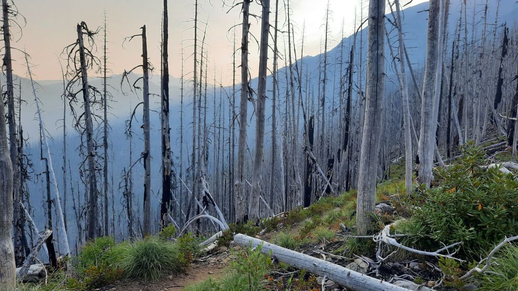
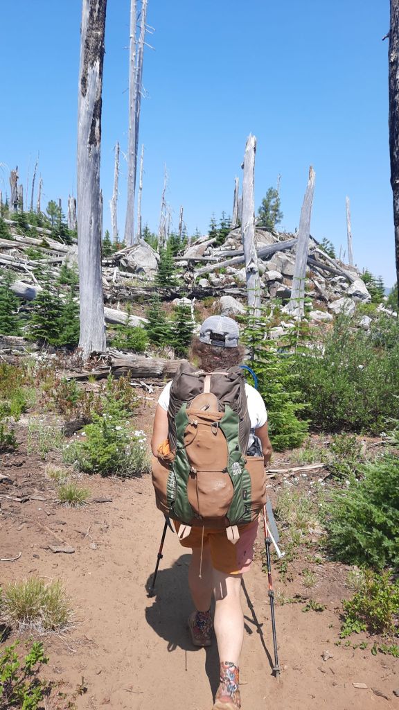
One mile after leaving camp we entered the burn. An apt description of the next campsite said “sleeping in an ash try.” Everything was torched. The plus? Berries were still lining the trail. I didn’t know huckleberries were so resilient!

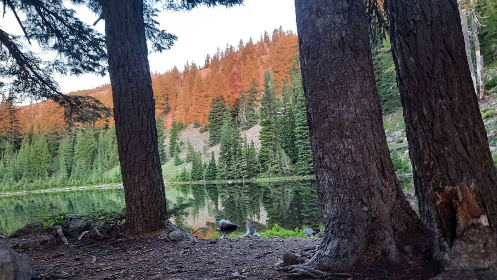
We climbed and climbed up to the start of Jefferson Park, and low and behold, much of the Park retained the lush green splendor! The numerous lakes and ponds must have kept the hot at bay, but there were incursions here and there where a patch of trees held the flames back.


We snacked at Russle Lake and enjoyed the rest, even despite the mosquitos trying to drive us away.

Then up and up some more to the next pass where NEMO had a tearful goodbye with Jefferson. This was a mountain to fall in love with.
The north side had snow fields and the trail was full of sand and rocks which acted as ball bearings as we gingerly made our way down.


It was almost the end of our hike, and our feet were ready to be done. We had visions of a swim in the lake when we got there, but when arriving at Breitenbush Lake we found blowdowns and no easy access. When we did manage to make it near the shore it was marshy with no place to take a dip. Bummed, we made our way back to the PCT and splashed off in the creek nearby and sat down to wait for Kirk.
A few hikers came by that we had been leapfrogging, and then the dusty blue pickup pulled up, early!!! Kirk brought cold drinks, fruit, and chips and I hauled the magic over to share with our new friends. More hikers showed up and soon there were 5 or 6 of us snacking in the shade.
Finally we decided it was time to leave the PCT and we loaded up in the truck for the harrowing six mile drive out on a very rough road. Once we reached pavement the going was much smoother, and we spend away to Sisters for a burger and a beer.
Oh PCT, we love you!

We slept hard. A solid sleep after a day of toil and effort is the sweetest thing.
We drank our coffee as the orangy morning light slowly lit up rockpile lake. What a way to start the day! There were four other hikers who had set up around the lake and soon everyone was up and about, rustling gear and shaking out tents. It was fun to be in the middle of the nobo and sobo rush. We were seeing plenty of folks headed in both directions, and it was a bit sad that we had to dip out so soon and leave the through-line.
The hiking was glorious! Nemo said this is what she had been dreaming about. Scrubby little lupine carpeted the ground with bright red paintbrush and yellow and white flowers joining in the medley.
Simply stunning.
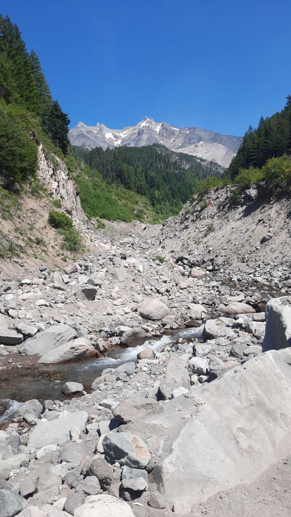
Mt. Jefferson played peekaboo with us as we climbed and descended ridges, and as the mountain got closer, so did our excitement and trepidation. The big burn of the last few years loomed ahead and had torched the last 13 miles of our hike into Breitenbush Lake and the magical Jefferson Park. What would it look like a few years later? I had been to Jefferson Park several times and knew what it used to look like, what would this trip bring?
We were full-body old lady achy today, so wanted to have a shorter day. Camping was in short supply though, and if we hiked too far we would be in the burn and suboptimal camp spots.
We hopped across Milk Creek, not as milky as you might expect, and reluctantly started climbing the grade ahead. I had been hoping for some good camping at the creek, but it hadn’t panned out.
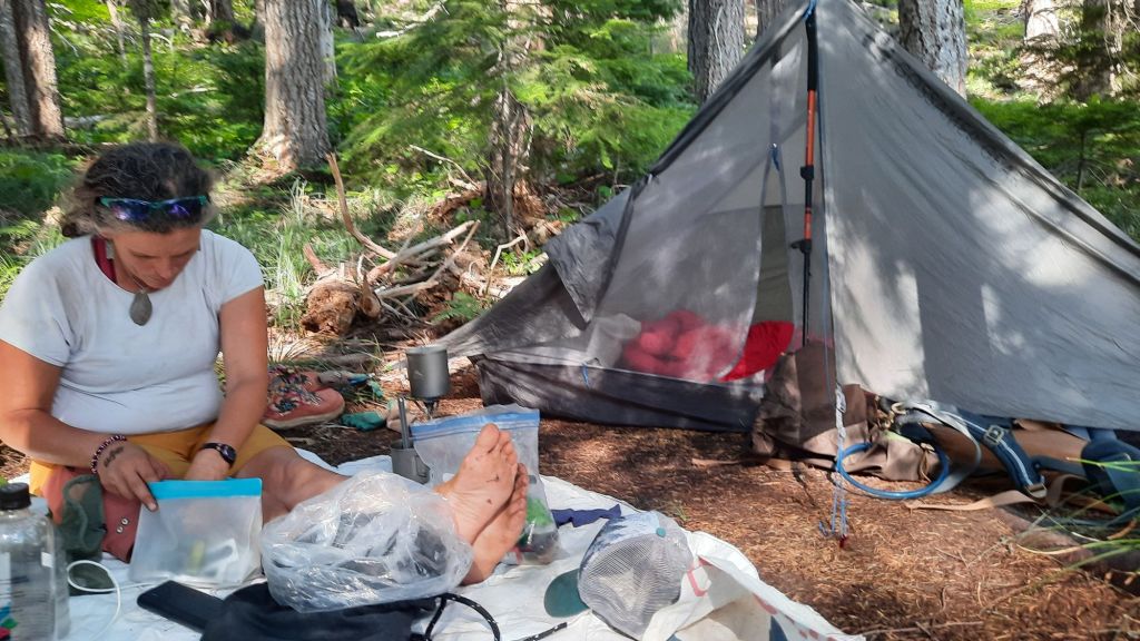
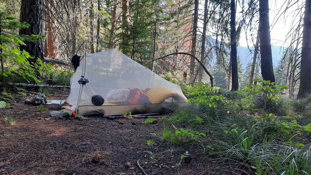
I kept my eye open. Sometimes there is a little spot flat enough for a tent or two hidden in these long climbs and descents, and after about a mile I spotted it! Just the right size for me and Nemo and our afternoon repose.
We luxuriate in the light breeze and bit of a view we had through the swaying trees. Quite sublime.

The aches are here.
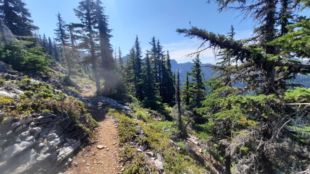
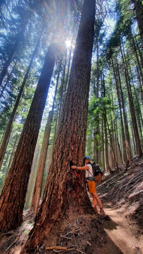
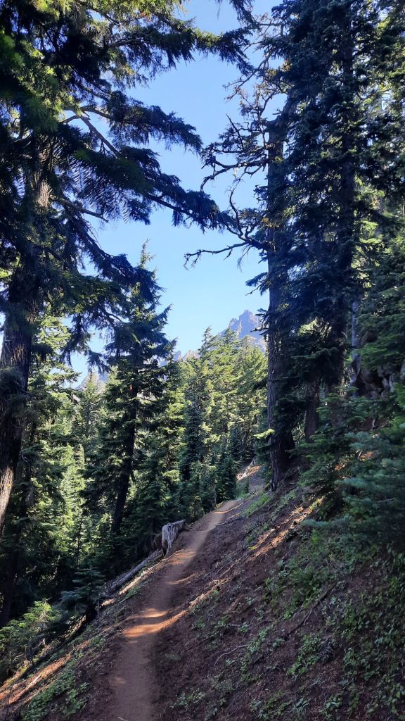
We are both in decent shape, NEMO just finished hiking the New York 46ers in a burst of mountain climbing before her birthday a few weeks ago, and I backpack regularly, like last weekend. But it’s becoming clear that we are not trail hardened, and a few long days on the trail are painful reminders. My PCT memory is of flat cruisy trail, and of course it is in some sections, but more often than not it’s going uphill or down. We are passing a mountain a day in this short hike so we have to climb up on the shoulders of each one….and it takes effort.
And the effort is rewarded. You just can’t beat the views on the PCT. Sooooo incredible. And so torched. These miles have been hit by fires again and again. We walk through successive burns and small pockets of lush old growth. Lush! The ground is often damp in these sections, damp! And the flowers 😍. And the air is so much cooler. It’s viscerally apparent how important these forests are when we hike into a burn area again and there is nothing but a cathedral of burned trees in every direction with the heavy smoke of the nearby Pyramid Fire hanging below us.


The heat smacks us in the face.
I want to walk in the forest again, but there isn’t much.. I brace myself to what we will see in the most recent burn at Jefferson Park. A wonderland of lakes and huckleberries…before the fire that is…
And fire is the theme because fire is everywhere. The story map I worked on with a group called Resilient Headwaters came out recently (take a look! It preforms much better on a desktop or laptop) It’s about the recovery and recreation. The story map covers aftermath of the Santium Canyon 2020 fires that burned through vast swaths of forest just to the west of us.
But I haven’t told you about the day! We didn’t realize what a smoke bomb we had been sleeping in until we hiked up and out to Three Finger Jack’s flanks and saw the dank carpeting the pass below.

Numerous southbounders sped past us on their quest to get to town, and the hiking, while mostly uphill, was also quite gentle.
We snacked and walked, lunched, and walked.
Three Finger Jack does impress. We walked right below the crumbly peaks and switchbacks down the northern spine. The views were stunning despite the hazy smoke look.

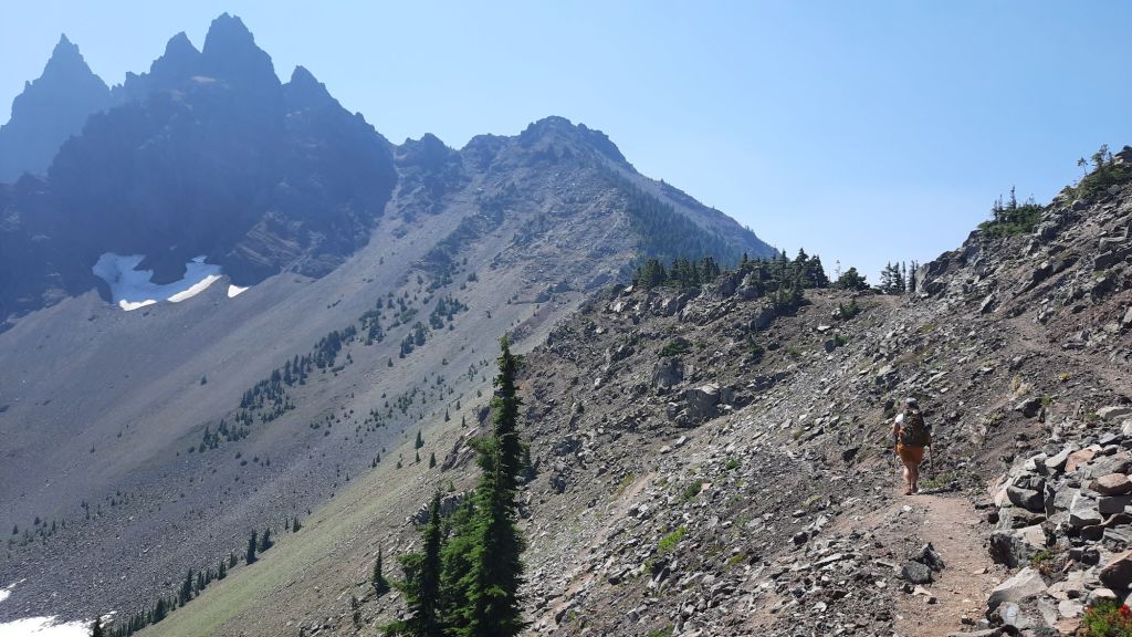

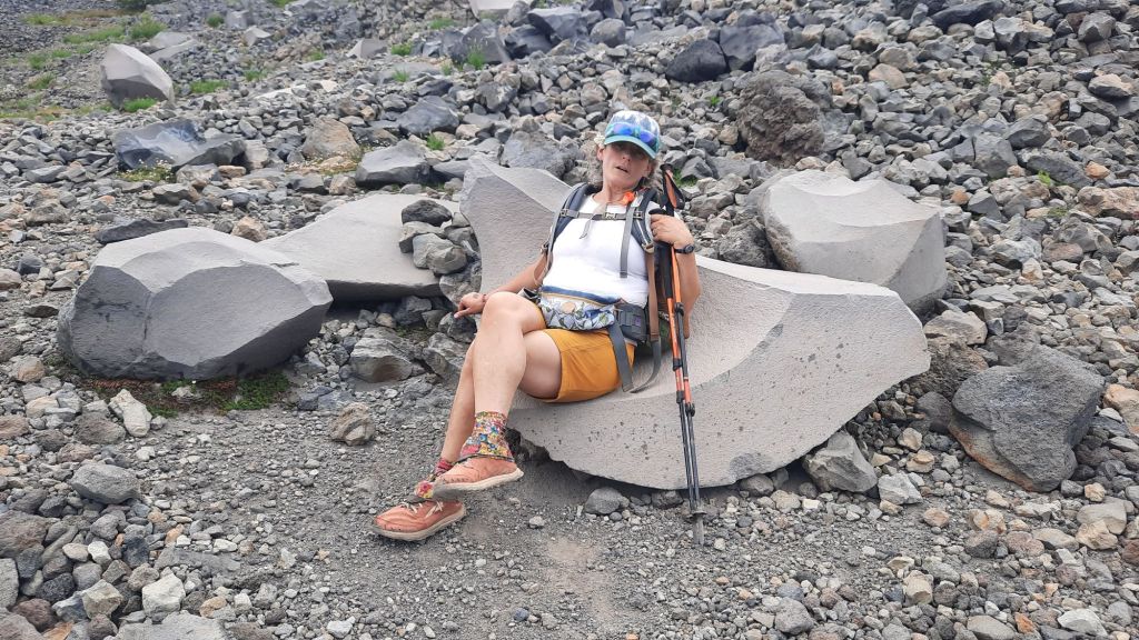
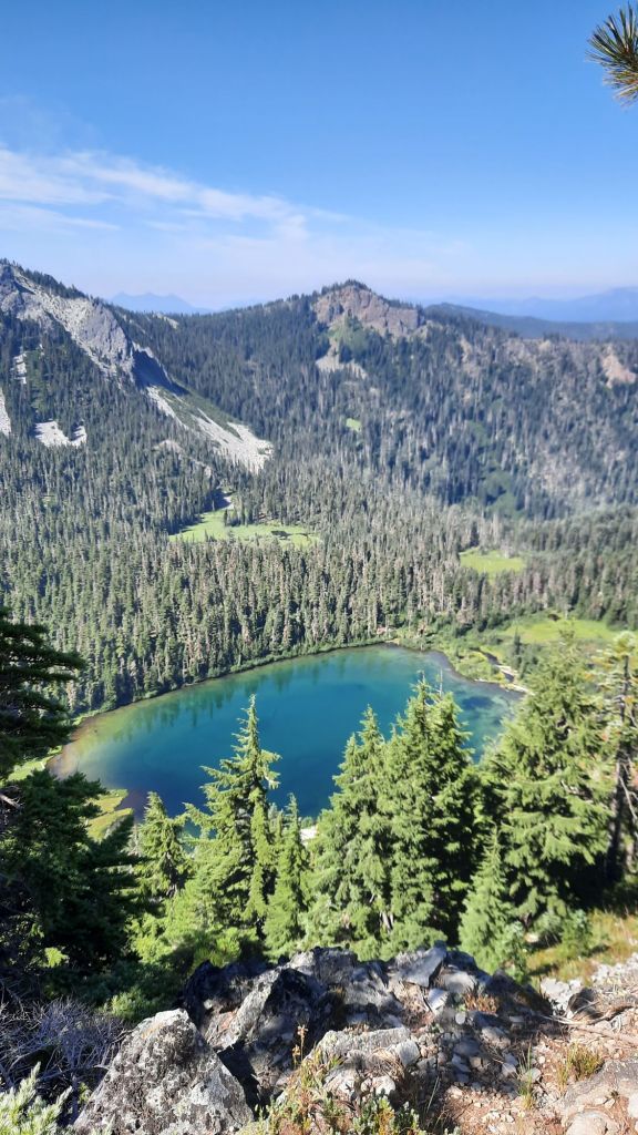
Up next were boulder fields and ponds nestled in the jumble. We spided the deep blue Wasco Lake and I convinced Nemo to go down for a swim. It required extra effort and I questioned my quest for a bit when the going got real steep on the way down. 500′ in .2 miles. Yikes, but when we were floating, the hurt that would hurt on the way up was far away.
Refreshed, we immediately lost that cool feeling on the climb up. But I did have wet hair and a wet shirt that helped with the hot afternoon. We had some lovely stretches of trail in small swaths of forest and finally arrived at Rockpile Lake which made a wonderful camp.


There was almost a chill in the air, so we put on layers with glee.
Lights out early tonight!
