Gila Wilderness – Day 3: 6 miles

From the tent I yell: “What if we just hike to the river?”

I could hear Allgood’s mind working from his tent 20 yards away.

We had been discussing loops and river sections all to add up to 15ish miles of hiking tomorrow. Why 15? Well, cause we said that’s what we would hike out here. The reality? We could do what we want.

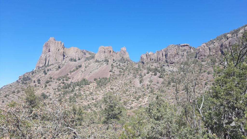
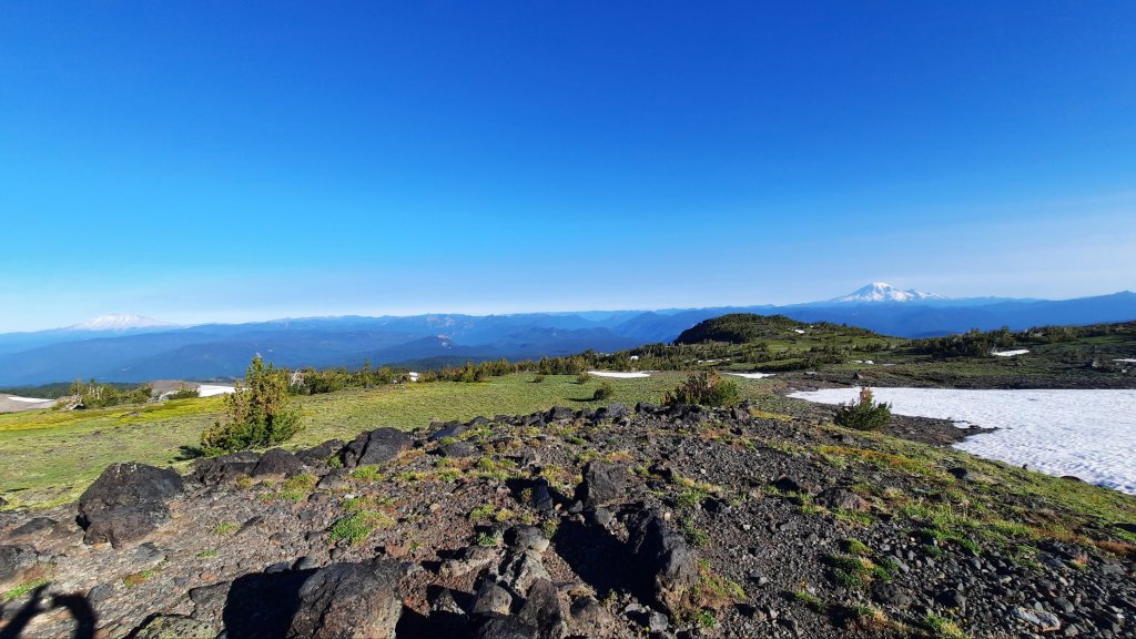
The map showed so many trails and so many options for a four-day hike that it was almost overwhelming. From the spot we camped last night we probably had 10 options for routes to hike back to the car in another two days. I was thinking about Allgood’s fishing rod in the side of his pack. Add on top the effort of permits and finding the right tackle, and this was something he appeared to want to do, but we hadn’t made the time to do yet.

“I love the way you think She-ra,” he called from his tent.
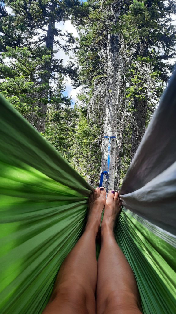
Alright, beach day!

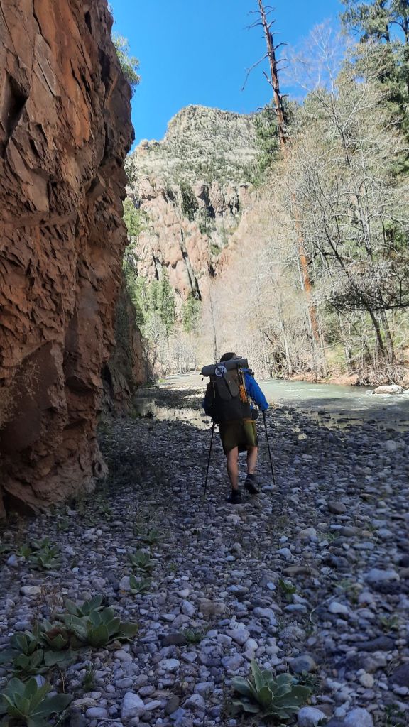
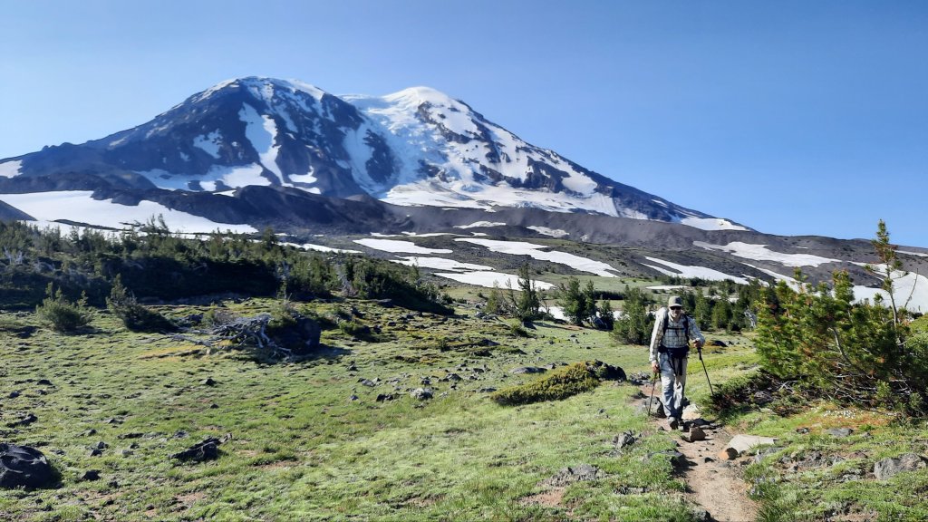
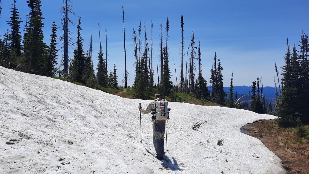
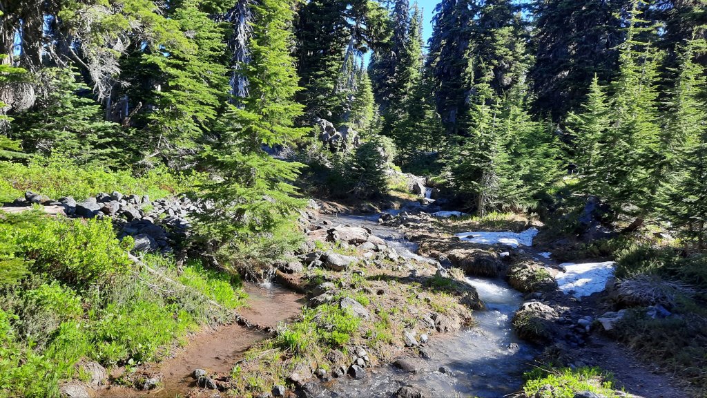
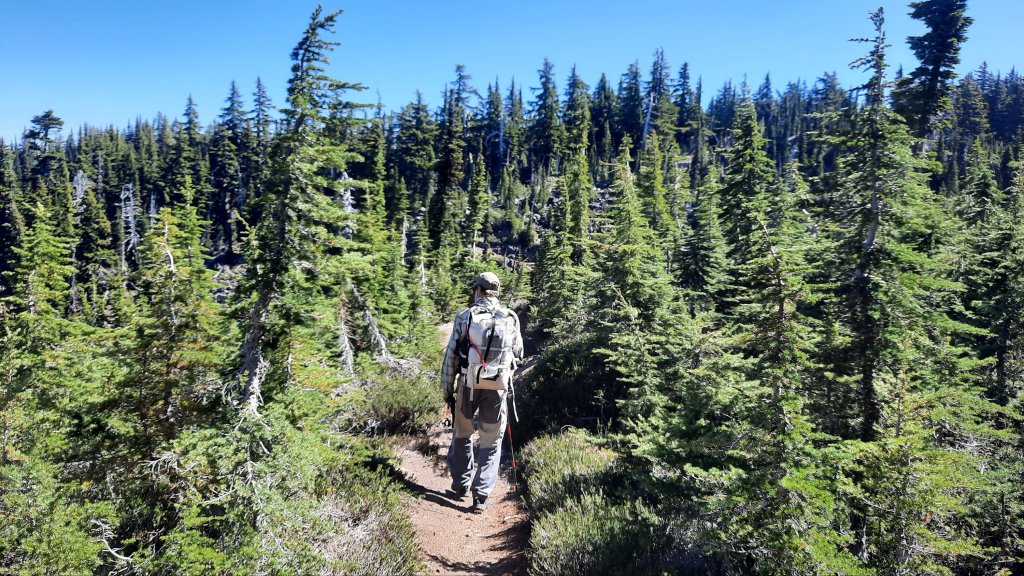
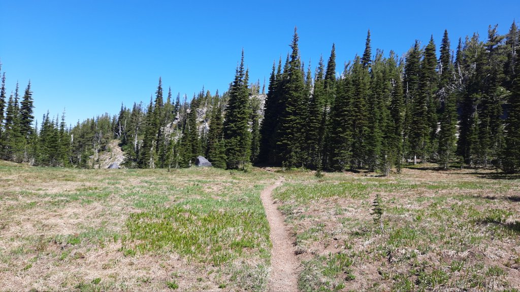
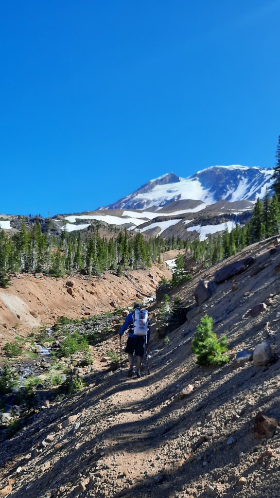
We had fourish gentle ponderosa pine forest miles to walk and almost two miles of switchbacks 1,000′ down to the Middle Fork of the Gila. That’s the CDT baby!


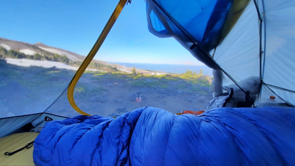
There was no reason to move until the sun came, so we didn’t. Later after some stretching and slow packing we set off about 9am.


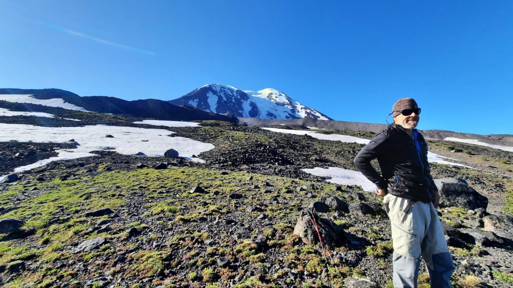
“I don’t usually hike like this,” Allgood said once on the trail. Allgood is a notorious mile-grinder and regularly hikes some crazy long miles on his trips. “But I could get used to it!” He chirps with glee.


“To the River!”

Yes we could find 15 miles to hike and then another 15 back to the car because we said we would, or we could hike to water where Allgood could have the time to fish, I could read, and we could chill. Go hiking and relax? Six miles today and 11 to the car tomorrow. No decision, really.

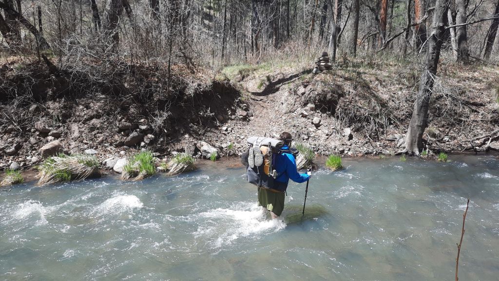
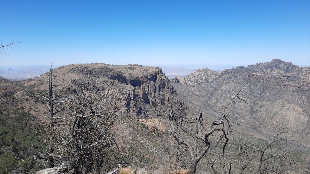
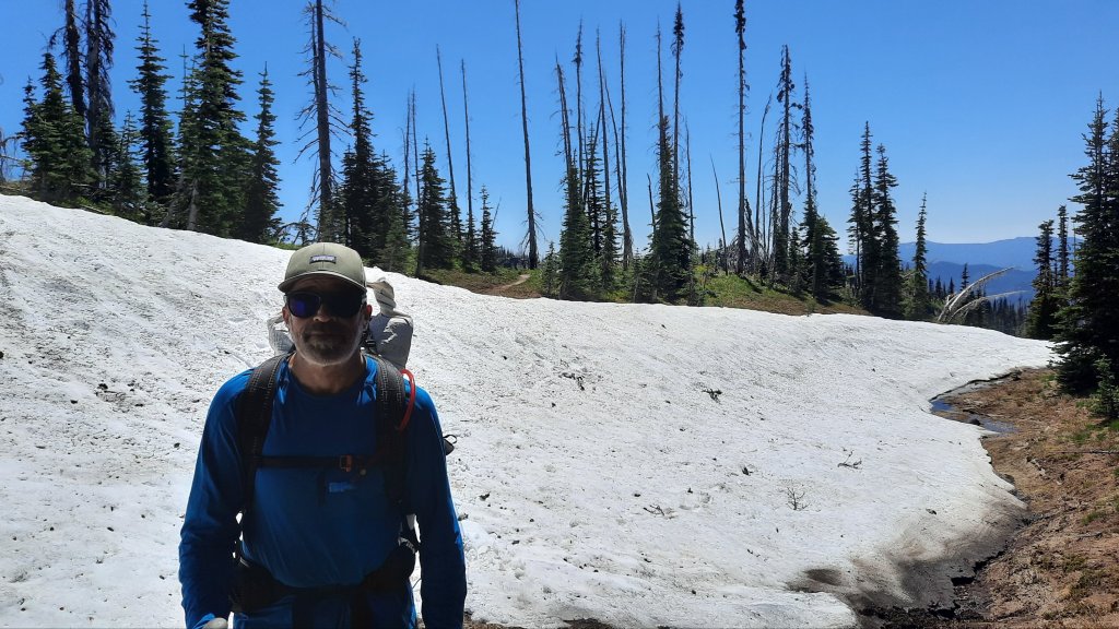
Right before the drop into the river canyon we see a thru-hiker coming our way. We stop. We have to stop! Kid was zooming along the CDT before he went to college in the fall. He was clocking 30s and feeling good until a brush with a swollen ice-melt river yesterday, and now he was on a high water alternate above the Gila. That had been part of our decision too, one of our route options included hiking down the Midde Fork of the Gila for eightish miles, but my full-face river dunk and slow progress on the river miles yesterday led us away from that choice. We had both hiked up the Middle Fork on our thru-hikes…and the water was cold.

Anyhoo…it was fun to talk to Kid for a bit and think ahead to all the adventures he would have. Allgood and I have been telling CDT stories for days now…


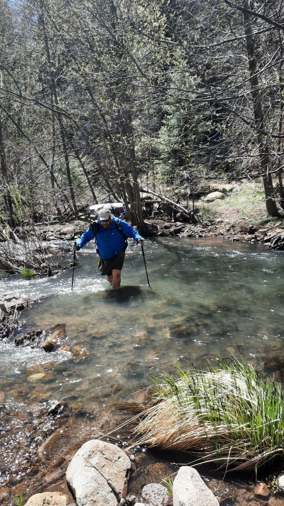
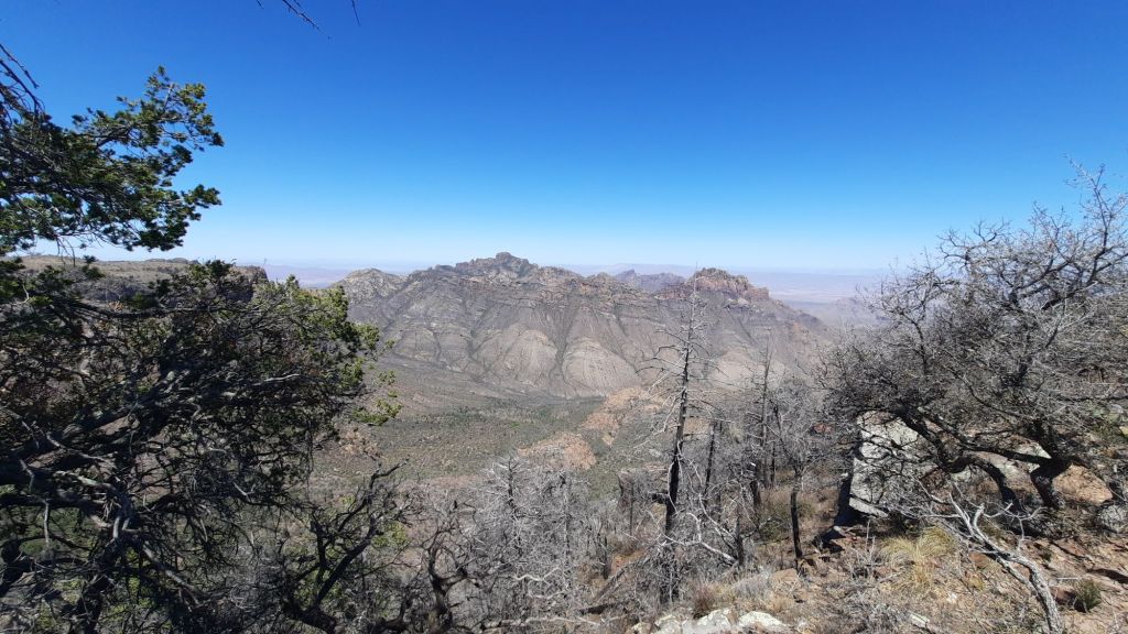
Once off again we pick our way down the countless switchbacks to the water below. My knee is bruised from my slip and rock encounter in the river yesterday, but it’s more the 46-year-old body I’ve been motoring around this week that had me feeling ready to sit down. That and the three hours I’ve gone without a snack. Being the same age, Allgood and I regularly chat about middle-aged body aches. Hiking while aging is a new experience for both of us. We can remember when we were thru-hiking in our 20s. That wasn’t that long ago, was it?
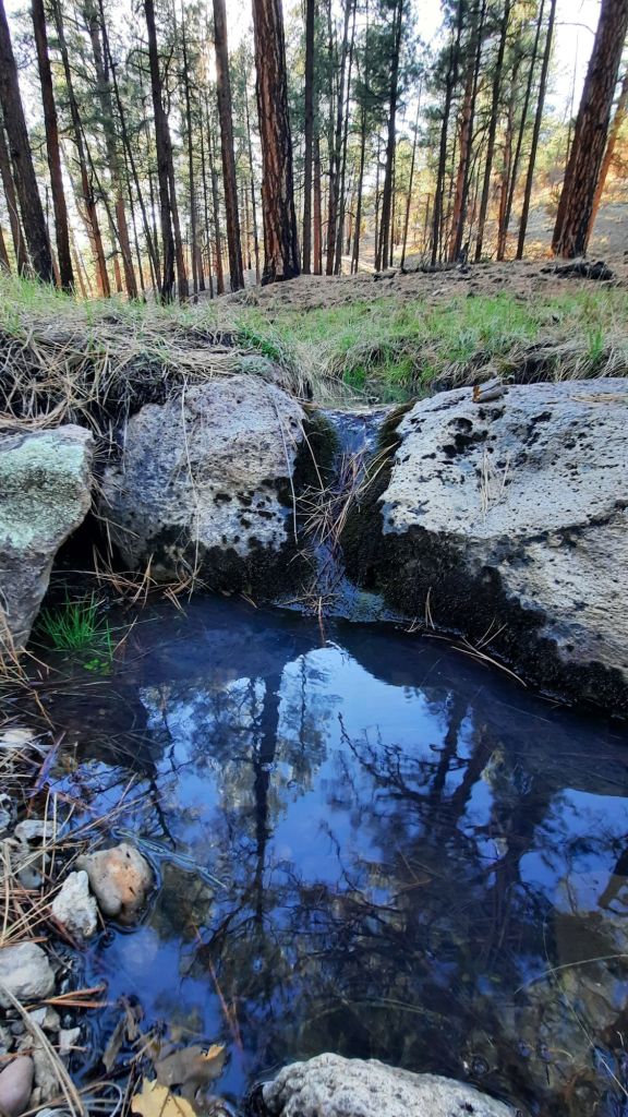
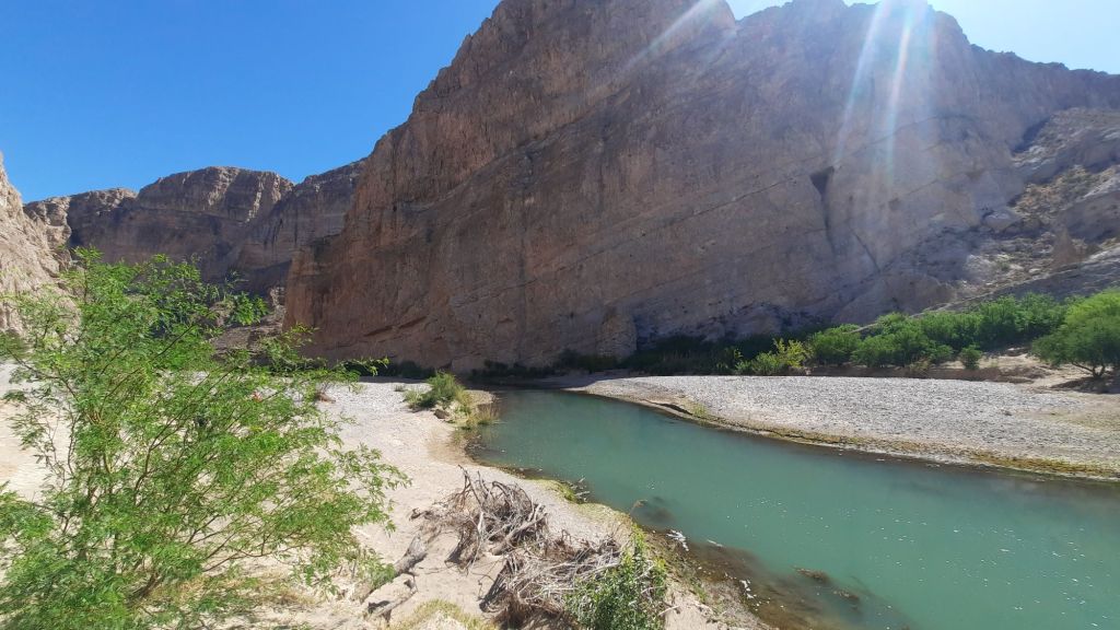
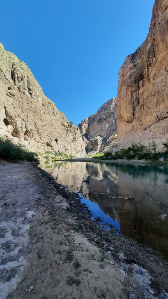
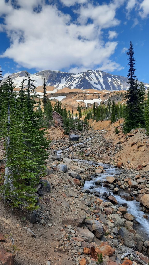
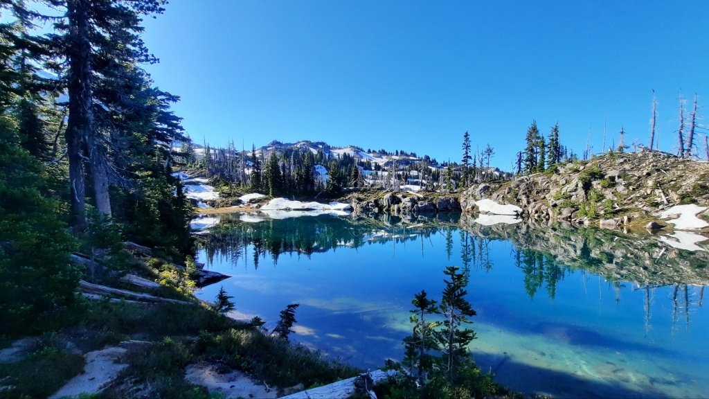
The river!


That beautiful aquamarine blue river.

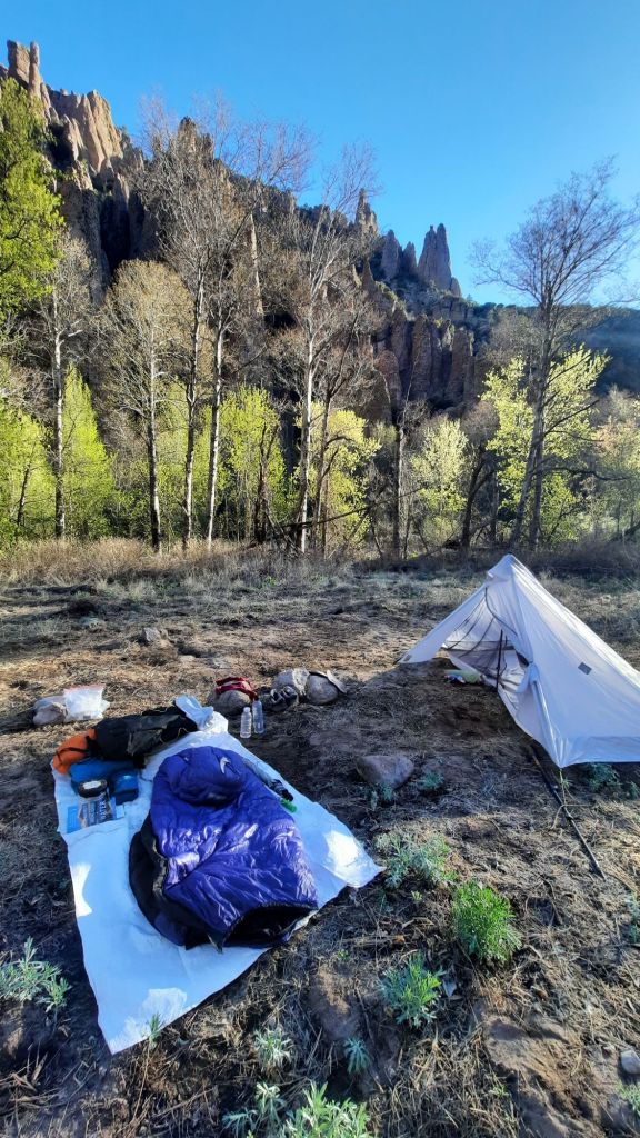
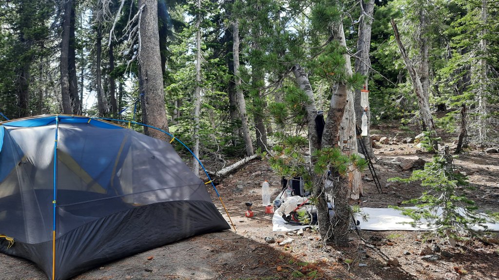
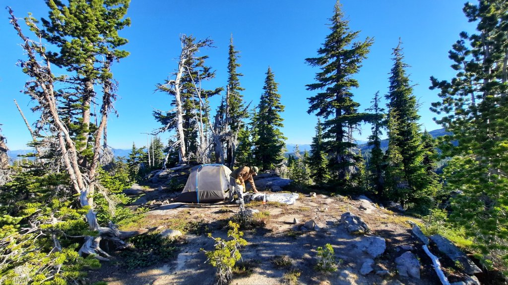
The trail guides us down to the most perfect camping spot ever, and it’s a given: we will be doing some hard-core chilling.

Fishing
Snacking
Reading
Napping
Snacking
Chatting
Eating

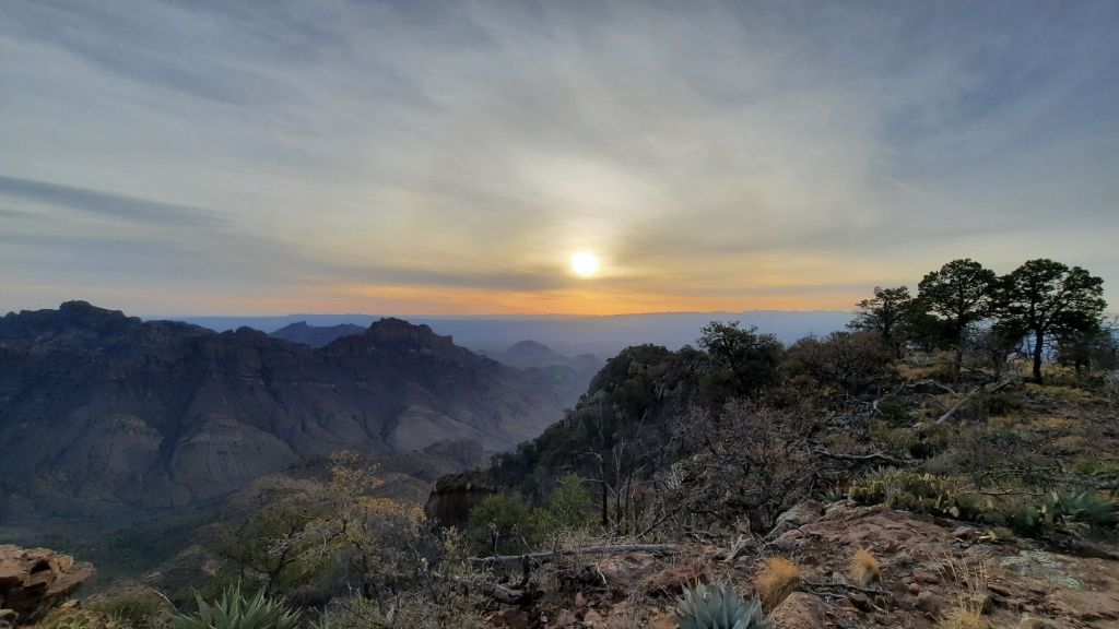
With the evening came the cold, so we made a fire.

Neither of us usually have campfires, but we could and it was cold. Fire! Due to the many years of fire building and tending in my various outdoor careers, the fire stoker me comes out and I happily poke at the pit the rest of the night.

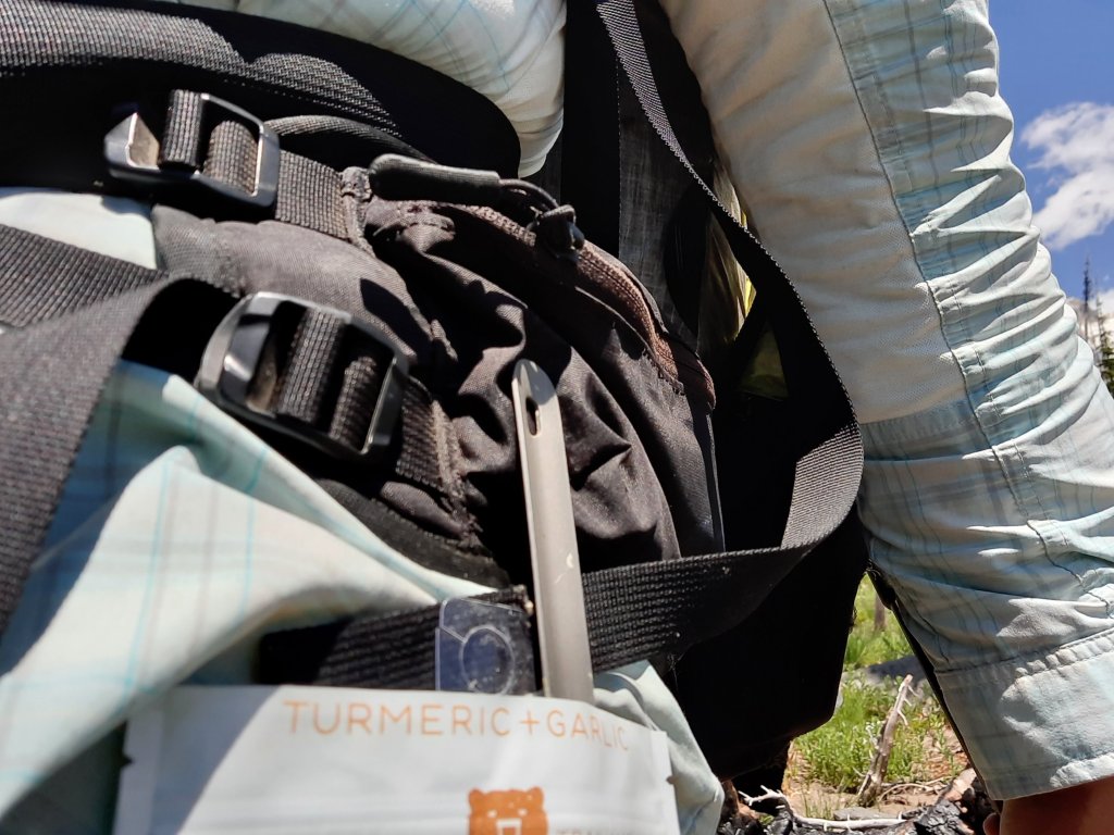
Oh, one delicious highlight from the hike so far has been Allgood’s Cipino fish soup. He and another hiking friend (Drop-n-Roll), bought a freeze drier and vacuum sealer and were making their own meals. His technique? Make something yummy, and freeze dry it.

Eggplant Parmasan, Spagetti and Meatballs, and Cipino soup were some excellent meals so far.

YUM.

Gila Wilderness- Day 2: 14 miles

The rushing water played DJ for sunrise, and that first long ray of sun was an event.

I had been up before sunrise, both Allgood and I went about our mornings from the warm cocoons of our tents. It was too frosty out to fully emerge; we would start hiking in the sun.


It was also safer. We probably crossed the river 30 times yesterday afternoon, and would at least 60 more times today. That water was recently snow, and with the deep cold shade of the canyon, hypothermia wasn’t off the table without the sun. I would have been in trouble later on when I slipped and went into the river face first, but I popped right back up and was able to keep my faculties in the sun.


Yeah, this wouldn’t be a trail to hike in inclement weather or even a cloudy day. Wet feet all day long.

River miles were slower, too. We often had to scout a bit and push our way through willows to make a safe crossing. And even then: an almost full dunk for me, and another slip and crack of the knee on a rock. Allgood faired much better, aside from the exhaustion that comes from 8ish miles of this type of hiking.


So eight miles of cold, yet eye popping wonder later, we were just about ready to cross the river a final time and climb up to the plautau above when we see a group of blue tents. We wave hello and meet a high-school semester group from New Hampshire that is spending the year on cool trips and adventures like this around the country. Wow.

I love seeing the trails get used. Love it!

We lunch on the far side and I dry off the last of the damp immersion from my clothes and prepare for a climb and stong winds. We decided to climb out of the West Fork canyon at a reassuring spot called Hell Hole.


The climb was moderate though, and took us up into a lovely ponderosa pine forest. A recent fire had burned away all the undergrowth, and the trail was so cruisy that I call it, “PCT dreamy.”

Then, we took a right at a trail junction down into Prior Canyon and the slight downslope of the tread allowed us to literally flow down. That was a help because we were both tired from the day. Listening to music on the way down greased our strides.

And a cold wind…


Water! Water was the indication that we could start looking for a camp spot, and we quickly decided to stop where we were.


The cold descended quickly, so we made short order of dinner to crawl into our nests.

Gila Wilderness – Day 1: 5 miles

I had a plan. All this driving would be worth it.

The Continental Divide Trail Coalition holds their kickoff weekend in Silver City, New Mexico every year, and 2024 marked their 10 year anniversary as a trail gateway community. That means: PARTY!

You may remember I’ve attended the CDT Kickoff before…I believe this is my fourth, and since I was in the neighborhood for the eclipse, I decided to add it to my spring adventure list.

I had a few days of unscheduled time (swoon) before the festivities would begin, and I wanted to hike. Just north of Silver City, the CDT splits into the Black Range or the Gila River Alternate. In 2015, I took the Gila River route up the Middle Fork (amazing), and Kirk and I packrafted the Middle Fork down in March 2020 (the “You Can’t Plan A Pandemic” trip).

So I immediately thought of hiking the Black Range south into Silver City, it was the unknown! I could get a shuttle up the trail and then walk back to town, but fires and lack of water made that route a challenge.

After talking to my pal Allgood (Mr. Whitney LaRuffa), who was also going to CDT Days, we decided to hike a few days in the Gila instead.

For this trip, we would walk up the West Fork for 10ish miles, and up, over, and back down the Middle Fork for a loop of 45ish miles. Of course, spring floods would have to be factored in…floods took out the trails almost every year, so I had mapped out options, and our options had options. We would figure it out.

And! This would be my first time hiking with Allgood. We have been friends for, oh, about 15 years now. He was the CDT Trail Ambassador for his 2016 thru-hike after I was for my 2015 thru. He then came up to hike the Oregon Desert Trail, but again, we didn’t hike together. Add in the fact that he is my birthday brother (born a few days after me in June 1977) and had helped groundtruth the Blue Mountains Trail at the same time I was out there in 2020 (see: The Intrepid Trio), this hike had to happen. Allgood had been back to Trail Days almost every year and often tacked on a hike into the Gila or Black Range; hiking before CDT Days is tradition for him.

We planned four days of luxurious 15-mile days in two of the most beautiful canyons in the world.

I drove into town after dropping Cindy off at the El Paso Airport and straight to Bob’s. Bob had been Allgood’s boss when he worked for Triple Crown Hats (the very hat company that made our the Oregon Desert Trail hats). I had also designed some national park logos for their line, so it was wonderful to see him again; Bob very graciously hosted us for the night, and after I oogled his beautiful adobe home, we went out for dinner and beers.

We drove up to Santa Clara to Open Space, a new thru-hiker owned brewery. I will probably get my facts wrong, but Highlight and Brew Hiker met on their CDT thru-hike a few years ago, fell in love, and decided to return to Silver City to start a brewery. My people! We enjoyed a frosty one in the courtyard while a band played, and kids ran around and around us in a “the parents aren’t watching” delirium.

Next, we stopped at a wood fired pizza place that probably had the coolest vibes ever. It was another music venue with several stages and an amazing view into the darkening desert sky.

My people!

I love this place.

Silver City is a community of artists and eclectic personalities. My artist friend Erika lives here with her bike-maker partner, and I’d be seeing her this trip too, but first hiking.

On the way out of town, we swung by to see Teresa (the ED of the CDTC) and then drove in the long, windy road into the Gila. We swung by Doc Campbell’s a resupply stop for CDT hikers and perused the store. I had been in touch with Kristy (a new owner since I had hiked through in 15) because I had asked her to participate in a talk I was doing that weekend (more on that later). We were chatting when I spy someone new who had walked in the store.

Nah, it wouldn’t be her.

I look again.

I think it’s her.

“Renee!”

It’s her!


It was Joanna, a coworker from the Oregon Natural Desert Association! She had left ONDA about the same time as I had last year and moved to Albuquerque to work on water conservation in the Colorado River Basin. A hard-hitting bad-ass conservation job if I’ve ever heard of one.

We hugged and caught up. She was a fellow backpacker, too, and had been down for the weekend exploring the Gila Cliff Dwellings and hiking. I love it! My people!

We drove to the West Fork trailhead. The water had spiked a day or so ago but looked doable. I say doable because much of the walking in both canyons would be in the water. Countless river crossings from one bank to the other created a gauntlet of challenges if water was high. When we got to the first crossing, it looked doable.

The highest the crossings got was mid-thigh, and we could almost always see the bottom in the slowly green-blue moving water. After maybe the 5th crossing, we met some backpackers hiking out. We were able to get beta on the trail ahead. Apparently the crossings get increasingly deep and sketch, but we think they were also crossing during the river’s spike, and a cooling trend in the next day would hopefully slow down the snow melt for us…it could be a perfect time to hike this trail.


The canyon walls will have to speak for themselves:


We meandered in about five miles before seeing a camp in a big clearing with an incredible view of rocks that were layered and puzzled into a maze of pillars.

Delight.

Big Bend National Park

2,500 miles later, I was ready to walk. Sitting in the car for that long brings its own aches and pains, and I was ready for an ache of a different kind. The ache that comes from climbing, sun, or big miles. Well, it won’t be miles on this trip… it’s hard to get in miles within this National Park, mainly because there is no water.

My friend Cindy and I had planned this trip to follow an eclipse chasing mission, and had successfully crossed the state of Texas once to catch a break in the clouds for totality on April 8 near Dallas, and crossed it again to visit the far reaches of this park.

Boot Spring sat in a nest of short backcountry campsites, and I had worked and reworked potential routes between the camps to get some miles in and hit the water once a day on our trip, doubling back on some trails, but alas, when we arrived we heard the spring was dry, so we decided to hike in, then out (back to the visitors center where we had parked) to fill up water bladders, then back in. The things you do in the desert! We weren’t willing to carry water for three days, so this would be the deal.

Before hiking in we spent the morning playing tourist…the fossils exhibit was quite impressive…many large dinosaurs we had never heard of had been found in the area, and we also drove to the Rio Grande part of the park and took a short hike to the river, tucked in the steep cliffs of the US and Mexico border. The water was shallow, but I’d still float it, and would have to do so on a return trip some time.


The Chisos Mountains were essentially the heart of the park, and their craggy volcanic hulk presided over the rest of the expanse. It was also the most popular, and after our short auto tour to the Mexican border, we had to wait in a line of cars for a parking spot to open up at the visitors center. One out, one in. One out, one in. It wasn’t a small area either. There was a campground, lodge, restaurant, store, visitors center, and backcountry hiking trails, but I expect we weren’t the only ones taking in the desert after the eclipse, or trying to find our slice of National Park before the heat got too much. From May on the park empties out…the sun is just too good at its job in the summer.

We headed up the 1,000′ climb late in the afternoon. We had less than three miles to hike. When I say short hikes, I mean it! Tomorrow, we would hike out and back in for tenish miles total. But despite the short miles, the mountains rewarded us. We would camp beneath pinnicals, and their pillars usher us up the trail.


The trails are nicely shaded and we meet lots of day hikers on their way down from climbing the 7,825′ Emory Peak. Camp is lovely. I plopped down on my tyvek, and Cindy went exploring. I put a big dent in my book…Christina (one of my most excellent trail angels from the Blue Mountains Trail four years ago) had recently recommended The Secret Knowledge of Water by Craig Childs when she heard I would be doing some hiking in the SW this spring (BTW, check out Christina’s new podcast Kinward! I’ll be on it sometime this summer).


Cindy came back from her wanderings with reports of copious amount of TP in the underbrush. I became incensed. Why would a National Park with established backcountry campsites one needed to reserve six months in advance have no latrines? Each campsite had a bear box, each campsite was used heavily during the season, so why did each campsite have a dirth of dirty toilet paper fanning out in all directions? We had a long conversation about Leave No Trace and simple little things that park managers could do to encourage proper waste disposal. We were protecting the wildlife from our food (bear boxes) why weren’t we protecting them from our poop?

The night was quiet, no animals bothered us for our crumbs.

The next morning we inventoried the night: both of us had slept poorly….it was too quiet? But we had a mission, and it involved hiking back down the 1,000′ we had climbed yesterday to get water and climb back up.

Again, we passed throngs of day hikers on their Emeory Peak quest, and we were back at the visitors center linkedy split. Then, onto a different trail to climb back up… this time all the way up to the southern shoulder of Emory.

I took a break up top with a nice man from Salida, CO. Inevitably, we talked about our mountain towns, and when I mentioned Bend, he asked if housing prices were as inflated as they were in Salida. If, by inflated, you mean a cheap fixer upper house is $500,000, I asked? He said, “Yep,” same for his town…the houses that were now half a million were $60,000 when he moved there. ☹️ And that, my friends, is why I’ll never own a home. This world is whack!

The next section of trail was quite lovely with shade trees and dappled sunshine filtering through. The trail wound around and dropped to the dry Boot Spring Canyon before climbing up again into a burn area. I had no idea when it had burned, but there was a permanent sign announcing the trail was closed beyond our campsite destination. Stange, there had been no closed sign on the other end of the trail we had passed earlier. The website had mentioned seasonal closures for nesting raptors. I can respect that! But a permanent sign??? My spidy senses tingle whenever there are inconsistencies in the trail or trail resources….this could be a job for She-ra! The trail fixer! The good thing about my trail consulting company was that I saw opportunity everywhere. An overwhelming amount of opportunity! Maps that are wrong, resources that are missing or confusing, the list goes on and on… I’ve had a wonderful array of projects come in my door over the last year, but I could take on more. I was hoping for a day when my services were so in demand that I had projects lined up for years and could employ a cadre of  subcontractors to help me with the work. One day! So if any of you, dear readers, know of a trail near you that needs some help, send them my way! 😉

When I got up to the East Rim where we had our next camp, the park stretched out before us into Mexico. Amazing. We sat on the edge and soak it in for a good while before I made camp and almost finished the ebook I had started yesterday (Hummingbird Salamander by Jeffery VanderMeer).

Dinner was pizza. No really!

The hike out the next morning was quite pleasant, and a bit of cloud cover made for some dramatic skies.

We had a reservation to stay another night in the park, but Cindy was flying out the next day, and it had been a week since my last shower, so we decided to forgoe that reservation and head to a hotel instead. The next chapter of my road trip and backpacking adventures would continue in New Mexico… more to come!

Mt. Adams – Day 5

We have been enjoying sleeping in out here; there is no need to rouse ourselves at any particular time. The trail will be there no matter when we start off, and the mild mileage lends itself to flowing days that can just happen without too much effort. I quite like it.

There were only a few miles left to intersect with the Cold Springs Trail that would deliver us back down onto the car, and we enjoyed the cool, bug-free morning walk. The sky had started to haze up the past day or so, and we theorized that a fire or two probably broke out while we were meandering on the mountain. Layer we found out the Tunnel Fire in the Columbia Gorge had burned up 10 houses and had reached about 500 acres.


Kirk won the first-to-spot-the-cars game, and before we knew it, we were slowly making our way back down the bumpy road, eating many of the snacks we left in the car.

A short trip to a burger place in The Dalles produced one of the largest burgers we had ever seen, and Kirk did his best to eat what he could…but five days of hiking wasn’t enough to create a hunger that can polish off a burger as big as your head.


Then the drive home….since we got home on a hot afternoon, there was time for a river float with my dear friend Carrie… a highly recommended way to finish a trip!

Mt. Adams – Day 4

Brrrrr, I was borderline warm enough at 7,000′ last night in my 40-degree quilt. At least the cold sent the mosquitos to bed… When I woke up, I was able to spend at least part of the morning away from my netting and spray.

Kirk and I took our coffee up the mountain a short way and absorbed the layers of mountains on mountains the stretched as far as the eye could see.


Our goal today would be to turn around and hike back towards the start….out and backs aren’t usually my thing, but when traversing around a mountain, the change in direction does bring different aspects to light.

We hiked the hike, passing just one hiker going north who looked suspiciously fast and lean….a PCT thru-hiker trying their luck on this northern section? The unprecedented levels of snow in the Sierra mountains this year have thru-hikers scrambling to find suitable sections to hike. July seems doable up here right now….


This trip has been particularly helpful in letting some new ideas percolate (ideas for the new business that is….). One outcome from the hiker survey that I launched in March were the very high numbers of long-distance backpackers who want to learn about, and be engaged in, environmental and conservation issues that affect the trails they hike. I had been primarily focused on infusing that information within the trail materials by working with the trail organizations, but now I see other opportunities to work directly with hikers….thus some of my expanded services I announced recently. But I have other ideas too. Oh yes! On this hike, I kept working at one particular idea that has been floating around for about six months now. I would pick it up, think on it a bit, put it away, pick it up again, modify it a little, and little by little, I think I have a really great concept. Walking helps me work these ideas out. Walking is the best.

The incessant bity bugs made stopping for breaks unpleasant, so we kept going, taking small respites in windy spots when we could. We did notice, though, that when we got closer to the south side of the mountain (and an old burn) that the mosquitos lessened. Perhaps there were fewer pockets of trees for them to hide out in?? The wind had less resistance in the burn and could blow them all to the northwest side of the mountain? We weren’t complaining! Whatever the magic that kept them away was most welcome.

Too buggy to stop for lunch, so pocket lunch!


We both got stumbly towards late afternoon and settled in a creek-adjacent campsite just a few miles from the trailhead. All of our good food was gone, and we regretted the last-minute decision a few days ago to leave extra snacks in the car. They wouldn’t have been extra after all. We would have eaten them all!


We played cards and closed our eyes early. It’s nice to have sounds of rushing water tonight.

Mt Adams – Day 3


We weren’t blasted by sand and grit during the night, and the clear skies throughout the night and morning promised a brilliant day.

From our perch above Crystal Lake we had a magnificent sunrise…even though we were camping on the western slopes of this mountain, the light found us early and warmed up the mosquitos faster than we would have liked.


The order of the day? Walk. Not too far, not too close, we wanted to walk just the right amount so we could backtrack tomorrow and cover most of the miles back to the trailhead and have a quick up and out on our last day. So, we set our sights on a place called high camp on the northern folds of Adams and set off through the mosquito haze.

Oh PCT, you are my muse. Could there be a more perfect trail? Of course there can be, but this one has just got it all. Today: views, views, and more views. We were inching closer to Mt. Rainier – that hulk of snow and ice had its own trail around the mountain…Kirk and I hiked that one the first year we started dating…the Wonderland Trail is extremely spectacular, but this Adams hike has got me all awestruck because of its even keel…the well graded trail is just so dreamy. We don’t have to work as hard as we did on the Wonderland.


Anyway, we stop for a short break on a lava flow, hoping a breeze will keep the monsters at bay, and it kind of works. But the best bet is to stay covered up and not give them a chance at skin.


Soon, we are at the side trail to go up, but this is no forgotten side trail like the one to Crystal Lake; this one had a lot of footprints. This one was well loved.

And it went up! We climbed and climbed to top out on a broad flat with trails criss-crossing the deep green alpine vegetation. This area had just started blooming where the snow recently receded and the sun just warmed. We crossed snow filled ravines and found the perfect perch right below the crumbling glaciers of the mountain above and to the side: Mt. Saint Helens features prominently on the horizon….the view was all mountains, every direction.


It was early, so we spent time reading, napping, exploring, playing cards, and just looking at the endless views.

Sunset was magnificent.

Mt. Adams – Day 2


The beasts have woken. They haven’t gotten insanely bloodthirsty yet, but with each hot summer minute, more and more mosquitos hatch and hone in.

We picked an extremely scenic yet windy spot for our tent last night. Once the sun went down, the winds picked up and started splashing up a fine volcanic sand into the air. We were already dozing by this time, and the increasingly gritty air roused Kirk. He got up to put the fly on the tent, but everything was already covered in sand. In the morning, piles of sand were in every little crevice, even our eyes.

First creek of the day: fash wash.


The trail around Mt Adams is blissfully graded. Even though we hadn’t met up with the PCT yet (we would get there about mid-day), the trail followed the contour lines of elevation most delightfully. The walking was wonderful. Of course, this was early season, so numerous blow-downs created tree gauntlets.

But now: the aches. My hip still hurt. But it was more like a dull ache today. I must have pulled a muscle climbing over one of the first fallen trees. It wasn’t debilitating, but I slowed my roll anyway. Oh, my hips!

The snow drifts increased in number and size as we worked our way to the western side of the mountain. Kirk put on his gortex socks, and I put on my chacos. We had two different strategies for dealing with the slushy snow.

PCT!!


The trail’s character didn’t change much when we reached the PCT; we were half expecting a wide superhighway of a trail, but it stayed 12″ and moderate. We did see many more footprints, though, and one woman with a tiny dog on a tiny leash.

Our goal was a high alpine lake. One map I had showed a trail to Crystal Lake, the other one didn’t. Then we missed the trail junction…the sign could have been under snow…but we found our way up, and faint traces of a trail disappeared under snow drifts and trees that had shattered in 200 pieces when they hit the ground.


Ironically, we started to see footprints, and when getting to the little aquamarine blue lake, met the two other backpackers (there have been very few people up here). There was room for all, so we hiked up past the lake to find the perfect nook with a view. This spot had trees for hammock time and enough shelter from the wind that we expect to be sand-in-the-face-free in the morning.

Except the lack of wind meant the beasts were out. And they were thirsty.

Mt. Adams – Day 1

This isn’t a thru-hike of Mt. Adams. This is a dabbling around Mt. Adams. A meandering, a wandering.

Sure, we could hike all the way around (it’s about 40 miles and requires a short cross-country talus/scrambly section through part of the Yakima Reservation (advanced permit and permission needed), but we don’t want to go that far.

Sure, we could climb the mountain, but I have done that before, and I’m not a mountain climber (I don’t really get excited by getting to the top of things), so instead Kirk and I are going to hike out and back, touch part of the PCT on the west side, and just enjoy our Mt. Adams dabbling.

I was stoked to get Kirk on a trail, too. We definitely trend more heavily to the water in the summer. Sweating up the side of a mountain can be a little brutal on an 80 degree day, but my vague recollections of a stunning cruisy trail in an alpine wonderland when I hiked the PCT in 2006 was quite appealing.

We left Bend early afternoon and fought our way through the growing throngs of vacationers and their RVs and boats tied precariously to the tops of their Subarus. It would be faster for us to drive up to Washington and the side of Mt. Adams than some of the other destinations in Oregon we had been thinking about. I forget about Washington sometimes!

The last hour of driving up to the Cold Springs Trailhead where our hike would start was a progressive nail biter. The road got increasingly rutted and narrow the higher we climbed in my little Honda Fit (oh please little car, please make it!) When big dipping swales across the road started popping up (to divert water), I scraped bottom a few times and crossed my fingers. Just as I was getting real nervous about the drive, we were there. Cars and trucks filled in the little parking spaces between small stands of trees and open burn area.

We found a spot just big enough for our little car (note: we weren’t the smallest car up here!) and started packing up.

There was little planning for this trip, so a rushed trip to the grocery store on the way up provided our 4-day food provisions. We repackaged and shuffled things in and out of stuff sacks before we were ready to go.

Then, hiking.

We walked through the old burn…it continued in and out of view as we worked our way up 1000ish feet to the Round the Mountain Trail.


Immediately, my right hip started hurting. Like a real hurt.

This was baffling: it hadn’t been bothering me at all before I started walking today. This felt odd and different. It felt like an injury, but there was no injury. Did I sit weird on the drive up? I guess I’m of an age where things like this can happen without warning. One minute, you are fine and going to multiple yoga classes a week. The next, you are limping up the side of a mountain.

We walked and I tried not to think about it. Today was just about getting a few miles up, so we soon found camp a few hundred feet above the trail, and I broke out the feast.


The evening put on a good show, and we watched the sinking sun in a bug-free bliss, happy, full, and living large.