Where does the time go? I intended to write up some final thoughts about the virtual hike shortly after completing the journey at the end of October, and here we are, in the middle of December.
I would like to be able to tell you that I healed from my injuries and am solidly in the recovery phase and planning for my next thru-hike, but that’s not the case. My doctors are mystified about why my body is not healing, and have some advanced imaging planned in the next month or two that we hope will shed some light on the issue. I’ve had to continue building my relationship with patience, and slower, intentional movement. What a journey this relationship with pain has been!
I think a good note to end this chapter on comes back to the work of the Oregon Trails Coalition. We recently held our annual Oregon Outdoor Recreation Summit and Annual Meeting where we got to celebrate all the incredible work our coalition members have done in the state, and highlighted the work we have in front of us in 2025.
I invite you to take a few minutes to watch this video recap, and please donate to support our work into the new year and beyond.
I woke up about midnight in excruciating pain. My neck and shoulders were on fire, and I could barely move without setting off waves of muscle spasm. Imagine if this was happening in my tent, 10 miles from the nearest out.
I couldn’t.
This was the reason I wasn’t out hiking this October. I would not be watching the colors slowly change in the trees as the trail tread gradually disappeared under splashes of gold, red, orange, yellow, and maroon. This was the reason I had to distract myself from the huge gaping hole left in the wake of what I love to do more than anything and can’t do…so much so that I designed my whole career around it…what was I going to do if I wasn’t thru-hiking?
The answer is obviously to try and fix the body. But that will require rest and very little movement for the near future…something I’m not so good at.
My neck and shoulders have been painful for two weeks now, and I think that pain was triggered by a rib injury that I sustained almost a month ago now. Several trips to urgent care and lots of epsom salt baths later and now I’m trying the chiropractic route. Last night was probably the most pain I’ve been in this whole time, but after the first two adjustments I finally feel like there is progress in my quest to return to backpacking condition. And yoga! I haven’t been able to do yoga for a month now, or much of anything else. I’m turning into jello with every passing day. How does anyone stand the inactivity?
If I had been hiking the Pinhoti right now, where would I be? Lets see. I would have started walking the Sunday after Pinhoti Fest ended…that was a little over a week ago now, and at a 15 mpd pace, I would have hiked about 135 miles.
Instead of making my first cup of coffee in the zero-dark hours on trail, hunkered in my sleeping bag, trying not to spill it all over myself as I start writing this blog on my phone, I am in front of my laptop in my office at home, drinking coffee through a straw. It hurts too much to bend my neck to sip, so I have to bring the coffee to me.
This not-hiking is agony, and I have weeks of it ahead of me. I am not working during this time; my brain needed a good long walk as much as my body did. Walking is what feeds it with new ideas, hiking causes it to play parkour with ponderings and musings. I need to give this hardworking brain of mine a rest too, so I am going to play a little game with myself while I heal. I’m going to give myself a virtual hike along the Oregon Coast Trail.
Wait, the Oregon Coast Trail? Yes, well, after I had pushed my departure off for the Pinhoti Trail for a second time, I stewed in self-pity for a few days before glomming onto the idea that I could rest another week and still go hiking. The Oregon Coast trail was close, had plenty of towns (outs) to bail if my body couldn’t take it, and I could talk a lot about real-time trail issues our long trails in Oregon are facing (a la Oregon Trails Coalition ).
I could even take public transportation! Walk out my front door, hop on a bus, then another, and arrive in Astoria. From there I could walk as far as my body would let me, and bus back home from wherever I made it to on the coast. A true masterpiece in connectivity. And talk about connectivity! The Oregon Coast Trail ties into other trails that are included in the Oregon Signature Trails project. There’s the Salmonberry Trail , a work in progress that will connect Portland with the coast, and potentially share some tread with the Oregon Coast Trail, and also the Corvallis to Sea Trail …the route Amber and I walked three years ago to its western terminus at Ona Beach. I’d walk right past it!
Then there are all the bazillion times I’ve been to the coast in the 20 years I’ve lived in Oregon. The first time I went to Beverly Beach with some new friends, we whipped ropes of seaweed like 13-year olds. Then there was the time Cindy and went hiking for New Years, and some hoodlums shot a bullet into our rental car. Or the time I taught a light-weight backpacking course at Portland Community Collage and we overnighted on the coast.
With a virtual hike of the trail, I could imagine and research what I would be experiencing in real time. What would that look like? What would I see and learn about the area? Where does the trail go, and why? What are the issues facing the Oregon Coast Trail and the coast itself? For the rest of my convalescing time, I’ll take myself on a virtual journey and share it with you like I usually do in my daily blog. BUT since I’m at home and love maps and multi-media storytelling, I’m going to make a story map of my virtual hike so you all can learn alongside me, in real time.
Each day I’ll “hike” my miles, and the next day will keep up my morning writing routine with you here. I’ll cover 400ish miles, create a story map, and share it with you.
Ok, lets go. (click below to start the journey- This story map is best viewed on a desktop, laptop, or tablet.)
Lets try another one of those tide/river crossing math problems for the Oregon Coast Trail.
Say I want to hike north from the campground to the next town of Bandon = 16 miles. The New River needs to be crossed at low tide = either 6:47am or 7:24pm. The New River is 11.3 miles from where I am camping. Oh yeah, this is the hardest section of the Oregon Coast Trail (says the guidebook) because of the deep soft sand I will be hiking through. Some say my progress will be 1.5 miles an hour, I’m betting I can walk 2 miles an hour.
What time do I have to leave camp if I want to cross the New River at low tide?
If I want to cross in the morning, I would need to leave camp just after midnight, and hike all of the miles to the river in the dark (sunrise is around 7am here). I don’t want to do that. If I’m going to hike the coast, I want to see it!
If I want to cross in the evening, I would need to leave camp after noon, cross the river at 7:24, and have 5 more miles to hike into Bandon. Sunset is at 7:04pm, so that would mean the river crossing and my last miles into town will be dark, and I would get in around 10ish. That is more doable, especially if I were staying at a hotel in Bandon, but I’m not, and don’t want to make Kirk drive up that late.
So, what I’ll do is an out and back. Hike north when I feel like it, and turn around when I feel like it. (Day hiking seems like quite the luxury some times!)
The last few days have been full of unhurried bliss.
We walked the beach at BandonAnd paddle boarded on the canal to the New River
This is especially sweet because I’ve booked a very busy next few months which includes a new business launch, three Blue Mountains Trail presentations (in Bend, Boise & La Grande), two ONDA stewardship trips, a wilderness first responder recert, teaching a Central Oregon Community College class, presenting at the Oregon Outdoor Recreation Conference and spearheading a Signature Trails calendarfundraiser as the incoming board chair for the Oregon Trails Coalition, visiting my folks in Louisiana, heading out on our annual Thanksgiving river trip, trying to catch the October eclipse in remote SE Oregon, and plenty more I’m sure! I only seem to have 2 modes: full steam ahead at 110%, or extreme sloth at 10%. I guess that’s my balance? But I can see that the inflection point for that balance is migrating. I seem to need more down time between the busy times…I guess that is the aging process?
Ok, beach time.
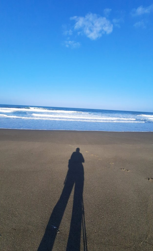
I walk.
I plod slowly up the beach.
Moving next to the constant ocean is to be in a timeless feedback loop.
Everyone always has walked this. This is what we do.
I don’t have the same motivation on an out and back trip that I do on a linear trail. I could turn around at any point. There is no real goal. I will be where I need to go even if I don’t leave. Eh. Then why go? I like progress. The kind of progress where the quickest way out is through.
I find what looks like an extra outlet for the New River far before where it should be, but thats what happens on the ocean: rivers migrate, water finds a way to make new inlets and outlets. The tide is rising and I can see that water passes between river and ocean here, and I don’t want to be on the wrong side of the tide… especially since the next low tide isn’t until tonight. So, I only walk another half hour north before turning around.
After I make it back to the south side of the river breech I find a windblock of a sand dune and spread out my tvek for a break.
Then I walk back and watch the colorful sails race up and down the lake.
Look close….there are about 20 folks out there
When a week is so slow and meditative that you are ready to get back to the frey, than its time to go. We’ll be wheels up in the morning (or later if there is wind for one last foil session).
Mission accomplished. I’m sufficiently rested and ready to taken on the world.
Nothing like a little adversity to put some pep in your step.
Low tide was at 4:45am. The Sixes river crossing was 5ish miles from our campground. The Elk River was another handful of miles past that. Both should be crossed at low to mid tides. High tide is at 11:15am. What time should I start?
😬
Add in storm surges and rain.
😬😬
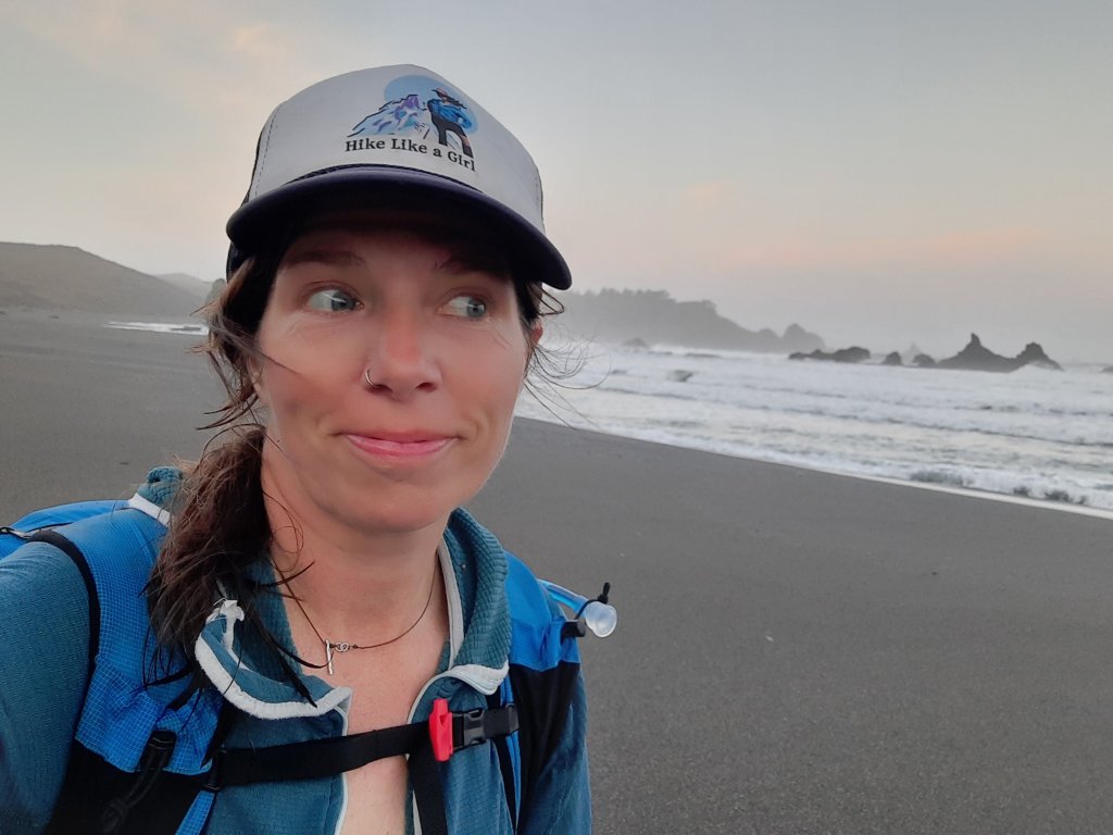
I decided on a 4:30am start, 3:50am wake up to make coffee and pack my day bag.
Out by headlamp. I should get to the first river crossing just at first light. No problem, right? Just hike hard and don’t stop.
Fortunately, Kirk and I hiked a few miles of this section of the Oregon Coast Trail a few days ago when it was merely pouring, not dark and pouring. It was a lovely little coastal tree tunnel of a hike then. Now it is a dank dripping dark tunnel of odd shapes playing in the shadows of my headlamp. Let’s do this!
Kirk and I are based out of Flores Lake for the last week of September for some much-needed R&R. Kirk has fallen down the foil boarding rabbit hole for a while now, and we were camping next to one of the best places to foil board in Oregon. (The link is not a photo of Kirk…maybe one day he’ll get some air!) Flores Lake is an inland lake that sits a mere sand dune away from the ocean, and all that wind is perfect for wings, kites, and sails.
He saw water. I saw trail.
We were also camping on the Oregon Coast Trail, well, everywhere on the coast is the Oregon Coast Trail. I had done small sections here and there, but nothing very deliberate. This would be the same: more opportunistic than intentional. I perused my copy of Bonnie Henderson’s Hiking the Oregon Coast Trail. Bonnie’s book is a wonderful resource and has most of the information you could want…aside from real-time conditions, which turns out is very important! I can imagine hiking the whole trail is a daily race against the tides…but then again there is something wonderfully humbling about walking next to the ocean. Your agenda becomes very small next to the expanse. You are on ocean time out here, and that is something you can’t forget.
But back to the hike.
The sky dried up shortly after I left the warm camper, and brought a brillant blue to keep me company.
I kept a brisk pace and made it through the river fords in time. Both crossings were almost fanny pack deep. Almost, but not quite.
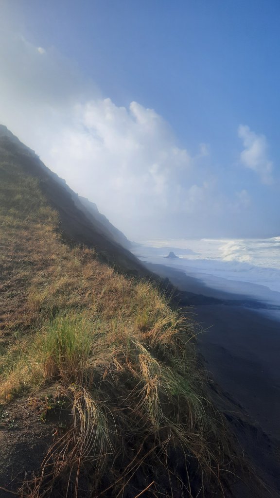
I thought I could relax then…I had been hiking hard for about five hours and was ready for a sit-down. I found a bluff perched over the incoming tide and puzzled over the next section. The guidebook didn’t say anything about high tide and the beach disappearing on the last stretch to Port Orford, but there I was, looking down at a beach with just feet of sand showing and the tide continuing to rise. No mam! I would NOT be walking that spit of beach. It must be the storm surges, surging up on the beach I was supposed to walk. I could wait hours for it to come back down again, or find a way around.
That’s a hard no for me.
After quite the deliberation and some fancy map work, I managed to get myself to Highway 101 and continued my hike south from there. It wasn’t as picturesque as the beach would have been, but it was safer, and on a thru-hike, it’s about connecting footsteps, right?
But I wasn’t on a thru-hike. I was on a day hike. 😔
Nevertheless, I did what all good thru-hikers do when they get to town: look for food. I came up to Crazy Norwegian’s Fish and Chips shop and ordered a snack while I waited for Kirk to come meet me for lunch.
The higher-than-usual tides and river crossings certainly make the Oregon Coast Trail something to respect and plan for. When I come back I’ll bring a packraft….those river crossings would be a cinch most of the time with one of the tiny inflatable boats like I used on the Columbia Plateau Route this spring.
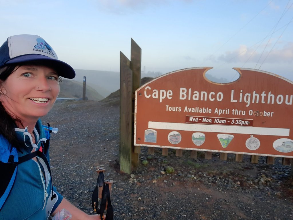
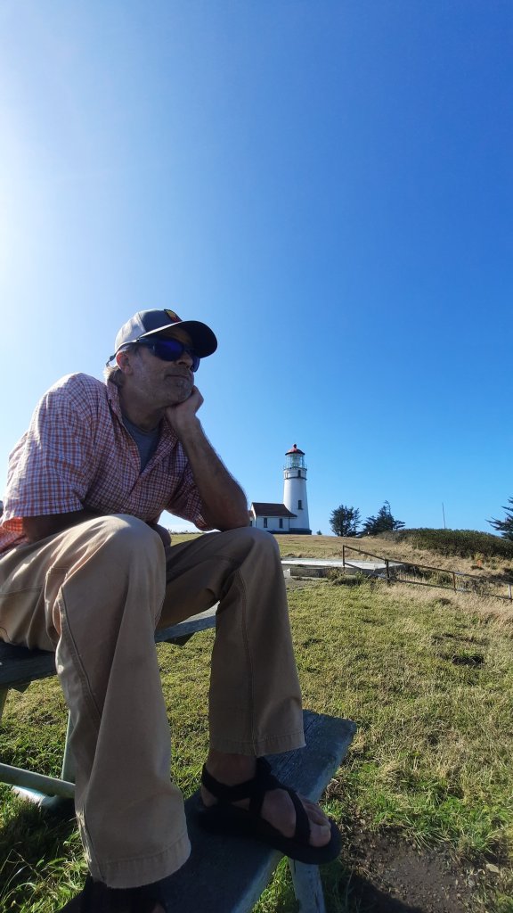
The rest of the afternoon we did the tourist thing, walked the beach (!!) And visited the Cape Blanco light house which I had crusied by hours ago.
I’m not sure when I’ll be back to hike more (or all), but you can be sure it is on my list, that ever-growing list of trails and routes. I’ll be back, oh yes! I’ll be back.
If you have read this far, thanks! If you want a sneak peak at what I’m up to next, click here. More info coming soon 🙂


