Blue Mountains Trail (Section 1) – Day 5: 22.9 miles (86.6 miles total)

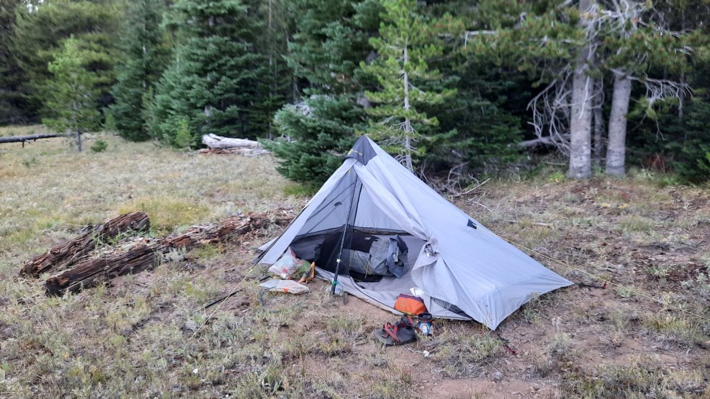
I could see flashing from under my closed eyes. I hadn’t been sleeping for long when a massive and fierce lightning storm rolled through. Rain poured, thunder crashed, and I lay in my tarp willing the lightning strikes to pass me by and leave the terrain I still had to travel alone.


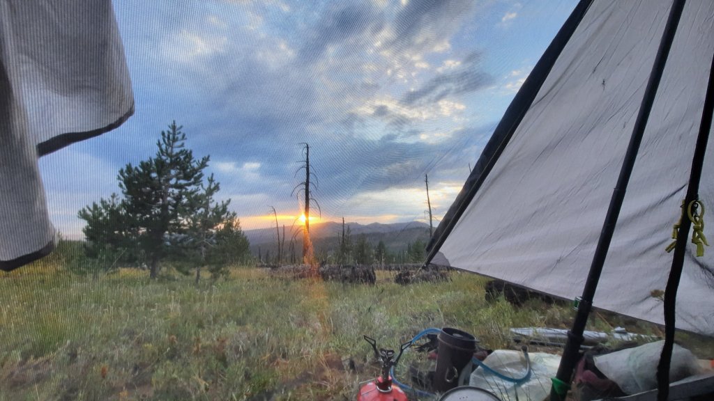
I slept hard, and in the morning decided on an extra special treat: dessert for breakfast! I had picked up a triple berry crisp when ordering a few things from Garage Grown Gear, and this caught my eye. A berry delight with my morning french press coffee? Don’t mind if I do!


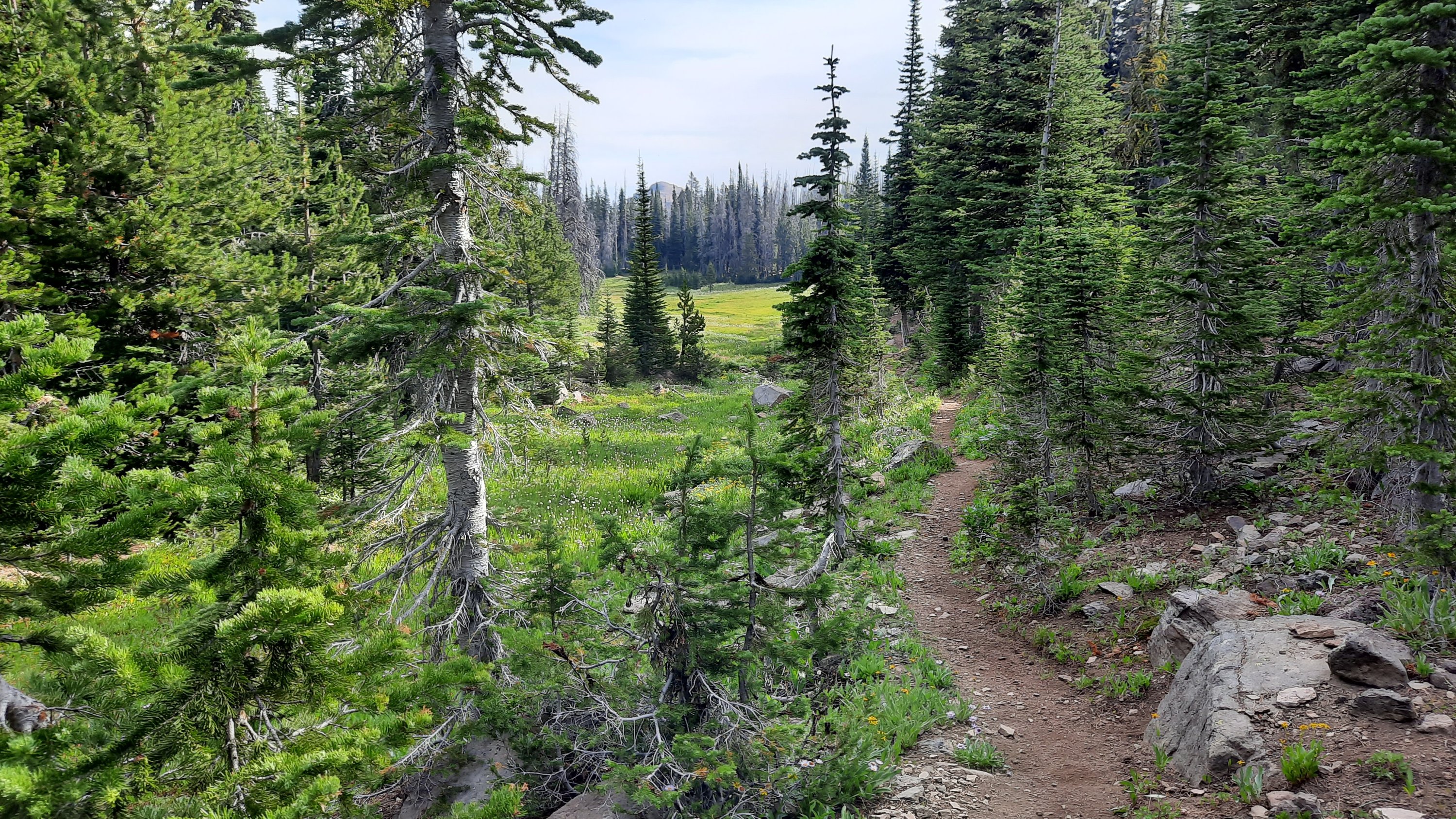
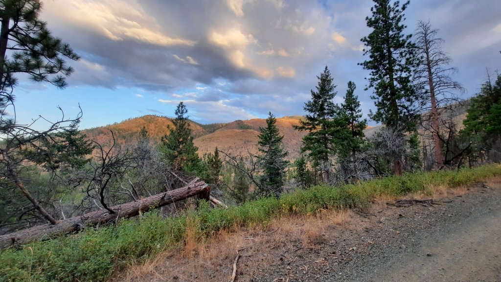
I cruised up the road, noticing more and more smoke. I tried to find more trails…and always they petered out and I found myself on game trails searching for the real thing. I guess it doesn’t get more real than a game trail though, and it is a certain acquired skill to find them.

Trail or game trail?


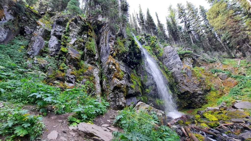
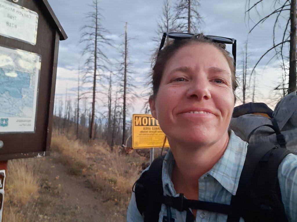
I decided to take a detour to capture some photos of a particular watershed that had some importance. Checking off a few conservation monitoring actions while on this hike? Sign me up!


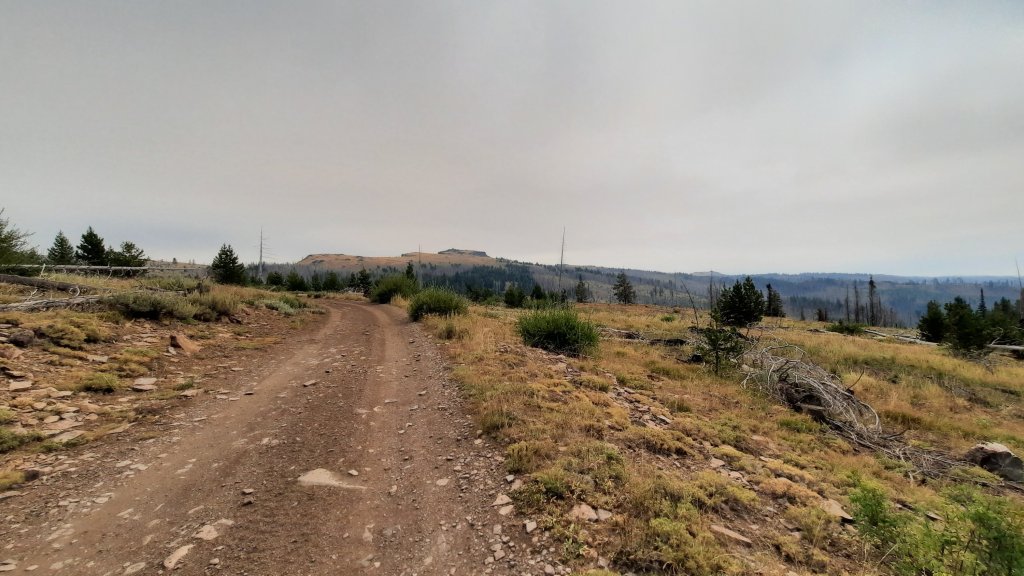
I made another route decision after my 4-mile off-route adventure and decided to keep walking the road up to the top of Table Rock. There was an active fire lookout there, and I was curious about all this smoke in the air. There was a trail through Monument Rock Wilderness, but it was torched and my notes said it probably didn’t exist. So up the road.


I passed a primitive campground at Elk Flat and noticed with disappointment that cows had gotten in the spring. Guess it’s cow water for me; I’d suggest an enclosure to keep the poop out of the spring right next to the campground…

A real picnic table to dry off my gear!


Onward. 


Then I came across a woman in the bushes. She was with the forest service and spraying invasive weeds on the side of the road. I picked her brain about the smoke and fires and learned, yes, there were a bunch of new fires, but no, they weren’t nearby. Whew!


I shared some stories and my encounters with recent trail work, and she said she would be sure to pass my appreciation on.

Yes!! 

Hazy day…with Table Rock coming into view


I was making miles, but the day eternally felt like evening…you know those wildfire suns that leave an orangy/red haze in the air? That was all day.


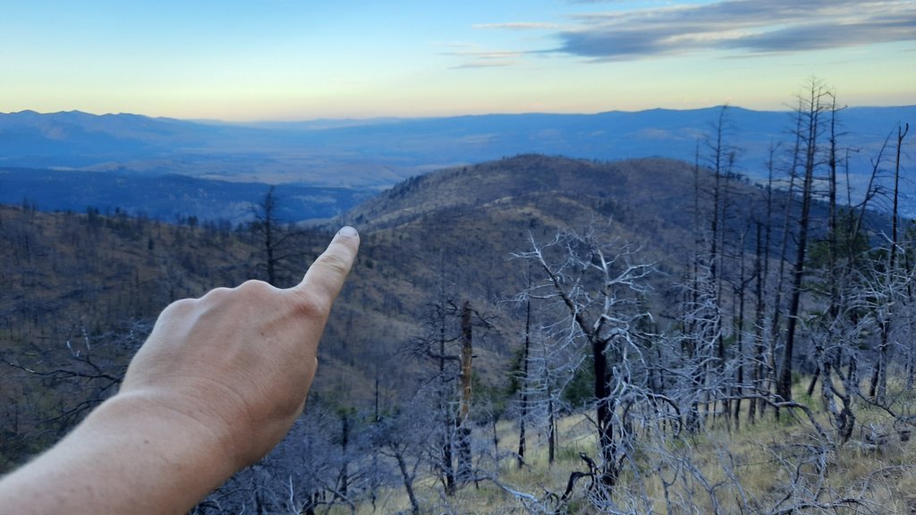
Since I had bypassed the trail through the wilderness, I didn’t get a chance to visit another notable drainage, so at a giant switchback in the road up to the fire tower lookout, I veered into the Monument Rock Wilderness for a few miles to take some more photos….and oh my…do I have a place at the top of my list to come back! The top of the ridge hadn’t been burned in the fire that claimed some of the lower reaches of the mountains, and wowowowow, I want to come back and explore, and it looks like there are more trails snaking their way through…

Monument Rock Wilderness


Once that mission was accomplished, I had some lunch and walked back towards the lookout. And the lookout! I have never seen a more dramatic and imposing lookout tower in my life. It was a mid-evil castle. It was a table of a rock that looked like a fortress, and i could see it for miles as I approached, could see its hulk overlooking the entire landscape. I guess that’s the point…


That’s where I’m headed next

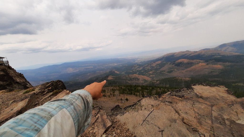
I took in the dramatic views all around, and let my sweaty back dry in the hazy light. I had more trail down from Table Rock through more burn area; yep, you guessed it, a trail that might not be there.


I went within shouting distance of the working tower to ask the lookout if they knew any info on the next trail…but that person didn’t respond, I could hear crackling from the radio, and I guess they were pretty busy after the hundreds of strikes that landed last night. As I have seen and will continue to see firsthand, this is a fire-prone landscape. Very fire-prone. 


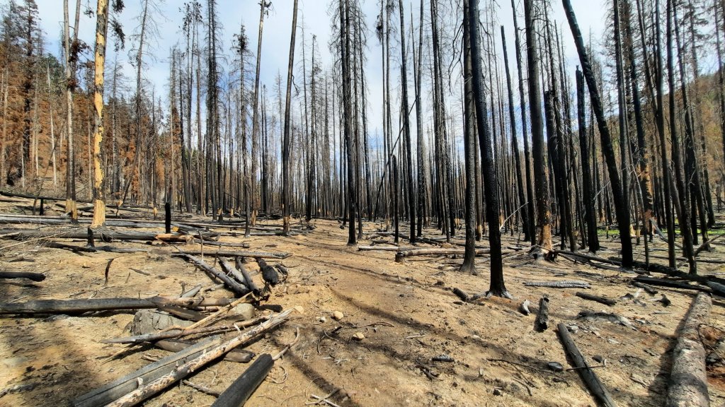
I hefted my pack on once more and walked over to the trail that started right under the summit. Another unmarked sign. I dropped off the back of the mountain into…surprise surprise, a giant burn area. Some thoughtful human had stacked cairns and even positioned burned logs to guide the way.

Looking back
Someone moved the logs to line the trail!

How lovely!

Just as I was taking some pictures and applauding the creative trail work, it ended. Looking at my map and phone, this “trail” had been taking me in the opposite direction than I wanted to go, but you know, these trails have been all over the place, so I never know if I should look for the trail where it should be, or where it happened to be.

When in doubt, see if the trail exists where drawn on the map. I made my way easily through the more intense part of the fire which burned almost everything clear to the ground. Then, to my horror, I ented the next zone of the fire…where only some of the trees are burned, some are standing, and some are resembling pick up sticks in front of me. Oh yeah, and there was a lot of new pine tree growth…super thick. 

Not fun…i.didn’t even take a picture of the worst of it


This is nightmare bushwacking. Pure nightmare. One step at a time, trying to push my way through without tripping or getting a stick impaled in my eye. One step at a time. I would eventually get out, right? I continued to work my way towards the line on the map and tried not to get overwhelmed. I looked for the path of least resistance in the trees. Finally, I spied a stand of timber that hadn’t burned…an island of refuge in the mayhem. 

Not fun


And then I found it! I found the trail! It was where it was supposed to be! These moments are pure gold. 

Much excite! I found the trail!


The trail hadn’t been maintained in a while, but it was infinitely more walkable than what I had just been through. So much relief!


I neared the trailhead, but then the trail kept going for another mile and popped me out where there was no trail on the map. Huh? Go figure. 


I walked road the rest of the afternoon, my feet increasingly unhappy with me. There had been no water since the dank cow spring…many miles ago, and I was rationing. I was determined to camp next to flowing water. I would hike as long as it took me to get there.


A lot of the drainages were dry, so I had to walk almost to the bottom of the mountains to find my babbling brook. And it was as good as I was imagining. 

Gear pile at camp

The Blue Mountains Trail

So back to the BMT. 


BMT stands for Blue Mountains Trail (a working title).


The Greater Hells Canyon Council has had the idea for a long-distance heritage hiking trail for years. Far longer than the Oregon Desert Trail has been around. I believe some work had been done before and there were some possible alignments on the ground, but the idea remained an idea for the most part.

A few years ago I was in La Grande to give a presentation about the ODT when Brian Kelly from the GHCC invited me for a chat. The organization wanted to make their trail happen, and wanted to pick my brain since the ODT went from 0 to fairly well established in such a short amount of time (trails can be decades-or-longer objectives for organizations)…and the model of a conservation organization creating a backpacking experience to immerse people in the landscapes they were actively trying to advocate for and protect was a common denominator.


I looked at some maps with Brian and immediately got excited about their vision. There were so many trails already on the ground in NE Oregon! The Wallowas, Hells Canyon, the Elkhorns, and more.


I suggested they think more about a route than a continuous trail, especially since there was so much trail around them already.


Routes link trails with roads and off-trail travel to meet their objective, in this case traversing the Blue Mountains. Roads are viable paths for walking and connecting to other trails. When you have a trail or a route that goes right through town, it’s a win-win for all. It makes hiker resupply and feasting opportunities infinitely easier (not to mention showers, laundry, sleeping in beds), you don’t have to spend hours trying to hitchhike to town and back, and you often meet people who like hiker stories so much that they become trail angels in these communities. 


I didn’t hear much more about the trail/route idea for a while…at least a year later I met Marina Richie, a GHCC board member, who was serving with me on an Oregon state outdoor coalition. In fact, on the same coalition was Jared Kennedy, an entrepreneur who helped start the Outdoor Project website. Jared and I had already crossed paths a few years earlier through the Oregon Desert Trail. 


Stay with me here…Jared’s dad is also a Greater Hells Canyon Council board member…and Jared and his dad decided to have a go at making the trail a reality. I had a series of phone calls and emails over the last six months where we talked about some good next steps. I was/am so grateful to participate in helping a new long-distance hiking opportunity launch.


So this summer Jared had a line on the map, and the plan was to see if it worked. 


Some friends will be ground-truthing the route from the other end soon, and I will be following them later this fall (if all goes well). It will be wonderful to follow their notes about what goes and what doesn’t and see if I can come up with some other solutions, or avoid the worst of the bushwacking. 


All and all though, it’s a grand adventure! So very exciting 😀 then I’ll have to connect it into the Oregon Desert Trail, naturally.

Blue Mountains Trail (Section 1) – Day 4: 23.5 miles (63.7 miles total)

So my main goal in being out here for a week is to ground-truth a series of trails and roads between John Day, Oregon, and a small little resupply spot along highway 26, Austin Junction. This 100ish mile section I was on was the first stab at linking together trails and roads in an attempt to complete a long-distance hiking route in northeast Oregon.

Yes, this assignment was made for me!

The route is the vision of the Greater Hells Canyon Council, a conservation organization based out of La Grande. I’ll tell you all about how I got involved in another post coming soon.

I woke up to a cloudy, moody morning. Last night was the first time I wore my fleece layer…so I was more than willing to welcome cooler temps.


This morning is a great example of why I built in some extra time to hike this route. Not long after leaving camp this morning, I noticed that even though I was hiking on the only trail in the area, I was pretty far off where the line appeared on the map. (I check Gaia often on my phone when I’m hiking something that might not be accurate). This isn’t unusual for short bits of trail, but this morning I was on the trail for 3 miles, much longer and farther than the maps indicated. Well, that’s exactly why I’m here…to find out what’s exactly on the ground.

I got to the trailhead and to my surprise saw a trail register in a kiosk! I signed in, very excited at the opportunity, and saw from the entries that, yes, in fact, a few folks had been through that month, and all remarked on the discrepancies. I think a trail crew left it… I love you trail crew!


I continue to the first paved road of the hike and went in search of water…unfortunately this turned into an almost 3-mile detour that involved an off-road hike down a drainage until I found water seeping out of the ground. Then I went in search of a trail that probably wasn’t there. My notes indicated the trail was gone, but I thought I should do my due diligence and check it out. And no trail. OK! There was an alternate indicated on a series of dirt roads nearby, so I climbed up to a feature named starvation rock, then began a cross country hike up the remainder of the ridgeline. A cool 1,000′ in a mile. Oofftaaaa.


The road up top existed and made for some sweet and easy walking. I walked under Lookout Mountain and at a saddle between Glacier Mountain (no glaciers to be seen) started down into the Sheep Creek drainage.


This was another area that might be nearly impassable due to a recent fire. Extremely recent it seemed, the ground was scorched bare. Right away I started seeing fresh cuts on the burnt logs crossing the trail…oh happy day! It seems like someone had just been through here to open up the trail…maybe just days or a week ago! I started singing a little song that mostly involved “thank you” over and over, with a few “trail crews” thrown in. I could see what backbreaking work it must have been, and was even more grateful. 


Most of the 5.5-mile trail was cleared minus a small section in the middle. The fire ravaged everything, and there was no place to camp or even a good spot to access the water…but there was water, so that was notable!


I reached another paved road and turned left. My next trail up an unnamed drainage was marked “probably doesn’t exist.” I started down the way…so far it didn’t really exist, and then spied a large camp the direction I was going. Now I didn’t see anyone, but I got the sense that I didn’t want to be seen. I have to listen to my gut when it flares up. This feeling was that I should avoid walking by the camp. 


Since the trail was probably gone, I decided to road walk around. It would add a bunch of miles…but again, when I’m feeling vulnerable out here I can only do what is in my control, and today that was to find another way.


Partway up the road around I pulled off on a side road that led to a big campsite. I walked to the back and found a flat shelf overlooking the drainage that may or may not have a trail. 


And what did I see on a log??? A beer bottle. Not so unusual, except this beer was unopened.

I picked it up.

The sun had faded one side of the label, and the bottle date was just last year….so….

I opened it, and enjoyed my trail magic as only a dirty tired hiker can. 

Blue Mountains Trail (Section 1) – Day 3: 16.5 miles (40.2 total)

I woke up smelling wildfire…a storm had moved through last night, dumping a bit of rain and one rumble of thunder.


I slept a few hours later than yesterday and know my body needed the extra rest. This hike is demanding, and I’m trying not to burn myself out too fast. Listen to the body!


In fact, the physical challenge is preventing me from thinking about much else…exactly what I needed.


I made it to the shoulder of Strawberry Mountain, a hulking 9,300′ mass of rock towering over John Day. I decided to pass on the summit because I wanted to leave time to deal with overgrown or fire-damaged trail. And, I wanted to spend a little extra time swimming in Strawberry Lake!!! 


I had reception on the shoulder of Strawberry Mountain, so I called my dad for his birthday. He is 72 years young today.


The walk down rivaled any alpine mountain wonderland. Lush wildflower-covered meadows, babbling brooks, towering mountains, and waterfalls.

That’s a patch of snow!


I ran into the first people of the trip near Strawberry Falls. The first trailhead I’ve encountered is a short hike away from Strawberry Lake…my next destination. 


Unfortunately, the spot i picked for a swim was shallow and mucky,  so I resorted to splashing off.

Strawberry Falls
Taping up the feet at Strawberry Lake


I filtered some water and readied myself for the next climb….and climb I did. The next destination for some at the trailhead is Slide Lake. I would be heading in that direction for a while, which meant the trail was in great shape. For as stunning as this mountain range is, it is remote enough that it doesn’t get much traffic, and trail conditions away from the one popular trailhead were not awesome. That said, the trails weren’t totally neglected, I have only had a few spots where I lost the trail so far.


And then down and back up…and that’s when some big trees were down on a steep bunch of switchbacks…it appeared that someone had gone through because branches were broken at just the right spot to climb over. I did overshoot a switchback and must have been following a game trail instead of the real trail. I caught myself before I had gone too far (thanks GaiaGPS!).


The rest of the afternoon I strolled in and out of burned areas, but there was always a way through…I looked for the cut ends of logs which indicated a trail crew had gotten most of the trees cleared from the actual tread. 


I called it a day just short of another trailhead. I will have some gravel road walking, and some trail that may or may not be there tomorrow.

Blue Mountains Trail (Section 1) – Day 2: 16 miles (23.7 total)

Today was hard. 16 miles of hiking along rocky ridges…it was stunning and rugged, and I’m wiped.

I took it easy in the morning, although I was up before the sun and walking by 6am. I hoped I hadn’t burnt my legs out yesterday with the climb, heat, 7 days of food, and lots of water.

Sunrise with pack

To my delight there was water in each of the drainages marked blue on my map. In fact, there was water flowing over the trail that didn’t even show up on the map. For a desert mountain range in the middle of August this was magical, and the opposite of what I had expected given my experience with desert mountain water sources on the ODT south of here.

The saddle where I camped last night

I took some breaks but kept moving slowly up the trail. There was a lot of exposure, and it had me uber focused on each step I took to avoid a tumble down the mountains. The level of attention the hike demanded was exhausting…my body and mind were 100% focused on the task at hand: don’t fall off the mountain.

The views though…

The trail took me through old burn areas where manzanita had started to encroach and obscure trail. Sometimes I just headed where I knew the trail was going, Sometimes I thrashed, hot and frustrated.

It was warm today, but some cloud cover helped me avoid triple-digit temps on the ridge walk.

The clouds gathered more steam, and a few drops practically sizzled on my skin when they decided to finally start falling. I passed an unmapped water source on the trail, setting my sights on camping at the next one just a little way up the trail. Of course, the trail went straight up (literally) from there, and when I arrived, wouldn’t you know it, this marked drainage was the first one without water the whole day. I had to backtrack, and there is no backtracking 😦

So tired. Rain, thunder, sleep. Tomorrow: more manzanita, the highest point on the route (for this section) and swimming potential…

Blue Mountains Trail (Section 1) – Day 1: 7.7 miles

At 5:30pm it was still 99 degrees. I had walked out of town about 4pm, willing the temps to go down as I looked at the thousands of feet I needed to climb.

By 5:30 I had left the last of the paved road behind. It felt like walking through a broiler … the road was covered in fresh shiny black chip-seal…but I wasn’t a piece of cheese toast melting to perfection under that hot; I was a hiker with 7 days of food in their pack and an unbearable quantity of water. I was hiking something of sorts that hadn’t quite been done before…at least not from the town of John Day, and I had no water knowledge for the first 30 miles of this new route.

Just what is the BMT you might be asking? Hang with me friends, all will be revealed in good time. But for now, that climb, and the main goal: don’t pass out from the heat.

Thank goodness my boyfriend Kirk is a smart man. When looking at the logistics for this hike yesterday, I realized what the climb entailed and saw the crazy hot temps forecast. Kirk suggested I slackpack myself partway up the mountain.

I think that saved me.

As I was setting up my bike shuttle earlier (this is a self-contained, one tank of gas, as little contact as possible hiking trip.. cause you know…COVID) I drove to the end of the pavement and stashed a bunch of water and half my gear. Hike smarter, not harder. I would walk out of the Oregon mountain town, John Day, with my most precious cargo: a week of food, sleeping bag, and tent.

I lay sweating in the shade next to my cache for the next hour, waiting for the evening hours before setting out again. I had another 2,000′ on deck, up into the Strawberry Mountains Wilderness (did someone say strawberries?!?)

I didn’t have a set goal for the day, so I simply lumbered up the steep gravel road towards the Crane Mountain Trailhead.

I passed several water sources, but they were all below a former mining site; the map was sprinkled with mining prospects, and my sweet repose was next to some mounds of tailings….all signs that led me to pass on any water downstream of these places. Who knows what might have leached into those water sources.

I encountered no cars on the next few miles, and as I sweated my way to the trailhead (almost at the crest of the mountains) it was almost dark. Wanting to sleep on the trail for my first night, I started down the single-track dug into the steep sides of the ridge and wrapped around to a saddle just as I was having trouble seeing the trail anymore.

I found a flat-enough spot and set up my tent…it was windy and clouds threatened moisture, a threat I very willingly desired.

Night one on the BMT. Bring it.