So my main goal in being out here for a week is to ground-truth a series of trails and roads between John Day, Oregon, and a small little resupply spot along highway 26, Austin Junction. This 100ish mile section I was on was the first stab at linking together trails and roads in an attempt to complete a long-distance hiking route in northeast Oregon.
Yes, this assignment was made for me!
The route is the vision of the Greater Hells Canyon Council, a conservation organization based out of La Grande. I’ll tell you all about how I got involved in another post coming soon.
I woke up to a cloudy, moody morning. Last night was the first time I wore my fleece layer…so I was more than willing to welcome cooler temps.
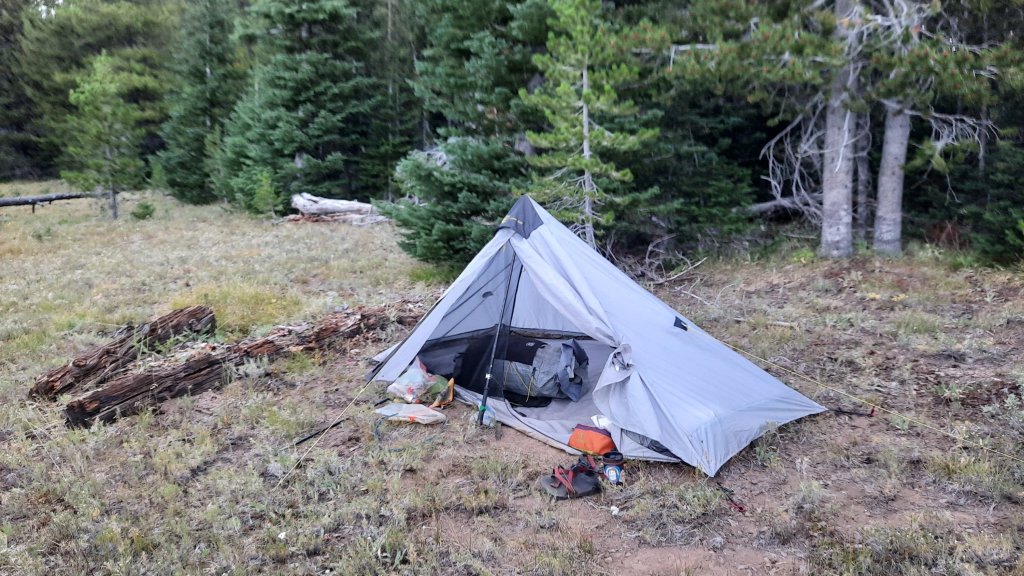

This morning is a great example of why I built in some extra time to hike this route. Not long after leaving camp this morning, I noticed that even though I was hiking on the only trail in the area, I was pretty far off where the line appeared on the map. (I check Gaia often on my phone when I’m hiking something that might not be accurate). This isn’t unusual for short bits of trail, but this morning I was on the trail for 3 miles, much longer and farther than the maps indicated. Well, that’s exactly why I’m here…to find out what’s exactly on the ground.

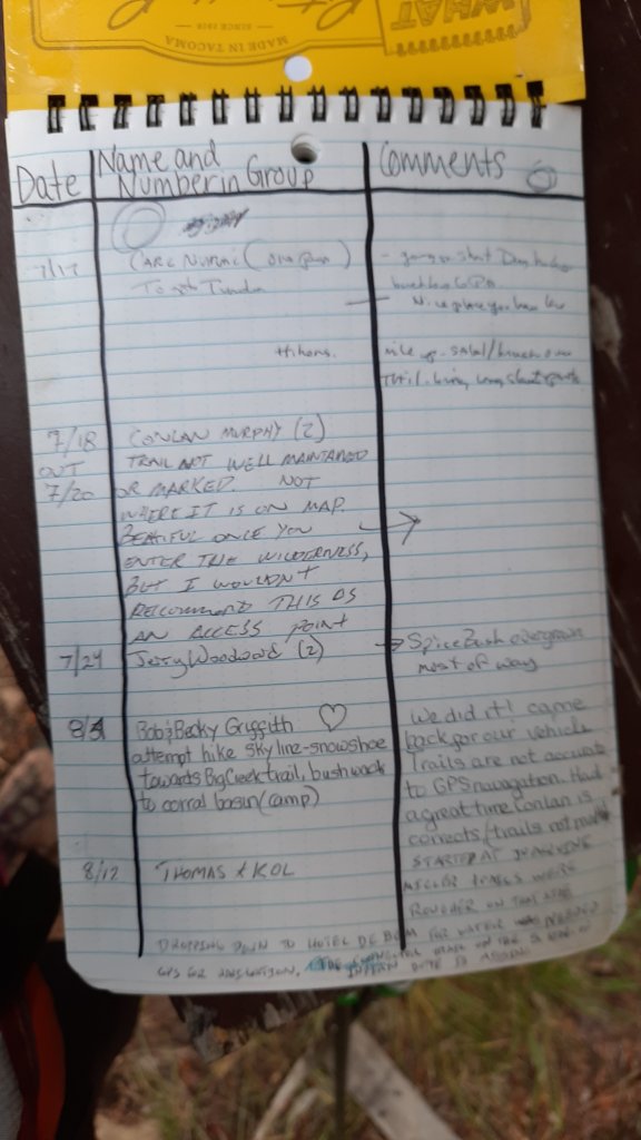
I got to the trailhead and to my surprise saw a trail register in a kiosk! I signed in, very excited at the opportunity, and saw from the entries that, yes, in fact, a few folks had been through that month, and all remarked on the discrepancies. I think a trail crew left it… I love you trail crew!
I continue to the first paved road of the hike and went in search of water…unfortunately this turned into an almost 3-mile detour that involved an off-road hike down a drainage until I found water seeping out of the ground. Then I went in search of a trail that probably wasn’t there. My notes indicated the trail was gone, but I thought I should do my due diligence and check it out. And no trail. OK! There was an alternate indicated on a series of dirt roads nearby, so I climbed up to a feature named starvation rock, then began a cross country hike up the remainder of the ridgeline. A cool 1,000′ in a mile. Oofftaaaa.

The road up top existed and made for some sweet and easy walking. I walked under Lookout Mountain and at a saddle between Glacier Mountain (no glaciers to be seen) started down into the Sheep Creek drainage.

This was another area that might be nearly impassable due to a recent fire. Extremely recent it seemed, the ground was scorched bare. Right away I started seeing fresh cuts on the burnt logs crossing the trail…oh happy day! It seems like someone had just been through here to open up the trail…maybe just days or a week ago! I started singing a little song that mostly involved “thank you” over and over, with a few “trail crews” thrown in. I could see what backbreaking work it must have been, and was even more grateful.
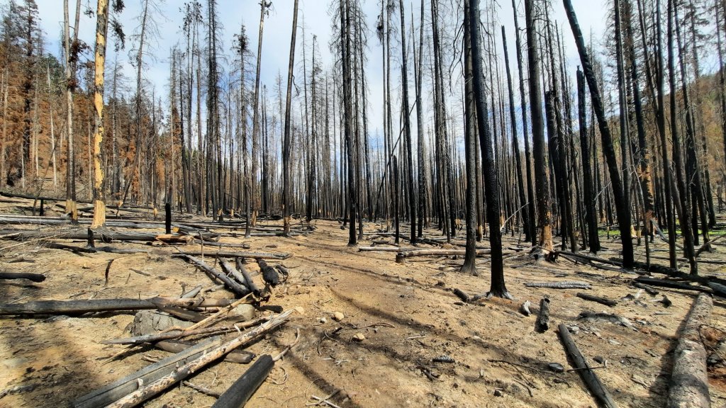
Most of the 5.5-mile trail was cleared minus a small section in the middle. The fire ravaged everything, and there was no place to camp or even a good spot to access the water…but there was water, so that was notable!
I reached another paved road and turned left. My next trail up an unnamed drainage was marked “probably doesn’t exist.” I started down the way…so far it didn’t really exist, and then spied a large camp the direction I was going. Now I didn’t see anyone, but I got the sense that I didn’t want to be seen. I have to listen to my gut when it flares up. This feeling was that I should avoid walking by the camp.
Since the trail was probably gone, I decided to road walk around. It would add a bunch of miles…but again, when I’m feeling vulnerable out here I can only do what is in my control, and today that was to find another way.
Partway up the road around I pulled off on a side road that led to a big campsite. I walked to the back and found a flat shelf overlooking the drainage that may or may not have a trail.
And what did I see on a log??? A beer bottle. Not so unusual, except this beer was unopened.
I picked it up.
The sun had faded one side of the label, and the bottle date was just last year….so….

I opened it, and enjoyed my trail magic as only a dirty tired hiker can.

So glad you are doing this trail-truthing and helping out on the BMHT. The wonderful postings are icing on the cake. Thank you.
LikeLiked by 1 person
Thanks Charlie! Very excited to be involved explore more of NE Oregon and learn more about the GHCC
LikeLike