It rained off and on during the night, but I stayed toasty warm and dry. I’ll do a detailed post when I’m done about strategies to hike in the wet and cold. I’m carrying lots more gear than I would on a summer hike, but all these layers mean multiple redundancies to keep me and my gear dry.
The first miles in the morning were along roads dripping with rain, but I was able to put my umbrella on standby for the most part.
When Fleetwood Mac’s Dreams came on, I was instantly transported to a place where I was cruising on my skateboard, not a care in the world. Oh wait…that wasn’t me. Have you seen this video? I’ve probably watched it 100 times at least. I think it has gone viral for a reason, the pure feeling of freedom and lighthearted joy is what we all need right now.
I did my best to get a flow going on those rarely used roads, and if I had an audience for my antics, it was a few chipmunks and maybe the odd deer hiding from all the hunters out here. Kirk did get me a long-board for my birthday this year, so I’ll be working on my skating with one particular sequence in mind….
All of the walking was on roads today, so I let my mind wander.
I stared listening to a Barry Lopez audio book last night….that language! It’s amazing, and his passion and poetry for the natural world resonates deeply with me. I had the opportunity to hear him speak in Bend last year for the release of his newest book Horizon. That was actually the first time I had read his work…I’m not sure how that happened, I tend to gravitate towards writers like him. I know he lives in Finn Rock on the McKenzie River. We boated past Finn Rock probably four times with our friends Brooke and Adryon this year (they are learning how to IK! How exciting!) But Finn Rock is a few miles from Blue River…and those areas were devastated in the Labor Day fires….does anyone know if Barry Lopez is ok?
The sun came out….it rained….it rained while the sun was out…it hailed…the sun came out. Repeat. I might have gotten my tent more wet when trying to dry it out over lunch.
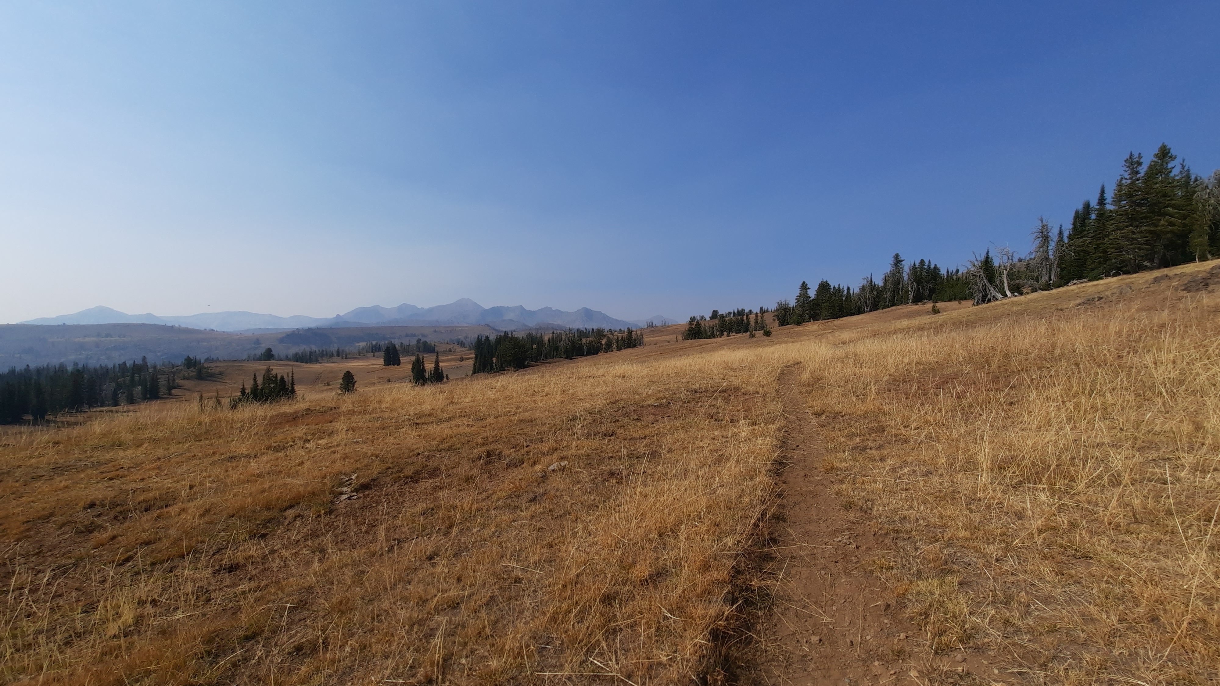
The rolling roads are taking me due west to the next river canyons that are so important to this area.
I had some reception during the day, so posted a few more photos to Instagram. I’ll do a big upload of photos when I get home in November, but for now the Insty is a way to see some pics.
I was up when the sky began to lighten and transferred the food box I had mailed to Christina into my pack. The rain hadn’t started yet, so I packed up my tent and gear while everything was dry. The forecast forecasted 5 days of rain, so I tried to stay ahead of the wet. The snow levels were dropping, but so was I. For the next few days I would be walking between 4,000-5,000′ on a series of dirt roads until I dropped down into Joseph Canyon, hopefully for a quick crossing and up the other side.
The Intrepid Three had gone a longer route into Joseph Canyon and came back with tales of bushwacking through blackberry thickets and poison ivy. I didn’t need any part of that, so we scoped out a few other ways in. None of them look easy…but that puzzle is for another day.
Christina came over bearing another gift…a smoothie! It was the sort of magic exlier filled with ingredients that make your body want to be better…and it helped. The afternoon of sitting and eating the good food that my trail angel brought had toughened up my blisters and eased the ache in my shins. Even partial days off can be a life saver on a long hike as your body knits itself back together again.
I had a couple of route choices in here, and after hearing from Christina, decided to take the longer more southerly routes. Why? It would take me to the Zumwalt Prarie, which as I came to understand, is the last of the paulouse (sp??) prairie left in the country. All the rest has been converted into wheat fields. (Someone may need to fact check me here…I should have been taking notes when Christina was talking, and now a day of walking may have altered the facts a bit in my brain.) A chance to walk through the last of a particular ecosystem? That’s a good reason for me.
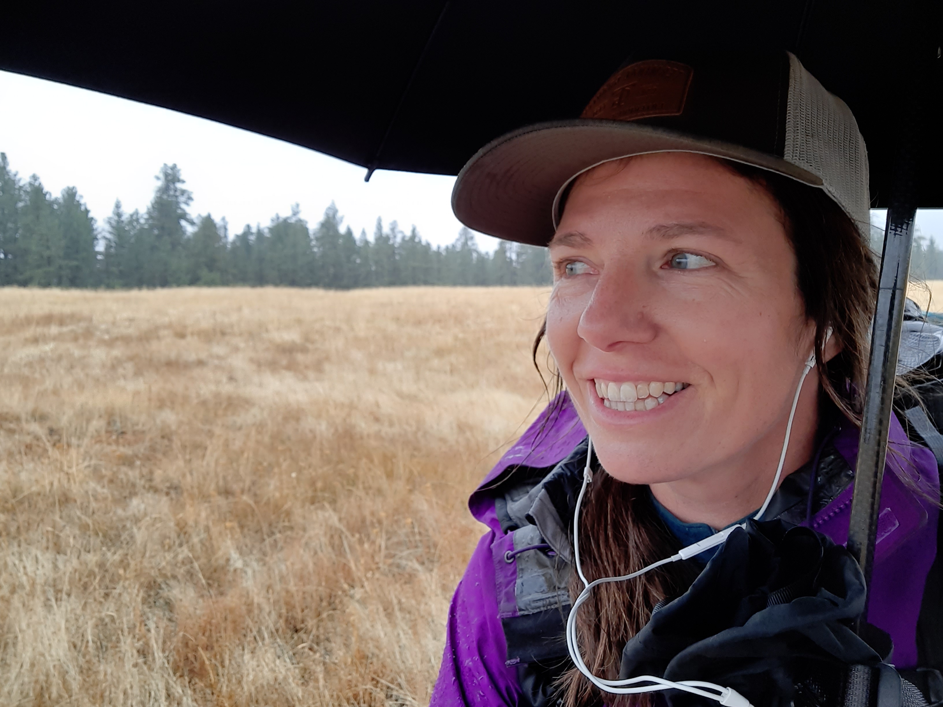
Christina decided to walk a few miles with me, so we set off under a still-dry sky. She is a wealth of information and good ideas…I’m glad she offered to resupply me again in Troy so we have another chance to connect.
Right after she decided to turn around, the first few drops started to fall. I pulled over under some trees to switch to my rain gear. I should be in good shape to walk through cold rain and snow on this trip, and was pretty happy that I was carrying all that extra gear. I had shoved a synthetic vest in my resupply box, and now I could tell, that vest would be a key piece of gear to keep my core warm in the cold wet.
The walking was quiet in the dripping ponderosa pine forest. I encountered an unknown access problem on one of the roads, so had to find a way around. My cross-country route was also blocked, so I headed north to walk around. The detour added five miles to the day, but it’s something I expect from time to time, and a small price to pay when groundtruthing a new route.
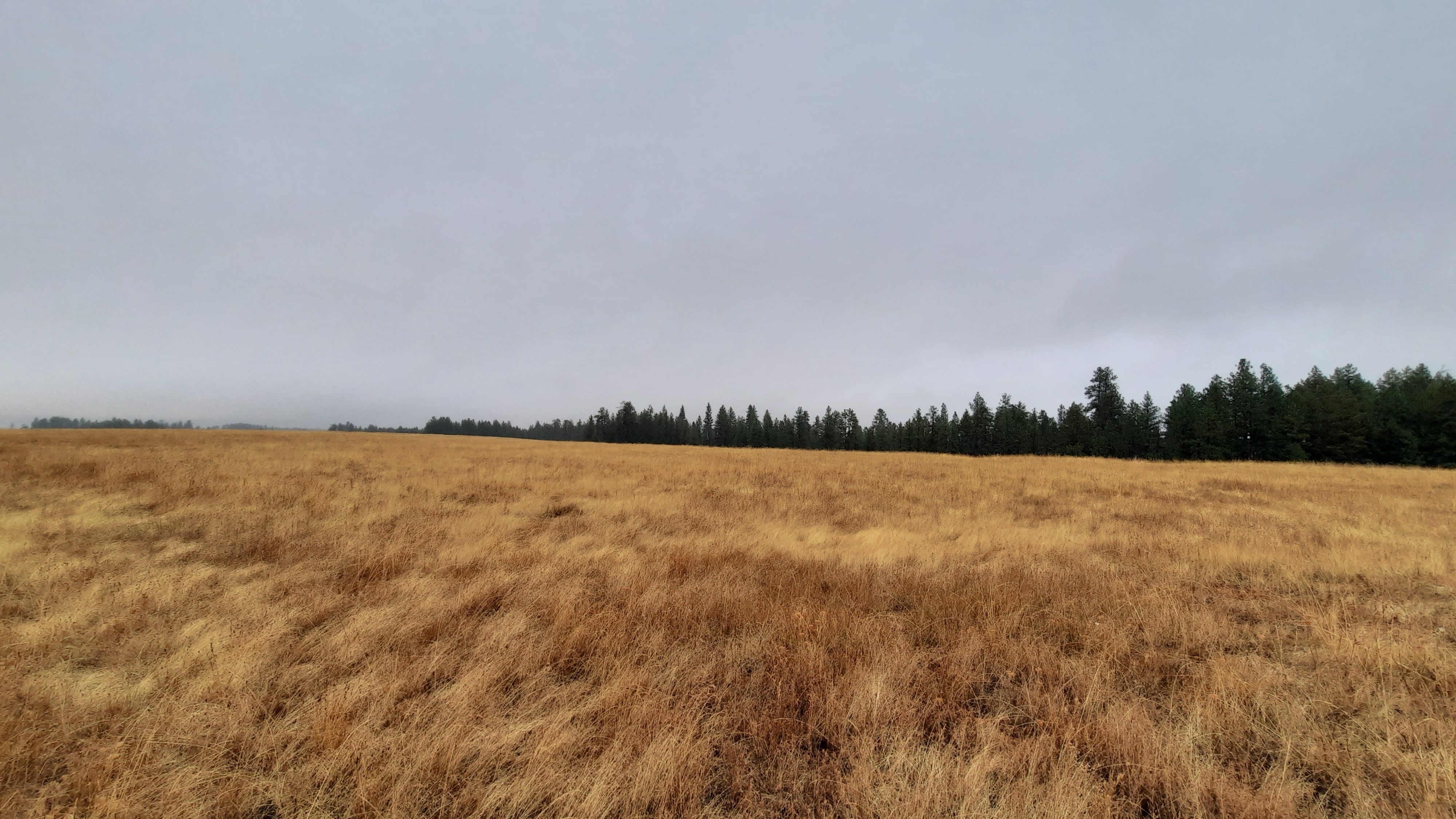
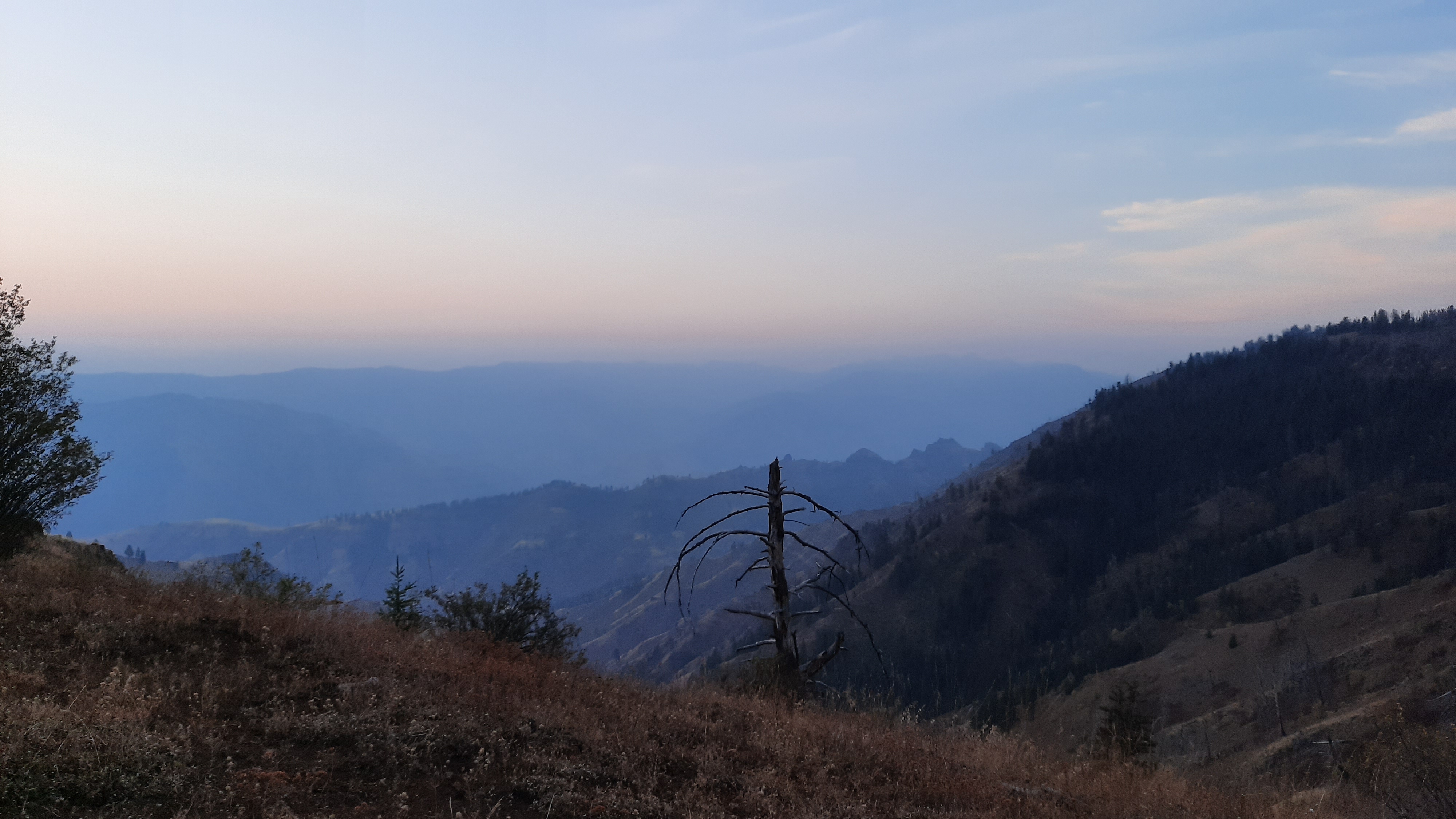
It rained all day save for a few minutes when I was on top of Cayuse Ridge. The native prairie areas were beautiful, especially in the misty rain that made the golden grasses shine.
I was ready to call it a day after a few more miles, so found a little perch for my tent that would be out of the gusty winds that were expected over night.
It’s a little more work to relax when arriving at camp wet and in the rain, but before long I was warm and ensconced in down and tent.
I was up just before the sun, drinking coffee and writing. When day broke I was once again surrounded by incredible beauty. This trail so far has been world class in views and terrain. It’s not easy, but then again, most things worth doing aren’t easy.
I touched the Imnaha river again. Remember night one when I descended from Hawkins Pass to sleep near the headwaters? Well here I was again near the end of the Imnaha’s run to the Snake River. This river does have a road alongside it the whole way, but I would love to come back with boats and experience this landscape from moving water.
The problem with hiking down from the top of these ridges is that you have to go up the other side. I was looking at a climb of over 4,000′ in just a few miles. By the time I set off it was late morning, and for October, the temps were in the 70’s….all things leading to a sweat-fest of a climb.
The first marker I saw was for the Nee Me Poo Trail, which is what the Nez Perce call themselves…to really put this climb and moment in place, I was listening to Thunder in the Mountains, the heart-wrenching story of Chief Joseph’s attempt to keep his tribe’s homelands of the Wallowa Valley for his people when homesteaders started trespassing in the mid to late 1800s. Ultimately they were pushed out; this trail I was walking was part of their exodus. (BTW, remember that I finished the CDT at the Chief Joseph Mountain trailhead on the Canadian border? Yep, the Indians marched from right here, their homelands that are at this moment under my feet, to Canada via Montana). I have a lot of rage and anger for what “progress” and “manifest destiny” did to the people we thought were inferior. I have a lot more reading and thinking to do, and my understanding of the Nee Me Poo people is just beginning. This history is part of the Blue Mountains Trail. It’s almost too much to take in, but my hope for the development of this route is to give hikers a reading and resource list so we can be learning as we are moving through this landscape. It’s past time for us as hikers to engage in a deeper way with the places we are walking through.
So back to the climb. It was brutal, but actually there was a lot of shade, berry bushes, apples, and water. It was gorgeous.
When I was almost back on top I collapsed onto the ground in a puddle of my own sweat. I lay flat out for a good half an hour before I considered moving again.
Fortunately the next few miles were on a blissfully graded old road (I LOVE a road walk after a hard section of trail).
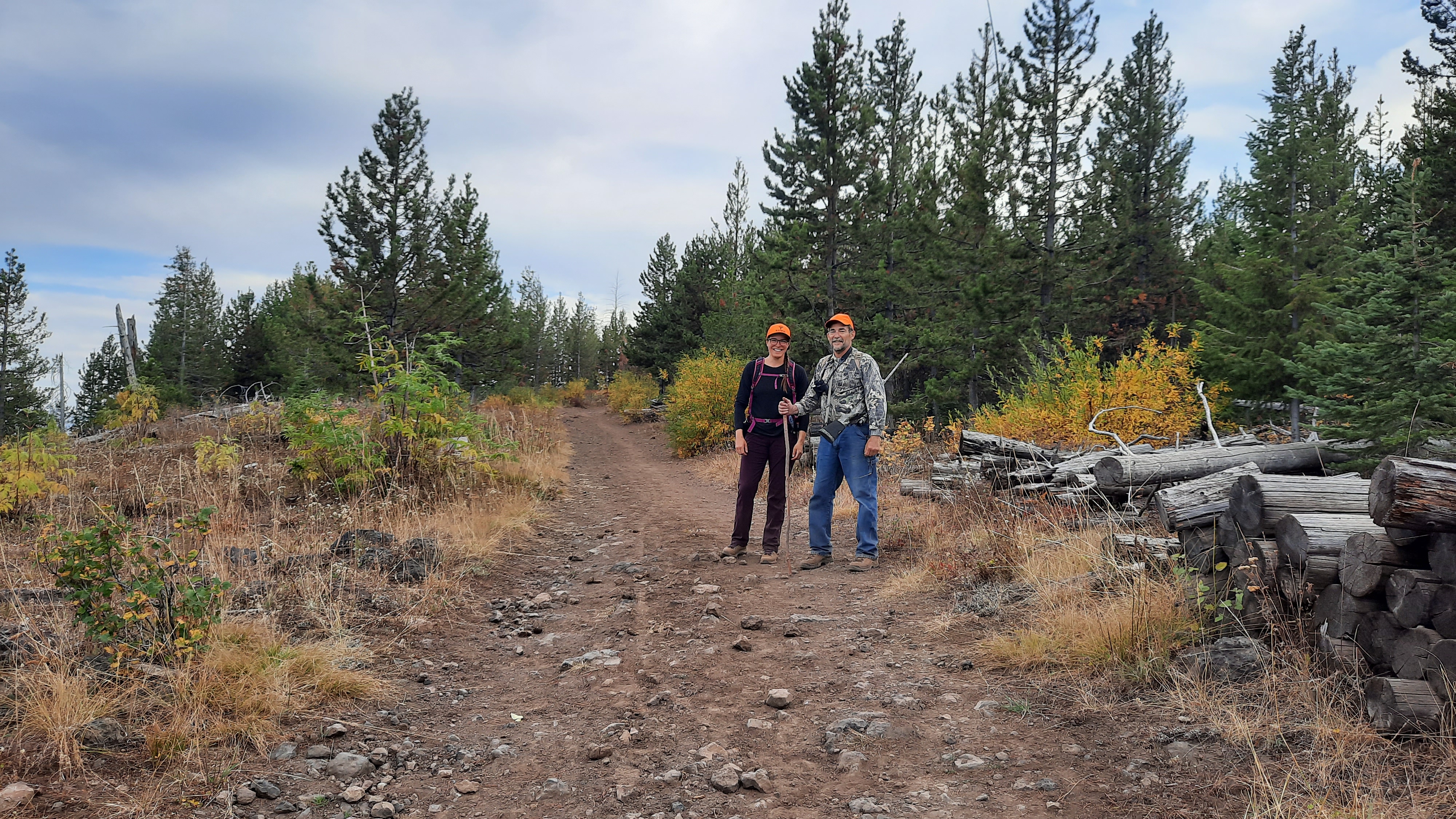
I was meeting Christina from the Greater Hells Canyon Council at Buckhorn Campground in a few hours. I had mailed her a resupply box, and she offered to come out and camp with me for the night. Company! Food! More bandaids!
I got to the campground and chatted with a few hunters who immediately offered me cold drinks and various other luxuries. I hobbled down to a spot by a deliciously cold spring, and proceeded to sit and air out my blisters until Christina drove up.
What a night! She made amazing food, brought fresh fruit and veggies, chips and salsa, wine…it was a wonderful evening and I know I connected with another kindred spirit trying to navigate this world with intention and grace. So far the people I have met on this hike give me hope, and its exactly what I need right now.
Every day my feet feel better and my body stronger. Today it might be the intoxicating cocktail of a cup of french press coffee, turmeric cashews, and a few vitamin I, but I’ll take it! (turmeric is anti-inflammatory…I put a little in my oatmeal every morning too).
I love my body the most when I’m thru-hiking.
The morning brought a quiet walk along the edge of the world before I turned left to continue on the ridge; the Snake River below also began a left turn on its journey to the sea.
I walked through meadows and forests, a number of springs flowed into troughs and I spied more hunting camps in the thick woods. As I was approaching Lord Flat I remembered a note that Whitney had passed on after he hiked through…to stay on the runway because the trail/road disappeared there. Just about that time I look up to see a plane circling….an active runway I see!
As I rounded the corner I saw a group of hunters eagerly awaiting the plane. The runway was little more than a two-track in the grasses, but sure enough there was a windsock. As the plane landed I put on my best smile and asked the group if I could lighten the load by taking some cold drinks or snacks off their hands. One guy went to a tote and brought back four cliff bars. Ahhhhh, thanks guys…(but not exactly what i had in mind…did you drink all the beer?)
As they loaded the plane I quickly walked down the runway to another faint two-track headed in the direction I wanted to go, and soon after the plane took off. I could see two people on horseback heading towards me and when they got within shouting distance I joked that it was the first traffic jam I had seen on the trip.
Jim and Paul were frequent visitors to this spot and I had just passed their hunting camp, although they weren’t really hunting on this trip, just enjoying the warm fall. We chatted for a bit and they invited me to their camp for elk steaks for dinner, and as much as I would have taken them up on their offer had it been the end of the day, there were miles to make.
Jim said that I was the first backpacker he had seen in that spot in the years he had been coming up here, but, mentioned that sometimes when he is riding on other trails hikers are openly pissed off when they see horses. That’s not cool. Reason #1??? It’s mostly the horse packers that use these trails, and CLEAR these trails. Almost every packer has a saw on their saddle, and since our agencies haven’t had the resources to prioritize trail maintenance, it is left to us as users to clear the trails, and equestrians do. (I could go on and on about the state of trail maintenance in this country…I know a lot of people who would love a good paying job in the woods all summer to clear trails, but the agencies can’t maintain everything in their purview, and as such primarily rely on volunteers and nonprofit groups to do the work. What that means is people either do it for free, or it doesn’t get done. Lets fund our agencies so they can hire people and pay them good money to maintain trails instead of relying on the public to do it).
Jim tossed me an apple as we said our goodbyes….now THAT’S some trail magic! Fresh fruit! He also said I could help myself to some water in his truck that I would pass on my walk down the next drainage. A true trail angel.
Thru-hiking has taught me the valuable lesson over the years that what you put out into the world you get back…it works with people and the natural world. It all feels reciprocal. Maybe that’s the secret…life is all about your relationship with the world around you….every part of your world…including yourself. (Hiking gets my brain ruminating like nothing else).
I traversed some skinny trail that dropped off steeply and couldn’t imagine Jim and Paul had just rode this on their horses. I don’t think I could trust the animal to walk it better than I could…but then again, I don’t ride horses.
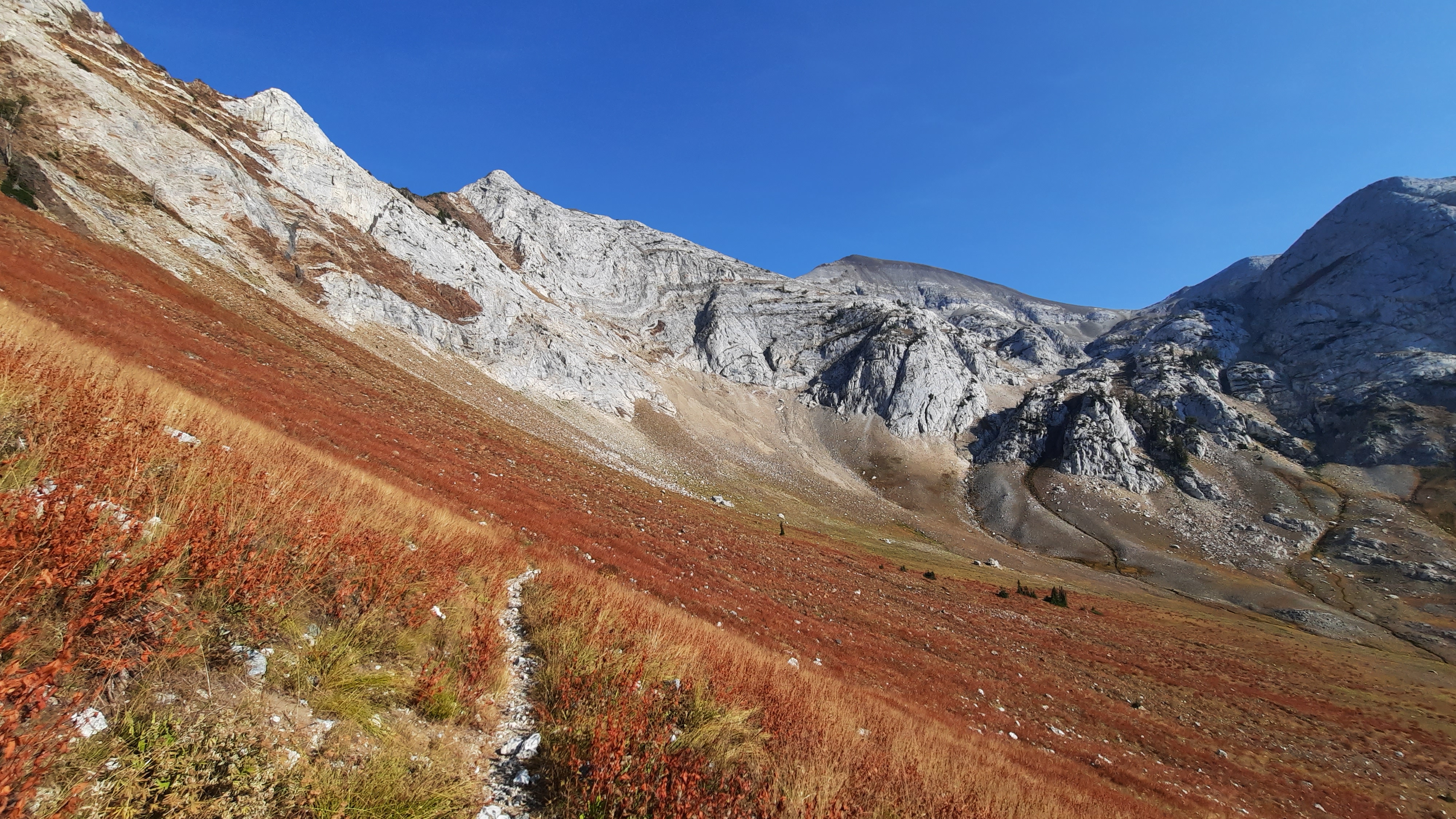
I started a steep switch-backing descent next; right now the word I have to define the climbs and descents in this section: grueling. It’s no wonder really, I’ve been walking above the deepest canyon in the country. Getting to the bottom is going to be difficult on foot no matter how you slice it.
But! The end of the switchbacks that had me slipping and falling on my butt several times was water. A creek. A creek with water. I sat down in a cloud of fatigue and willed there to be a nice cobble beach where I could access the water and shed the last four days of dirt and sweat. I walked more, and thank you world! I found my watery bath.
Refreshed and the least stinky I had been in days, I ambled a few more miles before setting up another cowboy camp on a bluff overlooking the stunning canyon. There is lots of bear poop now that I’m in a canyon, so that’s something else to keep in mind.
I know the vegetation has been changing as I hike north along the Hells Canyon rim, but this morning I noticed I was surrounded by sagebrush. It’s started like to look a lot like the high desert I know.
A note for future hikers: most of the springs up here have been flowing to some degree. This also explains why it is such an ecological hot spot…year round water is important in that way. Its pretty amazing considering what a dry year it has been.
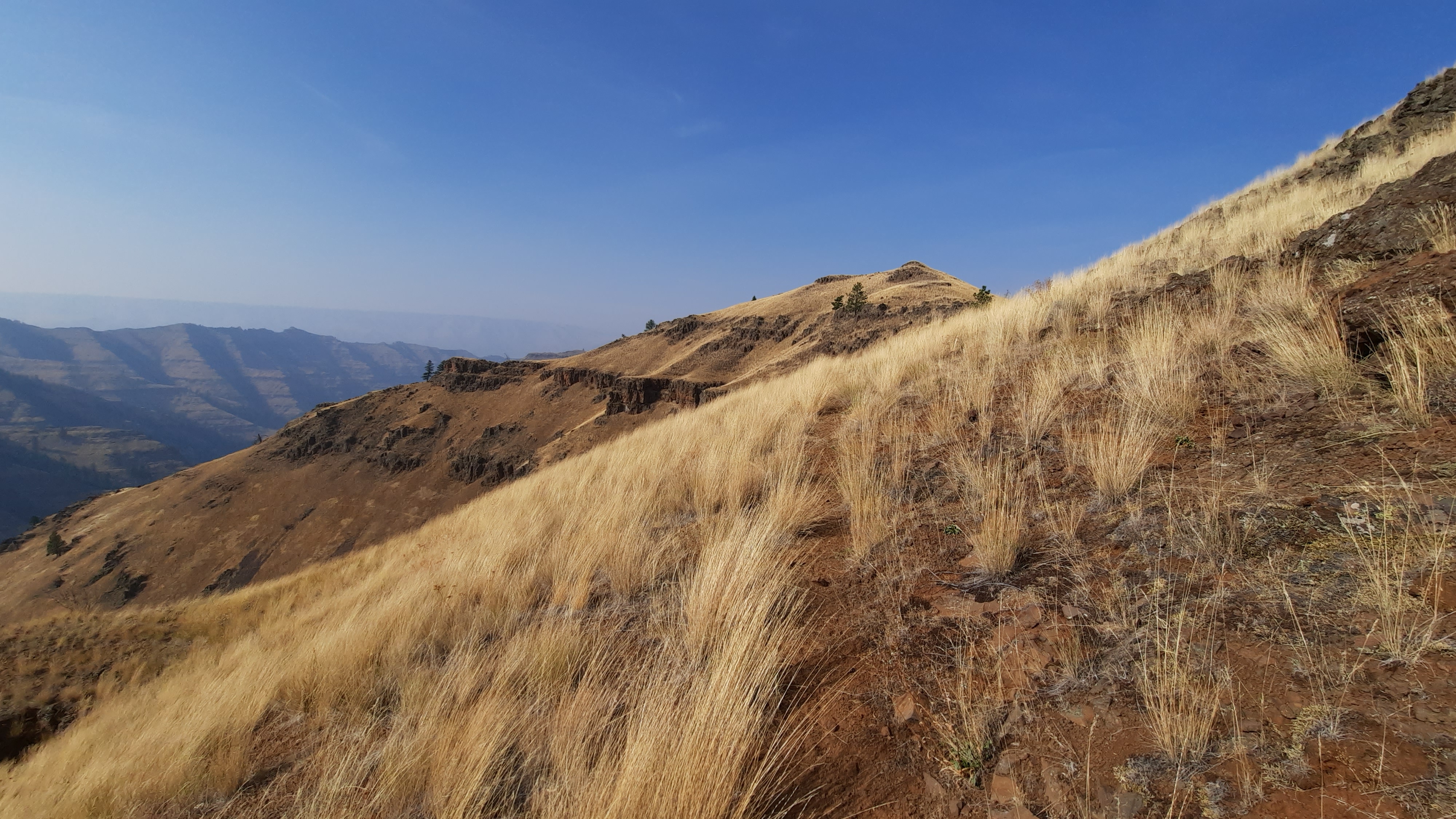
The walking this morning was on trail, and it was easy and gentle. When I started dropping down to Freezeout Saddle (I’m now on the Western Rim Trail), I think I encountered the second best views on the trip. The wind was rippling through the tall grasses, the trail was illuminated in the morning light against the golden hills, and the Imnaha Canyon and its many tributaries were crystal clear, away from that Idaho smoke on the other side of the ridge. There were cows, which left braided trails everywhere, but they couldn’t detract from my moments of awe on that walk. I put on some music by Arvo Part and literally floated down….not really, the view was so magnificent and the trail so narrow that I could either stop and look, or hike and focus on my feet. It was brilliant anyway.
I took a long break at Freezeout Saddle, my jaw hinged open half the time as I stared down the Saddle Creek drainage. There is a trail down there, and next time I come out I want to hike into the canyon. There are infinite ways you could connect this ridge trail with trails that drop to either side. I could truly spend a lifetime out here without hiking the same thing twice.
When I’m on a break I frequently study the maps and try to understand what my next hour or two looks like, and what to expect. That is very important out here because if I expect to walk downhill for a mile and then turn right at a spring and that doesn’t happen, I stop, look at my map, and pull out my phone and turn on GaiaGPS or CalTopo to check myself. I probably do that 50 times a day. It would be so easy to get distracted and end up thousands of feet, or miles, from where I really needed to be.
Actually this is the first time I’m using the Cal Topo app for Android. It doesn’t load as fast as Gaia, but when I leave note about trail conditions or track my bushwhacks it automatically updates the web map I’m using each time I turn off airplane mode and have cell reception. It’s pretty amazing! Instant feedback to anyone who is watching! I asked Kirk to see if the map was populating and he repeated a few of my comments back to me, “no good,” and “terrible bushwhack,” and I think there was a “why?” In there too. 🤣
I had a big climb out of Freezeout Saddle up to another major road that had campgrounds and the popular Hat Point lookout. I put on another grind song (today I started with Warpaint’s Disco//very). I didn’t make it to the top without stopping, but I can feel my endurance improving.
I finished the Timber Wars podcast when I was up top on the road, and if that won’t get your blood boiling about how we and our government have been treating our forests in the west, I don’t know what will. It’s an excellent podcast that I would suggest you all listen to. One of the producers is Ed Jahn of Oregon Field Guide who produced my ODT episode a few years ago. Great guy and I really respect his work.
I was back on the Western Rim Trail in mid afternoon and was shocked to see a ton of cars at the trailhead. I guess this is a popular stretch…and I soon saw why. The trail walked the edge of the rim to stunning views all around.
I passed a few hunters, and when the second couple I passed slowed to ask me about my pack, I stopped to chat. Would you believe what happened next? I don’t think I still believe it.
I was explaining what I was doing, this father/daughter couple had already mentioned they had thru-hiked the PCT a few years ago, so I knew they would understand what we were trying to do with the Blue Mountains Trail. The dad then asked if I had heard of the Oregon Desert Trail, of course I had to tell him I had been living and breathing the ODT for the past five years, and he says, “I’ve emailed you, I wanted to hike it this year.” Not only has he emailed me. When he told me his first name I knew exactly who he was and knew his last name. Even stranger? In one of the emails he had sent me a picture from the Hells Canyon Rim in winter…about 20 feet from where we were standing at the moment. Woah. Chills. And get this, they are not local. Cameron lives in Salem and his daughter Amanda in Portland. And we all crossed paths up here.
What a world! And if that doesn’t tell me I’m exactly where I need to be, I don’t know what else does. The world is a amazing place.
It’s day 4 and I still haven’t settled into life away from all the stresses of this year. I’m starting to crack though; nature is having her way with me…slowly soothing and comforting the 2020 anxieties.
I am not pitting myself against nature on this hike, I am hiking with nature. I am rediscovering my place in this natural world.
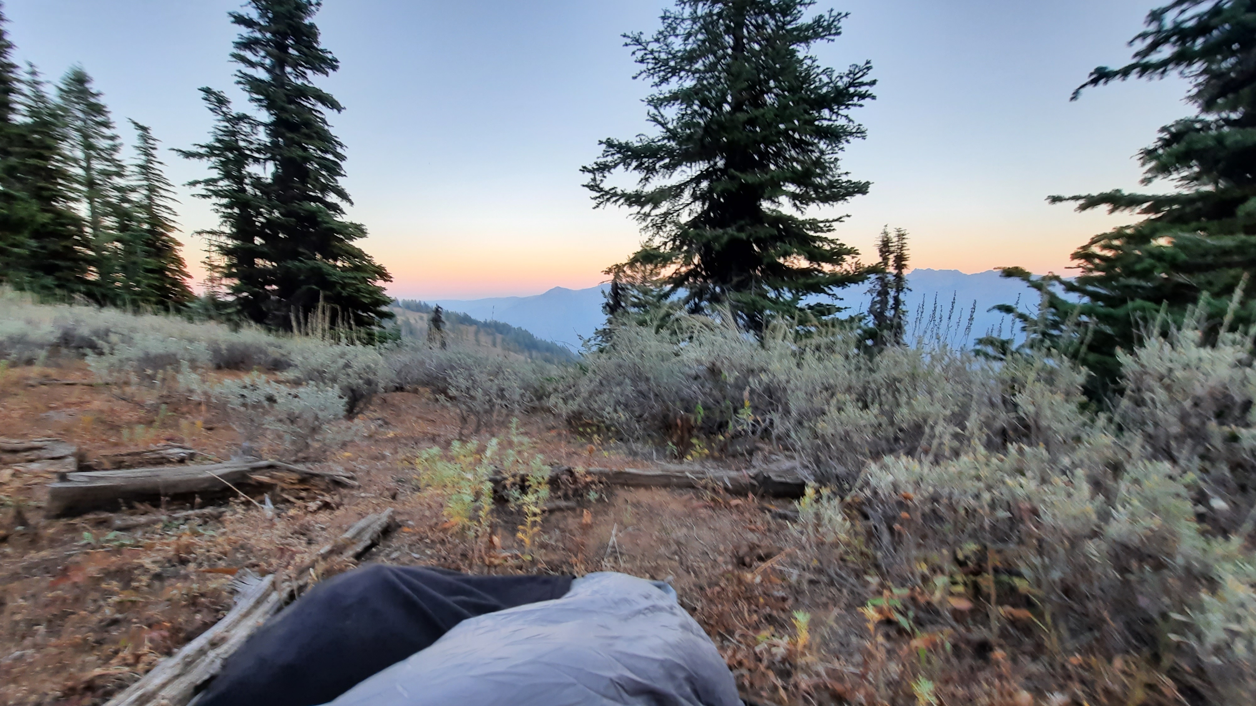
I woke early…before sunrise early, so I worked on my blog and read a bit. The sun didn’t come, and it still didn’t come. Sunrise is almost 7am now!! I have just about 12 hours of dark, a guess I’ll be doing a lot of reading this month if I can’t manage to sleep that long.
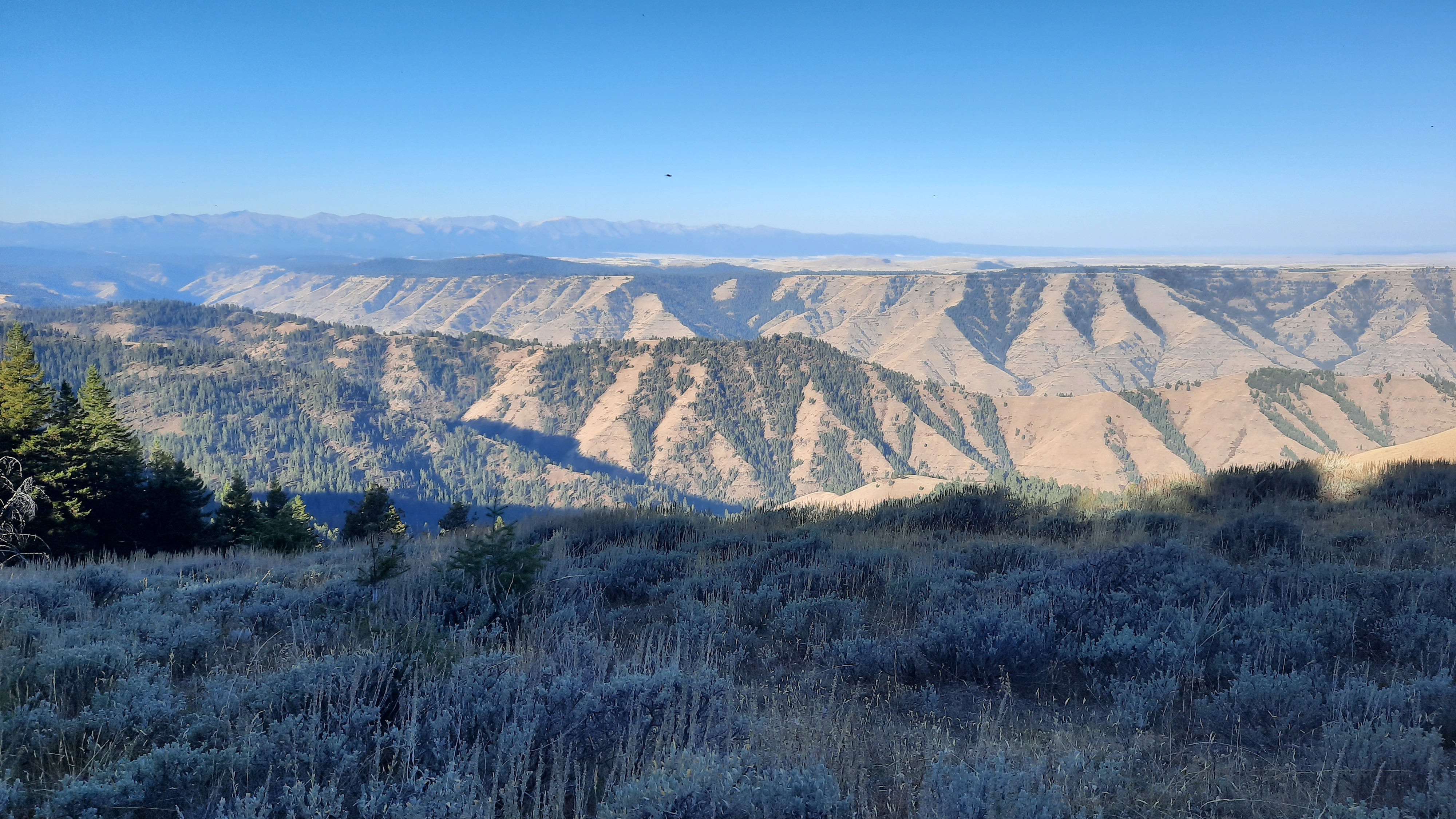
I watch the light finally spill over Hells Canyon and made a second cup of coffee. Finally I was jittery enough that I needed to walk off the excess caffeine, so I hit the road to head up to the legit Hells Canyon Overlook, complete with pit toilets and informational signs.
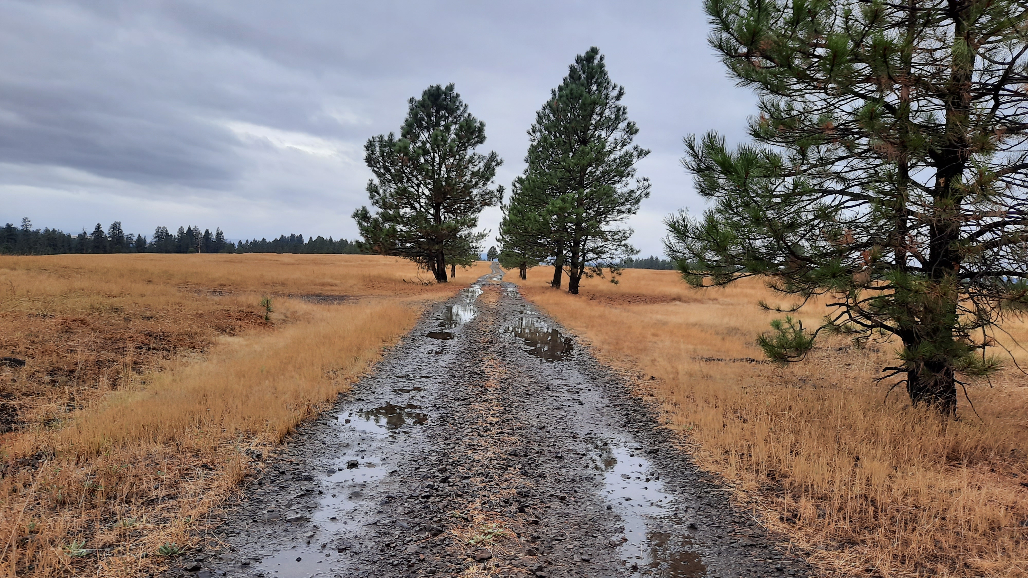
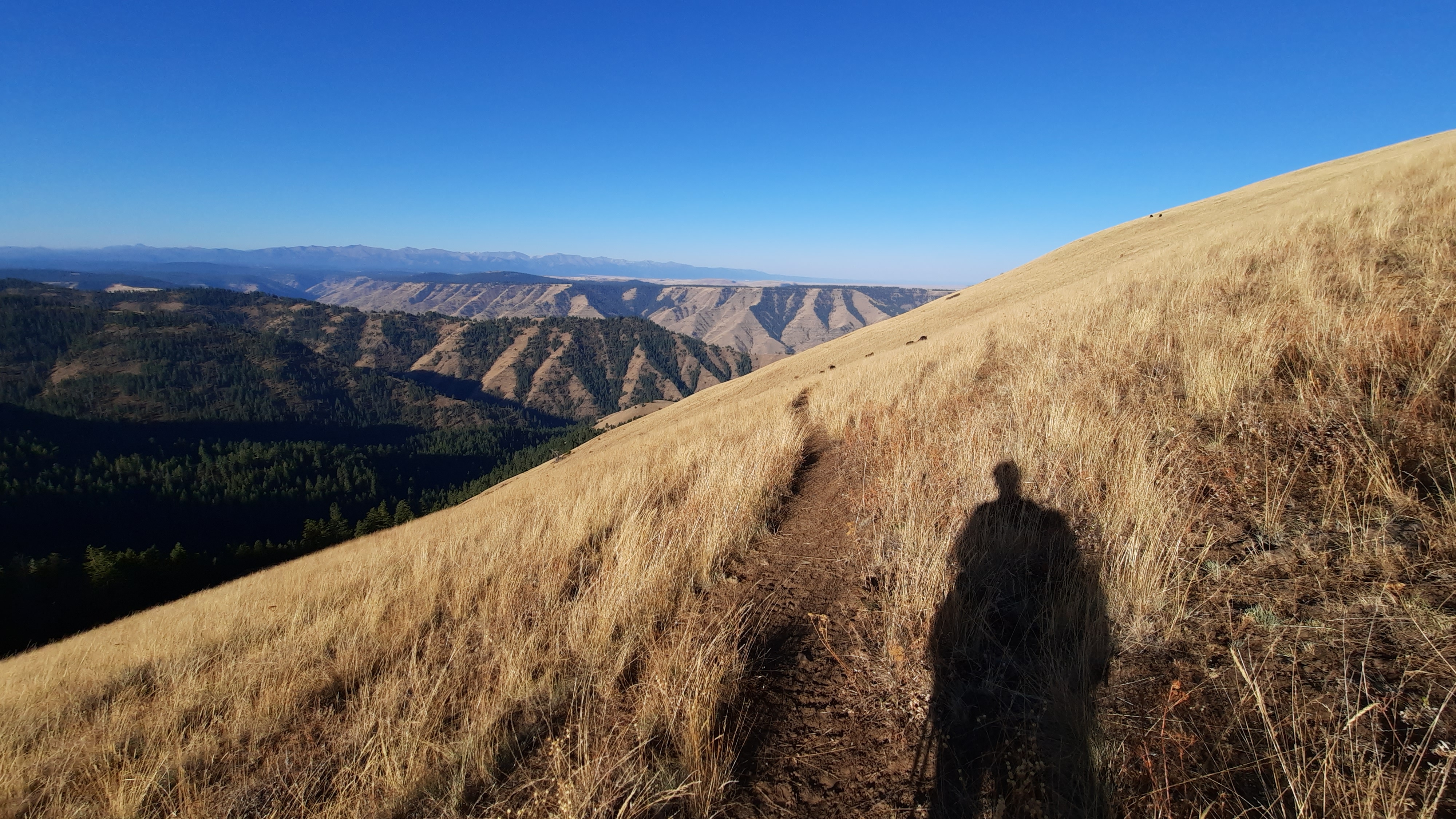
Most of the day I would be walking on gravel roads that straddle the Snake and Imnaha River canyons. Very few cars passed, and when I got to a section that I thought would be trail, found it was still road. Then I got to a section that I thought would be road, but it was gated, so was a trail on an old road. Regardless, the walking was easy and I didn’t have to wonder where I was at all during the day.
I know I will be up here a few more days and I finally looked at the data book and realized this was one long 52-mile ridge-walk! If you love ridge-walking like I do, you might have an idea how excited that makes me.
Even though the walking was “easy,” I still had to grind. What does that mean you might be wondering? Grinding is what I call hiking up a hill, incline, or mountain without stopping. You put yourself in a low gear and walk at a steady pace as long as you can. If you want to stop, walk a little slower and keep going. Eventually you will be able to hike farther and faster if you make it a practice grind regularly. I find music can help, and today this song did it for me.
Towards the end of the day I was filling up water at a spring when I heard a rustle behind me and a hunter materialized out of the woods. He came over and we chatted for a few…he and his friends had been packed in by some horsepackers for a week up here. There were some other guys camped near by on their own hunting trip too. He was nice enough and it was good to speak out loud for the first time today.
I made my way a little further before setting up with a view of the Seven Devils mountains in Idaho.
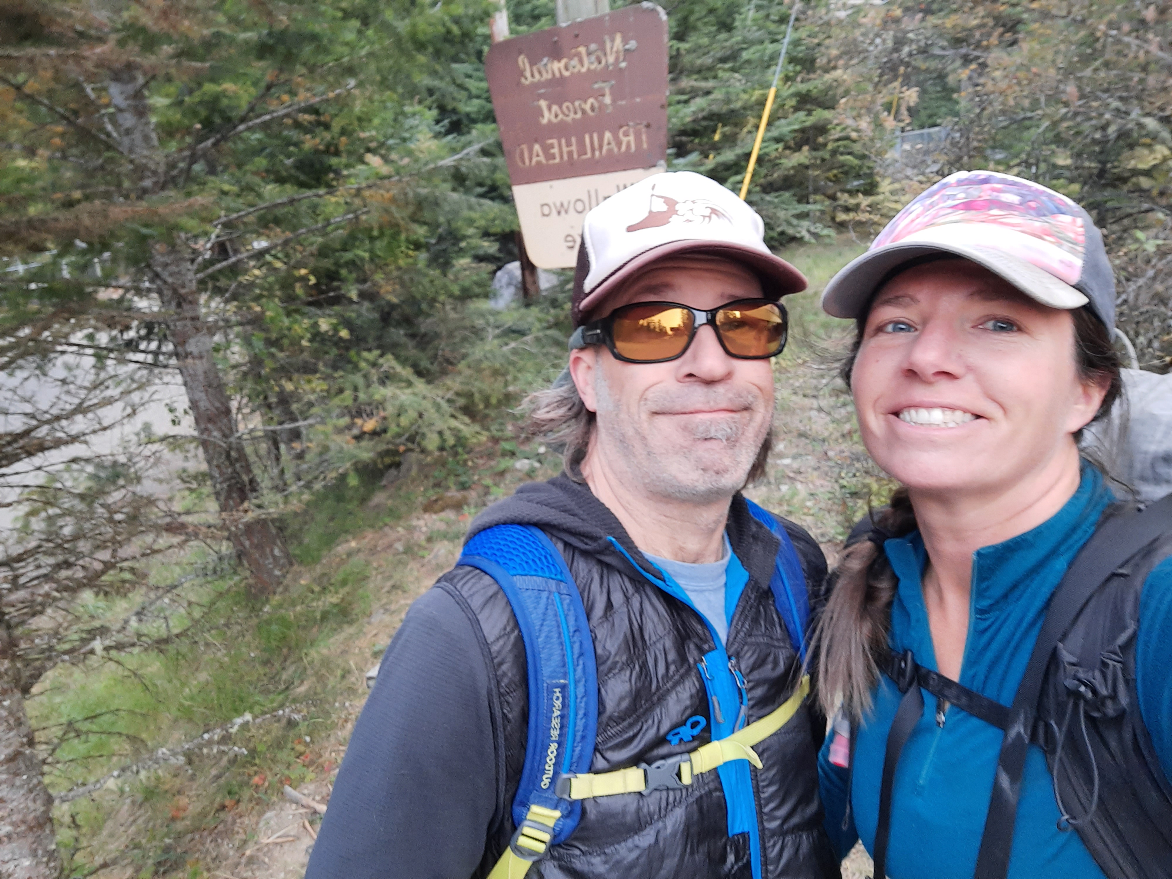
What luxury to spend the second night on the trail with a trail angel! Mike and Donna Higgins rolled out the red carpet for me, and we enjoyed a delicious dinner, a berry dessert (made with two kinds of fruit grown right there in Pine Valley…they live in Halfway, Oregon), and hours of excellent conversation.
Mike has spent a lifetime exploring the Wallowas and Hells Canyon area. In fact, he also joined Loren Hughes and Dick Hentze in their effort to create the Blue Mountains Trail in the 90’s, and he is absolutely thrilled that we are out here hiking it. (Post here about the 60-year history of the BMT!).
Now that a few of us are out hiking it, the route seems closer to reality than ever before…and I have a new respect for the vision these environmentalists had decades ago to create an experience through this stunning and ecological wonderland.
I can confidently add Mike and Donna into the category of: I’m better to have met them.
Mike also hosted the Intrepid Three (his name for Whitney, Mike & Naomi), and when I started to unpack my resupply box I had sent to his house, he also brought out a giant hiker box of goodies the Intrepid Three had left. Mike ended up meeting them three times on their just completed BMT hike, and man, they leave a GOOD hiker box!!
I took a slow morning, indulging in a scrumptious breakfast and a map session. Mike and I are cooking up plans to connect the Oregon Desert Trail up to the Blue Mountains Trail, and we’ll be putting some ideas together over the winter (hint: perhaps we tie into the Desert Trail route where it deviates from the ODT at Frenchglen!)
The purpose of today’s hike would be to transition over to Hells Canyon from the Wallowa Mountains. I would walk a series of dirt roads and trails that sit high on a ridge above the Imnaha River. An alternate option in here is to stay in the Imnaha drainage…but it’s a paved road full of cars and people, so hiker’s choice. I chose the high road, and all went relatively smoothly except for losing my Steens and Alvord Desert hat in a bushwack today (check out this beautiful painting by Bend artist Shelia Dunn on this hat I lost).
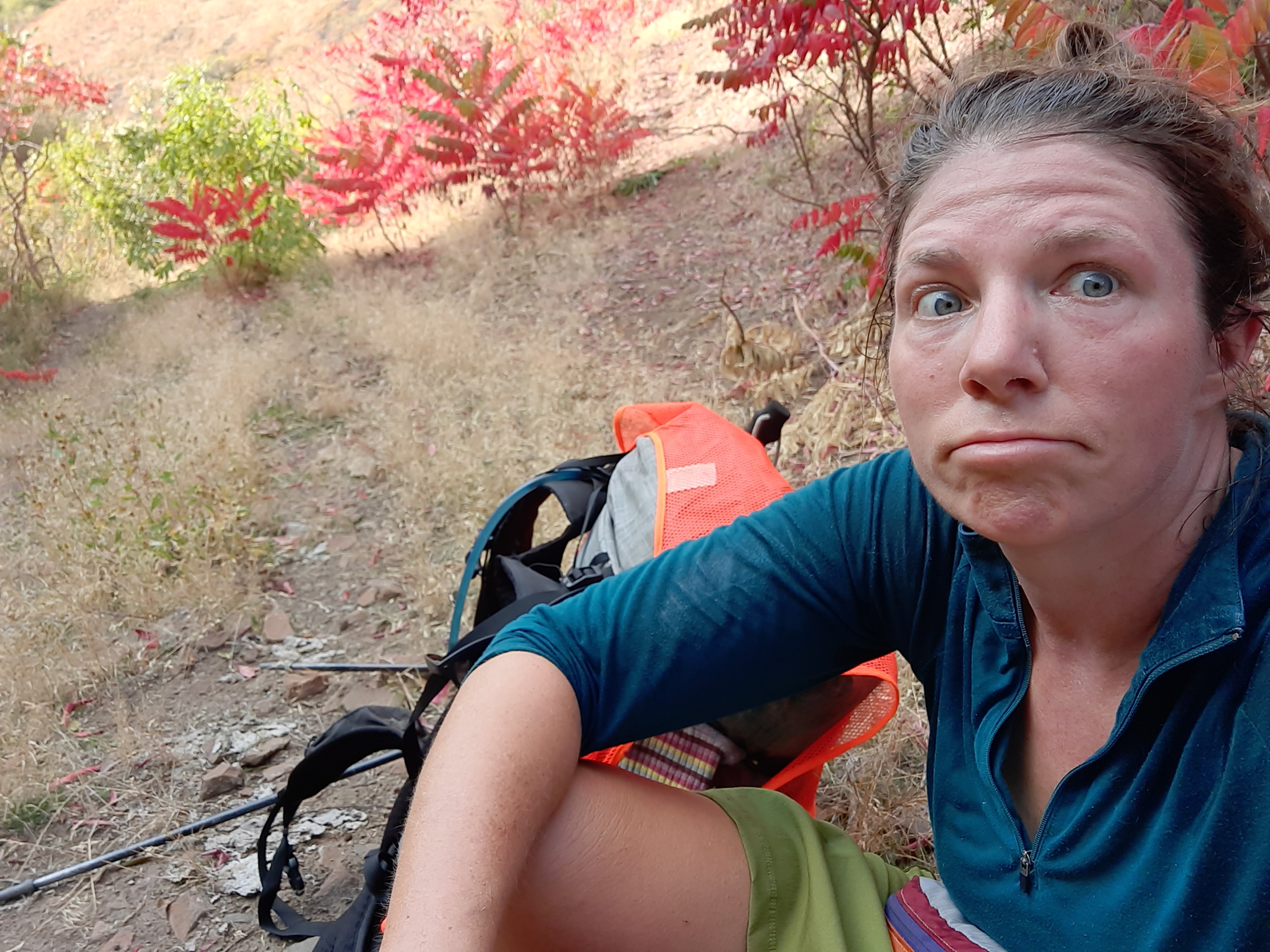
Day 3 is when the blisters really start popping up, and I contended with them all day on my breaks. I’m looking forward to when these soft spots harden up soon!
Since I had gotten a later start in the day, I hadn’t set my sights on an end destination for camp, but when I saw that Hells Canyon was in reach, I made a goal to sleep on the edge of the deepest canyon in the country.
Twilight was coming on and I still hadn’t reached the canyon, but I was so close. Even more concerning was my dwindling water supply. In the transition over from the Wallowas, the plentiful water became not so plentiful anymore. The springs and drainages were dry, so when I started up the paved road to Hells Canyon Overlook, I waved down a car with my empty water bottle. A very nice woman gave me three liters, and I was rejoicing the watery trail magic. Thank you random woman!
I had spied a spot on the map just off the road where it first meets a canyon overlook, and posited that there would be a spot for my prone body to lay down for the night. And there was!!!
I watched night fall over Idaho and this magnificent canyon. The stars and Milky Way are brilliant tonight, and once again I am sleeping out in the open on this amazing adventure.
My new quilt is like a dream. It is so fluffy and warm that I feel like I’m glamping. This is my first Katabatic quilt, but friends have been using them for years. When my pal Speedstick did a winter thru-hike of the AT a few years ago she kept talking about how she loved her chocolate caterpillar. She lived in her dark brown quilt that winter, and I will live in mine for the next month.
I was walking at first light and soon saw two hunters also out in the early day. This weekend was the start of hunting season, so I draped my pack in an orange hunting vest and wore my bright red coat.
It was incredibly warm for early October, and soon I shed my coat when it was time to ford the Imnaha River. I was due to climb up Blue Creek to walk below Sugarloaf Mountain later in the day.
The trail was in decent shape, although not exactly where drawn on the map. Once I got to my trail junction, a trail junction was not to be found, so I bushwhacked up the drainage until I stumbled on trail tread a short while later….I guess I should have hiked past where I thought the trail should be. This trail was in good shape too, although I lost it up top…but when the climb ends at a saddle, it’s pretty easy to find your way…the terrain practically leads you there by the hand.
A beautiful and smoky view awaited me up top and I took my first break of the day, three hours in. I don’t usually wait that long to sit down, but I was meeting Mike Higgins, one of the brains behind the BMT tonight at Twin Lakes Campground, and I didn’t want to be late!
When I turned on my phone I had a message from Allgood, Mike, and Naomi that they had finished their hike of the Blue Mountains Trail! When I knew Jared was looking for more people to ground truth the trail, I mentioned it to Whitney (trail name Allgood). He decided to take it on with 2 friends, and they set off in early September to hike it all. We had been sharing data and determined I would hike a series of alternates this fall when they encountered sections that posed some issues. Some of yesterday and most of today would be a different route than what those three had hiked…lots of options out here!
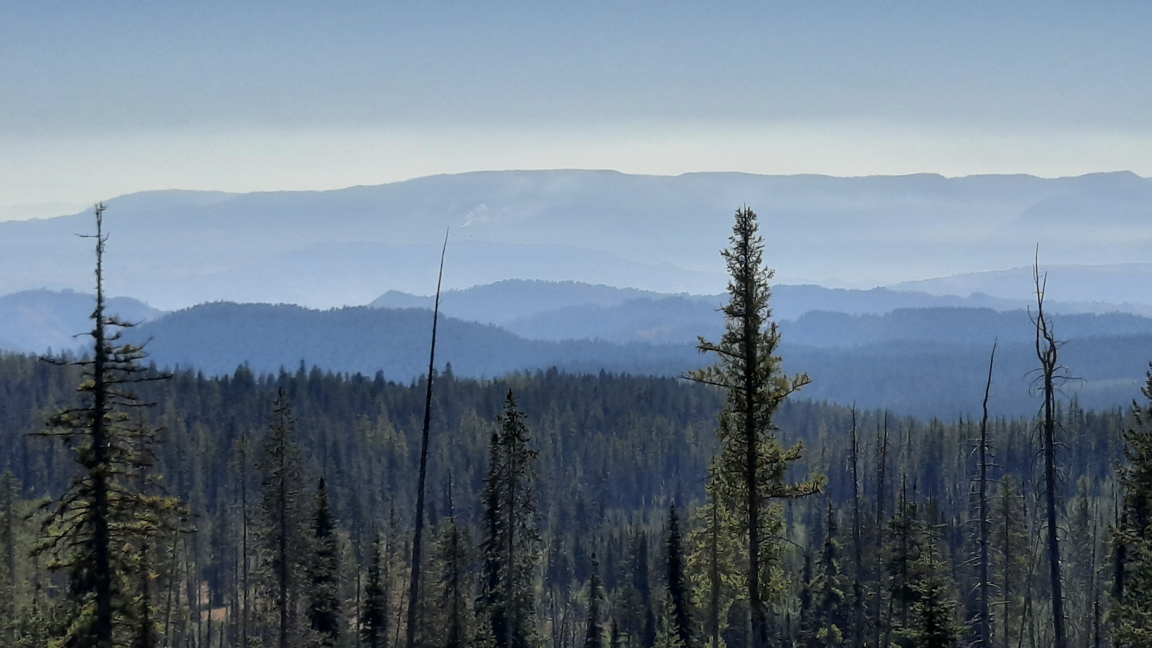
The walking from there was wonderful; the trail the rolled up and down folds of the earth. Everything was hazy due to fire smoke drifting over from Idaho, but I loved it none the less.
At a small cow-poop infested pond, the trail got confusing with cow trails crisscrossing every which way, but I finally found myself again.
More lovely trail, more lovely terrain.
I made it up to a decommissioned lookout tower on Russel Mountain and walked dirt roads from there, listing to episodes of Timber Wars, a new podcast from OPB.
I beat Mike to the campground, he said he’s bringing chips and beer!!!
Months of planning can feel almost uneventful when the trip finally arrives, or maybe it’s just hard to believe I’m actually here. The way 2020 has unfolded has been anything but expected, and here I am, at the start of a 500-mile, month-long hike to walk the rest of the Blue Mountains Trail and almost everything is going as expected. In fact, for an early October day, it’s warm…unseasonably warm. The extended forecast is warm and dry. I’ll take it!
We woke at first light in our car camping site at Wallowa State Park, and soon had mugs of coffee to fuel the packing up. The drive out from Bend yesterday had gone smoothly, and now it was time.
We drove to the trailhead which was perched at the mouth of the west fork of the Wallowa River. Kirk decided to hike in with me a couple miles, so we set off on the gentle climb through the lush forest. Even though the days had been warm and dry, the trees and brush had gotten the memo that it was fall, and were turning brilliant yellows and golds.
When it was finally time to say goodbye to my beau, I got a little choked up…I had all the feels, as they say, and I was overcome with the realization that I was here, I was hiking, and I wasn’t alone…metaphorically speaking. The day washed over me in a cascade as I hiked beneath towering granite mountains. I was finally here.
The first few days of the Blue Mountains Trail from the eastern terminus are quite different from the hike out of John Day 600 miles to the west. Oh I was gaining thousands of feet in elevation, but instead of hiking on hot chip-seal, I was walking on the soft dirt of a well-loved trail heading into the heart of the Eagle Cap Wilderness: the Lakes Basin.
The climb was gentle until it wasn’t. As I approached Frasier Lake the granite walls got vertical and towered over the drainage. Simply out of this world.
I had a short lunch at Little Frasier Lake and couldn’t resist the draw of the next climb…another 1,000 feet up to Hawkins Pass. The trail switch-backed through a gauntlet of granite, and I could spy the route from my lake-side lunch spot, so I cut lunch short, eager for the views up top.
Many steps and photos later, I reached the pass at 8,570 feet and audibly gasped when I saw the other side.
I won’t ruin it for you….consider this your invitation to visit Hawkins Pass.
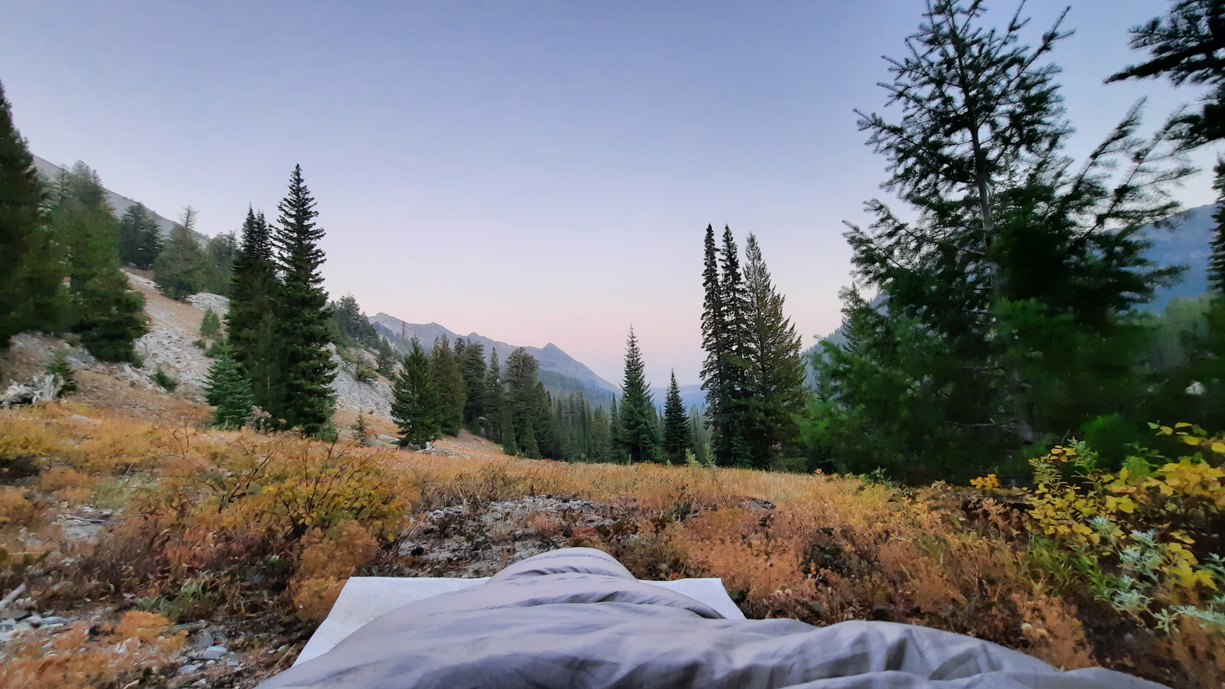
I slowed waaay down and positively sauntered down to the headwaters of the Imnaha River. I didn’t want to rush a moment of it.
Camp was a small nook perched high on a slope with views and sounds of rushing water.
I settled in for my first night on the trail, cowboy camping under the stars. My first meal would be a NEMO-special. Nemo is my soul-sister hiking partner (we met on the Pacific Crest Trail in 2006 and have since hiked thousands of miles together) who sent me a few goodies to take with me on the trail. In fact my breakfast this morning was a pear and tomato grown by my dear friends Brooke and Adryon. Who says this is a solo hike? My friends are feeding me already 🥰.
Thank you to all who helped get me here! The list is long, and I appreciate you all so much.
I decided to dedicate this hike to a dear friend of the family who passed away suddenly a few weeks ago, Pete Morgan. Pete and my dad worked together at the University of Wisconsin- Stephens Point for years. When our family later moved to Illinois, my parents would meet up with Pete and his wife Verona regularly. When I started writing about all of my adventures, Pete was always there with an encouraging word. He has been one of my biggest supporters as I threw myself into the unknown year after year, trail after trail. It was comforting to know he was cheering me on, and it’s my time to be thinking of him on his next journey.
In 2020 I plan to do a fair amount of hiking in the fall, so have prepared this gear list for cold temps and snow hiking. Some of these items will be switched out for other items on the list as I go. The main objective for a mid-fall hike? Stay warm, stay dry, stay alive.