
I know the vegetation has been changing as I hike north along the Hells Canyon rim, but this morning I noticed I was surrounded by sagebrush. It’s started like to look a lot like the high desert I know.
A note for future hikers: most of the springs up here have been flowing to some degree. This also explains why it is such an ecological hot spot…year round water is important in that way. Its pretty amazing considering what a dry year it has been.
The walking this morning was on trail, and it was easy and gentle. When I started dropping down to Freezeout Saddle (I’m now on the Western Rim Trail), I think I encountered the second best views on the trip. The wind was rippling through the tall grasses, the trail was illuminated in the morning light against the golden hills, and the Imnaha Canyon and its many tributaries were crystal clear, away from that Idaho smoke on the other side of the ridge. There were cows, which left braided trails everywhere, but they couldn’t detract from my moments of awe on that walk. I put on some music by Arvo Part and literally floated down….not really, the view was so magnificent and the trail so narrow that I could either stop and look, or hike and focus on my feet. It was brilliant anyway.
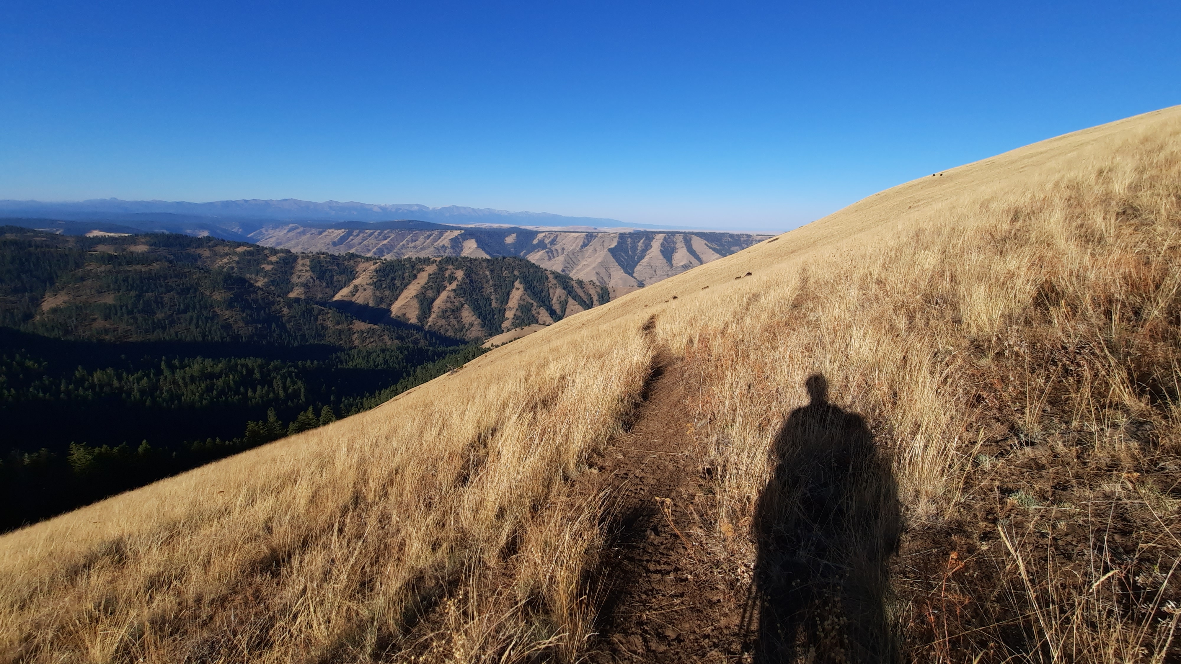
I took a long break at Freezeout Saddle, my jaw hinged open half the time as I stared down the Saddle Creek drainage. There is a trail down there, and next time I come out I want to hike into the canyon. There are infinite ways you could connect this ridge trail with trails that drop to either side. I could truly spend a lifetime out here without hiking the same thing twice.

When I’m on a break I frequently study the maps and try to understand what my next hour or two looks like, and what to expect. That is very important out here because if I expect to walk downhill for a mile and then turn right at a spring and that doesn’t happen, I stop, look at my map, and pull out my phone and turn on GaiaGPS or CalTopo to check myself. I probably do that 50 times a day. It would be so easy to get distracted and end up thousands of feet, or miles, from where I really needed to be.
Actually this is the first time I’m using the Cal Topo app for Android. It doesn’t load as fast as Gaia, but when I leave note about trail conditions or track my bushwhacks it automatically updates the web map I’m using each time I turn off airplane mode and have cell reception. It’s pretty amazing! Instant feedback to anyone who is watching! I asked Kirk to see if the map was populating and he repeated a few of my comments back to me, “no good,” and “terrible bushwhack,” and I think there was a “why?” In there too. 🤣
I had a big climb out of Freezeout Saddle up to another major road that had campgrounds and the popular Hat Point lookout. I put on another grind song (today I started with Warpaint’s Disco//very). I didn’t make it to the top without stopping, but I can feel my endurance improving.
I finished the Timber Wars podcast when I was up top on the road, and if that won’t get your blood boiling about how we and our government have been treating our forests in the west, I don’t know what will. It’s an excellent podcast that I would suggest you all listen to. One of the producers is Ed Jahn of Oregon Field Guide who produced my ODT episode a few years ago. Great guy and I really respect his work.
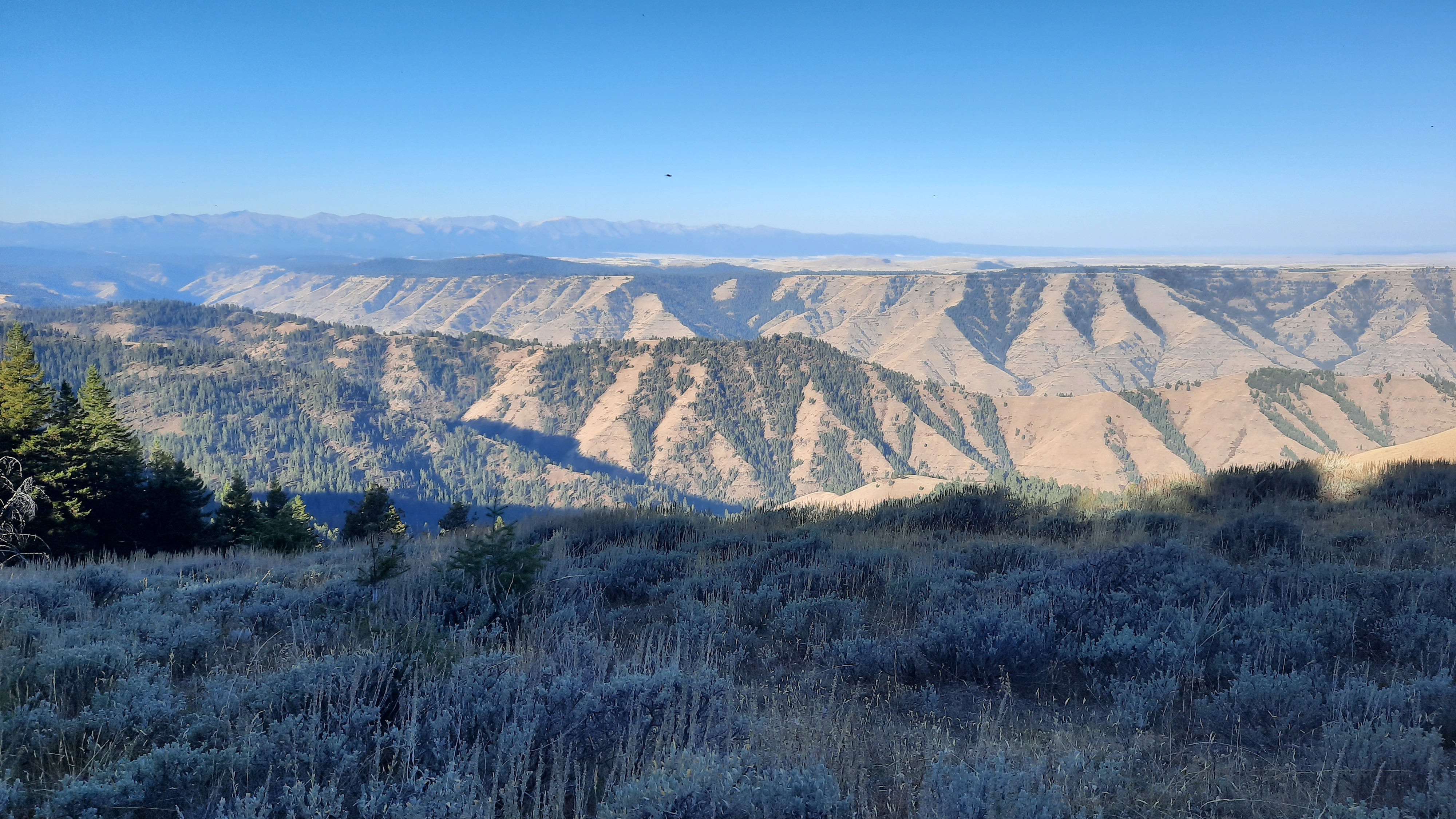
I was back on the Western Rim Trail in mid afternoon and was shocked to see a ton of cars at the trailhead. I guess this is a popular stretch…and I soon saw why. The trail walked the edge of the rim to stunning views all around.
I passed a few hunters, and when the second couple I passed slowed to ask me about my pack, I stopped to chat. Would you believe what happened next? I don’t think I still believe it.
I was explaining what I was doing, this father/daughter couple had already mentioned they had thru-hiked the PCT a few years ago, so I knew they would understand what we were trying to do with the Blue Mountains Trail. The dad then asked if I had heard of the Oregon Desert Trail, of course I had to tell him I had been living and breathing the ODT for the past five years, and he says, “I’ve emailed you, I wanted to hike it this year.” Not only has he emailed me. When he told me his first name I knew exactly who he was and knew his last name. Even stranger? In one of the emails he had sent me a picture from the Hells Canyon Rim in winter…about 20 feet from where we were standing at the moment. Woah. Chills. And get this, they are not local. Cameron lives in Salem and his daughter Amanda in Portland. And we all crossed paths up here.
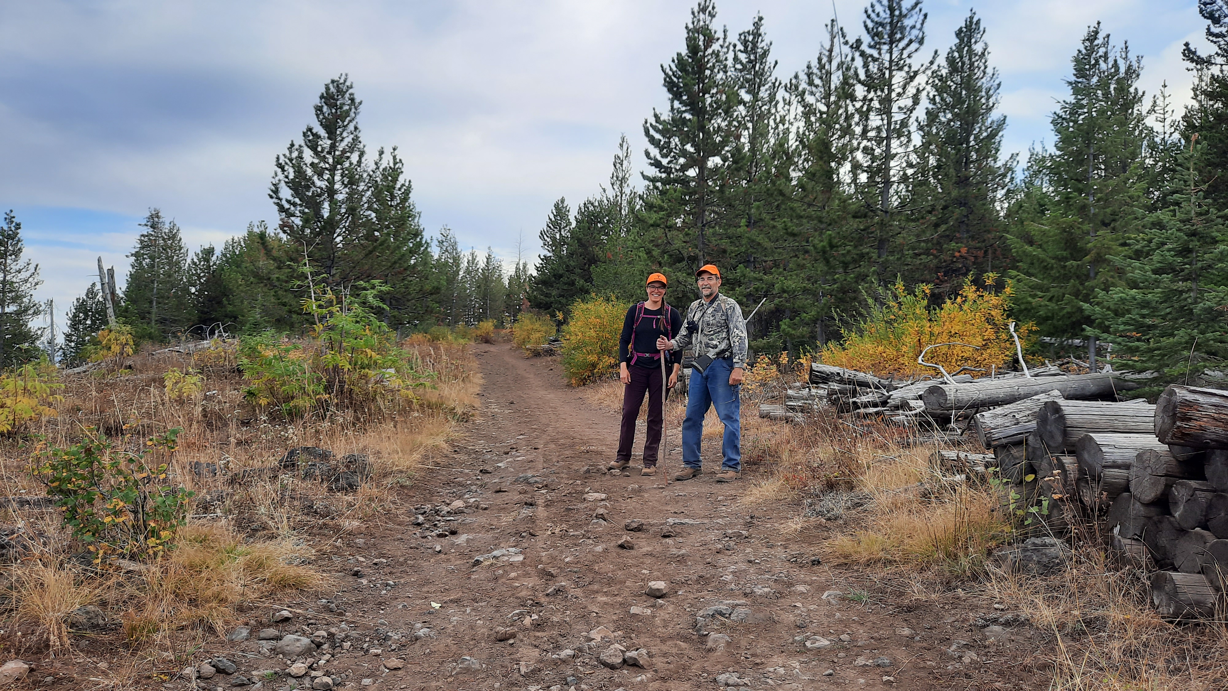
What a world! And if that doesn’t tell me I’m exactly where I need to be, I don’t know what else does. The world is a amazing place.

I received an email today from Whitney “Allgood” LaRuffa with day 1 of his hike on the Blue Mountain Trail. Is he on the same trail as you are?
LikeLike
Whitney started hiking it last month and is now posting about it. We are hiking some of the same, some different routes to try and find the best alignment…he finished last week!
LikeLike
Great “small world” story, Renee. Too often to be coincidence???
LikeLike
Guessing you are on the road/trail between Warnock Coral and Lord Flat. It’s pretty quiet except during deer & elk seasons. If it’s not too late the side trip to Sommers Point is worth it. It’s like an island savannah in the middle of a canyon. Incredible grasslands, old pines, and even a spring. On of my favorite spots ever.
LikeLiked by 1 person