
Today was the day, and despite constant rain all night, the early morning hours were dry, and when I unzipped the tent, I could finally see an emerging land below.
Stunning!
It had gotten cold overnight. Nothing had frozen, but I could see fresh snow on the far peaks.
I was up and walking by 7am, which has been my usual this trip. The objective was to walk the rim, 4-5ish miles to the very top of the mountain at 4,694′ and then drop over the top for a smattering of cross country hiking and some roads all the way into Mitchell and my shower. Ok!

This type of hiking is strange. It feels like you are making no progress at all on the large flat expanse of earth, but then you look back and see how far you have come. I stopped periodically to gaze around, down, up, and everywhere. It was a brilliant morning, and I felt so lucky to be up here.

Sutton Mountain is a Wilderness Study Area, and you might remember a hike I took up here last year from the Black Canyon side. As I mentioned in that blog post, this is an area that is being considered as a national monument. As a place to recreate, it was ideal… several trailheads to the top, rugged, yet approachable hiking, incredible terrain, lots of wildlife, and…it’s relatively safe. What do I mean by that? Sutton Mountain is surrounded on all sides by roads or the John Day River. Certainly, one could get lost in the almost 30,000 acres, but hike in any direction long enough, and you will make it to a road. The good thing about national monuments is that the management can be fairly flexible. The county and nearby communities like Mitchell and Twickenham can be involved, conservation groups like ONDA can be involved, and ranchers and recreators can be involved too when deciding how this area should be managed. The Painted Hills across the street is already a National Monument, and so are the Fossils Beds that I hiked by when I restarted my hike at Clarno. It will be exciting to see what happens!
I hiked and hiked and finally made it to the top. I really couldn’t have planned a better morning.


Then over and down. It’s all downhill from here!

I took a break by some springs and took off my soaking wet shoes and socks. The grasses had soon soaked my feet this morning, making for an unpleasant squishy feeling. I put on my chacos for the next few miles of a closed dirt road within the Wilderness Study Area, but the recent rain combined with the soil to make a nasty slurry that quickly got between my toes and straps and was just not going to work. I transitioned back to shoes.


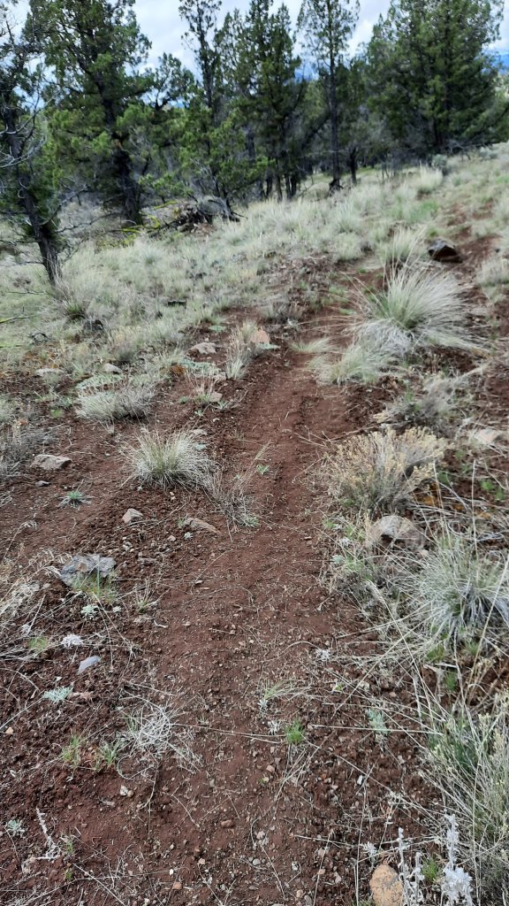
Soon, I was in an area I recognized! Last fall, after a trip to the Greater Hells Canyon Gala, I had stopped at Sutton Mountain and climbed up from Meyers Canyon for a night. I was disappointed, though, to see tire tracks on the road. This was a closed road, and someone had ignored the signage and deterrents and had driven up here anyway. 😖 not ok.
I continued on to cross Meyers Canyon itself, a deep dry ravine, to the other side and one last cross country climb up to another road. On this road, I walked through a trashed campsite. Large piles of trash were scattered about. I took a few photos to share with the BLM. Who does that? Why? The disrespect was sad.
Then walk, walk, walk, and I popped out near an old abandoned ranch (I later learned it was the Owens place) framed by the most stunning butte I had ever seen: Bailey Butte. The highway goes right by Bailey Butte, but I had never seen it from this angle. Incredible!

Once I made it to the highway, I had about a mile left to go, and it started raining so hard that I had to pull out my umbrella. Then…town.
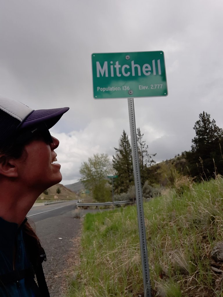
I made a straight line for the Tiger Town Brewery for lunch. In the seven hours I had been walking (with one sit-down break), I had eaten one granola bar and a few almonds. This hunger was hungry.
Soon, I was devouring a ruben sandwich, curly fries, washed down by a tasty amber beer. Soooooooooo delicious. My next order of business was heading next door to the general store for snacks and to see if they had any clothing that I could wear after taking a shower. I bought a Mitchell sweatshirt and some long john bottoms. Perfect! Then to the hostel. Sure, I could have had someone meet me this afternoon, I was only two hours from home, but I love trail towns, and Mitchell looked to have everything a hiker could need or want after a hike, and I wanted the full experience!

The Spoke’n Hostel is a hot spot for bicycle tourists. In addition to being on one of the cross-country bike routes, it was on several smaller road ride routes, too. Hosts Jalet and Patrick have renovated an old church into a beautiful and relaxing spot for travelers. Now, my experience was complete!
I got that shower, had clean clothes to put on, and the rest of the day, I truly reveled in not walking.
A great end to a challenging adventure!

Woo Hoo!
LikeLiked by 1 person
I love the photo of the biscuit clouds! I could walk under those for hours 🙂 -Vic
LikeLiked by 2 people
I know!!! 😍
LikeLike
Have you been fortunate enough to see any wolves? Seeing one in the wild is on my bucket list.
LikeLike
I have! On the CDT at Chief Joseph Pass…I saw tracks on the Blue Mountains Trail too…so cool, and humbling!
LikeLike
Congrats on completing a very interesting and challenging route.
LikeLiked by 1 person
Congrats!, Renee, and thanks for sharing your experience.
Friend, Mike
LikeLiked by 1 person
I believe I have seen you prior coming down Sutton a few years ago when my son and I were headed up. And Mitchell is for sure the best Brewery in 100 miles.
Great job and looking forward to seeing the connector trail to the ODT…
LikeLiked by 1 person
Nice! Beautiful country out there. 🤗
LikeLike