We woke up and sorted our food for the next leg of the hike. We found a spot in four days time for Courtney to come and camp with us and bring our last two days of food. This was a most excellent turn of events because our next section had some wicked climbs, and even two days of food weight would make a big difference.
We were back walking by 8am and quickly climbed Scout Mountain which gave us a view of her house where we had just been. And then what goes up must come down and we walked all the way down to cross Powell River, stopping to eat black berries that practically burst in our mouths.


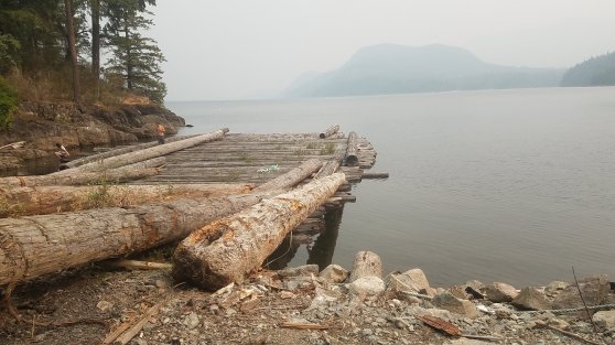
After a nice break under the bridge we continued on to walk along the edge of Powell Lake. Now I’ve come to learn that walking along the lakes out here primarily means a rocky/rooty up and down adventure, and this time was no different.


We met up with a road and it wrapped around to a giant log platform that some teenagers were jumping from, Nemo began calling out. Turns out it was Kalen, Courtney’s daughter! We chatted for a few minutes and continued on to another beach. We decided it would be ridiculous to pass on another swimming opportunity even though we hadn’t come very far, so we dropped our packs and dove in.
We walked along the shore again, up and down. Up and down and had lunch at a small beach that we resisted to urge to swim. We had to make miles if we were going to meet Courtney on Friday, but more importantly we needed to make miles to finish in time, make all the ferries, and make the long drive back so Nemo could catch her plane home. Onward!
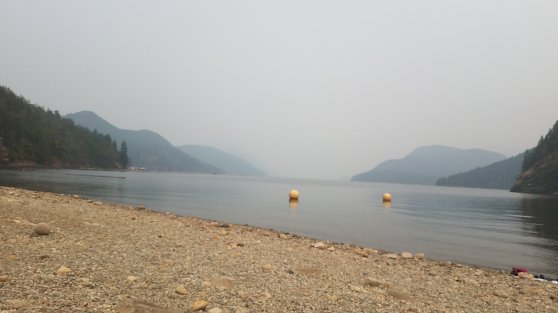
We climbed up to another lake, Lost Lake, and the trail skirted it and didn’t even meet the water. And then another Lake, Inland Lake came into view and we found a lovely, flat and wide dirt path circling the whole lake. Excellent! Bikes and families were out enjoying the day. And we inched our way along the path until coming to a picnic table where we could take a break. I was struggling. The miles were not coming easy today and we had a giant climb before we could make camp.
Fueled up with cold pizza and salty things we made the push. This was a straight up Appalachian Trail climb. All up and no mercy, We may have whined a little bit, maybe cursed a little bit, but we slowly inched out way up. If there was a sweating world record I surely won a podium spot. Drenched.

Finally the going eased and we came to Confederation Lake. We could see a trail crew had recently been through and there was fresh evidence of new log bridges and lots of loping. We finally made it to the shelter only to find it full with the trail crew.
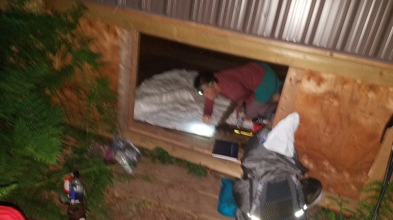
A full crew of ladies! BadAss! They had been flown up on a sea plane with their tools, but would be hiking out tomorrow. Bummer was there was no flat place to tent. They offered us the crawl space under the cabin, but it looked a little like a coffin, so we were not initially interested.
We had a swim and made dinner before we Nemo realized that the guy on the porch was Eagle, the founder and creator of the Sunshine Coast Trail! We talked his ear off for a few minutes and it was pretty awesome to meet him up here… On the trail no less!

After trying to find a spot to camp we finally relented and went back to the coffin. It was bigger than I had initially thought, and we both climbed in and made our nests for the night.
Tired.

My husband and I love following your adventures…when you started on the trail are you traveling north or going back south? Map? Safe journey…
LikeLike
Good point Kerry! I’ll do a recap post with map and notes and share the data book I put together, it’s open source so folks can add and update it as changes are made to the trail. Thanks for reading!!!
LikeLike
I started north and am hiking south…
LikeLike