Circles in the Blues – 2.5 miles

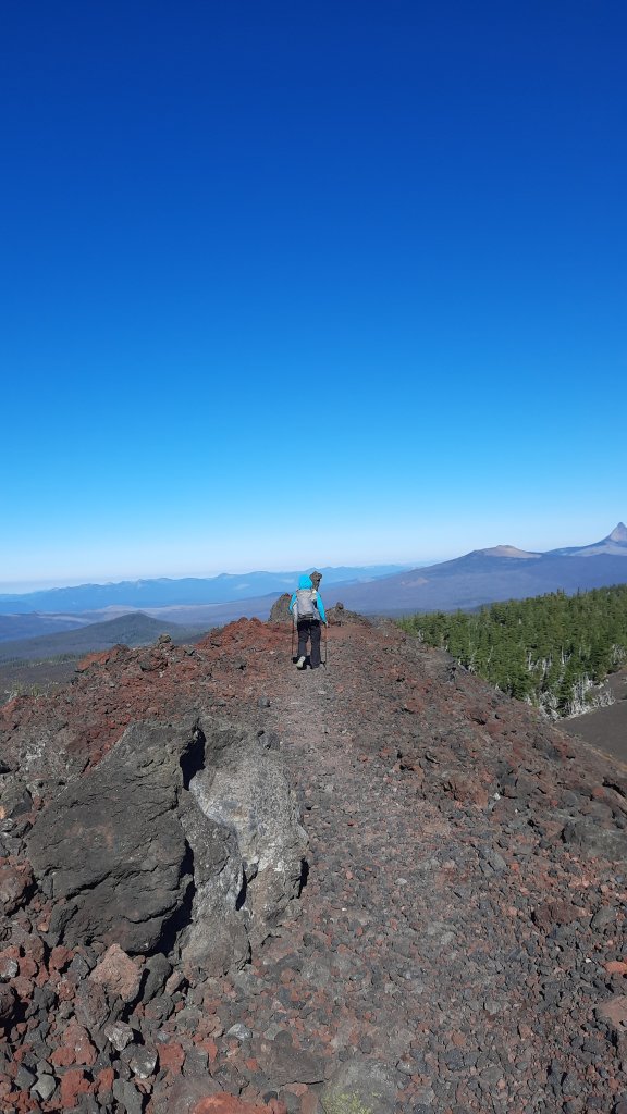
Here I am with my backpack on again, and another warm and sunny weekend on deck.

This time my circles are more time and place-based. These circles encompass two years and multiple trips.

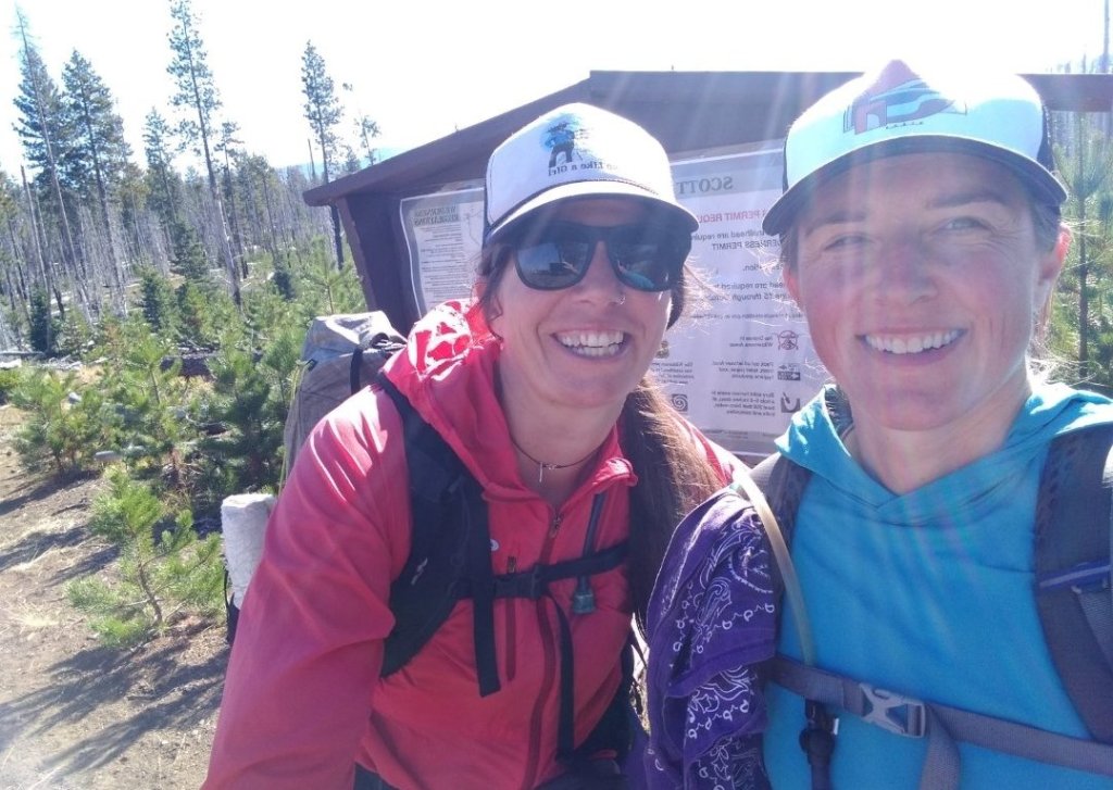
My first, most obvious loop, is returning to the scene of my Blue Mountains Trail groundtruthing hike. On this day two years ago I was walking above Hells Canyon and the Snake River. Today, I’m hiking along the headwaters of the North Fork John Day River. I drove up to NE Oregon this weekend for the Greater Hells Canyon Council’s yearly gala (if you remember, GHCC created the Blue Mountains Trail). Well, there hasn’t been a yearly gala since COVID happened, so this would be the return to an in-person event. Since I’ve come to call many of the people I met during my inaugural hike of the BMT friends, I jumped at the chance to visit and celebrate with them. AND my other 2020 hiking cohorts, Allgood, Mike, and Naomi will be there too!

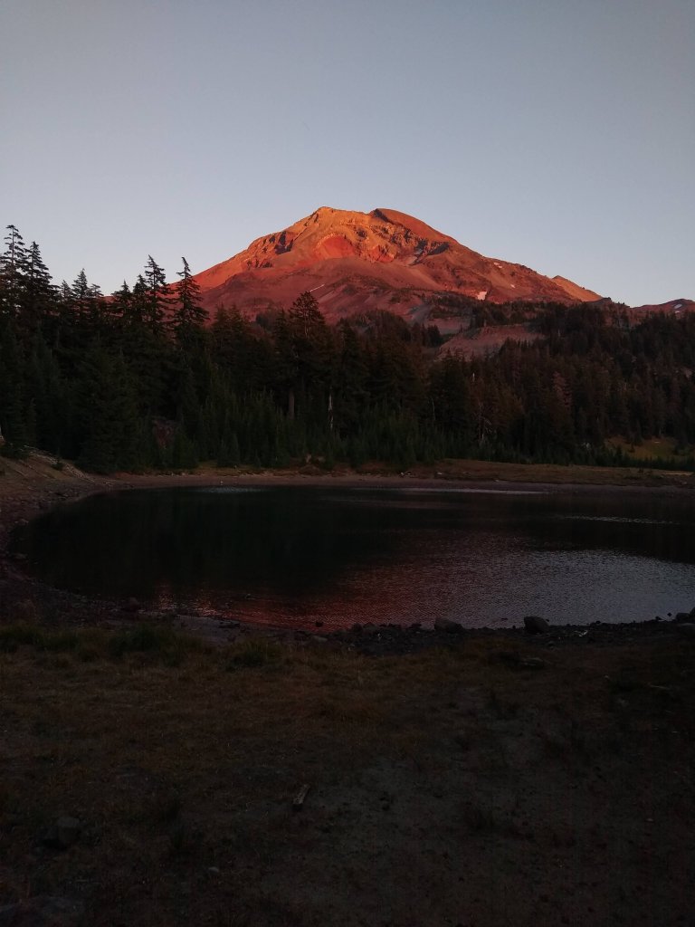
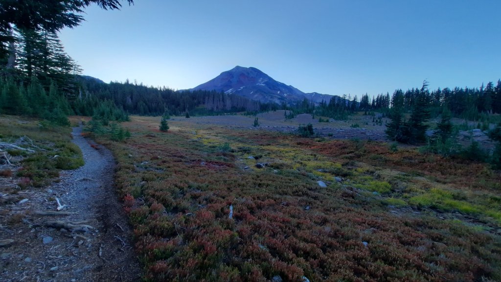
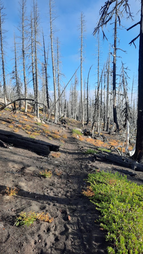
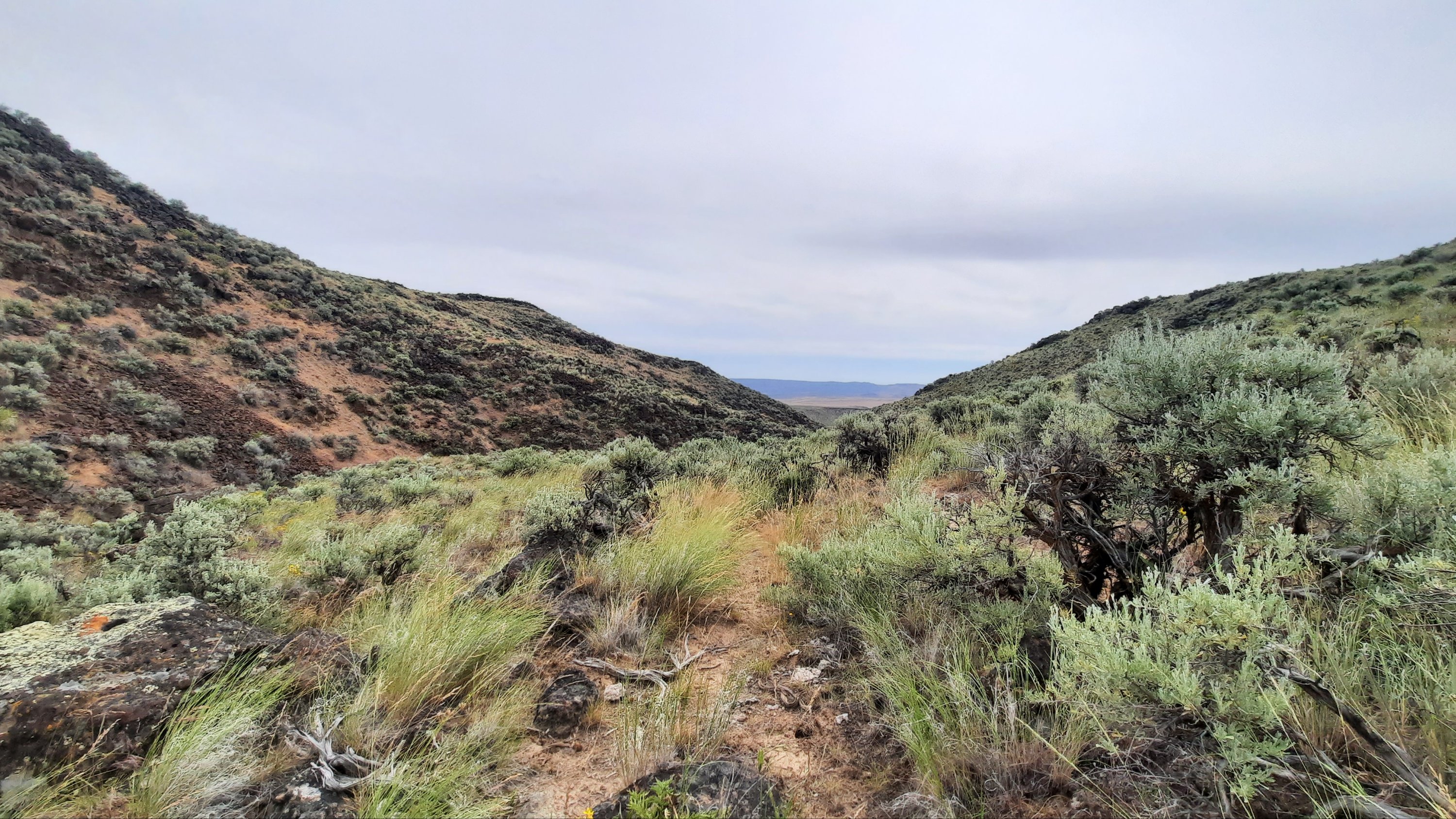
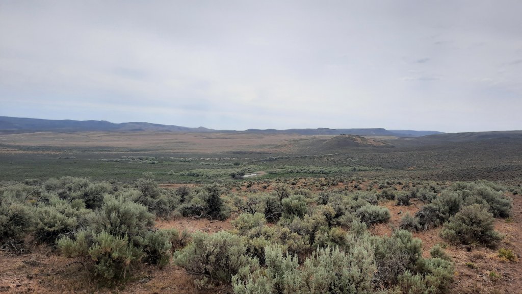
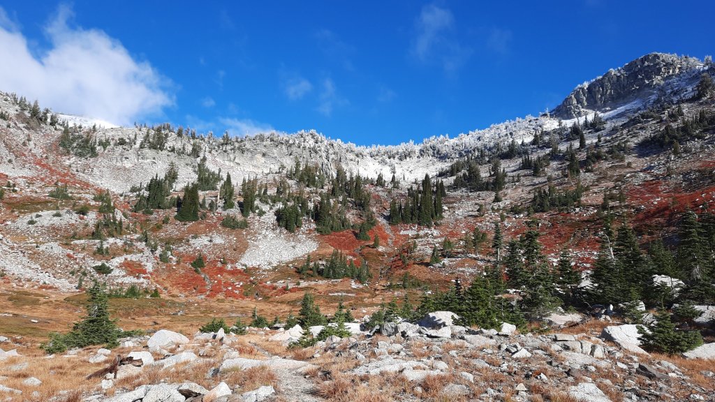
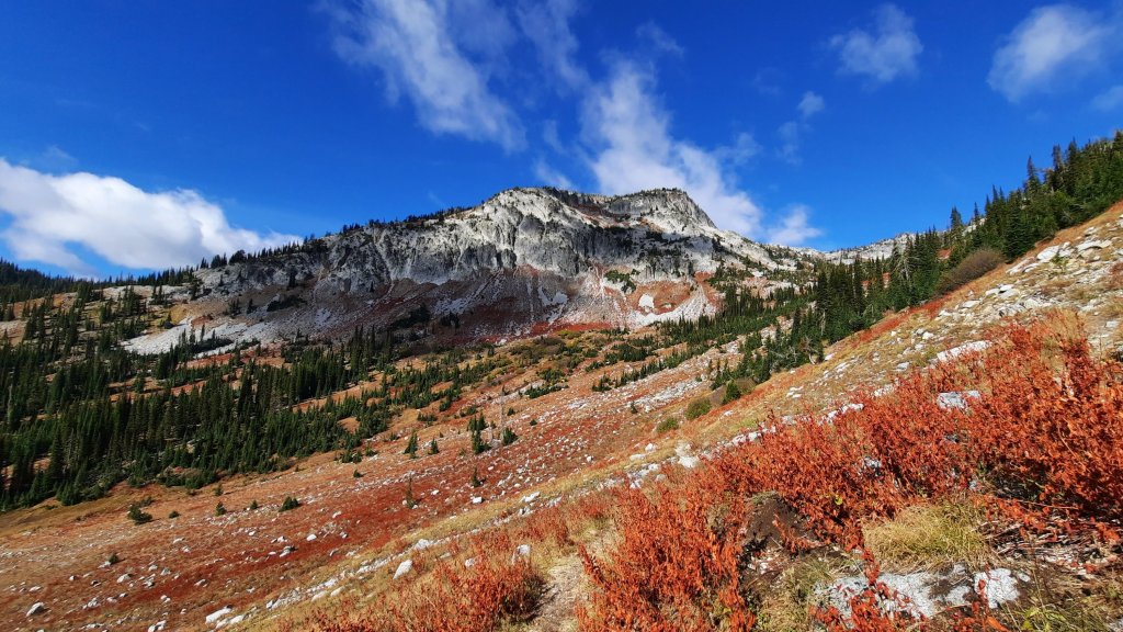
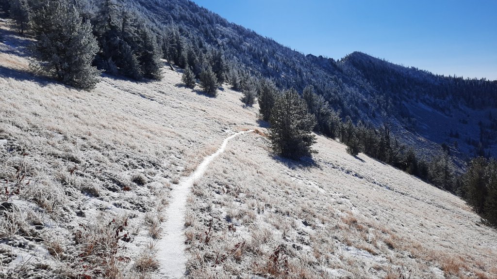
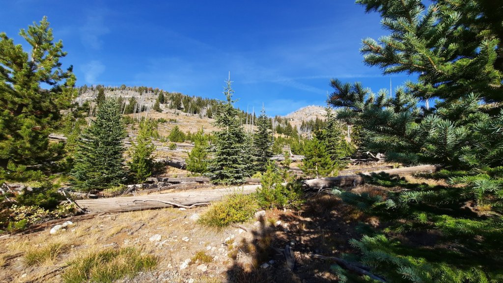
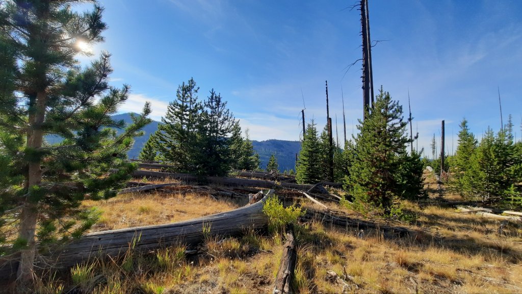
The gala isn’t until tomorrow so I had time for a short trip to walk and sleep in these mountains again. I wanted to visit the Vinegar Hill area and walk more of the Princess Trail, which looks to have some stunning ridgewalking, but the area was still closed from a fire this summer. Then I thought of the Peavy Cabin trail, which traces the headwaters of the NF John Day River until it pops up on the Elkhorn Crest and Blue Mountains Trail. Two years ago when I was here, snow blanketed the old burn area and I had just survived my first and only single degree night on the trail.


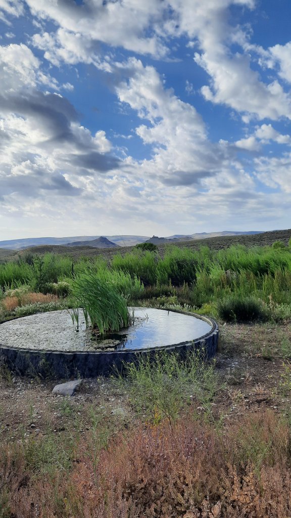
But that wasn’t the last time I was up here…another circle brings us back to summer 2021. Kirk and I took a month off work to travel the river from the source (where I am nowish, writing this) to the mouth at the Columbia River. “But wait, you didn’t write about that,” you might be thinking. Nope, I decided that I didn’t have to always capture every moment in text, last summer was a different kind of trip anyway. Was the idea to travel the length of one of the longest free-flowing rivers in the west born two years ago on the BMT as I peered down into this drainage from the crest above? It must have been, because I spent the next seven months planning for it, and in early June, Kirk and I started the attempt by walking up this trail towards the highest spring that fed the 300-mile river.

I’ll give you a few highlights…the whole month was full of excitement, card games, random meetings with friends, crazy weather, 120 degree tempatures, and quickly dropping water levels. Oh, then there was the tick in my ear…so far only a few people have heard that tale.

Kirk hiking along the headwaters
Hiking with our packrafts was too heavy.


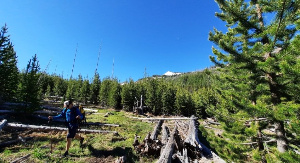
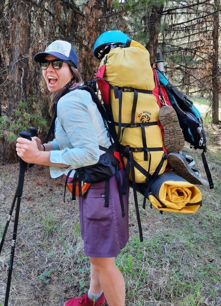
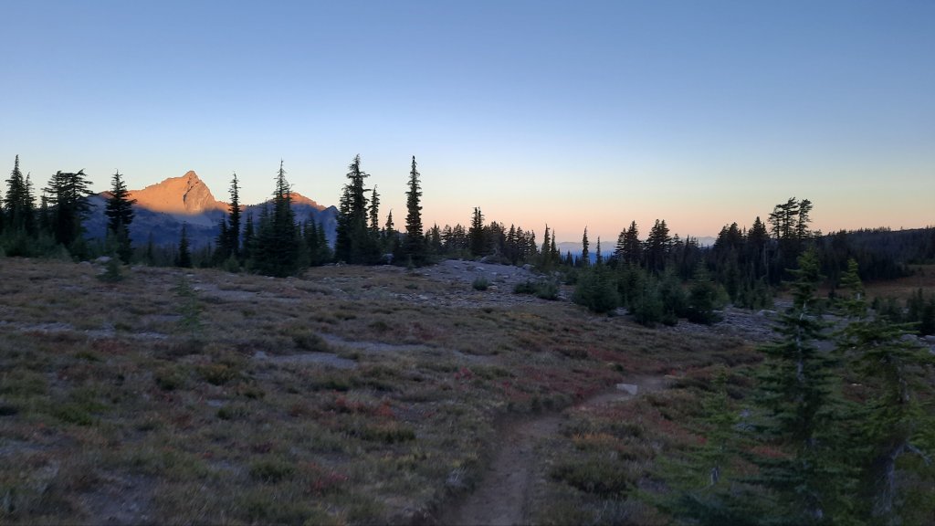
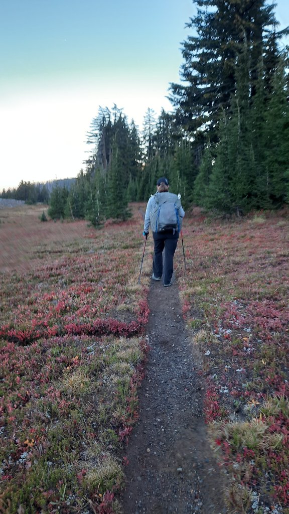
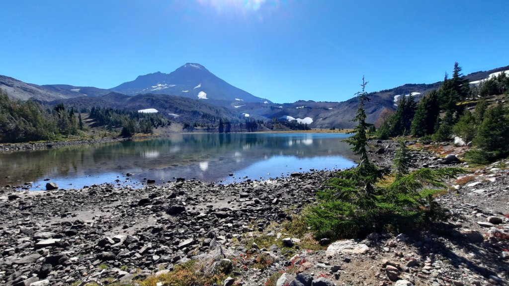
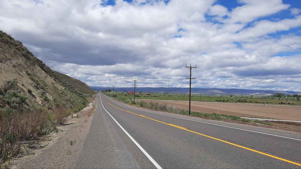
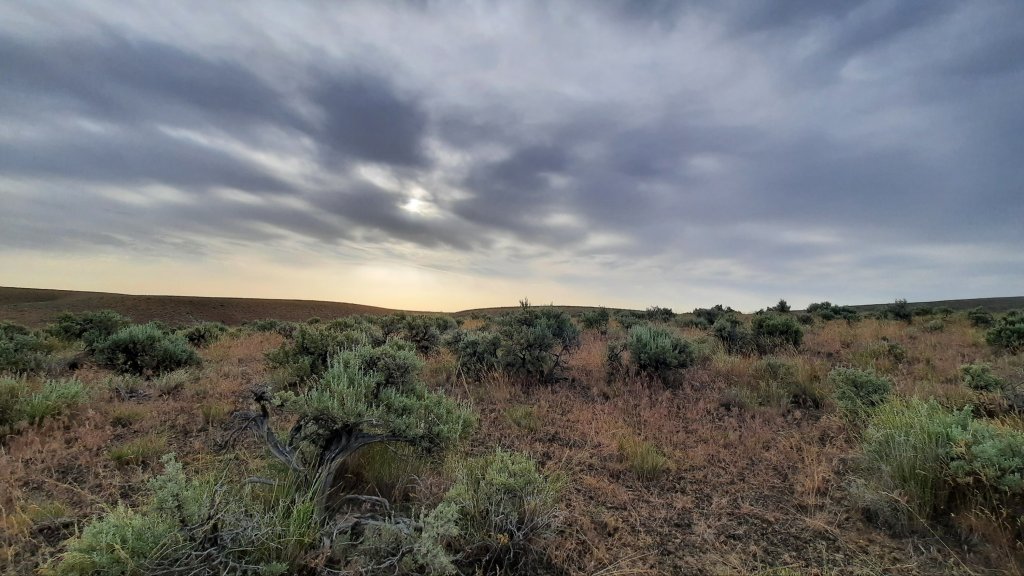
But back to today and my overlapping footsteps. I wanted to hike in a few miles, sleep with a view, and enjoy the surrounding mountains that have become so important in my life. I cruise up from Bend, bag still partially packed from my trip with Cindy in the Casades last weekend. Driving up the highway from the North Fork John Day Campground, I crossed paths with last year’s Kirk and Renee. Since we had decided on a multi-staged human-powered adventure, (hike, packraft, paddle board, IK, and raft), we had layers of logistics to figure out. BMT friends Jim and Rhonda Kennedy, who live on the Middle Fork John Day River, agreed to help out and shuttled us and some of our gear to the previously mentioned campground where we cached our packrafts. We would walk up to the headwaters, an out and back trip, because the river was too small and choked with wood to paddle.

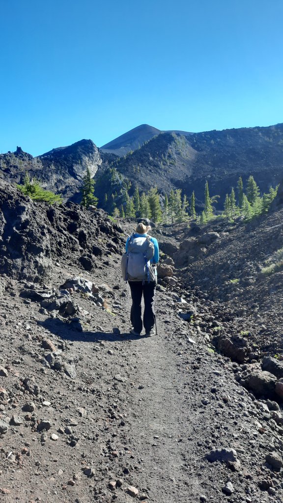
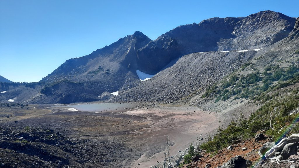
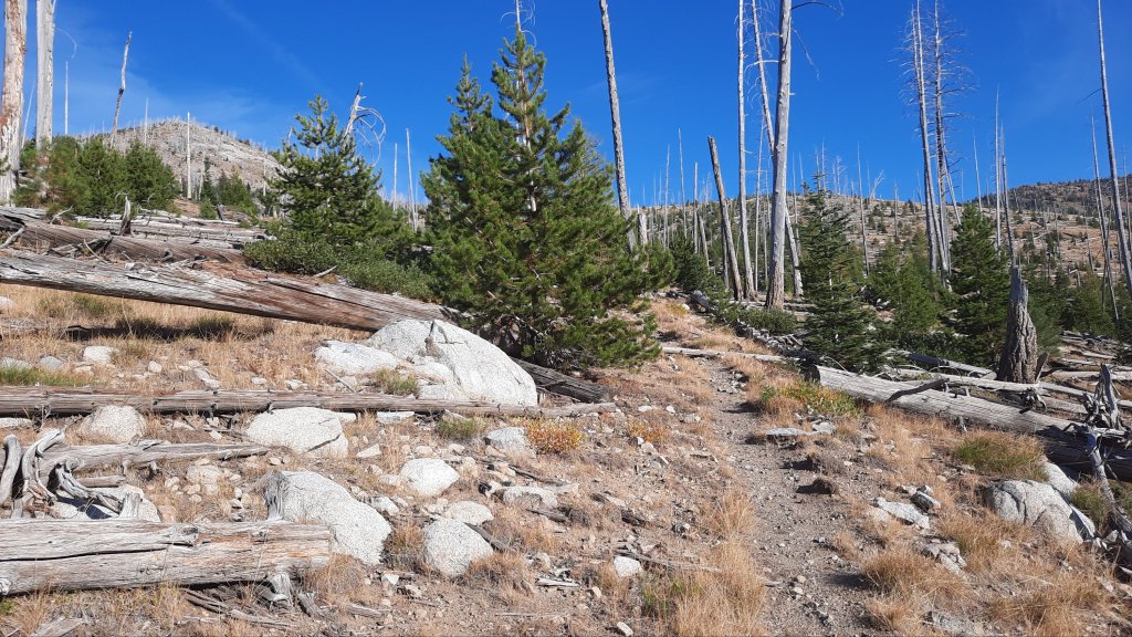
Today I drove up and parked at the end of the road, some fourish miles from that high spring. There is a trail that climbs to the ridge top and misses the highest spring, but last summer I had guessed that we could just bushwack over to it…or close to it anyway because it was on a steep part of the canyon wall. It being early June, we walked into snow and when the trail started reaching for the crest and away from the river we reevaluated.

Soft snow fields filled in the gaps of pickup stick trees – piles of them in all directions had fallen after a long-ago fire. The going looked to be a long sufferfest of postholing to that high spring, and Kirk and I looked at each other, not really wanting to put forth the effort after all. We had both arrived at this month off tired and burnt out. There had been a lot to do at work to ready for being gone for a month, and endless logistics to figure out for this trip (packing 30 days of food for two people being one detail), and now that we were here, the exhaustion had a chance to settle in.

“Nah,” we said. “Close enough.”

It’s completely hilarious to me that we bailed on the source-to-mouth thing on day one, but it also seemed quite fitting. Kirk doesn’t have the thru-hiker mentality like I do, and besides, he was here to paddle. “Let’s not take ourselves too seriously,” I thought. We were here to have a fun adventure together, and this was just the first day. (As luck, or good decisions, would have it, we missed two other sections of river during that month…our source-to-mouth trip wasn’t to be).

This river keeps her headwaters secretive…for even today as I’m climbing the trail up high and to the crest it looks like an arduous hike to visit that spring, even without the snow. The downed wood makes a gauntlet of the drainage, and I don’t have the effort it takes today either.

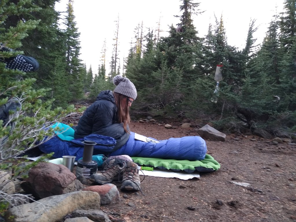
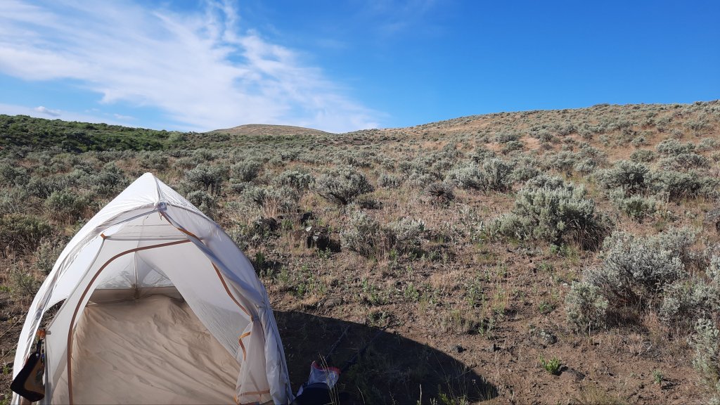
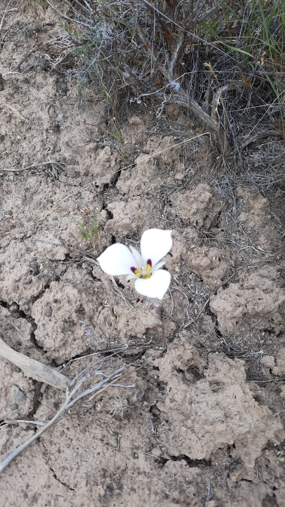
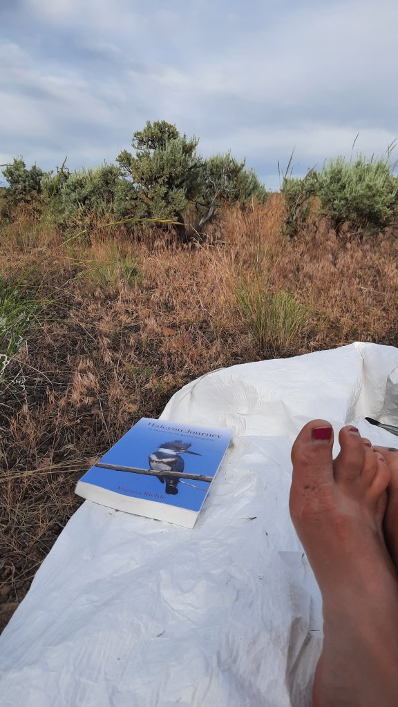
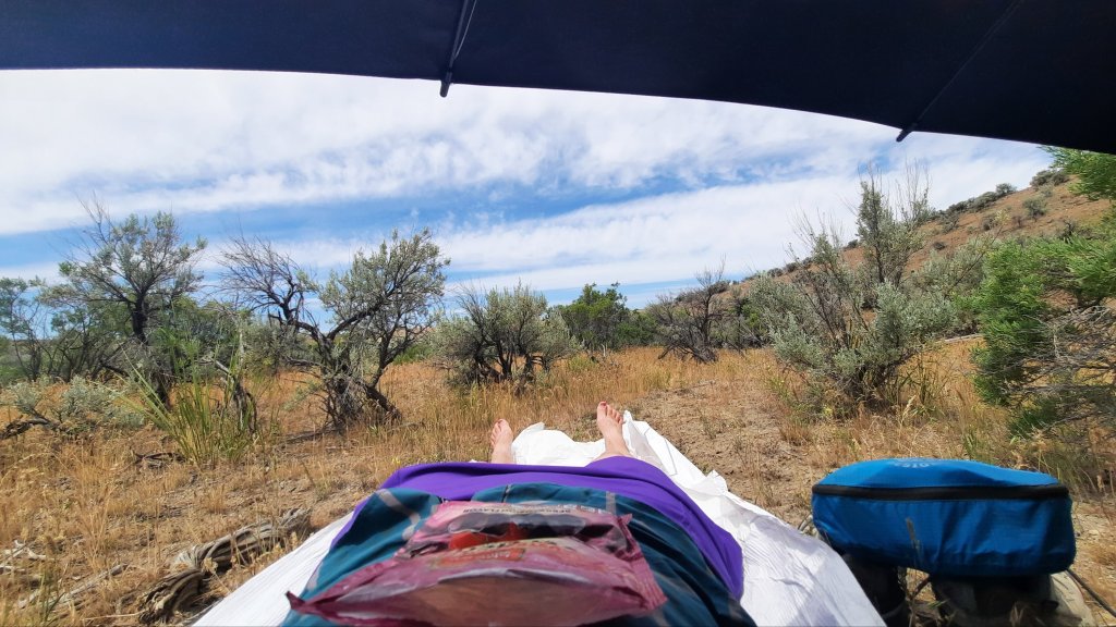
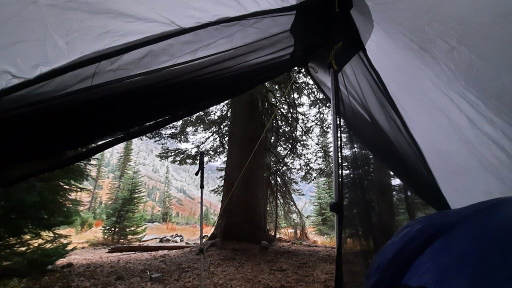
I hike in 2.5 miles until I have a view and somewhere flatish to sleep. I wasn’t feeling very mile hungry, and I kept getting stopped by good ideas that I had to write down. I am full of it when I walk…I mean them 😄


Good night, circles of me and memory. Until the next time.

Circles in the Cascades – Day 2: 16 miles

Photo by Cindy

I woke several times in the night…wouldn’t you know it, my sleeping pad had a leak. The cold ground was sharp enough to rouse me from the depth of the long miles the day before.

But! The stars were stunning and bright. I gazed at the Milky Way and the incredible infinity of the sky above. I tried to put more air into the sleeping pad but I slowly sank to the earth again and again. Drat.

When I finally had enough of the air games, I retrieved my food from the ursack and made coffee in the dark. By the time Cindy rustled herself awake at daybreak I was onto my second cup of hot drink and was reading the latest issue of Harper’s.


Ok, let’s hike! We were in the shadow of Middle Sister for hours this morning, but the air was still relatively warm, no frost yet. The colors were pure fall with carpets of maroon and gold as far as the eye could see. It was the best kind of hiking. I marveled over the difference from the Appalachian Trail…you almost can’t even compare the two trails, they are so different in character and style that it’s not really fair to sit them side by side. I do love the easy-breezy rock-free smooth trail, but my body wasn’t used to striding out…I kept falling behind Cindy and wondered if the steep rocky trail from this summer had caused me to shorten my gate…it was nearly impossible to take long smooth steps this summer….even on the flat bog bridges I had to hike a bit timid so my feet wouldn’t slide out from me on the wet wood (that happened anyway a few times).


When the sun finally hit, we were snacking by obsidian falls and about to enter the lava flow portion of the loop. Somehow a few trees were still able to do their thing, and grew precipitously from the volcanic rock. The air was clear enough to see up to Mt Hood, and we stopped often to take it all in.

My old friend
I had to wear my PCT socks for the occasion.


We were both feeling the miles in the early afternoon…even though I had hiked almost all day through the summer, the month at home and back at a desk had taken its toll, and my legs felt heavier with each mile.

Then back to the burn as we closed the loop on the weekend.


Finally I saw the glint of car through the burned out trees…cars! I do love seeing my vehicle intact at a trailhead, cause, you know, things can happen.

We hugged out our goodbyes and parted ways….Cindy had a long drive home, and I had a date with a tub of lavender scented epson salts.

What a fabulous weekend 🥰.

Photo by Cindy

Circles in the Cascades – Day 1: 18.5 miles

I’ve been home a month now, and have been perfectly content to spend most of my days inside, doing inside things.

The arm is still bothersome, but I’ve been to a physical therapist a few times, and a couple sessions of acupuncture has definitely helped me feel almost healed. I have high hope of being able to return to my regular activities, like yoga. (Oh how I miss it!)

So Cindy, my AT 2002 partner, had a permit for the Three Sisters Wilderness (my backyard), and invited me out.

The idea: Circumnavigate North and Middle Sister, a 30-oddish mile route. The weather was looking like the typical clear, warm, fall day that October can reward us with.

The start: We woke up at 5am. Cindy had arrived a few hours earlier from Portland, and I made us egg and cheese bagels while we packed our few last things. Wheels up by 6am, walking by 7:30.


We were eager to talk trail, afterall, it was Cindy’s 20-anniversery for the AT too!

The morning trail necessitated a brisk pace till we warmed up along with the sun. We were walking through a vast burn area that would take the whole morning to get through. We were heading south from Scott Pass Trailhead.


We lunched at the junction with Demeris Lake, and couldn’t resist the pull of treeline and the pass between South and Middle Sister. The lake at the top, camp lake, is apparently at risk of breaching the glacial rock, which forms its swell in the earth, and flooding Sisters. When I worked for Outward Bound we avoided this drainage for liability reasons, so when Cindy and I reached the water, it seemed i might have miss-remembered the whole situation or this was one has-been of a risk.


It was lovely though. It was all so beautiful.

We spent the afternoon sauntering, as much as you can saunter in lose scree fields, stopping for photos and expressions of delight.


The best news of all: we were headed for the PCT to walk the western portion of the loop back up to our cars. My old friend.

I can’t tell you what a psychic boost it is to have the Pacific Crest Trail in my backyard. I know it has had a profound effect on me these almost 15-years I have lived here. All trail all the time.

We worry about finding water for the night after passing several dry creeks, but our rationing fate was sweetly wiped from our brow when we saw the pretty little pond, our hopeful destination for the evening.

There would be no tents tonight…we tucked ourselves into a small clearing above the pond, and lay out our tyvek. Soon we had inflated all the things and surrounded ourselves in down cocoons. The early October air cooled around us as we looked at a small pocket meadow, all golden and shiny in front of us. Contentment. We ate snacks until it was time to lay down.

The best day.

Connections – The Shakedown Hike, Day 4: 8 miles (43.7 total)

The wind was cold last night. I thought about taking the rainfly off the tent because its mind-numbing flapping was barely tolerable, but the thin nylon was shielding me somewhat from the chilling wind. As it was I snuggled deep into my 40 degree quilt.

My morning route took a right onto a road as it crossed over another drainage, but I walked by the area, failing to see the road. I thought I could spy where it met the rise a couple hundred yards away, so turned around and looked closer. I finally noticed the gate. This road hasn’t been used as such in many decades. The tracks were gone where it crossed the drainage (with water of course) and thick vegetation obscured the way.

Here I go soaking my feet again, I thought. It wasn’t exactly the bog of eternal stench, (Labyrinth anyone?) but I was rock hopping just the same and got to the other side, dryness intact.

I’m glad I put my gaiters on this morning. The road walking was essentially cross country walking, then the next span of cross country walking was cheat grass walking.

I could see the lush farmland of the Malheur River valley below. I was working my way towards the highway where i would walk the last 5 miles to my car at Harper.

For the last bit I followed the contours of an open canal…with water! I can’t get over all the water I’ve come across on this trip. 

Then the road. Just as I step onto the pavement a semi blasts me with air and send my hat flying. I walk carefully after that, moving far away from traffic as I slowly inch around a looong corner, listening to a podcast to take my mind off speeding vehicles. 

Then, a car pulls over. I thought I might see some sympthatic recreationists on their way from the Skull Grinder bike race in Burns that weekend; I had spent the day there Wednesday as part of an Eastern Oregon Recreation Summit (talking trails and bikes) and the summit hosts were expecting hundreds of people for the race and festivities that weekend.

Ok, the car. Out gets Kate! Kate was with me at the summit and is the recreation lead for Eastern Oregon Visitors Association. I told the group I’d be out here walking, and here I am. Kate asked if I need anything, and I suggest getting a ride the last 1.5 miles to my car would be most excellent. She agreed and I hopped in. A short and lovely encounter on the side of the road. Thanks Kate!

I changed into my chacos and went inside to tell Brian about my trip. On Thursday when I showed up I convinced the owner of the gas station and store/bar to let me park my car there. Backpacking wasn’t a traditional past time in Harper, but I must have made a convincing argument because he agreed. In fact, my judgement may have been hasty. As I was walking away he waved me over to another Harper local to meet Jeanie. Jeanie’s brother had thru-hiked the Pacific Crest Trail and most of the Continental Divide Trail. Love it!

I enter the bar, remembering Brian had said he sells sandwiches. Rootbeer and sandwich…yes please! A few locals were nursing drinks, and Brian welcomed me with a Coors Light, then a rootbeer. Some of the cows belonged to a rancher at the counter, and I delicately mentioned how nice it would be if the cows were kept out of the springs… the conversation centered on the land, and I quizzed them on features and names of things. All and all, it was a great way to end the trip.

Ah, but it wasn’t over! At least I didn’t want it to be over. I had another day to play with, as my long miles on day 3 had me finishing ahead of time. So what is a big part of the hiking experience on a long trail? A town day! I decided to go the extra little bit to Ontario, Oregon and get myself a hotel room and nice dinner. 

I wasn’t ready to go home yet. Home means the end of the trip.

But getting in the car means the end of this blog….see you soon when I start writing about the Appalachian Trail! The countdown is on 😁

Connections – The Shakedown Hike, Day 3: 15.7 miles (35.7 total)

The birds chirp all night. 

On my last few outings this spring, the moon has been out and the birds don’t know to stop singing. Surely they know, but just don’t care? Do birds pull all nighters on a full moon?

I walked up the grade I saw the horseback rider on yesterday and found a better road to the spot. There was no way a big cattle truck would have taken the road I walked in on, but then again, you find astonishing things via these rough 4wd roads.

My next water source was a pleasant cruise down a grade filled with soft green hills. Patches of cloud cover rolled over the scene and the idealic setting took me to a beautiful tire-filled spring. These are the water sources we dream of. Little did I know this would be the best water of the day. I only took a liter and couldn’t resist holding it up to the light. Clean and clear.

I walked next to and through a creek the rest of the day. It was nice. 

Is it the cottonwood trees that are so fragrant? Their perfume sweetens the air.

I lunched at a spot called Hanging Rock Spring.  I failed to see the hanging rock, but then I wasn’t about to go rooting in the brush for a view. It must have been a modest hanging rock. 

Speaking of rock, the near-by drainage was named “Hoodoo Canyon” and the terrain did become very south-westish. Definitely Utah or New Mexico vibes. 

Again, I should have filled up my water when the road crossed the creek and I walked about 30 feet through it. I had already tried walking around, but once I was on the sandy talus above the drainage, the view showed me that I’d be trading a clean walk through the water for a marshy mud-foot crossing. No thanks. That’s a good way to lose a shoe.

Then I evaluated. My end of day water source wasn’t far off, as the crow flies, so decided on a cross country option up and over a few rises…such a cool way to hike! You can go anywhere out here…it’s wide open. Partial fire scars cleared the sagebrush and left cheatgrass in its wake….terrible for the ecosystem, but ok for walking.

The spring is hammered. Cows protest my approach to check it out and I find nothing but a cow paradise…there are flowers and green all around. It must be a lovely place to wallow if you are a cow.

Ok, next one looks to be a mile or so of cross country hiking. This is the part where the hills start looking like mesas and the soil turns an ashy white. Definitely a different look for this hike so far. Oh, and cactus! Blooming catus 🙂

This next spring is the worst by far.

No way. Not drinking that.

Now it’s 3 miles cross country, up and over a long climb. It’s early, walking only 10 miles is a big challenge for me when my pace is 3 miles an hour. I slow way down on a cross country sections, and in general am hiking slower on this trip, but I was cruising on this morning’s road walk.

I decided it had to be done. I could camp with what I had, but only if I eat a cold dinner and skip coffee in the morning. No thanks! Onward. One step at a time.

Ooo, there it is, my first blister of the trip. Day 3, not bad! And only when I pushed it over 10 miles. Good job body! By the way, my problem planter fasciitis foot was feeling good too. 

On the other side of the saddle that sat between the water sources I came to a spring cut deep into a narrow ravine filled with grasses and flowers. I found a way down on a cow trail (#^@%^$), but the cows haven’t mucked this one up too bad, so was able to get some cleanish water.

Whew.

Camp, eat, hide from the sun, read, close my eyes while the birds chirp me to sleep.

Connections – The Shakedown Hike, Day 2: 10 miles (20 total)

I slept well under the waning strawberry moon.

Morning was clouded up, and I was excited for the prospect of a day without sun. Temps would be much cooler and good for hiking.

A gradual cross country section brought me to a pinch-point and I scouted around a bit to find a good way down, twisting my ankle in the process. 

“Walk it off,” we say, and that works…sometimes.  

With the uneven and rocky weaving around sagebrush and the odd white mariposa lily, walking through cheatgrass just dried out enough to start sticking in my socks, but protected by my gaiters for just that reason, I found I wasn’t walking it off. I was slowly and methodically watching each footstep so I didn’t repeat the twist, and the ache remained.

Then road! But a rocky one, so the attention now went to avoiding the fresh cow pies. Oh yeah, the cows are out, and we are all going the same place: water.

The road exits a dramatic cut in the ridgeline and descends to a fenced and quite lush looking reservoir with piped water into a cattle tank. Score! This set up can provide some of the best water if it’s piped from a spring – or a cattle-free source. (Note: the danger remains that it might be pumped from the dirty cow tank behind you. I filter or treat most water when I don’t see it coming out of the ground….maybe thats just because I do so much hiking in cow country.)

Back to roads. I walked slowly up towards the top of something again. Basin and range: true sagebrush steppe walking. Except for the road that disappeared into the folds of sagebrush as far as the eye could see, it was unbroken.

The sun never came out and I walked happily under the bluish-gray moody day.

And then: a cattle truck. I knew I might run into a rancher or two with all the mooing on the landscape, but this one was really far away, I wasn’t quite sure until I got closer…thinking it could all be a mirage.

Then…a rider on horseback racing up the grade of the next climb. The human is going home. 

I am pleased that I’ll have my solo bubble intact for this 24 hours. It’s been a while since that has happened.

Another creek, and then camp. The birds are chirping away and I set up expecting a bit of rain overnight.

Mooooo.

Connections – The Shakedown Hike, Day 1: 10 miles

I’ve got to shake it off.

Shake off the time between my last solo backpacking trip and now. Those months have been filled with one unsettling event after another; my sweat is toxic with them the first day.

I am headed into the desert with modest but exciting goals: hike 10 miles a day, find water, and piece together some dirt roads stitched with cross country sections. Why? To groundtruth ideas I’ve had about linking together the Oregon Desert Trail in the Owyhees to the Blue Mountains Trail in the Strawberry Mountains, a personal plight…you might say for curiosity’s sake.

June provided a rare mild week right before summer solstice. Add in some well-deserved time-off after a week of work in the backcountry, and I had the time and good weather for a solo adventure.

This was also to be an experiment: can my rehabilitated planter fasciitis foot hold up to 10 miles a day for 5 days? I was optimistic, but am hedging my bets by going slow and stretching constantly. Oh, that, and the stick roller in my pack.

It was a shakedown hike!

I leave for the Appalachian Trail in a few weeks, so am testing my gear setup for the first time. Bits and pieces of gear always change between long trails. Each trail has it’s own gear needs, and I was preparing for hot and humid and maybe rainy weather.

I couldn’t possibly replicate those conditions in the dusty and scrubbed desert northwest of Lake Owyhee State Park, but enough pieces were in place for me to realize I was packing way too many clothes. It will take a while to dial in my AT pack…but with many options to ship things home or have Kirk send them ahead to me on the trail, I was giddy with excitement at how different a hike on the AT will be. I’ll find actual trail, people, (lots and lots of people), towns, different ecosystems and geology, trail angels all over the place, shelters, lots of water, lots of shade, lots of memories.

20 years ago from March 20 to August 22 I called the Appalachian Trail home, and I will be going home again for 2 months.

But back to the sagebrush sea.

I wandered 10 miles on rocky dirt roads that hadn’t seen any traffic in weeks if not longer. These roads are my favorite. They are everywhere in the desert and take you to water, cool things, and they are usually too rough to drive, so walk them!

Many many miles are like this on the Oregon Desert Trail. Sometimes they are whispers of a former road and you have to read the contours of the ground in front of you, and look for the ghosts of missing sagebrush. Last weekend when I was backpacking with my volunteers up into the Trout Creek Mountains, we turned onto one of those roads and the spaces where the road had been was filled with flowers. There are so many flowers in the desert right now!!! Our very rainy and snowy spring is soaking the ground frequently, so I’m hiking with great optimistim that the water marked on the map will be there…I also viewed the potential water sources on Google Maps…the detail in the satellite imagry is downright astonishing.

Even when I take my time it doesn’t take me long to hike 10 miles, so I need to purposefully slow down, take epic long breaks, linger over coffee, and read one of the 4 books I brought with me (3 digital of course!).


It’s a vacation hike! A belated birthday hike? I turned 45 on that volunteer trip last week, I ate cake with 20 people in the desert, which was amazing, but now I was treating myself to a little hike.

I intensly enjoy walking through the folds of the earth and knowing with 96% certainy that I won’t see any other humans. I am of this place and sometimes I feel this most intensily when I am alone.


Bring me back to the present, here and now. That’s what backpacking is good for. And I was brutally reminded of this when I stepped shin-deep in a mud-cow pie wetland at a desert spring. The rare desert nectar was stomped to death by their large, thirsty bodies. They wallowed in this spring, so I’m definitely filtering and treating it. 100% fecal contaminated.


Fence all the springs please!

Back to it: the walking was hot, I deployed my sun umbrella much of the afternoon, and my pale and pasty legs turned red in my new purple rain adventure skirt.

Breaks were taken in the old roadbed where my footprints joined those of deer, pronghorn, and cows, i was all spread out on new and crinkly tyvek.


It will take me at least a day to sweat town away, maybe longer. I have 5 days. Happy birthday to me!

Mountain Wandering: Day 3

Awe won. Hands down. 


Sometime in the night the rain stopped. When the first light opened the day I could see to the cliff sides across the creek; it will be a brilliant day.


I was packed and walking before 8am, excited at what I could already see. Because I took a layover day yesterday, the logistics of some of those loops and lakes were taken off the table, but it is what it is. My back is feeling better, and what I can do is climb up to Horton Pass at 8,500′ and peek over the other side to the lakes basin. I need about 25+ more backpacking trips here to see all that I want to see. 


This area has a strong pull on me.


I hike up and up, the trail isn’t messing around and only has a few miles to get me to the shoulder of Eagle Cap Mountain.


Soon I can see the snow zone. About the last mile to the top will be in snow, softened just enough by the sun to make the going easy.

I’m glad I wasn’t up here yesterday. 


This is simply astounding. 


There are no other tracks, no other signs of humans, I have the world to myself today. Up top I am greeted by ridgelines shrouded in cloud wisps, lakes and snow and trees as far as the eye can see. 


After just a few minutes I turn around and gingerly follow my footprints in the snow back down down down to Eagle Creek below.


From here I just need to decide where to camp. I am due to stay with Mike and Donna Higgins in Halfway tomorrow night, but the forecast has me a bit nervous for tomorrow. Rain is coming, snow in the high country. I drove my little Honda Fit out here, and accessing this trailhead alone had me at high elevations on gravel roads. I don’t want to get stuck, so I debate camping close to the car so I can make a mad dash if the rain/snow materializes early.


As it is, I find myself mulling over what ifs and maybes all the time, especially when I’m out by myself. Planning ahead and preparing for the worst is one of the best things you can do out here. If you are prepared for the worst, everything else will be delightful! It’s very much on my mind as I am hosting a conversation this week (October 14 on Zoom – 5pm Pacific time) about safety and risk and being prepared for a backcountry adventure. I’ll be talking with two people who were on different sides of search and rescue efforts: Stacy, who broke her knee while on the Oregon Desert Trail and needed to call for help, and Tomas who found and unconscious man and needed to provide help. Should be a good talk!


So I walk out, slowly, savoring the colors and granite and marble mountains. 


I am super close to the car, and can’t find a good spot to camp, so without really thinking about it walk right back to my car. It’s car camping time! I set up diagonally across the back of my Honda fit and manage an ok night of tossing and turning. 


This was a short and sweet little hike up into the heights of NE Oregon, and it only leaves me wanting more.

Mountain Wandering: Day 2

I thought I would give the day a head start and lay low this morning. The rain started as I was finishing my coffee and made the decision for me.

Thanks for the pancakes Charlie & Emelie!


I had 2,500’ish to climb in 3 miles. If this rain is snow up there, it could be a mild snowfall or a blizzard. Both are likely. I’ll check it out later after a morning nap.


While laying about, listening to rain drops splashing off my tent, I put on an On Being podcast episode. The topic was trees with Suzanne Simard. Suzanne did the science that proves all trees are connected, and further posits that humans are a part of that connection. 


I’m working on reconnecting presently.


It’s 10:30 am and the rain has only gotten heavier. I asked for a weather report on my InReach to find the forecast is for 100% rain this morning, tapering to 40% this afternoon and 0% over night. Tomorrow, sunny. 


Ok, decided. I dug a moat around my tent to guide the puddles of water formed in the compacted earth away from my dry things, and climbed back inside for some hot cider and reading. Thank goodness the fear I carry is boredom because I have a new book, half a Harper’s magazine and hours of podcasts in my pocket. The not walking will probably be good for my back and foot too. 


Well, the day happened, and at times the rain stopped and I could spy fresh snow above. Tomorrow will be stunning.

Mountain Wandering: Day 1

Can awe overcome pain?


The planter faciatus that I developed on the Blue Mountains Trail continues to plague me. I’ve made attempts (some successful) at solving the piercing pain in the heel of my right foot, but it always comes back. 


Oh, and I tweaked my back this summer for the first time. Kirk and I were up at Elk Lake for his birthday, moving paddleboards to the lake, when I twisted while picking one up and my whole lower back twinged and I had very little movement and a lot a pain. I did it again to a lessor degree last weekend when I tried to get out of my tent. 


Both are plaguing me on day one of a 4-day solo backpacking trip into the Wallowas. Maybe I can walk it off? Not likely with the heel pain, especially since I walked that one on last fall.


Ok, it is manage it then…but I’ve got to get serious about healing both. I have a 2-month sabbatical at work next year and I’m going hiking!


So to the awe: this marble and granite chunk of Mountains in NE Oregon (where I started the Blues Mountains Trail last year) is out of this world. I’m hiking (it really feels like plodding) up Eagle Creek towards Horton Pass. The golds and reds from the October fall days are piercing blocks of color against the green and silver rock of the canyon walls. 


A family out horsepacking passes me while I pulled over to eat lunch. They look prepared to set up somewhere for a few days, and when I saw their tracks headed up to Hidden Lake (my intended destination for the night) I found something lower, saving me the 1000′ climb. I’ll take it, for the views at my new camp are already making me forget my worries. 


It was a short day, relatively speaking, but I have no agenda, only loose ideas, and there are countless options for trails, and lakes, and passes, and loops, so I’m just going to take it as it comes this time. No imposing my will on the miles, instead, letting the Wallowas (and my body) impose their will on me.