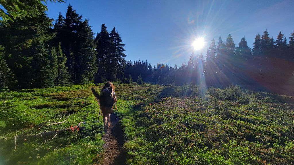
We lingered on the last moning. With only 12 mile to go and Kirk showing up around 5pm to pick us up, we had all day to make our way around Mt. Jefferson. It was a two cup of coffee kind of start to the day.
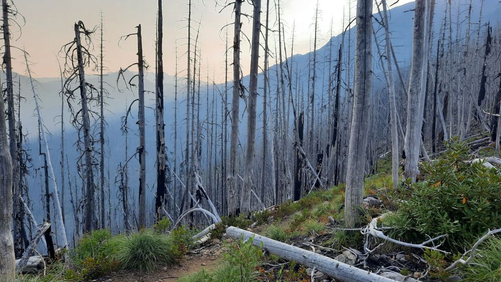
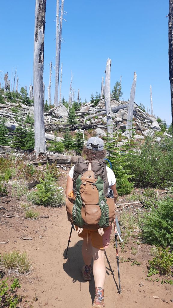
One mile after leaving camp we entered the burn. An apt description of the next campsite said “sleeping in an ash try.” Everything was torched. The plus? Berries were still lining the trail. I didn’t know huckleberries were so resilient!
We climbed and climbed up to the start of Jefferson Park, and low and behold, much of the Park retained the lush green splendor! The numerous lakes and ponds must have kept the hot at bay, but there were incursions here and there where a patch of trees held the flames back.
We snacked at Russle Lake and enjoyed the rest, even despite the mosquitos trying to drive us away.
Then up and up some more to the next pass where NEMO had a tearful goodbye with Jefferson. This was a mountain to fall in love with.
The north side had snow fields and the trail was full of sand and rocks which acted as ball bearings as we gingerly made our way down.
It was almost the end of our hike, and our feet were ready to be done. We had visions of a swim in the lake when we got there, but when arriving at Breitenbush Lake we found blowdowns and no easy access. When we did manage to make it near the shore it was marshy with no place to take a dip. Bummed, we made our way back to the PCT and splashed off in the creek nearby and sat down to wait for Kirk.
A few hikers came by that we had been leapfrogging, and then the dusty blue pickup pulled up, early!!! Kirk brought cold drinks, fruit, and chips and I hauled the magic over to share with our new friends. More hikers showed up and soon there were 5 or 6 of us snacking in the shade.
Finally we decided it was time to leave the PCT and we loaded up in the truck for the harrowing six mile drive out on a very rough road. Once we reached pavement the going was much smoother, and we spend away to Sisters for a burger and a beer.
We slept hard. A solid sleep after a day of toil and effort is the sweetest thing.
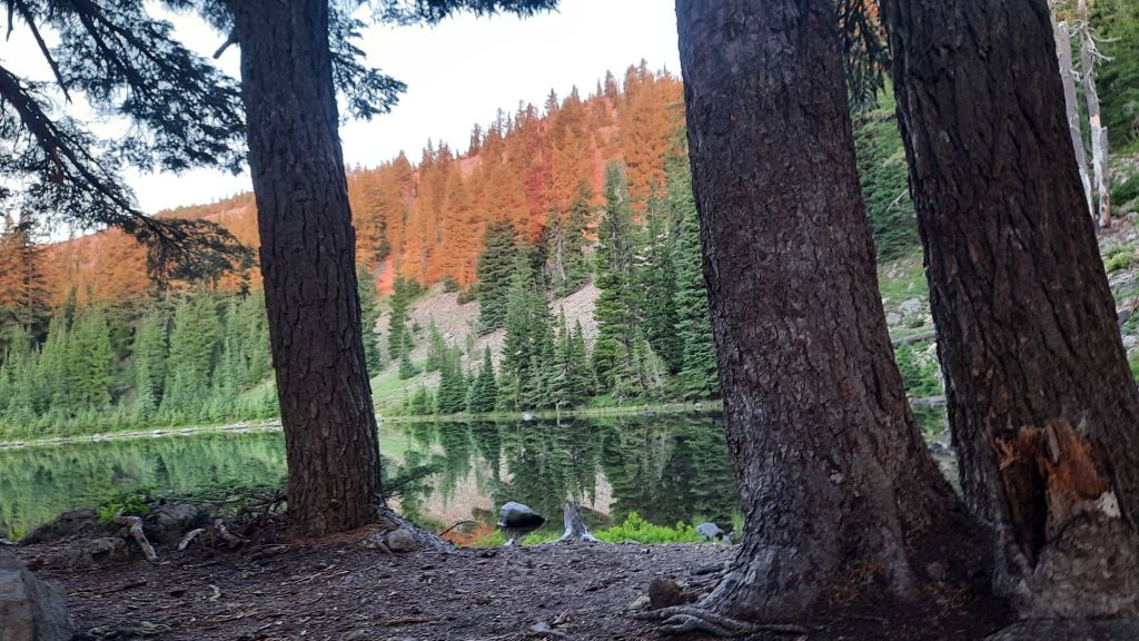
We drank our coffee as the orangy morning light slowly lit up rockpile lake. What a way to start the day! There were four other hikers who had set up around the lake and soon everyone was up and about, rustling gear and shaking out tents. It was fun to be in the middle of the nobo and sobo rush. We were seeing plenty of folks headed in both directions, and it was a bit sad that we had to dip out so soon and leave the through-line.
The hiking was glorious! Nemo said this is what she had been dreaming about. Scrubby little lupine carpeted the ground with bright red paintbrush and yellow and white flowers joining in the medley.
Simply stunning.
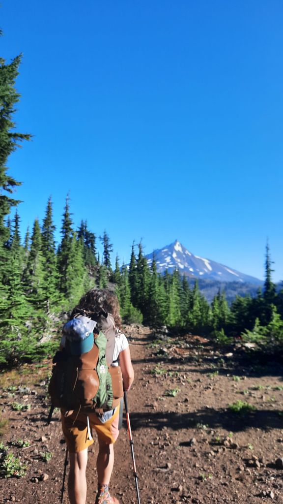
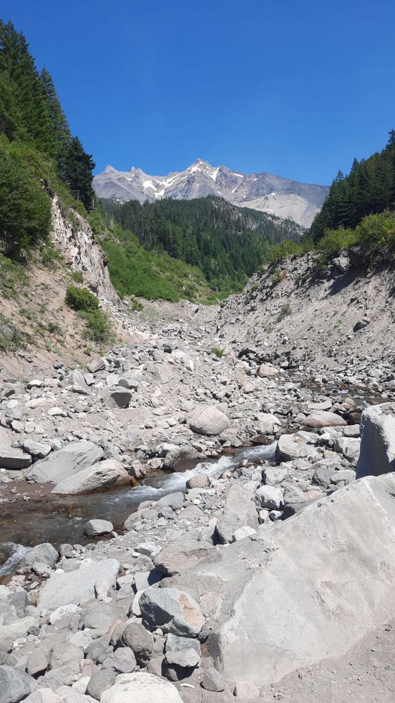
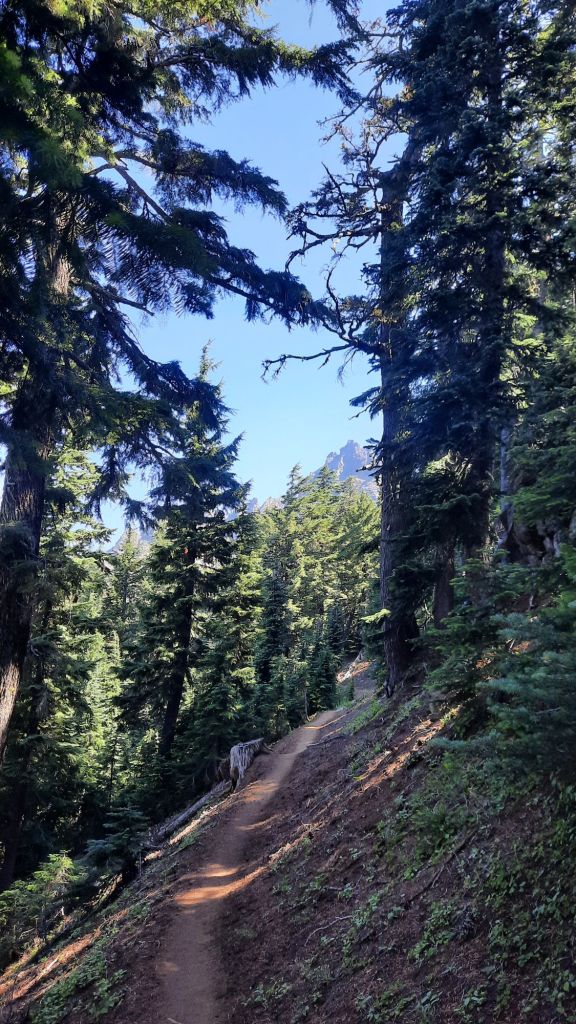
Mt. Jefferson played peekaboo with us as we climbed and descended ridges, and as the mountain got closer, so did our excitement and trepidation. The big burn of the last few years loomed ahead and had torched the last 13 miles of our hike into Breitenbush Lake and the magical Jefferson Park. What would it look like a few years later? I had been to Jefferson Park several times and knew what it used to look like, what would this trip bring?
We were full-body old lady achy today, so wanted to have a shorter day. Camping was in short supply though, and if we hiked too far we would be in the burn and suboptimal camp spots.
We hopped across Milk Creek, not as milky as you might expect, and reluctantly started climbing the grade ahead. I had been hoping for some good camping at the creek, but it hadn’t panned out.
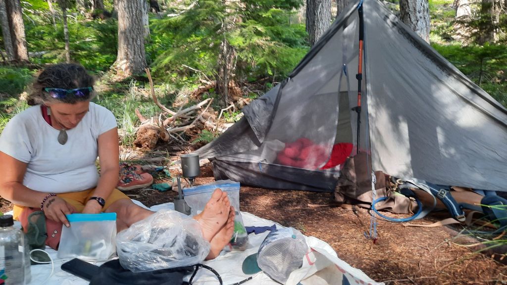
I kept my eye open. Sometimes there is a little spot flat enough for a tent or two hidden in these long climbs and descents, and after about a mile I spotted it! Just the right size for me and Nemo and our afternoon repose.
We luxuriate in the light breeze and bit of a view we had through the swaying trees. Quite sublime.
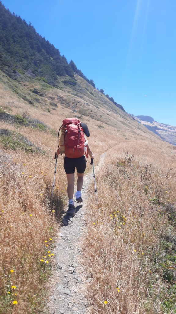
We are both in decent shape, NEMO just finished hiking the New York 46ers in a burst of mountain climbing before her birthday a few weeks ago, and I backpack regularly, like last weekend. But it’s becoming clear that we are not trail hardened, and a few long days on the trail are painful reminders. My PCT memory is of flat cruisy trail, and of course it is in some sections, but more often than not it’s going uphill or down. We are passing a mountain a day in this short hike so we have to climb up on the shoulders of each one….and it takes effort.
And the effort is rewarded. You just can’t beat the views on the PCT. Sooooo incredible. And so torched. These miles have been hit by fires again and again. We walk through successive burns and small pockets of lush old growth. Lush! The ground is often damp in these sections, damp! And the flowers 😍. And the air is so much cooler. It’s viscerally apparent how important these forests are when we hike into a burn area again and there is nothing but a cathedral of burned trees in every direction with the heavy smoke of the nearby Pyramid Fire hanging below us.
The heat smacks us in the face.
I want to walk in the forest again, but there isn’t much.. I brace myself to what we will see in the most recent burn at Jefferson Park. A wonderland of lakes and huckleberries…before the fire that is…
And fire is the theme because fire is everywhere. The story map I worked on with a group called Resilient Headwaters came out recently (take a look! It preforms much better on a desktop or laptop) It’s about the recovery and recreation. The story map covers aftermath of the Santium Canyon 2020 fires that burned through vast swaths of forest just to the west of us.
But I haven’t told you about the day! We didn’t realize what a smoke bomb we had been sleeping in until we hiked up and out to Three Finger Jack’s flanks and saw the dank carpeting the pass below.
Numerous southbounders sped past us on their quest to get to town, and the hiking, while mostly uphill, was also quite gentle.
We snacked and walked, lunched, and walked.
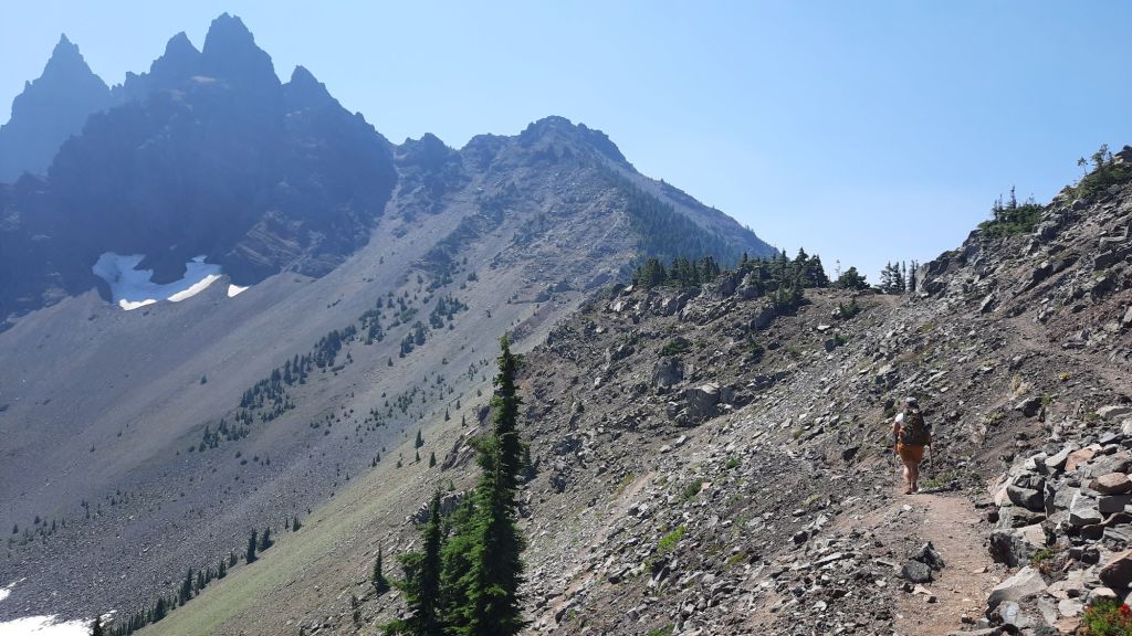
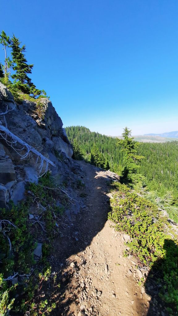
Three Finger Jack does impress. We walked right below the crumbly peaks and switchbacks down the northern spine. The views were stunning despite the hazy smoke look.
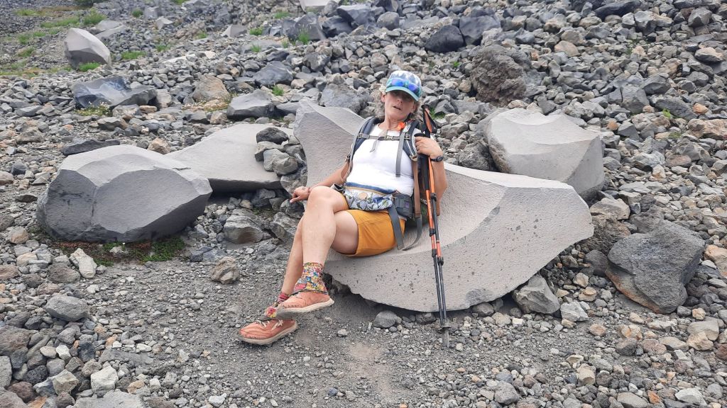
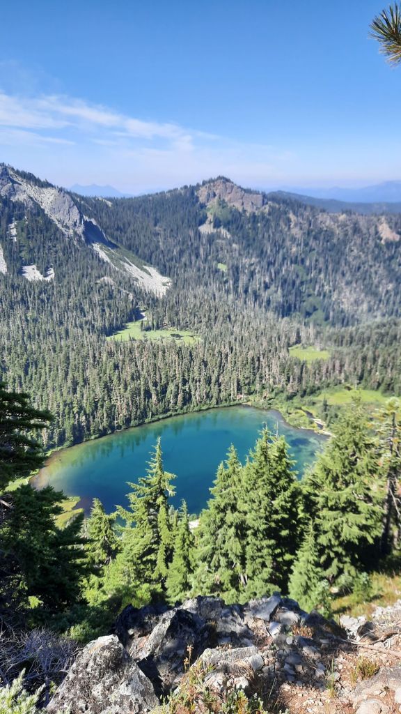
Up next were boulder fields and ponds nestled in the jumble. We spided the deep blue Wasco Lake and I convinced Nemo to go down for a swim. It required extra effort and I questioned my quest for a bit when the going got real steep on the way down. 500′ in .2 miles. Yikes, but when we were floating, the hurt that would hurt on the way up was far away.
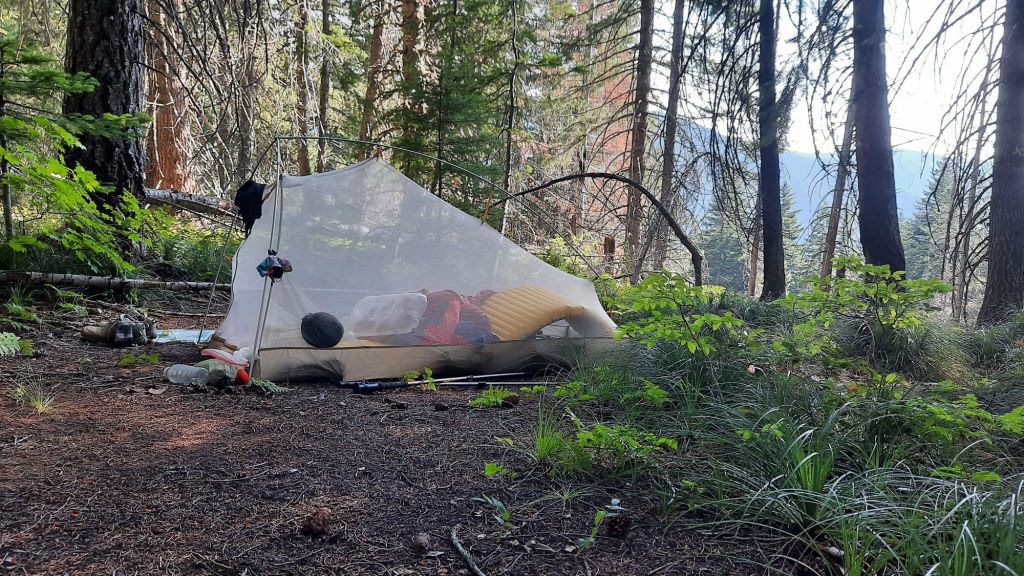
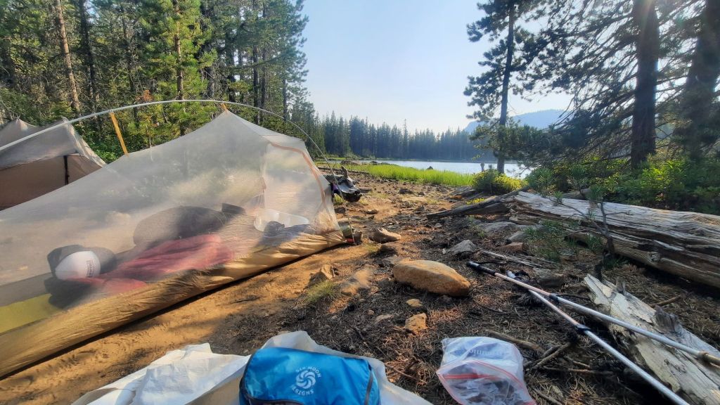
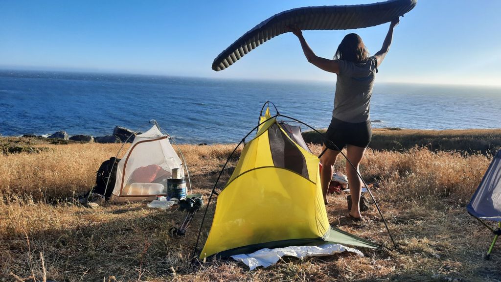
Refreshed, we immediately lost that cool feeling on the climb up. But I did have wet hair and a wet shirt that helped with the hot afternoon. We had some lovely stretches of trail in small swaths of forest and finally arrived at Rockpile Lake which made a wonderful camp.
There was almost a chill in the air, so we put on layers with glee.
We walked through lava fields and lava flows. Through burns and one little patch of not burn that was quite refreshing. The air was still enough and the sun bright enough that it slowly cooked our brains as we plodded through the miles of ridges and flows.
We kept hopschotching with Battery a thru-hiker from Germany we had met at the campground last night. Each time she stopped to snack, or we stopped to eat gummy worms and gummy butterflies, we got to know her a tiny bit better. By the time mid afternoon rolled around, the three of us had stopped to pluck huckleberries together. Battery was headed to Sisters from Santium Pass this afternoon, and we were stopping sooner than that at a pond that was reported to be both small and big.
As the day progressed, our feet and muffin tops felt the miles, but we were quite pleased with our 17 miles for the day. I thought we would see more thru-hikers, but we had to take into account the triple vortex: MacKenzie Pass, Big Lake Youth Camp, and Santium Pass offer hikers the delights of town, resupply and showers.
All in all, we spent the day focused on our feet, being careful not to trip and scrape our faces off on the jagged lava rocks.
Dinner was a NEMO-made mac and cheese special. Going horizontal was dessert.
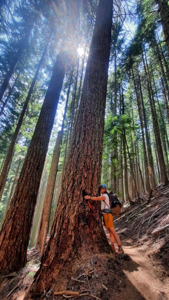
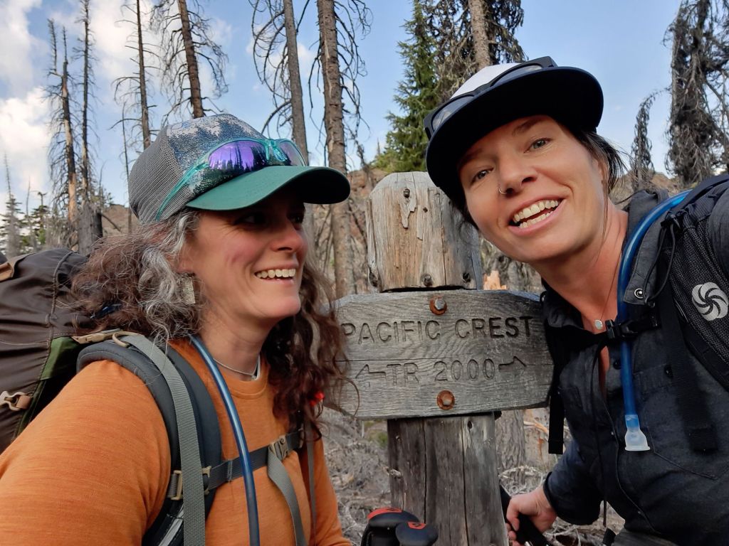
Every few years NEMO and I reunite to have a hiking adventure. There have been hikes on the Arizona Trail and Northville Placid Trail, the Sunshine Coast Trail and Appalachian Trail, but this time we would be returning to the scene of our friendship. We would be returning to the Pacific Crest Trail.
We both agree…there is something about the PCT that shines a bit brighter in our lives.
Maybe it was our age?
We both turned 29 that summer.
Maybe it was the community?
With a class of only 300, 2006 was an intimate time to hike and get to know some incredible people.
Maybe it was the landscape?
Yes. It was most definitely the landscape. We walked the length of mountain ranges from the Sierra to the Cascades, and each mountain meadow and chilly tarn was more dramatic than the next.
We fell in love on this trail: with the world, with ourselves, with possibility. We can do anything, and believed it. Still do.
Nemo was out for a week, and the plan included trail and river. After a 4-day jaunt on the PCT we would head to the lower Deschutes River for a splashy few days. It’s summer baby!
I put her on a bike for a margarita lunch date and cruise along the river before we hopped on a piece of inflatable pizza for a float.
When in Bend!
The first day was topped off with some Olympics and snoozing on the couch.
Nemo threaded the needle of family vacations, summer sicknesses, and a bursting garden to arrive in Central Oregon and our smoky skies. We were in the thick of fire season, and the toxic air was a risk factor to our plans. We watched the AQI and headed out the door with levels below 100. (Not far over the mountain though, Oakridge was well into the 400s. That’s poison air).
Kirk took us up to McKenzie Pass, and planned to pick us up 60 miles to the north in four days.
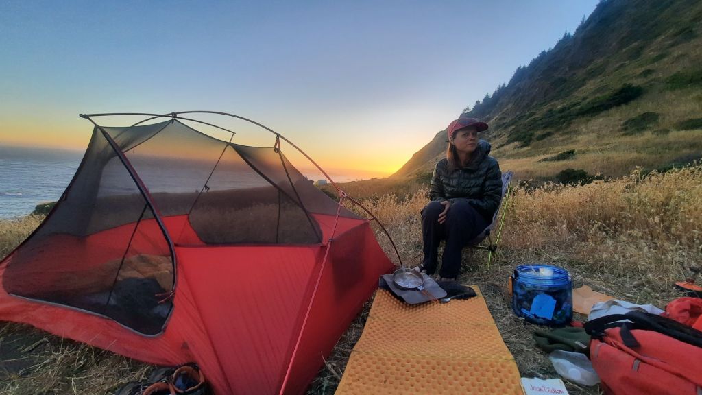
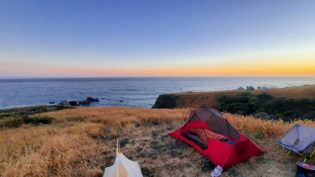
I went to bed thinking that I might regret sleeping without the rainfly on the tent due to dew and moisture and stuff in the coastal air, but things remained dry despite the early morning fog. Winning!
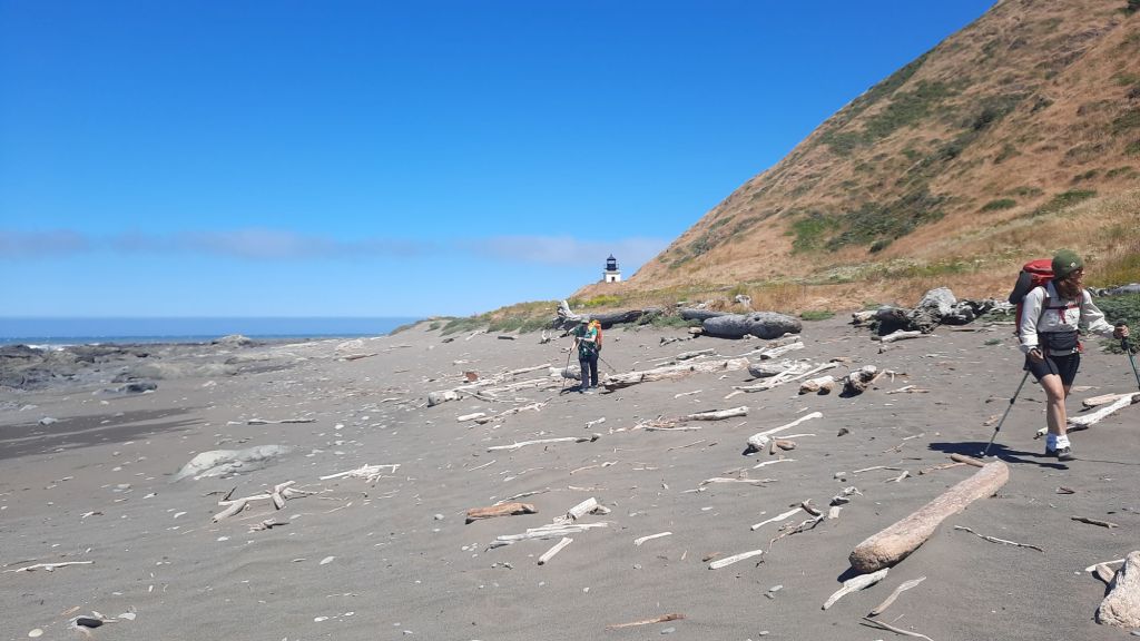
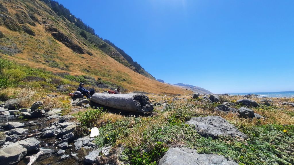
I had to make a trip to the beach to do my business, a beach that was all baseball-sized rocks. The drop-off into the water was sharp and I kept my eye on the ocean….it could have been disaster if a rogue wave had caught me precariously perched on that steep rocky slope of ball-bearings, but I made it through. The view was worth it!
This part of the trail has some of the deepest waters along the entire west coast. Check out these fun facts about the section of trail we would hike today:
“As you’re pinned against the cliffs, dodging waves and the occasional rock-fall, remember this: Just south of Shipman Creek, the ocean plunges into sudden depths of a channel of the Delgada Submarine Canyon. It gets deeper faster than almost anywhere else on the West Coast.
This canyon is a massive chute for sediment as it flows down into the deep sea. It is a remnant of the San Francisco Bay drainage. As the Pacific and North American plate slide past each other, it has migrated north at a few centimeters per year.” (From an online guide to the trail. There are other fun facts in there too, like the story of a hippy comune that took up residence at a lighthouse that we passed yesterday, and to get rid of them the BLM burned down all the buildings! 😯)
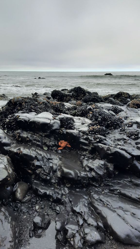
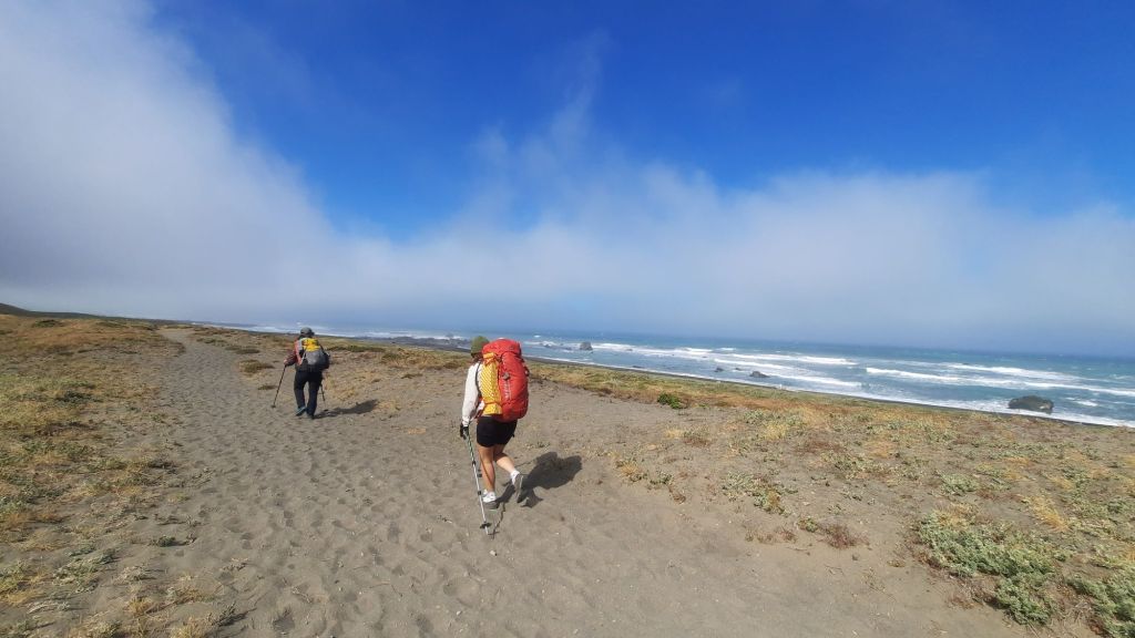
Back to the day…Cindy took off before we were packed up, she was feeling strong and spry…and is training for a Colorado Trail thru-hike later this summer. Lace and I walked along the hard-packed wet sand in the overcast day; it was a very pleasant morning because we had expected a slog through deep sand. Low tide was at 9:30 this morning, so we had ample exposed beach to walk. This part of the coast seemed much more abundant, and we started seeing starfish and other sea creatures in the tide pools…the tide pools to the north had been devoid of life to our disappointment. There was also a blissful absence of trash! Lace and I had only picked up three plastic bottles between us, and a few small pieces of colored plastic on the hike so far.
We dodged waves that broke on the beach when we got too close to the water, and stopped to smile at a few seals napping on rocks just off the shore.
We caught up to Cindy about half way into our mileage for the day as we walked towards Shelter Cove. The houses perched on cliffs above the sea steadily got larger, and we started talking about lunch options. Sure I could eat my last tuna packet for lunch, but I could also eat a burger in town….🤔 there really wasn’t a decision to be made 😉 we would reach the car about 11am, a hot meal was in our future shortly after.
We hadn’t been sure of our pace with the tide miles, so had given ourselves ample time to make it back to Bend….tomorrow if need be, but our early arrival at the car meant we could easily make the 9-hour drive back to Bend in time to sleep in our beds. Brilliant!
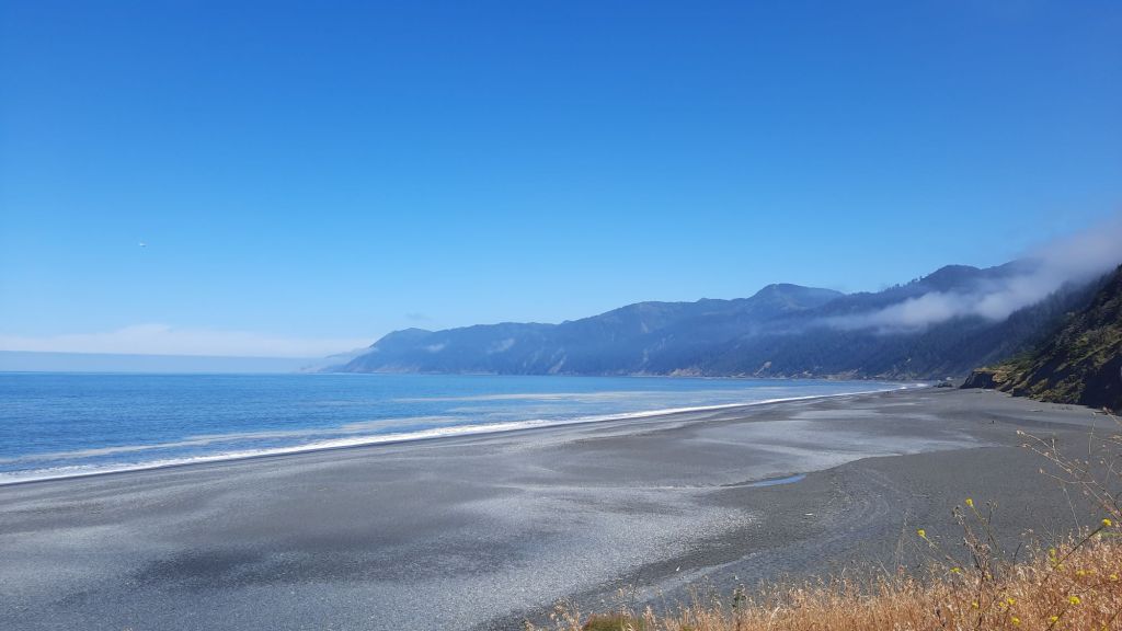
After burgers at the campground we walked over to view the coast stretching to the south and finally saw the namesake cove of Shelter Cove. We even saw whales breach the water! It was a fitting end to the trip.
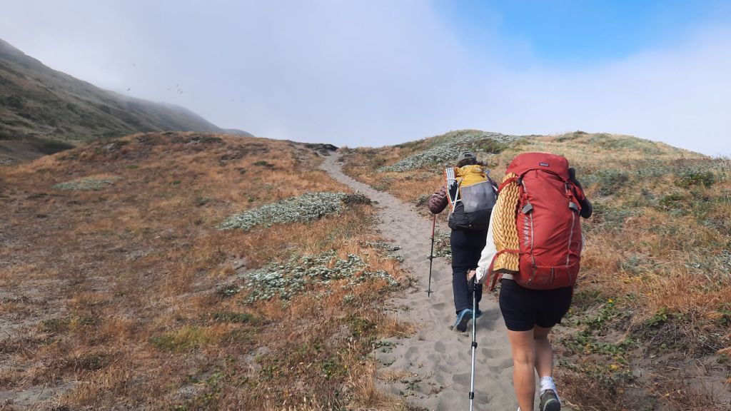
After sufficient coffee and food, we broke camp and entered poison oak ally. In short stints today, we would have to push through thigh-high bushes of danger and we tried to remind ourselves again and again to not touch our pants or our faces. You have never wanted to touch your face more than when you can’t.
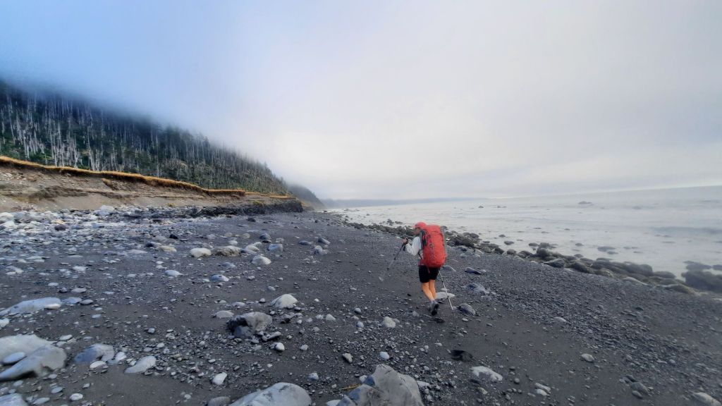
On the beach, we had a 4-mile low tide zone, or to be more accurate, a below 3-feet tide zone. The planning materials for the Lost Coast Trail gave a helpful hiking window tied to the tidal schedule each day, so essentially, we had until about noon to hike this section. Not all days are created equal, though, and other days, the hike window is shorter or at inopportune times. These few days lined up perfectly.
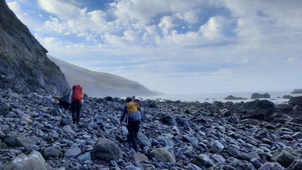
We had a buffet of surfaces today…the next up were basketball sized rocks covering the beach. Most were fairly stable, but a few would rock and roll when you stepped on them.
Then more sand. The walking was firmest in the wet sand close to the waves, but you had to be careful to avoid getting caught in those sneaky ones. All in all, it was a pleasant morning, and soon we were out of the danger zone and snacking in the sun.
The weather has just been perfect. Sunny, mild, a bit foggy and humid, but not oppressively so. We were all getting a healthy dose of vitamin D, but like the responsible mid-40s women we were, wore sunshirts and sunscreen.
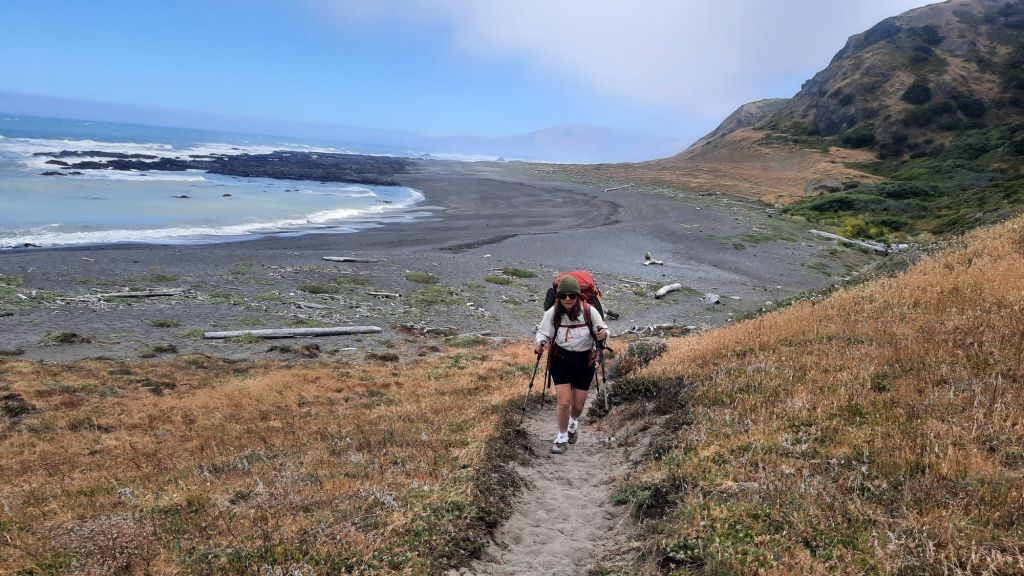
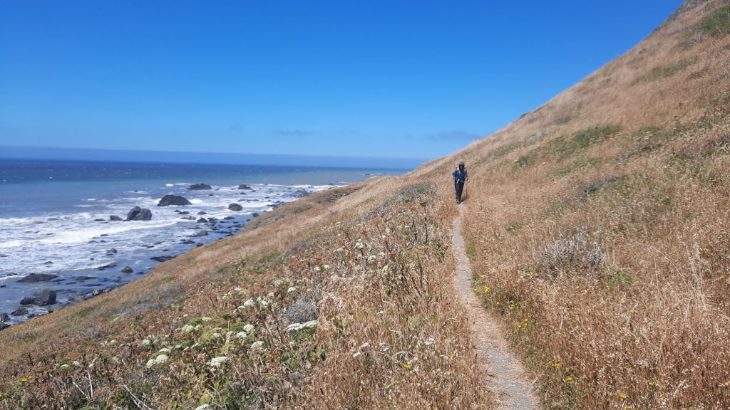
The next stretch was primarily on grassy bluffs above the sand where the walking was firm and fast. We cruised past a number of private cabins, and one even had their own airstrip. A flight in might be the easiest access, oh sure, there were trails that plunged off the steep mountains, providing access from the top, but as one guidebook explained, one of the trails out here has 2,000′ of elevation change in 1 mile, making it one of the steepest trails in the state. Ooffta. Now I know why it’s called the Lost Coast. Many don’t want to make the journey, either by carefully planning the tide tables as we are doing or dropping down a steep poison oak laden slope.
We lunched with a view and continued on.
Here is something interesting I had never done before on a hike: instead of walking inland away from the beach to dig a cat hole, we were instructed to dig our holes in the sand below where the next high tide would wash it away. Poor fish.
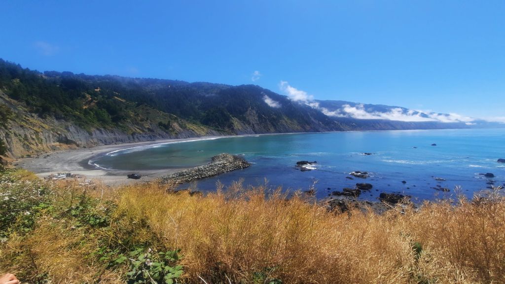
Camp was a big wide flat called Big Flat. We crossed the Flat River to find a charming camp nestled in the trees. We had shade, driftwood benches, and plenty of soft sand to make our nests for the night.
We had another happy hour spread with a bit more cheese, fruit, chocolate, and crackers that we had squirreled away, and lazed about reading and napping until it was time to make dinner and watch the sun set.
The hike would be done tomorrow, but in spite of the short miles, the trip felt immersive and all-encompassing. Maybe it was the sea, constantly reminding us of a force larger than ourselves, a timeline where we were only a grain of sand in the expanse of everything. Regardless, it has been a wonderful hike, and our group of three travels well together.
The ocean holds our itinerary. We can’t out hike her tides, and along this northern California coast, that means long hours of leisure between miles of no-go zones. Some of these zones stretch a 4 rocky miles, miles that are under water all but 5 or 6 hours a day. So we wait. We snack and nap and watch the sea lions and elephant seals play king of the mountain.
Speaking of elephant seals, I was walking the trail by the Punta Gorda Lighthouse when I had to stop and decide if the large lump ahead of me on the trail was a log, rock, or 4,000 pound elephant seal. When I realized it was a seal, Lace and I tiptoed onto the beach to avoid its slumber (they can be agressive…but we aren’t quite sure what that could look like) only to find more lumps of seal lazing about on the sand. We threaded the needle, tiptoeing between them, and passed by without incident. It was pretty cool.
But I haven’t told you how we got here… this morning, we woke up in the Shelter Cove campground, a bit bleary-eyed from the constant bouey echos just off shore, then packed up and drove to Black Sands Trailhead to meet our shuttle bus. Eight other hikers materialized with packs and poles, and at 7am sharp, we gathered for the safety talk, which included warnings about tides, pinch points, poison oak, and elephant seals. Then, to the bus for two hours of gut flipping mountain roads. We climbed and descended ridges and peaks, and I marveled at the houses we passed, perched on the steep sides. Our driver was full of interesting info…like the fact that this part of Humbolt County made a name for the California weed industry. It was so remote that folks could grow here back in the day, and law enforcement usually wouldn’t bother with them. Now that the drug is legal, the ease with which others can grow in the valley compared to the effort it takes to run a grow operation up here has cut into their hold on the market, so the plant has to lean on its brand of “original Humboldt County weed.”
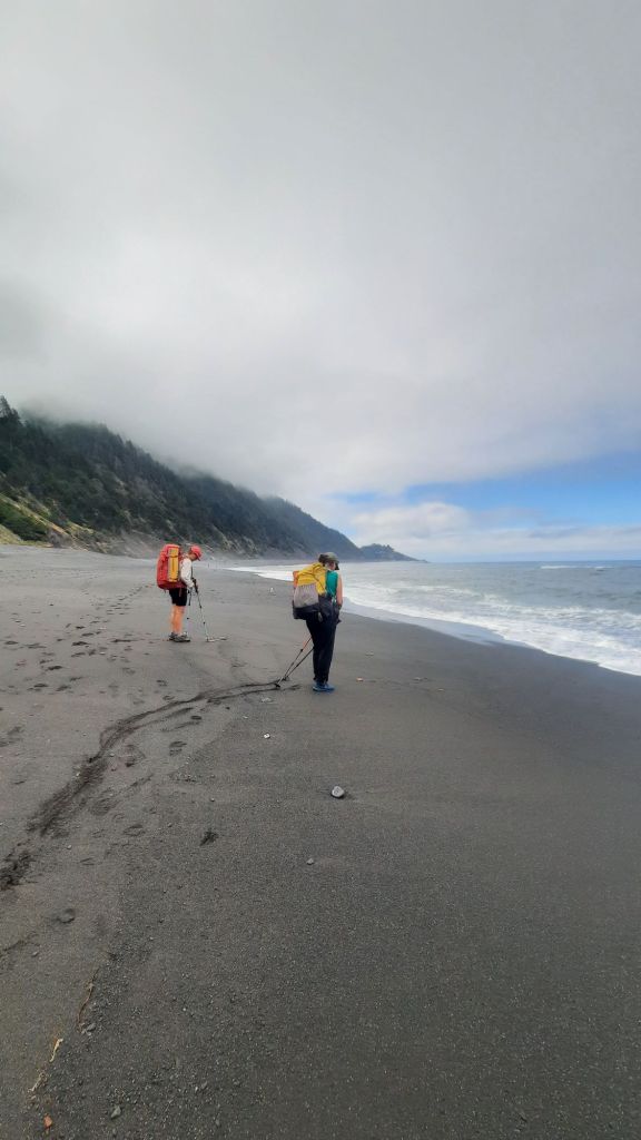
We finally arrived at our northern terminous, Mattole Trailhead, without anyone puking, and gratefully piled out. Packs on, we took our start photos and headed into the dunes. The first few miles, we walked in deep sand amid grasses clinging to the slopes, and we all put on layers to manage the cool California fog.
We decided that you can add “California” in front of most items to get the accurate nomenclature out here. Like California poppy, California pelican, and California sparrow. Lace is quite the interptive ranger and regales us with bird IDs using the Merlin app. Flowers carpet the slopes above the sand; most of the beautiful yellow splashes of color are courtesy of bountiful dandelions. California dandelions? We decide these flowers have gotten a bad rap from the roundup folks… Have they been demonized as yard weeds simply so this conglomerate can sell us poison? Dandelions are a food source! How can something beneficial be a weed?
Back to the walking. The walking was a bit arduous in the deep sand, but walking above on the grassy slopes was hard too…the poison oak is sneaky in the area, it carpets the ground and also uses the surrounding vegetation as a ladder and can get quite tall. It’s practly everywhere, so I choose to walk the beach more often than not.
The sand, though. I dump it out of my socks and shoes and lament that I didn’t bring gaiters to keep the grains out. Lace’s technique involves a bandana tied around each ankle, but success is mixed.
After only 4.9 miles, we make it to the next tidal zone, and it’s too late in the day to scoot ourselves through the four-mile beach. It’s almost covered in water, and will be until 5am tomorrow. So we make camp on a tilted perch 200 feet above the ocean and next to a little shady oasis of a creek. Thank goodness for the creek because there is no shade to be found at camp, and we pass long afternoon hours by the water and Lace even busts out a gormet happy hour spread with six kinds of cheeses. Cindy and I provided the wine, and we feasted like queens amid the poison oak.
Numerous groups hiked up and past and are all crowded into a few camp spots around the corner from us. We were a bubble of hikers that would most likely be leapfrogging each other the rest of the way as we timed our walk to the sea.
Most impressive was a family of five with three young ladies. I love to see it.
When the sun finally went down, we retreated to our tents for the night, lulled to sleep by the groans and honks of the seals.
Cindy, my road trip partner from the April eclipse and Big Bend hike arrived in town this morning after a very early drive from Portland, and Lace, a friend and former work colleague, came from a few neighborhoods over. The three of us piled backpacks, car snacks, and selves into Cindy’s Corola, and we were off for a tide-driven walk along the northern California coast.
Have you heard of the Lost Coast Trail? Lost is accurate, for a large percentage of the hike is under water due to tides, and hikers must plan their walks along long stretches of narrow beach carefully. Very carefully. On this trip, we would have the added gauntlet of breeding elephant seals. Really! An alert had been sent out warning us of these massive creatures and their anger. Added to the normal challenges of deep sand walking, wet rock hopping, poison oak laden trails around pinch points, and those short tide windows, and we were looking at an exercise in scheduling for this 25-mile hike.
I know! 25 miles isn’t a lot! But it will take us almost three days to put the puzzle pieces of challenges together. Let’s go!
Not long after driving into California, we popped out at the coast in Crescent City. This was the Cresent City of the Bigfoot Trail, the western terminus that is. The Bigfoot Trail is one of my trail clients this year…their 360-mile trail through 7 wilderness areas in the rugged Klamath Mountains wanted some help, so I did a through analysis of their trail materials and surveyed many of their stakeholder groups to produce a 40-page report of findings and recommendations for how they can shore things up and meet their goals. Great fun! This is what I want to do for all trails! The next step will be helping them implement some of those suggestions if we can find funding…I’m figuring out the whole business of trails things. It’s exciting, and I’ve taken the attitude of learning-by-doing.
The learning-by-doing nature of the Loast Coast Trail will include short stretches of hiking and long stretches of hanging out, looking at the high tide, and snacking. It’s very hikertrash of me to be thinking about the snacks on this short hike, but hey… you can take the hiker off the trail, but you can’t take the hikertrash out of the hiker.
We arrived at Shelter Cove, where we would meet our shuttle driver in the morning, and set up our tents at the campground perched near the sea. Next, dinner. We made our way over to the nearby pub for beers and dinner. Shelter Cove is a bit of a misnomer. By looking at a map, it seemed neither sheltered nor a cove…at least where the campground was. In fact, a post dinner hike revealed many houses too close to the ocean that I feared for their future in rising seas. But today the cliffs held and we luxuriate in a glorious sunset….the first of the trip!
Bedtime to the roiling sound of the sea.
P.S. There is indeed a cove at Shelter Cove, south of the campground. The maps are right 😄
It was another cold lazy morning, meaning we didn’t emerge until there was sunlight light on our tents. I guess we’ve been lucky because some parts of this deep canyon don’t get sun until late in the morning.
Our first mile and a half went straight up and out of the canyon and my legs wanted to have at it, so I let them fly and we topped out the 1,000′ climb at a steady 3mph pace. I was feeling strong and fabulous 💃
The rest of the miles back to the car were mellow, and of course they seemed longer than we wanted them to be. After a quick lunch break where I enjoyed another of my tuna packets in half of a pepper (delicious!) the terrain changed from the quiet ponderosa pine forest to more of a scrubby hot desert where we saw cholla for the first time. Big cholla!
The miles stretched and expanded and with every thought of being done and enjoying a cold drink in the shade, the trail stretched out a little longer. Ooofta.
Finally we saw evidence of civilization and emerged at a trailhead a short while later.
At the car we took out my camp chairs, took off our shoes, and dug beers from the cooler. Even though the ice had melted, they were cold enough. Done!
But not done, I had made a reservation at the Gila Hot Springs, and on the way we stopped in Doc Campbell’s again and visited with the owner Kristy who would be participating in my presentation at Trail Days soon. We bought chips and sausages for camp, and made our way down a dusty road to our campsite.
Soaking helped set the miles we had just hiked, and the rest of the afternoon we chatted with our neighbors and let the warm waters work their magic.