Many of you who have been reading my blog over the past year know that my job has morphed due to the pandemic; instead of leading group trail work trips, I went to work creating a program to give our volunteers an opportunity to contribute to ONDA‘s desert conservation work.
I had no idea how the program would turn out or what the interest would be, but some amazing volunteers worked with me as my coworkers and I put these projects together, and we got some great stuff done! We even hired a wonderful intern this fall to help me process all the data that folks were collecting for us.
You can read about Lily our intern here, and view the story map about 2021 here.
Thanks to Six Moon Designs for publishing this blog post about trying to get paid to hike 🙂
After five-months of joy, challenge, struggle, and laughter, I reached Canada on my 2006 PCT thru-hike determined to find a way to get paid to hike. I felt freedom and exhilaration in waking up each day, facing the obstacles of the trail, overcoming those obstacles, and making tangible progress towards my goal to walk across the country. I couldn’t imagine going back to the “real world” and my desk job, no matter that I had recently finished graduate school; I wanted to live and work outside and hike forever.
Sound familiar? Many thru-hikers get bitten by the hiking bug and decide to try and make hiking a career...try being the important word here. Making a career that lasts (and pays the bills) in the outdoors can be as daunting as the first step on a long trail, but as I learned from my varied career attempts (guiding, leading trail crews, working in wilderness therapy, organizing logistics for Outward Bound, starting a small hiking brand, freelancing as a writer and graphic designer, and finally to developing a new long-distance trail) I have tried almost everything to get paid to hike and live outdoors. That pursuit can be a struggle, but the rewards it can bring are so worth it, especially if those jobs give you the time and space to keep hiking.
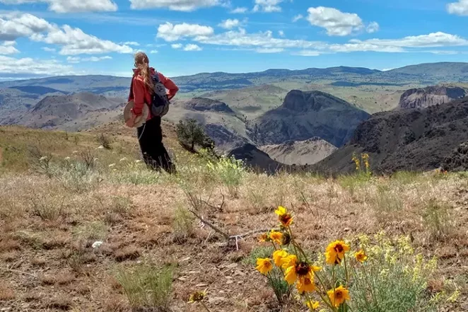
Renee is currently the Trail Coordinator for the Oregon Desert Trail, and started the brand hikertrash. Photo by Robert Curzon
Many times these careers start as a side-hustle…as a way to stay engaged in the hiker community while still being able to pay rent, but they can lead to more if you are willing to get creative and tackle the challenges of employment the same way you tackled the 4,000’ climbs, the flood-stage river crossings, or the two weeks of rain on your hike: through determination and showing up each day.
The Experts
I talked to a few of my favorite “career hikers” to learn more about their journeys into the profession, and discovered we had many things in common. Liz “Snorkle” Thomas is an author, speaker, and owner of the gear-review company, Treeline Review, with fellow long-distance hiker Naomi “The Punisher” Hudetz. Mandy “Purple Rain” Bland makes hikers look good with her line of Purple Rain Adventure Skirts, skirts, kits, and dresses. Jennifer “Odyssa” Pharr Davis is an author, National Geographic Explorer of the Year and owner of Blue Ridge HIking Co in Asheville, North Carolina, and Heather “Anish” Anderson has made a career as a writer and speaker, breaking many FKT records along the way, and has also been named a National Geographic Adventurer of the Year.
Many themes emerged among these five women as we talked about the why and how of trying to get paid to do what you love.
Connectedness to the world
What about thru-hiking is so compelling that someone would want to make a career out of it? The overwhelming answer from these incredible women came down to: realizing I am a part of nature.
Liz shared, “[Thru-hiking has helped me realize that] I’m a small part of the bigger ecosystem and universe. It puts everything I’m working on in life into perspective.” Naomi expanded, “nature accepts me for who I am at that moment. I truly feel alive, part of the world, and where I am supposed to be,“ and Jennifer commented, “Feeling the interconnectedness between humans and the environment has changed how I see the world and move through it.”
That connectedness to the greater world has truly been one of the best outcomes in my life since setting foot on the Appalachian Trail almost 20 years ago. Developing my relationship with nature and the world has been transformative, and thru-hiking has helped me understand that I am capable of much more than I would have imagined.
Realize your potential
“Thru hiking helped me find my strength,” Mandy explained. “We’re made to do hard things and hiking pushes you to that limit. So many times in my life I have looked back to my long hikes to find the motivation to get through the sticky stuff.”
Mandy with her son, both wearing Purple Rain Adventure Skirts
Those of you who have read Healther’s books will recognize these sentiments: “The thing about hiking that has impacted me the most is the self-reliance, courage, and resilience I’ve found within,” she said.
Helping others develop that connection
Something that keeps me motivated to contribute to the thru-hiking community is the thought that I can help others find true joy and fulfillment in moving their body through space and time while deepening their relationship with nature. This driving force was mentioned as a pivotal factor among the other hikers as well.
“I think the world would be a much better place if everyone could feel that sense of belonging to the world, Naomi said. “So many of our societal problems come from a place of not feeling accepted. And if I can help even one person along the path to experience that feeling of complete acceptance from Mother Nature herself, I would feel like I made a difference. So that’s what I want to do – help people get outside and feel comfortable doing it.”
“I had a great job at a museum that let me hike and come back and work, but I never loved it as much as I loved teaching and encouraging people to hike and backpack,” Jennifer shared. “I figured if I was going to stay in the museum world I would probably need to go back to grad school. I decided to follow my heart and try to start my own hiking company, telling myself that if I didn’t work I could always go back to grad school. It’s been 14 years and I still tell myself that.”
Jennifer had help with the opening of Blue Ridge HIking Co.
Liz shared, “For me, part of being a hiker and enjoying hiking is also about giving back. Being outdoors is about being happy and feeling like you’re truly living life. Having a career where I can help more people feel the joy of being outside is honest work and I’m proud to do it.”
My priorities were different after hiking
“I had a lot of trouble with transitioning back to ‘normal life’ after thru-hiking,” Mandy said. “I left a desk job hell bent on not going back there after the AT. I didn’t know what lay ahead but I knew I wouldn’t be going back to the daily 9-5. I think once you start living for yourself like you do on trail it’s hard to imagine following someone else’s schedule. I love the lifestyle of owning my own business, it’s full of freedom and adventure, what I love so much about trail! I found my strength and confidence on trail and transformed it into a skirt. I want to share that with everyone!”
I like to say thru-hiking ruined me for “normal life,” and once I’ve felt that freedom and exhillariation, spending 40+ hours a week on something I wasn’t as excited about felt dull and boring. I agree with Liz’s sentiments wholeheartedly, “Hiking as a career path feels like the most honest expression of myself. It’s something that I can give my whole heart to and honestly feel like that the work that I’m doing makes people’s lives better.”
Liz with her book, Long Trails: Mastering the Art of the Thru-Hike. Photo by Whitney LaRuffa
Not everyone I polled looked at the topic of careers in the same way. Heather commented, “I actively decided that I would never make the thing I love so much into a job because it would kill the joy. Instead I focused on developing a career that would allow me to spend as much time as possible engaging in outdoor activities. There were a lot of things I tried along the way, but finally found my niche several years ago as an author of hiking books and a professional speaker who focuses on connecting the lessons I’ve learned through my hiking experiences to daily life.”
Heather’s book Mud, Rocks and Blazes chronicles her 54-day thru-hike of the Appalachian Trail
Don’t be afraid to hustle and be honest about your priorities
“Look for problems and use your skills to find a solution, Liz explained. “Treeline Review was born to solve a problem I saw in outdoor gear writing. I wasn’t seeing outdoor gear reviews that felt objective…instead, gear reviews felt like they were pushing readers to buy the newest and greatest thing… “I wanted gear reviews to show people of all backgrounds, ages, and levels of experiences pointing readers to trusted gear and ‘can’t go wrong’ choices, like giving advice to a friend.”
Naomi advised: “Choose your career path very carefully. Don’t assume that because you love long-distance hiking that you’ll love doing it for your career. For example, I personally would never want to be a hiking or backpacking guide. My thru-hiking time is invaluable to me, and I don’t want to risk jeopardizing that by turning it into my job. Not to mention, it would take a LOT of hustle to earn enough to live on as a guide. So don’t rule out careers that are peripherally related to long-distance hiking, and get REALLY good at your job.”
Naomi regularly hikes, tests gear, and writes in-depth reviews for her business Treeline Review
“Decide if building a business or building a lifestyle is more important to you before you get started, Jennifer said. “There are lots of freelance and entrepreneurial jobs that will allow you to live simply and maintain a thru hiker lifestyle. If you want to build and grow a consistent business it’s probably going to take you off long trails for a bit.”
Mandy encouraged, “Go for it! The cottage gear industry is having its day and as consumers we are more conscious about where we spend money,” she said. “Start small, and have a side hustle to make ends meet. If you’re tough enough to love long distance hiking, you’re tough enough for business.”
Heather also suggested: “I would advise others to be honest with themselves about their skill set and get creative. Careers these days are much more varied than in the past and there’s constantly room for innovation and self-expression that results in meaningful, impactful work.”
Some final thoughts
“Don’t be afraid to take risks. One of the scariest things I ever did was take time off for my first thru hike. I don’t know how I found the courage to do that in the middle of a recession, but looking back it was one of the best decisions I’ve ever made in my life. There’s never a perfect time,” Naomi advised.
“Starting my career and motherhood are very much intertwined for me. Having my own business allowed me to stay home with my kiddo through the early years and it still does today,” Mandy said. “Not to say that it was easy, but I feel fortunate to have built my life in that way. I’m still hikertrash at heart and often run my business as such, but maybe that’s not such a bad thing.”
“Running a small business is a lot like hiking a long trail. That should be a confidence boost for any thru-prenuers! It also allows you to call your own shots. I’ve guided backpacking trips pregnant and with an infant strapped on my chest. We’ve had other female guides lead trips pregnant or with their nursing infants. I think that’s pretty awesome and I doubt it would have been possible working for someone else,” Jennifer said. “Feeling responsible and providing financially and emotionally for a family and/or employees is not lightweight.”
Wherever you are in your hiking life, or career path, it’s never too late to explore how to transition your love of trails into a profession, but as explained above, it’s worth diving into your motivations. Do you want to hike forever? Perhaps focus on creating the lifestyle that allows you to take large chunks of time each year to hike like Heather has done. Want the freedom to call your own shots and integrate being a parent into an outdoor business? Jennifer and Mandy have found creative ways to do so. And finally, one of the pieces of advice that resonates with me comes from Liz’s comment about finding a solution to a problem. Have you ever wished a certain piece of gear existed, or a service was available somewhere along your hike? Listen to that wish, it just might be your ticket into a new career path.
Six Moon Designs is also selling their Owyhee Tarp with a portion of proceeds going to support our work at the Oregon Natural Desert Association. Thanks for the support SMD!
I’ve been working hard over the last seven months to revamp the Oregon Natural Desert Associations Independent Stewards Program and all that hard work is starting to pay off! I just launched a few more projects this week, and we have plenty of opportunities for folks to go adventure and preform some important stewardship or monitoring tasks on their trip.
The Source (a weekly paper in Bend) just published a nice overview of the program.
Go and deepen your connection to Oregon’s high desert and help us with some work while you are out there.
ONDA’s Independent Stewards Program
Volunteer projects designed for individuals or households to safely undertake during the pandemic
BY DAMIAN FAGAN
This past year was a rough one, even for volunteers. Many nonprofit organizations canceled group volunteer projects to minimize exposure during the pandemic.
One local described that experience.
Photo by MARK DARNELL, Monitoring in the Spring Basin Wilderness in Eastern Oregon.
“I tried to volunteer last year, but COVID derailed that,” said Jess Beauchemin, a volunteer with the Oregon Natural Desert Association. This year, she’s signed up to do monitoring of Wilderness Study Areas in the Prineville District of the Bureau of Land Management.
With risk levels changing, the curtain is partially lifting, and ONDA is ramping up its Independent Stewards program.
“We’ve had an Independent Stewards program since about 2015,” said Renee Patrick, Independent Stewards program coordinator. “But it’s been a very small part of what we offer and wasn’t very well developed with resources to really help people feel comfortable going out by themselves to do stewardship or monitoring work on their own.” With that, ONDA’s Conservation and Campaign staff members began to explore options for utilizing volunteer help with on-the-ground projects, but in a different capacity than the historic group outing. “We went back to the beginning and dreamed big,” added Patrick.
The staff created projects that would be rewarding and engaging to volunteers and could be completed on a flexible schedule. The stewardship team then spent five to six months building out the projects with partnering land management agencies, drawing up maps and collating project information. “We are even doing video tutorials and some of the projects have introductions from our agency staff explaining how the work will impact the on-the-ground aspect to a location or contribute to some greater goal,” added Patrick. The goal was not just to create work projects, but to also relate these projects to the greater context of ONDA’s conservation work and the protection of wild places in the high desert.“To develop a deeper relationship with a place you’ve got to spend some time there.”—Jess Beauchemintweet this
ONDA launched its online volunteer registration form in late February, garnering over 350 interested people. The registration form provides ONDA staff with information about the volunteer’s interests, availability, and even details such as comfort levels with remote camping, backcountry navigation or four-wheel driving—often major aspects of working in hard-to-reach places strewn across the desert. The goal is to match volunteers with the right opportunity.
Available projects revolve mostly around habitat and recreation monitoring, wildlife monitoring and stewardship projects in various locations such as Wilderness Study Areas in the Prineville BLM, Steens Mountain, Fremont National Forest, Alvord Desert and other spots in eastern Oregon.
One such project is the Fremont National Recreation Trail Work/Monitoring project, where volunteers adopt a 1-mile section of the NRT to do some light trail work and to record visitor use with the Recreational Impact Monitoring System app, developed by the Colorado Mountain Club and adapted for ONDA’s work in Oregon. Another trail monitoring and stewardship project will focus on about 40 miles of trail through the Steens Mountain Wilderness.
Photo by JIM DAVIS, Juniper Mountain lek monitoring.
Through ONDA’s partnership with the Burns BLM District, staffers learned of unprecedented use of the Alvord Desert WSA in 2020. BLM staff related that the Alvord Desert was seeing impacts caused by three to four times what normal use was in previous years.
“Stewardship activities on the Alvord Desert will include dispersing fire rings (which are a safety hazard especially to vehicles, airplanes and land sailors), picking up trash, brushing out vehicle trespass incursions (beyond the allowed motorized use area), monitoring for negative wildlife interactions and handing out wag bags with included responsible recreation information,” said Lace Thornberg, ONDA communications manager.
“I spend a lot of time hiking in the desert, and I’ve gained a great appreciation of the high desert in the last five years that I’ve lived in Bend,” said volunteer Beauchemin. “This project gives me an opportunity to give back to the organizations that protect the lands that I like to recreate on, and I get to fulfill a deeper relationship with a place that I haven’t spent a lot of time in.”
Beauchemin has committed to visiting sites, twice per year, over the next three years, to provide some continuity even post-pandemic. “To develop a deeper relationship with a place you’ve got to spend some time there,” added Beauchemin.
I was thrilled to be asked to give the keynote speech at the May 8 fundraiser for the Greater Hells Canyon Council. The evening was a smashing success, and raised many thousands of dollars to support their work to connect, protect, and restore the wild lands, waters, native species and habitats of the Greater Hells Canyon Region in north eastern Oregon (and establish the Blue Mountains Trail!)
The speech was recorded ahead of time and you can now watch from the comfort of your couch, lawn chair, or tent (if you are so lucky.)
When my partner Kirk and I started packrafting almost 10 years ago, we soon learned one of the biggest challenges in the sport was not the rafting part, although I was on a steep learning curve to becoming a white-water paddler, but actually packing the boat.
The big appeal in packrafting was our new-found ability to walk into more remote rivers and creeks, then launch our boats in places that are inaccessible to vehicles (FYI – Kirk is to rivers as I am to trails, so packrafting combined our most favorite things). Your typical whitewater kayak weighs 45 pounds, and even an inflatable kayak weighs about 35 pounds. Our packrafts weigh closer to 8 pounds (winning!), but when you carry a boat into the backcountry there are other items needed to make your trip safe and successful. Those extra items can be a challenge to pack in a typical backpacking-style pack. On a packrafting trip we usually have: a PFD (life vest), a helmet, throw bag, dry suit, warm layers, paddle, river shoes, dry bags, pin kit (rescue gear), and then all the camping gear: first aid kit, food, water filter, tent, etc. Even when carrying an ultralight backpacking set up for camp, the boats and extra gear combine to make a LOAD, a heavy and cumbersome load.
When Six Moon Designs came out with their Flex pack in 2015 we were stoked to have a better way to carry our gear, and have since then put on the miles. We’ve done several week-long river trips and plenty of weekend hike in/boat out adventures. Over that time we’ve tallied up a list of modifications that would make the Flex pack even more of a power-house. Last year we had a chance to sit down with Whitney at Six Moons to discuss updates to the next generation of portage packs, and we are thrilled with the results.
The Original Flex vs. Flex PR
At first glance, the Flex PR pack looks very similar to the original, minus the fun new color choices (I went red, Kirk chose green), but when we look closer, the features have been modified in ways that provide much more versatility and flexibility. What does that mean for you? More options for fit and comfort.
Exterior Panel
The complete redesign of the exterior panel of the Flex PR has loads of improvements:
1. Width of the panel: The front panel is roughly 3 ½” wider, which translates into better load stabilization, which in turn allowed the front mesh pocket to be bigger, but more about that in the next paragraph. The wider exterior panel means the straps that go across the top to clip to the back panel are also wider. Imagine carrying a bear canister into a remote wilderness river in Montana, the wider those top straps are apart, the better that canister stays securely strapped down. We found it fits a boating helmet better too. Finally, the bottom portion of the bag (which holds all of your gear in place) is also wider – again, providing more surface area to contain the various items you may be carrying.
2. Front pocket improvements:The new double pocket is a game changer! I previously struggled to find a secure place to store my four-piece whitewater paddle, but the pleated pocket behind the existing mesh zipper pocket has changed all that. Place for paddle, check! And because the pocket is now pleated, the front mesh pocket can be used even when the other pocket is maxed out. On a recent trip I had both pockets full, and was able to easily get in and out of the zipper portion. The front pocket is 3” taller, and features the same bungee cord configuration as on the original Flex, a bungie that helps you attach even more odds and ends (did we mention packrafting isn’t exactly ultralight?) as desired.
3. Daisy chains:We love daisy chains! The addition of webbing along the entire exterior panel on either side of the front pockets, tacked every 2”, creates 9 loops on either side, and a bottom ice axe or trekking pole loop on each side. This improvement enables countless options for straps to help you further compress the pack contents, or attachment points for carabiner opportunities; boaters usually have an endless supply of carabiners to clip things to themselves and boat while on the river. I use these daisy chain loops to clip my throw-bag, helmet, and water bottle. Kirk pointed out these daisy chains can also be used to attach skis to the back of the pack, or even a gun scabbard if using it for hunting. Like we said, the options are endless.
4. Bottom stabilizer straps:The addition of a detachable “z-strap” configuration on either side of the bottom panel goes a long way towards keeping the body of the pack in place. Secure pack load = a happier packrafter. Because the straps are adjustable, they can accommodate different sizes of dry bags to expand or contract as needed.
Side Stabilizer Straps
The new side straps bring even more versatility to the pack:
Buckle/strap configuration: The Flex PR’s usefulness goes through the roof with the improved buckle and strap configuration. Previously the buckle was sewn to the exterior panel, the strap to the back, but now both exterior and back panels have webbing sewn to the pack, so the buckles can be moved (or easily replaced should a buckle break) and reconfigured between different straps on the pack. Because the double ladder-lock buckle is now in the middle, the pack can be stabilized from either the front or the back. All of the buckles are the same, which makes it easier to mix and match straps from different places on the pack, and the strap placement now matches the sewn-in loops on the 50 liter dry bag that is available as an accessory. With a dry bag securely attached the the pack, the whole system operates more like a typical backpack
Removable water bottle pockets: These new features are great. The Flex PR comes with a water bottle pocket for both sides of the pack, and because these external pockets also have full-lenth daisy chains on the back in addition to buckles on the side, they can be moved and attached to many other places on the pack. Buckle them into the side straps if you have a large load, or move them somewhere else on your pack, even using a carabiner to clip it on…it’s totally up to you.
Shoulder Yokes and Hip Belts
We know one size doesn’t fit all, so Six Moon Designs’ interchangeable shoulder yokes and hip belts all contribute to a better pack for all:
Shoulder yoke:Kirk and I are both using Six Moon Designs’ new S-Curve shoulder yoke. The longer sternum strap slider is easy to use; simply move the strap attachment to find the right placement. And, the longer slider creates the opportunity to have a bigger and taller shoulder pocket. We also realized the new sternum strap whistle is removable. Pop it off and put it in your pocket if you go for a stroll, you’ll still have an emergency whistle should trouble arise (the new whistle sounds more ear-piercing to me…which is a good thing if you need it!).
Versatile hip belts: The hip belts come in four sizes, and the zipper pockets on each side are plenty large enough to fit lots of snacks. The articulated buckles on the front help to cup your hip bones, which in turn helps to securely and comfortably transfer some of the load weight off your shoulders.
In conclusion, the biggest improvements in the Flex PR pack all add up to endless trip possibilities. Kirk and I are looking forward to all the different gear/pack/trip scenarios we can come up with when using the redesigned pack. We are starting to experiment in the SUP (Stand Up Paddleboard) world, so we already know we want to use the Flex PR to haul our inflatable boards up stream for some river SUPing. A multi-sport adventure is much more likely now that we can easily strap our skis onto a fully loaded packraft and Flex pack. I could go on, but I think you catch our drift. Thanks for the collab Six Moon Designs!
Over a year ago I started revamping ONDA’s independent stewards program. Traditionally our independent stewards took a self-directed approach to monitoring eastern Oregon public lands, helping us and the Bureau of Land Management with Wilderness Study Area monitoring. I was looking to streamline it and make it more effective all across the board, but then COVID hit.
Traditionally ONDA engages hundreds of volunteers each year on a variety of group stewardship projects (I always led the trail work portions), but this group volunteer model was just not prudent during a pandemic, so we canceled most of our trips last year.
What do we do in 2021? When we started planning for this year we had no idea if the virus would still be here, still be impacting how we gather, still limiting our activities, still changing how we spend time outside. So, it seemed the independent stewards model could be the answer…could we mobilize hundreds of volunteers to do projects on their own out the in desert? Well, we are going to find out.
We will need hundreds to do all the work we have lined out for the year, which includes stewarding almost 100 miles of trail along or near the Oregon Desert Trail…and much much more.
Can you enjoy the sunrise if you are cold, wet, and hypothermic? Can you enjoy the sunrise if you are ensconced in layers of warm down with a mug of hot coffee in your hands? Enjoyment and delight in nature is so much easier if you are comfortable.
Read more about my cold-weather hiking tips on this blog post I wrote for Katabatic Gear:
Can you enjoy the sunrise if you are cold, wet, and hypothermic? Can you enjoy the sunrise if you are ensconced in layers of warm down with a mug of hot coffee in your hands? Enjoyment and delight in nature is so much easier if you are comfortable.
I’ve spent many years as an outdoor professional hiking and adventuring in cold and wet weather, and have come to love the time I spend outside, even in the worst weather. Why? Because I’ve slowly evolved my systems so that I can be comfortable in just about any context. In fact, I think more folks will come to outdoor pursuits if we keep comfort at the top of the to-do list.
I outlined my “comfort in the cold” strategy for a month-long Blue Mountains Trail thru-hike in October of 2020. During the hike, temperatures ranged from 70 to 5 degrees. My general rule of thumb was to plan for the worst conditions I could imagine; if the worst never came I’d still be comfortable…or if the worst came every day of the trip, I would still be able to continue.
Shelter
Freestanding tent – I set out to hike almost 500 miles in a month, and knew that October would bring short daylight hours. Most days I would be hiking until dark and possibly pitching my shelter on snow or frozen ground. If I was cold and wet I would need to get into my shelter fast and change clothes to prevent hypothermia, so I choose to bring a free-standing double-walled shelter. A double-walled shelter, even though it is heavier, can save you and your gear from becoming soaked (have you ever brushed the inside of a single-walled tent when it’s wet?). I also used my tyvek groundsheet on the inside of the tent as an extra moisture barrier because I knew my body heat would melt the snow or ground beneath me.
Two sleeping pads – I love sleeping on air and have used inflatable pads for years in all types of weather. In the winter hikers need to be aware of the law of thermal conduction. Simply stated, if you sleep on the ground and the ground is colder than you are, the ground will suck the warmth from your body until you are the same temperature as the ground. So to keep the air in my sleeping pad from becoming the same temperature as the ground, I take a closed-cell foam sleeping pad to use beneath the inflatable sleeping pad. It’s amazing how much warmer even an eighth-inch piece of foam will make you.
Shelter storage – Your tent will get frosty at night, primarily from your breath freezing on the inside of the shelter. Bring a separate waterproof stuff sack for a wet tent (if you are storing the tent in your pack) or keep it on the outside of your pack. You can take it out to dry during the day, but realize it might not get warm or sunny enough for a drying session, so plan to manage the cold and wet as if you won’t get the opportunity.
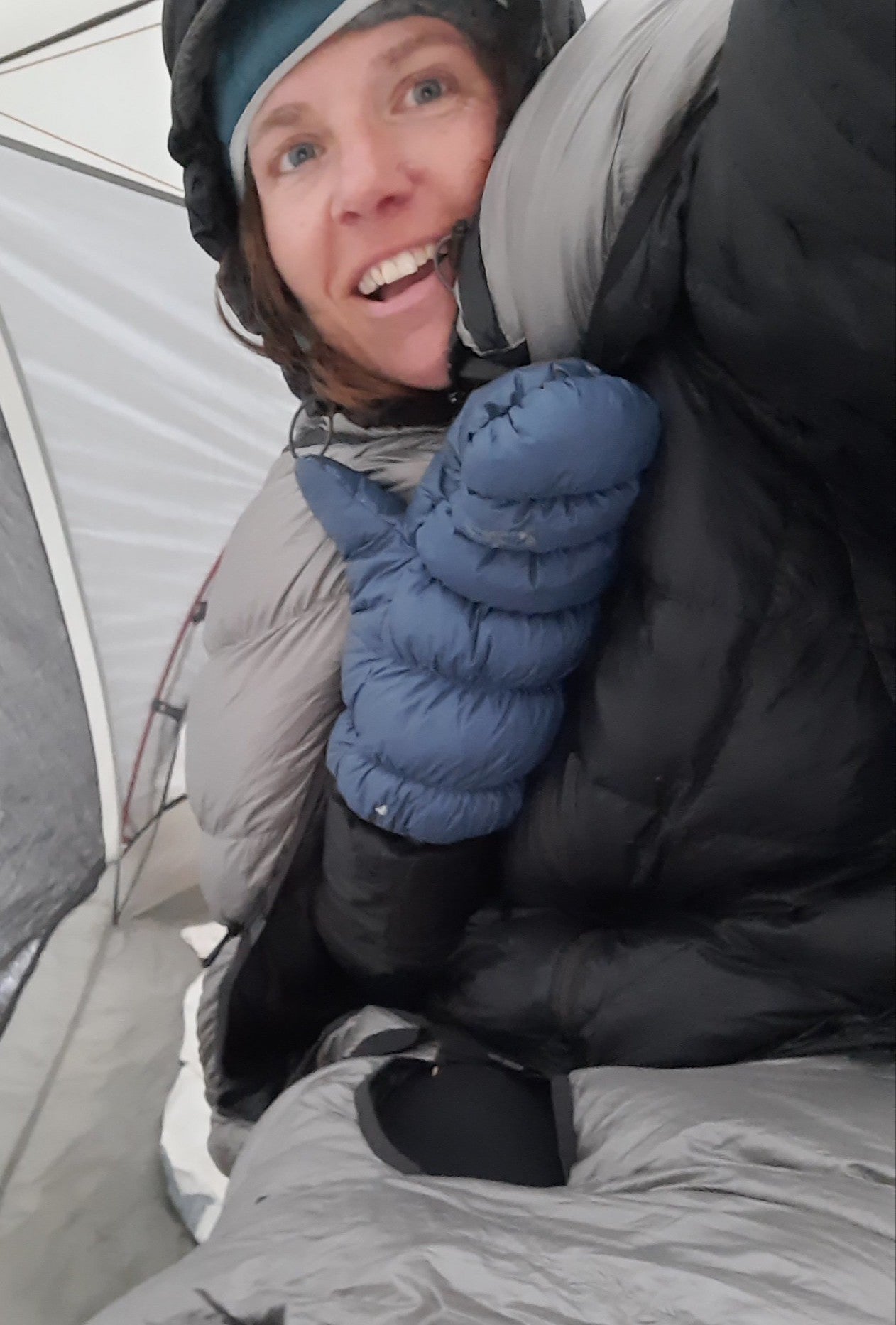
I learned to wear my Katabatic quilt as a cape to stay warm while cooking dinner. Photo by Renee Patrick
Sleep system
Down booties – Warm and dry down is the lightest and warmest insulation available, and wearing down booties at night does wonders to keep my appendages toasty warm even in the coldest temps.
Sleeping quilt/bag – Take a quilt or sleeping bag that matches or is rated for colder temps than you expect to encounter. This was the first time I used a cold-weather quilt, and Katabatic’s version was amazing. I discovered on one very cold night that I could turn the quilt around, keep my legs in the bottom half, and wear the top as a cape. I buttoned the quilt around my neck, which left my arms free to cook and eat. So cozy! And during the night I slept with my hooded fleece layer and my hooded down coat on so that I had three layers of warmth on my head: hat, fleece hood, down hood. Yes, even with a hoodless quilt you can keep your head warm, use those hoods!
Fill that empty space – if you find your sleeping quilt has a ton of extra space in it, try to fill that space with extra gear. Down works when your body heats the layer of air between you and the down. The more air your body needs to heat, the longer that space will take to get warm.
Don’t wear wind-blocking/waterproof layers to bed– If you block your body’s ability to warm the air in the quilt, you will not get warm, so take those raincoats, wind coats, and rain pants off. They will only prevent you from getting as warm as you could have.
Keep cold-vulnerable items warm at night – Electronics, medications (my epi pen), and wet wipes all come into the quilt with me at night. Think through all the things in your pack that could get damaged (or unusable) due to the cold, and throw them in your quilt with you.
Damp in the bag– It’s true that you can sleep with damp clothing and dry it out overnight with your body heat, but there are limits. Simply tossing your wet socks into the bottom of your bag might not do the trick if they get wadded up and never are exposed to your body heat. So I put things like mittens and socks next to my body in my long johns. Seriously. It’s a little cold at first, but they are toasty dry by morning.
Wear damp clothes to bed – Take the previous suggestion to the next level. The quickest way to dry a damp shirt is to wear it. Granted, this step should not be taken until you yourself are warm. Once your body has warmed up, you have eaten, and that internal furnace is stoked, take a deep breath and put that wet shirt on. It will suck, it will feel uncomfortable, but by morning your body will have dried it.
Hot water bottle– You can take a hot water bottle to bed if you have the right kind of bottle (I’ve only been comfortable doing this with a Nalgene). Pour some boiling water into your bottle and throw it to the bottom of your sleeping bag, or cuddle it.
The Oregon Desert Trail, better known as the ODT, is a 751.7-route that traverses eastern Oregon, connecting the Badlands Wilderness to Lake Owyhee State Park. The trail slips through dense sagebrush steppe and ancient juniper forests, across lava flows and through canyons incised deep into an old land. There’s wild and wilderness and plenty of opportunities for solitude and solace.
“The story begins in 2010 when our former executive director Brent Fenty had the idea of connecting places where ONDA had been working in and to highlight some of the success such as the Badlands Wilderness and Steens Wilderness,” said Renee Patrick, Oregon Natural Desert Association program manager who oversees development and stewardship of the ODT. “In between those two areas, we have done a lot of conservation work and thought we could help people connect to this landscape through a trail or route and help them see these lands first hand.”
Descriptors such as the Oregon Outback, High Desert and Sagebrush Sea do justice to this desert landscape of sweeping vistas, rolling hills, fault-block escarpments and deep canyons.
As Patrick puts it, “You’ll see more pronghorn than people.” The concept of spending time exploring and getting to know this remote section of Oregon may be foreign to some more accustomed to exploring the Cascades, Oregon’s verdant spine. However, the desert landscape’s subtle beauty reveals itself to those who wander.
Author Ellen Waterston writes about living in and exploring the High Desert in “Walking the High Desert: Encounters with Rural America along the Oregon Desert Trail.” When asked about her experience, Waterston said, “The high desert is inscrutable at best, but during the winter especially so. I relish the palpable sense of all that’s brewing beneath the surface of the desert’s vast expanses. And while I’m waiting, nature puts on a show: hoarfrost exquisitely tracing the slimmest blade or branch, a coyote plowing its snout through the snow as it tries to rout a rodent out of hiding or pronghorn kicking up a wake of wintery glitter as they speed across an open savannah carpeted in white.”
The task of designing the route fell to Jeremy Fox, Patrick’s predecessor. He began the arduous task of sketching out the trail, utilizing existing resources such as trails, two-tracks, dirt and paved roads for most of the route. Private property and highly sensitive wildlife areas or habitats were skirted. Blank spots on the map were connected by cross-country travel; nearly 35% of the trail includes trailless sections where a hiker’s navigational skill will be challenged.
“Long-distance backpacking is not a traditional pastime in eastern Oregon in the desert,” said Patrick. “There’s a lot of curiosity and disbelief.” Patrick has worked hard at informing land and business owners about the trail that passes by their properties and towns. Now, landowners living in the outback have a different take for Patrick. “They don’t ask why; they tell me stories of hikers that have passed through—so it’s really rewarding to see that trail culture developing.”
Whitney LaRuffa hiked the ODT with a couple of friends in the fall of 2018. “I picked that trail because it’s a part of Oregon that I’ve visited and always wanted to see more of,” said LaRuffa, a seasoned long-distance trail hiker and vice-president of sales and marketing for Six Moon Design. “There was a true sense of adventure hiking the ODT compared to some of the more established long-distance trails that are more plug-and-play,” LaRuffa added.
For LaRuffa, it wasn’t just about being a thru hiker. “People we met along the way were all very friendly, making sure we had food and water and that we knew where we were going,” LaRuffa said. After his hike, LaRuffa spent time on an ONDA trail stewardship project, giving back to the area he had passed through.
Though the trail exists to hike in its entirety, day hiking or shorter overnighters are possible. ONDA provides excellent resources such as maps, GPS waypoints, information about water resources, and other trip-planning details on its website, along with information about the wildlife, geology and history of the region.
Central Oregon day hikers looking to go somewhere COVID-19 safe may enjoy exploring unique geologic features in the Christmas Valley and Fort Rock area or “the backside” Pine Mountain. ONDA also initiated the Badland Challenge to encourage exploration of over 50 miles of trails in the Badlands Wilderness, located just east of Bend, where the ODT starts or ends—depending upon your sense of direction.
2020 may have turned our worlds upside down, but all that screen time for my once field-based job turned into an opportunity to go back to my roots in multi-media production.
I spent about half the year developing this awesome new researched-based story map for the Oregon Natural Desert Association with my passionate and super smart colleague Jeremy Austin.
This project helped me connect my graphic design and multi-media interests that started at Bradley University (yes, photoshop existed in 1995!), continued in grad school at Goldsmiths College (my dissertation revolved around taking the museum out of the museum…and I think this definitely qualifies as a virtual exhibit), and has now found a greater purpose in advocating for protection of our home…planet earth.
Take a few minutes and soak in the Greater Hart-Sheldon: Sagebrush Stronghold!
Renee Patrick started her epic walk through the Blue Mountains in the sweaty heat of July, and she finished it amid the nostril-freezing chill of an alpine autumn.
Along the 566 miles of hiking in between, Patrick was at turns challenged, enlightened and even awed by the eclectic landscapes of Northeast Oregon.
She also made history.
And now, a few months after she finished her trek, Patrick is helping to promote the Blue Mountains Trail, a route she and other proponents hope will join the ranks of America’s other long-distance wilderness paths.
“It’s fun to be at the beginning of an effort like this that people are excited about,” Patrick said in a Jan. 14 phone interview. “It’s exciting for the eastern half of the state to have more recreational opportunities. Northeast Oregon is not well-known, even by a lot of Oregonians.”
Although the current version of the Blue Mountains Trail is new, the concept dates back more than half a century.
Loren Hughes, a longtime La Grande jeweler who died on Jan. 29, 2016, envisioned a long hiking route through the Blue Mountains as far back as 1960.
Later, Hughes and Dick Hentze, who taught elementary school in Baker City from 1970 to 2000, conjured the idea of the Blue Mountain Heritage Trail.
Hentze, who moved from Baker City to the Eugene area in 2014, died on Aug. 8, 2020.
Mike Higgins of Halfway said in a Jan. 14 interview that he became involved with planning the trail in the 1990s along with Greg Dyson, director of the Hells Canyon Preservation Council.
(The organization, based in La Grande, was renamed as the Greater Hells Canyon Council in 2017, its 50th anniversary.)
“The route was much different then,” said Higgins, an advisory board member for the Greater Hells Canyon Council.
The previously proposed trail was a loop that covered about 870 miles.
Among the notable differences, the current route — the one that Patrick helped pioneer with her hike in the summer and fall of 2020 — is point to point rather than a loop, with Wallowa Lake State Park at the northern end and John Day at the southern.
“The current route to me is a lot more attractive,” Higgins said.
In particular, he appreciates that the Blue Mountains Trail passes through all seven of the federal wilderness areas in Northeast Oregon — Eagle Cap, Hells Canyon, Wenaha-Tucannon, North Fork Umatilla, North Fork John Day, Monument Rock and Strawberry Mountain.
Higgins said he believes this concept, so long in the making, finally has momentum.
“I think it’s going to go this time,” he said. “Jared is going to make sure it goes.”
“This is an opportunity for people to get a much better idea of the landscapes of the Blues,” Kennedy said in a Jan. 14 interview. “It really ties the region together.”
But when it comes to connections, no amount of conceptual planning or pondering of maps can replace the actual experience of hiking the route, Kennedy said.
That’s why the efforts of Patrick and a separate group of three hikers were so vital.
That trio — Whitney La Ruffa, Naomi Hudetz and Mike Unger — hiked the entire Blue Mountains Trail during September.
Patrick said she exchanged information with the three other hikers about their experiences, particularly any problems they encountered with navigation, distances between water sources and other matters important to future hikers.
Now that four people have negotiated the route, Kennedy said he has a much better idea of the trail’s attributes — and its problems.
Although it’s called a trail the route does include several sections on Forest Service roads, although most of those are little-traveled roads in remote areas, Kennedy said.
There are no plans to propose the construction of any new trail, he said.
With so much new data to digest — including GPS waypoints and other digital details — Kennedy is striving this winter to make the trail’s website more informative.
His goal is to have an online guide for hiker-ready sections of the Blue Mountains Trail, including maps, by spring, in time for the prime hiking season.
“Prime” not necessarily being a synonym for “perfect” in this case.
Kennedy points out that the window for hiking the entire Blue Mountains Trail is a relative small one, although he acknowledges that the vast majority of hikers will only attempt sections rather than trying to cover all 566 miles in a single trip or even a single year.
The reason is elevation.
The trail samples each of the higher ranges of the Blues, including the Strawberrys, Elkhorns, Greenhorns and Wallowas. Sections of the trail in those areas climb well above 7,000 feet, and in places are reliably free of snow only during August and September.
Yet the trail also descends into Hells Canyon, where summer temperatures regularly exceed 100 degrees.
Given that even an experienced long-distance hiker is likely to need 30 to 45 days to complete the entire trail, a start in July or early August would be the most plausible, both to avoid deep lingering snowdrifts from the previous winter, and the first storms of the next.
But a midsummer start has its own potential challenges, as Patrick discovered.
She began her journey at John Day in August. The temperature was 99 degrees. And the first day included a stint on a freshly blacktopped road (a rare paved section) and a 4,000-foot climb over 7 miles, among the more difficult ascents of the entire route.
Patrick said she took a break during the hottest part of that day and finished the climb in the comparative cool of the evening.
Her schedule allowed her to hike for only a week in August. She covered the 110-mile section from John Day to Austin Junction, where Highways 26 and 7 meet, about 50 miles southwest of Baker City.
Although that’s a longer trek than most hikers will ever attempt in a single trip, it’s little more than a jaunt by Patrick’s standards.
Few people can match her hiking resumé.
Patrick has thru-hiked — completing an entire trail in one year — America’s “triple crown” of long-distance routes, the Pacific Crest, Appalachian and Continental Divide trails.
The cumulative mileage of that trio of epic trails is about 7,800 miles — 3,100 miles for the Continental Divide Trail, 2,610 for the Pacific Crest, and 2,100 for the Appalachian.
Patrick also helped to pioneer the Oregon Desert Trail in the state’s remote, sagebrush-dominated southeast corner. She hiked the 750-mile route in 2016, the year after she was hired as Oregon Desert Trail coordinator for the Oregon Natural Desert Association in Bend, where she lives.
At 566 miles, the Blue Mountains Trail isn’t terribly daunting for a hiker with as many miles on her boots as Patrick.
But she said every route, regardless of distance, brings its unique challenges.
The Blue Mountains Trail, unlike the well-known and generally well-maintained Pacific Crest and Appalachian trails, includes several stretches that require hikers to “bushwhack” — find their own way across trailless (and roadless) stretches.
And although many of the trails and roads that comprise the Blue Mountains Trail are individually signed, there are no markers for this new trail itself.
“People need to be realistic about the challenges,” Patrick said. “It’s a great trail for section hiking, as a way to build your skills.”
Higgins, who helped La Ruffa, Hudetz and Unger during their thru-hike by meeting them at trailheads with boxes of food and other supplies, pointed out that the Blue Mountains Trail, because it is made up of so many existing trails and roads, has a multitude of access points.
And it features some sections that are easier to hike than others, such as the Elkhorn Crest National Recreation Trail west of Baker City.
“You can select sections that match your skill level,” Higgins said.
Regardless of where you hike, though, you’ll be surrounded by some of Oregon’s most spectacular scenery, Patrick said.
Among the sections that especially entranced her is through the Eagle Cap Wilderness south of Wallowa Lake. That’s where she started her second and final stint on the trail, in early October.
The Blue Mountains Trail follows the West Fork of the Wallowa River to Frazier Lake, then crosses Hawkins Pass and descends to the headwaters of the South Fork of the Imnaha River.
“I absolutely loved hiking in the Eagle Cap,” Patrick said. “That’s really an awesome section.”
She also appreciated that the route allowed her to trace a major river — the Imnaha — nearly from its headwaters below Hawkins Pass to its mouth at the Snake River in Hells Canyon.
The Blue Mountains Trail affords the hiker a similar experience with the Grande Ronde River.
“When you see it from the start to where it ends you almost have a relationship with the river,” Patrick said. “I really enjoyed that.”
The Blue Mountains Trail is also enticing for both its geology, which includes rocks more than 200 million years old, as well as considerably more recent cultural history.
Patrick said that while she hiked through the ancestral homeland of the Nez Perce tribe, including a section of the Nee-Me-Poo National Historic Trail, she listened to an audio version of “Thunder in the Mountains,” a historical account chronicling the Nez Perce being driven from the area in 1877 as white settlers moved into Wallowa County.
Patrick said the hike into and out of Joseph Canyon, named for Nez Perce Chief Joseph, was probably the hardest section of the Blue Mountains Trail.
Among the other difficult sections were those where wildfires have burned in the past decade or so. That includes what was otherwise one of Patrick’s favorite areas, the Wenaha River Canyon, which she describes as “amazing” and “beautiful.”
“Fire has affected a lot of the trails,” she said. “Every year more trees fall. It’s on ongoing maintenance issue.”
Nor is fire the only threat to some of the trail sections that make up the Blue Mountains Trail, Kennedy said.
“There are many, many sections of trail that are way behind in terms of maintenance,” he said.
Not long before Patrick finished her thru-hike in late October, she hiked the Elkhorn Crest Trail during an early preview of winter when temperatures plummeted into the single digits.
She wasn’t deterred — “I do a lot of cold weather and winter camping,” she said — but Patrick said the range of experiences, from her sweltering start to the frigid conclusion, was appropriate for a trail with so many moods.
Patrick, along with Kennedy and Higgins, hopes this newest addition to the West’s long-distance treks will not only enchant hikers, but also bring an economic benefit to the region.
The route comes close to several towns, including Baker City, La Grande and Enterprise, and Kennedy said local residents and businesses could earn extra money shuttling hikers between trailheads and providing other supplies and services that hikers would need.
Ultimately, though, she said the Blue Mountains Trail is a treasure for people who want to follow in her bootsteps.
“It’s a great opportunity for hikers,” Patrick said.