Oregon Desert Trail (2nd Section – Water Alternate): Day 10 – 24 miles (141.8 total)

I pulled over early this morning to look for some pictographs I knew were in the area and found some faint images. I’ve heard people were living in the Owyhee region from 11,000 to 12,000 years ago. Makes our modern age feel like a blip on that scale. I also passed an abandoned ranch. I’m sure life must have been hard out here but I could totally see the appeal.

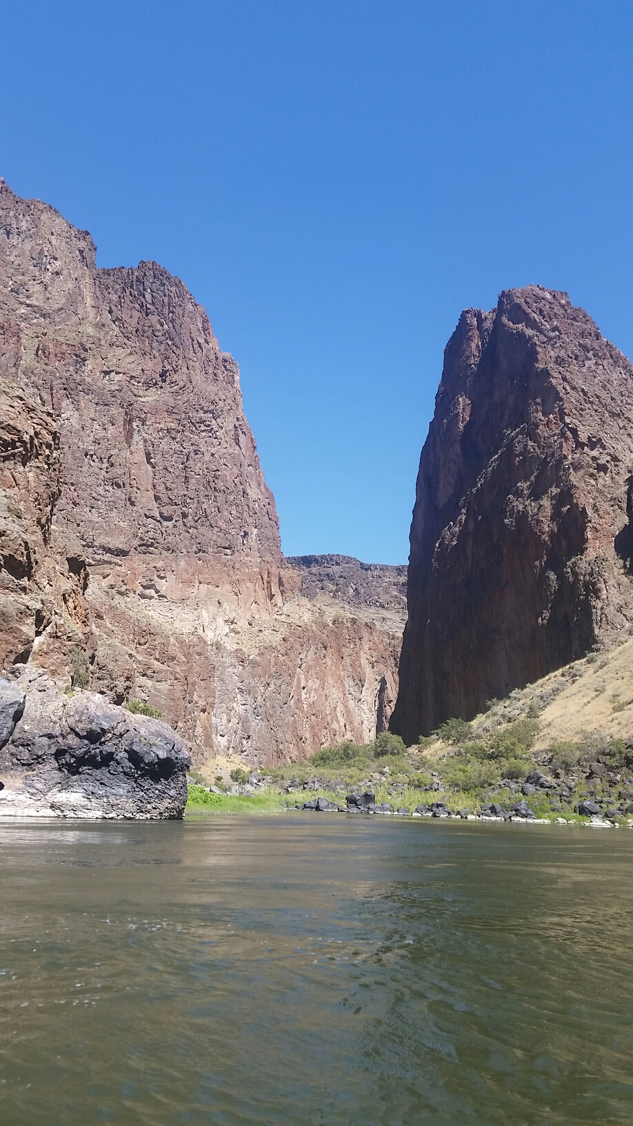
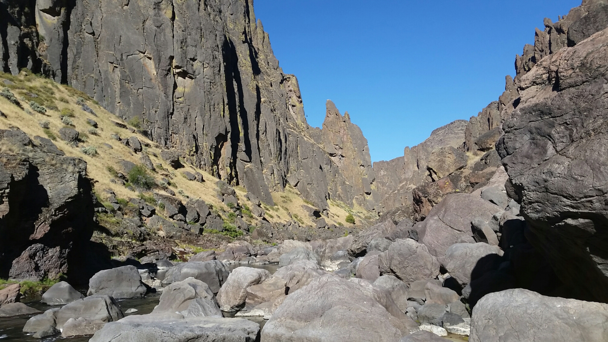
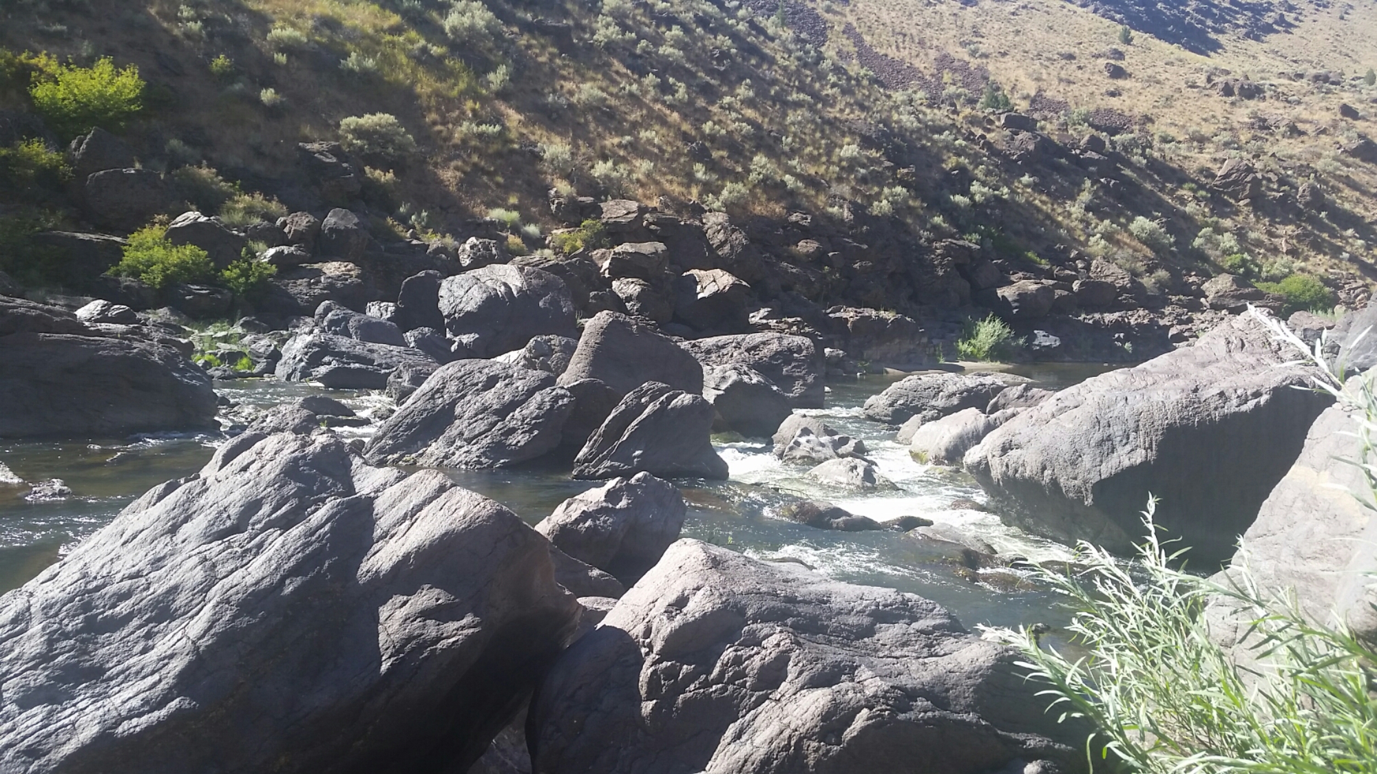
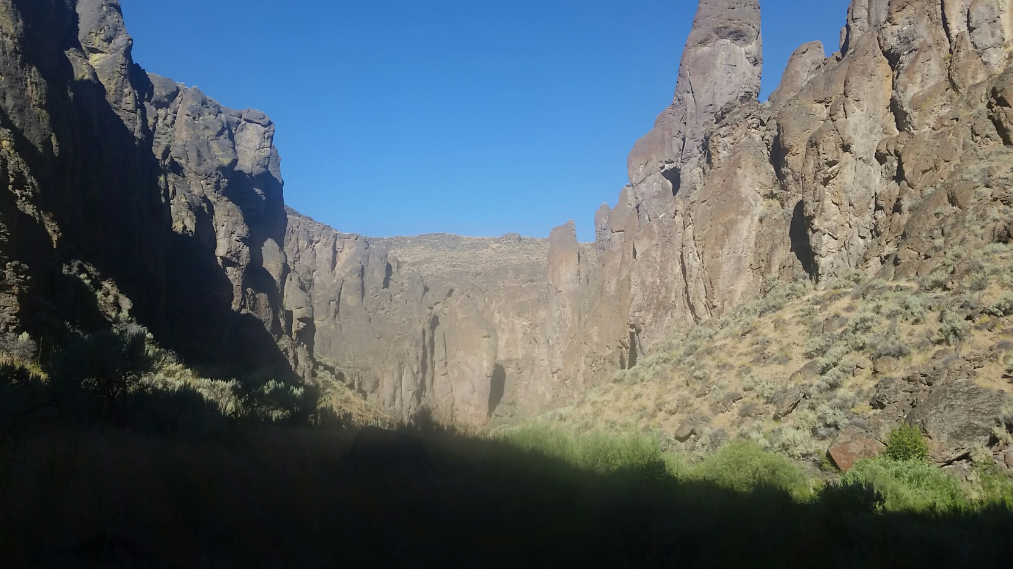
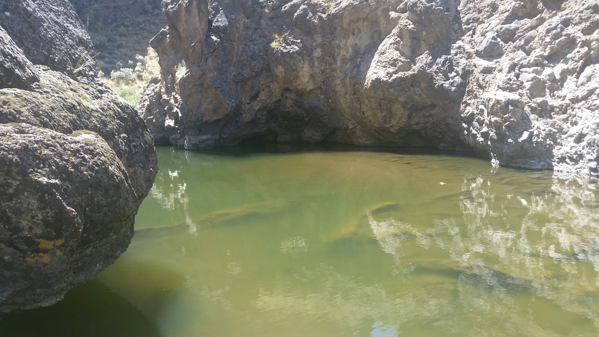
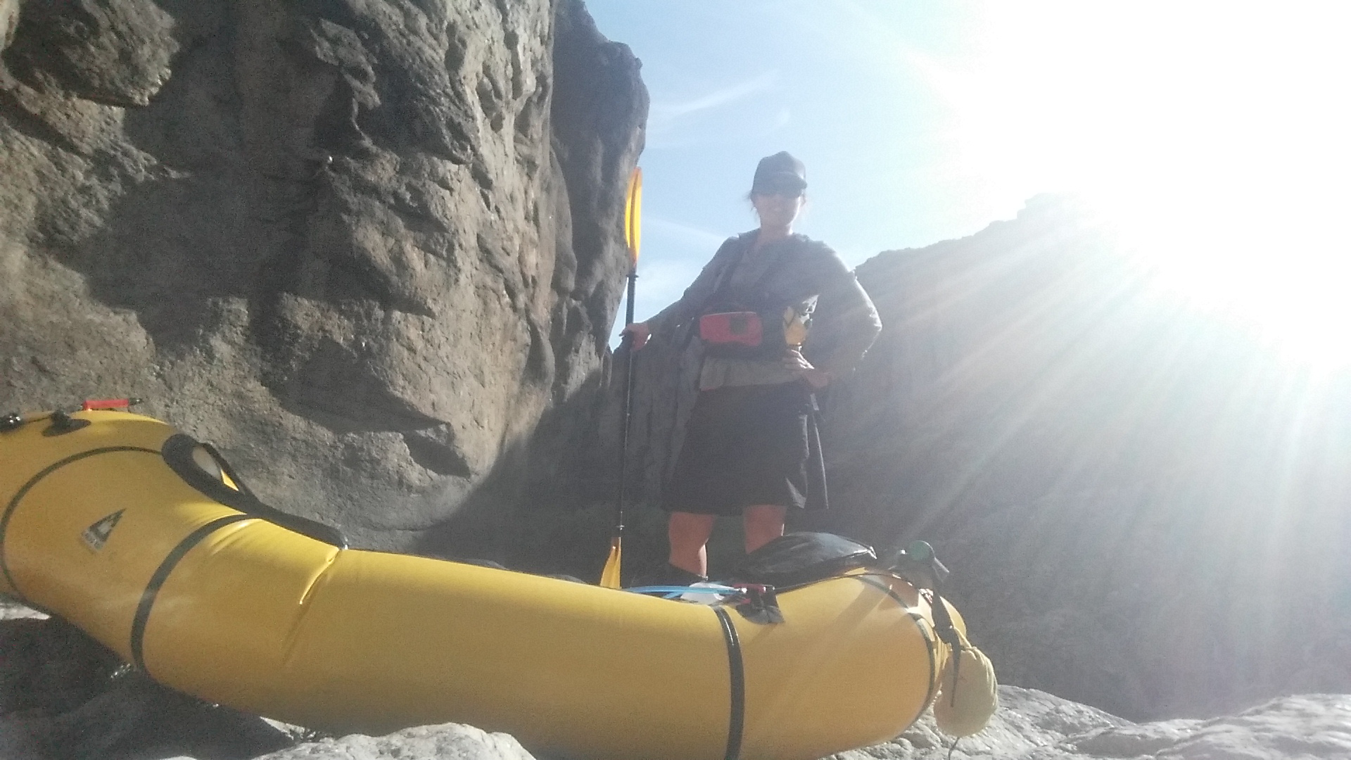
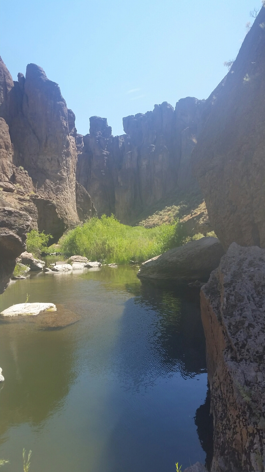
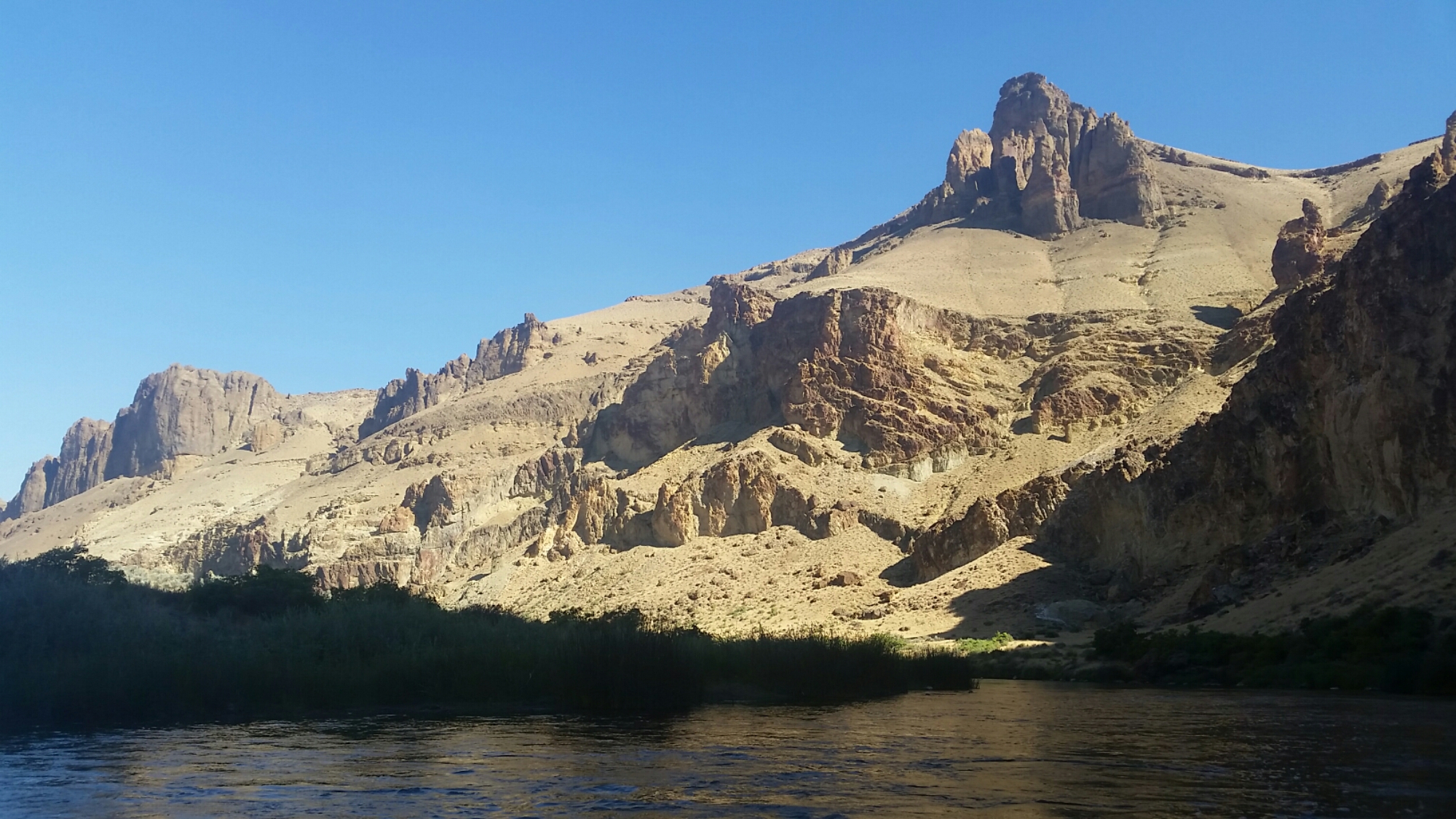
When I got to Greely Bar I went in search of the hotsprings that are supposed to be there, but they were quite shallow and with the heat of the day already coming on I just didn’t feel like getting in. The rocks were amazing. All the way to Birch Creek they were towering and magistic.


I thought I might see people at the Birch Creek takout, but there was only one group there, and they didn’t act real curious. Most river trips take out here as the Lesley Gulch takeout another 19 miles ahead can be half slack water when the Owyhee reservoir is full. 

I had on and off current until the end, and enjoyed a nice mellow float while listening to some podcasts like All Songs Considered, Reply All, Invisibila and Tim Ferris.
Kirk told me about some more hotsprings about 5 miles from the takeout, and while I didn’t think I would make it that far today,  I found myself there by 5pm. There wasn’t much to find, and the area had been trampled by cows. To top it off there were dead fish everywhere. The water levels were low, and must have fallen fast because rotting fish were beached everywhere. Yuck. I shouldn’t have come so far because now I’m left camping in this mess. I had entered the low reservoir and there is no paddling up stream!

I went around the corner and tried somewhere less offensive to camp. Ugg.
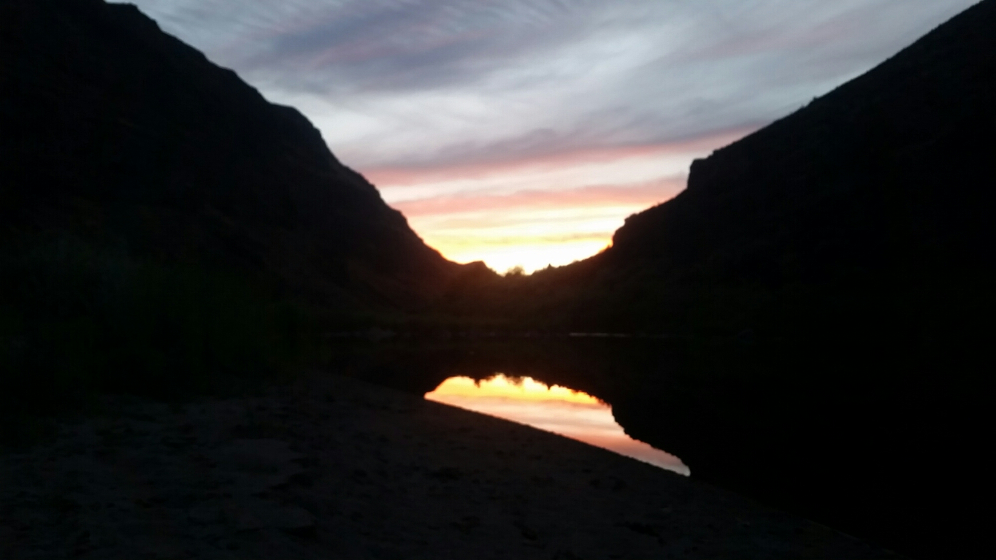
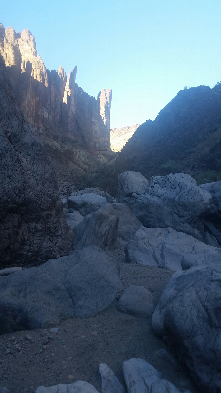
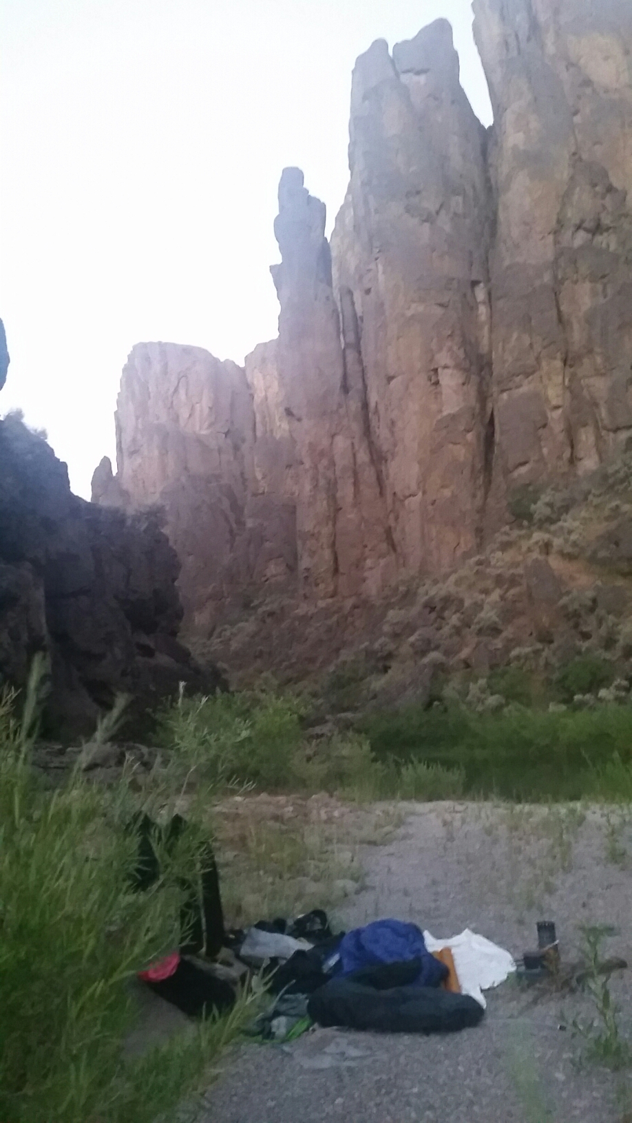
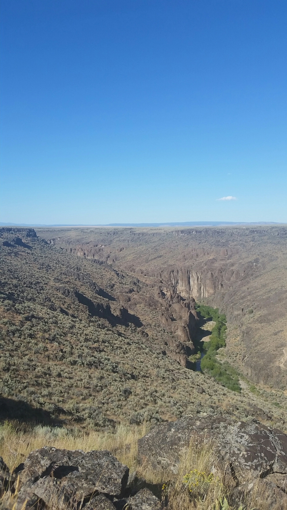
View from camp


Only about 4 miles to Lesley Gulch where I will transition back to hiking for the final 30 miles to the end of the Oregon Desert Trail and my second section of the trail!

Oregon Desert Trail (2nd Section – Water Alternate): Day 9 – 19 miles (117.8 total)

It’s been a full moon this week, and even though I haven’t set up my tarp once, I’ve been using my umbrella/bug condom combo so I’ve been able to sleep. It’s so bright out I would be much more tired without it.

On the river maps I’m using (Jefferson from work let me borrow his copy), there are a few notes about cultural sites, and this morning I took some time to look for the Lambert Inscription, not knowing exactly what it was, but didn’t find anything. JJ marked a bunch of spots that I’ll pass tomorrow, so I’m looking forward to that.

I found some hotsprings near Lambert Rocks, but they were too hot for me. Where one spilled out into the river I was able to soak there for a few minutes with the help of some cooler river water mixed in. Then I floated by the Chalk Basin. Wow!! Stunning views! And it would keep getting better.

I lunched after Whistling Bird rapid, and then started into the Iron Point area. Towering walls of rock squeezed in on both sides of the river. It was hard to take it all in. Amazing. I think the Owyhee is my favorite river I’ve ever floated. Its that good.

After a few more rapids I made camp where the landscape opens up again. There’s also an old road bed river right that I’m going to make an alternate so hikers can get down by the water again.

I’m make much more progress on the river than I thought I would, might finish up this section a little early!

Oregon Desert Trail (2nd Section – Water Alternate): ​Day 8 – 21 Miles – 1 mile hike, 20 river miles (98.8 total)

I forgot to include the 1/2 mile walk from Rome launch to Rome Station, and since I had to walk it back this morning and I don’t want to “skip” a mile I’ve included it today.

I got myself a cup of coffee from the cafe to drink while I was packing up, and set about putting another 7 days of resupply in my pack. I think that’s the heaviest thing I’m carrying out here-all the food. Then I want back to the cafe for breakfast and ordered a much too big plate of biscuits and gravy, eggs and sausage. I definitely don’t have hiker hunger, but sometime I forget!

Once I launched back on the river it was a flat slow 5 miles to get back to the canyon. It was already HOT and it’s supposed to get up to 100 today! Thank goodness for the river.

To pick it up, or not to pick it up…have I been on the river long enough?


It was a relief to be back in the towering rock walls, and was delighted to see numerous springs dumping fresh water into the river. There were so many springs I think it’s made a big difference in the water levels. The CFS at Rome was 135, but the rapids all have enough water to run, the boney pointy rocks are covered up for the most part, and there seems to be more push to the water. 

There’s gotta be more water now

Don’t know? I don’t think there is a river gage below Rome, so who knows. What it made for though were easy and smooth spots to run the numerous Class III rapids, and bigger wave trains in the riffles. I think I’m moving along quicker too. It’s more of a 3 mile an hour river now (with paddling). So much so that I made 20 miles by 5pm. That’s a lot espically since I didn’t get started until 8:30.

I’ve seen and heard a lot of fish suckling on rocks today. I have no idea why.
 I’ll be floating and he a sucking noise, and look over to see a big fish with its mouth on a rock by the shore. They are slurping off something delicious I guess!

Since I had a relatively early camp, I pulled out a book I bought in Rome, In Times Past by Hazel Fretwell-Johnson about the history of the Jordan Creek Area, or the area around Rome. Turns out the settlers here had some of the bloodiest skirmishes of all the west with the Native Americans here. It’s fascinating. I should pass some pictographs and other archeological sites tomorrow…looking forward to it!


I also packed out a can of wine to enjoy tonight. Nothing but the finest on the Owyhee!

Oregon Desert Trail (2nd Section – Water Alternate): Day 7 – 7 miles (77.8 total)

Here’s a view of packing my boat, made all the easier with the dry bags that store gear inside the boat.

When i put on the river i soon realized i was playing hide and seek with some river otters. They would pop up their heads, if they were close to me I could almost hear them say “ahh, she’s close!”and they would dive back under.
Then I passed be where a fire had been last month. Luckily the riparian area right next to the river was still intact.

The landscape soon change and the towering cliffs flattened out. I started to see fences again, and knew I was close to civilization.
Before I was ready, there was the Rome takeout. Rome is a one stop kind of place, but it had everything I needed. I had called ahead to make sure I could send a box there, and knew the grill would be on. Time for a burger!

At the boat ramp I met a nice family from Idaho who was fishing, and when I was packing up my boat, the woman came over and offered me a beer. When in Rome!

I walked over to Rome Station, ordered my burger, and settled into my cabin for an afternoon of bad TV and air conditioning. 

Oregon Desert Trail (2nd Section – Water Alternate): ​Day 6 – 13 river miles (70.8 miles)

I had a big morning with the widowmaker rapid, a mandatory portage, and before and after it were a bunch of other rapids, so all in all it was a full morning of scouting, running or portaging.

That’s a lot of rocks

All went well though, and I was glad that I wasn’t here when there was more water with less time to make decisions and bigger consequences. Once I got through all the rapids on the map, again there were plenty of others…in fact a lot of stout little Class III. I walked around a couple,  and on one portage just where I was going to step there was a little rattler. I’m glad he let me know he was there and I chose to go different way. Only my second rattlesnake of the trip!

Decided to walk this one. Thought I might get crunched.

Both my seat and my boat had little leaks today so when I got to camp I went about patching them, and hopefully they hold. Both were minor but the inflatable seat was quite annoying. I would blow it up and slowly start sinking, and it started happening more more frequently.

Another fine day.

It’s Kirk birthday today; I wish he could be here, he would really love it. He’s run this river, both of upper and the lower before, but never at the low flow. I’ve been able to text him a couple times daily with my delorum inreach…it sucks be away from him on his birthday but we’ll celebrate when I get home. I’ve had a couple people on this trip ask me how he handles letting  me do this alone, but really he has no choice! He’s always known this is the kind of life i like to live, and if he had it his way he’d be with me, but he in no way prevents these adventures, and always plays a big part in the trips. I feel lucky to have someone who understands,  supports, and trusts me out here by myself.

Oregon Desert Trail (2nd Section – Water Alternate): ​Day 5 -15.5 river miles (57.8 total)

It was a quiet morning as I had over 5 miles to go before my first big rapid called half mile. I’ll let you guess why its called half mile. The thing about boating at low flow, is there are lots of rapids that appear that normally aren’t there. Fortunately most of them are class two and three and a lot of fun to boat. I wanted to come do this trip in July to see how it would be to packraft it this time of year, and present this trip as an option for others, and my conclusion is it’s definitely doable, but only for experienced boaters!

I got to half mile about 10:30 in the morning and I just took it one rock at a time. I was able to boat some, and I had to portage some, but all in all it took me about an hour and a half. I think the rapid was much longer because it was low flow. Regardless I was happy to cross this barrior. I had some more big rapids today, but found plenty of others due to the 169-200cfs.


This canyon is gorgeous. It is absolutely stunning; I can’t believe I’m in Oregon and this is part of the trail.


All in all it was a good day. I did slip once when I was scouting and hit my tailbone good…I think it might be bruised as there’s no shooting pain. If thats all that happens aside from the numerous bug bites, bushwacking scratches, rock scrapes and other random mishaps, I’ll be in good shape. Note to self bring a tent next time. There are lots of biting things as I sleep on the sand next to the river and my bug condom just isn’t cutting it, especially because it’s warm at night and for some reason I brought my 20° sleeping bag which I don’t want anywhere near me.

Love the Owyhee!


So it looks like I’m making good time for the first half of my trip. I have another day and a half of boating before my resupply stop,  and then another week to go. I had no clue how long this first stretch would take, so I’m rather please that I’m doing what I expected. I have a big morning of rapids coming up and after that I think it’s a little mellow…but then again the river maps don’t show the low flow rapids so who knows? I still haven’t been sleeping well and I think that effects my energy level during the day so I’m crossing my fingers for a good nights rest tonight.

Oregon Desert Trail (2nd Section – Water Alternate): Day 4 – 14 miles – 2.5 hiking,11.5 river miles (42.3 total)

When I woke up I knew I only had 2.5 miles to go to meet the main fork of the Owyhee river. I made short order of those miles and when I got to the confluence I was stoked to see the river was flowing. Break out the packraft!

I put on the water and it was as good as I could have imagined. The cliffs were towering over the river and I was floating  along giggling at how difficult the last few days had been, and now how easy the float was.

Just in time for lunch I realized the water seeping out of some rocks were warm springs. No soaking pools, and some barely warmer than the water, but warm springs none-the-less. I pulled over where there were a few small streams, and lay down in the shallow cascade feeling like a million dollars.

Warm springs!

There were several more warm springs before the big one – Three Forks warm springs. Right before I got there I noticed a man on the bank. I surprise him when I said hello. He was out with his grandson – Ron and Gavin had been hiking and had even tried to hike a bit of the canyon near Anderson Crossing the day after I was there. This was their first time here, and were camped out for a few days. I explained my adventure with them and it turns out Ron is a member of ONDA and he lives over in the valley! And he hadn’t even been aware of the Oregon Desert Trail.

I was approaching the Three Forks warm springs when I saw more people. In fact they were kids tubing. When I saw cascading waterfalls I knew the soaking pools were up off the river, so I pulled over I made my way up. What a blissful scene. Warm water, deep blue pools, amazing. I enjoyed my soak but there were other people around and I was enjoying my solitude, and even though I considered camping there for the night it was only 3 p.m. so I decided to push on.

So many people

I passed the Three Forks boat launch and the other Fork of the Owyhee (which was barely a trickle). I knew I had a Class IV+ rapid around the corner called the ledge. Because the water flow was so low I wasn’t sure if the rapid would be just a bunch of boulders I could navigate in the slow water, or if it would be something I would have to walk around. I have lots of experience scouting rivers with Kirk, and am comfortable in Class III. I’ve run Class IV before, but would definitely not on this trip as I’m by myself. I came into this trip feeling confident I could figure out the best course of action.

When I got there I could see a horizon line and lots of large boulders so I pulled over river right to scout. It didn’t look like the boat could fit through any of the rocks so I decided to go to river left and double check from that angle. Once I was on the other side of the river I could definitely see none of the channels were big enough for my boat, the water was just too low. So I began a slow process of walking and lining, climbing over rocks, and walking in the water to get my boat past the impossible rocks. I thought I was done but there were more, in fact the rapid seem to be about a quarter mile long before I was in calm water again. All in all it took about 45 minutes to get through that section, so it gave me some perspective on whats to come.

Hmmm, how to get through?

I floated just to while longer until I saw a sandy bench under some trees where I decided to make camp. I am exhausted but exhilarated that I made so much progress today and have started my packrafting portion on the adventure. There are a number of notable rapids coming up, but I will take each one as they come, and do what I gotta do to keep going forward.

Oregon Desert Trail (2nd Section – Water Alternate): ​Day 3 -11.5 miles (28.3 miles total)

I was so tired but barely slept at all. When I went to bed there was a frog croaking, and he sounded like he was in my ear. What does he have to croak about? He kept on about something most of the night, and the last time I looked in my watch it was well after midnight.

So when I woke up I was tired but I had hope that today the going would be a little bit easier than yesterday. I packed up my boat and planned on a full day of hiking. I made good time this morning (Averaging  about a mile and a half an hour). The canyon seems to get more interesting the further I went, but the water for some reason started disappearing for long periods of time. I’ve only been carrying a small bit of water because I can grab it whenever I need it, but then I found I was needing it and there wasn’t any.

Lots of big boulder gardens to pick my way around and I still needed to pay attention to every step. I did take one small fall this morning but it was minor.

At lunch I went for a swim in a deep water hole and was surprised to see large fish. I picked my way over the boulders and finally when I got to Toppin Creek it felt like I was making progress. I only have a few more miles to get to Five Bar where i join the main river…and maybe, just maybe, I’ll be able to float. If not I’m hoping at 3 Forks to be packrafting the rest of the way.

Swimming hole!

Holy boulders.

Just before I made camp, I looked up the cliffside and saw two big horn sheep! So spectacular! The canyon just keeps getting better.

Oregon Desert Trail (2nd Section – Water Alternate): Day 2 – 7.5 miles (17 miles total)

12 hours to go 7.5 miles? I knew the going would be tough, but holy cow!

Soon after I started hiking I came to some huge boulders choking the creek. Climbing up I saw my options were to swim the deep pool on the other side, or blow up my boat! I opted for the boat, and used my throw bag to lower the boat into the water, then lowered myself down.

Bring out the boat!

Since I had already spent the time to transition to the packraft, I wanted to try and use it…so for most of the day I pool hopped down the creek. I probably could have made better time with my pack on, but there would have been significant swimming, so I was good with my choice.

The going was slow though. Each time a pool would end I would heft the boat (all my gear is stored inside the boat) onto one shoulder and often have to push my way through thick willows and thorny bushes. I was crossing my fingers that I wouldn’t pop my boat, and seemed to do ok.

It was exhausting. The load was extremely heavy on my shoulders and they ached terribly after a few hours. I was being very intentional with each step because I am extremely remote out here. Lots to pay attention to…but I missed something. I had my gopro out in the late afternoon, and when I took a break and decided to put the boat away and hike again, I realized it was gone. I could have sworn I put it away, but it wasn’t in my day bag. Shoot! I left my gear and hiked back a bit, but didn’t find it. I hope one of the next hikers down here finds it!!!

It was a good call to put the boat away, because soon after I started again there were HUGE boulders to climb up and around. Think Mooshic notch on the AT.

I inched along and had to go for a swim…up to my neck!

I stopped at a gravel bar for camp. I was starving, soaking wet, and Soooo tired.

Oregon Desert Trail (2nd Section – Water Alternate): ​Day 1 – 9.5 miles 

I woke up early to meet Mike, one of my colleagues at ONDA, to drive out to Burns, where I would then meet Julie, a former ONDA board member and desert guru, who would then take me to McDermitt where I would meet Ken, the owner of the market there, who would take me to Anderson Crossing where I had started my trip last time. Logistics of getting around to these remote areas of the Oregon desert can be  complicated. 

All was going well until I got to McDermitt to find Ken had to make a last minute trip to Boise due to some broken equipment, and he thought i was going next week! It was only a minute before Julie offered to drive me to Anderson Crossing. She had a small car, but has lived long enough in the desert to know to put heavy duty tires on the car…and even though the car would be scraping bottom in places, she was gracious enough to make the trip.

I’m glad she did, I had a great time getting to know her and learning about her years living in the high desert. I definitely owe her dinner sometime soon!

Julie saves the day!

It was the hottest part of the day when I got started. Instead of dropping down into the canyon at first, I opted to check out an alternate entry 9 miles further down stream. I had heard the first miles of the little west Owyhee (Louse Canyon ) were a very brushy bushwack, and I had a data point from a spot someone entered the canyon a few years ago. 9 miles of hiking on old roads put me in 13.5 river miles from Anderson Crossing. It was hot, but there was a decent breeze. My pack was massive with all my boating stuff, 7 days of food and things like wag bags I usually don’t carry (no pooping in the canyon! Pack it out!

Oofta. That’s heavy.

I hope to float more than pack, but we’ll see. I dropped down at Flag crossing, but took my time picking my way down the boulders…on high alert for rattlesnakes and ankle twisting rocks. The extra weight makes everything take a little longer, so I was more realistic in my mileage on this trip. I will be lucky to average 10-13 miles a day in the canyon either walking along the water or paddling.

That’s my Little West Owyhee!

The heat had gotten to me, and even though I was drinking water and eating snacks, I felt a little out of sorts in the canyon bottom. I took some time to lay back and rest, and finally decided to just call it a day. It wasn’t even 6, but I’m trying to learn from my last ODT section hike and not try to do too much at the beginning. I have an open ended finish date this time, and can even take more than 7 days for this first stretch if I need to. I’ve tried to think of all the senarios of what I would encounter down here, and having flexibility is definitely a major factor in a successful trip out here.

It’s already a beautiful deep canyon. The water is shin deep so far and fairly stagnant. Lots of cow poop and willows too. I’m not expecting to be able to boat for a few days, so will be picking my way down stream. I’m stoked to finally be here!