Oregon Desert Trail (3rd Section Hike): Day 1 – 22 Miles

When I woke up right before dawn I realized I was within sight of a house. Oops! They hadn’t had any lights on the night before, and the longer I looked I didn’t think anyone was home. Hogback road is not well traveled…and only 1 car passed as I was making coffee and packing up.

I was walking by 7am, and had a good hour on pavement before I took a little detour up a dirt road that looked to cut out about another mile of pavement. I don’t mind dirt roads, but pavement can be rough on the feet.


I started up Miners Draw, a pretty little canyon with periodic rock outcroppings. I found a water trough that still had water in it which was suprising given it was so late in the season. I didn’t fill up since I still had quite a bit. The day looked warm, but the air was COLD and whenever I stopped I needed to put some layers on. In fact when I stopped for lunch at the top of my 2,000’ climb I got out my sleeping bag. I was already exhausted and even though I tried to read some of my e-book, I just wanted to close my eyes.

I could see a dirt tank below still had some water, and found 2 tanks with water left, and a full water trough at Juniper spring with a trickle of clear water still flowing. What a year! Lots of these sources were dry last year, I guess the wet winter and spring really did make a big impact.

I was dragging a little bit…the start of a section hike is always a little rough. I listened to a few podcasts and motored along, really loving the scenery of the rolling Coyote Hills.


I had some cross country sections to hike near the end of the day so put on my gaiters to mitigate the shredding to my legs. It was slow going with lots of ankle twisting rocks hidden in the grasses. There had been a fire here at some point years ago and downed trees created an additional barrior.


When it came time to walk up Snyder Creek in the brush and downed trees I really didn’t see a clear path, but finally stumbled upon a cow trail going up the steep canyon. My feet were feeling the jagged rock walking by this time, and getting to the top was a relief even though the crossed country continued for a bit. There was a full lake of water at the top…this years’ hikers have it pretty good so far in this section!


I stumbled another mile and soon realized there was very little ground I could camp on due to all the rocks. I made my way over to a grove of junipers where some cows had made beds under the branches and claimed a tree all for myself.


A few pronghorn welcomed me to my spot and watched curiously as I set up camp.

I’m exhausted, and looking forward to my cozy sleeping bag!

Oregon Desert Trail (3rd Section Hike): Day 0

I wasn’t going to head out to the trail until after work today, so when I left the house I had my backpack ready to go. Since I felt the packing was a little rushed I brought my pack into the office to go over the contents one more time.

I got a call from Nikki who had been in contact with me about planning a thru-hike on the ODT. She and her friend Adrian drove out from Colorado for the hike and were ready to hit the trail. I had arranged to cache water for them since I would be caching for my own 250 mile section hike. I had spent 11 hours stashing 25 gallons of water for the three of us just a few days before…so the timing was perfect to help them out. They came to the office and I was able to drive them to the start of the trail in the Badlands Wilderness, an area ONDA perminently protected in 2009.

I will cross paths with them in about a week since I am hiking west and they are headed east.


It was a busy afternoon as I prepped to be out of the office for 2 weeks, and finally about 4pm I was headed out the door.


I picked up my friend Meg (trail name Delightful who you may remember from the CDT last year) and we headed out to Plush where I ended my section hike in June. I would start again in Plush and walk home to Bend!


We stopped for dinner in Paisley at the Homestead Cafe, and made it to a Plush just about 9pm. We pulled into the store excited to see an open sign still up. Meg would have had to backtrack to Lakeview to get gas,but now I was able to fill her up for the drive back to Bend. We had planned to camp at the Hart Mt Hotsprings, but she had to work, so we said our goodbyes on the side of the road as I hopped a fence on BLM land to find a place to camp. 

What a fitting send off! Now I’m tucked in between a bunch of tumbleweed and excited for 2 weeks back on the Oregon Desert Trail. 

Fall hiking at its best…more ODT!

I’m packing for my next section of Oregon Desert Trail…this will be a drier 250 miles including the area east of Bend down to Hart Mountain, so I spent Friday caching 25 gallons around the desert for myself and two other hikers who will be out there soon.

img_20160909_070959

img_20160909_150038

While caching water I passed the site of a fire on the south side of Pine Mountain

img_20160909_090250

I tried to camo the water caches as much as possible

I love hiking in the fall, and am looking forward to the route which walks the edge of Abert Rim, through the Fremont Forest, up Diablo Peak, and an alternate I’m taking through Crack in the Ground, up Green Mountain, and by 2 caves. Should be a fun 250 miles! Blog posts will be starting in a few days for this section hike.

Here’s a blog I wrote for Outdoor Research about fall hiking on the ODT:


DREAMING OF SOLITUDE AND STARS? HIKE THE OREGON DESERT TRAIL

I woke to the sound of yipping and sharp barks echoing off the cliffs around me. Dogs? No, I was backpacking deep in the Oregon desert … it must be coyotes. I scanned the canyon and found a high-speed chase unfolding before my eyes. Two coyotes were racing up the hillside with two more close on their tails. I burrowed deeper into my sleeping bag while watching the show. The blur of fur streaked across my view for a good 10 minutes and I laughed at the spectacle—I’ve seen something surprising every day on the Oregon Desert Trail.

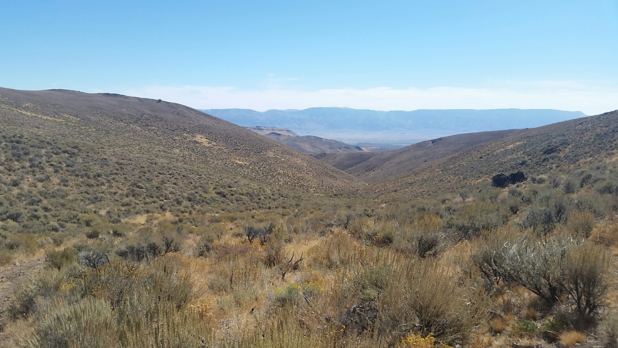
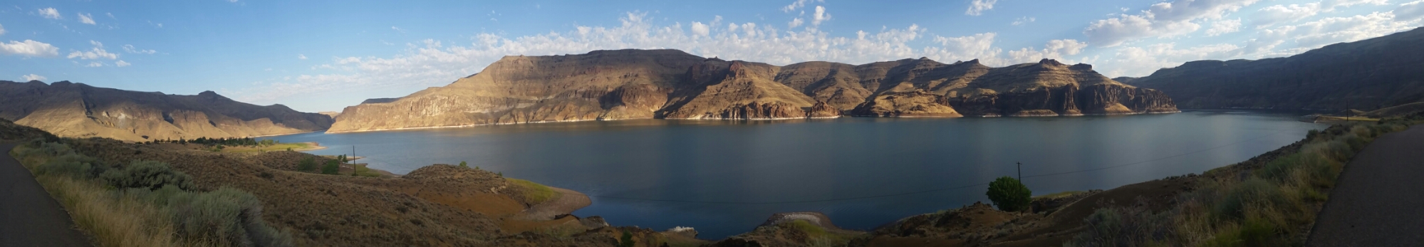
I decided to section-hike this 750-mile route across the Oregon desert, not only because it’s a fantastic way to discover my backyard in Bend, Oregon, but also because I had just started a new job as the Oregon Desert Trail Coordinator. To learn what one of the newest long-distance trails in the country needed to help it get established, I did the only obvious thing: hike it. My coyote variety show was about 400 miles into the endeavor, in the remote Owyhee River canyon, just one of the unique and spectacular regions along the route.

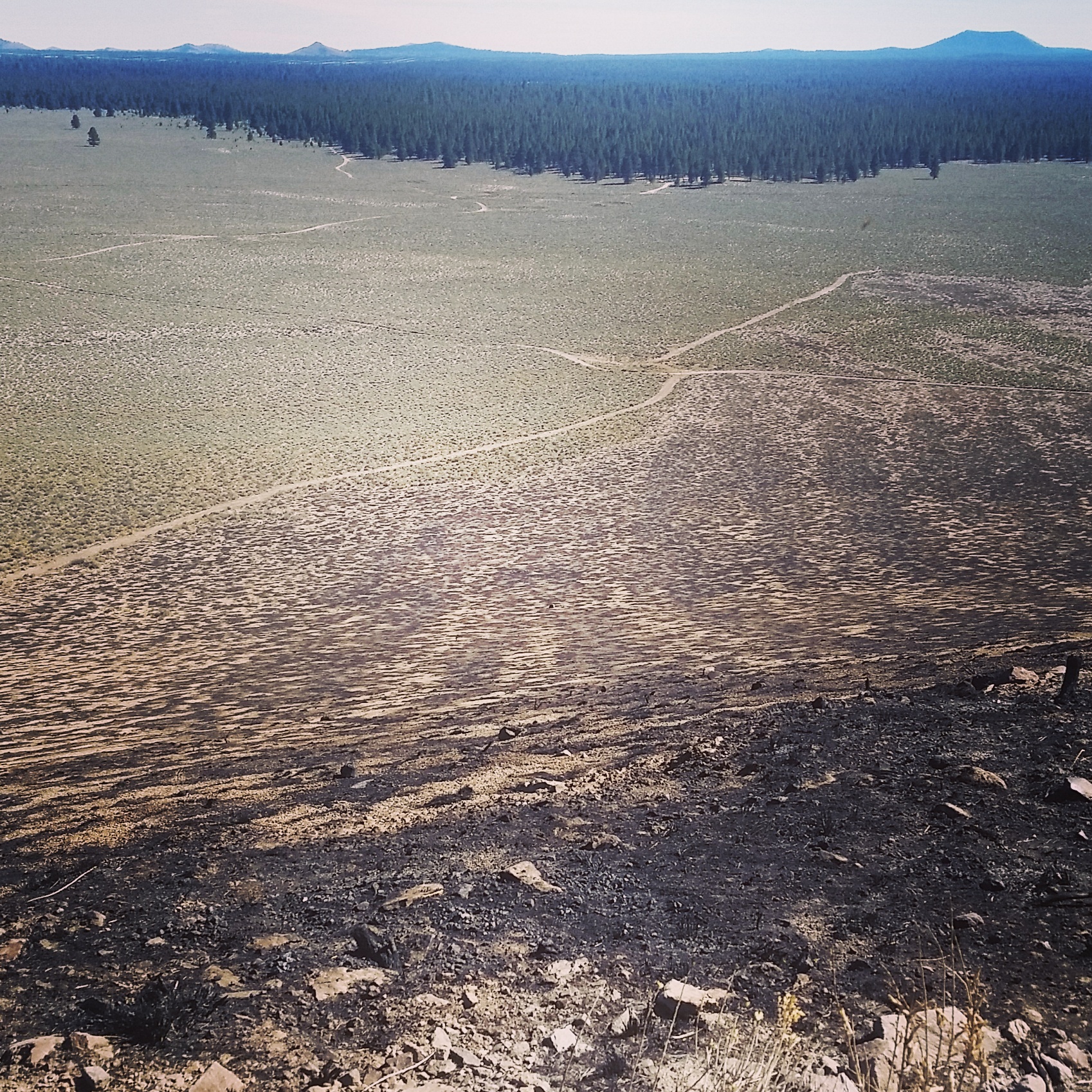
Founded by a conservation organization, the Oregon Natural Desert Association, the Oregon Desert Trail connects remote mountains, canyons and dry lakebeds with a mixture of trail, old roads, and cross-country travel. Places like the Hart Mountain National Antelope Refuge, Steens Mountain and the Owyhee Canyonlands immerse hikers in the very land ONDA has been striving to protect for 30 years. Perhaps by introducing more people to these amazing landscapes, the Oregon Desert Trail could help foster a sense of responsibility: responsibility to help protect, defend, and restore Oregon’s high desert for generations to come.
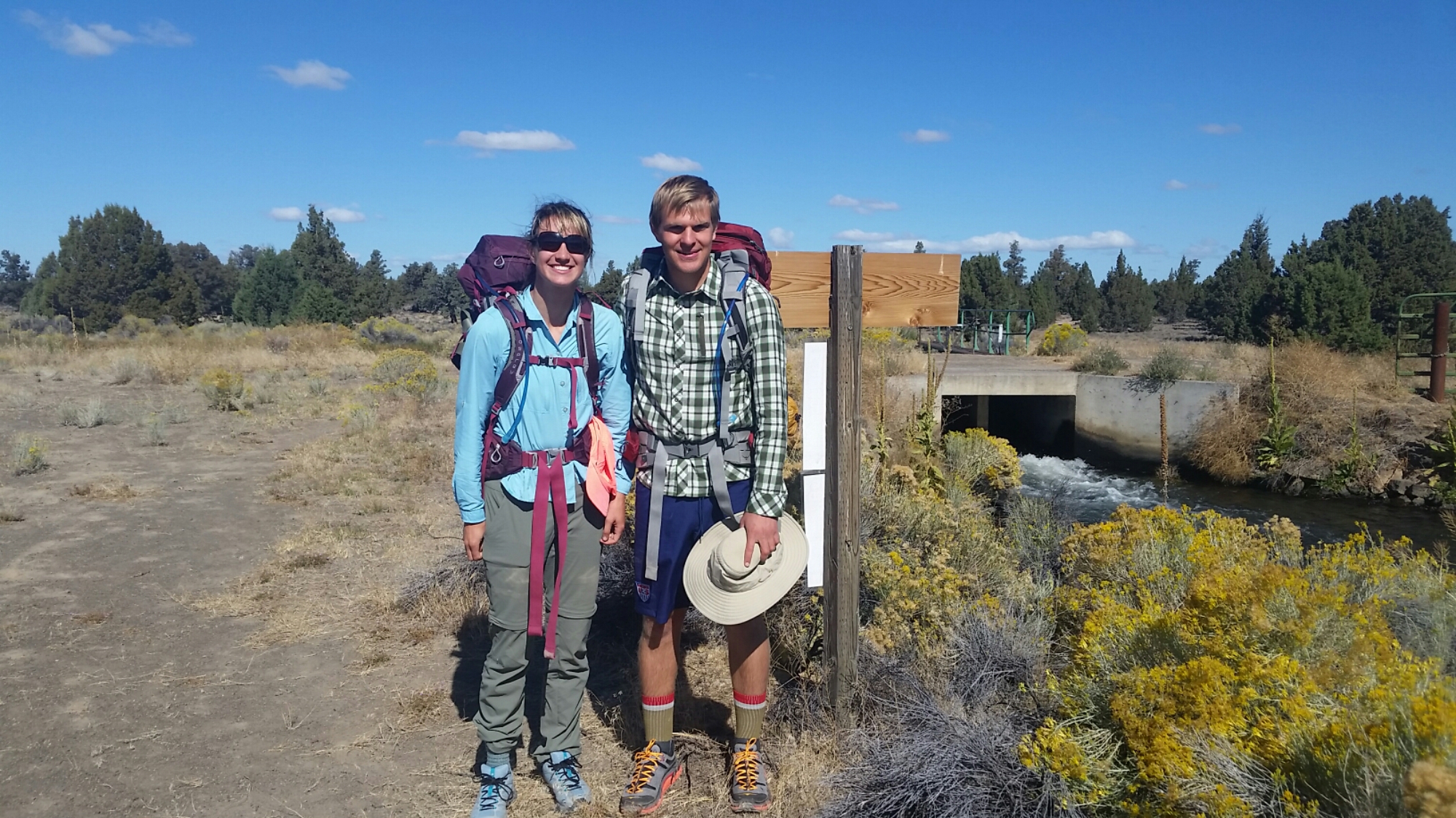
Now that fall is approaching, I’m eager to shoulder the pack and head out into the desert for the final 300 miles. Cooler autumn days are the perfect time to explore eastern Oregon. Solitude is abundant, and if you’ve struggled through the heavy traffic of other long distance trails, the Oregon Desert Trail will be a breath of fresh air. Literally.

How does one hike a route versus a trail? At this stage, Oregon Desert Trail hikers need to be experienced with map and compass and/or very comfortable using a GPS device, since the route is unmarked and requires quite a bit of off-trail cross-country travel. If you’re looking to break free from a traditional trail experience, this is the hike for you. There is freedom in the desert—freedom to make your own routes, to explore a nearby butte or canyon, and truly dive into the landscape, since there’s no official trail.

What can one expect on a day, week or month on the Oregon Desert Trail?

True solitude. It’s hard to find real solitude on the major trails these days with the recent popularity surge in long-distance hiking.
Hot springs. Soak the aches and pains of a day on the trail in one of the numerous hot springs along the trail.
History. The oldest human remains in North America have been found in this part of the desert, dating to some 14,000 years ago!
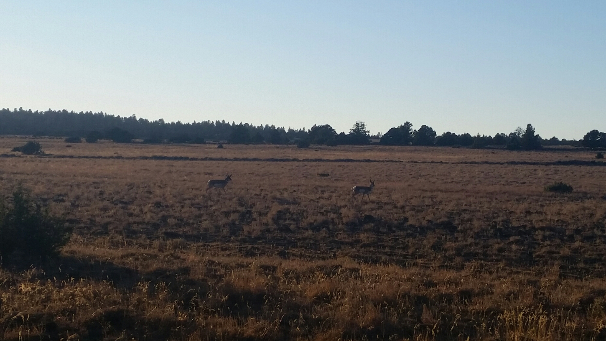
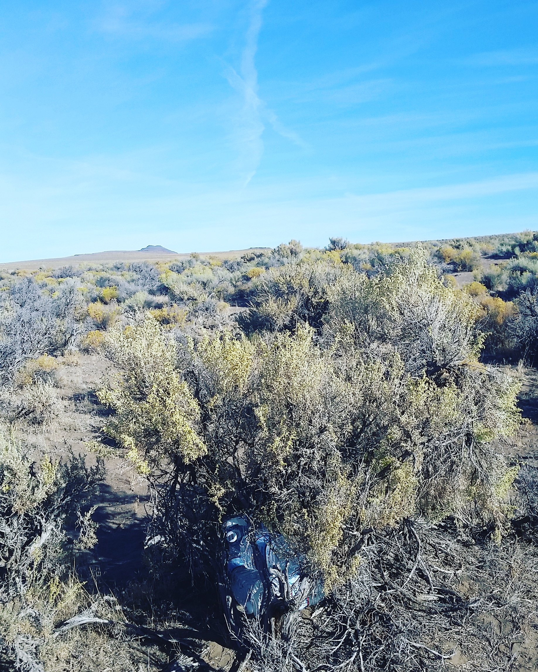
Habitat. The high desert is the perfect habitat for hundreds of different desert species like pronghorn, sage grouse, mule deer and jackrabbits.
Stars. The southeastern corner of Oregon has one of the last uninterrupted night-skies left in the country.
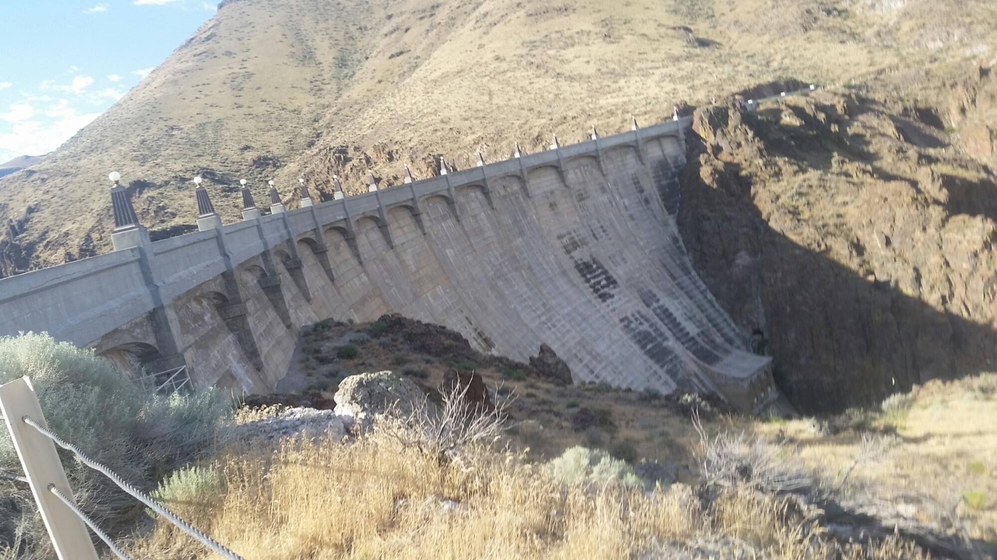
Rad rocks. Volcanos and plate tectonics play a big part in what makes this part of Oregon unique including the largest fault-block mountains in the country along Abert Rim and Steens Mountain.
Trail towns. Many of the 16 communities along the ODT are tiny, but offer amazing hospitality and are a great resource for learning more about the area.

The ODT can more accurately be called a route, instead of a trail, since about 30 percent of the 750 miles consist of cross-country travel, over 50 percent follows old roads that cross the desert, and the rest is on well-defined single track. Don’t let the lack of trail markers dissuade you from experiencing the remote beauty of the Oregon desert—we’ve put together a variety of resources to help you plan and navigate a trip on Oregon Desert Trail.

Maps
The trail is broken down into four regions, with each region spanning about 160 to 200 miles. Those four regions are divided into 25 sections, each with detailed maps indicating the type of tread (cross country, trail, or road), waypoints, mileage between waypoints, water sources, trail town info and declination information.

Guidebook
It’s nice to have a play-by-play account of what you will encounter in each section of the trail, and the guidebook will tell you to “take a left at that tree,” or “look out for pictographs around the next corner.” It references the waypoints on the maps and the databook, and includes a bunch of helpful information on planning your hike.

Databook/Waterchart
The databook includes information found on the maps and in the ODT guidebook. In addition, a water chart ranks water sources from reliable to questionable to unreliable, and is color coded to match the maps. Included is historical data from the past five seasons that hikers have been inventorying or hiking the trail, with a column for this year’s hikers to include their information on water sources. Better yet? It’s a Google Sheet; hikers who like to use their smart phones can download and update the chart electronically while they’re hiking. Once connected to data or Wifi again, the info will update automatically for the next hikers.

GPS Waypoints
You don’t NEED a GPS to hike this trail, but they sure are helpful. We have downloadable waypoints you can use.

Hiking Project Website & App
This is the age of the app, and the thanks to the website and mobile app, the Hiking Project, the first 270 miles of the trail are available for free with remaining miles due to be uploaded by the end of the year. Included are elevation profiles, a slimmed down version of the guidebook and a real-time view of where you are on the route at all times. Important junctions between cross-country and trail sections are marked, as well as water sources…and all match up with the waypoints and info you will find in our other ODT resources.

Water Cache Guidelines & Maps
The first 160 miles of the ODT are fairly dry, but luckily the hikers who have already completed the trail gave us detailed notes and maps on where they successfully cached their water. We also drafted some caching guidelines because caching can be a tricky thing if you’ve never done it before. Depending on how many miles you like to hike in a day, you may want to cache more than what’s suggested, and as time goes by and more people head out into the desert, we should have more information available.

Town Guide
There are 16 communities along or near the trail that can provide important services to hikers along their journey. Town can be a generous term in some cases as many of these spots consist of a single store/gas station/restaurant/bar/post office all in one building. The guide is available in draft form, and when complete will offer maps of each town with a directory of where you can eat, resupply, sleep, and more so tired hikers will know where to find the closest nachos, pizza and beer.

Gear for the ODT:

Sun protection
Exposure is no joke in the desert—you won’t find any trees in some sections. So a sun shirt is a great investment. Outdoor Research makes the Reflection Shirt, which is lightweight, and includes UPF 50+ protection in the fabric. And always carry lots of sunscreen.

Shelter
Eastern Oregon can be quite dry much of the year and hikers may find they don’t have to set up any shelter at all (hint: cowboy camping provides great views of the night sky), but it can rain, snow, or storm almost any month of the year. It’s a good idea to carry at least a lightweight tarp. Something like the MSR 12oz Thru-Hiker 70 Wing is a good option, or even the 4oz ZPacks Hexamid Pocket Tarp.

Footwear
Much of the terrain on the Oregon Desert Trail can be rocky. It’s a volcanic landscape and there are multiple sections with jagged lava rock to navigate. But in truth, over 50 percent of the route is on old dirt roads in the middle of the desert. Taking two pairs of footwear can be a good idea, 1) to give your feet a break from the long miles in the same pair of shoes, and 2) because you can. A rugged shoe like the Oboz Luna can hold up to the miles, and taking a second light weight sandal like the Luna Leadville Trail or a pair of Chacos can be a relief when walking along those old roads.

Misc.
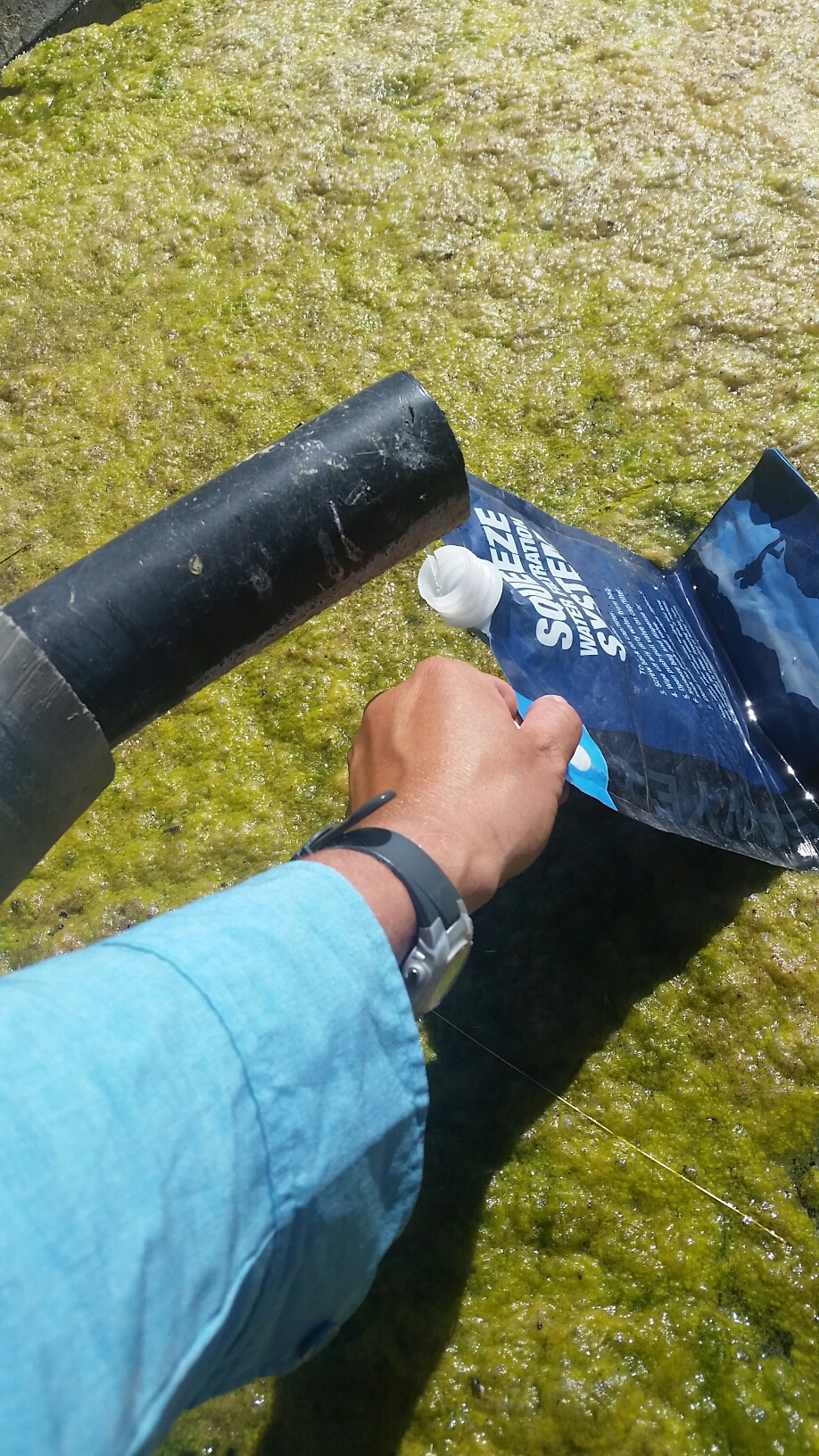
Most of your other backpacking items are similar to what you would take on any multi-day trip, but there are a few miscellaneous things that will be really helpful to have on this route. Gaiters like the Outdoor Research Veraglas Gaiters are a great way to protect your legs on the cross-country sections. It’s surprising how much cell phone reception can be found along the route, but in several of the more remote spots along the trail including the 175-mile section along the Owyhee River Canyon, it’s nice to have a satellite GPS device like the Delorme InReach Explorer.

Oregon Desert Trail: 175-Mile Packraft on the Owyhee River: The Prep

This is a repost from a blog I wrote for the ONDA website:


Ready to packraft the Chewaucan River outside Paisley in 2015

Ready to packraft the Chewaucan River outside Paisley in 2015

I have been looking forward to the exploring the Owyhee River section of the Oregon Desert Trail (ODT) ever since I visited Anderson Crossing with Sage Clegg on her 2013 thru-hike. Even though it was early July when we went to the Little West Owyhee that year, I saw pools of water and fish darting into the shadows; the sight had me dreaming of coming back with my packraft. I wondered: Is it boatable in the summer at lower flows? How low is too low? Do I have the skills to packraft the entire river? Could I create a river “alternate” to the 175 mile hike of the ODT in this area?

And so the seed of a great adventure was planted in my imagination. Couple that with my new job as the Oregon Desert Trail Coordinator, and ONDA’s efforts to protect the stunning wilderness of the Owyhee Canyonlands, and I had multiple reasons to immerse myself in the remote canyon.

Before I could start the next section of the trail I had some serious planning to undertake. Since I would be making the trip solo and adding in a more “risky” sport like packrafting on top of backpacking, I wanted to be sure I was going about the trip in a safe and smart manner. In addition, I was paddling a river I had never been on before that contained Class IV and V rapids, so I needed to be confident in my abilities, and my ability to get help if I needed it.

My boyfriend Kirk and I have been paddling remote rivers in our Alpacka Rafts since 2012, and I have enjoyed broadening my horizons beyond just backpacking. Since we live in Bend, many of our high desert rivers only flow in the spring, or usually have low flows. When I was a beginner packrafter I enjoyed paddling low-flow rivers, and have loved getting out sections of the North Fork John Day River, North Fork Malheur River, Chewaucan River, Crooked River, Wychus Creek, and others.

North Fork Crooked River

The North Fork of the Crooked River was one of my first packrafting trips in 2012

A large component to running remote rivers – either at low flow or at high – is scouting. I knew I would have to scout (or get out of the river to look for safe passage) a lot on the Owyhee River, especially since some of the larger rapids like Half Mile and Widowmaker were most likely impassable in my little boat. I tried to look up trip reports online to get a feel for what I would encounter, but didn’t find much about what these rapids would look like at 200 or less cfs (a river measurement for cubic feet per second). To give you perspective, a normal raft trip down the Owyhee River would not launch below 1,000 cfs, and many people run the river up to 10,000 cfs. 100 cfs would seem impossible to many…but to a packraft? I’d find out!

Renee Scouting

Scouting rapids is crucial for a safe and fun river trip

With 7 years of paddling experience, and 5 years of packrafting on desert rivers, I felt confident in my ability to make the right decisions in the Owyhee canyon to keep myself safe. Going solo, however, added another layer of risk which required me to consider all the scenarios of what I would encounter, and pack extra gear to cover my bases. My safety gear included a helmet, PFD (personal flotation device), a throw bag (could also use to line my boat down the river as I walked along the side), patch kit, well-stocked first aid kit, and Delorume InReach GPS device. The Delorume Inreach could send text messages during my trip, the device would track my progress every hour so Kirk could stay up-to-date on where I was, and in the event that I did need help, I could press the big red button that would bring search and rescue as a last resort. All of this helped put my and Kirk’s mind at ease.

Packing was another story. Since I wasn’t sure how many miles I would have to backpack down the West Little Owyhee before getting to a spot on the river with enough water to paddle, I was prepared to spend over a week in the first 87 miles of the route. I knew the West Little Owyhee was extremely challenging. Navigating in and around the boulder-choked narrow canyons and thick willows could make the trip so slow that my planned seven days to reach Rome (the half-way spot) could easily stretch into 10 or 12. But something I learned on my Continental Divide Trail thru-hike last year was to be prepared to be unprepared. I packed extra food, extra boating gear, extra shoes, extra everything so I could make decisions on the ground. But in reality all that added up to a HEAVY pack.

Renee packraft gear

Packrafting means lots of gear

Renee pack

Regardless of the results of my river trip, I was excited to be able to explore a different mode of travel along the Oregon Desert Trail, and asses the skill level needed to take this “water alternate.”

To the river!

Stay tuned for another blog post coming soon about the trip. Questions? Contact Renee at renee@onda.org.

TOAKS Titanium Review

Toaks Photo in use 2

TOAKS on the Owyhee River section of the Oregon Desert Trail

As an avid long distance backpacker, I’ve spent years researching gear in the effort to lighten up my pack weight. It may seem obvious, but a lighter pack translates to less stress on your legs, knees and feet, and more importantly, the ability to hike longer days and more miles. While a lighter pack makes a lot of sense when you are backpacking for months on end during a thru-hike, it is equally important when hikers set out for a weekend or few days in the backcountry.

I’ve seen many weekend hikers porting huge packs up and down the trails, grumbling about the torturous experience, and perhaps souring them on backpacking in the future. Don’t let this happen to you!

In this day and age there are many ultralight products to choose from, and in the 14 years I’ve been backpacking I’ve owned multiples of just about every piece of gear. But technology advances, and big improvements are made all the time in outdoor gear.

Since being introduced to TOAKS titanium products earlier this year, I’ve decided to try out a few items while hiking for my new job as the Oregon Desert Trail Coordinator. For a thru-hiker, getting to help establish a new long distance hiking trail is a dream job come true. This 750 mile trail traverses the desert of eastern Oregon, and has only been around for a few years, so in order to determine what the trail needs to move forward, I had to do the only obvious thing: hike it!

Oregon Desert Trail through the Alvord Desert

Oregon Desert Trail through the Alvord Desert

I decided to make a break from using traditional backpacking stoves and try out the TOAKS Titanium Backpacking Wood Burning Stove.  I’ve used lots of other stoves, but what they all have in common is fuel. There are as many types of fuel for backpacking stoves as there are stoves, and it can be a real challenge to find the right kind of fuel in the area of the world you are hiking. Finding fuel for a wood burning stove is as easy as it sounds.

So far I’ve carried this stove on 425 miles of the Oregon Desert Trail, 140 of those miles along the remote Owyhee River corridor. In all instances there was plenty of fuel to choose from. Dry pieces of sagebrush burn hot and leave almost no traces once burned down, and even along the river I was able to find dry driftwood to fuel the stove. It was such a peace of mind to know I didn’t have to figure out how to mail or find fuel along the eastern Oregon route.

Toaks Photo in use 1
There are a few things to know about cooking on a wood burning stove: 1) the fire does need your attention during the cooking phase, 2) cooking does take a little longer, and 3) cooking over an open flame will cover your stove and pot with soot. The benefits include: 1) stove weighs 7oz, 2) no need to carry fuel, 3) stove fits perfectly into the TOAKS Titanium 1100 ml pot, and 4) the set-up is stable, I had no concerns over the flames spilling out to surrounding grasses.

To keep the flame going long enough to boil water or cook you food, it’s a good idea to make a pile of small pieces of wood to keep feeding into the stove when the flame gets low. I like making a pile of 2-3 inch long pieces; these will be easy to add into the bottom chamber while your cook pot sits on top. Paying attention to your stove is always a good idea, and to make sure the flame doesn’t go out, it’s a good idea to put aside your other camp tasks and focus on the fire. Bonus: on cold nights or mornings you have some extra heat!

Because you are burning wood, the flame will release soot that can coat your stove and pot. Having a storage bag is important to keep the rest of your gear clean. I didn’t mind the black dust, and since I always carry some wet wipes, I was always able to clean off any smudges I might get on my hands.

Hikers will still need to pay attention to fire bans in certain areas during dry times of the year. In places where any open flame-type stoves are not allowed, the wood burner will not be the best choice, but for most environments this stove is a great option.

the sky seems bigger in the desert

When using a wood burning stove it’s important to pay attention to fire restrictions in the backcountry.

Have some damp wood you are trying to use? I’ve been using cotton balls with a bit of Vaseline on them. This hiker hack will burn long enough to dry out some of the smaller twigs, and the excellent air flow from the bottom of the stove will help your other pieces of wood dry out until they catch fire.

To round out my gear updates this summer, I’ve been using TOAKS Titanium tent stakes. Since Titanium is stronger than other popular aluminum stakes, these are not as likely to bend when trying to pitch your tent in hard-packed ground. They are incredibly lightweight, and easy to use.

Titanium is one of the lightest materials on the market, and TOAKS does a great job integrating it into their products so you will not only have some of the lightest gear on the market, but it will be incredibly durable and perform well in the backcountry.

Photos from my Oregon Desert Trail trips so far – 425 miles of awesomeness

wp-image-1423864038jpg.jpg

I’m hiking the Oregon Desert Trail in sections this year, and will be uploading photos periodically to the Oregon Natural Desert Association Flickr page. You can see the slideshows here:

Section 25

Section 24

Section 23

Section 22

Section 21

Section 20

McDermitt Alternate

Section 18

Section 17

Section 16

Section 15

Section 12

Section 11

Section 10

Repost from Adventures with Packraft

I’ve been done with my Owyhee trip for a week now. Since starting work on the Oregon Desert Trail late last year it’s been my goal to hike/packraft the entire 750 miles. This Owyhee chunk has me up to 425 miles, and I’ll complete the trail in September with the section between Bend and Plush, Oregon.
For a packraft alternate in the Owyhee canyon, I’ll be putting together specifics on which sections are suitable at low water to paddle; from 3 Forks to the area just after Iron Point I would recommend paddlers be comfortable scouting and running low flow to at least Class III. From Five Bar to 3 Forks and from Iron Point on I think less experienced paddlers would be fine (200 cfs and less). Stay tuned for more details.
All this rating of rapids in a remote canyon however is a bit of a faulty science. After talking with Kirk and length about what a Class III looks like road-side, compared to a Class III in a canyon days away from civilization, it seems like there could be a better rating system. Not all rapids are equal depending on your surroundings.

He shared this video with me about Addison’s scale that separates rapids or rivers into ratings based on the difficulty, danger, and exposure. Based on this rating boaters can get a much better picture of the true risk involved in a rapid or river.

For example, with the trip I just completed at low flow on the Owyhee, there wasn’t too much difficulty in the rapids, definitely some maneuvering and scouting, so I’d rate it a difficulty of Class III. The danger – risk of injury or death, was also in the realms of 3, however I think some of the portages may have been 4, getting around The Ledge, Half Mile, and Widowmaker involved some serious rock scrambling, lifting and lowering of the boat, climbing…even being very careful I slipped and cracked my tailbone good on one portage. Risk can be high, so I’m inclined to go with a 4. As for exposure, you are far far away from help on the Owyhee. If I had to hike out it would be days to help. I had a Delorum Inreach beacon, so that could have brought help to me, but that could take at least a day as well. So for exposure I would give the Owyhee a C rating. So for the Owyhee at low flow I give it a Class III-4-C rating.

Now for my gear list. I definitely had some extras that I should have brought, 4 pairs of socks??? Don’t know how that happened. I brought 2 throw bags, didn’t need 2. So below is mostly what I brought, but leaving off the extraneous things that I regretting bringing.

Item Specific Item Weight
Pack Six Moon Designs Flex Pack 51 oz
Packraft Alpacka Llama with Cargo Fly 8 lbs (with added thigh straps, back band and other modifications)
Paddle Werner Player 4 piece 40.5 oz
Helmet Sweet Protection Strutter 14.1 oz
PFD Astral Hybrid (no longer available, sob, I want one!! I used Kirk’s for the trip)
Throw bag Kirk made a small one
Bow bag Kirk made me one
Patch kit Tenacious tape, aqua seal, boat patches
Sleeping Pad Gossamer Gear Air Beam 3/4 Wide (Air Beam is not available anymore) 11.7 oz
Sleeping Bag Western Mountaineering Ultralight 20 degree 29 oz (I need to get a summer quilt, this was too warm)
Ground Cloth Tyvek 5 oz
Shelter Six Moon Designs Deschutes Cuben Fiber 7 oz (I should have brought a free standing net tent)
Stakes TOAKS Titanium stakes x6 1.3 oz
Poles Black Diamond Z-Poles with foam for tips when storing in boat 17 oz
Cook Pot TOAKS Titanium 1100ml Pot 4 oz
Spoon Oboz plastic spoon/spork 1 oz
Stove TOAKS Titanium Backpacking Wood Burning Stove 7.9 oz
French Press I bought at REI 10 years ago, I use plastic inner cup
Water Containers Platypus Hoser 1.8 liter 3.4 oz
Vapur 1 Liter Bottle 1.4 oz
Water Filter Sawyer Mini 2 oz
Water treatment eye dropper of bleach
Camera/Phone Galaxy S5 5.1 oz
Lifeproof Case 1.6 oz
GoPro 3 (3 batteries) (I lost my GoPro day 2)
External Battery Anker 2nd Gen Astro E5 10.9 oz
Headphones Generic
USB charger & 2 charging cords Verizon 7 oz
GPS/Beacon DeLorum InReach 7 oz
Umbrella Six Moon Designs Silver Shadow 8 oz
Headlamp Petzel Tikka RZP Rechargable Headlamp 4 oz
Stuff Sacks OR UltraLight Dry Sack 1.6 oz
Knife Gerber US1 1 oz
Bag Liner Trash compactor bag
Jacket Montbell Alpine Light Down Parka 11.8 oz
Patagonia Hoodini 4.3 oz
Outdoor Research Helium II 5.5 oz
hat Hikertrash trucker hat 2 oz
Outdoor Research Pinball Hat 2.7 oz
First Aid Misc
Long sleeve shirt Outdoor Research Reflection sun shirt 7.5 oz
Pants Outdoor Research Ferrosi Pant
Skirt Purple Rain Skirt
Long johns Outdoor Research Essence Tights 5.2 oz
Socks X3 pairs Point6 merino socks (should have just brought 1 pair of socks)
Shoes Oboz Luna 12.6 oz
Luna Sandles – Mono
Rain skirt trash compactor bag
Mittens Gordini Stash Lite Touch Mitt
Gaiters OR Gortex Gaiters 10.2 oz

Oregon Desert Trail (2nd Section – Water Alternate): Day 13 – Getting Home

I slept well next to the groaning and mutterings of the RVs around me. I packed up, made a cup of French press coffee for the road, and headed up to the road to walk myself to a point where I would be more likely to get a ride.

It was a beautiful morning, and a bit of cloud cover made for a pleasent walk.

I passed a couple more boat ramps and my optimism soared, even if I had to wait all day, surely some day trippers would be heading to town later.

After about 5 miles I hit the dam, I guess the Lake Owyhee dam was a test run for the Hoover Dam back in the day.

At the base of the dam were a few houses and some more camping. I could see a few fishermen in the river. I will get a ride today!

I sat down by the entrance to the community at the base of the dam and made myself a new hitching sign. The one I made last night said “help to Ontario” and I made another that said “help to town”. I didn’t want to limit myself.

After about an hour a few cars had passed, but when a truck with a top camper passed, it slowed down and backed up. Oh please…

Mark & Karna Berg hopped out and made room for me in the truck. The couple was from Albany, Oregon and was taking their first vacation in years. It was so nice to be in the truck knowing I had my ride. After a while they mentioned their plan was to head to Paulina Lake just outside Bend, and they would be happy to take me all the way back to town. What!?!?! Yes please. The Bergs saved me a whole day of trying to get home. What incredible generosity.
In Vale we stopped for lunch where I treated us all to some big burgers, then I sat back to relax on the 4 hour drive back home.

Done and done!

Oregon Desert Trail (2nd Section – Water Alternate): Day 12 – 22.5 miles & done!!! (175.3 total)

That’s 141.5 river miles, 33.8 hiking miles.

Today was brutal.

I woke up before the sun and made quick order of the morning. I may not know how many miles it was to the end point of the reservoir at Indian Springs Campground, but I was going to make it there. Determination had me in my boat by 6am. I took my coffee to go and had it perched between my feet so every so often I would take a 5 second break to re-up my caffeine levels.

The water was utterly still in the morning, and I made good time, paddling steadily north, only taking a few seconds to drink coffee and stretch my hands which were going to be stuck in a claw grip by the end of the day.

20160725_061921

The wind remained at bay most of the morning and I motored along, marveling at my surroundings as I steadily paddled. About 11am I passed a big group of houses…only water access here and I started to see more motor boats coming and going. I think I was still about 12+ miles out, and would TOTALLY live here if I had a chance. How cool! I had paddled past a house where someone had waved at me, and a short while later the man and his dog show up near by and slowed down to talk.

20160725_104604

Dave and his dog Clue had spent a few days at their cabin and were heading home that afternoon. He gave me some cold water, and we shared a beer there in the middle of the lake. Dave told me they didn’t know why all the fish had died this year and the water didn’t recede any faster than it normally does. He also mentioned a large algae bloom was the blame for all the green slime in the water, again, folks weren’t quite sure why that had happened either. Change is a foot in nature! Dave offered to give me a ride to the end, but I wanted to get there under my own steam, so thanked him and was on my way again. It was the longest break I had taken all day, and was grateful to give my arms a rest for a minute.

As soon as I turned the next corner the wind hit me full force. What I didn’t realize was that I would be paddling into the wind for the next 5 hours. Ouch. I gave the paddle another hour before I pulled over and tried to eat something and lay on the rocks in complete exhaustion. But I couldn’t stop. Had to keep motoring, and now that I was going against the wind I had to paddle harder and longer to go the same distance. THIS is why I was hesitant to paddle in the reservoir. But here I was and any pause to my paddling rhythm had me getting blown backwards. Curses!

I went into machine phase. For the next solid 5 hours I paddled. I paddled and tried not to think about the pain stretching through my shoulders, the fact that my wrists and elbows were straining under the repetition. With each stroke I would try and stretch my fingers a bit to give them a break, but I couldn’t stop. I had to keep going.

I’m not sure where my mind went during those hours. For a short while I sang whatever songs I could remember the words to really loudly into the wind. That helped. Then I tried to listen to some music on  my phone, and then just didn’t think at all. I was the paddle. I was the wind. I just was.

I continually checked Gaia to see what the most efficient route would be. Without it I surely would have taken a detour into one of the many arms of the lake, it was hard to tell what the route should be, so THANK YOU gps app. I made a pretty straight shot.

Screenshot_2016-07-29-07-58-02

When I finally knew I was getting close it was hard to keep up the rhythmic motion, I so badly wanted to stop. Finally, finally I saw the rocky jetty just behind Indian Springs Campground that was the official ending point of the Oregon Desert Trail. I thought about getting out and climbing up on the rock as I floated by, but then just figured I was close enough!

The end!

I reached the boat ramp at 4:45pm and even though I wanted to collapse on dry ground, if I had any chance of hitching out of the lake I would need to keep moving. My exit plan was simple. Catch a ride to Vale or Ontairo Oregon where there was a bus that left each morning at 9am for the trip to Bend. If I could get a ride to town tonight, I could be on the bus tomorrow and home. If I had to wait until the morning to get a ride, I would have to wait another whole day for the bus. Granted that wouldn’t be all bad…an air conditioned hotel room, probably some delivery pizza…not too bad at all! But I was eager to be home and have a few days to relax in my own space.

I deflated my boat, packed up everything and started sweating up the hill about a mile where I found the first shady spot along the road, and sat down to see if anyone from either of the 2 close by campgrounds would be leaving. 2 hours later at 7pm I new the gig was up, and that I should make my way to one of the campgrounds for the night. I had finally been able to relax in the shade of that tree by the side of the road. In fact I was horizontal in the dirt, not caring a bit I was so tired. I made some cold-soak Backpackers Pantry pasta and played solitare on my phone, just content to not be moving.

But I wouldn’t get a hitch tonight. I walked back to McCormack campground, got a spot, took a shower wearing all my clothes, and dripped dry in the hot evening night. I was surrounded by RVs and looked quite silly as I spread out my Tyvek and cowboy camped. No car, no RV, no tent. Just me and the dirt.

Oregon Desert Trail (2nd Section – Water Alternate): Day 11 – 11 miles – 2 mile hike, 9 river miles  (152.8 total)

I slept well despite being visited by some animal in the night. I think it might have been a raccoon after all the dead fish.

After my coffee I loaded my boat and started paddling the last few miles to the take out. I soon came upon Willow Creek where the trail meets the reservoir. I saw where hikers will skirt the edge of the water, and after Spring Creek will need to climb up about 100′ to avoid some pretty steep terrain along the water. Spring Creek even had a little trickle in it.

Gittin it done!

Gittin it done!

I got to the boat ramp just as the only car in sight was leaving. I took the next hour to transition to my hiking gear and fill up my 5 liters of water. Just as I was leaving a pickup comes in and pulls over. Ross and his friend were out for a drive, and we chatted for a few minutes about my trip and the incredible history of the area. They gave me a bottle of cold water before they left, thanks guys!

Trash cans at Lesley Gulch! It's the little things...

Trash cans at Lesley Gulch! It’s the little things…

As I walked up the road I immediately began second guessing my plan to hike the remaining 30 miles to the end. It was hot. So hot that I thought I might get myself in trouble. Heat exhaustion, heat stroke…I didn’t like my chances.

I sat down on the side of the road trying to decide what to do. Night hike? Paddle to the end? Get a ride out? Being this close to the end I’m mentally almost checked out. Packing up here would be so easy…but I’m so close. What to do…

After a long break I decided to go back to the water and inflate my boat and paddle to the end point. As I was walking back to the boat launch a truck pulled over and asked if I wanted a ride. “Sure!” I said, relieved to not have to walk that hot mile again. I hopped in the back of their pick up and they drop me off at the sheltered picnic tables where I would repack my boat. The couple was from Portland and were very curious about the Oregon Desert Trail and in fact they had seen the Patagonia article that Jeff Browning had written about running this section. I’m pretty sure they came out here because of that article and they loved the Owyhee region so much that they thought they would bring their kids here next year instead of Zion as they had originally planned. They were true trail angels and left me with a cold Gatorade and can of Guinness for later.

I had been hesitant to paddle in Lake Owyhee because paddling flat water in the packcraft is not very efficient, but I seem to do OK on the slow river this week, and given it was so hot out this seemed like the best decision.

I texted Kirk the change of plans and I paddled for a few hours. When the wind began to pick up I pulled over and made camp. The water levels are about 15 feet below where you can tell they normally are. There are less dead fish but I still had to flip a few away from my camp spot. The water has a filmy green algae floating in it, and since I’ve been swimming frequently now I smell like algae and dead fish too.

The best part of the day was when that hot hot sun set.

The best part of the day was when that hot hot sun set.

I not sure how many miles it is to the end at the Indians Springs campground but I’ve been using the tracking function on my gaia gps app so I should know when I get there. I’m guessing it’s about 20 miles from where I am. Kirk later texting me that it was over 100 degrees out. No wonder if feels so bloody hot. I’m really glad I decided not to hike; it would have been a nightmare. I hope Christof who is trying to run the trail right now is doing okay in the heat. I’ve been thinking about him a lot out here; when I was in Rome he was approximately halfway, but its been much hotter since then. I’m looking forwad to finding out how he’s doing. And getting in some air conditioning.
Update: Christof finished his run of the trail on July 29! 18 days, 750 miles.