Appalachian Trail Sobo Section: Day 29: 11.6 miles (323.5 miles total)

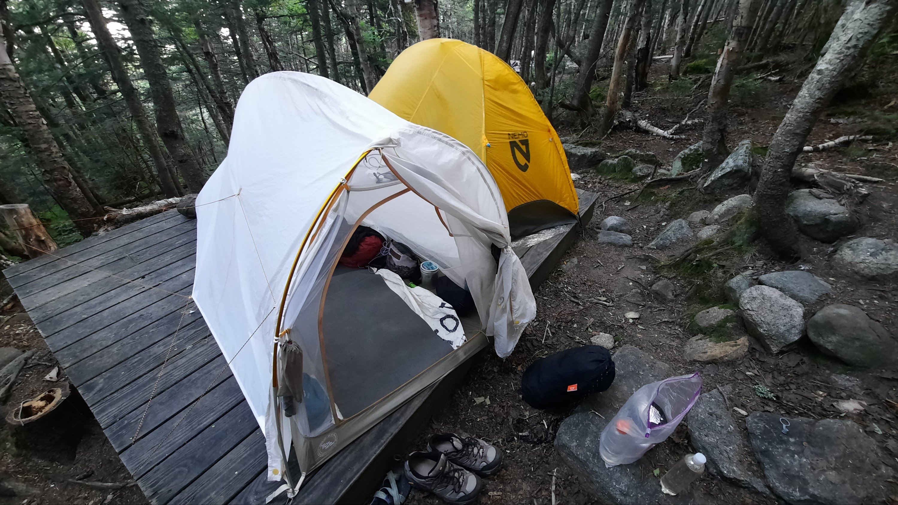
The wind didn’t stop all night and in the morning we woke a bit shell-shocked, yet rested.

I made coffee and ate breakfast in the kitchen area then packed up. Gormet had a big day and I wasn’t sure I would see her again…she was going to try and beat the storm over Mt Washington and I was going to wait for it to pass. I’m sad I might not see her again, but that is the way of the trail. The good news is that I hear Hero is only a day behind, so if I slow down maybe I’ll see him again!

And these are the days of trail life.

While I was snug in my sleeping bag I booked myself a bunk at Madison Springs Hut in a few days to avoid the storm (4g here!). It was a spendy thing to do, but if I paid to stay at the hut I could climb up to treeline before the storm, have shelter during the storm, enjoy a few hot meals, and then continue on to Mt Washington already having climbed up above treeline when the weather cleared. It was a decadent thing to do, but as I’m in my last month of vacation, decided to splurge.

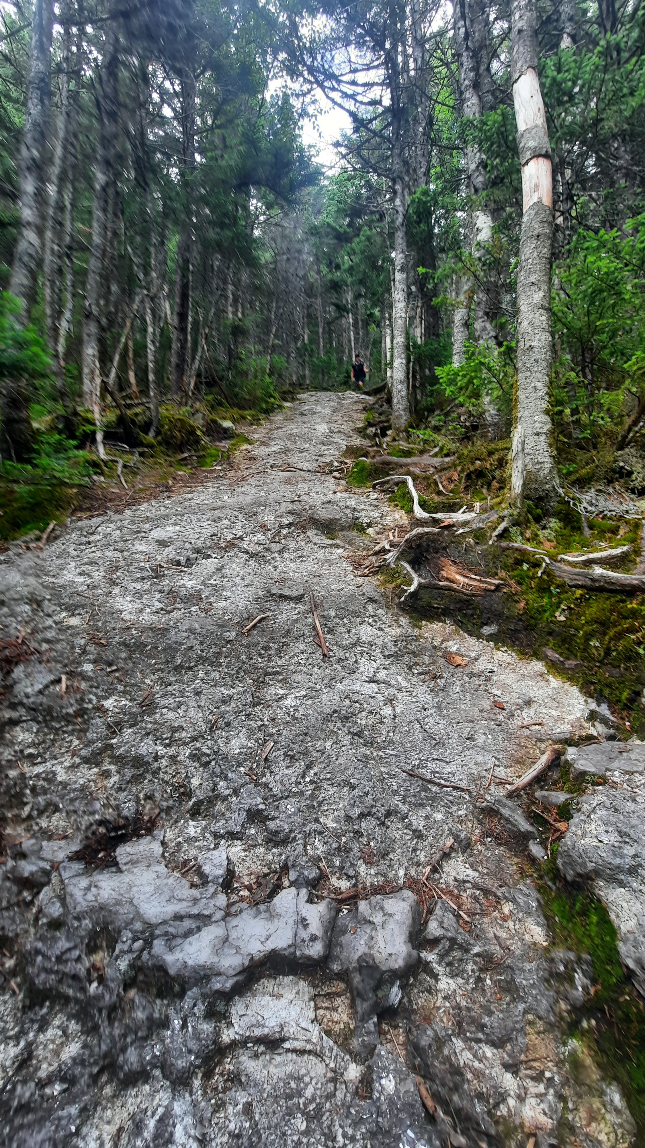
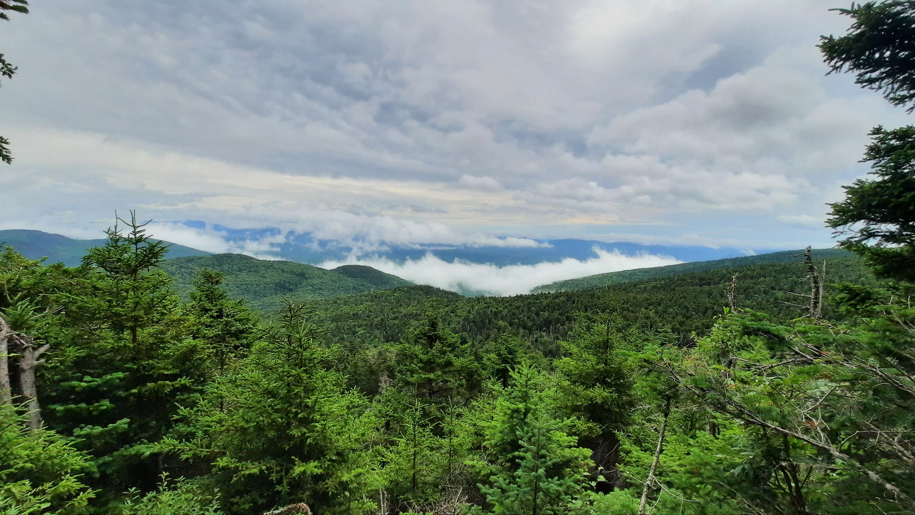
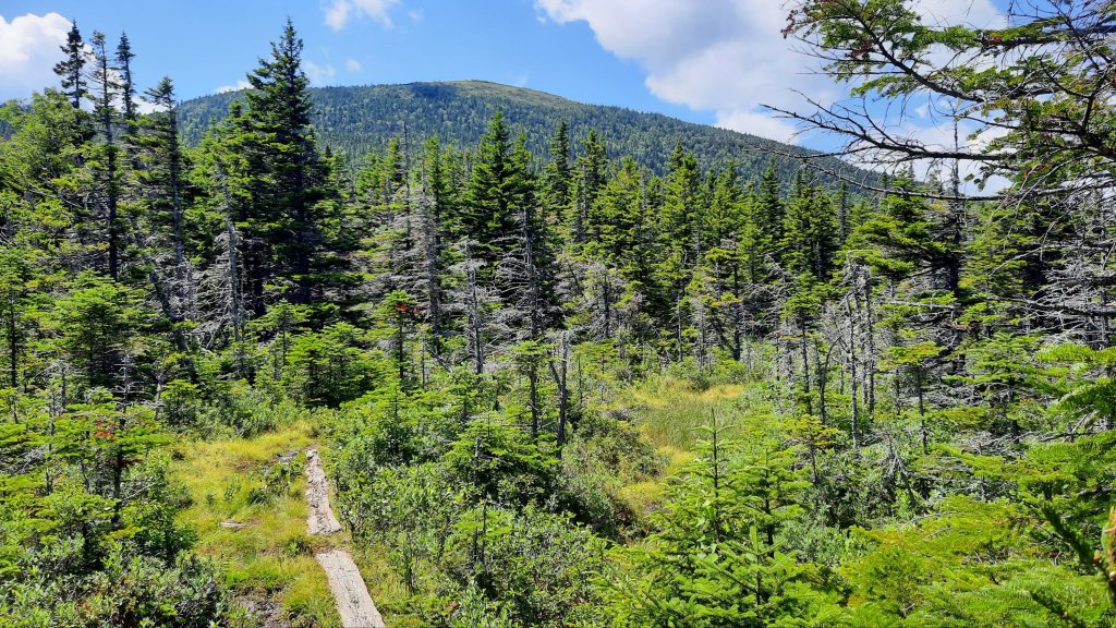
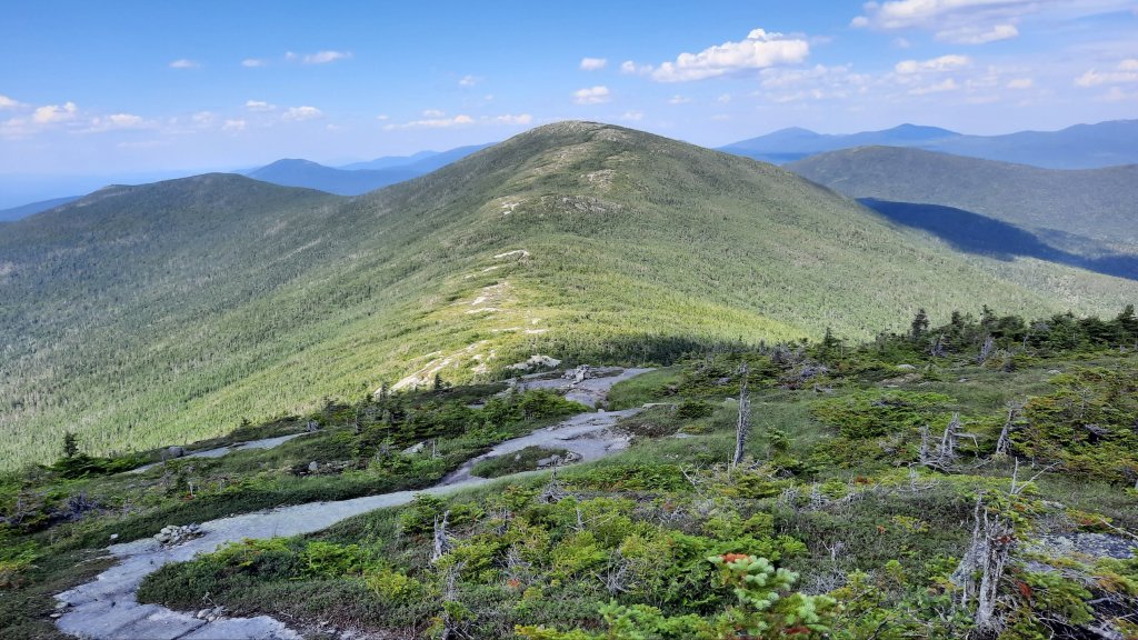
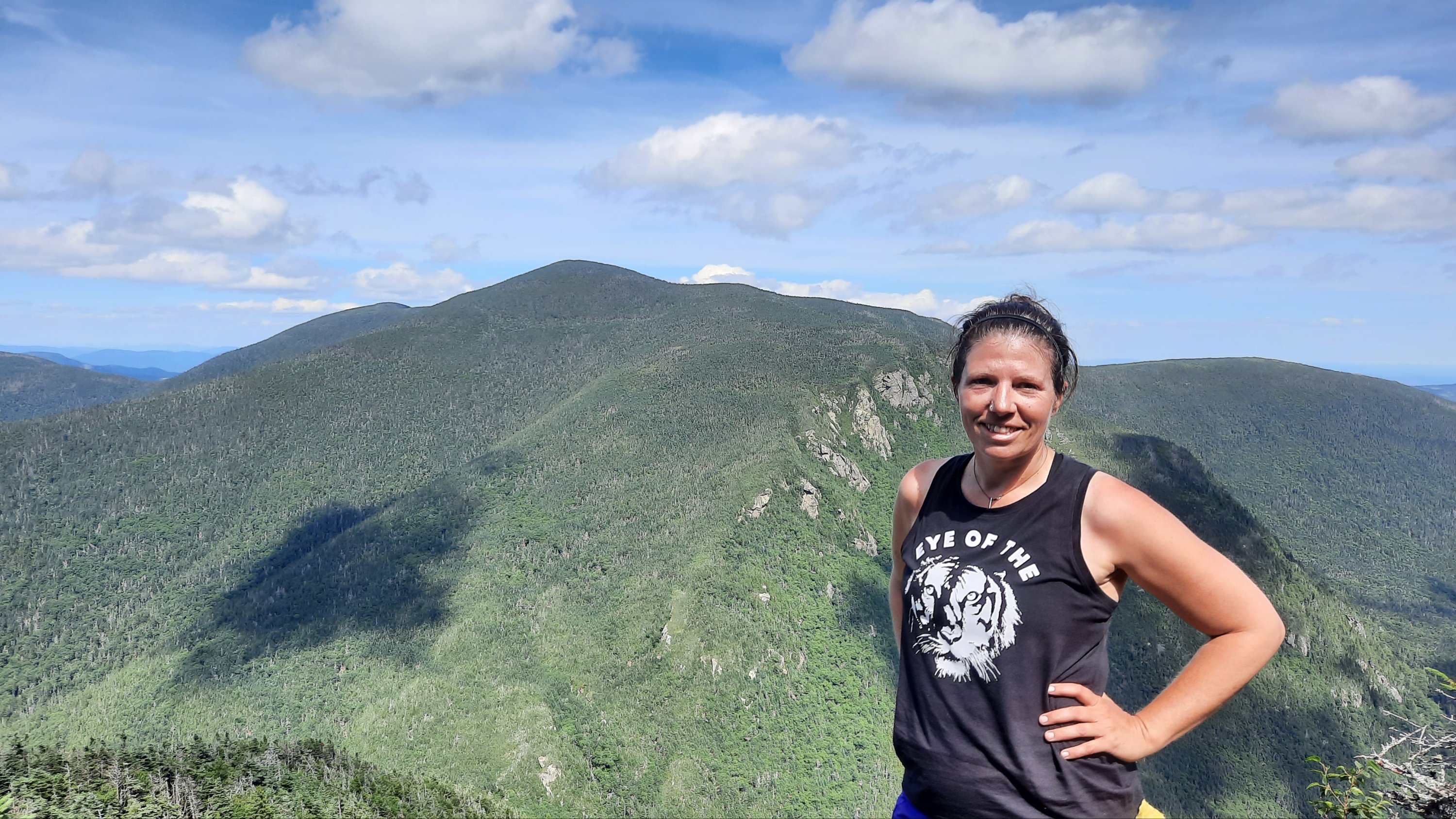
We are hiking over the Carter Range today, and there are multiple peaks over 4,000′. Fortunately most of the climbing is behind us, so we only have the short steeps (by short I still mean 1,000′).

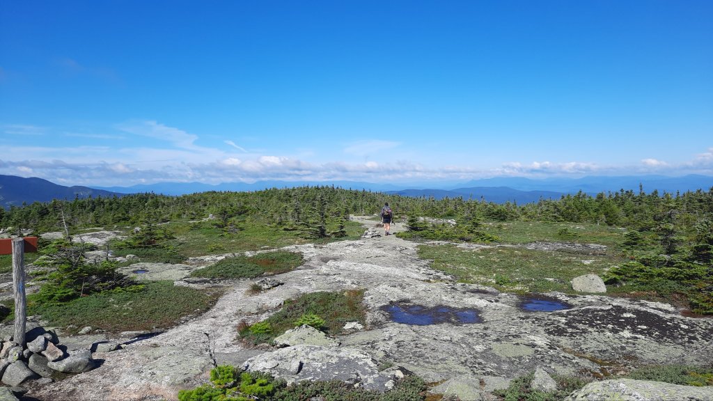
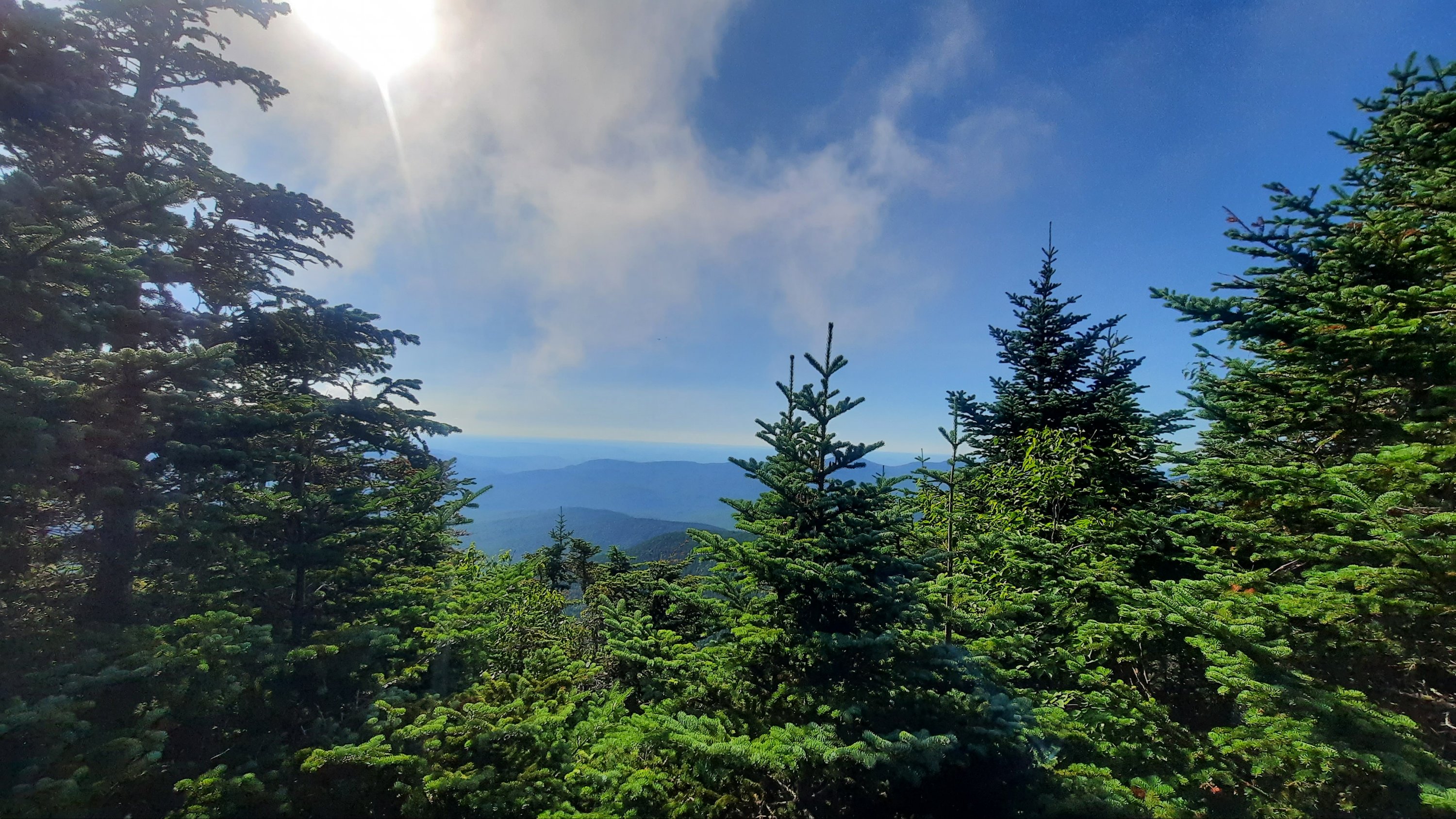
But there was some nice walking today, and even though the climbs did get a little Maineish, the morning was quite enjoyable.


Mt Washington

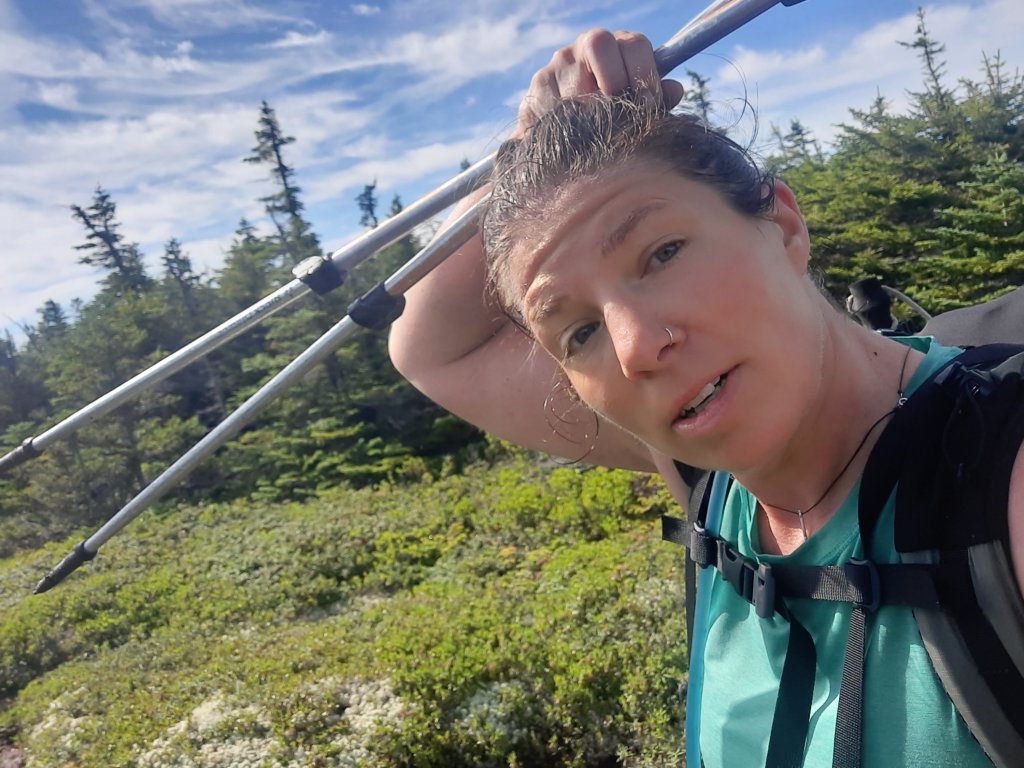
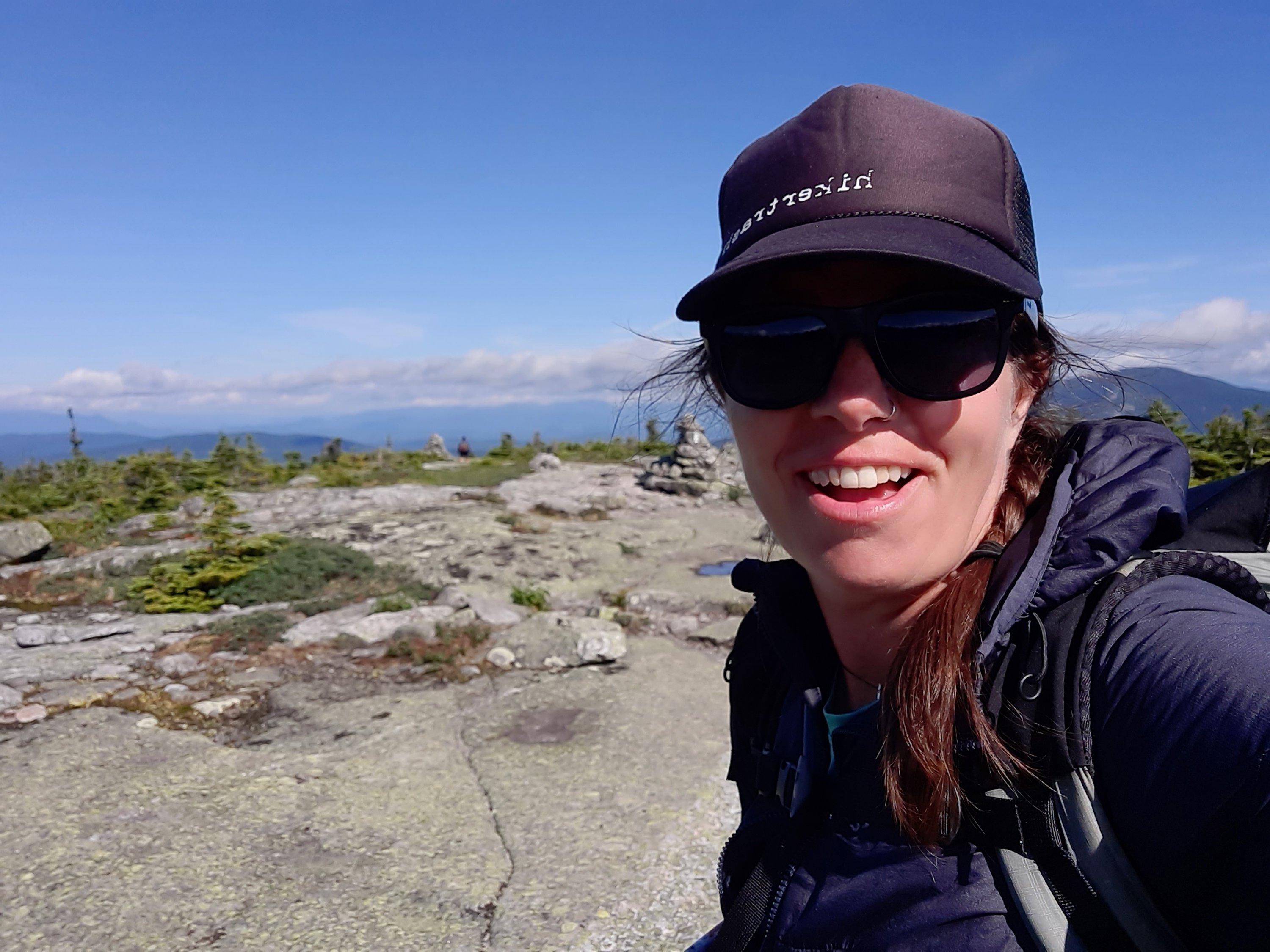
The sun was out too. And I basked in the rays after the cold and windy day yesterday. Contrasts are needed to feel the full appreciation of a thing.

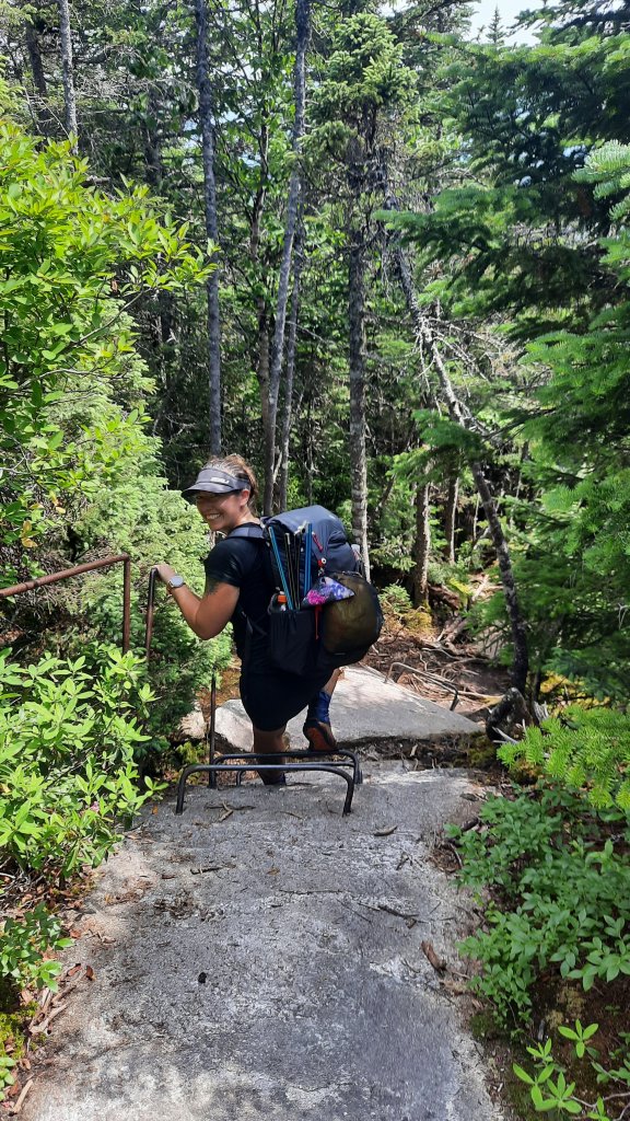
I did see Gormet again at a climb and snack break, but then she motored on and I slowed down. I don’t want to get to camp too early, but the effect of slowing down makes the miles go slower, and it starts to feel hard to make progress…my feet in molasses.

But then I come to Carter Hut, my first hut! I remember this place from 2002. We all went swimming here. We did a lot of swimming back then.


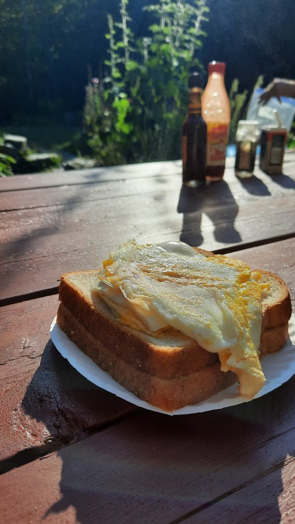
I walk into hut hoping for soup and find that they have free leftovers out from breakfast! I eat two plates of pancakes and eggs and no longer have room for soup. I hope most of the huts are like this.

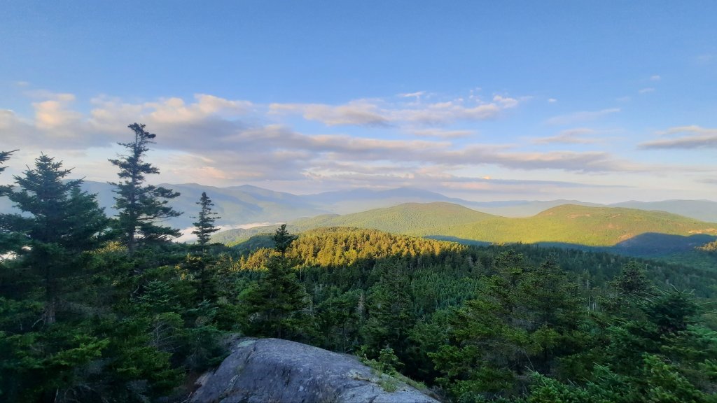
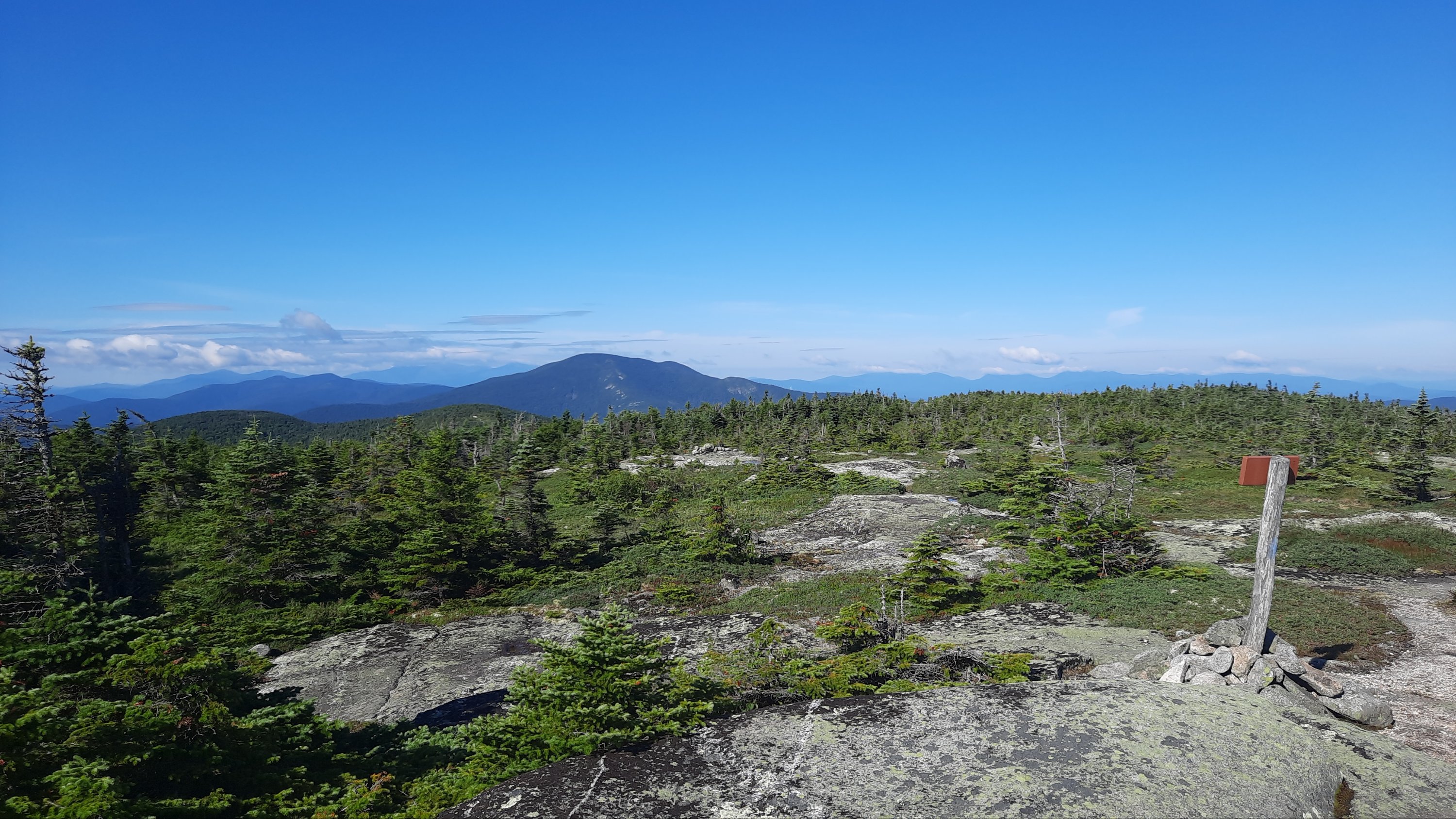
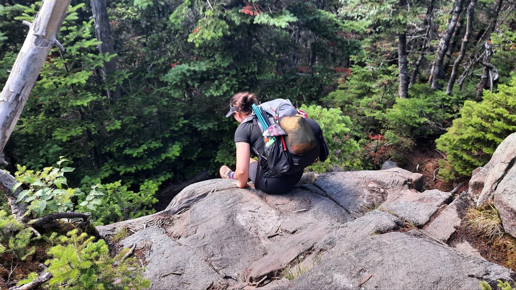
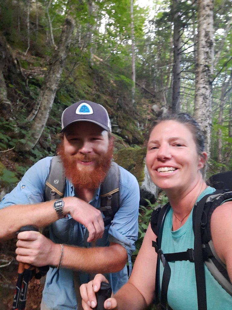
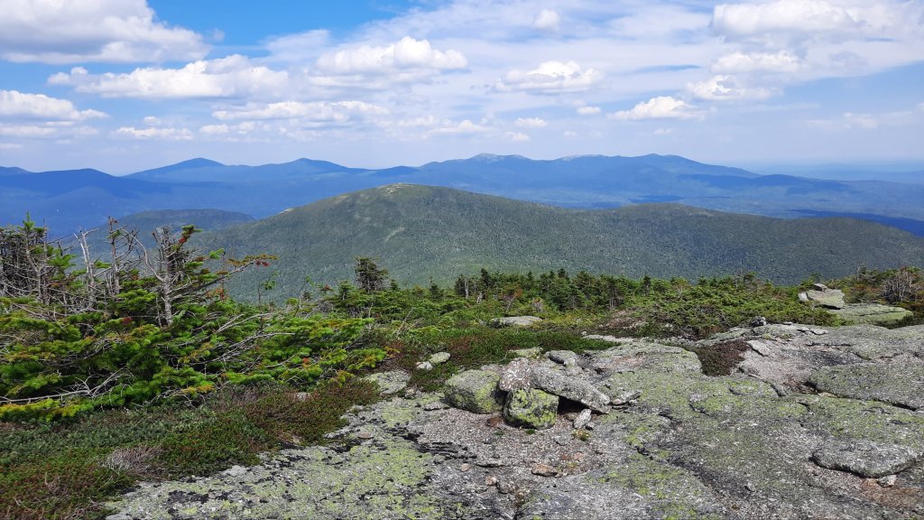
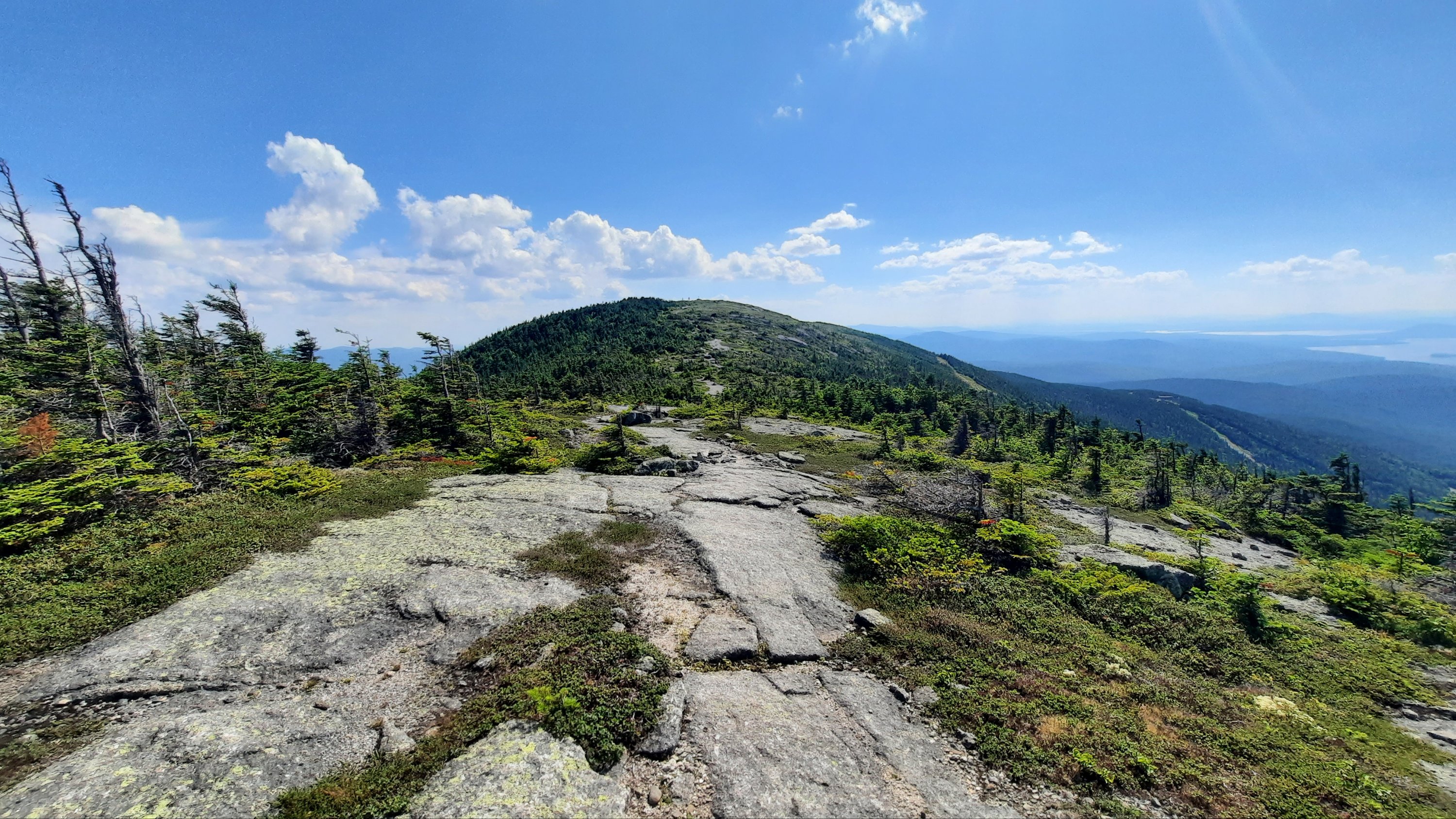
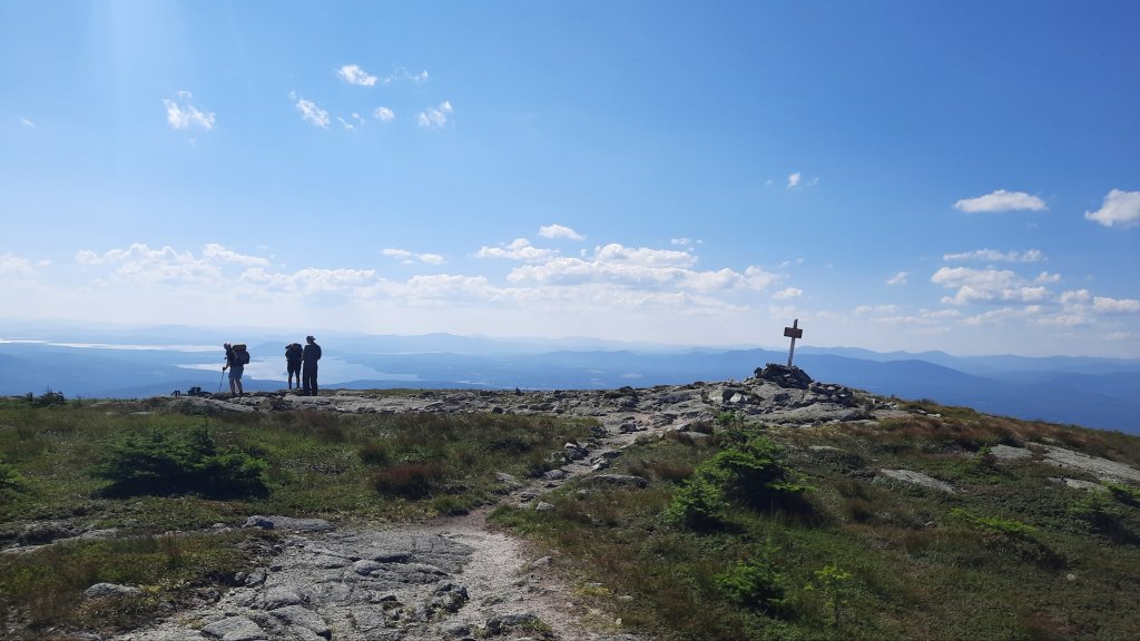
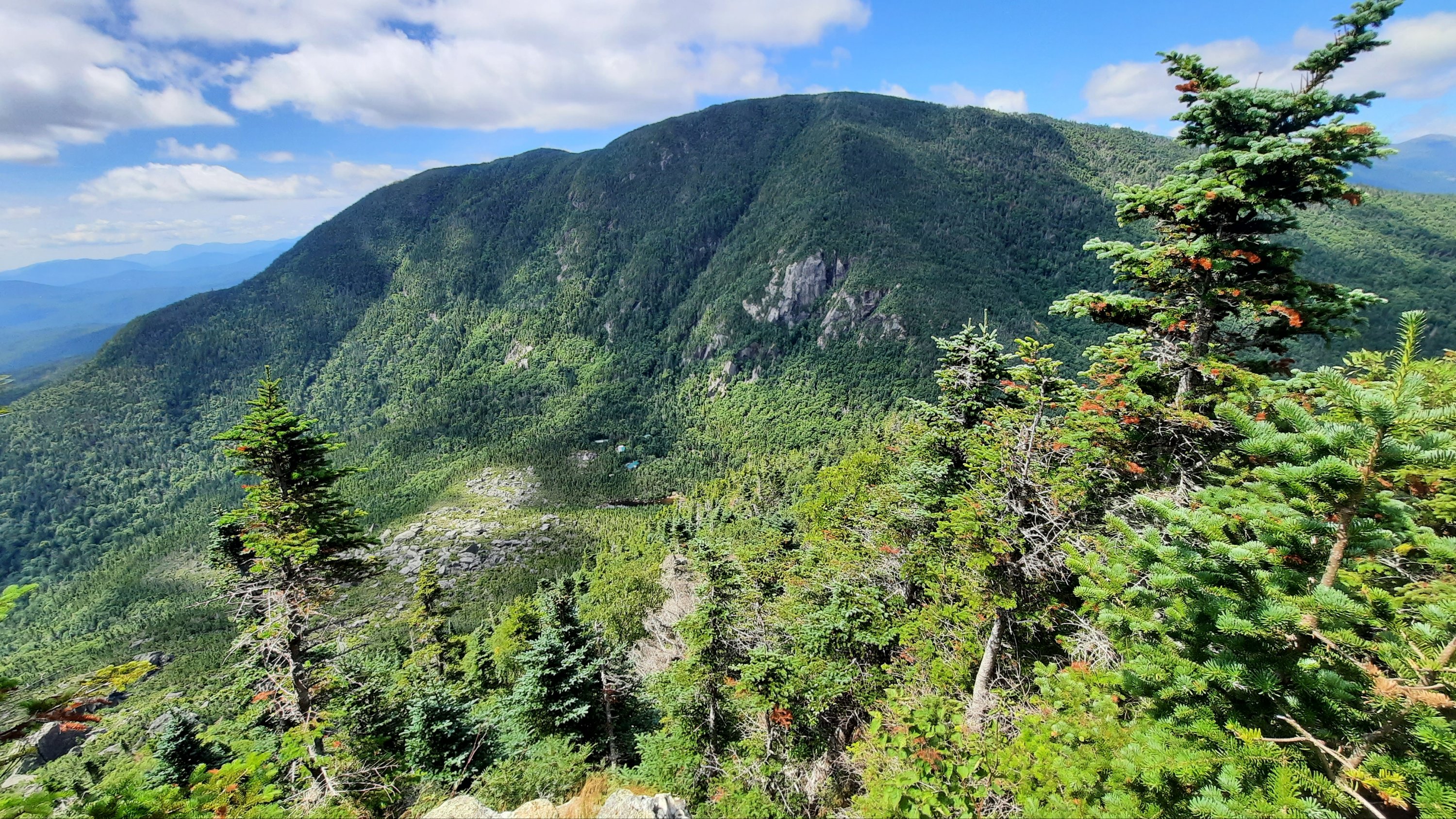
I push my way through the rest of the thick, slow afternoon, but have small glimmers: chatting with Freebird, a 2018 thru-hiker who lives near by and yearns to thru-hike again; seeing Anna, a sobo hiker who is hiking this section in reverse to spend another night in Gorham, she too is slowing down for the weather, so it sounds like I will see her again; and snacking at a fabulous view back to where I came today even with a perspective of the hut below.


Thanks for the photo tourists!

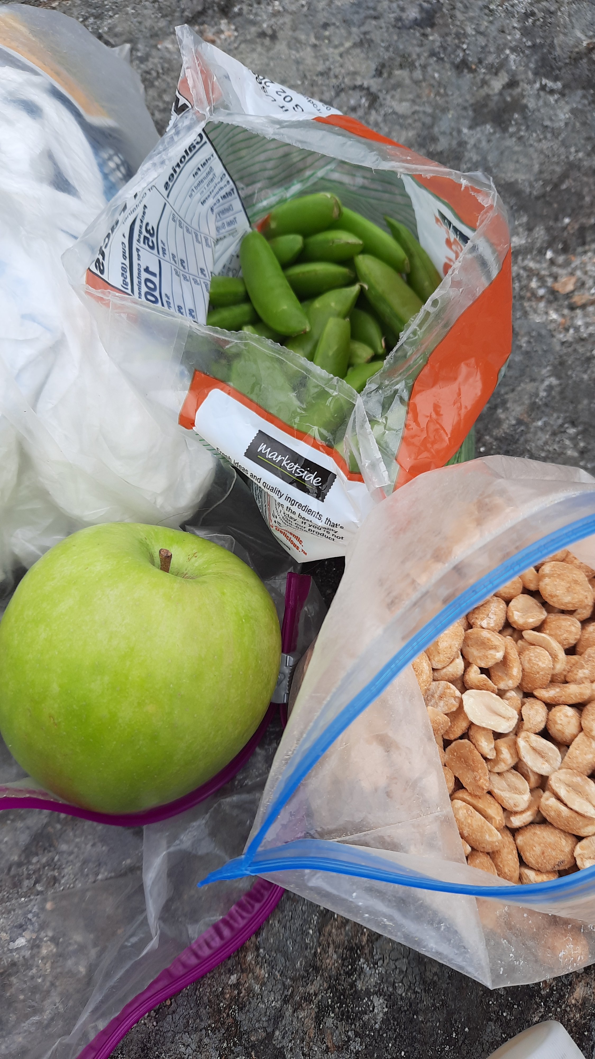
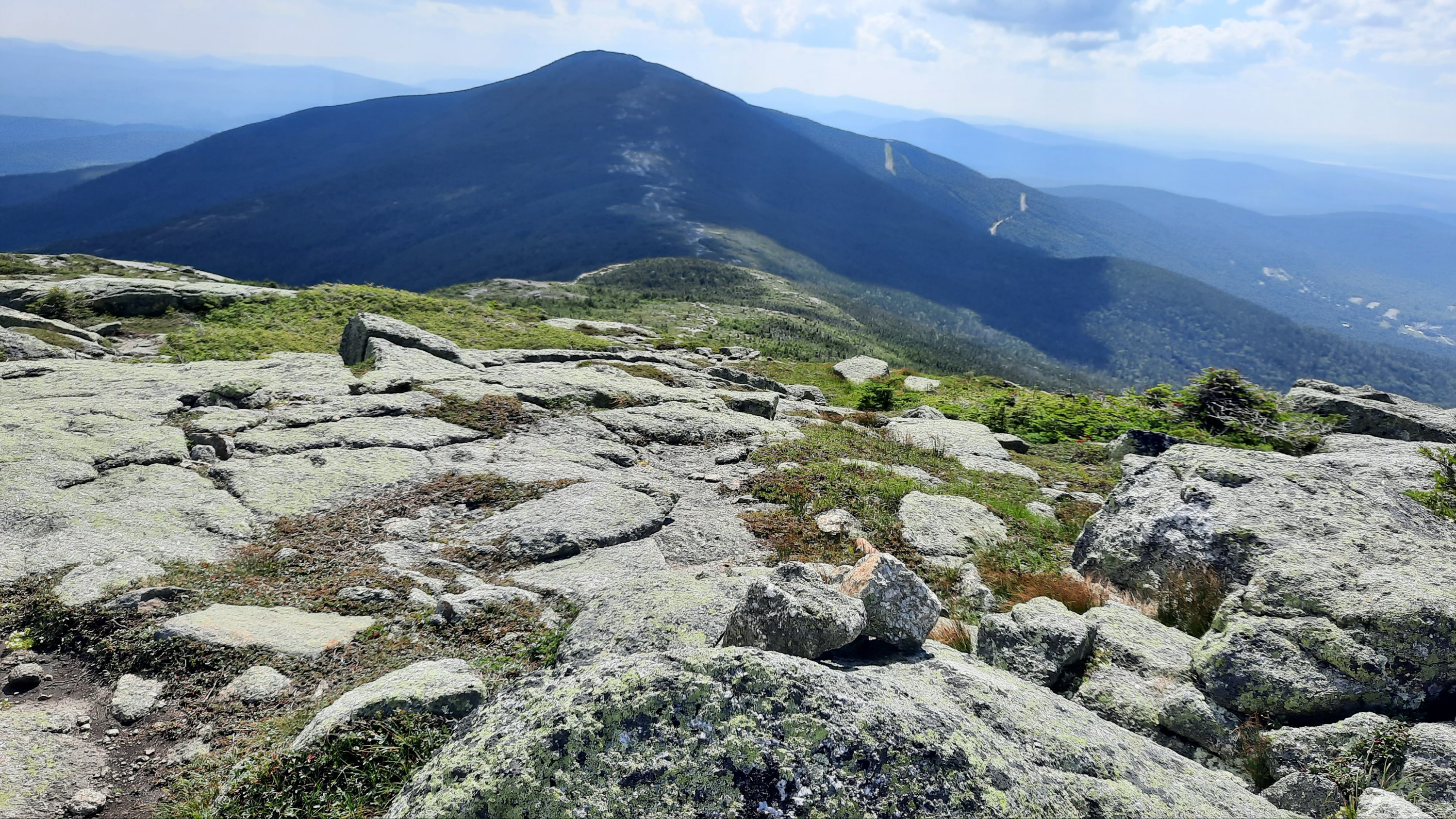
I find a little spot I can tuck myself into on the descent from Wildcat Mountain, and I definitely remember this beast. Very steep and exposed slabs of rock tower over the busy Pinkham Notch and road that passes through. I’ll be there tomorrow morning and the goal is an all you can eat breakfast in the lodge. With all this extra food maybe I can do the Whites without an official resupply. That would be nice.

Appalachian Trail Sobo Section: Day 28: 6.1 miles (311.9 miles total)

Those strawberries I packed in barely made it through the night. No matter. I’ll eat them all this morning in my granola.

I’m STOKED for all the good food I packed out. Heavy food, but food I want to eat: sugar snap peas, bagged salad (dinner last night), an apple, 2 oranges, garden cream cheese and deli turkey for the first couple of days (or until it fails the smell test), nuts, apple sauce packets. That food bag must be crazy heavy you are thinking…yep, it is, but I don’t care…at least I won’t care till I start going up one of those steep New Hampshire ups. Most of this will need to be eaten quickly anyway.

I took my time this morning and made it down to the main shelter about 8:30 to find Gormet having a second breakfast. Excellent! We catch up for a while and I put on a second pair of socks. I ended up getting a men’s pair of shoes because I needed the width, but my feet are sliding in them some. Today’s hike will be the real test.

The next mile or so of trail is gentle and then goes up, but the rocks are well spaced, at no point do I have to put a hand down or dig deep to make a 3′ step up. I like it!

As I climbed up the sky seemed to get gray under the tree cover. It was windier the higher I got, and when I topped out for the view I could see a dark, fast-moving grey cloud was sitting on top of Mt. Moriah.


I stopped to put on my long sleeve shirt and continued on to try and find a protected spot for lunch. Nope, everything was windy and I got chilled as I tried to eat some of my heaviest food. Gormet came up and left….too cold and windy. I reluctantly packed up and picked my way down the trail slowly.


I had tons of time today. The White Mountains are closely managed by the AMC, or Appalachian Mountain Club. There were specific places to camp, and places we definitely couldn’t camp, especially above tree line. The campsites and huts have caretakers, and the sites cost money, which doesn’t make some of the thru-hikers happy. The miles and space between sites in this section means my best option is to have a short day. I’ll pay $10 to camp at Imp Campsite today, and then I’ll get the thru-hiker card that lets me stay at other sites for 50% off, and gives me a ticket to baked goods and lunchtime soup at the huts. I will pass my first hut tomorrow, so it makes sense for me to pay to play since it will mean more goodies for me soon.

I also checked weather while on high….it’s not looking good for Tuesday when I had planned to climb Mt Washington which has some of the worst weather in the world (or country?? One of those). Storms on forecasted for Tuesday afternoon, so now I have to decide if I’ll push hard to get over it before the storm, or slow down and go after. Mt Washington is surrounded by miles and miles and miles of trail above treeline, so I need to plan carefully. Most thru-hikers say 10 miles a day is reasonable…very few people can make the miles they were doing before the Whites for the shear effort needed to hike the trails.

I get to camp in the early afternoon, pay my $$ and find Gormet. You have to use wooden tent platforms here, and they make you share them since there are so many people that backpack in the Whites. I set my tent up next to hers, both of them have rocks and guide lines going all over the place to keep things in place in the increasingly gusty wind.

The rest of the afternoon I rework my itinerary, read, and nap a little.

Dinner is in the group kitchen (no eating in your tents) and then it’s back to the tent.

Appalachian Trail Sobo Section: Day 27: 1.9 miles (305.8 miles total)

This is a wonderful bed…I forget what it’s like to be able to take up more than the width of my narrow one-person tent.

This morning is for business, and I get down to it.

  • Where am I going?
  • How many miles?
  • How many days of food?
  • Where will NEMO meet me in a week?
  • How much food should she bring?

And then because I’m entering one of the most special, regulated, and populated sections of the trail – The White Mountains – there are additional questions like:

  • Will I be able to get some food at the huts
  • Will I need to hitch for resupply?
  • Where?
  • Will I be able to get work for stay (and meals) at one of the huts?
  • Am I prepared if I get to Mt. Washington and the weather says, “Not today hiker”?

I make charts and graphs, lists and more lists. These are a lot of logistics and I reference both the Far Out app and the paper AT Guide.

Then there are chores: get small change for those $2 bowls of soup the huts provide for the hikers, mail some unneeded items home at the post office, buy new shoes, and drop off some extra stuff for the hiker box at the hostel.

When I get to the hardware/gear store I find only Merrill shoes. That’s ok, I wore Merrills on the Blue Mountains Trail, and even though I developed planter fasciitis in those shoes, I have new orthotics now. Ha! I tried to get my same Oboz when I was back in Monson, but they are out of stock across the country. I need some grippy soles now for the White Mountains I will start climbing tomorrow.

On my way back from the hostel I see Gormet in the park. We catch up and it sounds like we are both aiming for the same campsite tomorrow night. I’m surprised Late Start hasn’t arrived…he shouldn’t be that far behind us.

Hikers are everywhere in town and I don’t know any of them.

Then back to the hotel: pack bag, check out, hitch up to Walmart to finish my resupply. A kindly old woman named Marge picks me up; she gives lots of hikers rides she says. I love it.

As I’m perusing the athletic wear looking for a new shirt (that light green tank top I found in a hiker box shows all the dirt; I like to be a bit more incognito in my filth) and I spot the one. Remember the song I put on yesterday morning to go to town?

Yeah.


I like to listen to those synchroniticities (that has got to be spelled wrong) when I notice them.

Then I hitch out of town and Julie, a bike tour leader from Vermot picks me up. She is on her way to Maine to lead a multi-day trip and knows about the AT, her roomate hiked it.

Then walking.

Immediately I develop a case of town belly. Too much, too rich, too frequent: all my food choices gurgle around as I walk. Good thing my intended camp is less than two miles. I want to lay down.

As usual I hike out with what seems like way more than enough food until my next potential resupply run at Crawford Notch, but if I play my thru-hiker cards right (baked goods and lunch time “bottomless” bowls of soup at the huts for cheap, and cafes at Pinkham Notch and at the summit of Mt. Washington) I might be able to make it last longer…which would be helpful! But we’ll see, effort is usually hungry, and my potential for extreme effort expenditures this week is great.

I am in love with the Appalachian Trail again. The walking is easy breezy, and I’ve been reminded that this trail is more than my experience….this is a protected corridor of nature being squeezed on all sides by humans and their cities. It’s an incredible feat that this path through the woods is as immersive and rugged as it is. And the Whites! The first mountain I will climb tomorrow is Mt. Moriah. The comment by brettcolman99 in the app puts it into context:

If I think of the AT like the epic landscapes in Lord of the Rings (that will be easy in the White Mountains), the trip takes on a different tone.

After I make my short jaunt to camp, I set up just my screen tent and lay back listening to the forest, then started a new book that Zen Quake had recommended: Vesper Flights by Helen MacDonald.

The intro is 🔥

“What science does is what I would like more literature to do too: show us that we are living in an exquisitely complicated world that is not all about us. It does not belong to us alone. It never has done.

These are terrible times for the environment. Now more than ever before, we need to look long and hard at how we view and interact with the natural world. We’re living through the world’s sixth great extinction, one caused by us. The landscapes around us grow emptier and quieter each passing year. We need hard science to establish the rate and scale of these declines, to work out why it is occurring and what mitigation strategies can be brought into play. But we need literature, too; we need to communicate what the losses mean…

We need to communicate the value of things, so that more of us might fight to save them.”

Wow. I sit with that and am filled with the knowing that in addition to science and literature, I seek to do that through thru-hiking; to help people spend extended time in nature, see the value of things, and fight to save them.

That is the Oregon Desert Trail. That is what I would love to see for all trails. The context. The purpose. The action.

I listen to an absolutely lovely song, My Friend the Forest, as I watch the leaf shadows play against the screen on my tent. The barrier between me and this place is thin, or maybe that is just an illusion. There are no barriers. I belong here as much as that fern or that chipmunk. The afternoon slowly holds me in a softness I didn’t know I needed.

(Don’t you love it when I have time to think and write?…long blog posts 😁)

Appalachian Trail Sobo Section: Day 26: 9.7 miles (303.9 miles total)

Town day! I put Eye of the Tiger on for my first mile out of camp. For some reason I teared up as I powered up the first few root wads choking the trail. I let the emotions flow as I pushed on; I’m not sure why I was crying…but it was a good cry. I strided out to the song, feeling like a million bucks for about 30 seconds, then the silly steep started and I was tripping over those same roots, breathing heavy. I lost the pace, but it was a great 30 seconds.


You always know when you are the first one on the trail for the day because you get a face full of spiderwebs. The early bird gets the cobwebs on this trail.


This section needs some massive trail work… as in it hasn’t been cleared in years. There are full reroutes around fallen trees from yesteryear and the trees growing into the trail threaten to poke my eyes out.

I’ve been having lots of thoughts and conversations about trail maintenance out here. Having been on all sides of the coin: trail maintenance crew leader, volunteer, hiker, and planner, I know the tasks are monumental to adequately maintain a long-distance trail…I’d love to be able to contribute to a system that works better for everyone. So many ideas!

Back to the hardest hiking I’ve ever done; it’s unnecessarily hard. 2002 She-ra didn’t know any better, it was her first trail. 2022 She-ra does know better, mabe that makes it worse?

I imagine I am a video game character; I power up while I sleep, and for every zero I take I get an extra life. I need a life or two in reserve to make it through.

At the top of a climb I meet Inferno Man. He’s been section hiking the trail for a few years and I enjoy chatting with him for a bit. He says he’s going slow this morning, so I start down the next steep descent. When I make it to the top of the next climb I turn to find him close behind me. He’s not slow! We head out together on the next stretch of trail….a long hike down to the highway and town, and he looses me in his quick pace. He’s really not slow! For a man close to retirement he’s got legs.

We leave the forest together and start a short road walk to the trailhead where he is meeting his ride to the hostel where he parked his car for this section. The hostel owner is nice enough to give me a ride even though I’m not staying there, and I ask him about Lily. When Average Joe and I stayed in Gorham 20 years ago the previous owner’s young daughter Lily befriended us…she was super cute and curious about us. He knew her! She lives in Boston now. So fun to hear this.

Inferno Man offers to give me a ride to Walmart, a few miles out of town. I want to stock up on some treats to eat in the hotel and get a few supplies while I’m at it; I’ll do a full resupply tomorrow. I grab strawberries and salad, guacamole and a black bean bowl, coffee and wine. I’m so excited to rest up today and tomorrow.

After we shop Inferno Man drops me off at my hotel. It’s hours till check in (oh yeah, those 10 miles took me 5 hours to hike…not bad!) but I ask the front desk manager if I can stash my pack there while I go grab some lunch. She says my room is ready now, oh happy day!!!!

The rest of the day is spent eating, showering, sitting in the hot tub, and making plans with NEMO who is coming to hike with me soon.

Now THIS is food 😍

I love this day!

Appalachian Trail Sobo Section: Day 25: 14.4 miles (294.2 miles total)

It’s time for THE NOTCH.

Gormet and I were packed and ready to hike at 6:30. We wanted to have enough time to get through the mile-long notch (will two hours be enough?) and hike enough miles to make it into Gorham at a decent time tomorrow. We both have reservations to stay in town and I want to milk every last minute of my solo hotel room that I can.

I do remember 2002 She-ra going through the notch, it was fun and novel, especially with the silly antics that our little tramily enjoyed at the end. It’s time consuming to power climb up, lower yourself down, crawl on hands and knees, schmere what is left of your shoe rubber on the rock, and try that climbing hold you saw someone use once. Both of us think our years of yoga practice is coming in handy to make some of these moves work. At one point we came upon a nobo hiker that said, “Am I almost out?” Gormet and I looked at each other and said, “We thought we were almost out!” We all had a long way to go.

Onward. There were a couple of false finishes before we left the rock gauntlet, and yep, there was still snow and ice in some of the crevasses.

Whew, now we can just hike, right? Ummmm, not so fast. We had to go straight up something next. The challenges are always and everywhere out here.


I have to admit my thoughts got dark. Why does the AT hate hikers so much? And whose idea was it anyway to route the trail through the arm and notch? Why do people love this trail? Why am I doing this again?

My mood improved when I got to the next shelter and stopped for a snack break. Often snacks are the answer out here, but my body is not liking the bags of salt and sugar I packed out of the last town. The small little store in Andover didn’t have much in the way of nutritious packable food, and my body was telling me the empty calories of pop tarts and honey mustard pretzels wasn’t cutting it in this terrain. I need real food. I decided to pack out fruit and veggies in the next stop. Gorham has a Walmart and will have lots of food options to choose from.

The rest of the day was lovely and steep. The trail led me up to small peaks with views and log bog walking (note: don’t step off the log bridges…word is someone once fell in mud up to their armpits out here! These bogs are no joke!)

Then the moment I’ve been waiting for: New Hampshire! I crossed the line from the second hardest state to hike on the Appalachian Trail to the first hardest state! Oh joy 😵. No, really, I was excited at my progress. I stopped and ate more empty salty calories before continuing on.

Now the mission became hike as far as I could before crashing. I could not believe the steep bouldering that continued…you can’t call these trails…but they can, and do.

I listened to music all afternoon to give me some external motivation and decided I needed to download some Radiohead and classic rock for the next section. These music streaming services let you download playlists and most albums for a monthly fee. Totally worth it. I left Spotify in solidarity with Neil Young earlier this year (Spotify has some issues including paying artists almost nothing to stream their music) and have been using QoBuz which is pretty good.

I arrived at one of my potential destinations for the night, but it was only 5pm and even though my knees and thighs told me I was done for the day, my desire to be closer to town and have a shorter day tomorrow made me continue on. The elevation profile to the next lake helped…kind of flatish. If I could hike to Dream Lake and camp there for the night, I’d only have 10 miles to hike to Gorham tomorrow. Even that isn’t totally comforting. How long will it take me to hike 10 miles? I have no idea. One mile has taken me anywhere from 20 minutes to 2 hours to hike so far; it’s nearly impossible to tell what kind of miles the 10 will be, but I do know 10 miles will be quicker than 13, so I push on.

And I make it. I have the place to myself and claim the one tiny campsite with a view of the lily-pad laden lake and a peak off in the distance. It was a 12 hour day, and I feel it in every muscle in my body.

Ok Dream Lake, I hope your name is legit.

Appalachian Trail Sobo Section: Day 24: 13 miles (279.8 miles total)

My body chose the usual 5am wake up time again this morning….why??? When I can sleep as long as I want to, do I continue to get up at 5am? It’s solid routine now. Asking questions won’t change that.

I was packed and ready to go by 6:30…an early start even by my standards, but we had a few mountains to climb, and the unanswered question of the Mahoosucs…will we or won’t we? Both challenges come at the end of the day, so we can only really know when we get there and see how much energy we have left.

I told Gormet that I wanted to go through both with her. You see the Mahoosuc Arm is one mile that drops 1,500 feet…nearly vertical in some areas. The Mahoosuc Notch is a gauntlet of massive boulders with gaps between that seem to have no bottom, water, ice, and who knows what else hides in the shadows. The Notch is the most difficult mile on the trail because it is like a giant jungle gym. Sometimes you have to take off your pack to squeeze through an opening, sometimes take a leap of faith over a chasm…having another hiker there for both features is a good idea, not just for safety reasons, but so you have someone you can complain with.


Check out the insanity

But first we had Baldplate Mountain to climb, and then Old Spec….well over 5,000′ of climbing before we got to either Mahoosuc.

I was feeling strong and worked my way quickly to the top of the mountain. Glorious views surrounded the mountain and I could see the infamous Mount Washington shrouded in clouds in the distance. Wow!


I took a fat chill up top (not to be confused with the hiker, Fat Chill) and luxuriate in the sunshine…although the wind was chilly enough that I put on my jacket. That’s a first! I have yet to put on my jacket during the day, it’s just been too hot and humid.

When Gormet comes up I follow her down off the mountain; we have to go up again before we go down (of course) and during the descent we stop at a shelter for water.

Then down down down to Grafton Notch where we ponder the meaning of “Notch.” We conclude it means pass. Out west the mountain passes are where roads can travel through the mountains, and the notches here seem to serve the same purpose.

Then I start the 3,500′ climb in 3.5 miles. Seriously?

The trail met a wooded junction 0.4 miles to the top of the mountain, but I passed it by. I’ve had plenty of views and don’t need to add 0.8 miles to the day.

Ok, we descend to Speck Pond where we have to make our decision: hike down the arm and camp? Hike down the arm and through the notch and then climb a mountain and camp? Or stay right were we were at the pond. It was 3pm. We chose the arm and camp.

Nobos came huffing and puffing up as we started down and we congratulated them…some were excited, some beaten down. The steep was as steep as some of the other crazy insane descents we have already encountered in Maine, but this was longer and steeper. We picked our way down, knees screaming at us the whole way.


We were just about to a camp spot when I pull over to let another hiker pass and he says, “Renee?”

What?!?! I look closer and before I can register the face under the red beard he says, “It’s Cargo.”


Cargo??? What are the chances??? Cargo is from Oregon and hiked the Oregon Desert Trail a few years ago, even stranger, after that I was in the Denver Airport one spring flying to the CDT kickoff in Silver City when Cargo walks up to me…he was starting the CDT that spring. How crazy! We have a history of meeting up randomly, and here we were on the Mahoosuc Arm, chatting it up. Cargo had started hiking in January from the tip of the Flordia Keys…and was just about done. We made plans to chat this fall when we are both home, he wants to talk trails, and so do I.

So I hiked on and almost around the corner I find Gormet at camp. What a relief. I am so ready to stop walking.

Dinner is ramen with a side of mashed potatoes.

Appalachian Trail Sobo Section: Day 23: 14.6 miles (266.8 total miles)

Despite having to climb down from my bunk a few times during the night, I got some decent sleep. The hostel was at full capacity, yet I didn’t hear any snoring.

Breakfast was blueberry pancakes (notice a theme here?), scrambled eggs, sausage, melon, a banana, potatoes, and oj. They would not accept any leftovers, so the hikers were encouraged to pack out all the remains. What a place!

Then we all piled into the vehicles for a ride back to the trail. Gormet, Fat Chill, and I started south from the South Arm road. Others were shuttled to B Hill Road, 10 miles south from there. The easy road access meant lots of folks will slack pack this section…meaning they will hike between the two roads with only a day pack, and will stay at the hostel another night on the other side. We were going farther than 10 miles, so had our full loads with four days of food…Gorham and New Hampshire were up next!!


Honey

The climb out of the road was a doozy, and then another…it was misty then rainy. Regardless the sweat poured out.

Up top I breaked at a shelter and met the other group from the hostel that was hiking north between roads. Lots more north bounders today overall. I’m happy with my choice to hike sobo; I’ve had some peaceful trail and camps…there really haven’t been too many people, which is great for such a popular trail. I just can’t imagine starting a nobo hike with hundreds of people all around going a similar mileage each day.


After a long stretch of trail (too long, I was bonking and should have stopped sooner) I came to a lovely waterfall. As I was relaxing the sky opened up and it poured. I popped open my umbrella…pleased I could use it at last. I really can’t hike and use the umbrella at the same time…I need both hands on the trekking poles, and it’s so warm out that I want the rain to wash the sweat away. I’ll still keep the umbrella though. Not sure why.

The next stretch of trail went up, but there was some pleasent tread where I could really stride out. The rain had stopped and the sunlight filtered through a glistening forest. It was quite lovely.

At some point you have to ask yourself, “Why am I doing this? Choosing such a demanding and strenuous trip on my time off?” That was this afternoon. When I take a step back and look objectively at the monumental task I had taken in this southbound hike, walking the hardest of the hard terrain, alone, for fun, I have to laugh. I know the reasons, but sometimes it just seems so absurd! I am weird, but then so are a lot of the others out here. I have company in my strange desires to struggle and sweat up these mountains. That’s nice.


Speaking of struggle, I meet John near the next shelter. John has been coming out for a week at a time for years to pick away at the trail. He started at Katahdin many trips ago. I can’t imagine hiking out here for a week, getting beaten up by the terrain, and then going home to do it all over again the next year. At least I have weeks of hiking and stamina built up to where I can do 15+ miles a day. He said he’ll retire next year and can start doing longer sections. Go John! The retirees out here are super inspirational. I will still be hiking when I’m in my 60s too. I have some good role models out here.

So to the shelter for the night: I pitch my tent (I sleep so much better on my own in a tent…the shelters can be busy)…where I set up, and make mac and cheese with tuna and extra Vermont sharp cheddar cheese chunks thrown in for good measure.

I look at the terrain ahead…oh wow! I’m already to the Mahoosuc Notch! The hardest mile on the entire AT. I could even hike it tomorrow if I wanted! I chat with Gormet, I think we will stop short of the notch tomorrow and leave the struggle for first thing in the morning the next day…and then the Maine miles will be done; the New Hampshire state line is just after that. Wow!

Appalachian Trail Sobo Section: Day 22: 12.4 miles (252.2 miles total)

I love sleeping with the sound of a river in the backgound…those are the best sleeps.

I wake before the others, and even with my long morning writing routine, am packed and ready to go before Gormet and Matt (Late Start??) stir.

I fill up on water because the water report is dim for the day, but people’s definitions of poor water is really skewed out here…or mine is after relying on desert sources for so long. I find tons of water, but I have so much on my back that I dont need it. Doh!

The climb is sweaty…they all are…and up top I turn on the phone and check weather. Ohhhh nooo. Heavy storms coming in tonight and tomorrow….high winds, heavy rains, lightening. I look at my options again. I could have hiked tomorrow and gone into the next resupply stop, Andover, or I could go in today. Looking at my options again, I decided to go into town today and stay the night at The Cabin, a well loved and long running hostel. When Gormet and Late Start come hiking up I share my intel, and they decide to go into town too. Who needs to hike in heavy rain and winds??…that can be down right treacherous with this hiking that is really class 3 scrambling.

I call the hostel and there is only room for two. You see the nobo bubble is approaching. The number of nobo hikers we pass has been increasing with every day, and the word on the street is things are going to get busy, especially at the hostels and hotels when the bulk of the nobo hikers hit the area.

Late Start makes other arrangements and we carry on. We now have 10 miles to hike to get our ride. Fortunately we are at the top of the biggest climb of the day…but these little climbs and descents can really do a number on your legs too. Maine is by far the hardest hiking I have ever done in my life, soon to be surpassed by New Hampshire hiking (I don’t remember specifics about the terrain from the 2002 hike, but these miles will be seared into my brain…probably cause I’m 20 years older now).

We book it, as much as we can. Breaks are short and the growing cloud cover reminds us of our mission.

We run into more sobos, Flower, Chaos, and Chef. They are fast.

From the top of Old Blue Mountain we call The Cabin again to arrange our shuttle (oh the things phones can do!) and go down about as steep a trail as we’ve encountered yet. Geez!


Sometimes there are steps when the rocks are too steep to walk.

At the road with minutes to spare we moan and groan about the state of our bodies. Have I told you Maine hiking is hard?

Don, Honey’s son (Honey and Bear own The Cabin…Bear passed away a while ago and Honey runs it now with help…she is 90 years old!!!!!) picks us up and we make a quick resupply run before getting to the hostel.

We have just enough time for showers before dinner…you can add on dinner and breakfast to your bill here…tonight is lasagana!! How did I get so lucky?????

The spread is fabulous and the hostel is packed. Hikers are busting out of every corner, but there is enough food for all, even for second helpings of the lasagna and garlic bread…and dessert of course! Brownies and Moose Tracks ice cream…how appropriate 🤗

I mention to Honey that the hiker Rambling Rose who I met in the 100 miles wilderness told me I couldn’t miss her hostel, and she said that he had called and offered to pay for my stay should I show up! Wowowowow, thanks Rambling Rose! What a treat, such thoughtful trail magic. I love this community ❤️.

Skywalker, a nobo hiker, puts Attack of the Clones on the TV after dinner. This looks familiar and I ask what year it came out. 2002. I went to see this movie in a theater somewhere on the trail 20 years ago. What are the chances? The magic of the trail finds me everywhere.

Appalachian Trail Sobo Section: Day 21: 16.4 (239.8 miles total)

Call me Sheet Rock.

I was introducing myself to Steve, the caretaker at the Hiker Hut outside Rangely this morning, and instead of She-ra, he heard Sheet Rock. It was so funny, and I kept laughing about it during the day that it might have to be my trail name alternate for the rest of my AT hike. Sheet Rock!! 🤣🤣🤣


The Hiker Hut made resupply super easy this morning. The shelter we camped at was less than two miles from the next highway, and a 0.3 mile walk on the road. The hostel is off-grid, so no wifi or charging electronics is available, but that makes it all the more serene, and Steve will make hikers and egg and cheese sandwich and stocks a good amount of resupply food, so we didn’t have to go into town. Thanks Steve! That saves us hikers both time and money. Granted these small resupplies at hostels are usually more expensive than a grocery market, but we are paying for the convenience, and that works for me. What we are missing is the extra meal or two we would have in town, but I don’t need it yet, the hiker hunger hasn’t reared its ugly head yet.

Our crew that left the Roadhouse together is down to Gormet, Matt (Goldfish?), and myself. We have similar paces which helps, and if we don’t hike together, we see each other frequently at breaks.

I had no set agenda for the day, but I was determined to mosey and take my time.

The walking was mellow, until it wasn’t, but most of it was easy breezy walking. At a water break we were looking ahead and saw Long Lake had a sandy beach and looked good for swimming. Fabulous! It was supposed to be 90 degrees today, but the sweat wasn’t dripping any more than usual, so I’m not sure it actually was. But I do have a favorite new audio clip…I was listening to an episode of Backpacker Radio (check out this segment they recorded with me a few years ago) and they kept opening cans of beer. The “sssss” of the can opening sent me into fits of day dreaming. I tried to manifest a cooler full of cold sodas. Where are the coolers??? The AT northbound had a cooler at every road crossing! Here I was almost 250 miles in and I had encountered one cooler. Come on Maine peeps, it’s 90 degrees out!

I arrived to Long Lake just after Gormet and Matt, stripped down to my underwater and walked in. Warmish! But lovely. It was super shallow but had a sandy bottom so I just sat down in it. The others joined in and we laughed as the waves tossed us around. Later back on the trail we all realized the waves had filled our drawers with sand. Ahhhh, that wouldn’t work well with any chaffing. Maybe Matt’s trail name should be Sandy Pants?

Then I came down out of the woods onto a highway.. what the? It hadn’t been on my radar, and when I saw a scenic pull out close by with people, I made a beeline over, intent on yogi’ing a cold soda. I walked up to the first group of people a said, “I’ll trade you a hiking story for a cold drink!” The woman said, “Of course,” and proceeded to fish two bottles of cold water out of her cooler. Ok, not bad. I took the water with many thanks, but they didn’t seem interested in the story. I turn to see Goldfish (Sandy Pants?) walking up and I gave him one of the water bottles. The cold water was so delicious, but I still had visions of the “sssss” from a cold can of rootbeer, but no matter, I was satiated for now. I chatted with a girl that looks hikerish. Waypoint had hiked a few months on the AT this spring and was now meeting up with some trail friends who had kept going while she had to get off. Waypoint gave us some sugar cookies, wow, thanks!!!


I also had a few raspberries today!

The hike down to the next river was steep…our intended camping spot for the night, and nobo after nobo passed me on the climb. I’m glad we are done climbing for the day…however we will have a humdinger of an up in the morning when we climb Bevis Mountain….but that’s a climb for another day.

I splashed off in the cold river and we made camp, eating dinner together like a little trail family.

One more story: I was somewhere in the day when a nobo approached. I usually like to say hello and ask how the hike is going…when this gentleman walked away I said, “Enjoy the rest of your hike.” He said, “oh, I haven’t been enjoying it for months!”

I’m glad I can say I’m enjoying it.

Appalachian Trail Sobo Section: Day 20: 16.9 miles (223.4 total)


The days are flying by. This sabbatical is like sand running through my hands, please don’t go too fast!!

I woke after a partial night’s sleep in the tent I had haphazardly thrown up in the trail in the middle of the night. I’m tired, but not ridiculously so.

I leave the shelter right after Gormet, we have a lofty day ahead of us with lots of climbing. Today we would cross the Saddlebacks! This has one of the largest alpine zones in Maine, the biggest ski resort, and we’d be walking on granite slabs and above treeline for almost three miles. Wowee!

But first we had to go down, way down, to go up, and then up some more. Gormet and I pass each other at breaks, and curse the bouldering over snacks. More full-body hiking, and more than a few grumbles from nobo hikers. This stuff is overwhelming.

The climb up Popular Ridge was stout, and I was stepping carefully in my chacos when some day hikers passed and commented on me wearing my sandals in such a demanding section. “It forces me to slow down and be intentional with every step,” I explained. “It really works for me.” They nodded in understanding and we kept on.

I wore my sandals though the climb up Little Saddleback too. This is where I had to regularly use my hands to “hike.” One poor nobo had a big gash on his face. We really are very close to danger out here. On one of my falls today I stabbed the sharp end of my trekking pole in my thigh…luckily it was a soft stab and I didn’t bleed…but I did have a few new scrapes on my legs that turned red. Ooofta.


Then the top! Wow, oh wait, there was one more down and up before the top, but still, it was amazing!


I’m so glad I got here on a good weather day. I spent the afternoon walking with a grin. Alpine zones are such a treat: small little plants carpet the ground, tiny little pine trees sprout through cracks in the rocks…and the rock: thick and rolling slabs of the sparkly stuff – sticky enough that you can walk on some steep angles without sliding. And the views 😍


On top of the biggest Saddleback I ran into some other sobos. Our group had caught up to the group that left the Roadhouse the day before us.


We all hobbled down the last two miles to a shelter together. Those two miles had been stretched into four by the demands of the day.

Then camp. I pitched my tent, so excited for dinner and a full night’s sleep.

Sweet dreams are made of these.

Today’s stats:

11 hours, 17 miles, 5722′ ascent, 4695 desent